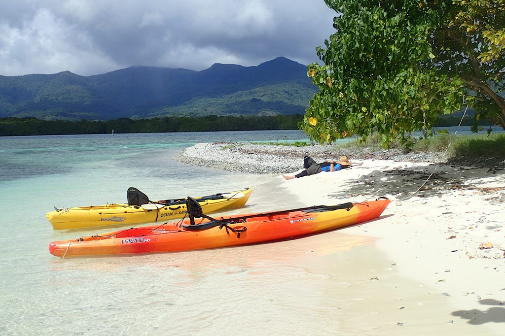
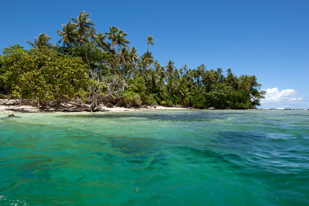
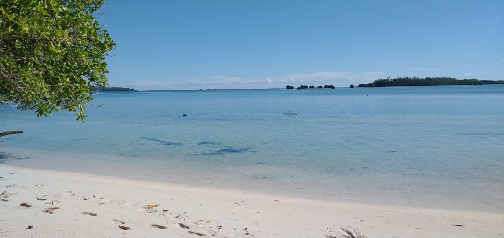
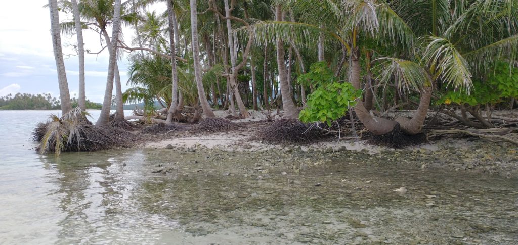
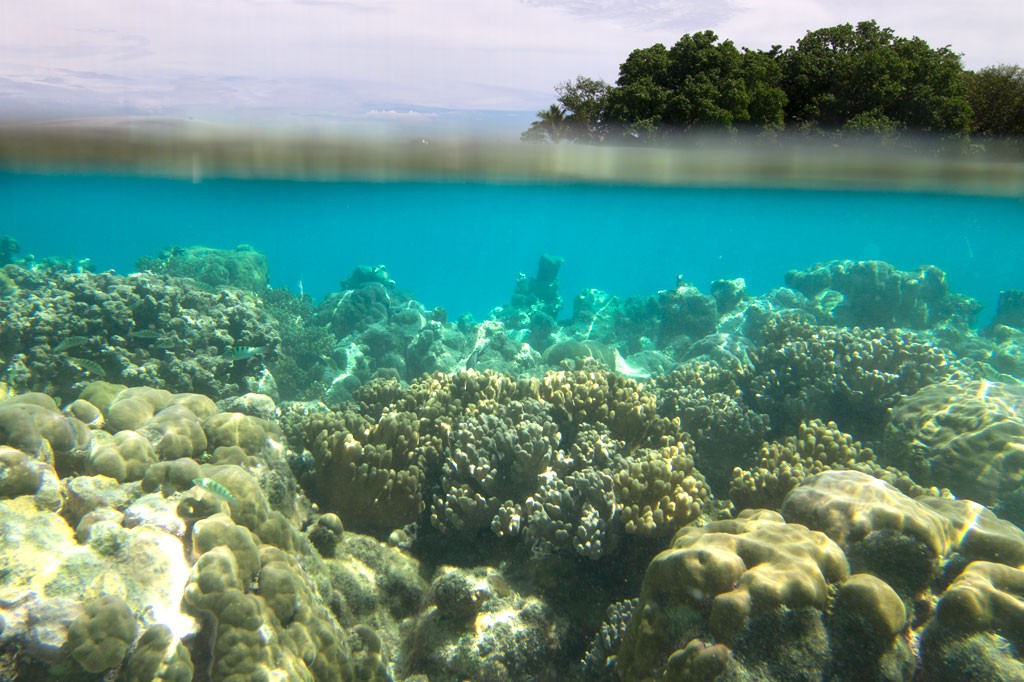
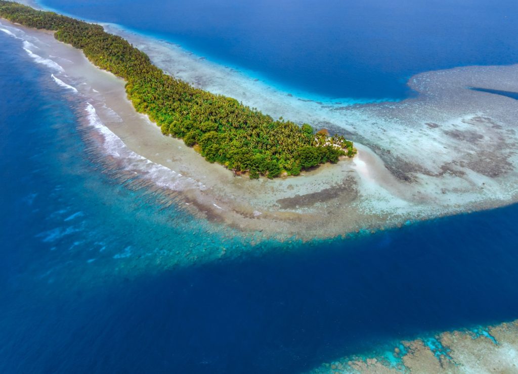
Ros is another beautiful uninhabited reef island in the south. The long, skinny island seems to be slowly disappearing as it erodes, but there are huge areas of wonderful sand on the west side to lounge about on and a narrow belt of trees. It’s mostly notable as a destination for paddlers, taking a break from exploring mangrove forests nearby, or SCUBA enthusiasts, resting between dives (Kepidauen Ros is one of two locations on Pohnpei famous for manta rays). There is good swimming and snorkeling a few kicks from the island.
For permission to visit or camp on the island, call +691.320.5896 or the Kitti Municipal Government Office at +691.320.5038, 320.5808, 320.5049, or 320.3257.
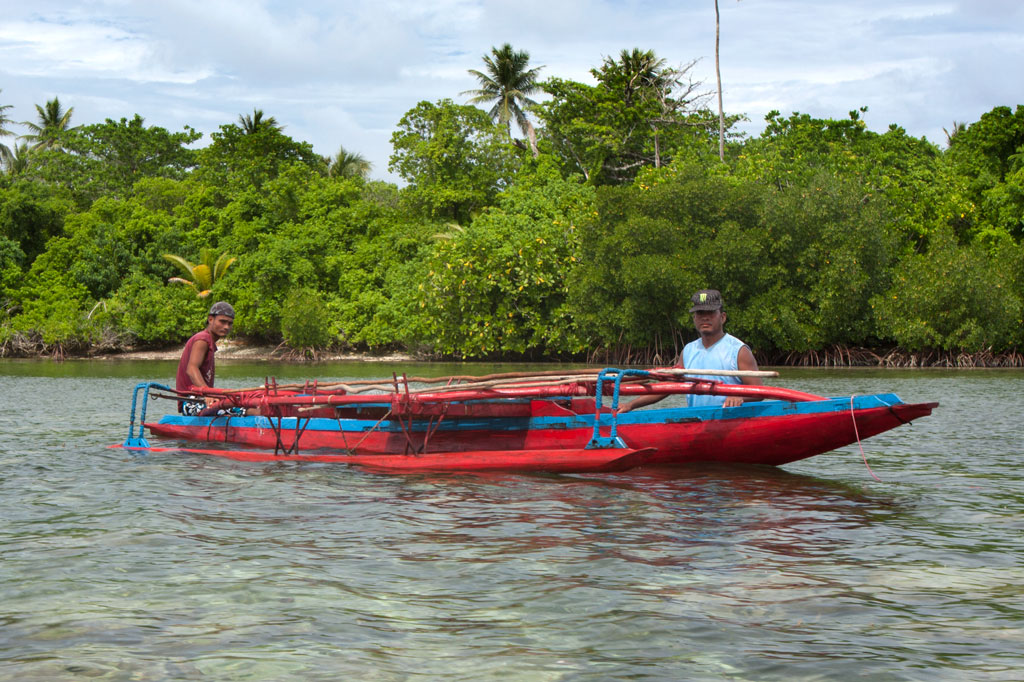
Nahlap, owned by former FSM congressman John David, has become one of the most popular lagoon island get-aways in Pohnpei State largely because it’s easy to get to, affordable, and has lots of huts for visitors. There are two docks, several stilt huts out over the water for lounging around and taking in the scenery, a volleyball court, and a variety of picnic spots. The island also has a small chapel on it located further in from the picnic area. They also have wifi on the island but only in a certain area and not across the whole island. The island is large, shady, and quite pleasant. Though the surrounding ocean is dominated by mangroves and seagrass, there are places on the far side and around the docks with good snorkeling. The southeast coast has some shady beaches at low tide (the best is in front of the tiny chapel) and rope swings for the kids. The turn-off for the launch at Sekeren Iap is about 21 km west and south of Kolonia. Continue past the Henry Nanpei memorial and the Rohnkitti Church all the way to the end of the road.
To make reservations or arrange for a boat taxi from Sekeren Iap in Rohnkitti, call +691.320.2776. Or call the Kitti Municipal Government Office at +691.320.5038, 320.5808, 320.5049, or 320.3257 and ask for assistance.
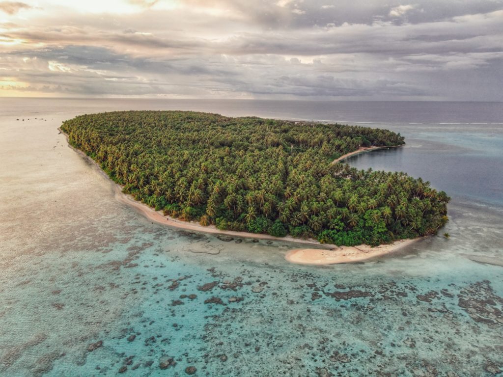
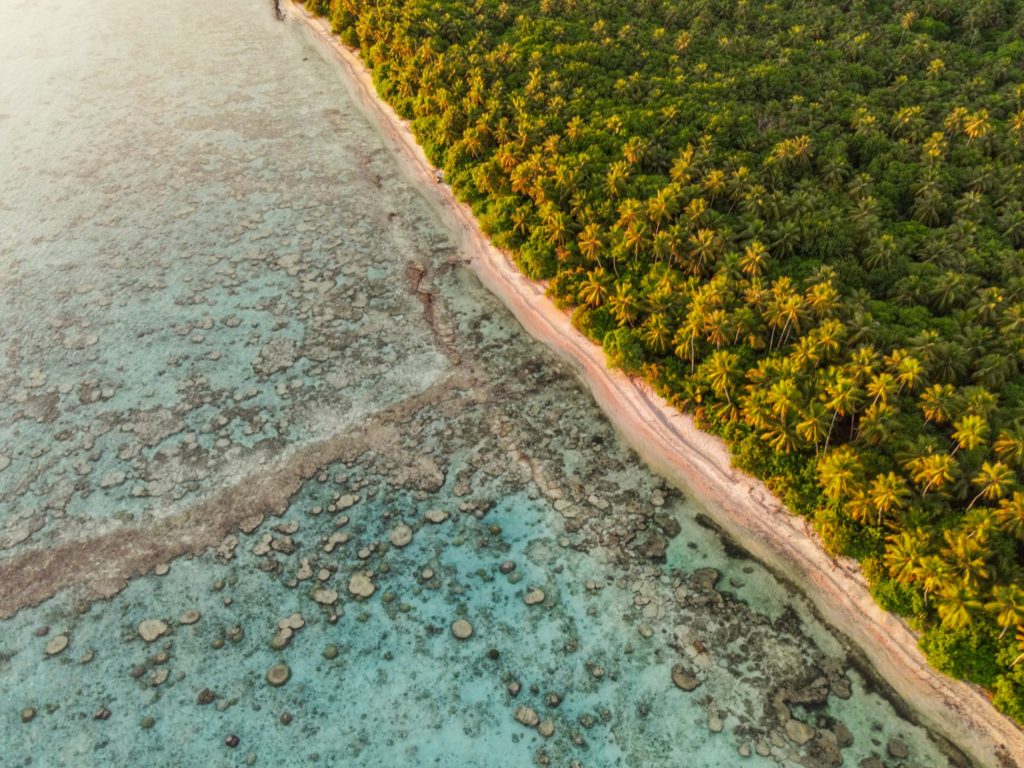
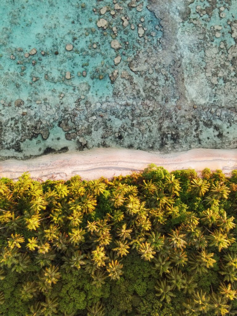
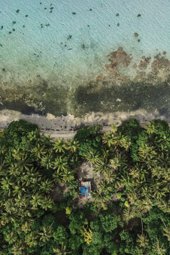
Dekehtik, which means “small island”, also called Sand Island is an uninhabited coral islet west of Na, of which it was once a part (not be confused with the island of the same name on which the airport is located). The north coast is most suitable for camping with some sandy beaches at low tide and stunningly clear water for swimming and ogling the many stingrays in the area. There are huts on the island for people to stay in while on the island. The island is currently owned by the Adams family (the proprietors of Ace Hardware and Ace Office Supply). The best snorkeling is northwest of the island along the edge of the deep, blue hole of Pahn Nahkapw. The island itself is characterized by thickets of shrubby vegetation and coconut palms. Sandy beaches form on the north coast at low tide.
To make reservations for day visits or night stays and to arrange boat transport call ACE at +691.320.8279 / 5637.
Dekehtik in the foreground, Na Island in the background (PC: Lee Arkhie Perez)
Deketihk Island with Nahkapw Island in the background. (PC: Lee Arkhie Perez)
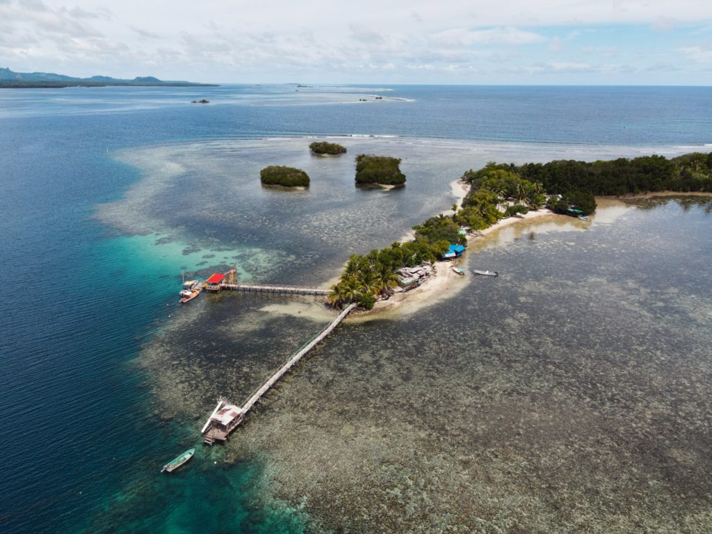
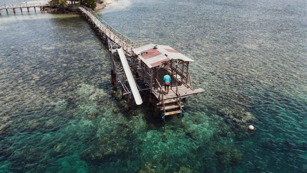
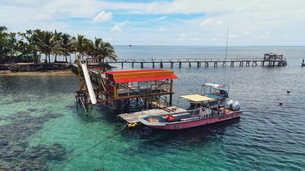
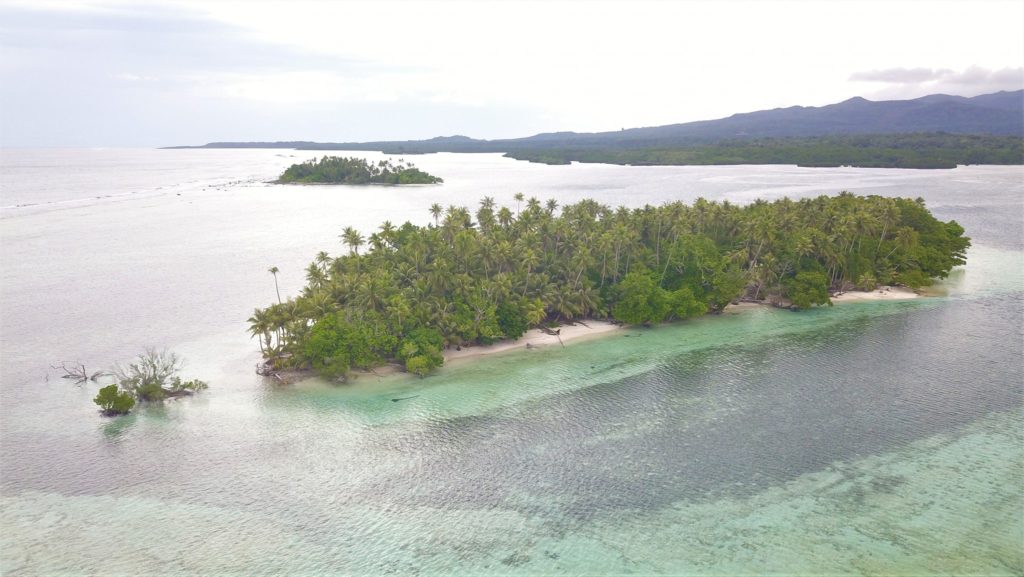
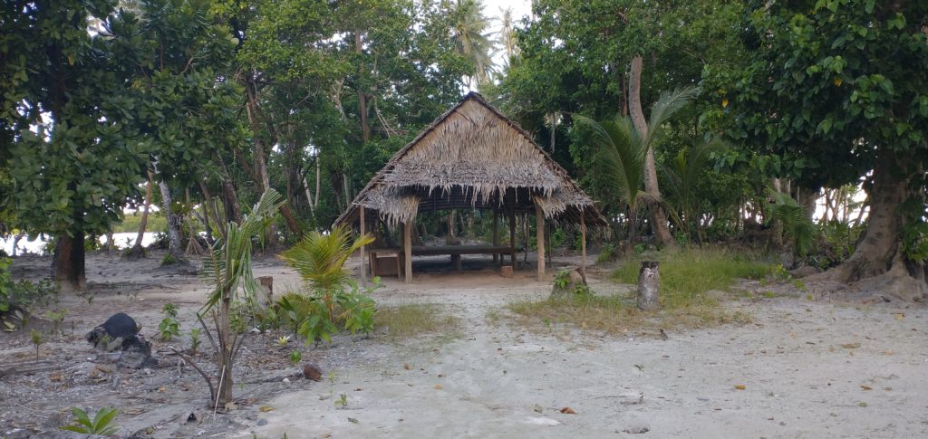
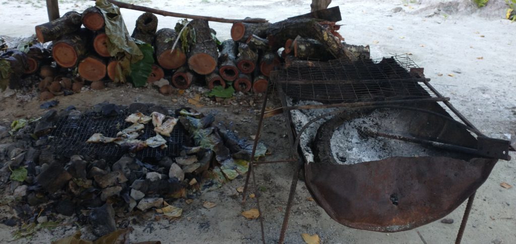
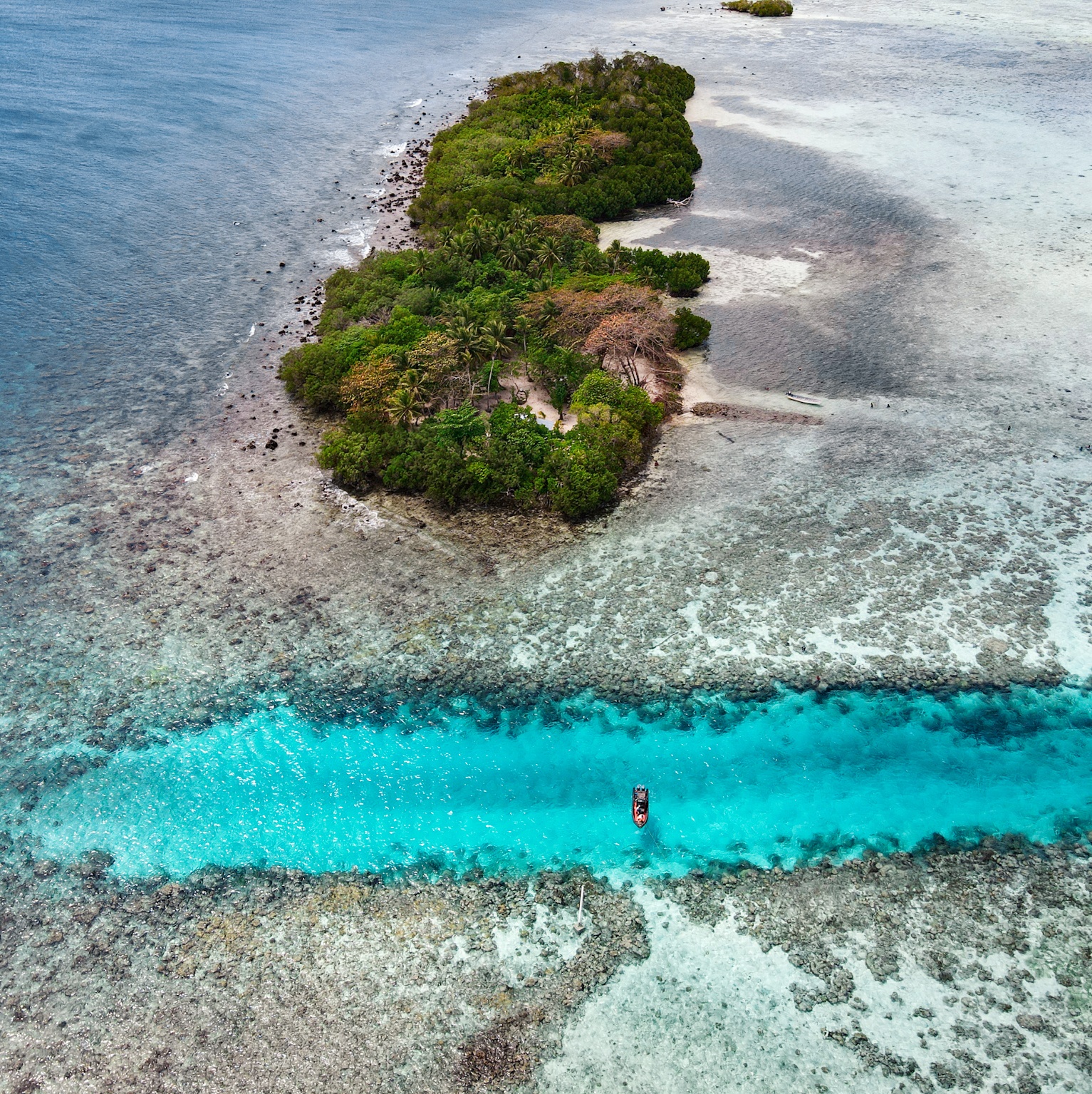
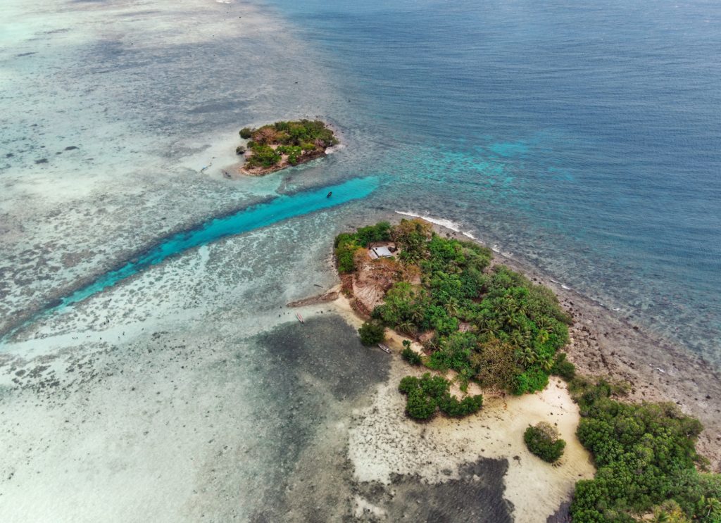
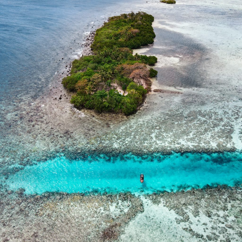
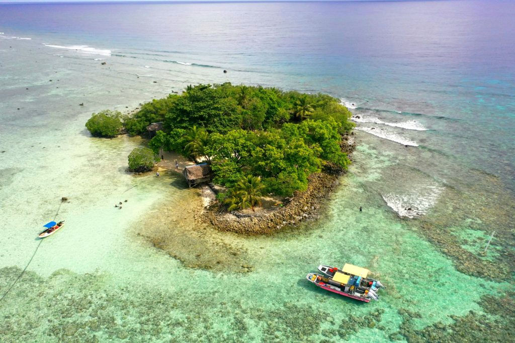
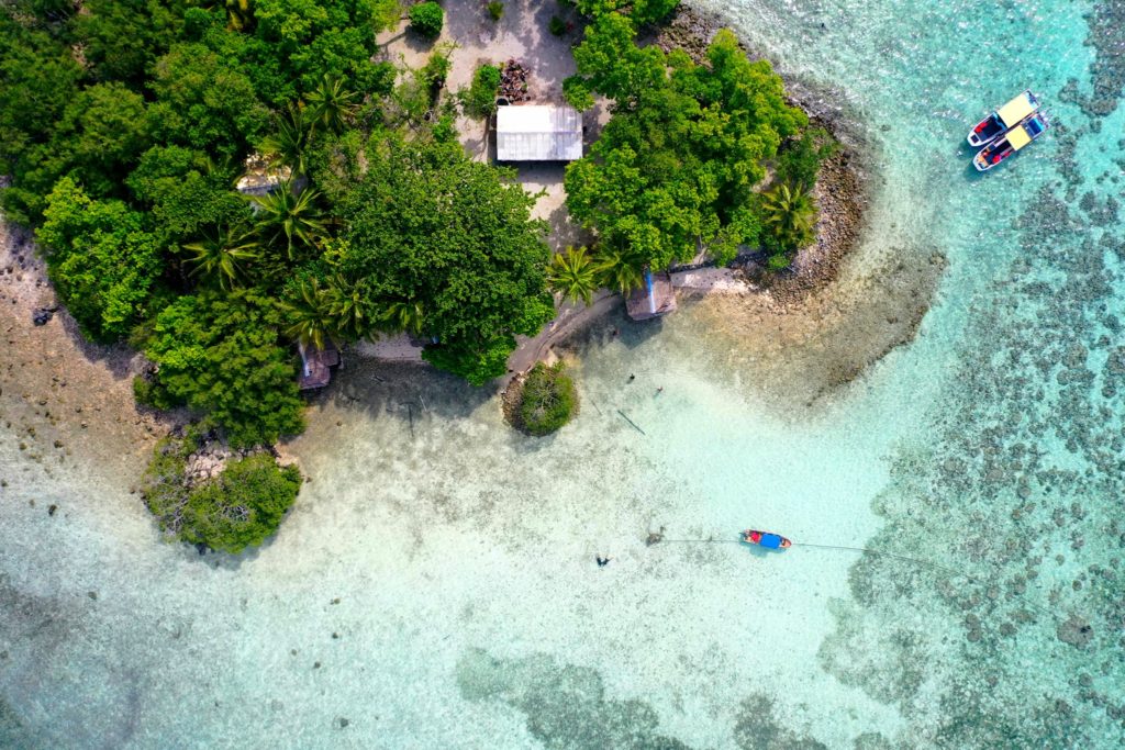
Though not as developed as Black Coral the small thatched huts are adequate for camping trips, the island is equally as shady and much larger than Black Coral, and it actually offers easier access to the excellent snorkeling around Kehpara Pass. It’s cheaper, too. At low tide, there’s a beautiful sandy beach between the two islands. The island has solar lights set up around the island to provide some light at night however we recommend bringing along a lantern and some flashlights to help illuminate inside the huts since they are not rigged with lights.
To make reservations for day visits or overnight stays and arrange for boat pick-up from the launch behind Seinwar Elementary School, call Nickson Abraham (Oaun Kitti) at +691.925.5340 / +691.920.8081 or the Kitti Municipal Government Office at +691.320.5038, 320.5808, 320.5049, or 320.3257.
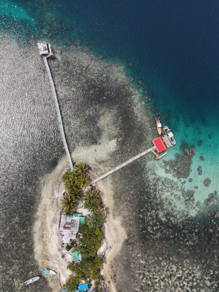
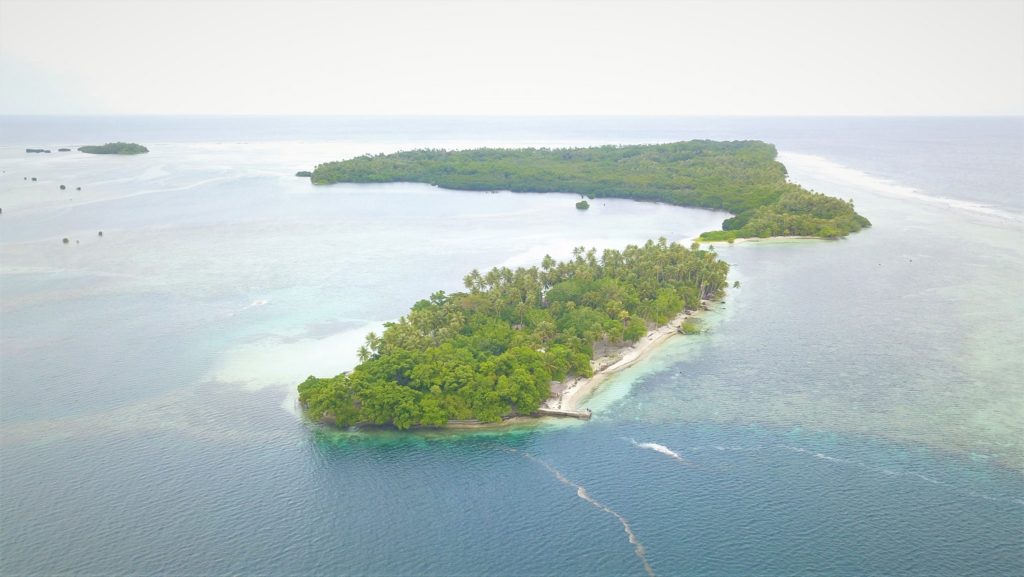
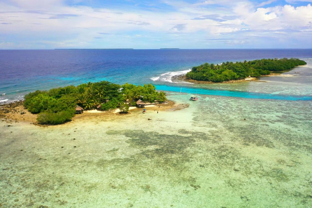
Black Coral (top island) and Kehpara (bottom island)
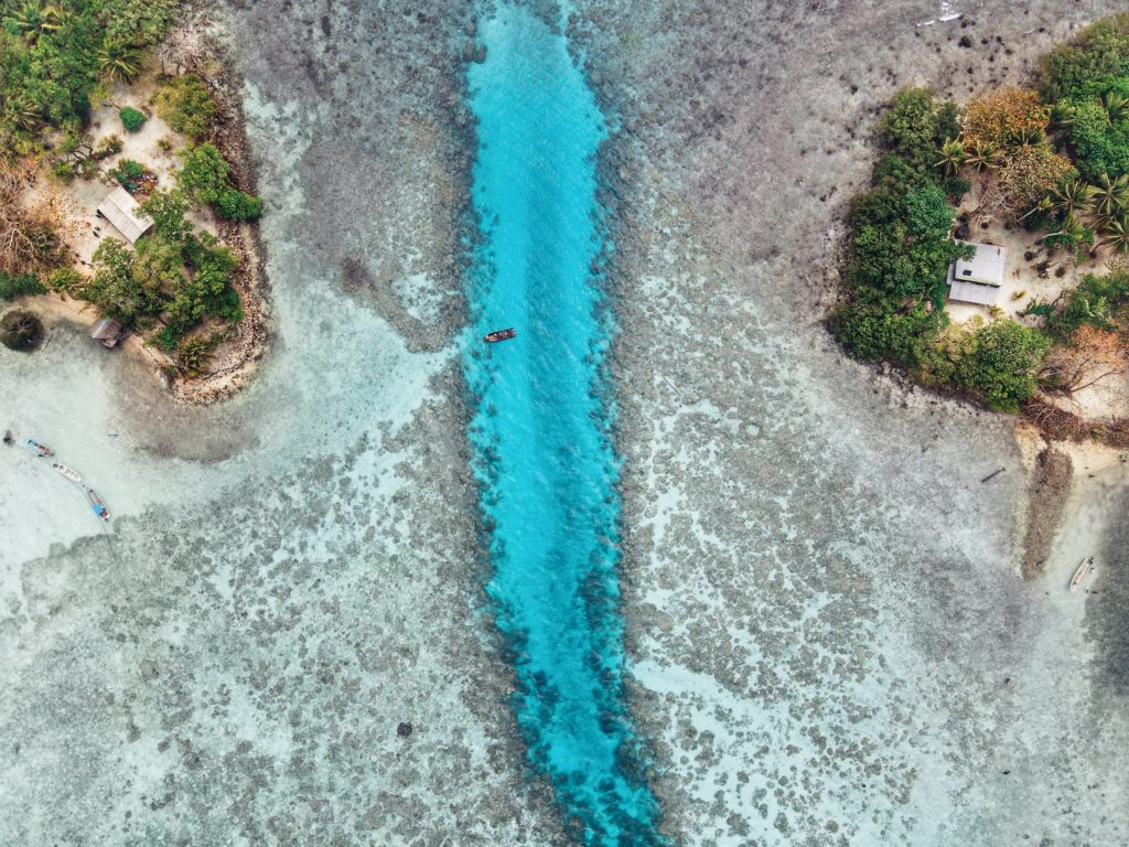
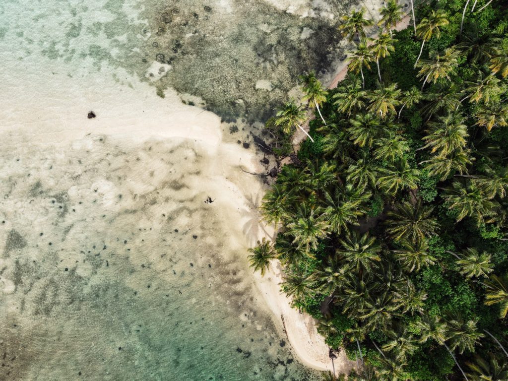
“Black Coral” is the southernmost islet in the Namwmour chain of islands that straddles Kehpara Pass (Dauen Kehpara) on the southwest corner of Pohnpei’s barrier reef. It’s true name is said to be Kehpara, but hardly anyone calls it that. Instead, Kehpara is usually used to refer to the island on the opposite side of the pass (island on lower right side of top image). In the mid-1600s, the conquering hero, Isokelekel, first entered Pohnpei’s barrier reef through Kehpara Pass on his way from Ahnd Atoll to Nan Madol. The sandy and well-shaded coral island, which lies within the Kehpara Marine Protected Area (MPA), is currently owned by the Adams family (the proprietors of Ace Hardware and Ace Office Supply). Black Coral is immaculately maintained with serpentine footpaths running here and there through large sprawling trees and several simple, wooden huts for overnight camping. Good snorkeling is located off the eastern shore and in the pass to the north, where white-tip and black-tip reef sharks, spotted eagle rays, and other marine wonders can often be seen. The best SCUBA diving is along the outer edge of the barrier reef north of the pass, a spot called Kehpara Wall. The area is a spawning ground for several varieties of protected grouper. Though some sandy areas appear at low tide along the inner coast, Black Coral doesn’t have any true beaches.
To make reservations for day visits or night stays and to arrange boat transport from the Seinwar Launch behind Seinwar Elementary School call ACE at +691.320.8279 / 5637.
PC: Lee Arkhie Perez
Black Coral from above. (PC: Lee Arkhie Perez)
Black coral on the left, Kehpara on the right. (PC: Lee Arkhie Perez)
Black Coral (top island) and Kehpara (bottom island)
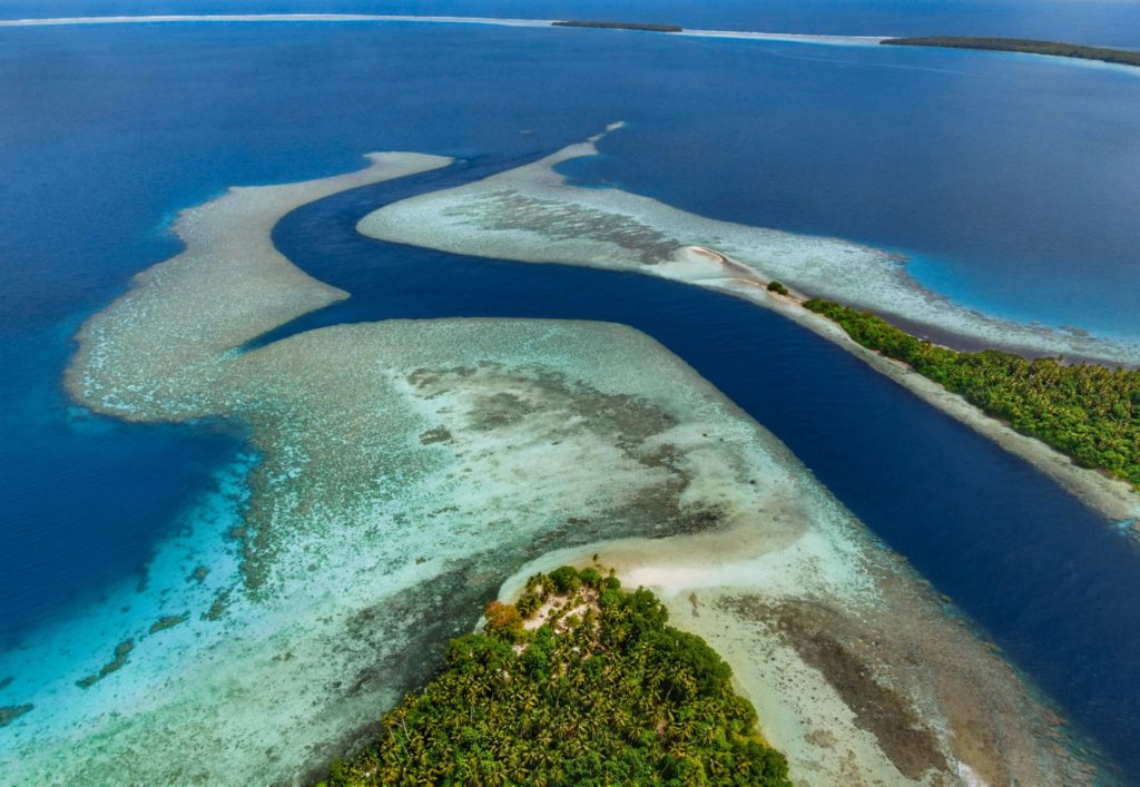
Beyond Pohnpei’s lagoon, the closest land to be found exists on two “satellite atolls” called Ahnd (pronounced änt) and Pakin (pä.keen). An atoll is made up of a number of coralline islets in a ring around a relatively shallow lagoon and is created when a high, volcanic island submerges over millions of years, leaving only the reef that fringed its shores. The islands form as sand, coral rubble, and other detritus collect on the reef and begin to support trees, small plants, and animals. Coral sand accumulates on the lagoon sides of the islands and creates beaches.
Ahnd (“Ant”) Atoll
Ahnd Atoll, popularly but erroneously spelled “Ant,” is 16 km (8 mi) southwest of Rohnkitti and consists of 13 low, luxuriant islands 3-4 meters above sea-level and a lagoon of 70 km2 entered by a single passage in the reef.
When the larger-than-life hero Isokelekel voyaged to Pohnpei, intent on overthrowing the rulers of Nan Madol, he came first to Ahnd and lived there for some time, learning about Pohnpeian customs from its inhabitants. In modern times, the entire atoll became the property of a single Pohnpeian family — the descendents of Henry Nanpei, who lived from 1862 to 1928. Nanpei’s shrewd business sense and knack for manipulating local power politics enabled him to acquire the atoll and amass a great deal of other land.
Ahnd Atoll Channel
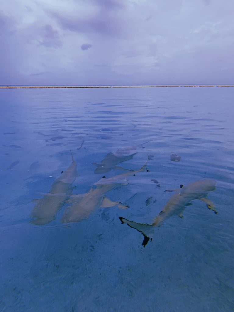
Black tip reef sharks at Ahnd Atoll (PC: Tia Panuelo)
Ahnd Atoll, Federated States of Micronesia (PC: Alex Zuccarelli)
Ahnd Atoll, Federated States of Micronesia (PC: Alex Zuccarelli)
Ahnd Atoll, Federated States of Micronesia (PC: Alex Zuccarelli)
Imwen Sapw Island and channel entrance
Today Ahnd has a few human residents, the biosphere rangers who make sure people do not fish within the protected area. There is also resort run by the Nanpei family located on the island of Pasa (information for booking trips can be found below).
It is home to some of the largest colonies of black noddies, terns, boobies, and frigatebirds in the Pacific as well as a healthy community of gray reef sharks in and around Dauenai (passage).
The most interesting islands to camp on are Pasa, Nikahlap, Dolen Mwuroi, and Nahlos. The former two have long stretches of deserted white-sand beach and excellent swimming. Nan Imwinsapw is closest to Dauenai (passage), where all the best snorkeling and the most accessible diving is found, but it has a big rat problem. Pahn Mwek is near to both excellent snorkeling and some of the rare diving that exists inside the lagoon. For the most part, however, the lagoon is the domain of snorkelers, sandy and punctuated by beautiful coral heads with lots of color and life at low tide.
Dauenai on the south side is where most people go to SCUBA dive. It is known for orange sponges (on the west wall) and large numbers of barracudas, jacks, and sharks throughout. Reef fish populations around the pass, unfortunately, have declined in the last two decades, but hopefully will recover now that the area is protected. Even so, the place still feels busy compared to other locations and you’ll see all the familiar species — unicornfish, triggerfish, wrasses, surgeons, groupers, butterflyfish, angelfish, moorish idols, and more. Moray eels might be spotted on occasion. Spinner dolphins are regularly seen at the mouth of the passage and in the waters around Ahnd. Visibility in the pass, though not as spectacular as outside the reef, can reach 50 meters (164 feet) — certainly nothing to complain about.
In addition to drift-dives on either side of the deep passage, there is stunning (and frequently overlooked) diving on the outer wall of the barrier reef on the northwest side near Olouna (often known as “bird island” for the huge colonies of seabirds that nest there), and north of Pasa. The west wall of the barrier reef plummets to great depths, and because it is more protected from the northeasterly winds and waves, it is marked by an abundance of soft coral, holes, tunnels, and caves — an exciting place for any advanced diver. Giant clams are also common. Visibility on the outside edges can be extraordinary, exceeding 70 meters (230 feet). Currents can be swift both in the pass and around the outer walls.
Visiting Ahnd Atoll / Permission & Protected Areas
Because Ahnd is a privately owned island and UNESCO marine biosphere reserve permission is required from the Nanpei family for visits.
Contact LP Gas at +691.320.5661 / 2675 to make arrangements.
Core area(s) comprise a strictly protected ecosystem that contributes to the conservation of landscapes, ecosystems, species, and genetic variation.
A buffer zone surrounds or adjoins the core areas, and is used for activities compatible with sound ecological practices that can reinforce scientific research, monitoring, training, and education.
The transition area is the part of the reserve where the greatest activity is allowed, fostering economic and human development that is socio-culturally and ecologically sustainable.
Olouna (“Bird Island”)
Landing on Olouna island is prohibited to prevent disruption of the habitats of the seabirds who nest there. If you’d like to take a look at Olouna, consider making a kayak trip around it. You can arrange to pay your boat extra to transport a small ocean kayak or two.
Pakin Atoll
Pakin Atoll is composed of about 16 low islands, 13.6 km2 of reef, and a lagoon of 11 km2. It lies 38 km (24 mi) northwest of Palikir. In the early 1900s, Sokehs residents of Mortlockese descent were allowed to settle on the atoll, where their descendents (about 80) live to this day. Most of the islands are sparsely inhabited and all have excellent beaches, swimming, and nearby snorkeling.
One complication of visiting, however, is that Pakin has no true passage, making entry into the lagoon impossible for large boats and both difficult and dangerous for small boats. Boats enter at high tide at one of two places in the barrier reef (the usual spot is known as Uhrek), where the coral is slightly deeper than elsewhere — by a matter of a few inches. The crossing is narrow and complicated by strong surge. Except at the highest tides, the crossing must be carefully timed to correspond with the surge. Boats can easily capsize in the surf or be thrown up on the reef; several locals have been killed at the spot while trying to make the crossing in less than ideal conditions. When planning a visit, make sure that you hire an experienced pilot who knows this particular crossing and is committed to the safety of his passengers. Also, it is important to plan arrivals and departures to coincide with the highest tides.
All of the diving and the best snorkeling is on the reef wall outside the lagoon, where water clarity and reef conditions are simply mind-blowing. The wall north of Nikahlap is known for sharks, while the opposite side of the island is home to large schools barracuda. For sea turtle sightings, divers will want to try the walls on the northeast side. Turtles nest on many of the small islets north of Painpwel, Sapangin, Kehrot, and Osetik.
This small reserve covers an area of 1.39 km2 and includes the pristine mangrove forests around Pwudoi (north of Dolen Uh) and some of the adjacent lagoon and fringing reef. There are two major mangrove channels that run through the sanctuary. One goes 0.69 km (0.43 mi) up to Pilen Seleur — the same watercourse where the eel pools are located. The other channel is 0.61 km (0.38 mi) long. Both are excellent, scenic paddles with plenty of seabirds to scope out. The launch at Seinwar is a good point of access for this area.
Entering the MPA requires a permit. Visit our MPA page for details.
Mangrove Channels & Coastline
Western Kitti doesn’t have an abundance of long mangrove channels to paddle through, but it does have lots of smaller ones. The best of these are in the north. One interesting loop cuts around a chunk of mangrove forest, combining the 0.68 km (0.42 mi) of Dauen Tomwara with another 0.7 km (0.44 mi) segment. Another loop encircles Kiparalap Island with a 0.48 km (0.3 mi) segment through the mangroves. If you put in near the Sakartik Stream bridge (Pilen Sakartik), you can also experience this 0.89 km (0.55 mi) channel leading to the lagoon. Dauen Nansakar offers another 0.83 km (0.52 mi) of channel to explore.
Nearby Islands
Two single islands in the north — Kiparalap and Pohn Lahpar — and two island chains make great destinations for paddlers. You can get to the coast of Kiparalap from the south side and Pohn Lahpar from the east side. Otherwise, both islands are surrounded by mangrove forests. A string of small islands and mangrove clumps on the barrier reef south of Dauahk Passage (Kepidauen Dauahk) are roughly 5.5 km (3.42 mi) west of the community launch in Dien. It’s a fairly long paddle, but the islands make a nice spot for a rest and some lunch. The snorkeling on the inner reef walls in the area is sublime. Finally, the beautiful islands of Kehpara and “Black Coral” lie 6.58 km (4.1 mi) southwest of the Seinwar launch. There are primitive shelters on both islands for camping and incredible snorkeling in the pass that runs between. Kehpara has a beautiful white sand beach at one end.
Visit the Islands page for more information about Kehpara and Black Coral islands and how to book huts for overnight stays in either location.
Entering Kehpara MPA requires a permit. Visit our MPA page for details.
If Nan Madol is your primary destination, the southern route around Temwen is the shortest, following the tranquil passage of Dauen Moahk (a meditative way to begin or end the day). Note, however, that east-bound passage under the two bridges at Temwen Causeway is extremely difficult or impossible when the tide is coming in. The current flowing into the bay can be as powerful as a river.
Temwen Island Circumnavigation
For people that want an upper-body workout, the 8.9 km (5.3 mi) paddle around Temwen is an interesting journey with a variety of different sights along the way. Be informed on the tides before starting as the reefs on the northeast and northwest sides are only inches deep at low tide.
Heading north, there are wonderful views of scenic (but murky) Madolenihmw Bay and nearby Takaiuh and Nahnpahlap hills. Peipas Island, a man-made basalt burial structure that is probably related to Nan Madol, is hidden among the mangroves of Temwen’s western coast. Further on, stony Salong Point juts north almost to the edge of the channel. Unusual eroded rock formations and a complete lack of mangroves make the place visually unique and worth a look. There’s also a small sea-cave and a portal in the topography that frames conical Takaiuh. Depending on tides and recent rain, the sheltered bay east of the point is sometimes a nice place for a dip, though there isn’t enough coral in the area for snorkeling.
The segment between Salong Point and the Japanese Wharf can be a challenging paddle as Kepidauen Deleur is known for its rough water. This is apparently due to two seamounts in the area, called Mwudokendil and Mwudokensepehl. From the Japanese Wharf, it’s another 1.4 km (0.87 mi) to Nan Douwas. Enter the ruins from the north between Temwen and Peniot.
On the southern side of Temwen, you have the choice of several different channels through the mangroves, though all except Dauen Moahk are heavily silted in and impassable at low tide. The two largest islands between Temwen and Pohnpei — Mwudokalap and Mwudoketik — both host prehistoric stone structures related to Nan Madol. The former was the place where Isokelekel first encountered his estranged son, Nahlepenien, who would eventually become the first Nahnken and later the Nahnmwarki of U.
Nahnningi & Mall Islands
South of Temwen are Nahnningi(believed to be a man-made island from the Nan Madol era) and Mall islands. The latter has a stone tomb at the northern end. The Namwen Nahnningi Stingray Sanctuary lies northwest of the islands.
Visit the Islands page for more information about these locations.
Other Islands
Five islands are found northeast of Temwen at the edge of the massive reef shelf called Mad Pahra. Nahpali is littered with Japanese-era historical sites and has a couple of nice sandy beaches. Little Dekehmwahu also has a nice, secluded beach, but to get to it, you’ll have to paddle around Nahpali’s southern side. Na island’s nicest coasts are on the north side. The same is true of Dekehtik. Nahkapw is a little apart from the others with easy access to the best snorkeling in the area.
Visit the Islands page for more information about these locations.
Pahn Nahkapw & Kahnimweiso
The deep water between Nan Madol and Nahkapw at first appears to be a wide channel leading to the open ocean, but may in fact be something called a “blue hole.” It has been hypothesized that this trench is actually a collapsed portion of the reef shelf. Pohnpei oral histories speak of another stone city, called Kahnimweiso, that pre-dated Nan Madol and was said to lie where Pahn Nakapw is now. One theory proposes that the weight of the basalt constructions coupled with the undermining of the limestone reef shelf by freshwater run-off, could have caused a collapse and sent Kahnimweiso plummeting 65 meters to the bottom. When you see how the sandy shore at Nahkapw’s north end drops straight off into deep blue or experience the odd currents in the area, it’s not hard to believe that the site is special. To date, the theories have not been properly tested and Pahn Nahkapw has retained its secrets and its eerie feel.
Nan Madol
If coming from the south, enter the ruins through Dauen Moahk, the first mangrove channel encountered (high tide only). The first stops include Pahn Kadira and Kelepwel islets. From there, you can venture northeast up the canal to Peikapw, Idehd, Dorong, and Peneiring. Further north, notable sites include Kerian, Peikapw Sapwawas, Dau, Pahn Douwas, Pohn Douwas, Nan Douwas, and Konderek. On the return trip south, catch Lemenkau and adjacent Namwenkau (pool) and the huge boulder wall of Pahnwi at the southwest corner. The upper portion of Mweiden Kitti is silted in and nearly closed off by encroaching mangrove trees; it’s impassable even at high tide. All of the entrances on Madol Pah‘s southwest perimeter are now dead-ends, but provide nice sandy spots to picnic.
From the north, it’s easiest to enter Nan Madol at Dauen Nankieilmwahu between Temwen and Peniot islet — especially when surge and choppy seas in Pahn Nahkapw make the narrow gap at Nan Mwoluhsei too risky.
Paddling Distances Around Temwen Island
Starting
Ending
Distance (km)
Distance (mi)
MERIP
—-
Temwen Causeway
0.59 km
0.37 mi
Temwen Causeway
—-
Pahn Kadira islet*
1.7 km
1.0 mi
Dauen Moahk
—-
Pahnwi islet
0.89 km
0.55 mi
Pahnwi islet
—-
Lemenkau islet*
0.58 km
0.36 mi
Lemenkau islet
—-
Dorong islet*
0.62 km
0.39 mi
Lemenkau islet
—-
Peinering islet*
0.39 km
0.25 mi
Peinering islet
—-
Kerian islet*
0.42 km
0.26 mi
Peinering islet
—-
Nan Douwas islet*
0.41 km
0.25 mi
MERIP
—-
Salong Point
2.2 km
1.37 mi
Salong Point
—-
Japanese Wharf
1.0 km
0.64 mi
Japanese Wharf
—-
Nan Douwas islet*
1.4 km
0.87 mi
Japanese Wharf
—-
Nahpali Island
2.63 km
1.63 mi
Nahpali Island
—-
Dekehmwahu Island
2.00 km
1.5 mi
Kerian islet
—-
Nahkapw Island
0.89 km
0.55 mi
Nahkapw Island
—-
Dekehtik Island
0.52 km
0.32 mi
Dekehtik Island
—-
Northern Na Island
2.9 km
1.8 mi
Northern Na Island
—-
Dekehmwahu Island
0.77 km
0.48 mi
Mweiden Kitti
—-
Nahnningi Island
0.69 km
0.43 mi
Nahnningi Island
—-
Mall Island
0.42 km
0.26 mi
*Silted-in estuary. This segment may be difficult or impossible to traverse at low tide.
Dauen Sapwalap is the largest drainage in Madolenihmw, a wide, meandering channel that cuts through the mangrove forests from Kitamw and eventually empties into Madolenihmw Bay. Although the Lehdau River (Pillapen Lehdau) is probably the largest contributor to this major estuary, the two are not synonymous; the channel is also fed by three other watercourses, including the Kitamw Stream (Pilen Kitamw), Pwadapwad Stream (Pilen Pwadapwad), and River of Sekere Riau (Pillapen Sekere Riau). According to legend, a powerful demi-god named Lapongo — the same character involved in the story of Takaiuh peak — dug out the channel with his penis. The matriarch of the Lasialap Clan — a great eel responsible for the creation of Lipwentiak in Kitti and whose tail formed the great mountain in Nett, Pohnlehr — was also said to have dwelt in this channel for many years, terrorizing the local inhabitants.
During the 1889-1890 wars between the Spanish and Pohnpeians, which began in Ohwa and concluded in Kitamw, two contingents of Spanish troops were dispatched at the mouth of Dauen Sapwalap and attempted to move up both banks of the Pillapen Lehdau (Lehdau River) to reach a small half-finished fort built on a low hill by the Pohnpeian fighters. The first group of soldiers got terribly lost in the tangled forests and happened upon the fort only by mere chance. The second group was forced off-route by a seemingly supernatural flood and also ended up lost, camping overnight at Elieliwi before joining the fray. The assault cost the Spanish 21 men, and in the end the Pohnpeians merely withdrew and yielded a position that had meant little to them from the beginning.
In the last decade, the estuary became part of the Senipehn Mangrove Forest Reserve and afforded some environmental protections; tree-cutting, fishing, and gathering of other natural resources in the area is prohibited in most circumstances. Paddlers can explore the 2.6 km (1.62 mi) primary channel and its side passages by launching near the Lehdau River bridge, at the end of the road near Tahio, at the Madolenihmw “Ice Dock”, or at the MERIP boathouse.
Entering the mangrove reserve requires a permit. Visit our MPA page for details.
Takaiuh Peak
While Sokehs Rock is the stand-out natural feature in the north, in Madolenihmw that title certainly goes to Takaiuh (“standing rock”), a majestic conical hill-island on the north side of the bay. Westerners called this feature “Sugarloaf” after the molded cones of sugar that were popular in Western Europe as early as 1470, but the local name and its story are much more interesting (see Madolenihmw Bay Area page for more).
Paddlers can get right up close to the iconic hill for a view from the water that is better than from anywhere on land. There’s also good fun to be had noodling around in the mangrove forests on the eastern shore (at high tide). A sweet spot to stop for a picnic lunch is the top of an exposed rocky rise 0.36 km (0.22 mi) northwest of the peak (no mangroves skirt this bit of the shore).
Pahn Dieinuh
Pahn Dieinuh, the southern point of the Dolopwail peninsula, is significant historically for the 1836 conflict that began there between the visiting British whaleship Falcon and two rival Pohnpeian chiefs — Luhk en Kesik ( the Nahnmwarki) and the Wasai, the first and second ranking men in the royal line, respectively. Things got ugly when the Nahnmwarki made a move to seize the ship and its cargo. When the ship attempted to flee, it ran up on the reef. The cargo was transferred to Nahpali Island and then stolen a month later by the Nahnmwarki‘s brother, Nahnawa. A battle ensued on Nahpali between Nahnawa‘s party and the whalers, ending in the deaths of the ship’s captain and three other sailors. The Wasai, who had been challenging the Nahnmwarki‘s authority for some time, seized this opportunity to rid the land of his enemy by joining the crews of other whaleships in hunting down both Nahnawa and the Nahnmwarki. Fighting continued for several days until the Nahnmwarki was shot and Nahnawa captured and hanged from the yardarm of the whaleship Lambton. Both bodies were buried at Pahn Dieinuh, and the Wasai assumed the position of the Nahnmwarki. There isn’t much of anything to see at Pahn Dieinuh now, but it’s a good spot for a break mid-route. The closest launch points are MERIP boathouse, the “Ice Dock”, and the Metipw launch.
Mwudokolos Island
In addition to the seven islands (Nahpali, Dekemwahu, Na, Dehketik, Nahkapw, Nahnningi, and Mall) found around Temwen, there are three small islands to the north that shouldn’t be missed. The first of these — Mwudokolos — is found a half-kilometer (0.33 mi) northeast of Metipw and easily accessed from the coral-dredged causeway/dock found there (ask at the nearest house for permission to launch). Archaeologist Arthur Saxe believed that the island was tied to Nan Madol in some way and that it might even be a man-made island, but Japanese archaeologists working on the island in recent years have found no hard evidence to support that idea. They did discover prehistoric stone structures and a house platform that dates to the Nahnmwarki Period of Nan Madol (post-1700). Glass beads, sherds, and clay pipes were also found, suggesting that Mwudokolos was occupied by foreign traders in the late 1800s. The island is privately owned, but unoccupied.
To obtain permission for day visits or overnight stays, call Sesuko Hadley at +691.320.2540.
Dahu Reirei Island
From Mwudokolos, paddlers can continue 1.8 km (1.13 mi) further north through the easternmost of two dredged reef channels to reach Dahu Reirei (“long channel”), a narrow, man-made islet with huts for picnickers and campers and lots of pleasant swimming and snorkeling. When we say this island is narrow, we mean narrow (10 meters wide). Unless you like being crammed together elbow-to-elbow, avoid the place on weekends and holidays. It’s also not a place to be on intensely hot days (there are no trees large enough to provide shade) or during bad weather (the island is hardly a meter above sea level at high tide). On partly-cloudy weekdays, however, it can be heavenly. The surrounding water is generally crystal-clear and the reefs, which consist mainly of varieties of staghorn coral, are surprisingly healthy and relatively well-populated with reef fish. Small thatched huts along the length of the strip can be rented for the day or overnight.
To make reservations for day visits or overnight stays and to arrange boat transport, call Joseph Helgenberger at +691.320.2229.
Lepin Dau (“Channel Island”)
The final island covered in this sector (it’s just off the edge of the Central Madolenihmw map, but appears on the U & Northern Madolenihmw map) is claimed by the same family as Dahu Reirei and has no official name, but as it lies adjacent to the primary channel every boat in the area uses to go from Areu and Ohwa to Madolenihmw Bay, it’s known as Lepin Dau or “Channel Island.” This island is larger and higher than Dahu Reirei and has some welcoming tree-cover (mostly pandanus). The channel on the west side is a nice spot to snorkel at slack tide, but at other times, the current can be so strong that snorkelers and swimmers run a strong risk of being swept away. A better spot for snorkeling is in the blue holes around the southeast side — well out of the path of the current. Here you can find beautiful coral grottoes, huge schools of needlefish, barracuda, cuttlefish, trumpetfish, angelfish, and parrotfish, an odd seasnake (the latter are venomous, but so passive that they pose little danger to snorkelers), and from time to time even eagle rays and small green turtles. It’s a fantastic picnic destination for paddlers.
You don’t really need to get permission to make day visits to “Channel Island,” but overnighters should call Joseph Helgenberger at +691.320.2229.
Nanwap Marine Protected Area
The reefs on the north side of Kepidauen Deleur make up the Nanwap Marine Protected Area (MPA), a marine reserve with excellent snorkeling and diving. The best place to snorkel is about 1.3 km east of Metipw in a protected reef hole, but watch for strong currents.
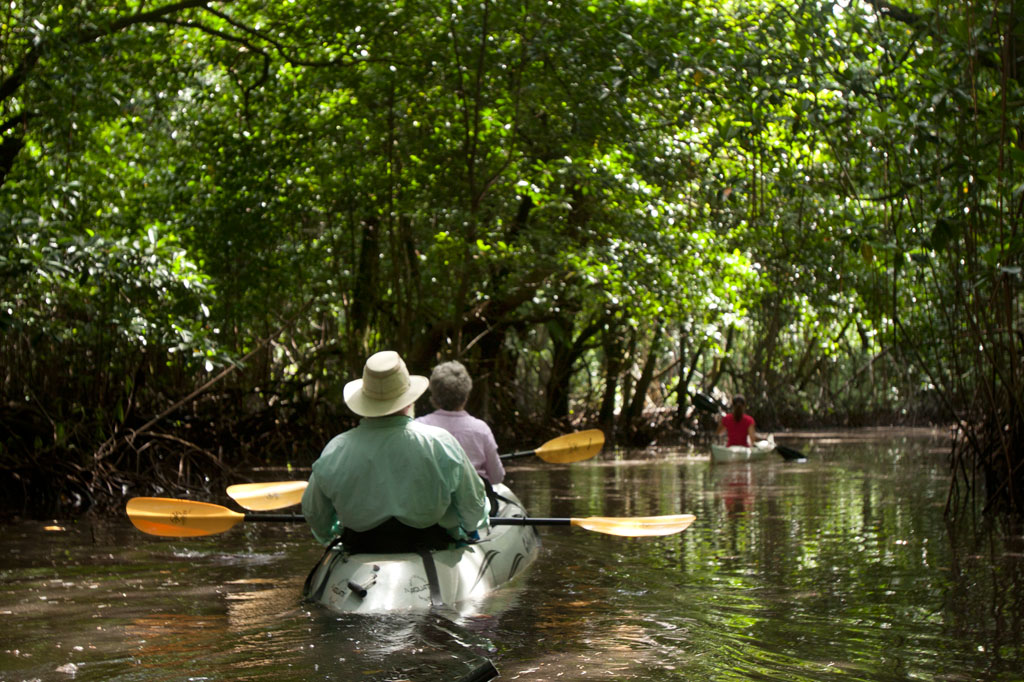
Daumwoakote, the magical 2 km (1.24 mi) mangrove passage running between Sokehs Island and Pohnpei Island, is an absolute must-see for anyone with a heart for adventure and an eye for beauty. If you launch opposite St. Peter’s Church, you can catch the tide and cruise west through the tunnel-like avenue of trees to the accompaniment of a chorus of birds. Early in the morning and late in the afternoon there are so many winged creatures around that the place feels like an aviary. The trees are also bewildering–great twisted wonders with looping prop roots and spiking pneumatophores. The mangroves propagate both by dropping dart-like propagules into the silty mud and by sending down hundreds of dangling extensions that add to the primordial atmosphere. Several species are found in the area. About two-thirds of the way through, you have the option of continuing in the main channel or deviating to one of two smaller passages just wide enough for a kayak or canoe.
Sokehs Island Circumnavigation
From the west end of Daumwoakote, roughly 10 km (6.2 mi) remain to completely encircle the island. Along the way, you’ll cross emerald reef pools in the bay, skirt dense mangrove forests, and get fantastic views of the green cliffs of Pohndollap. The “Doldrums” at APSCO makes a perfect spot for a rest, a rejuvenating swim, and a snack.
The Labyrinth
The “Labyrinth”, located southwest of Daumwoakote at the mouth of the Nankewi River, is composed of hundreds of small mangrove islets growing in a dense cluster. There is no particular route–just paddle in and let yourself wander through the myriad passageways and shallow pools, inhabited by crabs, the occasional black-tip reef shark or hunting snapper, communities of juvenile fish, and a variety of seabirds and shorebirds. The water depth ranges from a half meter to 1.5 meters.
Note that the area between the Sokehs Island Bridge and Daumwoakote is very shallow at low tide, and at high tide, you may find that branches over the water don’t give you much room to move. Most of the routes on this guide, however, should be passable during all but the most freakish of tidal fluctuations.

")

")
")
")
")
") Further on, stony Salong Point juts north almost to the edge of the channel. Unusual eroded rock formations and a complete lack of mangroves make the place visually unique and worth a look. There’s also a small sea-cave and a portal in the topography that frames conical Takaiuh. Depending on tides and recent rain, the sheltered bay east of the point is sometimes a nice place for a dip, though there isn’t enough coral in the area for snorkeling.
Further on, stony Salong Point juts north almost to the edge of the channel. Unusual eroded rock formations and a complete lack of mangroves make the place visually unique and worth a look. There’s also a small sea-cave and a portal in the topography that frames conical Takaiuh. Depending on tides and recent rain, the sheltered bay east of the point is sometimes a nice place for a dip, though there isn’t enough coral in the area for snorkeling.")
")


")