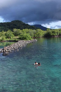
Pahnsapw & Nankep Waterfalls

BikingHiking / TrekkingWaterfallSwimmingPicnicking

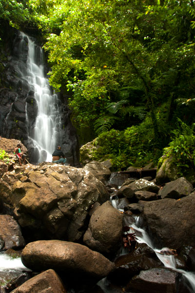
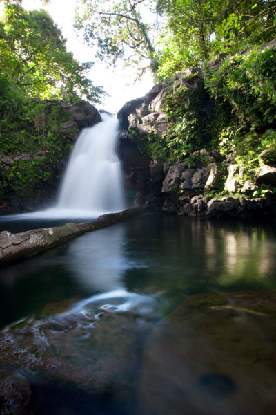
Lower Pahnsapw Falls, Pohnauleng, Pohnpei, Federated States of Micronesia (FSM)

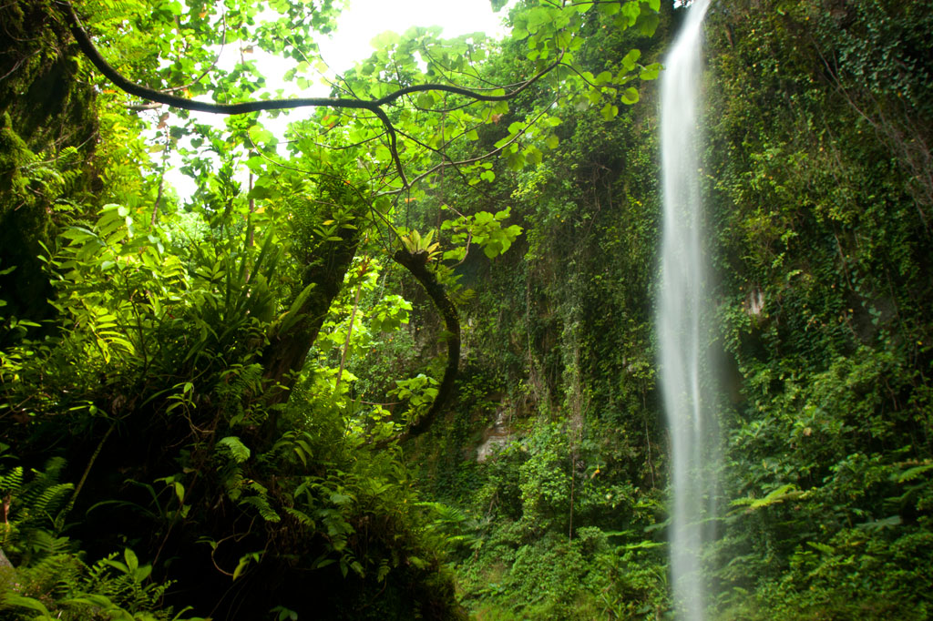
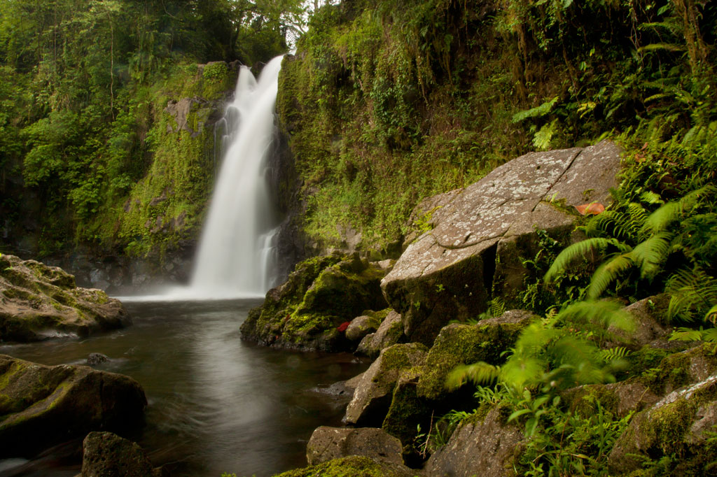
Pahnsapw, which means “beneath the land,” refers to a pair of tall, majestic waterfalls which plummet off the edge of a high plateau in central Madolenihmw (it’s also the name of the farmstead). Both waterfalls are found on the land of the Silbanuz family (relatives of the people at the Nan Madol trailhead) — the smaller falls is lower down and hidden from view until you get up-stream, but the upper falls can be seen from the Circle Island Road.

The hike starts at the end of an unpaved road and criss-crosses the stream or runs along the bank up to the first falls, which is about 4 to 6 meters (13-20 ft) high and has a beautiful shallow pool at the base, excellent for a quick, cool swim. Unless you’re in good physical condition and don’t mind getting dirty, this is where you should stop.

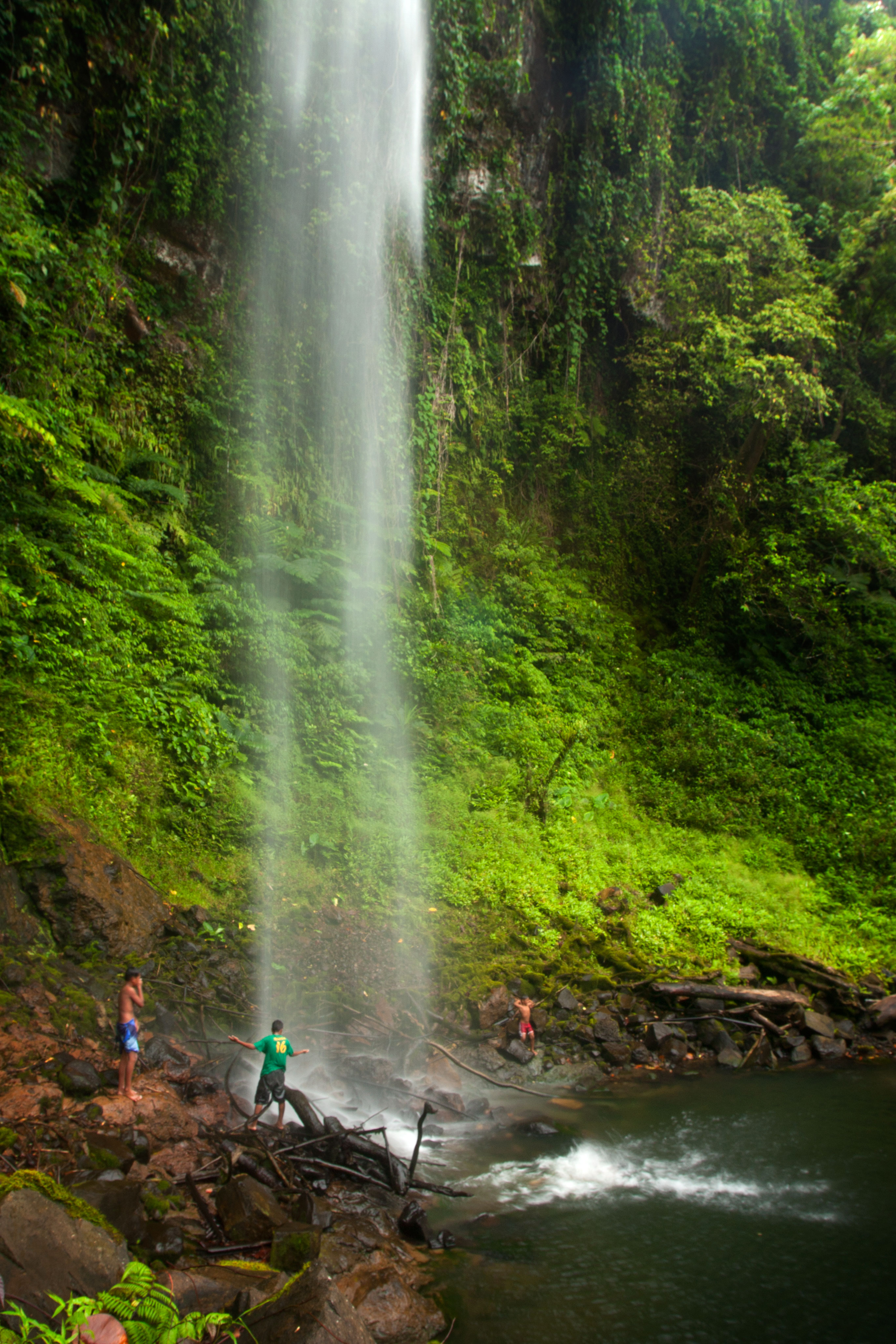
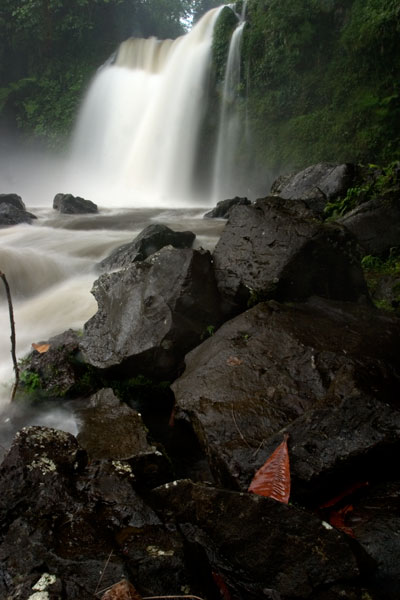
Upper Pahnsapw Falls, Pohnauleng, Pohnpei, Federated States of Micronesia (FSM)

To reach the second falls, the route climbs straight up an extremely steep (and sometimes muddy) slope to the right of the lower waterfall with little to hold on to, turns horizontally across the slope face, and then returns to the river, where there’s a secluded pool in a shady nook. It might be a good idea to bring a length of rope and have the guide secure it to something at the top of the slope prior to scrambling up. Five minutes up-stream is the second waterfall, which is about 18 meters (60 ft) tall and falls into a large, deep pool. The water at both waterfalls is cool and very clean.

The Silbanuz family charges an access fee of $2.00 per person. Any of the teenagers around the house can be hired as guides. Offer $12.00.

  • Plan for 2 hours round-trip with some leisure time at both of the waterfall pools.

Nankep Waterfall

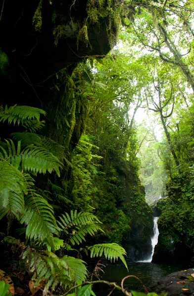
The next waterfall going south is known as Nankep. People living in the area say the name means “inlet” or “in the cup” (depending on who you talk to). The latter seems logical, except that the Pohnpeian word kep is a loaner from English and wouldn’t date back beyond the early 1800s. The site may have had a different name prior to that time or it has picked up new meaning over the years. The road to this trailhead is steeper and more rutted than the one to Pahnsapw, so it’s best to park at the bottom near the Circle Island Road and walk to the end, where the trail begins on Waltis Herdinand’s land — an area referred to as Elilpei. The hike is short and relatively easy, concluding in a hidden nook with a small plunge pool. The best time to visit Nankep is after a period of heavy rain as it can be nothing more than a tiny ribbon of water at other times. Some people believe that the falls will be dry if all the members of the visiting group are male, so mix it up.

No official access fee is charged.

  • Plan for 90 minutes round-trip with time to swim at the falls.
  • To hire a guide, ask at the houses in the area, contact Hanke Albert at +691.320.4047, or call the owner of the land around the falls, Waltis Herdinand, at +691.320.2909. Offer $12.00.

Map Guides >> Central Madolenihmw >> Pahnsapw & Nankep Waterfalls

Marine Parks

CampingSwimmingSnorkelingKayaking / CanoeingPicnicking

Awak Pah Marine Park

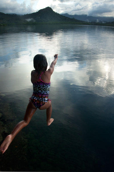
A swimmer leaps from the wall at Awak Pah Marine Park, Pohnpei, Federated States of Micronesia (FSM)
Awak Pah Marine Park is the most well-known of the parks in the area and has a nice big sign right out on the main road. From the parking area near the owner’s house, a 0.2 km (0.12 mi) coral and concrete walkway leads to the water through a dense section of mangrove forests. At the end, there’s a tiny picnic area by the water, a large nahs, and a few other huts that can be rented at an extra cost. The water is shallow and a bit silty on the south side and deep on the west and northwest side where a huge pair of PVC rings have been anchored (a good place to swim). The rock wall by the water is a fun place to jump from, but it can be difficult to climb back out. Snorkeling can be pretty good to the west along the reef wall with lots of small fish and some interesting coral growth. Unfortunately, local visitors have been careless with their garbage and the beautiful reef scenery is frequently ruined by the presence of discarded aluminum soda cans or flashlight batteries — a sad trend on Pohnpei. Water clarity varies from crystal clear to murky depending on the tides; it’s best to visit on an in-coming tide. You can visit Awak Marine Park without making arrangements beforehand.

Shallows at Paieke, Pohnpei, Federated States of Micronesia (FSM)

Paieke Marine Park

Owned by Bryan Damarlane, this pleasant, breezy swim-picnic-camp park is located on a network of dredged coral causeways that extend out into the lagoon at the point where the road begins to turn east toward the Awak valley. A number of thatched residential huts varying in size and a nahs (meeting hut) or two are positioned around the water’s edge for guests at an extra cost. The swimming is good all along the west side, though the shallows tend to be silty rather than sandy. Snorkelers should follow the edge of the reef further out into the lagoon for best results. The kids will love tinkering around in the shallows under the shady trees. Paieke operates on a reservation-only basis.

  • To make reservations for day visits or overnight stays, call Bryan Damarlane at +691.925.0382.

Pein Ahi Marine Park

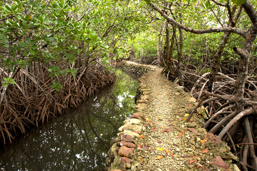
This charming, but little-known, park (pictured at top) is found just after Awak Marine Park, but as it lacks a sign, most people drive right by without realizing it’s there. From the road, a beautiful 0.16 km (0.1 mi) stone and coral walkway winds through the picturesque mangrove forests and ends at a grassy picnic area with a nahs and a large fish pond. The family keeps some very curious pufferfish and a few other reef fish in the pond, mostly for the amusement of visiting local children. The swimming all around the outside of the pond walls is excellent with consistently good water clarity. There’s a relatively shallow area on the south side that works well for kids or beginning swimmers and deeper water on the west and north. They also have a pair of large bamboo-pontoon rafts that are fun to cruise around the mangrove fringe on. Except on big holidays, you can usually visit without making any prior arrangements.

Nihco Marine Park

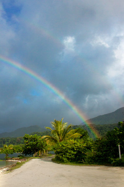
Rainbow over the beach at Nihco Marine Park, Pohnpei, Federated States of Micronesia (FSM)
Nihco Marine Park, on the southwest coast of scenic Sokehs Bay is an appealing place for people of all ages to swim, barbecue, and soak up the sun. The park is comprised of a narrow, man-made semi-circle of sand with a placid lagoon in the middle where turtles and reef fish are kept. There’s a white-sand beach on the outer edge and simple thatched huts for either day or overnight visits. Small kayaks can be rented for a few dollars. The place can be packed on weekends and holidays.

  • To make reservations for day visits or overnight stays, call +691.320.2135 / 2659

Nihco Surf

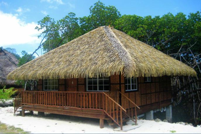
Nihco Bungalows, Sokehs, Pohnpei, Federated States of Micronesia (FSM)

Nihco Surf is one of two thriving operations that cater to foreign surfers and tap into the radical power of the now world-famous reef-break at Palikir Pass. The locally owned and managed camp, situated inside Nihco Marine Park, offers six air-conditioned wifi-equipped bungalows that look out over Sokehs Bay; an on-site restaurant; kayak-rental; boat tours; And Atoll trips; and daily excursions to P-Pass, Lighthouse Break, and Mwahnd Pass.

Map Guides >> Greater Nett & Western U >> Marine Parks

Nett Point

BikingSwimmingSnorkelingKayaking / CanoeingPicnickingBeaches

Nearly all of Pohnpei’s coastline is surrounded by mangroves, and though these otherworldly swamp forests are incredible to explore by kayak, canoe, or paddleboard, they tend not to make good swimming spots. As a result, Nett Point — a long man-made strip of dredged coral and concrete at the north end of the Nett Peninsula — is currently the closest thing Pohnpei Island has to a beach. During the American Period, the place used to be the primary commercial dock. Supply ships would anchor at the end and a barge would carry cargo into Kolonia Harbor (the barge now rusts on the edge of the mangroves just south of Nett Point). The problem, however, was that lots of shallow reefs made Kolonia Harbor and the areas in the lagoon to the north risky for ships to navigate through. Sokehs Passage (Peinmen), to the west, was deeper and better protected. Once the modern commercial harbor and dock were established on the west coast of Dekehtik Island and big ships started using Peinmen (now called “Main Pass”) instead of Kepidauen Pweitik, Nett Point was abandoned. Over the years, the buildings and dock have been used for a variety of purposes, including storing outrigger canoes for the Nett paddling team and, most recently, as part of a clam hatchery operation. However, the point has simultaneously been a popular swimming and picnicking location for decades. The dock area has nice deep water for serious swimming and jumping and the sandy man-made beaches are perfect for kids. Some of the large trees overhanging the water have ropes attached that local kids like to swing around on. If you start near the dock and swim out along the edges of the nearby reefs, you can find some decent snorkeling. Many people barbecue on the east edge of the causeway or on the dock. Overall, Nett Point is a great place to swim, relax, and get to know some locals on a sunny day. Shade is scarce, so bring a hat. Depending on tides and recent rains (best during mid to late in-coming tide), the water is usually clean and clear with a visibility of more than ten meters.

In 2011, the Office of Tourism and the Nett Municipal Government attempted to improve the spot by cleaning it up, dumping large quantities of white sand along the western edge of the causeway, and planting trees. Further developments were announced — sand volleyball courts, public restrooms, and more were said to be in the works and it was announced that the municipality would be charging a small entry fee. After several accidents involving local boats and swimmers, a new channel was dredged not far away and all traffic was encouraged to completely by-pass the areas where people swim. When boats continued to zip through the channel without regard to people in the water, a buoy line was finally placed at the north entrance to the channel and the south end was partially blocked by a causeway. Though these changes solved the boat problem, they created another — inhibiting the natural flow of the tide through the area and reducing the water quality significantly. A small set of outhouse-style restrooms were eventually slapped together near the main road, but these were quickly destroyed by local kids. No fee was ever charged, and it’s unclear how the money would have been collected anyway. Things are very much still in flux. What Nett Point will look like in the future is anyone’s guess.

  • It’s easy to spend a 4-6 hours at Nett Point, when the conditions are good.

Map Guides >> Nett & Western U >> Nett Point

Liduduhniap Waterfall, Nanipil & Nan Madap Attractions

BikingHiking / TrekkingWaterfallBird-WatchingCampingSwimmingPicnicking

Liduduhniap Waterfalls

Liduduhniap upper falls, Pohnpei, Federated States of Micronesia (FSM)

The easiest waterfalls to visit on Pohnpei (no hiking required) are the tiered “horse-tail” falls, Liduhduhniap, just a few kilometers from Kolonia. When the Greater Nett Eco-Adventure Guide was published in 2015, we wrote of Liduduhniap:

“Some might consider accessibility to be a red flag and assume that a location so close to town would be completely spoiled by a constant flow of visitors and thoughtless development. That’s not the case here.”

Unfortunately, things have changed recently (2017). Under the direction of Pohnpei’s new tourism department, the landowners at Liduduhniap have chosen to severely undermine the natural integrity of the site by replacing the dirt path to the lower falls with an unsightly series of concrete steps and a concrete hut near the edge of the pool. Toilets have also been built on the site. For those of us who knew the place before this “development”, it will never be quite the same again, but Liduduhniap is still a beautiful spot — not just the two waterfalls themselves, but the greater area, which is lush, rugged, and often partially enshrouded in thick mists that drift down from the steep mountains. The population around the site is relatively sparse, and it is hoped that most of the land will remain as it has for decades — green and wild.

The Liduduhniap Waterfalls lie on a portion of the Nanipil River (Pillapen Nanipil) located right at the feet of the mountains and fed by a great deal of rain (the primary dam and reservoir that supplies the town with water is just a bit upstream). The upper falls cascades 4 meters (13 ft) into a deep basalt plunge pool with a jaw-dropping elevated view of the river valley and the slopes of the mountains. From there it spills over the lip and plummets another 8 meters or so (26 ft) into a larger, but shallower pool. Swimming is excellent at both pools, though the first is more difficult to get in and out of. Most people simply opt to take a flying leap off the rocks, but you can also carefully cross the river above the falls and climb down to the pool from the far side without too much trouble (go barefoot or wear five-fingers to avoid losing your flip-flops in the swampy sections). The water is crystal clear — except immediately after heavy rains — and always on the chilly side, making it a great escape for oppressively hot and humid Pohnpei days. The deep, narrow valley funnels air along so that there’s always a bit of a breeze, too, which keeps the ferns waving hypnotically and the temps down. No one is quite sure how deep the upper pool is, but it’s deep — deeper than you’ll ever sink after a jump. However, one must still take care to scan the water before leaping; flash floods sometimes wash tree trunks and other debris down from the mountains and these can become wedged in the pool below the surface. Depending on how high the river is, you may be able to swim up and get behind the falls, where there’s a small depression in the rock. There’s also a large cavern on the eastern side of the pool. The lower pool is too shallow for jumping.

Liduduhniap lower falls during a flash flood, Pohnpei, Federated States of Micronesia (FSM)

The well-manicured and landscaped gravel trail to the site begins left of a large nahs (community hut) near the unpaved road and opposite the landowners’ house, meandering past blossoming hibiscus shrubs, plumeria trees, and ginger until it reaches a couple of ramshackle huts above the river. These make nice spots for a picnic lunch, while in the evenings the family uses them for pounding and drinking Pohnpei’s dizzying ceremonial drink, sakau (kava). Turn right by the huts and scramble down to the river to visit the upper falls. Note the mortar holes on the north side of the pool rim, where sakau was pounded in ancient times. To reach the lower pool and waterfall, continue along the main trail and down a series of concrete steps. The family charges an access fee of $1.00 per person to visit the falls. Occasionally they may ask you for $5.00 if it looks like you plan to take a lot of photos of the site.

Be advised that there have been many injuries and several fatalities at Liduduhniap! The spot is extremely prone to flash floods. In 1999, two Pohnpeians were swept away by a flash flood and carried over both falls to their deaths. In 2002, three visiting Palauan athletes were also killed by a flash flood; there’s a monument to them next to the trailhead. Danger from slips and falls is another issue. In 2012, an American educational volunteer fell to her death from the upper falls, which prompted the landowners to install a dodgy rope ladder on one side of the upper pool. Read the Safety Considerations in the right column and BE CAREFUL.
  • Plan for 30 min – 2 hours to enjoy the waterfalls.

Upper Nanipil Bird Walk

If you continue up the road from Liduduhniap, you’ll soon pass the dam and reservoir on the left. Just beyond this, also on the left, a footpath leads into the forest and runs through the woods above the stream for 1.1 km (0.68 mi). Among birders, this scenic walk is second only to Sokehs Mountain in terms of the variety and prevalence of species that can be seen. It’s easy to get to and doesn’t require any huffing and puffing, and the forests are rich and unspoiled and full of birds. There are no houses along the trail, which means that traffic and noise are at a minimum. You can see many species on the walk, but highlights include the Pohnpei Cicadabird (Coracina insperata), Pohnpei Fantail (Rhipidura kubaryi), Pohnpei Flycatcher (Myiagra pluto), and Crimson-Crowned Fruit Dove (Ptilinopus porphyraceus). We suggest you hire a local birding guide and bring a pair of binoculars. Stick to the path to avoid damaging this pristine watershed.

  • Plan for 2-3 hours for this walk.
  • Visit our Birding page to learn how to find birding guides.

Sengnaip Waterfalls, Pohnpei, Federated States of Micronesia (FSM)

Sengnaip Waterfall

This little-known two-tiered waterfall is located about 400 m (0.25 mi) south of the Nanipil Bird Walk described above. If you cut off the path and continue down the slope for about 170 m (186 yd), you’ll hit the main stream, which you can follow up for another 144 m (157 yd). At this point, you reach a large basalt pool that narrows on the far side and disappears into a rocky slot. You can get a great view and wonderful pictures of the falls from the rocks on the east side of the pool, but there’s no easy way to go further without swimming. If you do the latter, you’ll end up in a small plunge pool enclosed on three sides by high rock walls. There’s a cave just above the water level on the east side. The spot is unbelievably peaceful and has been seen by very few people. Treat it with utmost respect.

Like Liduduhniap downstream, this location has extreme flash flood potential. Read the Safety Considerations in the right column.

Likei & Pahn Pwet Waterfalls

If you hire a knowledgeable guide and continue hiking south at the conclusion of the Nanipil Bird Walk (where the trail crosses a stream on a large log), you’ll soon strike the main river again. The route stays with the watercourse for 1.5 km (0.93 mi) with very gentle elevation gain (4% slope avg). At the end of this segment, the river is joined by another stream coming from the southeast. Following either course for about a third of a kilometer will lead you to a waterfall. The western route continues 0.37 km (0.23 mi) up a slope, where the hike steepens to about a 25% slope average before coming to Likei Waterfall. The eastern course leads 0.23 km (0.14 mi) with a 18% slope average to Pahn Pwet Waterfall. The two waterfalls are quite dramatic and little-known both by visitors and by local people. This area, called Nan Madap, is actually disputed territory; both Sokehs and Kitti claim it, though the municipal boundaries as they are typically drawn seem to place the location within Sokehs.

Nan Kiepw Waterfall

Also with a local guide, a third falls can be accessed from a completely different route, beginning just west of the community hut by the Liduduhniap trailhead. This hike climbs up the mountain slopes fairly steadily for 3 km (1.86 mi). The first two thirds of the distance is relatively easy with a slope average of about 12%, but then the slope steepens considerably to about 41%. Nan Kiepw Waterfall is high up at about 500 meters of elevation (it may be one of the highest falls on the island), just below the summit of Dolen Nanikep and off the east side of the trail. Sometimes you can see this falls from the lagoon after heavy rain.

Serious trekkers have the option of continuing past the waterfall, up to Dolen Kiepw (610 m), and on to Dolmweir (735 m), where a thatched shelter was built for hikers in 2013 (note that the roof of the hut was already deteriorating when we visited only six months or so after it was constructed). This is an admittedly tough hike with slopes ranging from 25% to 40% and very rough terrain. The shelter is 1.5 km (0.93 mi) beyond Nan Kiepw falls. From the shelter, trails run west to Pekenuht (705 m) and down into Pehleng or east to Nahnalaud (772 m).

Nanipil River Swimming Holes

“Cable Bridge Hole”

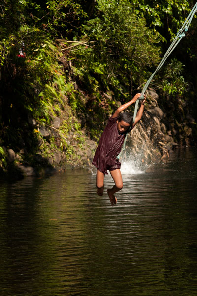
A local boy swings on a rope at the Swimming Pond, Pohnpei, Federated States of Micronesia (FSM)

This is by far the most popular swimming spot on the Nanipil River located 4 km (2.5 mi) from downtown Kolonia, where the watercourse turns sharply away from the Nanipil River Road and forms two deep, placid pools. There used to be a cable footbridge that crossed this portion of the stream, but now all that remains are a couple rusting cables strung high above the water. The water at the site is clean and quite cool — an excellent place to freshen up on a sweltering afternoon. Avoid the site, however, during or immediately after heavy rain, as the water gets muddy from all the sediment washing into the valley upstream. Cars can be parked on the opposite side of the road.

“The Swimming Pond”

This is a favorite with young kids in the area, located 5.3 km (3.3 mi) from downtown Kolonia. A short walk from the Nanipil River Road leads to a long, deep pool with a steep slope on the far bank. Rope swings are often strung up on both sides of the pool, and there are some grassy spots to picnic and a tiny hut or two. The landowners, who live in a house on the side of the road opposite the trailhead, charge visitors $1.00 per person.

Flash floods are an issue at both sites, due to Nanipil Valley’s narrowness and the volume of rain that can fall in a short period of time in the steep mountains to the rear. Be wary.

Map Guides >> Nett & Western U >> Liduduhniap Waterfall, Nanipil & Nan Madap Attractions

Lenger WWII Historical Sites

Hiking / TrekkingWorld War II FortificationsArchaeology Site / RuinCave, Tunnel, or BunkerBird-Watching

Southwest Side

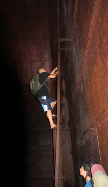
Descending a ladder into a subterranean oil tank on Lenger Island, Pohnpei, Federated States of Micronesia (FSM)

Subterranean Crude Oil Facility (Pahnlenger)

Built beneath Dolen Lenger, the Japanese crude oil storage complex is without question the most impressive of the island’s historical sites. If tight spaces, heights, cobwebs, bats, or the dark make you nervous, this is where you should grab your flashlight and confront your phobias! You don’t want to miss this experience, but do take care where you put your feet and watch out for swiftlets darting about.

The facility is accessed through the first of a trio of steel gates that opens onto a wide rock tunnel lying parallel to the hillside (Gates 2 & 3 are blocked by mud and rock-fall). Steel ladders in alcoves opposite each of the gates run up the wall to concrete lofts from which Japanese personnel could inspect the massive oil tanks. Each tank is 40 meters long and 10 meters wide (131 x 33 ft) with an arched, riveted ceiling and an estimated capacity of 3,300 metric tons. From each loft a second ladder descends 10 meters (33 ft) through a hatch to the floor of the tank. Depending on recent rains, there may between 10 cm and a meter of standing water on the floor, but it’s usually possible to explore without getting too wet. Japanese graffiti on the wall of the first loft reads: “Push forward bravely and strive.” Records seem to indicate that only the third tank was operational. A large diesel engine in front of Tank 3 was probably used to pump the oil in and out. A pipe runs all the way to the coast.
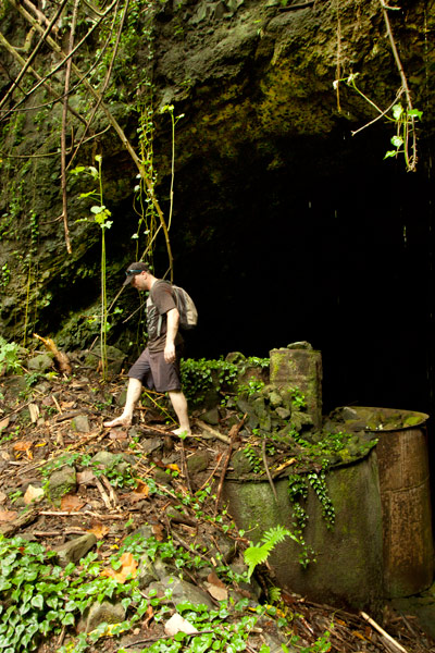
One of four caves dynamited out by the Japanese on Lenger Island, Pohnpei, Federated States of Micronesia (FSM)

Storage Caves (Pahnaiau)

The four caves carved into the slope of Dolen Lenger were probably intended for use as storage facilities (and also for defense as a last resort), but may not have been completed. Cave 1 is tiny (about 6 meters deep). The other three are grouped together 50 meters (164 ft) to the northwest. Cave 2 is 15 meters deep, 8.5 meters across (49 x 28 ft), and nearly as high with a wide entrance sloping steeply to a soggy floor. If you venture down, be careful of broken glass from bottles that might have been meant for Molotov cocktails (gasoline bombs). Cave 3 is slightly larger and deeper with several terraces. A line of rock-filled barrels at the mouth seems to have been added as protection against a land attack, and the third terrace may have been intended for a machine gun. Cave 4 is the largest with a depth of 28 meters. All of the caves are muddy, often have standing water on their floors, and are occupied by colonies of Caroline Islands swiftlets. The name of the area, Pahnaiau, means “under the banyan tree.”

Concrete Plant Equipment (Pahnaiau)

West of the main path to the caves is a ballast mound with a mango tree on top and a cluster of equipment used in the process of making cement: three concrete mixers, a large Yanmar diesel engine, and the 610 mm gauge rail lines that were used to transport dynamited rock from the cave sites along the hillside. A rock-crusher lies 23 meters (75 feet) southwest of the mixers.

South Side

Oil Tank Complex (Pahnkamal)

This large walled complex originally contained two steel tanks for the storage of crude oil, which was pumped in from the coast. The larger tank, with a 1000-liter capacity, was dismantled in the 1970s by a man who needed steel plates for his ship. He was in the process of taking apart the smaller one, when the government intervened. The existing tank can be entered where the lower panels have been removed. The roof is accessible via a ladder on the inside, leading to a manhole. A courtyard wall surrounds the entire facility (now being used by local residents as a pigpen) and concrete channels lead to a pair of rectangular cisterns (currently piled with coconut husks). Large bomb craters from the American bombardment are found on the northwest and south sides.
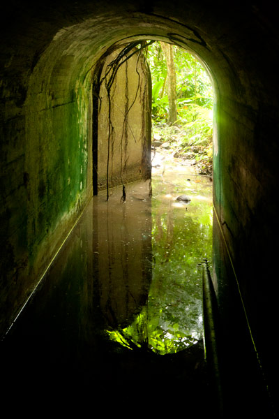
The gate and tunnel leading to an underground aviation fuel tank on Lenger Island, Pohnpei, Federated States of Micronesia (FSM)

Aviation Fuel Reservoir Tunnel (Pahnkamal)

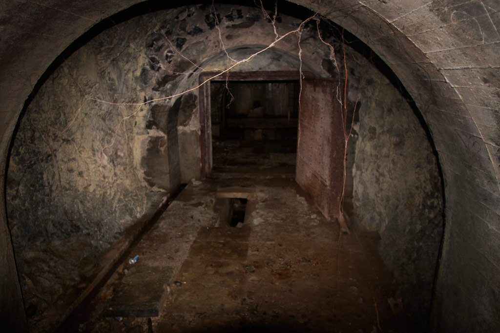
Northwest of the main path is a subterranean tank that supplied the seaplanes with aviation fuel. A steel door in the hillside opens on a tunnel about 8 meters long (typically flooded with about 20 cm of standing water and silty mud). At the end of the tunnel, the fuel pipes turn to the right and disappear into a concrete wall, behind which the reservoir lies. A ladder runs up to a secondary entrance hatch on the slope, but it is now rusted shut. The Japanese took fuel from this location by truck to the seaplane facility.

East Side

Cisterns & Machines(Nanpeilam)

Footpaths leading toward residences on the eastern coast pass a variety of rusting machine parts and two rectangular concrete cisterns. The southernmost cistern can be entered through a hole knocked in the south wall. A ladder also runs up to the roof.
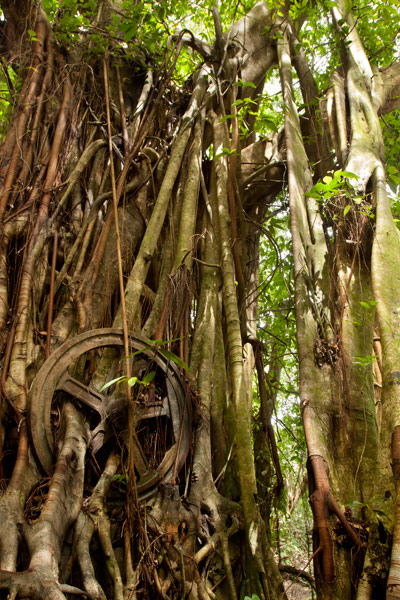
The Banyan Wheel, a Japanese machine completely absorbed by a banyan on Lenger Island, Pohnpei, Federated States of Micronesia (FSM)

“The Banyan Wheel” (Dausong)

The most photogenic of the island’s attractions is not far from the main path on a terrace cut into the eastern slope of Dolen Lenger. There are several concrete foundations here and on one of them is an unidentified machine (perhaps an engine or rock-crusher) that has been completely absorbed by a huge banyan tree, such that the large machine wheel is permanently fixed on the outside of the tree with two roots growing right through the spokes. Take our word for it: it’s pretty darn cool.

Northeast Side

Seaplane Hangar & Aircraft Wreckage (Dietakai)

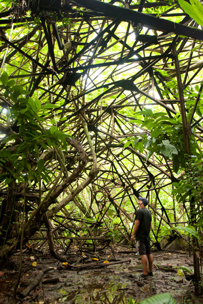
The hangar on the northeast side of the island once housed the “flying boats” that flew between Chuuk, Pohnpei, and the Marshall Islands and the Naval Type-O Observation seaplanes that were used for recon. Roof girders of a partially collapsed Japanese seaplane hangar on Lenger Island, Pohnpei, Federated States of Micronesia (FSM)The structure sustained at least two direct hits from bombs, leaving massive craters at the front and on the southeast wall and possibly contributing to the eventual collapse of most of the braced girder roof in the 1980s (only the rear portion still stands). Near the northeast corner is a half-buried air compressor and just beyond this the engine cylinder of a destroyed aircraft, but the tangled girders make it difficult to move further inside from this direction. A careful search near the east side of the foundation should yield the wreckage of at least one plane (an Aichi E13A1 Jake), including the engine and propeller, portions of a wing, a pontoon, strut, and bits of bulkhead next to one of the carriers used to move the planes. The hangar can be much more easily entered at the rear, where the roof girders are still intact. A pair of carriers — on their way to being devoured by a ficus — were used to transport the seaplanes.
Seaplane Ramp & Apron (Dietakai)

The large seaplane ramp and apron dates to 1939 or shortly after and was constructed by a labor force consisting of Japanese, Korean, Pingelapese, Mwoakillese, and Pohnpeian workers. The structure lies on a reclaimed portion of the island and stretches northeast into the sea. The underwater section was made from concrete slabs poured elsewhere and lowered from barges, where they were assembled by divers. Stone seawalls around the perimeter were constructed in the highly stable yabane-tanizumi configuration. Written accounts left by local workers describe slave-labor conditions and harsh punishments for anyone who did not cooperate (one account says men were strung up to bake in the sun). A Pohnpeian marching dance (“Ke Dehr Lemeleme Me Se Ruksang Doadoahk en Kaigun”) composed during the event, commemorates the regular desertions of laborers.

Today, the cratered apron has been claimed by the forest and is difficult to even identify from the ground, but at the time of writing there was a clear path across it. The ramp was repaired by the Americans and used as the primary airstrip until the current airport on Dekehtik was completed. It remains mostly intact, though several structures in the area post-date the Japanese period (including an old hut for picnickers and the concrete tanks from a giant clam hatchery that operated in the 1990s).

Dolen Lenger

Japanese beer bottle, Pohnpei, Federated States of Micronesia (FSM)

Dug-Outs & Tunnels (Dolen Lenger)

The ascent of Dolen Lenger follows the northernmost of two Japanese roads that lead up the hill and eventually intersect. The lower part of the southern road is mostly blocked by trees and mud and is no longer a good way to access the hill, but you can explore the upper section, where several dug-outs cut into the slope on either side. Two of the entrances are connected by a short tunnel.

Gatepost & Barracks Foundations (Dolen Lenger)

A bit further up the northern path, hikers pass a gatepost (its twin has fallen down the hill), adorned with round, colorful river stones imported from Japan. Naval personnel gathered at this spot for their morning meeting. Not far ahead, the foundations of a barracks complex are found on a large terrace in the hillside. The area is littered with Japanese beer bottles, old diesel engines, steel water tanks, and rusting machine parts. A short tunnel worms into the slope to the left of where the path climbs a flight of concrete steps and continues up the hill.
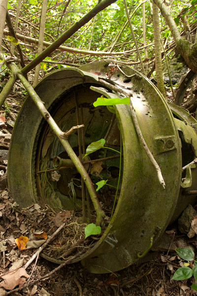
The drum of a 110 cm Japanese searchlight on Lenger Island, Pohnpei, Federated States of Micronesia (FSM)

Searchlight (Dolen Lenger)

The drum and turn-table of a 110 cm searchlight (probably a Navy Model 92) lie just off the right edge of the path. The light was originally mounted on the rock outcropping five meters (16 ft) west of the its current position and was used to identify targets at night. It was probably dismantled by American personnel after the war.

Small Gun Station (Dolen Lenger)

Further along, a deviation from the main path leads to an unknown battery, probably for a machine gun or small artillery, which was removed after the war. A short stone wall protects the site and contains two ammunition magazines.

Anti-Aircraft Gun Stations (Dolen Lenger)

Two anti-aircraft batteries crown the hill, one to the west and the other at the end of the main path. Both sites consist of concrete rings surrounded by stone and earth revetments and a number of ammunition magazines (nine at the first station and six at the second). Naval 8 cm Type 3 Dual-Purpose Guns were installed at these locations to protect the seaplane base and other important Lenger facilities. Unfortunately, both guns were removed after the war.

Dolen Lenger Summit Area

From the last anti-aircraft gun station, it’s possible to continue another 50 meters (164 ft) or so to the 77 meter summit of the hill (marked with a brass USGS benchmark) and pick your way to the cliff-top for expansive views of Kolonia and the northern lagoon. Bring a machete and take care at the edge of the precipice.

Coastal Battery & 15 cm Naval Gun (Dolen Lenger)

Just north of the searchlight, a branch in the path turns west and descends a series of muddy steps to the coastal batteries and their four naval gun stations. Records disagree as to whether guns were actually installed at all four of the stations or if one station at each battery was a decoy. The only gun remaining on Lenger — a 15 cm 40 caliber British Armstrong-Whitworth naval canon — lies on its side in the mud at the southernmost station not far from the pedestal mount. It was probably thrown there by the detonation of one of the many bombs dropped by Allied aircraft in 1944. The barrel and shield are separated from the jacket and recuperator and partly buried. Japanese records state that the 15 cm gun on Sokehs Mountain was originally installed at Lenger and moved during the war. Lenger’s guns were intended to prevent surface invasions from Pweitik Passage to the northwest and had a range of roughly 7 kilometers (4.3 mi).

Heavy Ordnance Magazine Foundation (Dolen Lenger)

Past the gun stations is the foundation of what was probably a magazine for heavy ordnance surrounded by impressive inclined blast walls of quarried basalt rock. As is true of the best examples of Japanese architecture on Pohnpei, the stones were laid in the alternating diagonal pattern called “herringbone style” (or yabane-tanizumi). The site was most definitely covered during the operational period and camouflaged to make it invisible from the air.

West Side

Coastal Barracks Foundations

The remains of two large barracks are found on the western coast of the island. Both of the structures were wooden pitched-roof buildings raised above the ground on concrete posts and reached by short flights of stairs. Each barracks housed as many as fifty men. Only the posts and stairs remain today. The southern foundation has a nahs built on top of it, which was part of one the island’s two “resorts” in the 1990s.

ACKNOWLEDGMENTS

The Lenger Island guide would not exist without the amazing work and cooperation of archaeologist Takuya Nagaoka, who was the first person to map the historical sites on Lenger. Nagaoka’s meticulous survey maps and exhaustive report (as yet, unpublished) were indispensable in the process of finding and interpreting neglected sites that had become heavily overgrown.

Eco-Adventure Map Guides >> Lenger Island >> Lenger Historical Sites

The Doldrums at APSCO Quarry

SwimmingSnorkelingSCUBA divingKayaking / CanoeingPicnicking

“The Doldrums”

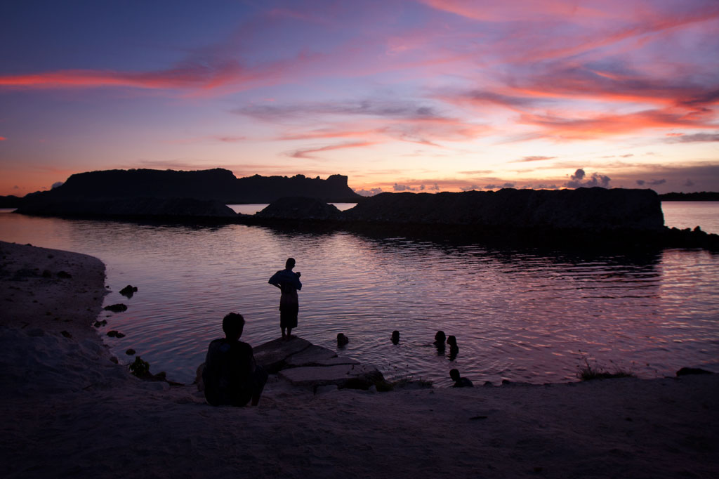
Doldrums at APSCO Quarry, Pohnpei, Federated States of Micronesia (FSM)

The hottest days call for the coolest swimming holes, and there’s no better place than the “Doldrums” at APSCO Gravel Quarry, owned by the Akinaga family. The quarry property encompasses all of the land around Dolehtik, a small hill at the northern end of Sokehs Island. Across the street is a high cliff where prismatic basalt columns are stripped off the mountain with heavy equipment and later crushed into various grades of gravel. This same site may also have been one of the quarry locations for the stones of Nan Madol.

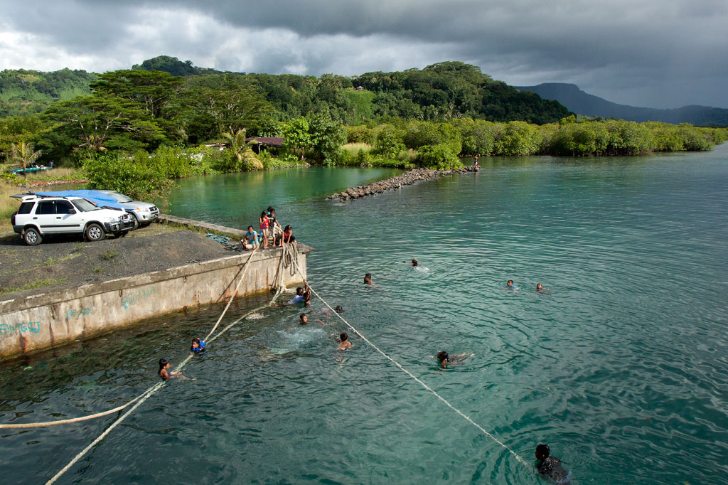
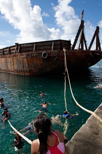
A large concrete dock 0.46 km (0.29 mi) northwest of the quarry entrance provides access to a beautiful swath of the lagoon. With no residences or pig pens inside this rather large area, the surrounding water is pristine with a visibility of more than 25 meters (80 ft). The spot got its nickname from a giant barge that, until the summer of 2013, was moored just off-shore and functioned as a jungle gym of sorts for local kids and foreigners alike. The barge is no longer there, but the main attraction is still the water itself, which is deep and gets deeper quick. The “Doldrums” is a great picnic destination and an idyllic place to stop in the middle of a paddling excursion around the island. Please keep this location beautiful by taking all of your trash with you when you leave for the day.

APSCO Quarry, Pohnpei, Federated States of Micronesia (FSM)

The main gate to the quarry is usually open, but visitors must report to the on-site office and ask the security guard to unlock the second gate, leading to the water. The facility is locked down for the night at 6:00 PM every evening. Make sure you’re out in time.

Snorkeling

Though coral development in the area is scarce, there are quite a few reef fish around. If you swim along the coast to the south, you might find some colorful starfish and an urchin or two.

Paddling

Kayaks can be easily launched on either side of the dock where the ground slopes gradually to the water.

Map Guides >> Sokehs Island >> The Doldrums at APSCO

Scroll to top