Marine Attractions GPS Data
Downloadable GPS Data Files
The following files contain all the packaged GPS data for each feature or attraction on the Marine Attractions guide.
Three file types are provided. KMZ and KML files are compatible with Google Earth. KML is compatible with Google Maps. GPX files can be imported into ArcGIS (a professional mapping application) and some hand-held GPS devices.
Coastline
These lines were drawn during the course of this project from existing aerial photography and satellite imagery.
- Pohnpei Island Coastline (2013) – KMZ format (284 kb)
- Pohnpei Island Coastline (2013) – KML format (753 kb)
- Pohnpei Island Coastline (2013) – GPX format (1.1 mb)
Mangroves
Including all mangrove forests around Pohnpei Island and its lagoon islands; these lines were drawn during the course of this project from existing aerial photography and satellite imagery.
- Mangrove Forests (2014) – KML format (5.3 mb)
- Mangrove Forests (2014) – KMZ format (1.8 mb)
- Mangrove Forests (2014) – GPX format (7.8 mb)
Reefs
These lines were drawn during the course of this project from existing aerial photography and satellite imagery.
- Pohnpei Island Reef System (2014) – KMZ format (3.2 mb)
- Pohnpei Island Reef System (2014) – KML format (9.1 mb)
- Pohnpei Island Reef System (2014) – GPX format (13.3 mb)
Surf Breaks
Locations were marked based on data provided Pohnpei Surf Club.
- Pohnpei Surf Break Locations (2015) – KMZ format (5 kb)
- Pohnpei Surf Break Locations (2015) – KML format (17 kb)
- Pohnpei Surf Break Locations (2015) – GPX format (11 kb)
SCUBA Diving & Snorkeling
Locations were marked based on data provided by knowledgeable local diving guides and our own on-the-ground data gathering experiences.
- Pohnpei SCUBA Diving & Snorkeling (2014) – KMZ format (50 kb)
- Pohnpei SCUBA Diving & Snorkeling (2014) – KML format (188 kb)
- Pohnpei SCUBA Diving & Snorkeling (2014) – GPX format (179 kb)
Swimming Spots
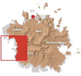
Locations where poor water quality or environmental contamination make them unsafe for swimming have not been included here. This includes all of the watercourses around Mand, Madolenihmw Municipality (with one exception) and almost everything in Sokehs Municipality. Locations are GPS-verified.
- Swimming Spots (2014) – KMZ format (5 kb)
- Swimming Spots (2014) – KML format (40 kb)
- Swimming Spots (2014) – GPX format (8 kb)
Paddling (Suggested Kayaking, Canoeing & Paddleboarding Routes)
All data was gathered first-hand during this project (all of these routes were paddled); routes are GPS-verified.
- Kayaking & Paddleboarding Routes (2014) – KMZ format (539 kb)
- Kayaking & Paddleboarding Routes (2014) – KML format (1.6 mb)
- Kayaking & Paddleboarding Routes (2014) – GPX format (2.2 mb)
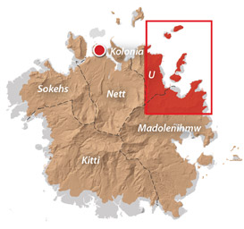
Marine Parks in Awak Pah (2015)
Marine Protected Areas, Mangrove Forest Reserves, and Sanctuaries
Shapes are approximations based on data and maps provided by Conservation Society of Pohnpei (CSP) and were not GPS-verified in the course of this project.
- Pohnpei Marine Protected Areas (2013) – KMZ format (17 kb)
- Pohnpei Marine Protected Areas (2013) – KML format (57 kb)
- Pohnpei Marine Protected Areas (2013) – GPX format (65 kb)
Coordinates
The following coordinates correspond with sites featured on the Marine Attractions Eco-Adventure Map Guide. It is our dream to eventually create a Pohnpei GPS app that could be uploaded to smartphones and other devices, but for now, these points of interest can be entered manually in a hand-held GPS device as needed.
Awak Marine Parks
| Awak Pah MP Entrance | —- | 6.965910° 158.250758° |
| Pein Ahi Entrance | —- | 6.966711° 158.251138° |
| Paieke Entrance | —- | 6.969853° 158.256294° |
| Awak Pah MP Dock | —- | 6.966470° 158.248785° |
| Pein Ahi Fish Pond | —- | 6.967572° 158.249929° |