
![]()
![]()
![]()
![]()
![]()
Kupwuriso, Pohnpei’s fifth highest mountain (depending on how you count them), is impossible to miss when driving through eastern U, where it towers over everything, its precipitous slopes clad in groves of endemic palms called kotop (Clinostigma ponapensis). When the Pohnpeian hero Isokelekel sailed around the island in the mid-1600s on a mission to overthrow the Saudeleur dynasty, he initially balked at the sight of the mountain palms which he mistook for an army of giant warriors dressed in grass skirts. It was not until he returned to And Atoll, that a local woman pointed out his mistake. Giants or no, the mountain has an ominous look and feel. It’s unusually close to the coast and rises up very steeply, making it appear much taller than it really is (630 m / 2,067 ft). The name means “stomach.”
Awak Valley Approach
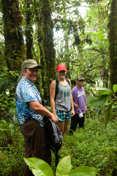
There are two major routes to the small, rocky summit (630 m). The first begins not far from the end of the primary paved road at the rear of the Awak Valley. To protect Mwahnd and Alohkapw (Areu) Passages from invasion, the Japanese decided to place two 15 cm naval canons just below the summit of Kupwuriso at a place called Dol Reirei (“long hill”). To get the massive weapons up the mountain, they constructed a road that climbs up on the south side of the Awak Valley and follows the ridge north. The hike uses this track for most of the way, starting on a rocky private footpath to the right of the road. The steepest section comes at the beginning. Once on the ridge, things mostly flatten out, though there are some gentle ups and downs. The terrain is fairly tame the rest of the way, passing through upland groves of kotop palm, wild banana plants (utin wel), and gnarled stands of campnosperma (dohng) and elaeocarpus (sadak) — trees used to make canoe hulls.
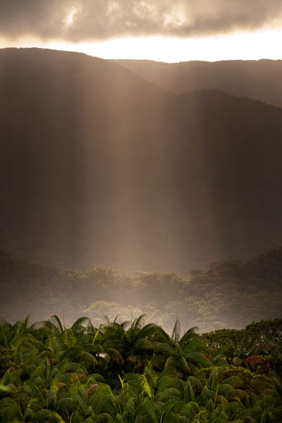
One of the benefits of climbing Kupwuriso is that you’re more likely to get a clear view from the summit than from Nahnalaud. The perspective is better, too; Nahnalaud’s summit sits on a wide plateau, while Kupwuriso’s looks down to the valley from the top of a cliff. Sometimes, however, the mountain is fog-bound — especially from about noon to 2 PM. Plan for 4-6 hours round-trip.
Rohi Approach
The second route starts in Rohi district at the end of a paved road. This way is shorter but considerably more strenuous, shooting 1.3 km (0.82 mi) straight up the side of the mountain. It should be noted that a number of hikers have sustained injuries on this approach, so hire a good guide, go slow, and watch for loose rocks! The route begins in the inhabited lowland agroforest, which Pohnpeians call nansapw, and quickly ascends to the mid-level forests (nanwel), populated by giant hardwoods and tree-ferns. Beyond, the forest opens up and kotop palms abound. Once the slope starts to even out, you’ve entered the cloud forest — a fantasy world of stunted, twisting trees and air plants. It’s always wet here, and every surface is covered with a thick layer of bryophytic growth. Plan for 4-6 hours round-trip.
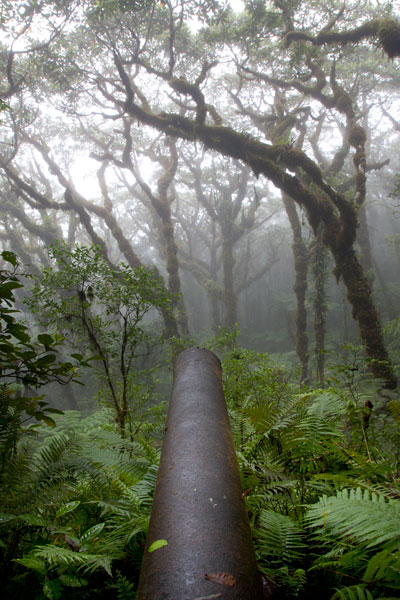
Japanese Gun Battery
The two guns are the British Armstrong Whitworth naval type identical to the one on Sokehs Mountain. Both are housed in steel and concrete bunkers and separated by a pillbox, where machine guns were placed. The battery was installed in 1943 and took fifty-five local men eight months to complete. At 580 meters (1,903 ft), these are the highest guns on Pohnpei Island. The gnarled forest that has grown up in front of the gun sites is mesmerizing, especially in foggy conditions.
Bird-Watching
Birders will find much to look at on the way up the mountain. Besides the typical honey-eaters, starlings, and lorikeets, this is a good place to look for the Crimson-Crowned Fruit Dove, Imperial Pigeon, and Pohnpei Cicadabird. Swiftlets are common at the summit.
- Please visit the Birding page for additional information.
Ridge Camping
There’s a fantastic place to camp at 593 meters not far from the gun sites with a beautiful, unobstructed view of the valley. Bring your own water, dry tender, a tarp or heavy-duty rainfly, and stakes for your tent and tarp (high winds are a distinct possibility at such elevations). Remember to leave your site exactly as you found it. Pack out everything you packed in and properly bury all human waste.
Hiring a Local Guide
A lot of people know the way up Kupwuriso, so finding a guide is not difficult. If you want to tackle the Rohi approach, Miller Benjamin (from Saladak) is a good choice. From Awak, we recommend Relio Lengsi. Conservation Society of Pohnpei (CSP) can also assist you in finding a guide. Offer $40-50 for a group of five hikers or less (plus tips). Agree on a price beforehand.
- Please visit the Local Guides & Tour Operators page for guide contact information.