
![]()
![]()
![]()
![]()
![]()
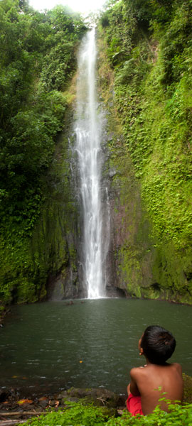
Located on converging streams within Salapwuk’s deep Sahwar Gorge, Sahwartik and Sahwarlap are a pair of waterfalls whose splendor and grace defy reality. The wider falls is named Sahwarlap, which means “shining brightly,” and its tall, thin neighbor is called Sahwartik (“shining faintly”). Sahwartik, a “horsetail” falls, is the more picturesque of the pair and is probably the tallest waterfall on Pohnpei at about 20-24 meters (65-80 ft). It lies at the terminus of the gorge, hidden in a fern-carpeted niche with a sizable plunge pool and enough flow to create its own misty breeze. The water is very clean and often quite chilly — amazingly refreshing after a hot hike. Sahwarlap’s stream angles into Sahwartik’s from the northwest. The falls is wider and shorter than Sahwartik and has a much shallower pool. Both waterfalls are great for a mid-hike swim, but Sahwarlap‘s pool is shallow, while Sahwartik‘s is relatively deep.
The trek begins east of the road that leads to Salapwuk Elementary School, just before the paving ends (park under the trees on the east side of the road). After crossing the landowner’s property, a well-maintained trail begins at the rim of the gorge with inspiring views of both waterfalls, then descends in a zigzag along the slope to the stream bed. The slope trail is generally well-tended, but without any railing on the outer edge. Hikers should move slowly and with care. In a few places there are rough steps that can deteriorate after heavy rain.
Once one reaches the bottom of the gorge, there’s no obvious trail, but the way is clear. Merely head up-stream and stick close to the water — a collection of little streamlets. There are no deviations from the valley, so it’s impossible to lose your way before hitting Sahwartik. Sahwarlap can be a little trickier to locate. Hug the west side of the stream bed and keep your eyes peeled for a path near where the Sahwarlap Stream (Pilen Sahwarlap) flows into the larger watercourse (Pilen Sahwar). This footpath climbs over a little hillock, from the top of which the falls is visible through the trees.
Note that sakau (known elsewhere as kava) is heavily cultivated throughout the west side of the valley and along the slope trail. The large shrub with its heart-shaped leaves and thick, knobby branches — sometimes pure green, but more often mottled — is easy to identify. The plants have great value to their owners. Hikers should treat them with respect and avoid breaking branches or otherwise damaging them as they pass.
The Sesiwo family charges $5.00 per person for access. No guide is necessary for this hike, but if you want one, the family can scare up some kids to go with you. Offer $5.00 and make sure that everyone is clear that you’re paying one person, even if a whole group of kids trail along behind.
- Plan for 90 minutes to 3 hours round-trip with a swimming session at each waterfall.
How the Sahwar Valley was Formed
There was once a woman in Salapwuk named Lienlama who had two sons named Mwohnmur and Sarapwau. The boys had many adventures and became notorious in Pohnpeian legend, being responsible for the creation of a number of interesting geographical features including Takaiuh (hill), Pohnpaip (rock), and the island of Takaieu. The boys were eternally curious, and one time they took their mother’s loom stick (made from a sword fern) and dug in the earth to see what was below it. The hole that they dug was so deep that they reached the Underworld, and because they could see the shining lights of that other world through the hole, the gorge was named Sahwar, which means “shining” or “flashing.”