Backpacking Stoves

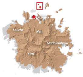
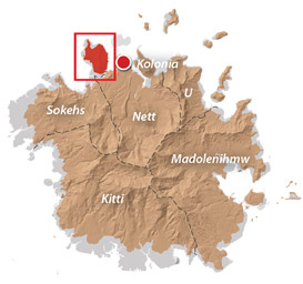
Gear Advice: Backpacking Stoves for Pohnpei

Liquid Fuel Stoves

MSR Whisperlite Liquid Fuel Stove
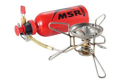
Liquid fuel stoves, such as those made by MSR and Optimus / Svea, are an option on Pohnpei, as white gas is available at the local hardware stores.

PROS: They heat quickly and have adjustable flames. They perform well in windy conditions. You can buy the fuel on-island.

CONS: You can’t bring these stoves on the airplane — you’d have to ship them to yourself surface mail, which would take up to 2 months. Liquid fuel stoves are also notorious for clogging. You have to waste fuel to prime some of them. The fuel is pretty toxic, and if it leaks in your pack, it will ruin a lot of stuff. Fuel has to be stored in metal bottles — which are heavy. The stoves themselves are also heavy.

Canister Stoves

Canister StoveThese stoves are fueled by an external butane or propane fuel canister that is thrown away when depleted.

PROS: They are more fuel-efficient than a liquid fuel stove.

CONS: The canisters are expensive and heavy. You can’t find replacement canisters in Pohnpei’s stores. Canisters can’t be brought on an airplane at all (including airmail), because they contain pressurized, flammable material. They’re also very bad for the environment; empty canisters can’t be refilled — they end up as trash.

Alcohol Stoves

Cat Food Can Alcohol StoveThe last choice is the alcohol stove. This is the simplest type of stove, the lightest, and the least prone to malfunction, because it has no complicated parts (no parts at all). It is nothing more than a reservoir that holds fuel, which is set aflame and burns out on its own.

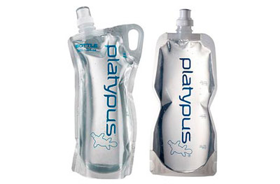
PROS: The benefits of this stove type for an adventure trekker are many. Alcohol stoves are small and weigh less than 28 g (5 oz). They are fueled by denatured alcohol, which is cheap and can be purchased at Pohnpei’s hardware stores. Fuel can be stored in a regular plastic bottle. You can make the stove itself for less than $10.00 with simple materials found on Pohnpei, so you don’t need to worry about bringing one. If you do bring one, it can be taken on the airplane, as long as it’s clean.

CONS: Alcohol stoves have a slower than average boil time (6-8 minutes) and a lack of flame adjustment. It’s easy to crush these tiny stoves, but they can usually be bent back into shape with relative ease.

OUR RECOMMENDATION: A self-made cat food can alcohol stove combined with a home-made windscreen is by far the the most practical and affordable choice for Pohnpei trekkers. Watch Andrew Skurka’s video below to learn how to make this awesome stove.

Adventures >> Gear Recommendations >> Stoves

Backpacking Cookware

Gear Advice: Backpacking Cookware for Pohnpei

MSR Titan Kettle

MSR Titan Kettle Titanium CookwareThis is a popular model among ultra-light trekkers. It holds 0.85 L (0.9 qt) and has a lid and folding handles.

PROS: It’s light — just 4.2 oz (119 g) — very durable, and not too pricey (about $60.00).

CONS: After heating, the handles are too hot to pick up bare-handed. This pot has a reputation for being hard to clean (some foods tend to stick). It’s too small if you’re cooking for two.

Evernew Titanium Pasta Pot

Evernew Titanium Pasta PotThis is a 1 L (1 qt) pot with folding insulated handles and lid.

PROS: It’s even lighter than the MSR Titan Kettle at 4.1 oz (116 g). The insulation on the handles makes it possible to grip them without protection. It has a nice strainer feature on the lid for pouring off excess water. You can get it for cheaper than the Titan, too, at about $45.00.

CONS: It’s not quite as durable as the MSR Titan. Like the Titan, it’s a small pot that isn’t practical when cooking for others.

MSR Base 2 Pot Set

MSR Base 2 Cookware SetIf you’re cooking for two or more, the MSR Base 2 Set is an option. It includes 1.5 L (1.6 qt) and 2.5 L (2.6 qt) pots that nest inside each other, a lid, and a detachable pot-holder.

PROS: For what’s included, the weight isn’t too bad — about 1 lb (481 g) for everything. The coating on the pots prevents sticking of food, making cleaning easier. The detachable handle doesn’t get hot the way an attached handle does.

CONS: Aluminum isn’t as light as titanium and it’s also less durable — the pots tend to get bent out of shape. They also scratch easily; the coating doesn’t stand-up over the long-term. It’s way too heavy if you’re cooking just for yourself.

OUR RECOMMENDATION: If you’re eating on your own, the Evernew Titanium Pasta Pot narrowly beats out the MSR Titan. If you’re cooking for a small group, the MSR Base 2 Set is the best choice.

Adventures >> Gear Recommendations >> Cookware

Water Bottles

Gear Advice: Water Bottles for Pohnpei

Nalgene Classic Hard-Sided Water Bottle

Hard-Sided Bottles

Hard-sided plastic bottles made by companies like Nalgene are a common choice among backpackers.

PROS: They don’t leak in your bag or crack when dropped (at least the stalwart classic model).

CONS: They’re heavy and bulky, and an empty bottle will take up just as much space in your pack as a full one. This is a problem when you’re doing longer hikes, where every bit of your backpack real estate is precious, or when covering very rough terrain, when you want your load as light as possible.

Platypus Collapsible Water Bottles

Collapsible Bottles

An alternative to hard bottles are soft-sided bottles, like those sold by Platypus. These are essentially the modern version of the water skin. They have small openings to prevent the water from spewing out when handled.

PROS: They’re light and can compress to next to nothing when empty.

CONS: They can rip or puncture, and they aren’t as easy to refill as hard-sided bottles because of the small mouths.

Camelbak Hydration Bladder

Hydration Bladders / Reservoirs

A third choice for water storage is a hydration bladder or reservoir. This is essentially a large, plastic water sack with a drinking tube and valve at one end. Bladders usually go with a canvass or nylon pouch or backpack-style carrier. Many good companies make them, including Camelbak, Platypus, MSR, Nalgene, and Osprey.

PROS: There are several really strong points to using bladders. They allow you to distribute the weight of the water you’re carrying evenly across your back, and they are lighter than hard-sided bottles. The bladders are designed to lay flat, and because they are soft-sided, you’ll never have to worry about the corner of a bottle sticking into your ribs or scapula as you hike. You can find backpacks with an outside pocket specifically designed to hold the reservoir. The reservoir doesn’t need to be removed from your pack in order to drink, because the drinking tube is always hanging over your shoulder. In fact, you don’t even need to stop hiking; you can just grab the valve with your mouth and bite down on it to drink as you chug along. Almost all bladders have a large screw-top opening, which makes filling them easier.

CONS: Reservoirs are designed to carry all your water, so they tend to be much bigger than soft-sided bottles, and as you drink the water, what’s left sloshes around a lot until you stop to refill. Marginally annoying. They are also heavier than soft-sided bottles, mainly due to the drinking tube. Like soft-sided bottles, bladders can be punctured or torn and are also prone to leaks at the seams. Filling them completely can be a challenge if you’re dealing with a stream or waterfall; you’ll need someone to hold the bladder up in the air and then either pour or pump water into it (you can’t fill it while the thing is lying on the ground). The bite valves get chewed up over time and don’t work as well anymore. They can also clog easily if there’s any sediment in your water. Perhaps the biggest drawback is keeping bladders clean. They don’t dry easily inside and are prone to bacterial and fungal growth; it is necessary to regularly flush them with vinegar, baking soda, or bleach. Sometimes the water can taste a bit funky compared to other types of water storage — probably due to the previous point. Finally, bladders are the most expensive option for water storage.

For an in-depth review of the top 10 hydration bladder models on the market, check out this article at SealGrinderPT.

OUR RECOMMENDATION: Hard-sided bottles are fine for half-day hikes, but soft-sided, collapsible bottles are more practical for longer treks when weight and efficient use of pack-space are crucial. Bladders have some definite advantages for shorter hikes, but also score below soft-sided bottles in terms of practicality for multi-treks in challenging terrain.

Adventures >> Gear Recommendations >> Water Bottles

Shelters

Gear Advice: Shelters

Tents

Sierra Designs One-Man Tent
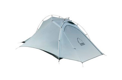
Weekend hikers usually think of tents as the definitive backpacking shelter, but they actually have many drawbacks. One tent model is available for purchase on Pohnpei, but it’s so heavy you’d never want to hike anywhere with it much less Pohnpei’s rugged mountains and rainforest. Those set on using a tent should bring one from home. Sierra Designs is a good brand.

PROS: Tents are easy to set up on any patch of relatively flat ground and don’t require trees. They protect sleepers against wind and blowing rain. They keep the bugs out.

CONS: They’re very heavy and bulky. Even the most well-ventilated models don’t provide enough airflow to be comfortable in Pohnpei’s extremely warm, humid climate, soaking the occupants in sweat and the condensation from their breath. They require a groundsheet as insulation, which is added weight in your pack. The typically nylon rainflies won’t be able to stand up to Pohnpei’s torrential rains for very long. The poles sometimes break. Finally, good tents are really expensive — $500+ is not unusual.

Tarp Systems

The “big blue tarp” that is widely sold on Pohnpei is terrible for hiking — bulky, very heavy, and difficult to hang without a lot of conveniently located trees and skeins of heavy rope. There are, however, tarps that are well-designed for trekking. The best are made by Mountain Laurel Designs.MLD Cuben Fiber Grace Tarp

For a single sleeper, the 2.1 x 1.5 x 2.7 meter (7 x 5 x 9 ft) Cuben Fiber Grace is a good choice. It only weighs 180 g (5.9 oz), the ridgeline is bonded and taped, and there are 8 tie-outs. The tarp can be hung as an A-frame with a ridgeline or pitched like a tent with trekking poles as the vertical supports. Cuben Fiber can stand up to a solid night of heavy rain without issue.

MLD Hammock Hexagon TarpFor a pair of sleepers, the Cuben Fiber Grace has a larger 2.6 x 2.1 x 2.8 meter (8.5 x 7 x 9.2 ft) version that weighs 225 g (7.8 oz). Also, a larger, heavier option is the 3.2 x 2.6 meter (10.5 x 8.5 ft) Hammock Hexagon Tarp, which weighs 241 g (8.5 oz). It also has a bonded and taped ridgeline seam, but only 6 tie-outs. Though it is designed to hang above a hammock, it can also be pitched A-frame tent style with trekking poles.

PROS: These tarps are super light and pack small, can handle Pohnpei’s regular torrents, and provide plenty of durability. Unlike tents, they allow plenty of airflow, making sleeping more comfortable.

CONS: They’re super expensive — $285-300. They take some experience to hang properly and can be frustrating if you don’t know what you’re doing. If you’re pitching tent-style, you’ll need trekking poles or something else to use as vertical supports.

OUR RECOMMENDATION: The benefits of tarps far out-weigh those of tents when trekking on Pohnpei. Both the MLD Grace and Hammock Hexagon models are great choices that will perform well in island conditions.

How-To Videos

How to Hang a Ridgeline

How to Tie a Cow Hitch Knot

How to Use a Sleeping Hammock

Adventures >> Gear Recommendations >> Shelters

Western Kitti GPS Data

Downloadable GPS Data Files

The following files contain all the packaged GPS data for each of the featured locations in the Western Kitti Eco-Adventure Map Guide.

Three file types are provided. KMZ and KML files are compatible with Google Earth. KML is compatible with Google Maps. GPX files can be imported into ArcGIS (a professional mapping application) and some hand-held GPS devices.

NOTE: All files are free to the public and can be used for any purpose without permission.

Dolen Uh Hike & Pilen Seleur Eel Pools (2015)

Sahwartik & Sahwarlap Waterfalls Hike (2015)

Six Waterfalls Hike (2015)

Coordinates

The following coordinates correspond with sites featured on the Western Kitti Eco-Adventure Map Guide. It is our dream to eventually create a Pohnpei GPS app that could be uploaded to smartphones and other devices, but for now, these points of interest can be entered manually in a hand-held GPS device as needed.

NOTE: All GPS devices have a margin of error. That margin increases with interference — when there is a thick canopy of trees, during bad weather, or when mountains obstruct the satellite link. The geosynchronous satellites employed when navigating on Pohnpei are located low on the southwestern horizon, such that maintaining a strong connection while hiking on the northeast side of a given mountain range can be difficult. Coordinates on the northeastern slopes of mountains are less accurate than in other locations.

Coordinates are not yet available for this area. We’re working to get them on-line ASAP. Please check back soon!

Downloads >> GPS Central >> Western Kitti GPS Data

(Central) Madolenihmw GPS Data

Downloadable GPS Data Files

The following files contain all the packaged GPS data for each of the featured locations in the (Central) Madolenihmw Eco-Adventure Map Guide.

Three file types are provided. KMZ and KML files are compatible with Google Earth. KML is compatible with Google Maps. GPX files can be imported into ArcGIS (a professional mapping application) and some hand-held GPS devices.

NOTE: All files are free to the public and can be used for any purpose without permission.

Dolen Merewi Hike (2015)

Madolenihmw Bay Area Attractions (2015)

Nankep Waterfall Hike (2015)

Pahnsapw Waterfalls Hike (2015)

Pahn Sile Waterfall Hike (2015)

Pohnpaip Petroglyphs (2015)

Coordinates

The following coordinates correspond with sites featured on the (Central) Madolenihmw Eco-Adventure Map Guide. It is our dream to eventually create a Pohnpei GPS app that could be uploaded to smartphones and other devices, but for now, these points of interest can be entered manually in a hand-held GPS device as needed.

NOTE: All GPS devices have a margin of error. That margin increases with interference — when there is a thick canopy of trees, during bad weather, or when mountains obstruct the satellite link. The geosynchronous satellites employed when navigating on Pohnpei are located low on the southwestern horizon, such that maintaining a strong connection while hiking on the northeast side of a given mountain range can be difficult. Coordinates on the northeastern slopes of mountains are less accurate than in other locations.

Dolen Merewi

Dolen Merewi Turn-Off —- 6.882208° 158.290005°
Road Branching – bear left —- 6.881983° 158.278225°
Dolen Merewi Trailhead —- 6.880292° 158.274669°
Private Residence —- 6.880442° 158.274156°
Look-Out Point —- 6.883006° 158.270929°
Dolen Merewi True Summit —- 6.882815° 158.270869°

Madolenihmw Bay Area

Lukop, Metipw & Kepine Turn-Off —- 6.898141° 158.315994°
Road Branching – bear left for Lukop and Metipw; bear right for Kepine and Takaiuh —- 6.889728° 158.314120°
Bridge —- 6.884719° 158.313625°
Japanese Agricultural Plots —- 6.886711° 158.311515°
Nanpahlap Trailhead —- 6.876366° 158.318225°
Nanpahlap Summit —- 6.875491° 158.315744°
Tahio Trailhead —- 6.874010° 158.317018°
Japanese Dug-Out —- 6.873007° 158.316122°
Japanese Trench —- 6.872754° 158.315133°
Japanese Tunnel —- 6.873264° 158.314119°
Abandoned Community Hut (nahs) —- 6.872849° 158.314316°
Takaiuh Summit —- 6.872128° 158.310713°
Rocky Hill —- 6.874429° 158.308532°
Dauen Sapwalap Entrance —- 6.876938° 158.308196°
Japanese Rice Paddies Turn-Off —- 6.888314° 158.296764°
Japanese Rice Paddies & Irrigation Canals —- 6.887325° 158.303652°
Metipw Causeway / Launch —- 6.878051° 158.333074°
Mwudokolos Island —- 6.883576° 158.336525°
Dahu Reirei Island —- 6.888759° 158.344288°
“Channel Island” —- 6.899494° 158.342153°
Nanwap Marine Protected Area —- 6.872988° 158.353673°
Nahpali Island Dock —- 6.861877° 158.354457°
Salong Point, Temwen Island —- 6.856468° 158.322737°
MERIP Boathouse —- 6.844010° 158.308539°
Madolenihmw Ice Dock —- 6.849520° 158.302712°
Madolenihmw Bay Scenic Point —- 6.855273° 158.295686°

Nankep Waterfall

Nankep Waterfall Turn-Off —- 6.858738° 158.291440°
Bridge —- 6.858789° 158.291453°
Nankep Waterfall Trailhead —- 6.859867° 158.286390°
Nankep Waterfall —- 6.859335° 158.283177°

Nankepinmerepw Valley

Nankepinmerepw Turn-Off —- 6.873704° 158.286552°
Nankepinmerepw Trailhead —- 6.875185° 158.273305°
Senipehn Footbridge —- 6.876110° 158.271732°
Private Residence —- 6.877294° 158.263737°
Small Falls & Swimming Pool —- 6.877911° 158.242150°
Prismatic Basalt Quarry Site / Falls —- 6.878689° 158.240613°
Nankepinmerepw Waterfall —- 6.880498° 158.239370°
Block Waterfall —- 6.882766° 158.238850°
Trail Branching – bear right for Nahnalaud; bear left for “The Cave.” —- 6.888859° 158.288880°
“The Cave” —- 6.866427° 158.230917°
USGS Benchmark —- 6.874333° 158.230076°
Nahnalaud Look-Out Point #2 —- 6.874333° 158.230076°
Nahnalaud Look-Out Point #1 / Observed Summit —- 6.873876° 158.228524°
Nahnalaud True Summit —- 6.873323° 158.228724°
Nahnalaud Mountain Shelter —- 6.874001° 158.227374°

Pahnsapw Waterfalls

Pahnsapw Waterfall Turn-Off —- 6.871427° 158.285654°
Sakau Market —- 6.871839° 158.285500°
Sakau Market —- 6.871234° 158.285637°
Road Branching – bear right —- 6.870202° 158.282381°
Bridge —- 6.870052° 158.280071°
Road Branching – bear right —- 6.870060° 158.280108°
Road Branching – bear left —- 6.869425° 158.278666°
Pahnsapw Trailhead —- 6.868207° 158.278527°
Silbanuz Residence —- 6.867969° 158.278513°
Pahnsapw Lower Falls —- 6.865171° 158.277289°
Hidden Pool —- 6.865183° 158.277071°
Pahnsapw Upper Falls —- 6.864683° 158.277100°

Pahn Sile Waterfall

Pahn Sile Waterfall Turn-Off —- 6.873704° 158.286552°
Taxi Stop —- 6.873691° 158.286771°
Bridge —- 6.873629° 158.286431°
Road Branching – bear left —- 6.875588° 158.281340°
Road Branching – bear left —- 6.875802° 158.276411°
Road Branching – bear left —- 6.875179° 158.273294°
Pahn Sile Trailhead —- 6.873597° 158.269375°
Trail Branching – bear right —- 6.873598° 158.269382°
Trail Branching – bear left —- 6.873662° 158.269032°
Japanese Irrigation Canal —- 6.871403° 158.266674°
Japanese Irrigation Canal —- 6.870612° 158.265405°
Stream Crossing —- 6.866702° 158.264493°
Trail Branching – Bear right for waterfall & pool; left to see the falls from above —- 6.866048° 158.264342°
Senipehn River Crossing —- 6.865499° 158.263650°
Pahn Sile Waterfall Pool —- 6.864499° 158.263151°
Pahn Sile Waterfall —- 6.864467° 158.263028°
Break north From trail to see the falls from above —- 6.864209° 158.262860°

Pohnpaip Petroglyphs

Pohnpaip Petroglyphs Turn-Off —- 6.886941° 158.291017°
Bridge —- 6.886789° 158.290910°
Pohnpaip Trailhead —- 6.888161° 158.289097°
Herson Residence —- 6.887435° 158.288495°
Pohnpaip Outcropping —- 6.887621° 158.288259°
Magical Door of Pohnpaip —- 6.887551° 158.288181°
Takain Pahsu —- 6.888396° 158.288694°
“Hindquarters Rock” —- 6.888665° 158.288933°
“Enveloped Cross Rock” —- 6.888859° 158.288880°

Downloads >> GPS Central >> Madolenihmw GPS Data

Temwen Vicinity GPS Data

Downloadable GPS Data Files

The following files contain all the packaged GPS data for each of the featured locations in the Temwen Vicinity Eco-Adventure Map Guide.

Three file types are provided. KMZ and KML files are compatible with Google Earth. KML is compatible with Google Maps. GPX files can be imported into ArcGIS (a professional mapping application) and some hand-held GPS devices.

NOTE: All files are free to the public and can be used for any purpose without permission.

Temwen Island Coastline (2015)

Temwen Island Mangroves (2015)

Temwen Island Contour Lines (2015)

Temwen Island Roads (2015)

Temwen Island Trails & Routes (2015)

Temwen Island Points of Interest (2015)

Dolopwuropwur Gun Battery (2015)

Coordinates

The following coordinates correspond with sites featured on the Temwen Vicinity Eco-Adventure Map Guide. It is our dream to eventually create a Pohnpei GPS app that could be uploaded to smartphones and other devices, but for now, these points of interest can be entered manually in a hand-held GPS device as needed.

NOTE: All GPS devices have a margin of error. That margin increases with interference — when there is a thick canopy of trees, during bad weather, or when mountains obstruct the satellite link. The geosynchronous satellites employed when navigating on Pohnpei are located low on the southwestern horizon, such that maintaining a strong connection while hiking on the northeast side of a given mountain range can be difficult. Coordinates on the northeastern slopes of mountains are less accurate than in other locations.

Temwen Island

Temwen Causeway South Bridge —- 6.843731° 158.313411°
Temwen Causeway North Bridge —- 6.845294° 158.314911°
Peipas Island (Approx. location) —- 6.848979° 158.315855°
Salong Point —- 6.856344° 158.322675°
Temwen Elementary School —- 6.851509° 158.329239°
Current Nahnmwarki’s Residence —- 6.851064° 158.332056°
Japanese Wharf —- 6.855733° 158.332092°
Turn-Off to Nan Madol Trail —- 6.846941° 158.328562°
Nan Madol Trail Parking —- 6.845865° 158.330689°
Nan Madol Trailhead —- 6.844408° 158.330671°
End of Temwen Road / Beginning of Footpath —- 6.846342° 158.319744°
Causeway Store —- 6.845268° 158.314783°

Nan Madol Ruins

Nan Madol Trailhead —- 6.844408° 158.330671°
Peinkitel Perimeter Wall North Corner —- 6.844326° 158.331118°
Peinkitel Entrance —- 6.844018° 158.330501°
Peinkitel Tomb —- 6.844041° 158.330894°
Central Peidoh Islet —- 6.844092° 158.331846°
Sapwohng Islet West Corner —- 6.843660° 158.332228°
Huge Tree —- 6.843828° 158.333042°
Central Peilapalap Islet —- 6.842964° 158.332899°
Central Rasalap Islet —- 6.843384° 158.333474°
Central Pahseid Islet —- 6.843888° 158.333827°
Central Usendau Islet —- 6.844284° 158.334102°
Central Dau Islet —- 6.844609° 158.335067°
Nan Douwas Islet Entrance —- 6.844533° 158.335524°
Nan Douwas Islet Sakau Stones —- 6.844560° 158.335479°
Nan Douwas Islet Sakau Stone —- 6.844547° 158.335663°
Nan Douwas Islet Central Tomb —- 6.844535° 158.335799°
Nan Douwas Islet North Tomb —- 6.844698° 158.335777°
Nan Douwas Islet South Tomb —- 6.844390° 158.335724°
Central Pohn Douwas Islet —- 6.845042° 158.335810°
Central Kohnderek Islet —- 6.845558° 158.335205°
Central Pwalahng Islet —- 6.845051° 158.334678°
Kahnimweiso Gate (approx.) —- 6.843599° 158.337261°
Nan Mwoluhsei Sea-wall Entrance —- 6.844190° 158.336966°
Central Peikapw Sapwawas Islet —- 6.843553° 158.334780°
Central Pwilak Islet —- 6.843159° 158.333909°
Central Peinior Islet —- 6.842824° 158.334263°
Peinering Islet Entrance —- 6.842123° 158.333784°
Central Perektuhke Islet —- 6.841853° 158.332661°
Central Pahn Katau Islet —- 6.841491° 158.332450°
Central Dapahu Islet —- 6.842452° 158.332358°
Central Usennamw Islet —- 6.842585° 158.331411°
Central Peitaup Islet —- 6.841846° 158.331174°
Central Dekehtik Islet —- 6.841530° 158.331148°
Dorong Islet Perimeter Wall North Corner —- 6.840986° 158.329394°
Lehnkei (Pool) —- 6.840853° 158.331381°
Central Peikapw Islet —- 6.841907° 158.330170°
Idehd Islet Northwest Entrance —- 6.841308° 158.330293°
Dolen Idehd / Midden —- 6.841081° 158.330336°
Nan Samwol’s Hole, Idehd —- 6.841252° 158.330532°
Idehd Islet Northeast Entrance —- 6.841288° 158.330555°
Isokelekel’s Slingstones, Idehd —- 6.841194° 158.330428°
Pahn Kadira Islet Sokehs Corner —- 6.841195° 158.329971°
Pahn Kadira Islet Katau Corner —- 6.840766° 158.329374°
Pahn Kadira Islet House Foundation —- 6.840986° 158.329394°
Temple of Nankieilmwahu, Pahn Kadira —- 6.841427° 158.329366°
Saudeleur’s House Foundation, Pahn Kadira —- 6.841484° 158.328948°
Pahn Kadira Islet Southwest Entrance —- 6.841074° 158.329119°
Pahn Kadira Islet Sakau Stone —- 6.841186° 158.329195°
Pahn Kadira Islet Sakau Stone —- 6.841220° 158.329145°
Pahn Kadira Islet Sakau Stone —- 6.841266° 158.329161°
Pahn Kadira Islet Sakau Stone —- 6.841305° 158.329112°
Pahn Kadira Islet Sakau Stone —- 6.841333° 158.329119°
Pahn Kadira Islet Madolenihmw (Likapwar) Corner —- 6.841558° 158.328740°
Pahn Kadira Islet Kitti Corner —- 6.842035° 158.329364°
Saudeleur’s Bathing Area, Pahn Kadira —- 6.841207° 158.329844°
Central Pahn Kadira Islet Annex —- 6.841268° 158.328655°
Central Wasao Islet —- 6.841982° 158.328645°
Central Reitik Islet —- 6.841565° 158.328299°
Central Peilam Islet —- 6.840527° 158.328599°
Central Kelepwel Islet —- 6.840592° 158.329081°
Central Peinmwek Islet —- 6.840670° 158.329624°
Central Palakapw Islet —- 6.840433° 158.330480°
Central Pohnkeimw Islet —- 6.840469° 158.326021°
Mweiden Kitti (Opening) —- 6.839358° 158.327282°
Central Pahnmweid Islet —- 6.839566° 158.326991°
Central Mweid Islet —- 6.838856° 158.327817°
Boulder Wall, Pahnwi Islet —- 6.837491° 158.328793°
Upper Pahnwi Islet —- 6.838243° 158.329723°
Mweiden Weliwel (Opening) —- 6.838459° 158.330260°
Kepinehd Islet —- 6.838917° 158.330884°
Mweiden Nahnsapwe (Opening) —- 6.839264° 158.331517°
Pikalap Islet —- 6.839387° 158.331645°
Mweidalap (Opening) —- 6.839462° 158.331846°
Lemensai Islet —- 6.839657° 158.331986°
Namwenkau (Pool) —- 6.839964° 158.332334°
Central Lemenkau Islet & Sakau Stones —- 6.840380° 158.332956°
Lemenkau Islet West Entrance —- 6.840332° 158.332482°
Pahn Mwasangapw Burial Chamber —- 6.841272° 158.334303°
Angeir Burial Chamber —- 6.841597° 158.334853°
Sapwuhtik Burial Chamber —- 6.841978° 158.335596°
Lukepen Kerian —- 6.842601° 158.336477°
Kerian Islet Southwest Entrance —- 6.842727° 158.336632°
Kerian Islet Central Tomb —- 6.842821° 158.336771°
Kerian Islet North Tomb —- 6.842859° 158.336748°
Kerian Islet South Tomb —- 6.842776° 158.336799°
Barge Wreck, Kerian —- 6.842461° 158.336651°
Huge Sakau Stone, Kerian —- 6.842687° 158.336623°

Dolopwuropwur Battery

Turn-off to Dolopwuropwur Trailhead —- 6.850746° 158.329126°
Dolopwuropwur Trailhead —- 6.848025° 158.325991°
15 cm Gun #1 —- 6.849032° 158.325672°
15 cm Gun #2 —- 6.848915° 158.325796°
15 cm Gun #3 —- 6.848777° 158.325841°
15 cm Gun #4 —- 6.848569° 158.325807°
Northern Ammunition Magazine —- 6.848901° 158.325669°
Southern Ammunition Magazine —- 6.848668° 158.325755°
Unknown Japanese Foundation —- 6.848775° 158.325632°
Stone Tower Steps —- 6.848635° 158.325571°
Japanese Stone Tower —- 6.848609° 158.325540°
Dug-Out —- 6.848583° 158.325497°
Japanese Trench North End —- 6.848767° 158.325589°
Japanese Trench Intersection —- 6.848156° 158.324919°
Unknown Japanese Structure —- 6.848138° 158.325148°
Japanese Trench South End / Path Intersection —- 6.847964° 158.323712°
Cross Island Footpath South End —- 6.846107° 158.322737°
Cross Island Footpath North End —- 6.851214° 158.325296°
Dolopwuropwur Peak —- 6.848742° 158.325911°

Around Temwen

Pohnpei Agriculture & Trade School (PATS) —- 6.843103° 158.307976°
Marine Environmental Research Institute of Pohnpei (MERIP) —- 6.843932° 158.308811°
MERIP Apartments —- 6.843340° 158.308811°
Mwudoketik Island —- 6.841213° 158.319636°
Mwudokalap Island —- 6.839816° 158.317841°
Ulidei Island —- 6.841085° 158.316101°
Dauen Moahk (Channel) West End —- 6.845671° 158.314698°
Dauen Moahk (Channel) East End —- 6.840842° 158.328417°
Namwen Nahnningi Stingray Reserve —- 6.833504° 158.322414°
Nahnningi Island —- 6.831781° 158.326057°
Mall Island —- 6.829152° 158.322269°
Nahnningi Snorkeling Pool —- 6.828426° 158.326448°
Nahnningi Dive Site —- 6.826786° 158.324659°
Straight Wall Dive Site —- 6.832236° 158.334271°
Pahn Nahkapw Bridge Dive Site —- 6.840180° 158.342650°
Kepidauen Nahkapw (Reef Passage) —- 6.840793° 158.342252°
Nahkapw Island —- 6.843777° 158.344200°
Pahn Nahkapw Wall Dive Site & Snorkeling —- 6.843689° 158.342220°
Nipaden Nahkapw Snorkeling Spot —- 6.846010° 158.346045°
Dekehtik Island —- 6.848340° 158.348134°
Dekehtik Island Snorkeling Spot —- 6.847929° 158.346902°
Namwen Na Stingray Reserve —- 6.853543° 158.352856°
Na North Coast Camping, Swimming & Snorkeling —- 6.852748° 158.356608°
Nahpali Island —- 6.861427° 158.355330°
Dekehmwahu Island —- 6.860339° 158.359588°
Nahpali Island Snorkeling —- 6.860600° 158.353214°
Nahpali Island Searchlight Drum —- 6.862617° 158.356630°
Nahpali Island Gun Station #3 —- 6.862775° 158.356153°
Nahpali Island Gun Station #2 —- 6.862848° 158.355992°
Nahpali Island Gun Station #1 —- 6.862914° 158.355861°
Nahpali Island Japanes Coastal Foundation —- 6.862591° 158.355395°
Nahpali Island Beach —- 6.862192° 158.354946°
Nahpali Island Beach —- 6.863028° 158.355964°
Nahpali Island Japanese Coastal Foundation —- 6.862075° 158.354758°
Nahpali Island Japanese Diesel Engine —- 6.861961° 158.354814°
Nahpali Island Japanese Foundations —- 6.861690° 158.354699°
Nahpali Island Japanese Foundation —- 6.861393° 158.354617°
Nahpali Island Japanese Water Tank —- 6.861250° 158.354561°
Nahpali Island Japanese Coastal Water Tank —- 6.861402° 158.354411°
Nahpali Island Gateway Tree —- 6.861229° 158.354377°
Nahpali Island Japanese Cistern —- 6.861601° 158.354808°
Dekehmwahu Beach —- 6.861424° 158.359777°
Na Dive Site —- 6.846678° 158.365113°
Nanwap Corner Dive Site —- 6.871079° 158.356093°
Kepidauen Deleur (Reef Passage) —- 6.863361° 158.343756°
Madolenihmw Bay —- 6.861248° 158.306274°
Nahpali Surf Break —- 6.867134° 158.361762°
Nan Madol (Kepidauen Nahkapw) Surf Break —- 6.839137° 158.340387°

Downloads >> GPS Central >> Temwen Vicinity GPS Data

U & Northern Madolenihmw GPS

Downloadable GPS Data Files

The following files contain all the packaged GPS data for each of the featured locations in U & Northern Madolenihmw.

Three file types are provided. KMZ and KML files are compatible with Google Earth. KML is compatible with Google Maps. GPX files can be imported into ArcGIS (a professional mapping application) and some hand-held GPS devices.

NOTE: All files are free to the public and can be used for any purpose without permission.

Dolen Nahnsapwe Hike (2015)

Kupwuriso Mountain & Japanese Gun Battery Hike (2015)

Marine Parks in Awak Pah (2015)

Pahntakai Caves & Waterfall Hike (2015)

Timwen Men, Dolakapw & Pohn Tehnmei Hikes (2015)

Coordinates

The following coordinates correspond with sites featured on the Greater Nett & Western u Eco-Adventure Map Guide. It is our dream to eventually create a Pohnpei GPS app that could be uploaded to smartphones and other devices, but for now, these points of interest can be entered manually in a hand-held GPS device as needed.

NOTE: All GPS devices have a margin of error. That margin increases with interference — when there is a thick canopy of trees, during bad weather, or when mountains obstruct the satellite link. The geosynchronous satellites employed when navigating on Pohnpei are located low on the southwestern horizon, such that maintaining a strong connection while hiking on the northeast side of a given mountain range can be difficult. Coordinates on the northeastern slopes of mountains are less accurate than in other locations.

Awak Marine Parks

Awak Pah MP Entrance —- 6.965910° 158.250758°
Pein Ahi Entrance —- 6.966711° 158.251138°
Paieke Entrance —- 6.969853° 158.256294°
Awak Pah MP Dock —- 6.966470° 158.248785°
Pein Ahi Fish Pond —- 6.967572° 158.249929°

Dolen Nahnsapwe

Dolen Nahnsapwe Trailhead – Nett Approach —- 6.927169° 158.246675°
Dolen Nahnsapwe Trailhead – U Approach —- 6.918897° 158.270844°
Dolen Nahnsapwe Summit —- 6.909546° 158.260936°
Dolen Nahnsapwe Turn-Off from Lou Rahn Trail —- 6.923336° 158.249283°

Downloads >> GPS Central >> U & Northern Madolenihmw GPS Data

Lenger Island GPS Data

Downloadable GPS Data Files

The following files contain all the packaged GPS data for the Lenger Island Eco-Adventure Map Guide, including the island’s coastline, ocean depth info, ten meter contour lines, mangrove forests, roads and trails, land divisions, World War II features, modern features, and other points of interest.

Three file types are provided. KMZ and KML files are compatible with Google Earth. KML is compatible with Google Maps. GPX files can be imported into ArcGIS (a professional mapping application) and some hand-held GPS devices.

NOTE: All files are free to the public and can be used for any purpose without permission.

Lenger Island (2016)

Coordinates

The following coordinates correspond with sites featured on the Lenger Island Eco-Adventure Map Guide. It is our dream to eventually create a Pohnpei GPS app that could be uploaded to smartphones and other devices, but for now, these points of interest can be entered manually in a hand-held GPS device as needed.

NOTE: All GPS devices have a margin of error. That margin increases with interference — when there is a thick canopy of trees, during bad weather, or when mountains obstruct the satellite link. The geosynchronous satellites employed when navigating on Pohnpei are located low on the southwestern horizon, such that maintaining a strong connection while hiking on the northeast side of a given mountain range can be difficult. Coordinates on the northeastern slopes of mountains are less accurate than in other locations.

Southwestern Lenger

Barbosa’s Wharf —- 6.993799° 158.228531°
Former Barbosa Resort Site —- 6.994306° 158.229159°
Japanese Coastal Warehouse Foundation —- 6.994406° 158.229708°
Japanese Underground Crude Oil Complex Trailhead —- 6.994717° 158.229517°
Gate 1 – Crude Oil Complex —- 6.995515° 158.230239°
Japanese Storage Caves Trailhead —- 6.993890° 158.230359°
Japanese Concrete Plant Trailhead —- 6.994275° 158.230646°
Japanese Concrete Plant Equipment —- 6.994502° 158.230447°
Ballast Hill —- 6.994418° 158.230380°
Japanese Cave 1 —- 6.994567° 158.231047°
Japanese Cave 2 —- 6.994792° 158.230931°
Japanese Cave 3 —- 6.994894° 158.230736°
Japanese Cave 4 —- 6.994950° 158.230661°
Japanese Above-Ground Oil Tank —- 6.993772° 158.230847°
Japanese Above-Ground Oil Tank Foundation —- 6.993894° 158.230716°
Path Intersection Point —- 6.993445° 158.230835°

Southern Lenger

Japanese Machine Parts —- 6.993100° 158.231317°
Japanese Square Cistern —- 6.993406° 158.231139°
Japanese Aviation Fuel Tank Trailhead —- 6.993896° 158.231492°
Japanese Aviation Fuel Tank Tunnel Gate —- 6.994211° 158.231342°
Japanese Rectangular Cistern —- 6.994006° 158.231840°
Japanese Machinery & Wheels —- 6.993628° 158.231561°

Eastern Lenger

Stream Crossing —- 6.995612° 158.232389°
Banyan Wheel —- 6.996089° 158.232106°
Dolen Lenger Trailhead (Eastern Route) —- 6.995896° 158.232360°

Northeastern Lenger

Japanese Seaplane Hangar Ruin —- 6.997648° 158.232069°
Compressor —- 6.997654° 158.232009°
Japanese Seaplane Strut —- 6.997610° 158.231969°
Japanese Seaplane Engine & Prop —- 6.997646° 158.231922°
Japanese Seaplane Carriers —- 6.997317° 158.231503°
Japanese Seaplane Ramp Trailhead —- 6.998005° 158.231864°
Japanese Seaplane Ramp —- 6.999088° 158.233040°

Northern Lenger

Well —- 6.998180° 158.231401°
Bomb Craters —- 6.998240° 158.230883°

Western Lenger

Japanese Coastal Barracks Site —- 6.996593° 158.228989°
Japanese Coastal Barracks Site —- 6.997418° 158.228861°
Dolen Lenger Trailhead Western Route A —- 6.997555° 158.229206°
Dolen Lenger Trailhead Western Route B —- 6.997874° 158.229242°

Central Lenger (Hill Area)

Intersection of Japanese Hill Roads —- 6.997592° 158.230367°
Tunnel Entrance —- 6.997431° 158.230122°
Japanese Dug-out 1 —- 6.997294° 158.230053°
Japanese Dug-out 2 —- 6.997325° 158.230153°
Japanese Gatepost —- 6.997197° 158.230789°
Dolen Lenger Japanese Cistern 1 —- 6.996967° 158.230894°
Cement Steps —- 6.996908° 158.230919°
Japanese Coastal Battery Trailhead —- 6.996659° 158.230743°
15-cm Gun Station 3 —- 6.996673° 158.230400°
15-cm Gun Station 4 —- 6.996549° 158.230341°
15-cm Gun 4 —- 6.996589° 158.230353°
Japanese Heavy Ordnance Magazine —- 6.996374° 158.230300°
Japanese Searchlight Drum —- 6.996547° 158.230692°
Searchlight Mount —- 6.996547° 158.230644°
Well —- 6.996164° 158.230914°
Small Japanese Gun Station —- 6.996278° 158.230736°
Japanese Anti-Aircraft Gun Station 1 —- 6.996000° 158.230706°
Cliff-Top Viewpoint —- 6.995681° 158.230625°
Japanese Anti-Aircraft Gun Station 2 —- 6.995547° 158.230878°
Cliff-top Viewpoint —- 6.995256° 158.231036°
Dolen Lenger Summit —- 6.995211° 158.231133°
Tunnel Entrance —- 6.996831° 158.230875°
Japanese Hillslope Barracks Foundations —- 6.996666° 158.231196°
Dolen Lenger Japanese Cistern —- 6.996650° 158.231408°
Japanese Diesel Engines —- 6.996544° 158.231369°
Japanese Catchments —- 6.996519° 158.231397°

Around Lenger Island

Mangrove Channel – North End —- 6.994655° 158.233077°
Mangrove Channel – South End —- 6.992055° 158.232919°
Kohatsu Wharf Ruin —- 6.991614° 158.232224°
Jaluit Cistern —- 6.994608° 158.227631°

Central Sapwtik

Sapwtik Island Japanese Wharf —- 7.002000° 158.223916°
Coastal Path Intersection Point —- 7.004462° 158.224978°
Ascent to Dolen Sapwtik —- 7.004270° 158.225460°
Japanese Hilltop Wall —- 7.004401° 158.225972°
Dolen Sapwtik Summit —- 7.004317° 158.226247°
Japanese Hilltop Foundation 1 —- 7.004372° 158.226264°
Japanese Hilltop Foundation 2 —- 7.004531° 158.226044°
Japanese Hilltop Foundation 3 —- 7.004643° 158.225894°
Great Banyan —- 7.004788° 158.225917°
Japanese Hilltop Cistern 1 —- 7.004421° 158.226434°
Japanese Hilltop Cistern 2 —- 7.004567° 158.226193°

Western Sapwtik

Japanese Heavy Ordnance Magazine —- 7.005594° 158.224468°
Japanese Coastal Gun Station 1 —- 7.005850° 158.224329°
Japanese Coastal Gun Station 2 —- 7.005976° 158.224384°
Japanese Coastal Gun Station 3 —- 7.006085° 158.224460°
Japanese Coastal Gun Station 4 —- 7.006203° 158.224497°

Northern Sapwtik

Japanese Hillside Rifle Pit —- 7.005679° 158.224880°

Downloads >> GPS Central >> Lenger Island GPS Data

Sokehs Island GPS Data

Downloadable GPS Data Files

The following files contain all the packaged GPS data for each of the featured locations in Sokehs Island.

Three file types are provided. KMZ and KML files are compatible with Google Earth. KML is compatible with Google Maps. GPX files can be imported into ArcGIS (a professional mapping application) and some hand-held GPS devices.

NOTE: All files are free to the public and can be used for any purpose without permission.
Google Earth imagery exhibits some scaling errors in this sector (i.e. the GPS track, which was checked multiple times with multiple devices, does not line up with the imagery for the primary road leading up Sokehs Mountain). We are confident that our data is as accurate as possible and that some of the aerial images on Google Earth are incorrectly positioned.

Sokehs Island (2013) – All destinations and landmarks

Coordinates

The following coordinates correspond with sites featured on the Sokehs Island Eco-Adventure Map Guide. It is our dream to eventually create a Pohnpei GPS app that could be uploaded to smartphones and other devices, but for now, these points of interest can be entered manually in a hand-held GPS device as needed.

NOTE: All GPS devices have a margin of error. That margin increases with interference — when there is a thick canopy of trees, during bad weather, or when mountains obstruct the satellite link. The geosynchronous satellites employed when navigating on Pohnpei are located low on the southwestern horizon, such that maintaining a strong connection while hiking on the northeast side of a given mountain range can be difficult. Coordinates on the northeastern slopes of mountains are less accurate than in other locations.
Sokehs Ridge Trailhead / Parking A —- 6.961462° 158.195136°
Overlook / Parking B —- 6.967450° 158.191733°
Japanese Stone Wall —- 6.963677° 158.191191°
Japanese Foundation —- 6.963862° 158.191156°
Japanese Lookout Post —- 6.963977° 158.190538°
Japanese Personnel Tunnel —- 6.964164° 158.190475°
12.7 cm Anti-Aircraft Gun 1 —- 6.964264° 158.190400°
12.7 cm Anti-Aircraft Gun 2 —- 6.964161° 158.190933°
Japanese Command Post Entrance —- 6.963936° 158.190680°
Japanese Command Post Foundations —- 6.964045° 158.190628°
Japanese Concrete Stairs —- 6.963892° 158.190686°
Japanese Barracks Foundations —- 6.963401° 158.190810°
Japanese Stove —- 6.963339° 158.190848°
Japanese Concrete Cistern —- 6.963368° 158.190658°
15 cm Coastal Gun & Bunker —- 6.962280° 158.189922°
Japanese Rifle Pits —- 6.966399° 158.189686°
Japanese Defensive Trench & Monument —- 6.969568° 158.189515°
Dollap Summit —- 6.969504° 158.189671°

Sokehs Rock (Paipalap)

Sokehs Rock Trailhead —- 6.977449° 158.193532°
Rock Formations / Bouldering Location —- 6.977236° 158.191589°
Tree Cliff —- 6.976622° 158.190800°
Rear Foot, Sokehs Rock —- 6.976828° 158.190633°
The Spire —- 6.976230° 158.190944°
The Adam’s Apple —- 6.975772° 158.190901°
Sokehs Rock Summit —- 6.978172° 158.190044°

Kepindau & Pohn Pillap Waterfalls

Eel Pool, Kepindau —- 6.976746° 158.185047°
Kepindau Falls Trailhead —- 6.976732° 158.184887°
Kepindau Falls —- 6.974786° 158.185720°
Pohn Pillap Falls Trailhead —- 6.976320° 158.183070°
Pohn Pillap Falls —- 6.975267° 158.182845°

Around Sokehs Island

Sokehs Municipal Office —- 6.958175° 158.194753°
Mwalok A-1 Store —- 6.968211° 158.196875°
Mwalok Community —- 6.968740° 158.196965°
Mwalok Congregationalist Church —- 6.969022° 158.196926°
Danipei Community —- 6.978790° 158.192938°
Danipei United Church of Christ —- 6.978364° 158.193000°
Historic Preservation Office Nahs —- 6.979906° 158.193745°
Portage Point —- 6.980388° 158.194301°
German Road A East End —- 6.979963° 158.191738°
German Road A West End —- 6.980274° 158.190965°
German Road B East End —- 6.980830° 158.189582°
German Road B West End —- 6.981042° 158.188068°
Nan Imwinsapw Picnic Area —- 6.981113° 158.188154°
Plateau Road North End —- 6.977893° 158.181932°
APSCO Quarry Office —- 6.980230° 158.181378°
The Doldrums Swimming Spot —- 6.983199° 158.176991°
Roie Church —- 6.970795° 158.176375°
Sokehs Pah Launch —- 6.969430° 158.176897°
Sokehs Pah Volleyball Court —- 6.964280° 158.183795°
Plateau Road South End —- 6.962296° 158.184584°
Sokehs Pah Basketball Court —- 6.955223° 158.189363°
St. Peter’s Launch —- 6.956975° 158.196907°
Sokehs Island Turn-off —- 6.956358° 158.198737°
Sokehs Island Bridge —- 6.957245° 158.195640°
Daumwoakote (Channel) East End —- 6.954688° 158.194789°
Daumwoakote (Channel) West End —- 6.953596° 158.181093°
The Labyrinth —- 6.951691° 158.177859°

Downloads >> GPS Central >> Sokehs Island GPS Data

Scroll to top