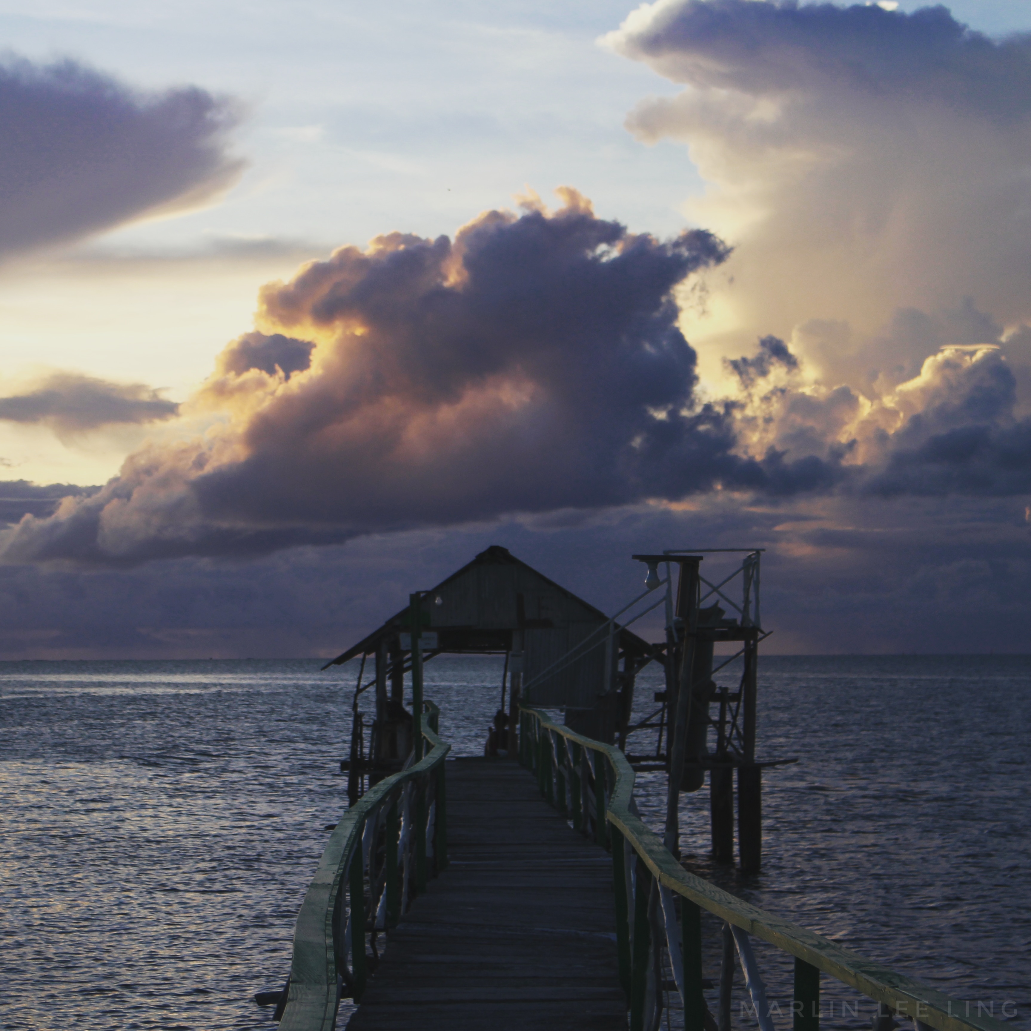
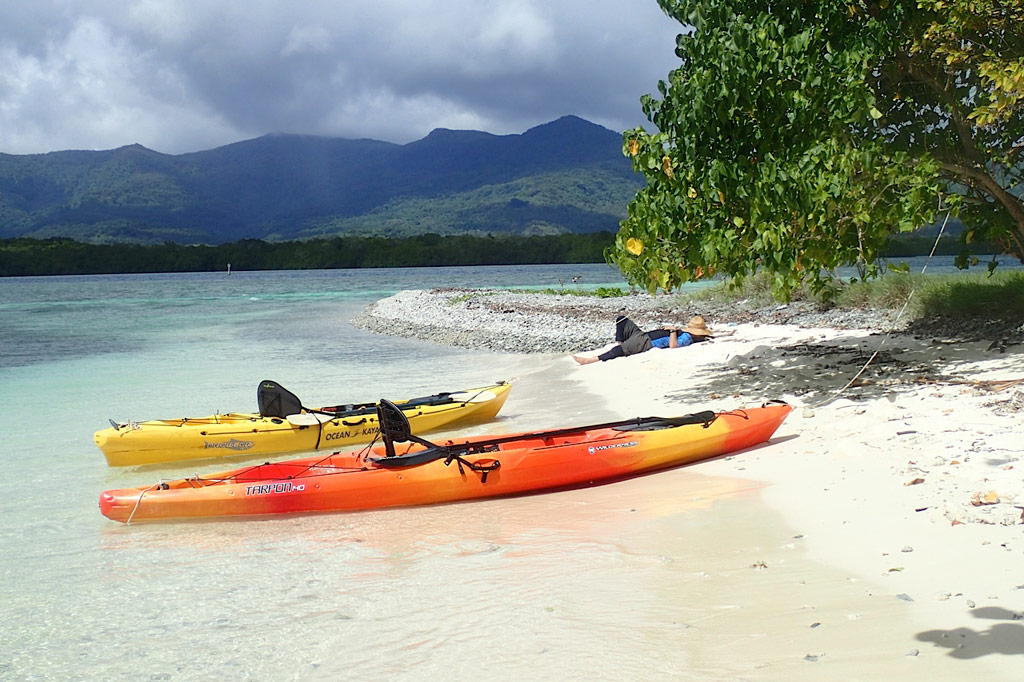
The best snorkeling in the area is west of Nahkapw (island) along the edge of the reef, where a coral wall drops quickly off into Pahn Nahkapw‘s blue hole. Fish are abundant here and the coral is thriving. Start at the north tip of Nahkapw and follow the reef around. To the east you’ll see the massive basalt boulders that make up the island’s Nan Madol-era breakwall.
Kepindausiso
The reef walls north, west, and south of Dekehtik (island), at the northeast end of Pahn Nahkapw, offer plenty of nice underwater views and crystal-clear water. This portion of the hole is referred to as Kepindausiso –“below the noble’s channel”.
Namwen Na Stingray Sanctuary
This reserve lies between Nahpali, Dekehmwahu, and Na (islands). It’s a moderately deep pool in the middle of shallow, sandy reef flats populated by a large number of stingrays (we saw more than fifteen in under an hour). You can swim out to the western edge from the southern tip of Nahpali or explore the eastern side from Na. There can be some strong currents coming from the northeast, so be alert.
Northern Na Island Coast
Na‘s northern coast offers narrow sandy beaches and a swath of beautiful, crystal-clear water over a sandy bottom. Further out, the floor turns to beds of seagrass. There are plenty of stingrays to see in the area. When walking in the shallows, be alert and shuffle your feet to avoid potentially serious accidents.
Visit our Island page for more about this location.
Nahpali Island
Nahpali‘s underwater sights are all around the west side and most easily accessed from the Japanese Wharf at the edge of the reef.
Visit our Island page for more about this location.
“Nan Madol”
The water around the northeastern perimeter of Nan Madol is usually too rough and/or murky for sub-surface exploration, but the reef pool southeast of Lemenkau can be nice on calm days and at mid to high tides. At other times, it’s either difficult to reach or has waves breaking over it.
Namwen Nahnningi Stingray Sanctuary
Similar to the reserve near Na, this marine protected area consists of several deep pools in the middle of the reef shelf with sandy bottoms, good visibility, and healthy coral populations around the edge. Stingrays are abundant and reef fish diverse. The pools are a short swim from Nahnningi (island) (a.k.a. “Joy”).
Joy / Nahnningi / Para Nuii
Southeast of Nahnningi is a circular pool on the edge of the fringing reef. There’s a narrow opening on the ocean side that allows water and fish to flow in. Depending on the tides, this place can have amazing numbers of reef fish, but it’s too rough for snorkeling when the Northeasterlies are blowing during the winter. You can snorkel to the pool from Nahnningi.
Penieu is a gorgeous reef island in the southeast next to Kepidauen Ne (pass). The island is a major rookery for a colony of noddies and other seabirds, which fill the air with raucous clamor as they swoop around the trees. The primary nesting spot is within a strip of mangroves at the north end of the island (which we’ve dubbed “Noddy City”) and should be given a wide berth to avoid disturbing the habitat of the birds. The island also has a strange, curving sandbar around the north that forms a kind of protected, shallow lagoon with a sandy bottom. This is an excellent place for wading, swimming and playing if you have your kids along, but keep an eye out for stingrays. There are also sandy beaches and good swimming and snorkeling on the west coasts. A pearl farming operation was in progress in the shallow lagoon areas nearby, and a few ramshackle huts were been built on the beach for that purpose (unfortunately, they’re untidy and don’t add much to the scenery). Currents can be quite strong around the eastern side of the island.
Camping is possible on Penieu, which is owned by the Nahnmwarki of Kitti. Unfortunately, it’s difficult to get him or a family representative on the phone. If you’re interested in visiting, contact the Kitti Municipal Government Office at +691.320.5038, 320.5808, 320.5049, or 320.3257 and ask for assistance.
Sapwtik, which means “small land,” is a tiny volcanic island located directly north of Kolonia and 0.5 km northwest of Lenger. Seen in profile, the island resembles a large submarine, leading some locals to nickname it “Submarine Island.” Sapwtik is jointly-owned by the Eschiet family, which has some small houses at the eastern end of island, and their in-laws, the Adams family. During the 1880s, Sapwtik was purchased by Jan Stanisław Kubary, a Polish naturalist and ethnographer, along with a large piece of land east of what is now Kolonia — a place called Mpwoampw. In 1896, after returning from an extended absence and finding his homestead in ruins and his claims on the properties questioned by the Spanish authorities, Kubary committed suicide. Mpwoampw and Sapwtik were then purchased by Dominique Escheit, a Belgian trader who had operated in the Marshall Islands before coming to Pohnpei. Between 1914 and 1945, the Japanese were in charge and a great deal of land was seized by the military for defensive purposes — including Sapwtik. Like its neighbor, Lenger, Sapwtik was fortified in the late 1930s in preparation for an Allied invasion that never came. The primary features are found on the low hilltop and at the western terminus.
Sapwtik Island Attractions
Japanese Wharf
Visitors to Sapwtik will want to make their first stop at the Japanese Wharf, a 296 meter-long (324 yd) basalt structure that juts out from the island’s southwest coast all the way to the edge of the reef. With the exception of the very end, which has sustained some damage from waves, the wharf is in excellent condition almost 80 years after it was built — a testament to the quality of Japanese construction during the colonial period (and the use of the highly stable tanizumi, or herringbone, style of stonework). The wharf connects with the coastal road, also built by the Japanese, which skirts the mangroves from one end of the island to the other. The road is built above a stone retaining wall that stabilizes it against the swampy mangrove environment. Retaining walls also run along the opposite edge to prevent erosion from the steep hillside above.
Snorkeling & Swimming
All the ocean areas around Sapwtik belong to the Sapwtik Marine Protected Area, a sanctuary protected by legislation. The snorkeling off the reef walls at the end of the wharf is quite nice with generally good visibility and lots of fish. Just start at the wharf and follow the reef wall in either direction (the further from the island, the better it gets). The best place to swim is also right off the end of the wharf. Shallow areas on either sides of the wharf are silty.
Command Center & Barracks
The central hill is most easily accessed from the maintained Japanese coastal road. About 60 meters east of the wharf, hikers can cut off the road and up the slope (another 60 m) to reach the summit. The Adam’s family keeps the hill extremely tidy, cutting the grass, planting flowers, and keeping the historical features free of vines and brush. The place has a manicured, park-like feel and a stunning view of everything to the south. One of the best preserved yabane-tanizumi style rock walls on Pohnpei runs the length of the hilltop on the south side with two breaks, where earthen ramps lead up to the top. Two foundations were likely a command center and a barracks for personnel stationed on the island. The northern foundation is the largest and has seven sets of steps leading up to where the floor once was. The structure itself would have been wooden, while only the support posts and the lower parts of the walls were concrete. Two large concrete cisterns are connected to the two foundations (check out the bullet holes from Allied strafing). At the north end of the complex, the hill road begins, cutting right through the hill and running all the way to the gun batteries at the northwestern end of the island. Some of the road is currently impassable due to piles of felled trees and branches, but it’s impressive none the less.
To visit the gun batteries, it’s best to return to the coastal road and hike northwest all the way to the end. The road is well-kept and easy to follow.
Magazine Complex / Shell Storage
From the cut-off point for the hilltop, it’s about 150 m (164 yd) along the road to the first point of interest, a high-walled magazine complex for heavy ordnance similar to the one at the coastal gun battery on Lenger. The surrounding basalt rock wall (also tanizumi style) runs north and then curves sharply back to the south to enclose the foundation of the magazine structure, which is about 6 meters long. On the inside of the enclosure, the walls are steeply sloped. There is no roof, but the entire feature may have been covered with canvas and camouflaged during war-time. The entrance is narrow — less than 2 meters wide — and curved.
Coastal Gun Battery
About 12 meters northwest of the magazine is the first of four 75 mm field gun stations. These are similar to the structures on Lenger, though the Sapwtik sites are more primitive with less concrete and more earthen features. No guns remain, and two of the sites may have been decoys that never had guns installed. Guns would have protected the primary entrance to Kolonia at Pweitik Passage (Kepidauen Pweitik) to the northwest. A footpath continues north past the gun emplacements and then turns southeast to follow the contour of the hill. Along this are a few stone rifle pits or machine gun emplacements. Old Japanese beer bottles litter the forest.
NOTE: The ruins of a searchlight and a tunnel, cutting completely through part of the central hill, also exist on Sapwtik, but we did not have the opportunity to locate them during our brief period of fieldwork on the island. If you’re interested in seeing these features, contact Richie Adams at (+691.320.5735). The Pacific Wrecks website has photos of both.
To obtain permission to visit, call Richie Adams (Adam’s Brothers Corporation) at +691.320.5735 or call Ace Hardware’s office at +691.320.2723.
ACKNOWLEDGMENTS
The Sapwtik Island information would not exist without the cooperation of the Adams family.
Naappears to be the largest island in Madolenihmw after Temwen, although it mostly consists of mangrove forests. In the mid-1830s, Na was home to a renegade Pohnpeian chief — the Wasai — who joined a group of foreign whalers in a fight against the Nahnmwarki of Madolenihmw and his brother, Nahnawa. The violent conflict ended with the murders of the Nahnmwarki and Nahnawa at the hands of the whalers, and the Wasai became the new Nahnmwarki (beginning a long cycle of violent power struggles in the district).
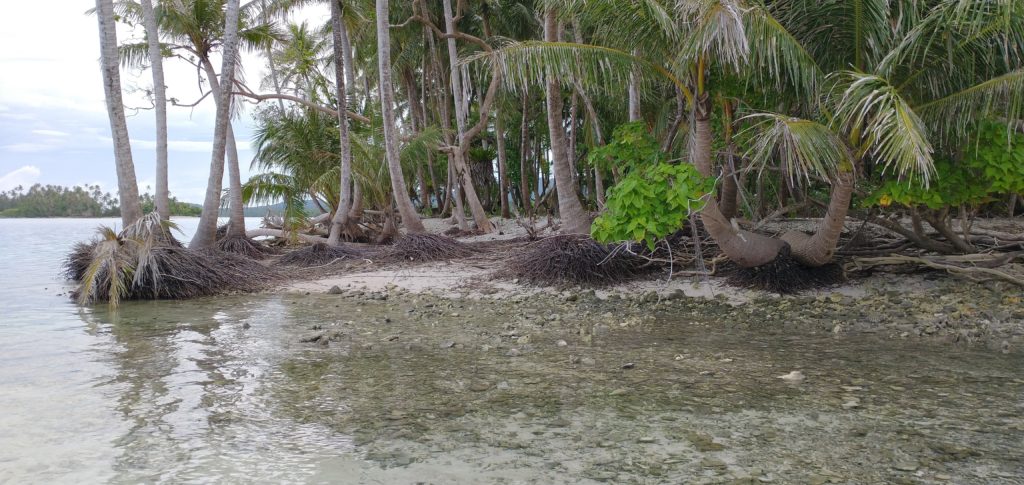
Currently Na is uninhabited. Though seagrass beds characterize the areas further out, there’s a beautiful swath of shallow, crystal clear water between them and the northern coastline. The bottom is sandy and a fantastic place to observe resident stingrays. The island itself is little more than a long, curving sandbar that has collected trees over its lifetime — mostly coconut palms. All the potential camp sites are on the northern coast as well as the beaches and best swimming.Snorkeling spots include Namwen Na Stingray Sanctuary to the north and the reef walls at the eastern edge of Pahn Nahkapw south of the island. The closest SCUBA diving is located on the reef wall around the eastern end of the island (boat access from outside the reef only). Divers usually begin there and drift on an in-coming tide along the wall as it curves west. Due to exposure to the prevailing winds, which cause heavy seas, the site is only an option during the middle of summer.
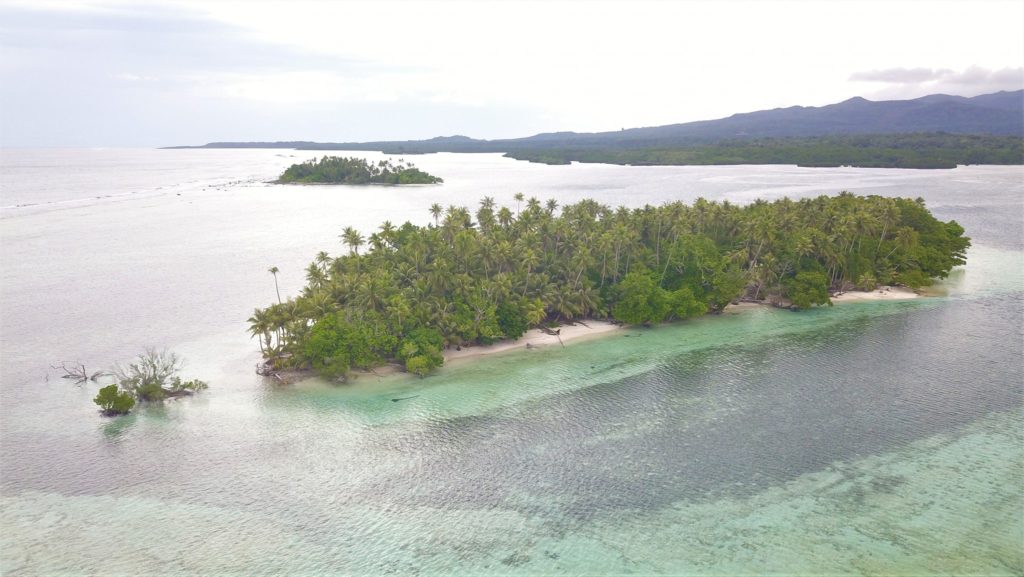
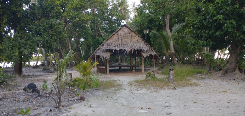
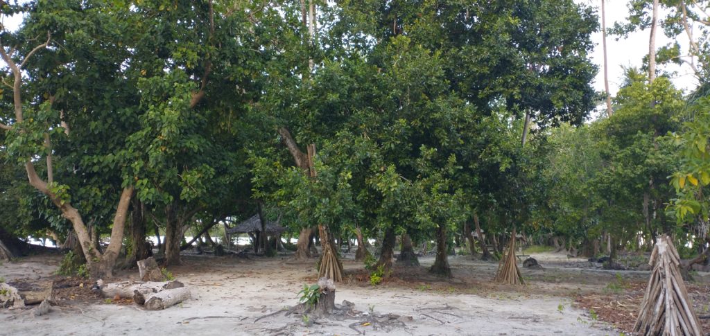
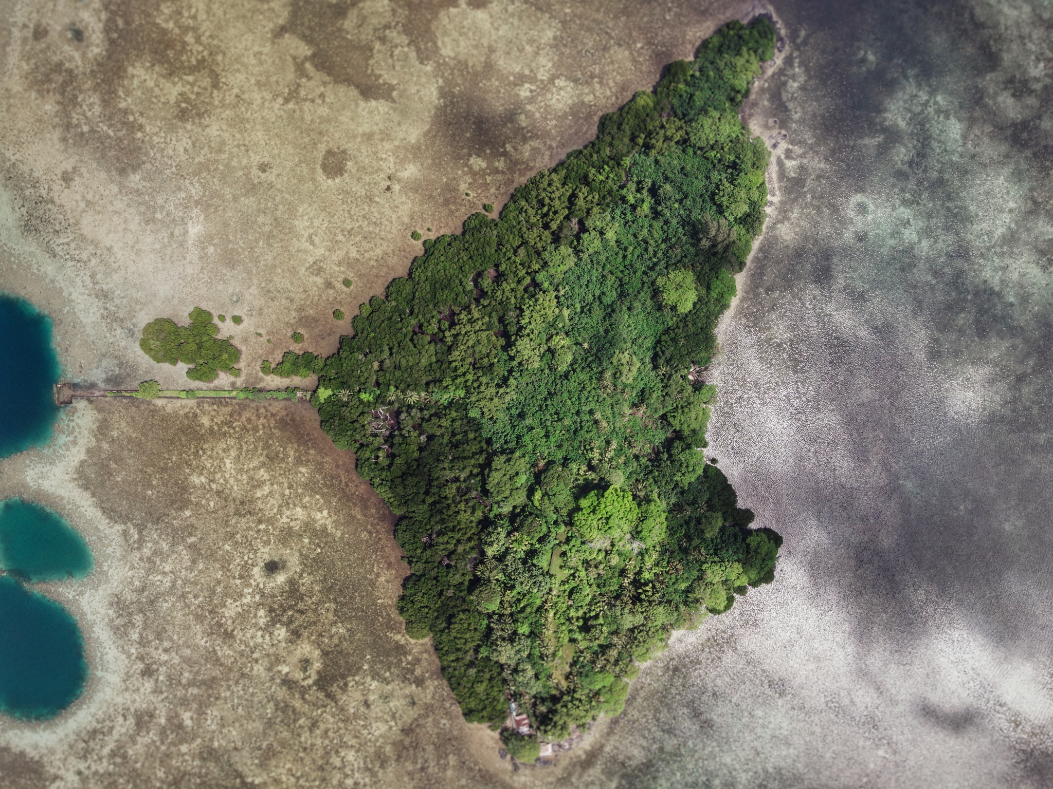
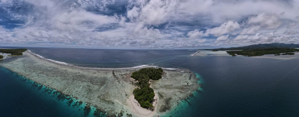
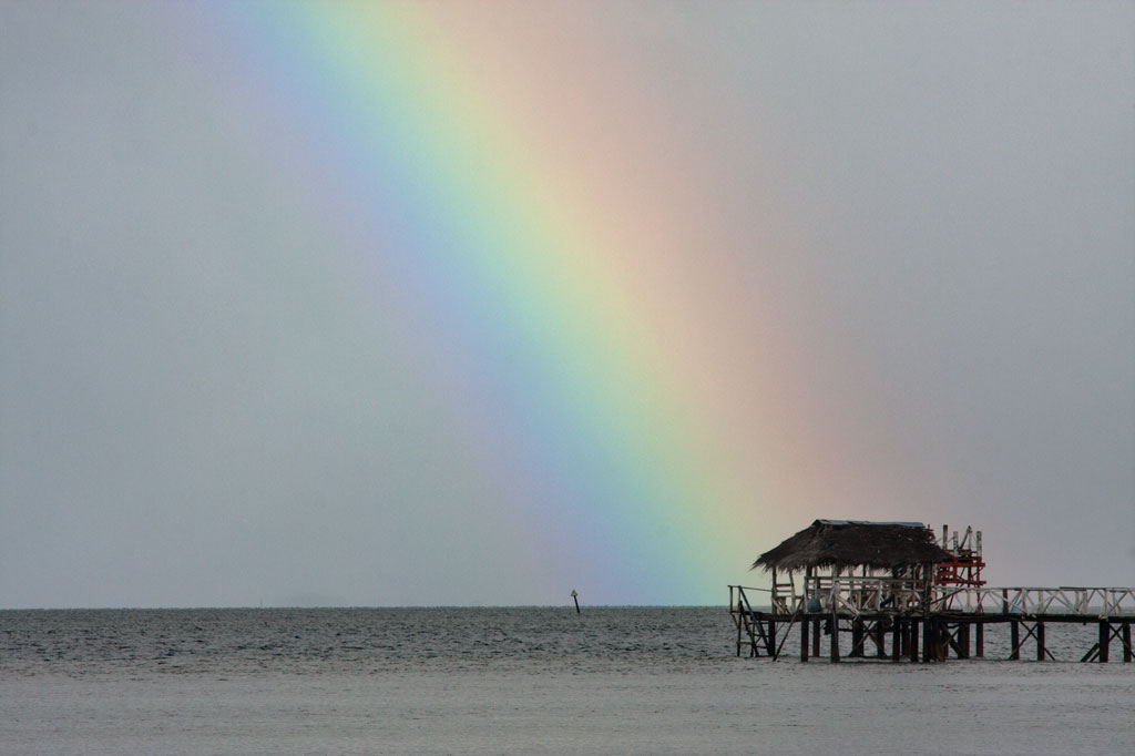
Nahkapw is the island directly across from Nan Madol, and if you want to stay overnight and explore the ruins over a couple of days, this is the place to camp. The island is composed of coral rubble and thickly forested. Sandy beaches lie around the north and northeast coasts and there’s a nice protected, shallow place to swim on the west coast inside the boulder break-wall. The latter is believed to have been constructed during the Nan Madol Period or perhaps even before. Legends speak of two ancient stone cities that pre-dated Nan Madol; one of these is said to lie beneath or beyond Nahkapw. Some archaeologists have proposed that the island itself is man-made, but though much of the western and northern coastlines are surrounded by gigantic basalt boulders that are certainly not natural to the area, there doesn’t seem to be any columnar basalt around Nahkapw. The island has an irregular shape. The best swimming is off the north end, where the beach drops straight off into the deeps of Pahn Nahkapw — a huge “blue hole”. The snorkeling and SCUBA diving around the west edge of the reef wall (next to the boulder line) and to the northeast is excellent.
To obtain permission for overnight stays, call Hentrick Etse at +691.320.8782.
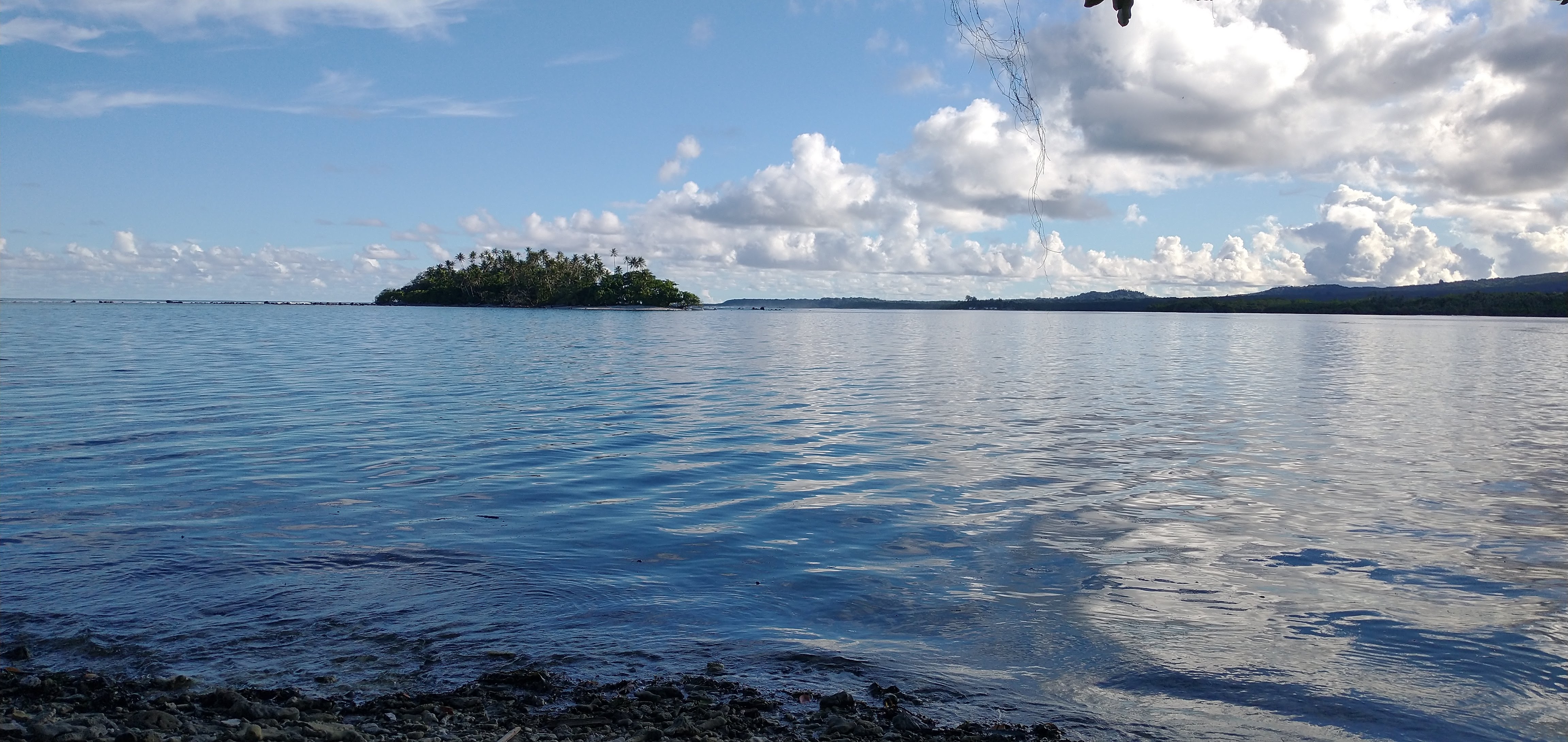
Nan Madol on the right side of Nahkapw and Na Island on the left side of Nahkapw.
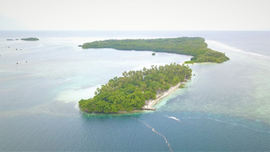
Mall is located just to the south of Nahnningi, and though it looks larger, about half of the island’s area is mangroves. The most interesting feature on Mall (also known as ‘Small Island’) is a prehistoric stone tomb located at the north end. According to oral history, the island was home to two brothers named Semen Pwei Tikitik and Semen Pwei Lapalap. Dissatisfied with the greed of the reigning Saudeleur, the brothers left Pohnpei and sailed for another land. Only the younger of the two survived the journey. Eventually, Semen Pwei Tikitik returned, armed with the knowledge he’d gathered during his travels. He went to Nan Madol and shared what he’d learned about the more egalitarian culture he’d visited. The Saudeleur, however, refused to see reason, so Semen Pwei Tikitik killed him. Unfortunately, the assassination did not end the dynasty and the dead Sau was soon replace by a new leader.
To obtain permission to visit, call William Hawley — the Rosa — at +691.320.2111 / 5050. Or contact the family run business, LP Gas, and inquire about visiting the island +691.320.5661 / 2675
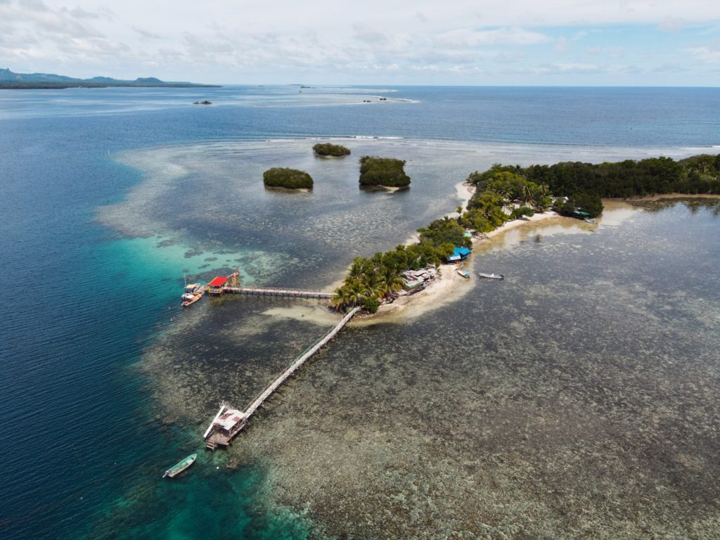
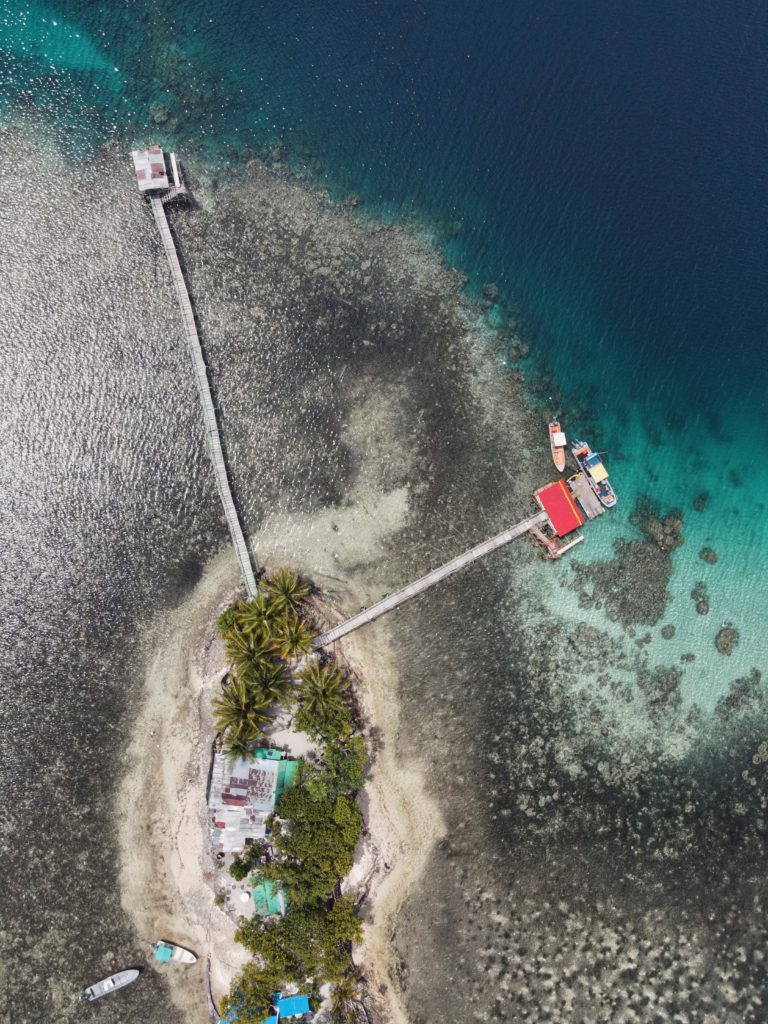
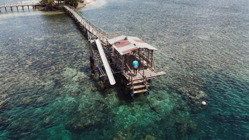
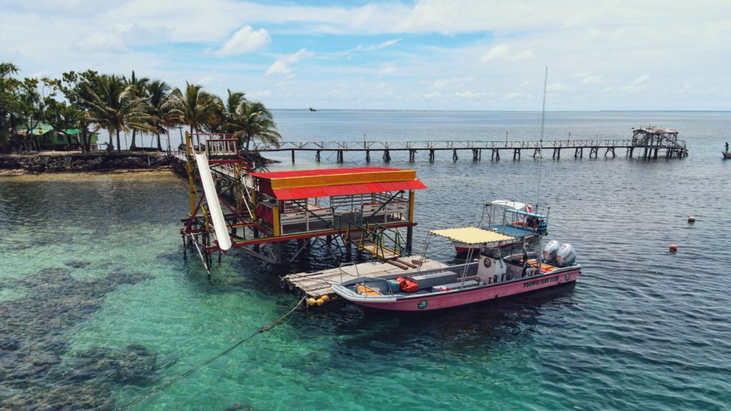
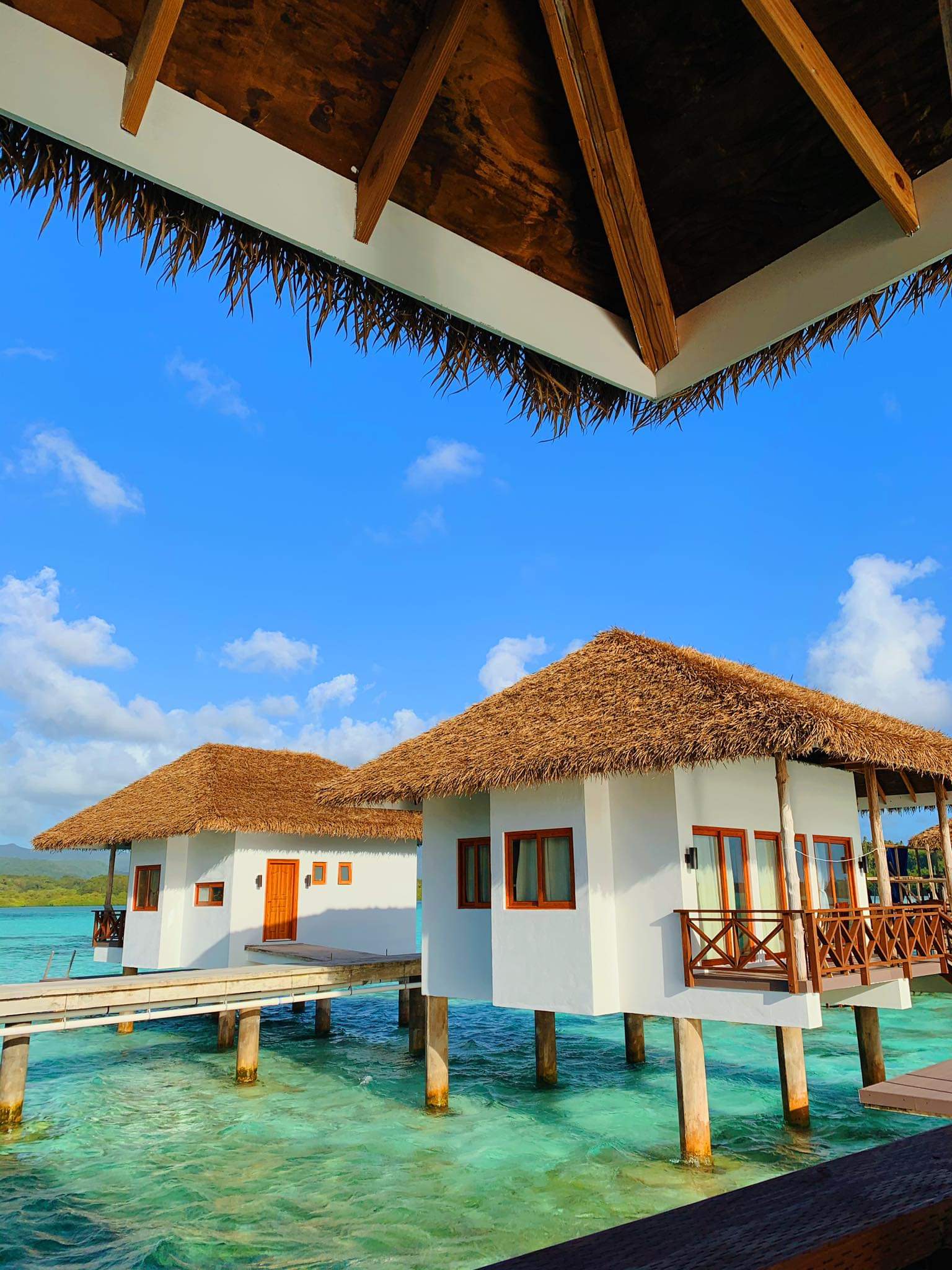
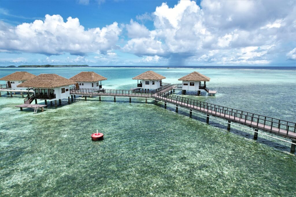
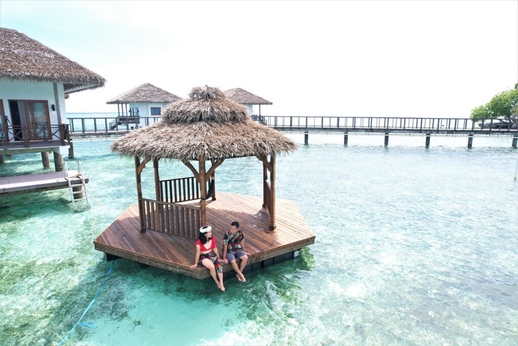
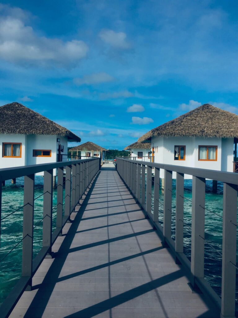
Nahnningi is known by most as “Joy Island”. There used to be a popular camping operation there in the 1990s, but for many years the island was not open to tourists. Recently it has become available again, but even more developed and open for both locals and tourists. The island is now called Para Nuii and is home to one of Pohnpei’s best picnic spots. The appeal of the island has to do with the shallow sandy areas around it, which are great for swimming and stingray-watching (beaches form at low tide) as well as housing situation. Para Nuii has fully furnished bungalows that stretch our from the northern end of the island. It is definitely “higher class” than most housing situations on the other islands, however because of this it does come with a steeper price tag than the other lagoon islands. There’s good snorkeling and SCUBA diving to the northeast along the outer reef and at a small channel near Mall. The Namwen Nahnningi Stingray Sanctuary is also within a close distance of the island.
Most archaeologists agree that Nahnningi is man-made and was constructed during the Nan Madol Period (it’s square and has low columnar basalt walls around much of its coastline). Purchase the Temwen Vicinity Eco-Adventure Map Guide for detailed maps and additional info.
To book a reservation for Para Nuii contact One World Plaza’s office located on the 1st floor of One World Plaza building or via their website listed below.
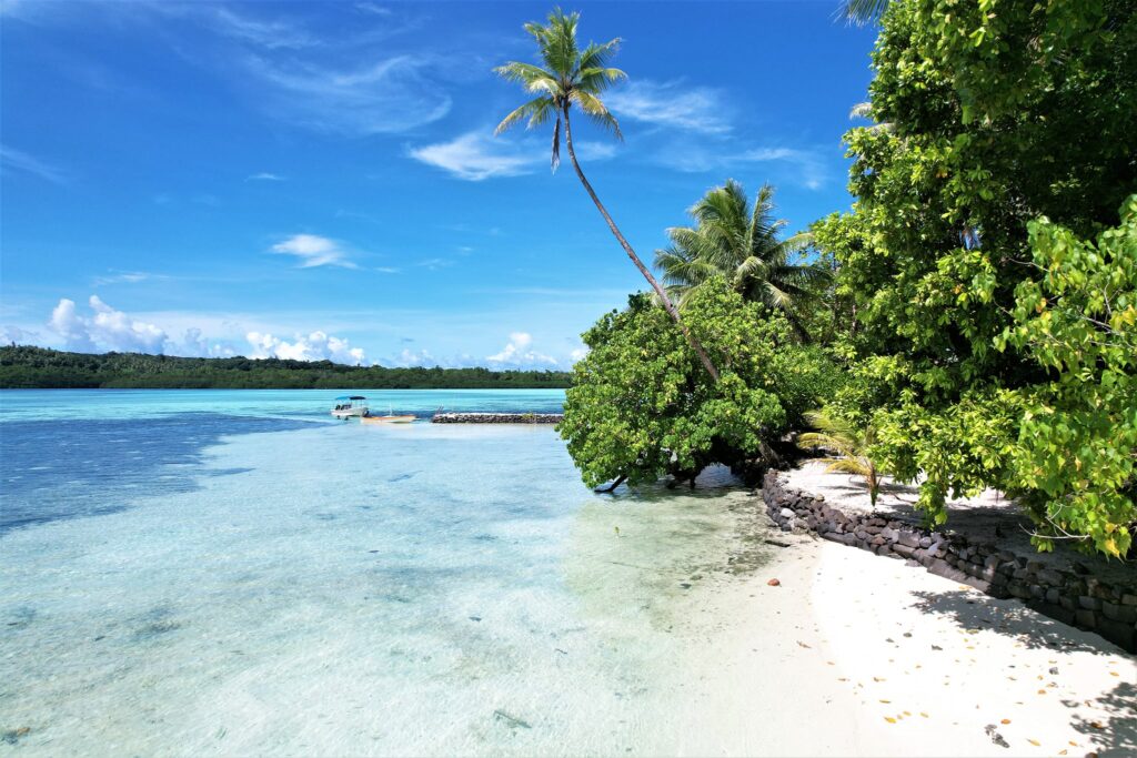
Ros is another beautiful uninhabited reef island in the south. The long, skinny island seems to be slowly disappearing as it erodes, but there are huge areas of wonderful sand on the west side to lounge about on and a narrow belt of trees. It’s mostly notable as a destination for paddlers, taking a break from exploring mangrove forests nearby, or SCUBA enthusiasts, resting between dives (Kepidauen Ros is one of two locations on Pohnpei famous for manta rays). There is good swimming and snorkeling a few kicks from the island.
For permission to visit or camp on the island, call +691.320.5896 or the Kitti Municipal Government Office at +691.320.5038, 320.5808, 320.5049, or 320.3257.
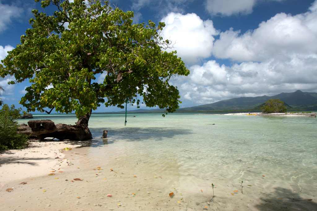
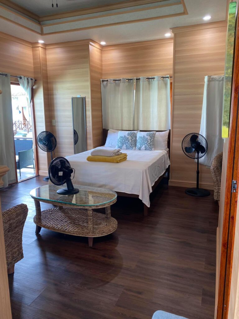
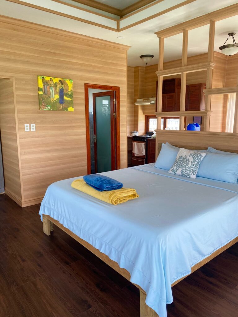
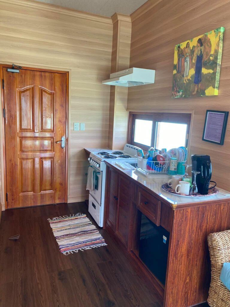
Nahlap, owned by former FSM congressman John David, has become one of the most popular lagoon island get-aways in Pohnpei State largely because it’s easy to get to, affordable, and has lots of huts for visitors. There are two docks, several stilt huts out over the water for lounging around and taking in the scenery, a volleyball court, and a variety of picnic spots. The island also has a small chapel on it located further in from the picnic area. They also have wifi on the island but only in a certain area and not across the whole island. The island is large, shady, and quite pleasant. Though the surrounding ocean is dominated by mangroves and seagrass, there are places on the far side and around the docks with good snorkeling. The southeast coast has some shady beaches at low tide (the best is in front of the tiny chapel) and rope swings for the kids. The turn-off for the launch at Sekeren Iap is about 21 km west and south of Kolonia. Continue past the Henry Nanpei memorial and the Rohnkitti Church all the way to the end of the road.
To make reservations or arrange for a boat taxi from Sekeren Iap in Rohnkitti, call +691.320.2776. Or call the Kitti Municipal Government Office at +691.320.5038, 320.5808, 320.5049, or 320.3257 and ask for assistance.
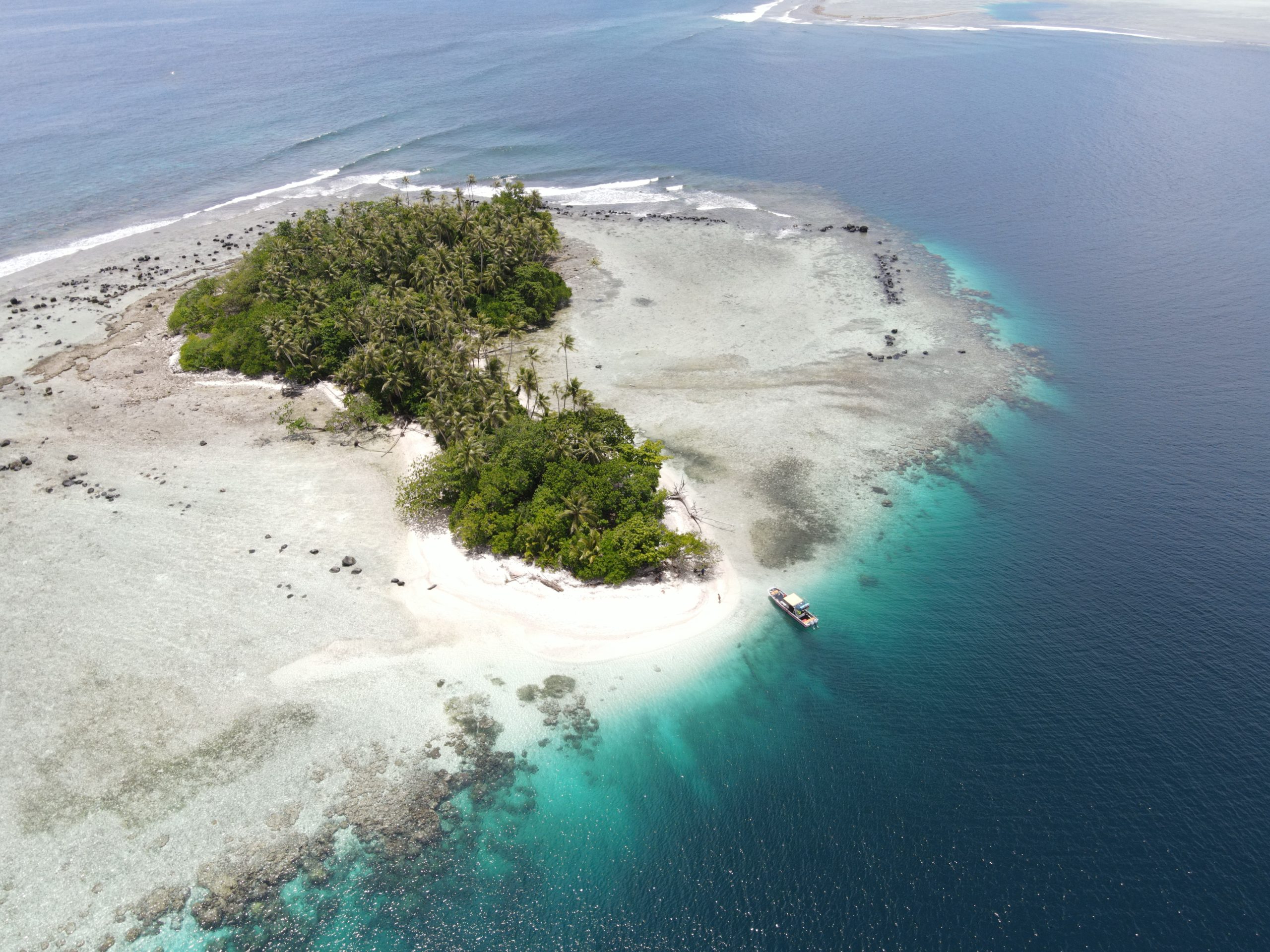
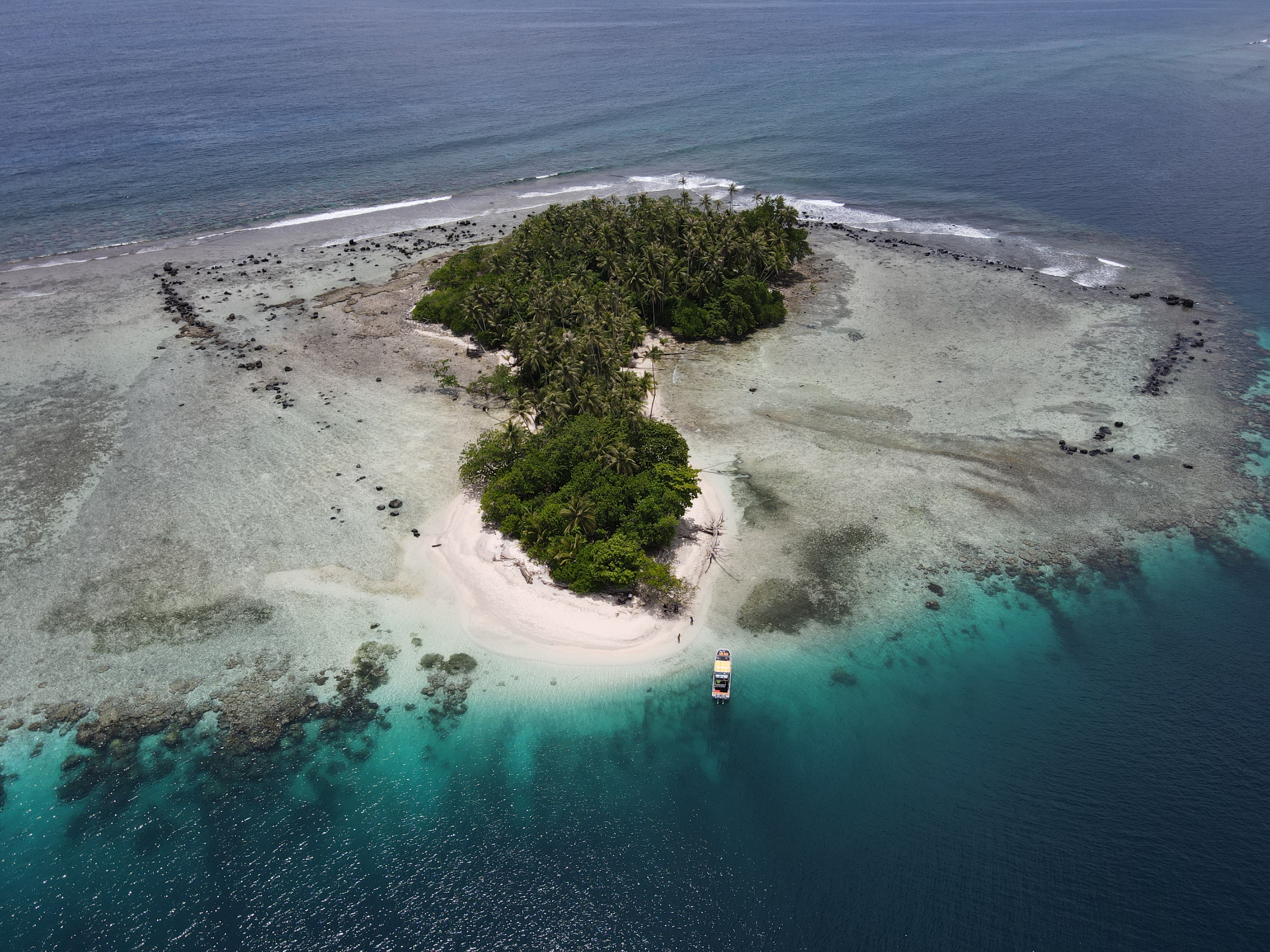
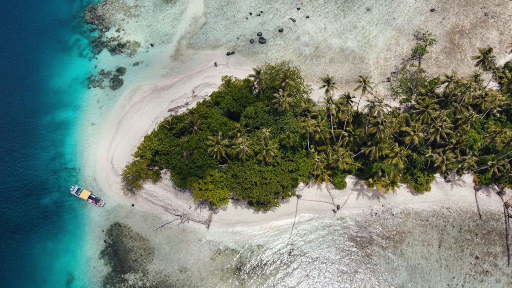
Dekehtik, which means “small island”, also called Sand Island is an uninhabited coral islet west of Na, of which it was once a part (not be confused with the island of the same name on which the airport is located). The north coast is most suitable for camping with some sandy beaches at low tide and stunningly clear water for swimming and ogling the many stingrays in the area. There are huts on the island for people to stay in while on the island. The island is currently owned by the Adams family (the proprietors of Ace Hardware and Ace Office Supply). The best snorkeling is northwest of the island along the edge of the deep, blue hole of Pahn Nahkapw. The island itself is characterized by thickets of shrubby vegetation and coconut palms. Sandy beaches form on the north coast at low tide.
To make reservations for day visits or night stays and to arrange boat transport call ACE at +691.320.8279 / 5637.
Dekehtik in the foreground, Na Island in the background (PC: Lee Arkhie Perez)
Deketihk Island with Nahkapw Island in the background. (PC: Lee Arkhie Perez)


")


")