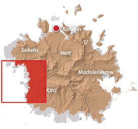
Historical Sites in Mainland Sokehs


“Military Road” Hike / Bike Tour
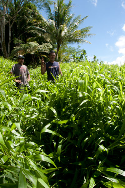
One of the most rewarding routes for Japanese World War II-era historical sites follows a road 0.46 km (0.29 mi) northeast of the turn-off to the FSM capital. This track was built by the Japanese in the 1930s to access the many military sites in the area and remains unpaved. Whether it is public or private, however, seems to be a matter of some debate. FSM Telecom, which maintains a mobile phone tower near “Radar Station Hill” and uses the road often, says that the road and the areas immediately alongside it belong to the municipality and that people living beyond the Thomas residence are squatters without legal land claims. Even so, a family living on the south side of the road about 1 km (0.62 mi) from the Circle Island Road insists that everything beyond their house is private. There are two ways for visitors to deal with this issue: either (1) hire a knowledgeable local guide to escort you on your hike (you’ll likely find more with them anyway) or (2) visit the house in question and ask permission yourself. During our fieldwork, we used both options successfully. The road, though unpaved, is in pretty good condition, and as it doesn’t climb much, it’s a great choice for either hiking or biking. You can park your vehicle at the beginning near the Circle Island Road and go from there.
")
“Bunker Hill”
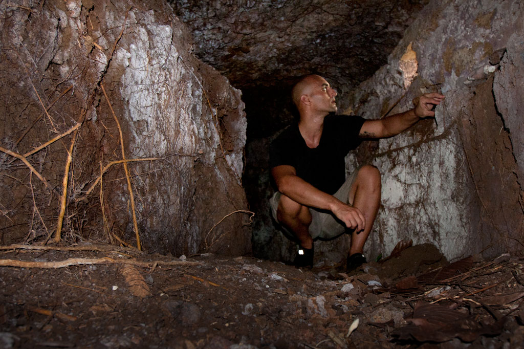
About 100 m (109 yd) from the starting point, you can cut off the road to the right and climb up the grassy hill, making your way toward the landowner’s house about 200 m (219 yd) to the northeast. This is the place to ask for permission to explore in detail. There are several points of interest worth looking into. At the southwest and northeast ends of the hill, there are bunker-like observation stations that consist of curved tunnels with domed concrete roofs and several gun ports. The southern bunker site is well-hidden with the entrance near the base of a large tree that has grown up in recent years. Entering is a dirty job, but once you’re inside, the structure becomes quite roomy. The gun ports allow light inside. The northern site is close to a large cassava plantation and is kept cleared. You can enter easily from either end. These structures were likely manned by a few riflemen and intended to protect the roads on both sides of the hill. In view of the landowner’s house you can also find a zigzag trench and two gun sites, one of which was probably a medium-sized anti-aircraft gun. No guns remain now. Some people believe a gun at this location shot down the American bomber “Love Bug”. Others say it was one on Dolen Pahniepw.
Paul Thomas’s Hill
Another 277 m (303 yd) further down the road, one comes to the residence of a friendly West Virginian native, Paul Thomas, and his local wife. Thomas enjoys a good chat, and if you ask politely, will happily point you in the direction of several interesting sites on the hill above his house. Easily found are two pairs of bunkers similar to those mentioned already, and between these, three small gun sites and several foxholes. Thomas keeps the hill trimmed and neat; all but one of the sites (the first set of bunkers) lie along the crest of the hill over a distance of about 125 m (137 yd). The hill commands sweeping views of the Palikir valley to the west.
- If you want to make arrangements ahead of time, call Paul Thomas at +691.320.4562.
")
Dolen Pahniepw
The next stop is Dolen Pahniepw. An overgrown trail begins off the right side of the road 0.56 km (0.35 mi) past Thomas’s driveway and runs 0.43 km (0.27 mi) to the summit of the hill. About 300 m (328 yd) along the trail, one comes to the ruins of an army barracks, which consists of concrete house posts,
foundations, and a bombed-out cistern. Sets of concrete steps led to the entrances of the wooden buildings. Some scrounging in the jungle around the site should yield some old Japanese beer bottles. At the end of the trail is a large anti-aircraft gun site, which probably housed a medium-sized gun similar to those on Lenger Island. On the northeast side of the hill, you may be able to locate the foundation of a radio tower, some tunnels, and the chassis of a truck.
At the southern end of the hill near the road, you can scramble up the bank and find a pair of unfinished small gun emplacements, some trenches in the woods, and a defused bomb.
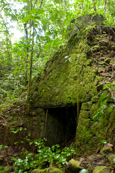
“Radar Station Hill”
The road ends near the FSM Telecom cellular phone tower at the summit of a hill. A footpath continues west to a cement platform for a Japanese radar array, two foxholes, and two circular gun sites. A large bomb crater south of the road makes an excellent tent site for campers with unobstructed views of the whole of mainland Sokehs. Back east down the road, an L-shaped cutting leads to a path and eventually to the site of a generator station with a concrete storage alcove built into the embankment and a rusting motor.
- Plan for a half day to full day for this hike/ride, depending on how many sites you want to explore.
- No guide is necessary for the Military Road sites as long as you ask permission wherever private land is an issue. However, you are likely to discover much more of interest with a guide who knows the sites. Please visit the Local Guides & Tour Operators page for a list of experienced guides available for hikes around Sokehs, if desired. Offer $25-50 for a group of five or less.
PBJ-H1 “Love Bug” Bomber Ruins
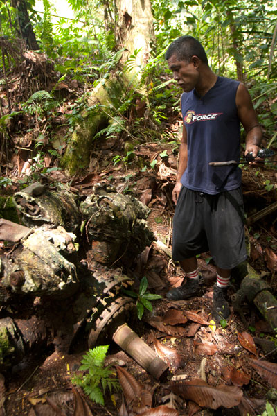
Throughout 1944 and early 1945, the U.S. carried out a brutal bombing campaign of Japanese fortifications on Pohnpei. The only bomber ever shot down was a PBJ-1H (the U.S. Marines version of the Airforce B-25H) nicknamed “Love Bug” and piloted by First Lieutenant William J. Love. On February 6, 1945, while on a mission to destroy targets at the nearby Palikir airfield, the Love Bug was picked out of the sky by an anti-aircraft gun on one of the nearby hills (possibly “Bunker Hill”, Paul Thomas’s hill, or Dolen Pahniepw). The plane burst into flames upon impact, killing the entire crew. After the crash, Japanese soldiers collected the bodies and buried them in a marked grave near the crash site. A monument to the crew used to be found at the burial site, but it was taken apart by looters in the 1980s.
The crew was disinterred and reburied several times during the American Period before coming to rest at Jefferson Barracks National Cemetery in the U.S. — all except Sgt. David Snider, whose whereabouts were unknown until 1948. The wreckage was not positively identified until 2001, when two aviation archaeologists surveyed the area. The tail section and rudder were still visible in the forest in the 1980s, but the site has been heavily looted since and only a few large pieces remain — the port engine (sans prop), landing gear and wheel, and a portion of a stabilizer. Bits of wreckage are strewn across an area of some 7,000 square meters. Three defused bombs are also said to be in the vicinity, but we were unable to locate them during our visits.
It’s easiest to visit the site from the unpaved water tank road behind the FSM presidential housing facility. No guide is necessary, but you’ll have to ask the officer at the security check-point to let you through. The wreck is found on the forested slope a few meters off the north edge of the road before the water tank.
- Plan for 1 hour for this hike. No guide is necessary, but you will need to ask the security guard on the road to let you through.
Nankewi River Vicinity
Ethanol Manufacturing Site
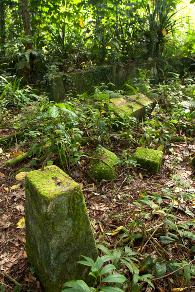
On the banks of Pillapen Nankewi (Nankewi River) the remnants of Japanese industry can still be seen. Neat stone retaining walls frame the river and trenches and pipes form a grid on the north bank. On the south bank are three large fermentation tanks, a variety of other distilling gear, brick ovens built into the hillside, a huge press, a crank, and other rusting machinery. The equipment was likely used to distill ethanol from sugar cane for fuel and other industrial purposes. A great deal of Japanese beer and liquor bottles litter the spot.
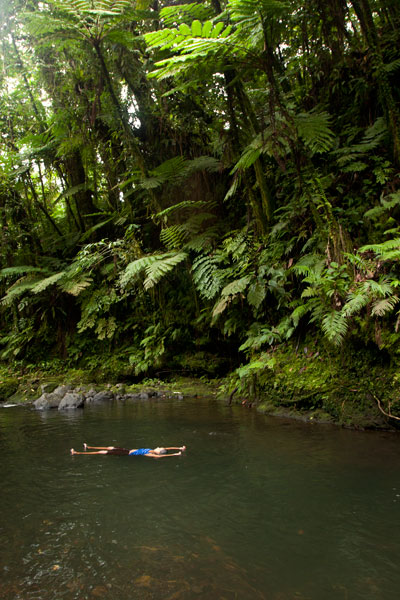
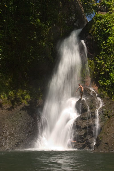
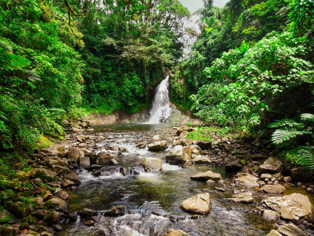
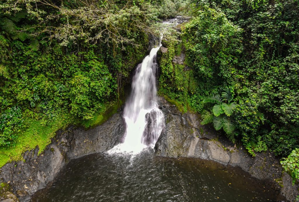
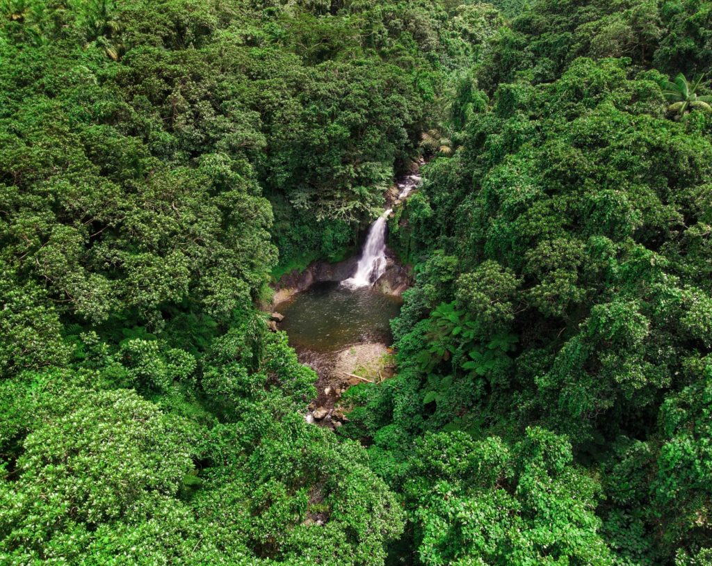
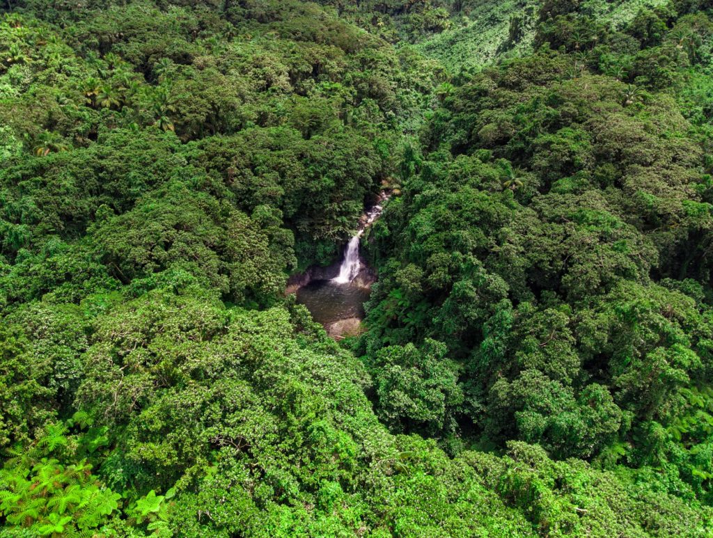
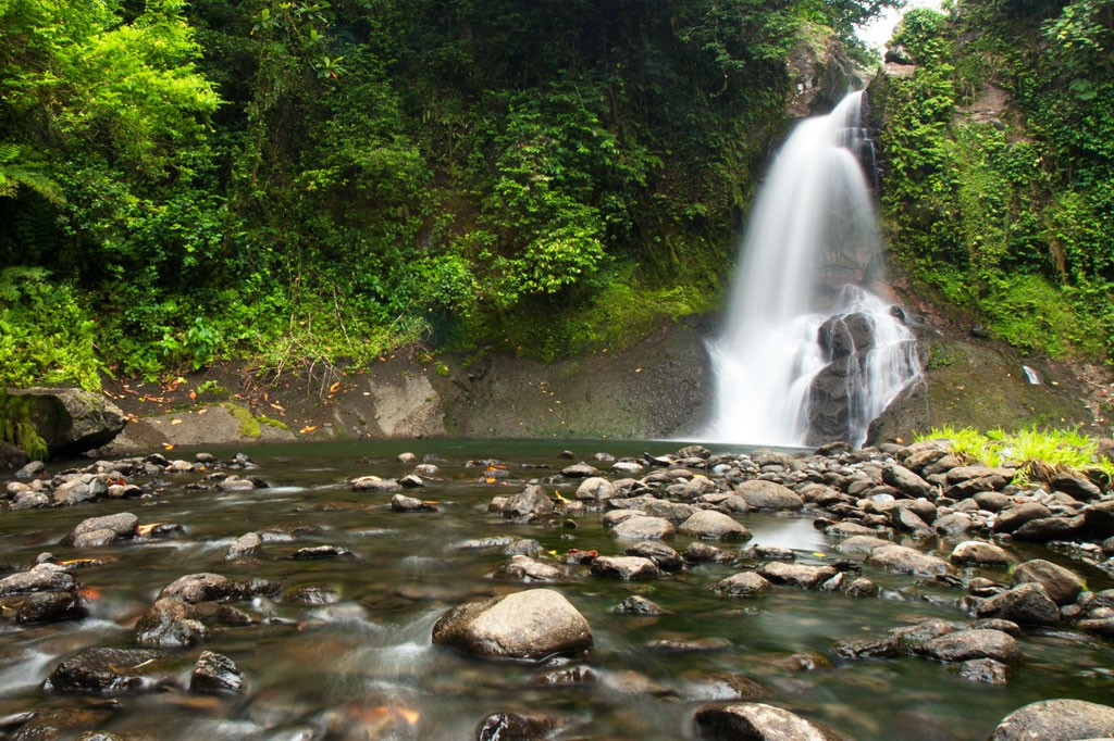
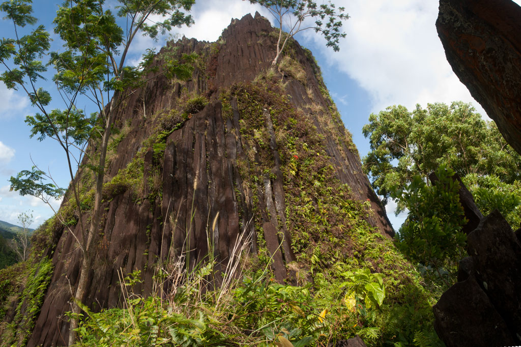
Parpwu Waterfall
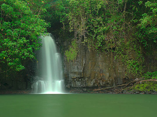
The rather flat terrain in greater Sokehs doesn’t make for a lot of waterfalls, but Parpwu (a.k.a. “Nan Lohlo” or “Nankewi”) — located on the Nankewi River just behind the now deserted Sokehs Shopping Center — is unusual because it’s so close to the coast, almost in the mangroves. In fact, during very high tides, you can kayak all the way from Sokehs Bay to the falls. The waterfall is a beautiful sight, but unfortunately, upstream piggeries have polluted the watercourse and swimming is ill-advised (even though you’ll see local kids from the area doing just that). Photo courtesy of Bill Jaynes.
- Plan for 1 hour for this hike. Its easy to find someone to guide you down to the falls and/or distillery site. Just ask in the area. Offer $6.00.
Map Guides >> Mainland Sokehs >> Mainland Sokehs Historical Sites


")
")
")