")
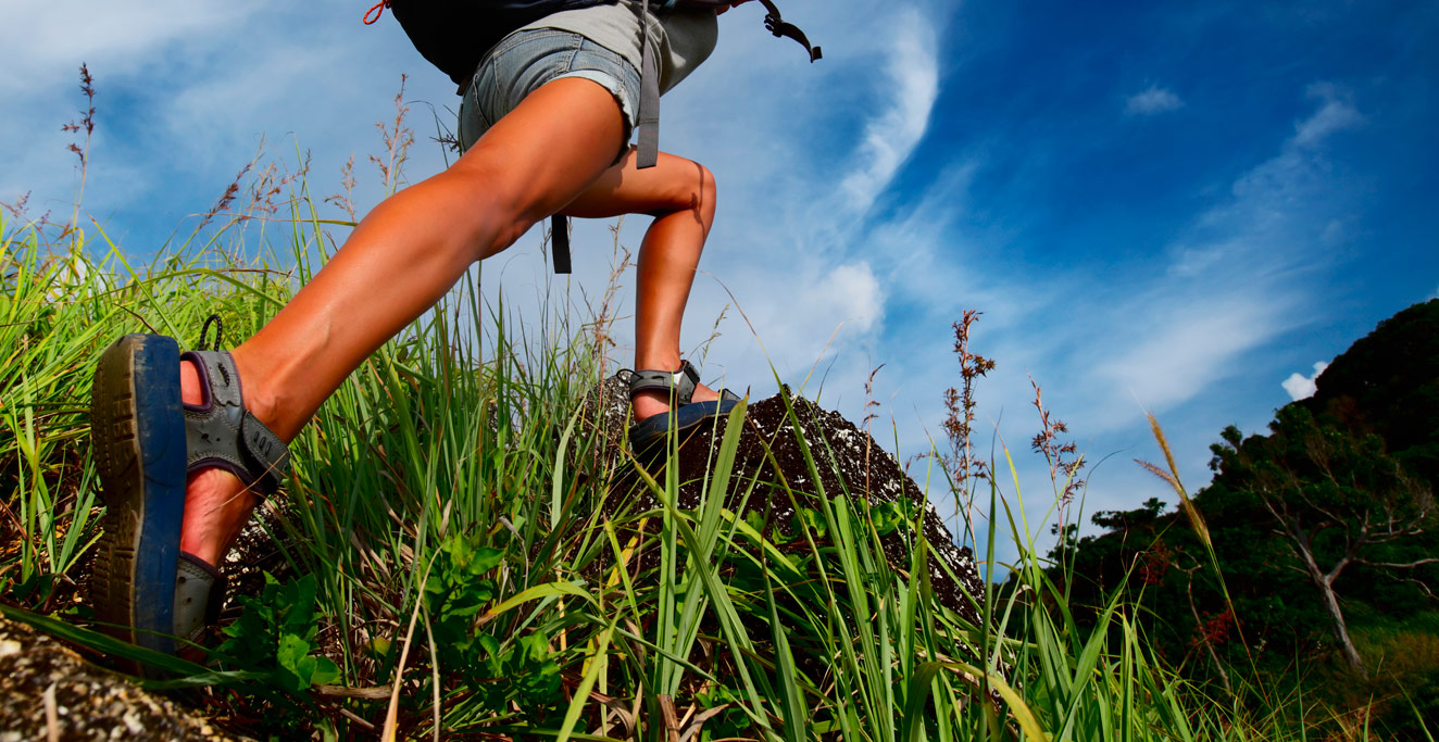
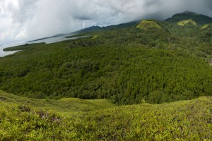
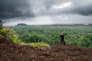
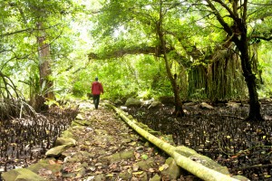
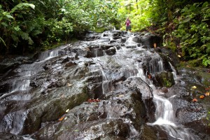
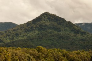
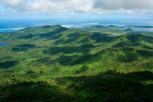
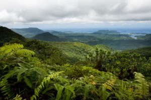
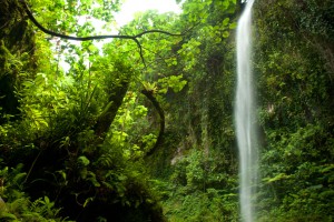
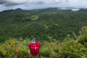
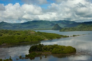
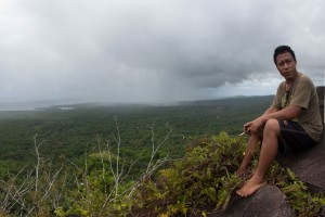
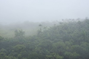
Pohnpei Island is like something out of a Robert Louis Stevenson novel, a thing of lush green ridges, eroded mountain peaks poking through angry shreds of cloud, steaming rainforests, sheer cliffs, and crashing waterfalls. The bulk of the island’s population lives around the coast, leaving most of the interior wild and mysterious. The central part of the island is so difficult to penetrate that it makes hikes that would be considered short and easy in other places, extremely challenging. A four kilometer (2.5 mile) hike can easily take all day and every ounce of one’s energy, but they aren’t all like that; there are hikes for every skill level, every level of fitness. The Pohnpei Eco-Adventure Map Guides seek to provide detailed information about the best hikes on the island. As more guides are completed, more hikes and treks will be added to this page, so stay tuned!
Trails, Paths & Routes
")
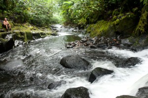
We use three terms when talking about hikes on Pohnpei: trails, paths and routes. Trails and paths are the same thing; well-established foot-tracks, frequently used by locals who live in the vicinity, by sakau farmers who grow their plants way up on the mountain slopes and in hidden interior valleys, or by hunters. Most often trails are narrow, rocky and/or muddy. Routes, on the other hand, are less defined. They aren’t trails that you’d be able to pick out by eye. People may go that way from time to time, but there isn’t enough consistent traffic for an obvious trail to form. Local guides will know these routes and be able to follow them using landmarks that may be not be apparent to an outsider.
Throughout our guides and on this site, we’ve made it clear when a hike can be done without a guide and when it can’t. The majority of hikes on Pohnpei, and certainly anything in the interior, require guides. Don’t try them without, unless you want to get completely lost.

Finding Local Hiking Guides
Pohnpei is still very much a do-it-yourself kind of tourist destination. However there are private tour operators that can arrange hikes and treks for you and provide their own guides. For one thing, none of the tour companies on the island specialize in hiking. They take people once in a while, but usually only to the most well-known destinations. Though you’ll have to do more leg-work if you make your own arrangements, it’s really not terribly difficult to do, and with each hike featured in our guides, we’ve done our best to make suggestions that will help you out. Often, just knowing where a hike starts is enough, as you can ask at houses around the trailhead and usually find someone who grew up there and knows the trail or route better than anyone else. The best way to find a guide is with your hotel front desk, a local tour operator or at the hike location. Be aware that taxi drives can take you to places, but will provide you with almost no relevant information about anything related to your trip or hike, especially for Nan Madol.
Self-Guided Hikes
You can do the following hikes without a local guide as long as you have the appropriate Eco-Adventure Map Guide handy. Always hike with a friend or in a group, let people know where you’re headed before you set out, and carry a first-aid kit, a mobile phone, a compass, a knife, a flashlight (torch) or headlamp, and plenty of water. More hikes will be added to this list as the Eco-Adventure Map Guides are completed.
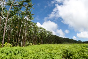
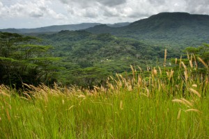
Treeless Hills & Fern Meadows One of the most visually distinctive features of the area between Pehleng and Pwudoi involves the fern meadows that crown the tops of several treeless ...
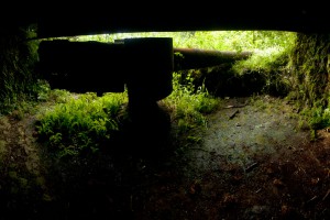
The most extensive Japanese gun battery on Pohnpei lies on Temwen’s rounded central hill, Nindol, perched at its 60 meter peak, Dolopwuropwur. Gun Stations The four guns at the summit ...
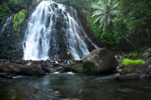
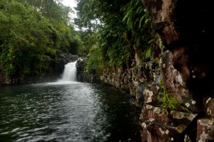
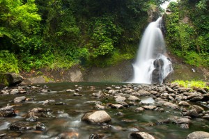
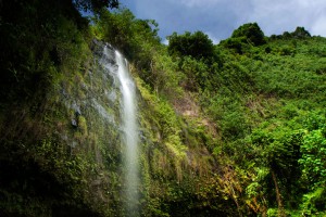
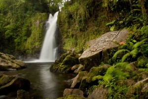
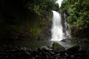
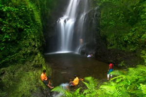
Kepirohi, which lies on the lower Mand Stream (Pilen Mand) in Kepirohi Kousapw, is certainly Pohnpei’s most famous and most photographed waterfall and makes a nice picnic stop after a ...
Kitti has a lot of waterfalls, but one of the most fun to visit is Lehnpaipohn between Salapwuk and Pwoaipwoai districts (at least two kousapw claim the falls area). It ...
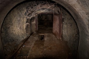
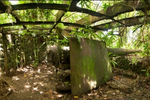
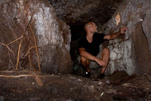
Southwest Side Subterranean Crude Oil Facility (Pahnlenger) Built beneath Dolen Lenger, the Japanese crude oil storage complex is without question the most impressive of the island's historical sites. If tight ...
Nan Madol Ruins Nan Madol is a prehistoric "city" of more than ninety man-made islets off the coast of Temwen Island, constructed of naturally-occurring prismatic basalt columns, basalt boulders, and ...
Though you can reach the top of Nanpohnmweli from Mand, the best way to access this falls (also known as "Kerenis" Waterfall) is from the Circle Island Road in Sapwehrek ...
Unlike some of the other unusual rock formations on Pohnpei, the massive rock of Nipai is easy to miss. Obscuring trees prevent it from having the prominent visibility on the ...
Located on the pristine Senipehn River, Pahn Sile is one of the few waterfalls well into the interior that almost anyone (even small children) can reach without the help of ...
Pahntakai literally means "under the rock" and one visit makes it immediately apparent why this geologically-unique location was given its name. A thin waterfall plummets over a concave cliff-wall more ...
Waterfalls and mountains can be visited in many places, but the experience to be had at Pilen Seleur in Pwudoi is uniquely Pohnpeian. River pools on either side of the ...
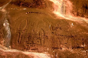
Just south of the newly renovated Sapwalap Elementary School lies one of Micronesia’s most unusual sites. More than 700 prehistoric motifs are inscribed on rocks in the area, the largest ...
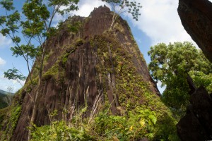
The disputed Sokehs-Kitti border is marked by Pwisehn Malek, a strange hill of columnar basalt rock that resembles a cartoon volcano and looms over the road. According to legend, the ...
Rohi, the first district in Kitti after passing over the border from Madolenihmw, is host to an obscure, but beautiful, waterfall that few people -- other than those who live ...
Located on converging streams within Salapwuk’s deep Sahwar Gorge, Sahwartik and Sahwarlap are a pair of waterfalls whose splendor and grace defy reality. The wider falls is named Sahwarlap, which ...
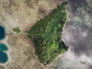
Sapwtik, which means "small land," is a tiny volcanic island located directly north of Kolonia and 0.5 km northwest of Lenger. Seen in profile, the island resembles a large submarine, ...
Historical Sites in Mainland Sokehs "Military Road" Hike / Bike Tour One of the most rewarding routes for Japanese World War II-era historical sites follows a road 0.46 km (0.29 ...
Sokehs Mountain or Pohndollap, which means "on the big hill," is a long, mostly flat-topped ridge running north-south along the length of Sokehs Island with a knoll-like summit near the ...
Paipalap, or Sokehs Rock, is without question the most striking feature of Pohnpei’s topography. Over 100 vertical meters (328 ft) of exposed basalt form the upper portion of a gigantic ...
In 1909, the German colonial government tried to force the residents of Sokehs to build a road around the northern end of Sokehs Island. When the people didn't cooperate, they ...
Guided Hikes
Local guides are required for the following hikes. More hikes will be added to this list as the Eco-Adventure Map Guides are completed.
Kepindau Waterfall The larger of two small waterfalls found on Sokehs Island (the only waterfalls not on the main island of Pohnpei) is known as Kepindau and is located in ...

Dolen Nett ("hill of Nett") is a steep-sided mountain running the length of the Nett Point peninsula. Leaf-shaped, this peninsula juts north into the lagoon east of Kolonia and is ...
Liduduhniap Waterfalls The easiest waterfalls to visit on Pohnpei (no hiking required) are the tiered "horse-tail" falls, Liduhduhniap, just a few kilometers from Kolonia. When the Greater Nett Eco-Adventure Guide ...
Tucked away in the little-seen Nett hinterlands is one of Pohnpei’s most beautiful hiking destinations. Uluhlen Lou Rahn, a fence-like ridge, extends northwest from the place where the mountains of ...
Nan Kiepw Nan Kiepw Nan Kiepw, which means “in the lilies,” is a hillside overshadowed by Dolmweir peak. A Pohnpeian myth tells of a Yapese magician, named Sou Iap, who ...
Dolen Eirike (“hill of Eirike”) is a prominent pyramid-shaped peak in Eirike district at the rear of Nett -- easily visible from Kolonia and standing out from everything else as ...
Anyone who takes a good look at the mountains on the eastern border of Nett will note a dark patch of naked basalt amid the otherwise unvarying green of the ...
Kupwuriso, Pohnpei's fifth highest mountain (depending on how you count them), is impossible to miss when driving through eastern U, where it towers over everything, its precipitous slopes clad in ...
North Madolenihmw Hikes The northernmost section of Madolenihmw is separated from the rest of the municipality by a range of low mountains that run east-west from Mesihsou to Alohkapw. This ...
Dolen Nahnsapwe, “hill of thunder,” is a small peak near the Nett-U border. As the crow flies, it's about 1.3 km (0.8 mi) southwest of the Kupwuriso summit. Though rarely ...
Pahnsapw, which means “beneath the land," refers to a pair of tall, majestic waterfalls which plummet off the edge of a high plateau in central Madolenihmw (it's also the name ...
Dolen Merewi is a flat-topped hill that stands apart from the interior mountains to the west and is highly conspicuous when driving through northeastern Madolenihmw. During the Spanish Period (1886-1898), ...
Dauen Sapwalap / Senipehn Mangrove Reserve Visit the Paddling Around Madolenihmw page for a detailed description of this location and the adventures to be had in the area. Entering the ...
This route passes through the gorgeous valley of Nankepinmerepw, following the upper tributaries of the Nan Riohk Stream (Pilen Nan Riohk) and eventually arriving north of Nahnalaud on an arm ...
Mand is a little community of Pingelapese people who were given a parcel of land by the Nahnmwarki of Madolenihmw in Pohnpei's modern past. You can't call it a town, ...
Southern Kitti’s most obvious natural feature is the Rock of Silehu -- a spire of basalt rock that stabs out from the hills above Nintok. Because of its phallic shape, ...
Mallen Nihpit & Mallen Pitetik On the large upland plateau of Nihpit in the mountains above Mwoakot are two expansive savannahs or fern meadows. Upland savannahs of this sort usually ...
Dolotomw is the highest peak in the region of Kitti once known as Onohnleng. Its prominence led Russian explore Fedor Lütke, in 1828, to incorrectly conclude that it was the ...
Mallen Pohn Pehnmen In the remote mountainous area called Pohn Pehnmen is an upland savannah similar to those on the Nihpit plateau, but smaller and at a much higher elevation ...
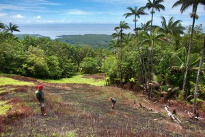
Because Pohnpei’s rainforested terrain is so challenging to move through, inexperienced hikers might think a jaunt into the wild interior of the island is out of reach. It isn’t. Almost ...
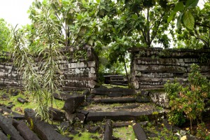
Prehistoric Sites & Ruins in Kitti The Fortress of Sapwtakai Sapwtakai (“rock land”) is a 13,000 m2 stone complex that crowns a hill north of Wenik. The site was first ...
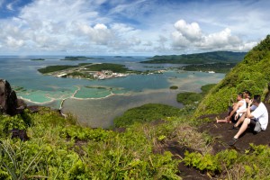
The Big Mountain The highest mountain in the Federated States of Micronesia (FSM) is called Nahnalaud (which means "big mountain") and is located almost in the exact middle of Pohnpei ...
Southeast of Palikir, Pohnpei’s primary mountain system makes an almost 90° turn to the south at Temwetemwensekir (594 m), a prominent peak that dominates the topography and feeds six major ...
Dolen Palikir ("hill of Palikir") is a long hill in the middle of Palikir that runs northeast-southwest and has knolls at each end. The southern summit is slightly higher than ...
Adventures >> Hiking & Trekking