
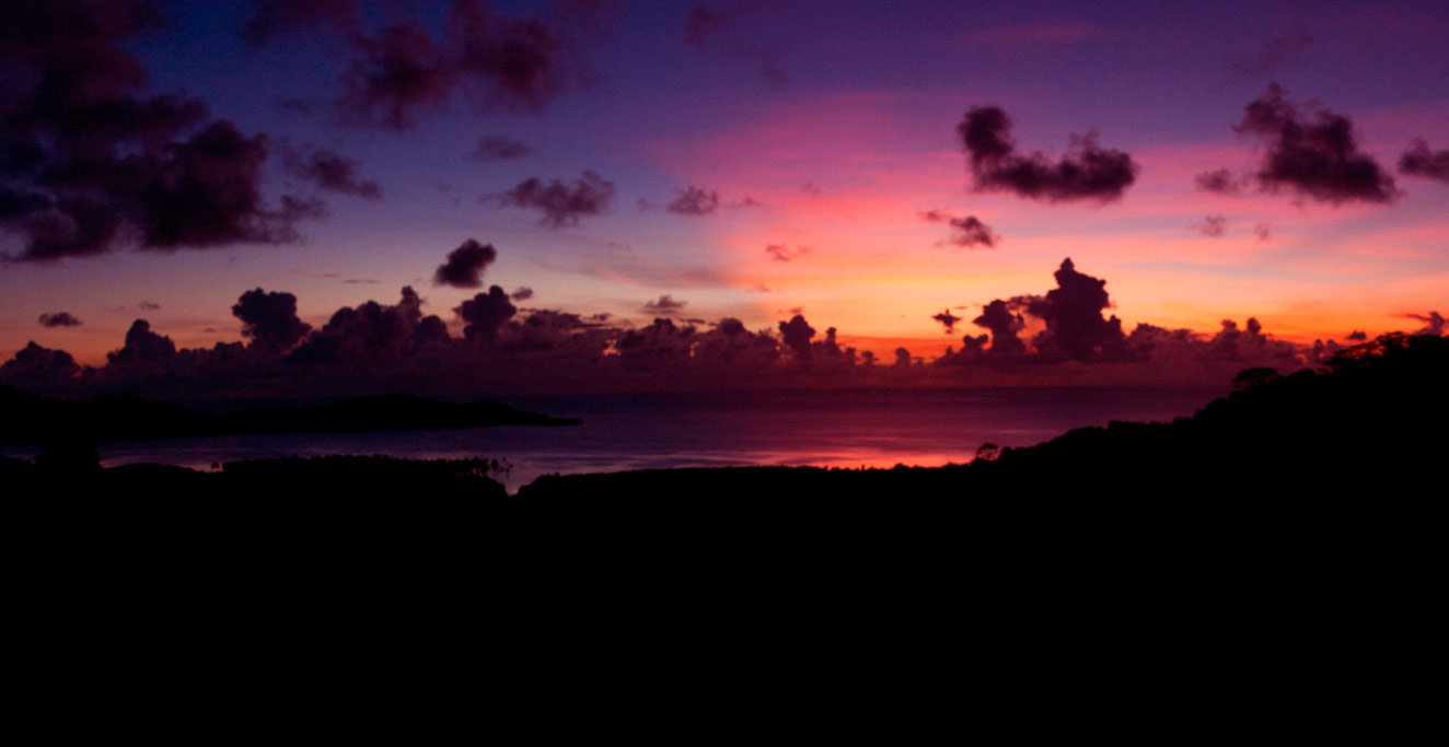
Mainland Sokehs
![]()
![]()
![]()
![]()
![]()
![]()
![]()
![]()
![]()
![]()
![]()
![]()
![]()
![]()
An Introduction to Mainland Sokehs
Two millennia ago, what we now know as Sokehs and Nett (pronounced sō.kĕhs and nĕtch) consisted of several autonomous regions. When Olsihpa and Olsohpa founded Nan Madol and attempted to bring all of Pohnpei under their dominion, these areas — renamed Pwapwalik — maintained some of their autonomy, but were required to pay tribute. Under Nan Madol, Palikir, the largest division of Pwapwalik, became increasingly defiant and its highest chief (Lepen Palikir) was even credited with the assassination of one of the Saudeleurs. When Nan Madol finally fell, the Sounkawad clan conquered the north and formed the modern state of Sokehs with the Wasai Sokehs as its leader.
Sokehs in the 19th Century was characterized by wars with U and struggles between the Wasai and the Protestant missionaries, who founded a mission (called Kenan) in what is now Kolonia. The Wasai eventually allied with the newly-arrived Spanish in 1886 to get rid of the Protestants, only to find Spain an even worse adversary. The next fourteen years saw many violent confrontations between Pohnpeians and the Spanish, including the siege of Santiago de la Ascension — Spain’s tiny colony — and the assassination of the Spanish governor by Sokehs warriors. Spain never gained the upper hand and, in 1898, sold the Caroline Islands to Germany for $4 million.
The Germans were initially more interested in economic ventures than in dominating the native population, but when they also tried to force Pohnpeians to work for them, the result was similar to what had happened with the Spanish. When the Japanese took over in 1914, Palikir was transformed into a thriving, moderately large-scale agricultural center, where rice and a large variety of fruit and vegetables were produced to feed the new colony.
Today, the centers of activity in Sokehs are the FSM Government in Palikir and the College of Micronesia National Campus in Paies. Many of the region’s inhabitants are descended from outer island people — particularly those from the Mortlock Islands in Chuuk — who were resettled on Pohnpei after a typhoon ravaged their home islands.
A History of Mainland Sokehs
The story of greater Sokehs begins roughly 2,000 years ago when Pohnpei had no central leadership and the island consisted of competing clans in a near-constant state of war. At some point the Lasialap (Great Eel Clan) came to rule the northern part of the island, while a sub-clan of the Dipwinwai (Foreign Clan) came to power in what is now mainland Sokehs. When the Sounkawad clan arrived from the modern-day Marshall Islands and sought land on which to settle, the already established clans chased them up into the interior regions above the Nanipil valley and forced them to live in isolation at a place called Nankawad.
Many things changed when Olsihpa and Olsohpa arrived on the scene, established their powerful empire at Nan Madol, and attempted to bring the whole island under their rule. Olsohpa, the first Saudeleur (“Lord of Deleur”), divided Pohnpei into three parts called Malenkopwale, Pwapwalik, and Kohpwaleng (roughly coinciding with modern-day Madolenihmw and U, Sokehs and Nett, and Kitti). Pwapwalik had six regions, including Palikir, which consisted of all of what is now mainland Sokehs; Sokehs (Island); Pakin (Atoll); and three regions in modern-day Nett — Tipwendongalap, Kahmar, and Nanmeir. Palikir remained mostly self-governing, but was required to bow to the ultimate authority of the Saudeleurs and pay them regular tribute. As time went on, however, the Saudeleurs became increasingly tyrannical. Unrest developed in many places on Pohnpei, but particularly in Palikir, where the highest-ranking chief, Lepen Palikir, became openly defiant of Nan Madol (one story even credits him with the assassination of a Saudeleur).
After Isokelekel overthrew the Saudeleurs in the mid-1600s, Pwapwalik reverted to a collection of autonomous regions that included Palikir, Sokehs (Island), Pakin, Tipwendongalap, and Nansokele. It was not until a century later that the Sounkawad clan swept down from the mountains and wrested control from the Lasialap, uniting the five sections and forming the modern-day state of Sokehs. The Wasai Sokehs was installed as the paramount chief of the new state with the secondary chief, Lepen Nett, presiding over the portion that is now called Nett.
Little is known about the internal history of mainland Sokehs (the Palikir area) from the middle of the 18th century to the middle of the 19th. While Kitti and Madolenihmw saw an influx of foreign whaling and trading ships, Palikir was largely ignored. The next noteworthy event took place in the mid-1800s when Sokehs and U briefly went to war. The conflict allegedly began when a Sokehs woman was promised to the Wasai of U and then given instead to the famed “Tattooed Irishman,” James O’Connell, who had arrived on Pohnpei in the 1820s. In the end, Sokehs triumphed, the Wasai of U was killed in battle, and the man’s heart was devoured in ritual fashion by the Wasai Sokehs.

The 1850s saw the arrival of American Protestant missionaries, who founded a mission called Kenan (the Pohnpeian pronunciation of “Canaan“) in what is now Kolonia Town. The presence of the missionaries and their teachings set off a series of convoluted struggles between the mission and the Wasai Sokehs, who rightly believed that the teachings of the church would undermine his chiefly authority. Partly as a result of his resistance, the Protestants were never able to establish any lasting foothold in the north and eventually abandoned the region, focusing their efforts instead on Kitti and Madolenihmw.
On July 25th, 1886, the Spanish warship, Manila, landed at Rohnkitti and claimed Pohnpei as a Spanish territory. The northern peninsula of Mesenieng was chosen as the site of the new colony because the surrounding harbors had already been well mapped. The first governor Don Isidro Posadillo arrived on March 13th, 1887, with a party of 85, including Filipino soldiers, laborers, and Catholic priests. A church and residential buildings were quickly constructed in the area called Niahlik (where the Kolonia Ball Park is now located) and named Santiago de la Ascension, though it usually went by the nickname La Colonia (“the colony”). Almost immediately, conflicts erupted between the Spanish and the Protestant missionaries, whose mission station had been established in the area more than thirty years earlier. When Edward Doane, leader of the mission protested the Spanish encroachment, he was arrested and deported to Manila.
Posadillo then decreed that each chiefdom would contribute a 30-man work team every week to assist in building projects around the colony. Workers were housed on the now vacant grounds of the Protestant mission. When the team from Madolenihmw failed to show up for work, Posadillo threatened to personally give the Nahnmwarki of Madolenihmw a beating. It goes without saying that such disrespect toward traditional leaders was a source of gathering Pohnpeian rage, but the Spanish overseers were also harsh and insulting to the workers who did show up, stole wages from the laborers, and trafficked local women into brothels for the Filipino soldiers. On June 20th, 1887, all the Pohnpeian laborers stopped working. Simultaneously, Lepen Nett and Wasai Sokehs made the decision to stage a revolt. That night Pohnpeians broke into the Spanish armories and stole guns and ammunition. When Posadillo sent soldiers to arrest the two troublesome chiefs at Danipei on Sokehs Island, Pohnpeian warriors killed two overseers and seventeen soldiers. They then advanced to Mesenieng, killed six more soldiers in the fighting, and finally besieged the colony. Most of the non-combatants were able to slip out and reach a barge moored in the lagoon, but Posadillo and many of his soldiers were not allowed to escape. The siege, led by a young Sokehs warrior named Niue, lasted until July 3rd. By that time desperate, Posadillo and his remaining men attempted to slip out by night and make it to the barge, but the Pohnpeians caught them in the shallows and Lepen Nett and others cut them down. The colony was completely dismantled. The people on the barge were left alone at the pleading of the missionaries and remained where they were for two months, surviving by trading with Pohnpeian canoes that passed by.
In late October, 700 Spanish reinforcements arrived and the Pohnpeian forces were compelled to stand down. When the Spanish demanded that the individuals who had killed Posadillo answer for their crimes, three low-ranking men from Nett and Sokehs volunteered to bear the penalty of death for their respective paramount chiefs. The following month, a new governor named Cadarso was installed and instantly set about rebuilding and fortifying the colony with an encircling wall, which was built with rocks from a sacred Pohnpeian shrine at in the area Nintu (near the current street of the same name). The new colony was dubbed Fort Alfonso XIII and consisted of a hospital, barracks, and the governor’s house.
Niue, the Sokehs warrior who led the seige of La Colonia, did not vanish into obscurity after the Spanish departed. In 1910, under his new title Soumadaun Sokehs, he led the people of Sokehs Island in another rebellion — this time against Pohnpei’s new colonial masters, the Germans. In a move reminiscent of events 23 years earlier, Soumadaun Sokehs and his band of warriors killed the German administrator, attacked Kolonia, and eluded capture for many months. During this time, the rebels’ only ally was Lepen Palikir, the highest-ranking chief of the Palikir section. Nett, U, Madolenihmw and Kitti all joined with the Germans, eventually forcing Soumadau and the others to surrender. German retribution shattered the state; the leaders of the rebellion were executed by firing squad and almost the entire Pohnpeian population of Sokehs was sent away to Palau to labor in the German phosphate mines. This was the last Pohnpeian revolt.
The next colony was established by the Japanese, who acquired Pohnpei through the League of Nations Mandate. The Japanese had much bigger plans than any of their predecessors and arrived in great numbers. By the end of 1945, there were 14,000 Japanese residents on Pohnpei, including army and navy personnel and civilians — almost three Japanese for every Pohnpeian. The Palikir region, in particular, caught the eye of the Japanese, who recognized that the mostly flat landscape was an ideal setting for the farming of rice and other crops. About 0.26 km2 of land were converted into terraced paddies and planted with a variety of rice tolerant to Pohnpei’s perpetually warm, wet climate. An experimental town, called Haruki Maru (“coming of spring”), was also built in Palikir in 1931, functioning as a market center and consisting of barracks, a truck repair shop, police department, school, and general store.
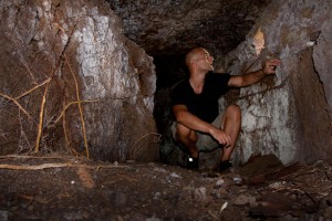
In the years leading up to World War II, the Japanese began to fortify all the strategic areas on Pohnpei. Palikir and Sekere’s hills were criss-crossed with trenches and dotted with rifle pits, pillboxes, radar stations, and anti-aircraft gun installations. Over the course of sixteen days in 1944, members of the 221st Naval Construction Battalion built a new airfield with a 1,000-meter runway where the FSM National Government complex now stands. This facility was supposed to complement the already existing airfield in Nahnpohnmal, but it never got much use; there was only one take-off and landing before the Allied bombing raids began. Raids were frequent enough from that point on to prevent the airfield from gaining operational status again.
Japanese defenses on Pohnpei seemed to have been designed with a surface invasion in mind, but the Americans ultimately decided the island wasn’t worth the effort. Pohnpei’s shallow harbors and ultra-rainy climate made it a poor location for a military base, and its encircling barrier reef and dense coastal mangrove forests would have been nearly impossible for landing craft and troops to penetrate without heavy losses. The Allies opted instead to neutralize the island with a brutal series of bombings. Once the bombardment began in earnest, there was little the Japanese defenders could do. Only one American plane was shot down over Pohnpei; it was hit by anti-aircraft fire and crashed near Dolen Pahniepw. Within a couple of days, all of the key Japanese strongholds had been obliterated and Kolonia Town burned to the ground. Crops were destroyed, supply lines ceased to function, and in a matter of months, people were starving. The survivors holed up in crude caves and dug-outs and stole food from the Pohnpeians, who had mostly stayed away from the combat zones.
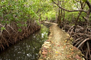
Today mainland Sokehs is made up of fourteen sections — Kepin, Kepinkep, Sekere, Nanpahniop, Likie, Sapwawas, Palikir, Lewetik, Tomwara Pah, Tomwara Powe, Kipar, Kepira, Nan Madap, and Paies — and predominately populated by people of Pohnpeian and Mortlockese descent. The busiest areas surround the FSM National Government complex and the College of Micronesia National Campus in Palikir and Paies, respectively.
Mainland Sokehs Attractions
Marine Parks
Sokehs Japanese Sites & Parpwu Waterfall
Pwisehn Malek (“Chickenshit”)
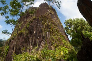
Temwetemwensekir Peak
Dolen Palikir
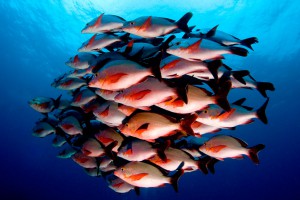
Pohnpei Diving – West Side Sites

Fat-Tire Biking
ACKNOWLEDGMENTS
Kalangan to Miller Benjamin for helping to check mainland Sokehs‘s place names for accuracy; Peterson Anson of Pohnpei Transportation & Infrastructure for helping to create the beautiful shaded relief on our maps; Danko Taborosi of Island Research & Education Initiative (IREI) for his considerable support and technical assistance; and the Australian Government for funding the production of these guides.