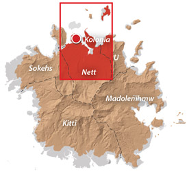
An Introduction to Nett
Nett (pronounced nĕtch) is the youngest of Pohnpei’s traditional chiefdoms. Originally a semi-autonomous region within Sokehs chiefdom, Nett became independent in 1874 after the paramount chief of Sokehs, the Wasai Sokehs, tried to extend the scope of his authority over Nett by simultaneously adopting its highest-ranking chiefly title (Lepen Nett).
In 1886, Mesenieng, the part of Nett that now comprises Kolonia Town, was the center of a fierce land dispute between American Protestant missionaries, local chiefs, and the Spanish colonial government. The missionaries eventually abandoned their station to the Spanish, who, in turn, became the new focus of Pohnpeian ire. A year later, after the Spanish tried to force Pohnpeians to work without pay, a group of men from Sokehs and Nett united, killed fifty Spanish soldiers, and besieged the colony before finally dispatching the governor. This event would later be echoed in the 1910 Sokehs Rebellion, which was led by one of the key players in the Rebellion of 1887: a man called Niue and later titled Soumadaun Sokehs.
The most notorious foreigner in Nett was James F. O’Connell, an Irishman who ended up on Pohnpei in 1828, was adopted by a lesser chief, and tattooed in the traditional way. The Tattooed Irishman’s fanciful account of his years on the island was published in 1836 under the title Eleven Years in New Holland and the Caroline Islands. It’s a fascinating work full of bold exaggerations, downright lies, some very strange misconceptions, and also a bit of honest history.
Greater Nett & Western U Attractions

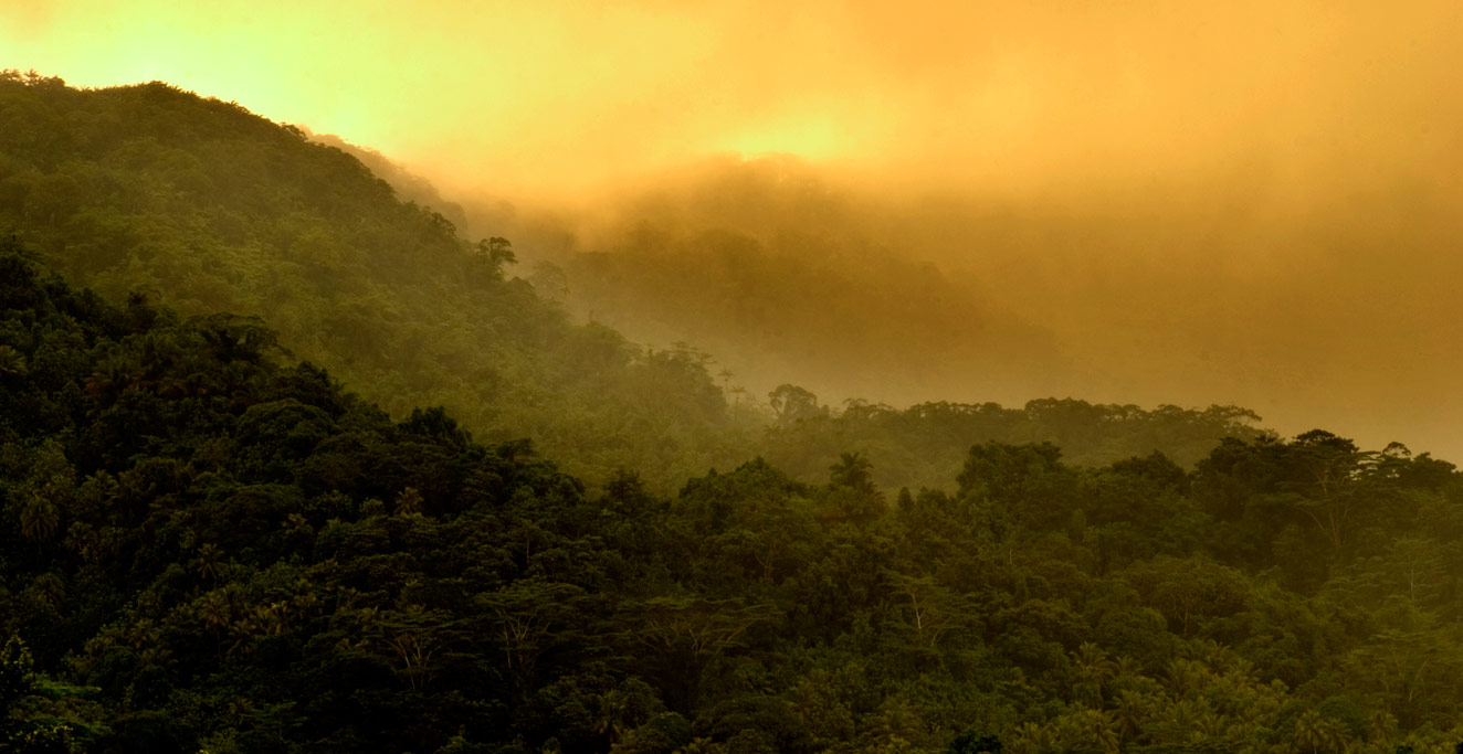
Dolen Nett ("hill of Nett") is a steep-sided mountain running the length of the Nett Point peninsula. Leaf-shaped, this peninsula juts north into the lagoon east of Kolonia and is said, in myth, to have been formed by the corpse ...
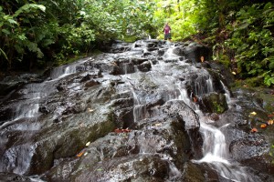
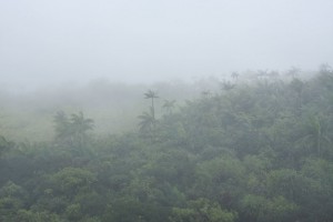
Tucked away in the little-seen Nett hinterlands is one of Pohnpei’s most beautiful hiking destinations. Uluhlen Lou Rahn, a fence-like ridge, extends northwest from the place where the mountains of U meet those of Nett, hiding from view the verdant ...
Nan Kiepw Nan Kiepw Nan Kiepw, which means “in the lilies,” is a hillside overshadowed by Dolmweir peak. A Pohnpeian myth tells of a Yapese magician, named Sou Iap, who voyaged to Pohnpei and was responsible for the creation of ...
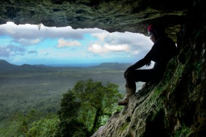
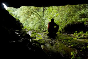
Anyone who takes a good look at the mountains on the eastern border of Nett will note a dark patch of naked basalt amid the otherwise unvarying green of the steep hillsides. This is the cliff-wall and caverns of Nan ...
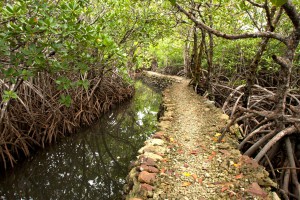
Nearly all of Pohnpei's coastline is surrounded by mangroves, and though these otherworldly swamp forests are incredible to explore by kayak, canoe, or paddleboard, they tend not to make good swimming spots. As a result, Nett Point -- a long ...
Nihco Marine Park Nihco Marine Park, on the southwest coast of scenic Sokehs Bay is an appealing place for people of all ages to swim, barbecue, and soak up the sun. The park is comprised of a narrow, man-made semi-circle ...
The Big Mountain The highest mountain in the Federated States of Micronesia (FSM) is called Nahnalaud (which means "big mountain") and is located almost in the exact middle of Pohnpei Island. Pohnpeians consider the mountain sacred and regard it with ...
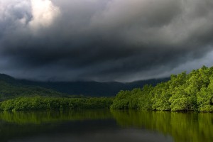
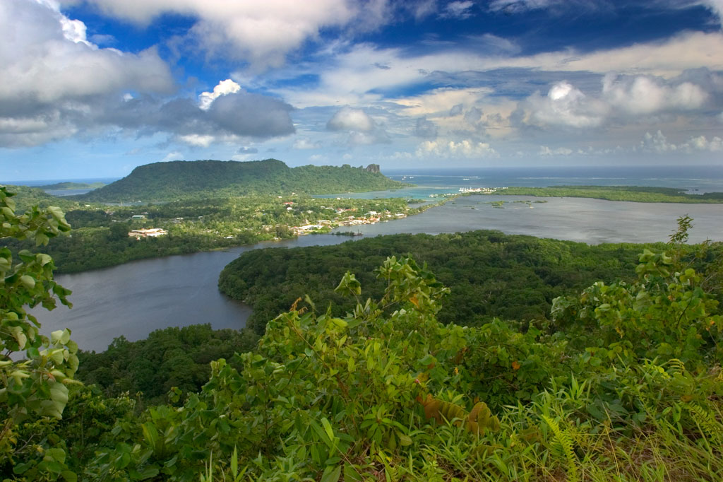
Dausokele Estuary As paddling goes in the Nett region, Dausokele estuary ("channel of the dwarves") is the crown jewel, a long, gorgeous inlet that lies between Kolonia and the leaf-shaped Nett Peninsula and serves as the mouth of a number ...
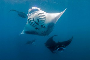
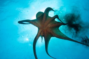
"Manta Road" Manta Road is easily Pohnpei's most famous dive spot due to its resident community of manta rays (including the all-black Black Morph variety) that cruise back and forth through the narrow channel as they filter-feed. The site is ...
Downloadable GPS Data Files The following files contain all the packaged GPS data for each of the featured locations in Greater Nett & Western U. Three file types are provided. KMZ and KML files are compatible with Google Earth. KML ...
Marine Protected Areas (MPA), Sanctuaries, and Forest Reserves Pohnpei Island currently has thirteen marine protected areas, including three mangrove forest reserves and two stingray sanctuaries. Additionally, Pakin Atoll has five of its own MPAs and all of Ahnd Atoll is ...

The Best Type of Bike Pohnpei is a wild place. There are no paved bike paths or bike lanes on the roads. Off-road conditions are muddy, rocky, slippery, and very rough. Potholes are everywhere. For these reasons, mountain bikes are ...
ACKNOWLEDGMENTS
Kalangan to Miller Benjamin and Relio Lengsi for helping to check central Nett and western U‘s place names for accuracy; Peterson Anson of Pohnpei Transportation & Infrastructure for helping to create the beautiful shaded relief on our maps; Danko Taborosi of Island Research & Education Initiative (IREI) for his considerable support and technical assistance; and the Australian Government for funding the production of these guides.
Eco-Adventure Map Guides >> Greater Nett & Western U