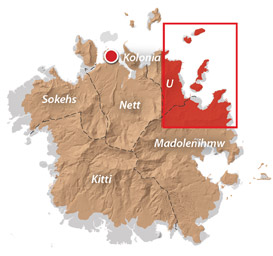
An Introduction to U
U (pronounced ū) does not hold the record for shortest place name, as is often claimed — there are sixteen other locations around the world with single-letter names — but it is a singular place in Pohnpeian terms. It is the smallest of the five chiefdoms on Pohnpei (18.5 km2), and though it did not become a municipal division until 1947, its history began 2,000 years earlier, when the valley of Awak was settled. After the fall of Nan Madol, the area that now comprises U was a section of Madolenihmw called Wenik. Nahlapenien, son of the conqueror Isokelekel, united the divisions of Wenik and became the first paramount chief of U. The chiefdom did not play as prominent a role in modern historical events as the others, but frequently went to war with its neighbors (in one such engagement, U was defeated and the Wasai’s heart ceremonially consumed by his opponent in Sokehs). There were also bloody conflicts between foreign “beachcombers,” several of which lived on Dehpehk Island. Awak remained an autonomous state until the late 1800s and was the center of a tense 1894 war between Protestants and Catholics.
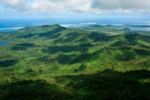
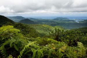
Today, U retains a strong sense of solidarity and pride. Communities are tight-knit and well-organized. The geography of the municipality is dramatic with deep, narrow valleys; high, steep mountains; and a few seasonal waterfalls way up on the cliffs.
U & Northern Madolenihmw Attractions
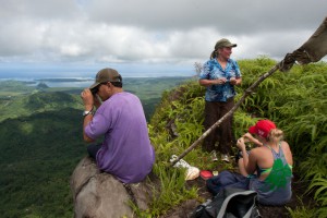
Kupwuriso, Pohnpei's fifth highest mountain (depending on how you count them), is impossible to miss when driving through eastern U, where it towers over everything, its precipitous slopes clad in groves of endemic palms called kotop (Clinostigma ponapensis). When the ...
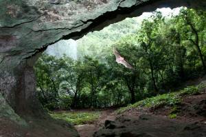
Pahntakai literally means "under the rock" and one visit makes it immediately apparent why this geologically-unique location was given its name. A thin waterfall plummets over a concave cliff-wall more than 30 meters high, which shelters a wide strip of ...
North Madolenihmw Hikes The northernmost section of Madolenihmw is separated from the rest of the municipality by a range of low mountains that run east-west from Mesihsou to Alohkapw. This range was fortified by the Japanese army during World War ...
Dolen Nahnsapwe, “hill of thunder,” is a small peak near the Nett-U border. As the crow flies, it's about 1.3 km (0.8 mi) southwest of the Kupwuriso summit. Though rarely visited and not the highest point in the area, Dolen ...
This island is claimed by the same family as Dahu Reirei and has no true name, but as it lies adjacent to the primary channel every boat in the area uses to go from Areu and Ohwa to Madolenihmw Bay, ...
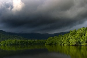
Dausokele Estuary As paddling goes in the Nett region, Dausokele estuary ("channel of the dwarves") is the crown jewel, a long, gorgeous inlet that lies between Kolonia and the leaf-shaped Nett Peninsula and serves as the mouth of a number ...
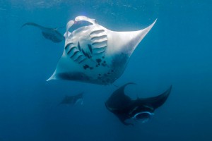
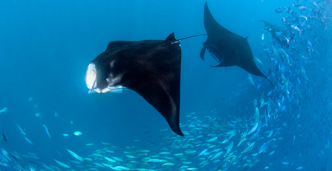
"Manta Road" Manta Road is easily Pohnpei's most famous dive spot due to its resident community of manta rays (including the all-black Black Morph variety) that cruise back and forth through the narrow channel as they filter-feed. The site is ...
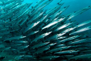
"Straight Wall" This dive is on the outer edge of the long, straight fringing reef east of Nahnningi (Joy) Island. It's a good place to see schools of tuna and barracuda hanging out beyond the wall. It's also one of ...
Downloadable GPS Data Files The following files contain all the packaged GPS data for each of the featured locations in U & Northern Madolenihmw. Three file types are provided. KMZ and KML files are compatible with Google Earth. KML is ...
Marine Protected Areas (MPA), Sanctuaries, and Forest Reserves Pohnpei Island currently has thirteen marine protected areas, including three mangrove forest reserves and two stingray sanctuaries. Additionally, Pakin Atoll has five of its own MPAs and all of Ahnd Atoll is ...
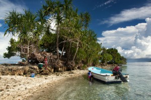
Takaieu and Dehpehk are two large volcanic islands connected by a bridge and linked to the coast of U by a causeway. Most of the local residents live around the eastern and northern coasts of Takaieu and the western coast ...
ACKNOWLEDGMENTS
Kalangan to Miller Benjamin for helping to check U & northern Madolenihmw‘s place names for accuracy; Peterson Anson of Pohnpei Transportation & Infrastructure for helping to create the beautiful shaded relief on our maps; Danko Taborosi of Island Research & Education Initiative (IREI) for his considerable support and technical assistance; and the Australian Government for funding the production of this guide.
Eco-Adventure Map Guides >> U Municipality & Northern Madolenihmw