
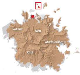
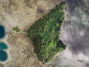
An Introduction to Lenger Island
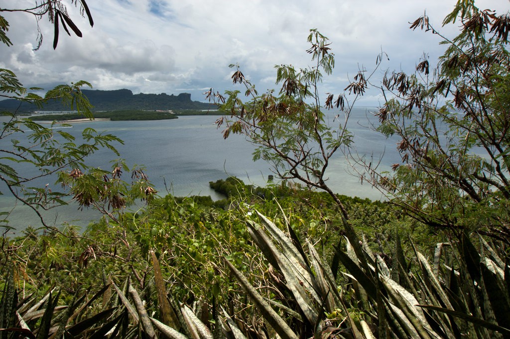
Lenger (pronounced lāng.ĕr or läng.ĕr) is a high volcanic island in Pohnpei’s lagoon 3.25 km (2 mi) northeast of Kolonia Town. The island and its nearest neighbor, Sapwtik (säp.chik), sit on a contiguous reef flat called wahrapwoat (“one canoe”), which legend states was formed by a magical canoe voyaging from Sapwuahfik Atoll. Both islands were heavily fortified by the Japanese Imperial Navy prior to WWII and are full of interesting historical sites. In 2008, archaeologist Takuya Nagaoka completed a meticulous field survey of Lenger, documenting hundreds of sites and creating scores of detailed maps. We selected the most interesting and most easily accessible sites for inclusion in the Lenger Island Eco-Adventure Map Guide and have provided additional information for travelers here.
A History of Lenger
Prior to the mid-1700s, Lenger belonged to Sokehs Chiefdom and was controlled by section chief Lepen Lenger. In 1874, Capelle & Co. (a Marshall Islands-based trading firm) purchased land from the paramount chief of newly independent Nett Chiefdom and established a trading post on Lenger’s east coast. The German-own Jaluit Gesellschaft Company followed suit ten years later, establishing its own outpost on the western shore of the island and developing a lucrative copra operation, which expanded after the Germans made Pohnpei part of their colonial empire in 1890. The Germans also imposed land reforms on Pohnpei, taking the land away from the chiefs and dividing it into family-own parcels. Lenger was broken into more than a dozen divisions that still exist to this day.
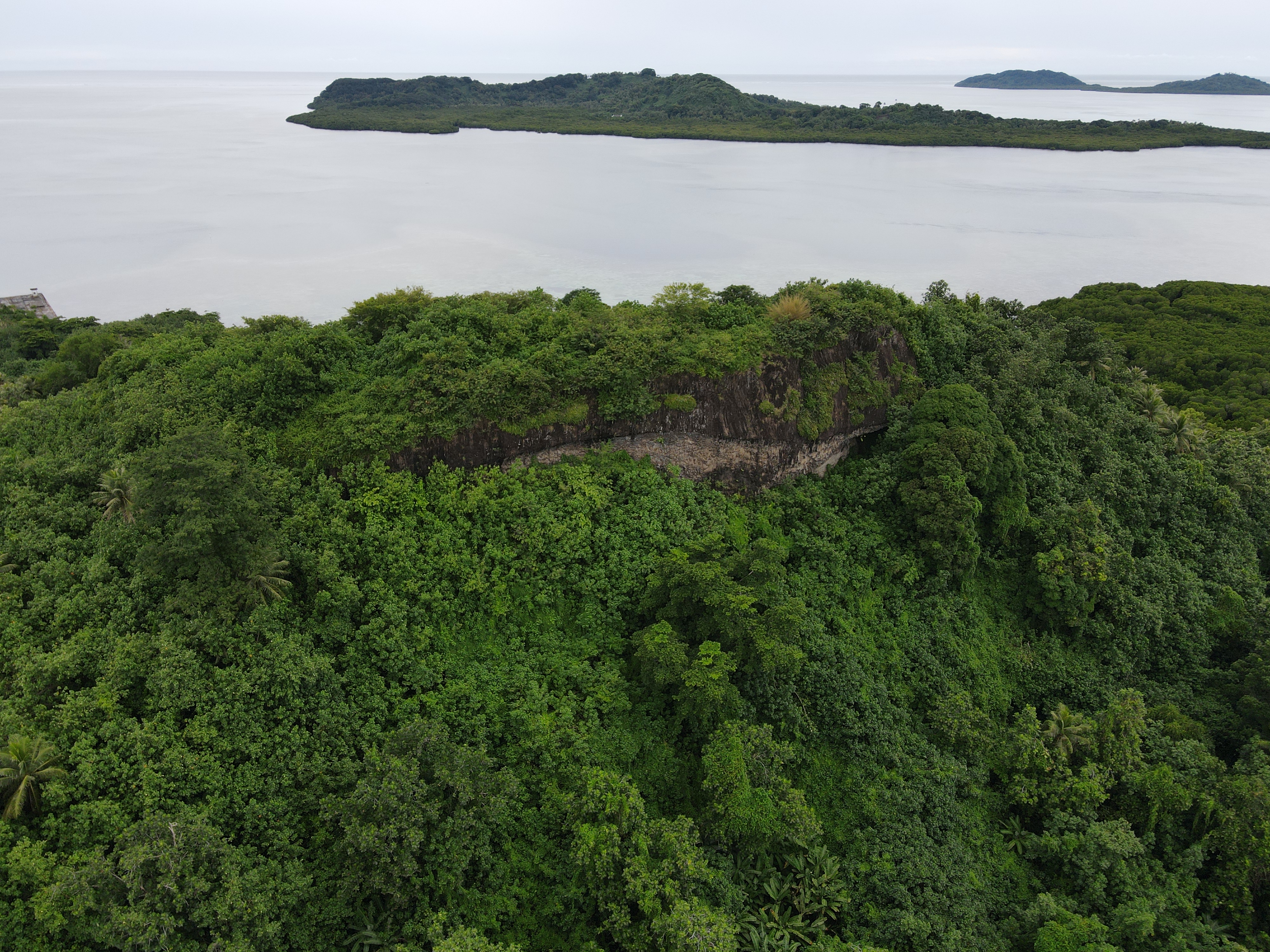
The German Period was short-lived, however. In 1914 the Micronesian islands were annexed by Japan, and Lenger became the jurisdiction of the Japanese Imperial Navy. In the 1930s, the Japanese began the process of enlarging Lenger by almost 60%. Korean and Pohnpeian workers were recruited to extend the entire northern coast with stone and earth. Basalt was blasted from the cliff faces with dynamite and moved to the construction site by wagon. Workers from Pohnpei, Mwoakilloa, and Pingelap were also conscripted to build two roads up the island’s central hill, Dolen Lenger. Almost all of the work was done without heavy machinery.

The Imperial Navy began to fortify the island in 1939, and imported large teams of laborers, including 170 Koreans who were housed in barracks on the southern tip of the island (near Nandeke). Roads, barracks complexes, and a seaplane ramp and hangar were constructed, as well as a coastal battery manned by 80 members of the 42nd Naval Guard Unit. At its height, Lenger may have been occupied by more than 700 Japanese personnel.

On February 15, 1944, Allied aircraft began to bomb strategic targets on Pohnpei and Lenger. At the same time, American ships surrounded the island and shelled it from all sides. The Japanese guns, with a range of no more than 9,000 meters, were useless against ships anchored more than three times as far. In less than a day, most of the surface features on Lenger had been destroyed. Bombing attacks continued off and on throughout the year, preventing any further attempts at construction other than the digging of trenches and rifle pits.
When the Japanese finally surrendered, Pohnpei — along with all of Japan’s Pacific territories — passed to the United States and became part of the U.S. Trust Territory of the Pacific. During the more than three decades of American administration, many of the surviving Japanese structures on Lenger were dismantled and the island’s original inhabitants were allowed to return.
Lenger did not have many visitors until the 1990s, when two small tourist establishments were founded on the west and southwest coasts. Referred to — somewhat misleadingly — as resorts, both offered rustic camping experiences in small thatched stilt-huts sitting over the water or in a large Pohnpeian-style community hut (nahs). Though popular with local vacationers, bands of teenagers, and church groups, both resorts collapsed by the mid-2000s. At present, the location of the previous southwest resort has been rebuilt and improved greatly from what used to be there. The place is owned and operated by the family of Feliciano Perman.
Today Lenger belongs to Nett Municipality. The island is inhabited by six families, but feels vacant most of the time. Since Nagaoka’s survey in 2008, the many historical sites have been mostly left to nature and the deteriorating effects of the elements.
Lenger Island Attractions
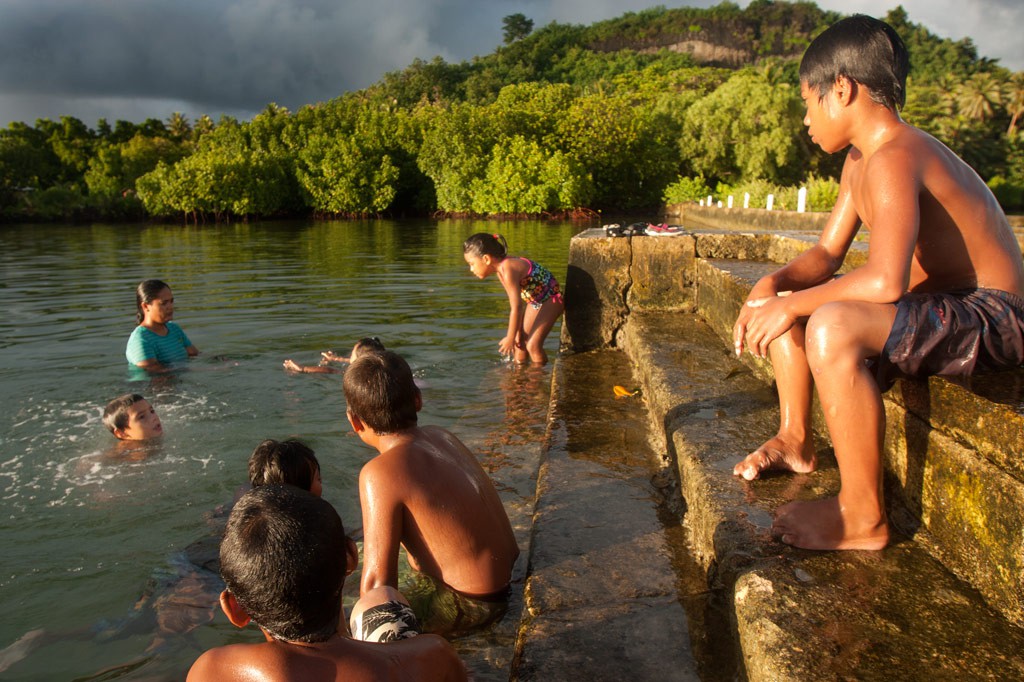
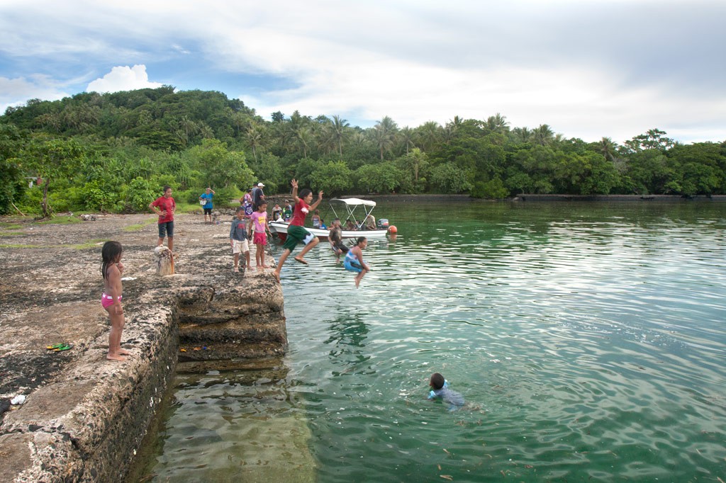
Picnicking & Swimming
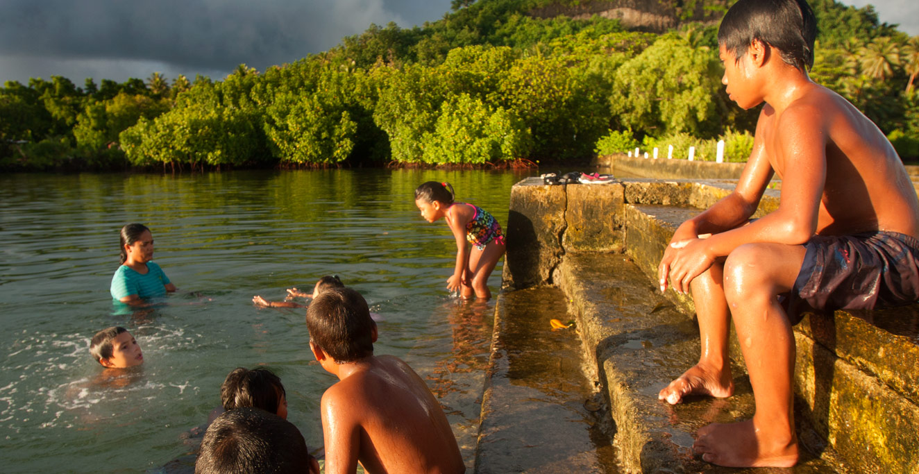
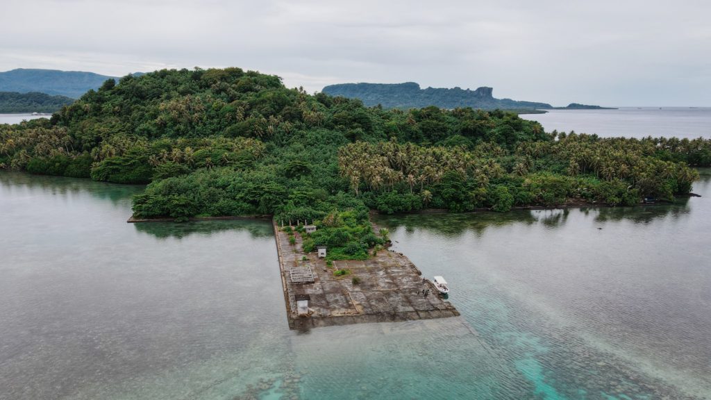
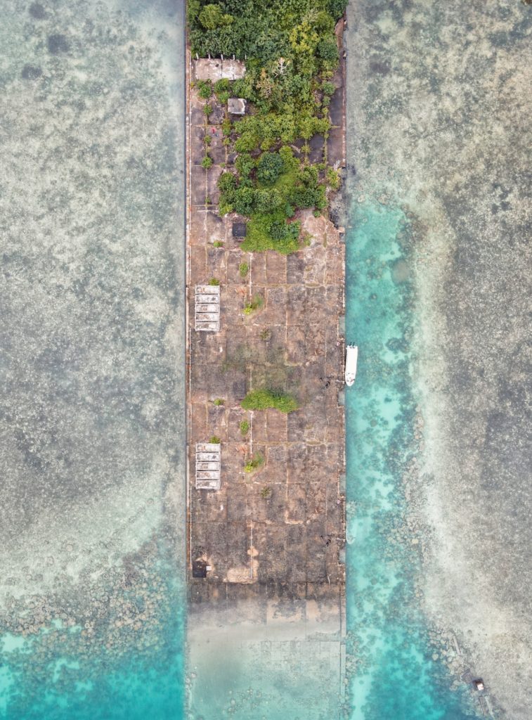
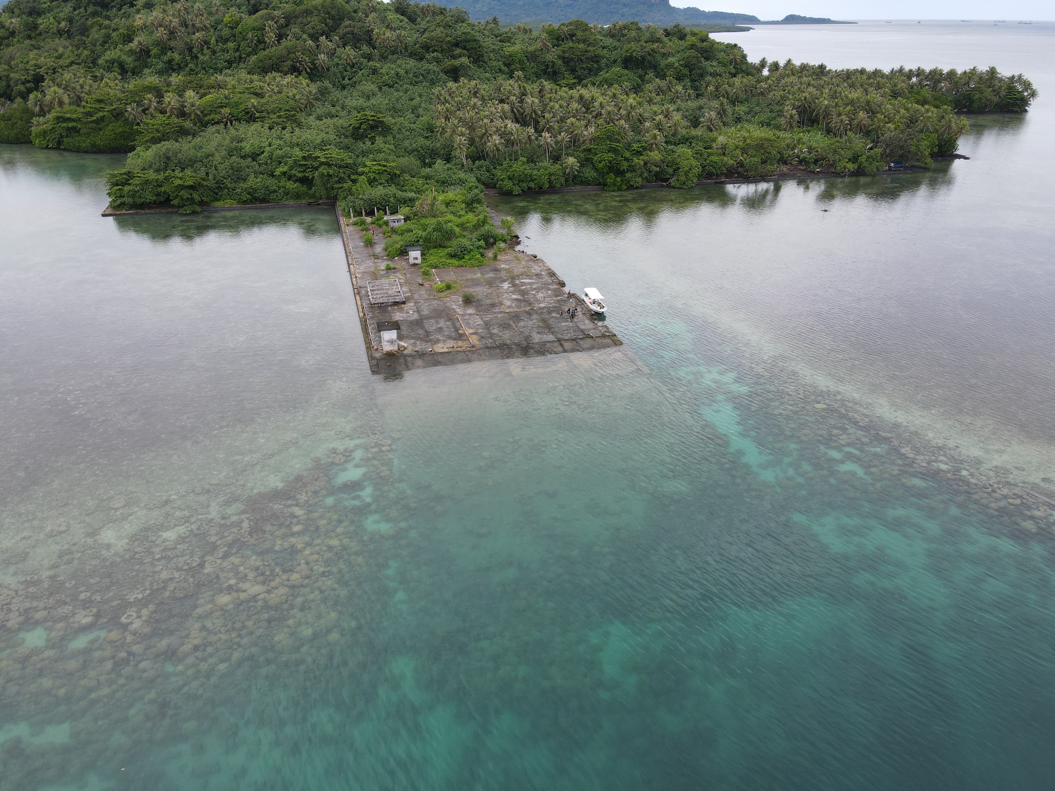
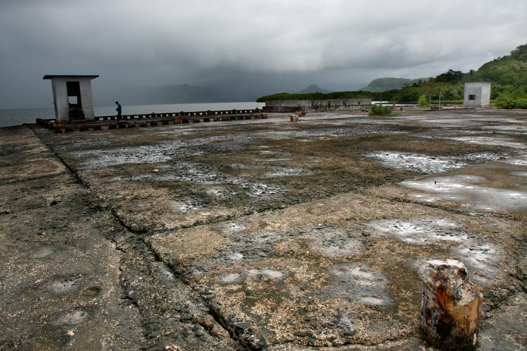
Two popular spots include Pahnaiau Getaway (Barbosa’s Wharf) and the Japanese Seaplane Ramp. Both areas offer good, clear water for swimming and some nearby snorkeling spots. On Pahnaiau side, there’s a large community hut (nahs) near the wharf that can be used to shelter from rain or sun, there are also smaller huts that people can stay in for day visits or over-night trips. The seaplane ramp consists of rough and occasionally grass-grown concrete. A couple of picnic shelters were built here years ago, but they have long since fallen to pieces. Lenger is less frequently visited these days than in the past; it’s not uncommon to find yourself pretty much on your own, aside from the locals who live there and the occasional weekend visitors.
- To book day-trips and overnight stays at Pahnaiau Getaway call the owners at +691.320.8294. There is a visitor’s fee for Pahnaiau Getaway inquire what the rates are when calling to book a trip.
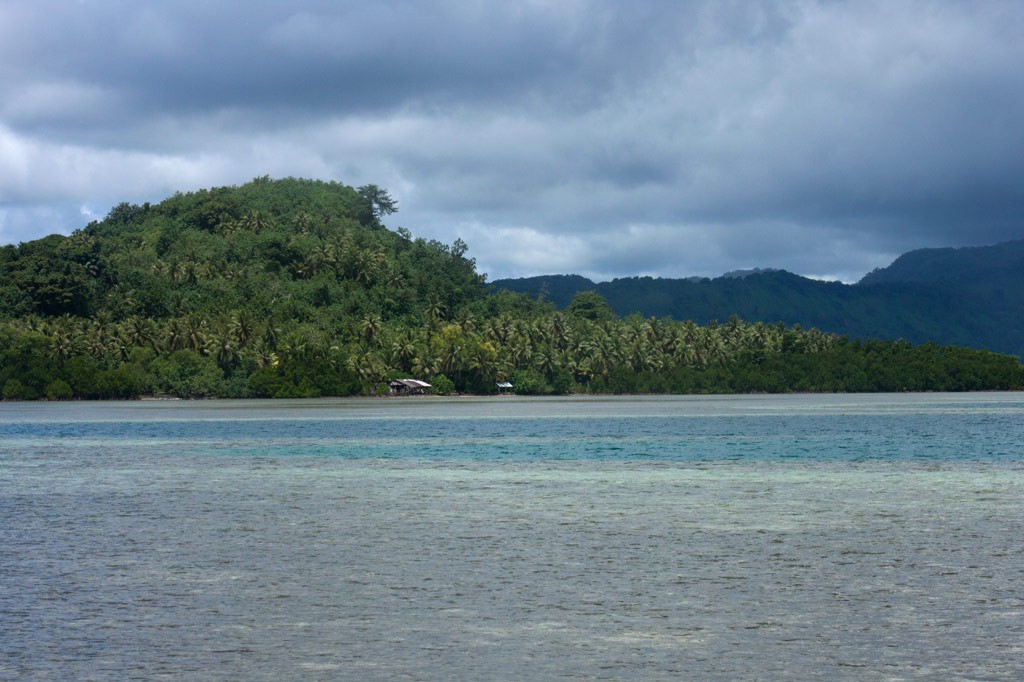
Snorkeling
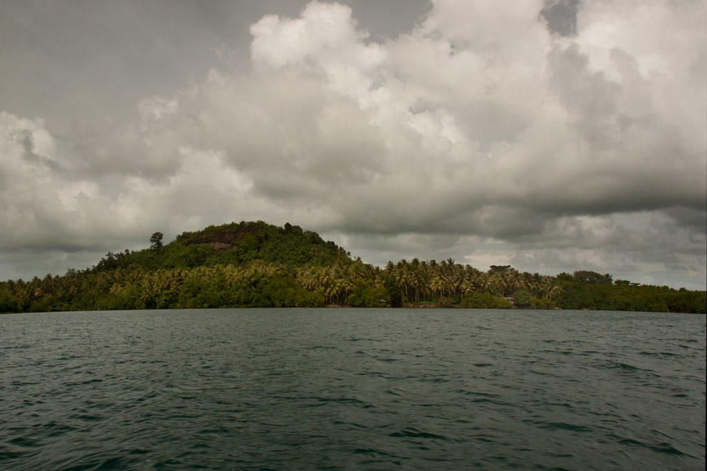
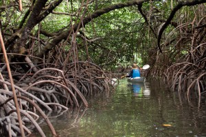
The snorkeling is by no means dazzling at Lenger, but there are some nice locations a short swim out from the southwest and northeast coasts. The best bet in the south is to swim out to the reef wall from Pahnaiau Getaway and then follow it north. We’ve found good visuals and the most fish northwest of the Jaluit Cistern. On the opposite side of the island, the healthiest coral and the densest populations of fish are found along the reef walls northeast of the seaplane ramp. Water clarity is best when the tide is coming in and after periods of low rainfall.
ACKNOWLEDGMENTS
The Lenger Island guide would not exist without the amazing work and cooperation of archaeologist Takuya Nagaoka, who was the first person to map the historical sites on Lenger. Nagaoka’s meticulous survey maps and exhaustive report (as yet, unpublished) were indispensable in the process of finding and interpreting neglected sites that had become heavily overgrown. Kalangan also to Peterson Anson of Pohnpei Transportation & Infrastructure for helping to create the beautiful shaded relief on our maps; Danko Taborosi of Island Research & Education Initiative (IREI) for his considerable support and technical assistance; and Bermance Aldis at FSM Resources & Development for covering the cost of printing and shipping.