Marine Protected Areas (MPA), Sanctuaries, and Forest Reserves
Pohnpei Island currently has thirteen marine protected areas, including three mangrove forest reserves and two stingray sanctuaries. Additionally, Pakin Atoll has five of its own MPAs and all of Ahnd Atoll is a UNESCO Biosphere Reserve.
If you wish to visit a MPA it is best to work with a tour operators as they have the necessary permits that allow entry into these MPAs and biosphere reserves.
Current MPAs
Sapwtik MPA
Sapwtik Marine Protected Area is a 0.83 km2 (0.32 mi2) area encompassing Sapwtik (island), portions of its fringing reef, and sections of the lagoon southwest and northeast of the island.
Dekehos (Mwahnd) MPA
Dekehos Marine Protected Area is a 4.60 km2 (1.78 mi2) area encompassing Mwahnd Passage (Kepidauen Mwahnd) and portions of the barrier reef north of the pass and to the south as far as the fringing reef of Mwahnd Peidak (island).
Dehpehk MPA
Dehpehk Marine Protected Area is a 2.12 km2 (0.82 mi2) area encompassing the eastern and northern coasts of Dehpehk (island) and adjacent fringing reefs.
Nanwap MPA
Nanwap Marine Protected Area is a 3.05 km2 (1.18 mi2) section of the barrier reef and adjacent lagoon areas north of the Madolenihmw Bay passage (Kepidauen Deleur).
Senipehn Mangrove Forest Reserve
Senipehn Mangrove Forest Reserve is a 1.30 km2 (0.5 mi2) area of mangrove forest surrounding Dauen Sapwalap in Madolenihmw.
Namwen Na Stingray Sanctuary
Namwen Na Stingray Sanctuary is a 0.71 km2 (0.27 mi2) area encompassing both shallow reef and deep water areas located north of Na (island) and south of Nahpali (island).
Namwen Nahnningi Stingray Sanctuary
Namwen Nahnningi Stingray Sanctuary is a 0.34 km2 (0.13 mi2) area encompassing four large reef pools and the adjacent reefs northwest of Nahnningi (island).
Nahtik MPA
Nahtik Marine Protected Area is a 0.75 km2 (0.29 mi2) area encompassing Nahtik (island) and all fringing reefs.
Enipein Mangrove Reserve
Enipein Mangrove Reserve is a 9.55 km2 (3.69 mi2) area of mangrove forest located in Enipein, Kitti.
Kehpara MPA
Kehpara Marine Protected Area is a 1.89 km2 (0.73 mi2) area encompassing the three Namwmwour barrier reef islands (including Kehpara) and large sections of the barrier reef both north, south, and east of the islands. This area is completely closed to diving and snorkeling from January 1 to June 30 every year.
Pwudoi Mangrove Sanctuary
Pwudoi Mangrove Sanctuary is a 1.39 km2 (0.52 mi2) area encompassing large sections of mangrove forest in Pwudoi, Kitti, as well as adjacent fringing reefs and portions of the lagoon.
Wahulap MPA
Wahulap Marine Protected Area on Pakin Atoll encompasses Nikahlap Island and all surrounding reefs.
Painpwel MPA
Painpwel Marine Protected Area on Pakin Atoll encompasses Painpwel Island, a number of tiny islands off the north coast where sea turtles nest, and all surrounding reefs.
Palikir MPA
Palikir Marine Protected Area is one of Pohnpei’s largest inner-lagoon sanctuaries. It stretches from the shore of Palikir all the way to Palikir Pass. It is also one of Pohnpei’s most successful MPA’s and in 2020 efforts were made expand the MPA’s borders.
Sapangin MPA
Sapangin Marine Protected Area on Pakin Atoll encompasses Sapangin Island, several tiny islets to the north where sea turtles nest, and all surrounding reefs.
Kehrot MPA
Kehrot Marine Protected Area on Pakin Atoll encompasses Kehrot Island, many tiny islets to the northeast where sea turtles nest, and all surrounding reefs.
Mwahnid MPA
Mwahnid Marine Protected Area on Pakin Atoll encompasses Mwahnid Island and all surrounding reefs.
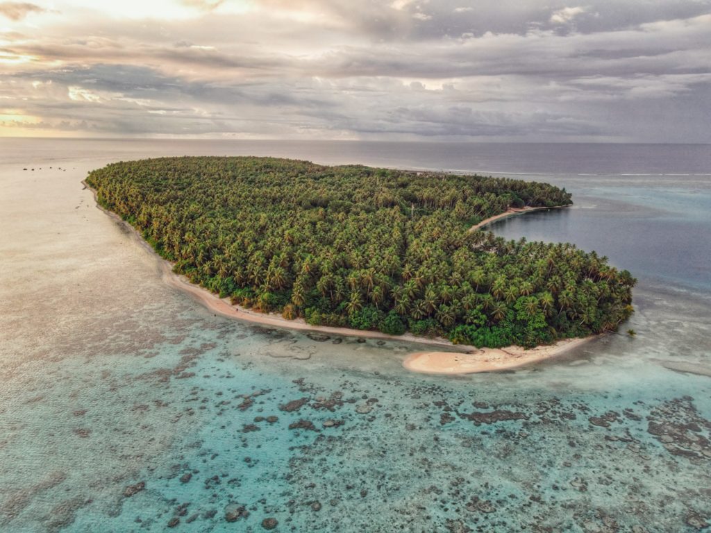
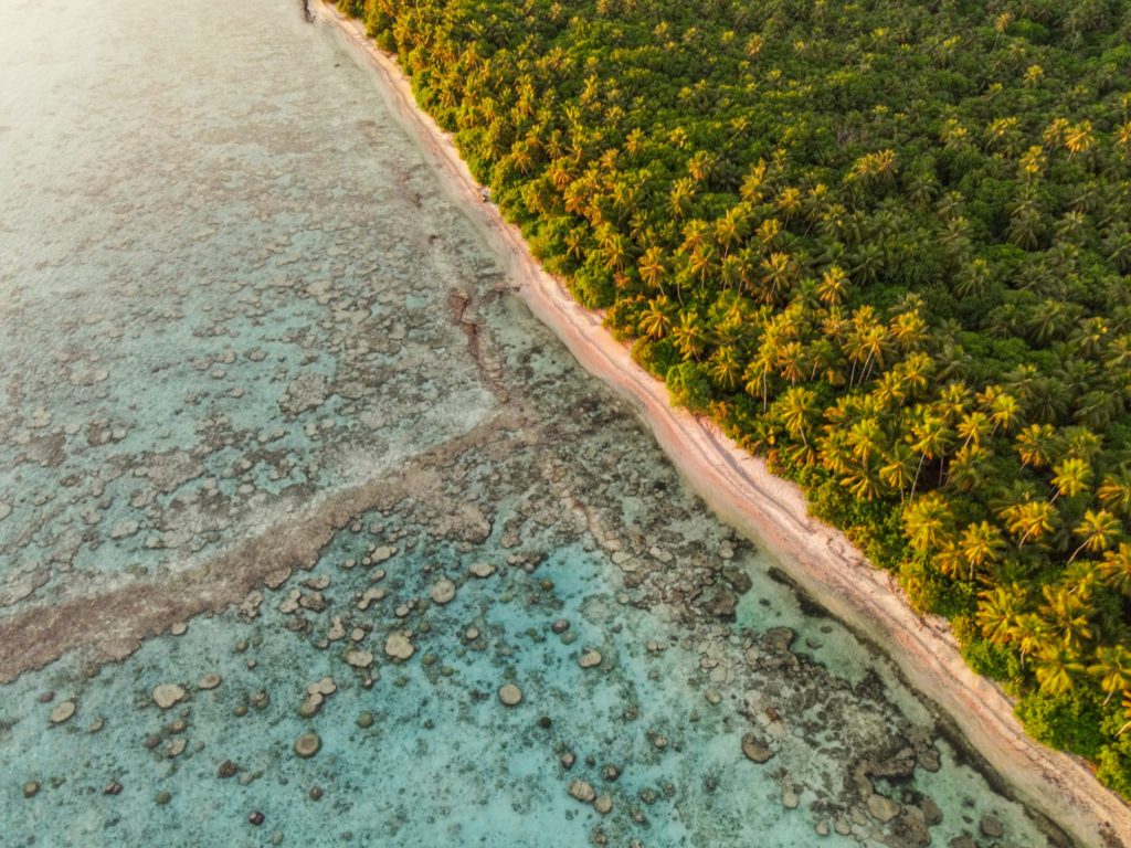
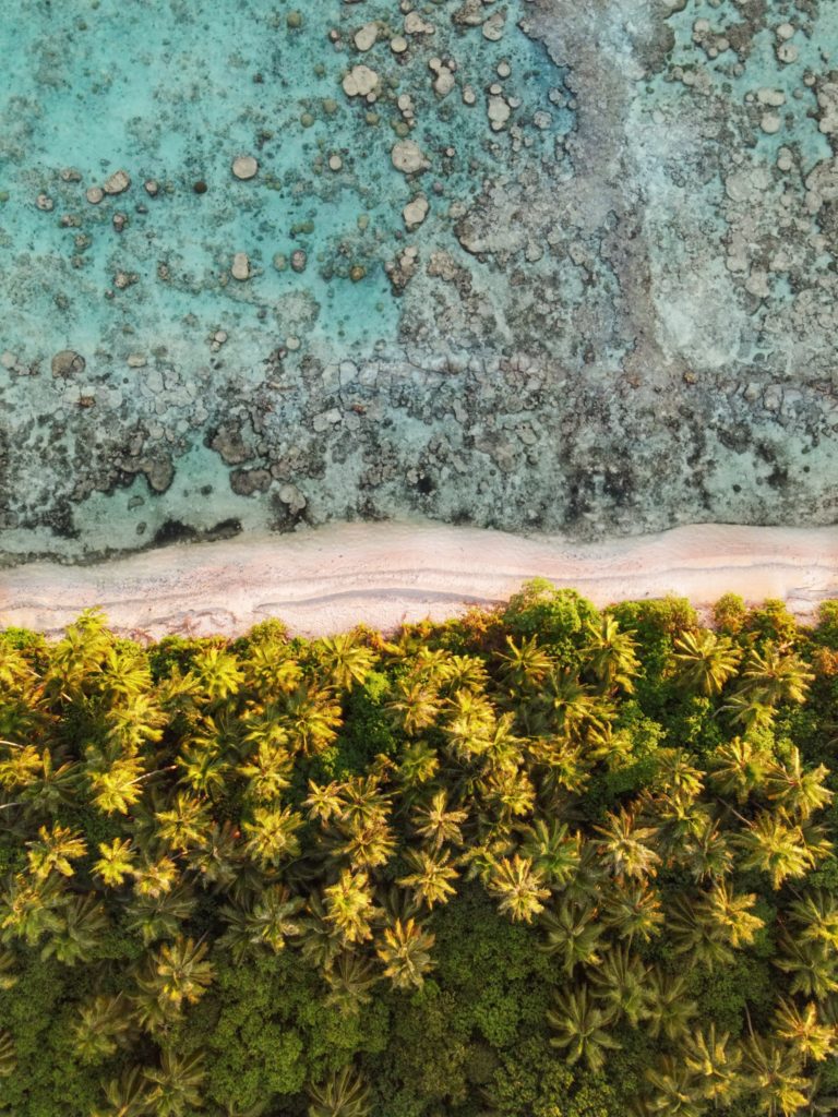
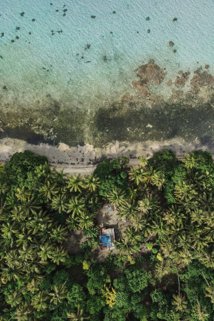
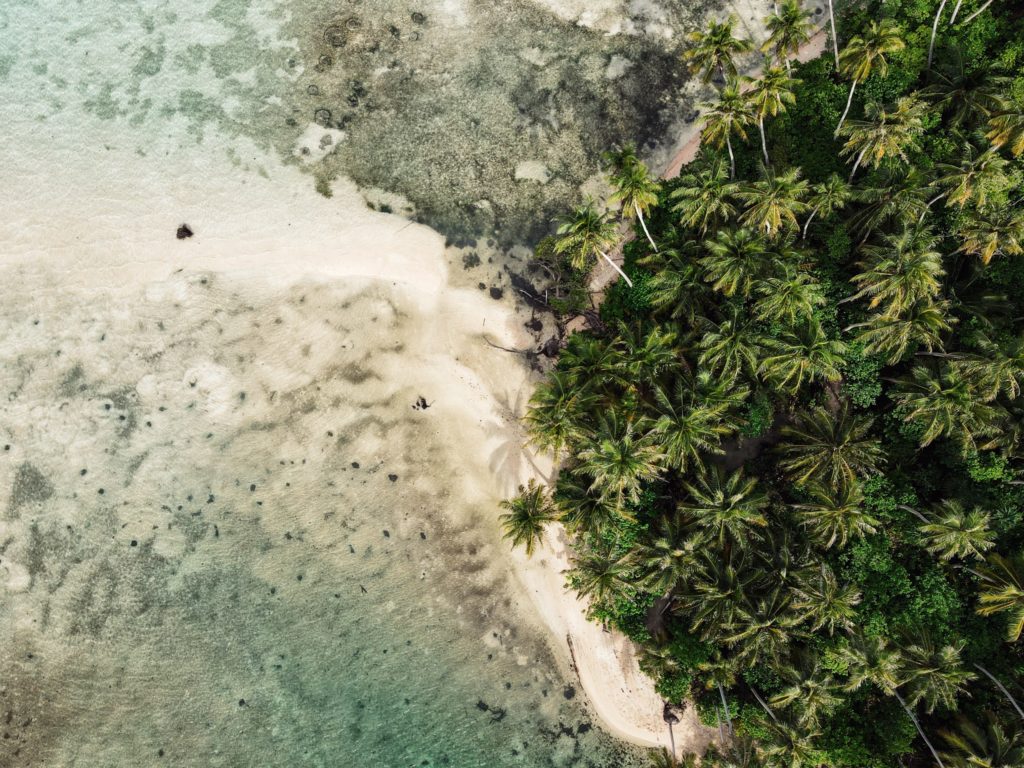
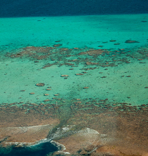
Beyond Pohnpei’s lagoon, the closest land to be found exists on two “satellite atolls” called Ahnd (pronounced änt) and Pakin (pä.keen). An atoll is made up of a number of coralline islets in a ring around a relatively shallow lagoon and is created when a high, volcanic island submerges over millions of years, leaving only the reef that fringed its shores. The islands form as sand, coral rubble, and other detritus collect on the reef and begin to support trees, small plants, and animals. Coral sand accumulates on the lagoon sides of the islands and creates beaches.
Ahnd (“Ant”) Atoll
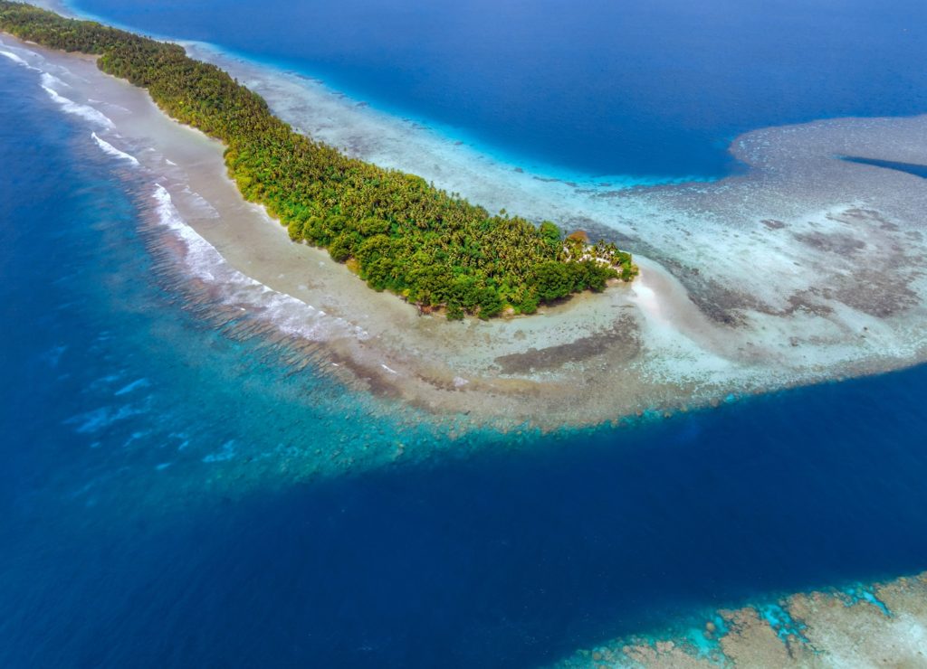
Ahnd Atoll, popularly but erroneously spelled “Ant,” is 16 km (8 mi) southwest of Rohnkitti and consists of 13 low, luxuriant islands 3-4 meters above sea-level and a lagoon of 70 km2 entered by a single passage in the reef.
When the larger-than-life hero Isokelekel voyaged to Pohnpei, intent on overthrowing the rulers of Nan Madol, he came first to Ahnd and lived there for some time, learning about Pohnpeian customs from its inhabitants. In modern times, the entire atoll became the property of a single Pohnpeian family — the descendents of Henry Nanpei, who lived from 1862 to 1928. Nanpei’s shrewd business sense and knack for manipulating local power politics enabled him to acquire the atoll and amass a great deal of other land.
Ahnd Atoll Channel
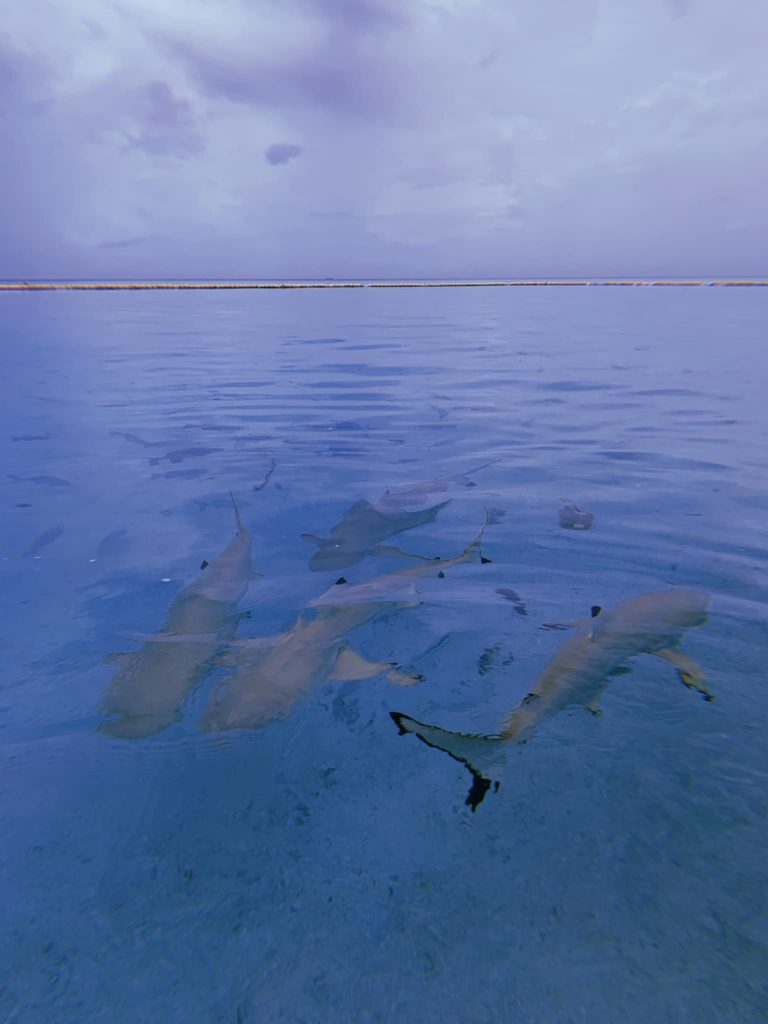
Black tip reef sharks at Ahnd Atoll (PC: Tia Panuelo)
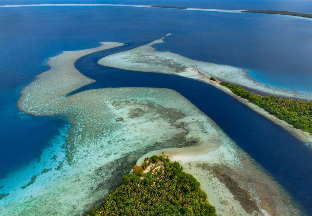
Ahnd Atoll, Federated States of Micronesia (PC: Alex Zuccarelli)
Ahnd Atoll, Federated States of Micronesia (PC: Alex Zuccarelli)
Ahnd Atoll, Federated States of Micronesia (PC: Alex Zuccarelli)
Imwen Sapw Island and channel entrance
Today Ahnd has a few human residents, the biosphere rangers who make sure people do not fish within the protected area. There is also resort run by the Nanpei family located on the island of Pasa (information for booking trips can be found below).
It is home to some of the largest colonies of black noddies, terns, boobies, and frigatebirds in the Pacific as well as a healthy community of gray reef sharks in and around Dauenai (passage).
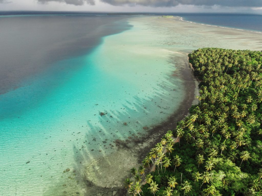
The most interesting islands to camp on are Pasa, Nikahlap, Dolen Mwuroi, and Nahlos. The former two have long stretches of deserted white-sand beach and excellent swimming. Nan Imwinsapw is closest to Dauenai (passage), where all the best snorkeling and the most accessible diving is found, but it has a big rat problem. Pahn Mwek is near to both excellent snorkeling and some of the rare diving that exists inside the lagoon. For the most part, however, the lagoon is the domain of snorkelers, sandy and punctuated by beautiful coral heads with lots of color and life at low tide.
Dauenai on the south side is where most people go to SCUBA dive. It is known for orange sponges (on the west wall) and large numbers of barracudas, jacks, and sharks throughout. Reef fish populations around the pass, unfortunately, have declined in the last two decades, but hopefully will recover now that the area is protected. Even so, the place still feels busy compared to other locations and you’ll see all the familiar species — unicornfish, triggerfish, wrasses, surgeons, groupers, butterflyfish, angelfish, moorish idols, and more. Moray eels might be spotted on occasion. Spinner dolphins are regularly seen at the mouth of the passage and in the waters around Ahnd. Visibility in the pass, though not as spectacular as outside the reef, can reach 50 meters (164 feet) — certainly nothing to complain about.
In addition to drift-dives on either side of the deep passage, there is stunning (and frequently overlooked) diving on the outer wall of the barrier reef on the northwest side near Olouna (often known as “bird island” for the huge colonies of seabirds that nest there), and north of Pasa. The west wall of the barrier reef plummets to great depths, and because it is more protected from the northeasterly winds and waves, it is marked by an abundance of soft coral, holes, tunnels, and caves — an exciting place for any advanced diver. Giant clams are also common. Visibility on the outside edges can be extraordinary, exceeding 70 meters (230 feet). Currents can be swift both in the pass and around the outer walls.
Visiting Ahnd Atoll / Permission & Protected Areas
Because Ahnd is a privately owned island and UNESCO marine biosphere reserve permission is required from the Nanpei family for visits.
Contact LP Gas at +691.320.5661 / 2675 to make arrangements.
Core area(s) comprise a strictly protected ecosystem that contributes to the conservation of landscapes, ecosystems, species, and genetic variation.
A buffer zone surrounds or adjoins the core areas, and is used for activities compatible with sound ecological practices that can reinforce scientific research, monitoring, training, and education.
The transition area is the part of the reserve where the greatest activity is allowed, fostering economic and human development that is socio-culturally and ecologically sustainable.
Olouna (“Bird Island”)
Landing on Olouna island is prohibited to prevent disruption of the habitats of the seabirds who nest there. If you’d like to take a look at Olouna, consider making a kayak trip around it. You can arrange to pay your boat extra to transport a small ocean kayak or two.
Pakin Atoll
Pakin Atoll is composed of about 16 low islands, 13.6 km2 of reef, and a lagoon of 11 km2. It lies 38 km (24 mi) northwest of Palikir. In the early 1900s, Sokehs residents of Mortlockese descent were allowed to settle on the atoll, where their descendents (about 80) live to this day. Most of the islands are sparsely inhabited and all have excellent beaches, swimming, and nearby snorkeling.
One complication of visiting, however, is that Pakin has no true passage, making entry into the lagoon impossible for large boats and both difficult and dangerous for small boats. Boats enter at high tide at one of two places in the barrier reef (the usual spot is known as Uhrek), where the coral is slightly deeper than elsewhere — by a matter of a few inches. The crossing is narrow and complicated by strong surge. Except at the highest tides, the crossing must be carefully timed to correspond with the surge. Boats can easily capsize in the surf or be thrown up on the reef; several locals have been killed at the spot while trying to make the crossing in less than ideal conditions. When planning a visit, make sure that you hire an experienced pilot who knows this particular crossing and is committed to the safety of his passengers. Also, it is important to plan arrivals and departures to coincide with the highest tides.
All of the diving and the best snorkeling is on the reef wall outside the lagoon, where water clarity and reef conditions are simply mind-blowing. The wall north of Nikahlap is known for sharks, while the opposite side of the island is home to large schools barracuda. For sea turtle sightings, divers will want to try the walls on the northeast side. Turtles nest on many of the small islets north of Painpwel, Sapangin, Kehrot, and Osetik.
Pakin has similar features and conditions as And, except that the atoll has no true passage into the lagoon — which is limiting. Divers will mostly want to stay outside the lagoon. Small boats can enter only at high tide at one of two locations along the west side of the barrier reef. Both of these spots are sketchy with very narrow areas to maneuver, extremely shallow conditions, and dangerous currents and surge. Local residents have been killed attempting to enter when the conditions were less than ideal. The reefs on the west side drop off extremely deep — straight down. Hard coral and excellent visibility (often exceeding 60 meters) can be found all around the outside and in the lagoon as well. Most of the sites offer the same sorts of attractions, including large pelagic species, barracuda, jacks, tuna, whitetip and blacktip reef sharks, and sea turtles. Diving at Pakin is possible from May through October, but the best conditions are usually September-October.
“Turtle Gardens”
The many small islets around Painpwel, Sapangin, and Kehrot are nesting sites for sea turtles. Consequently, the outer reef wall northwest of Painpwel is famous for turtle sightings. Best at 10-35 meters.. Advanced.
“Barracuda Cove”
As the name suggests, this spot on the edge of the reef wall southwest of Nikahlap (Island) is a good place to see large schools of barracudas (among other things). Best at 10-30 meters.. Advanced.
“Barracude Cove” is inside an MPA and requires a permit. Visit our MPA page for details.
“Shark Bay”
This drift follows the reef wall north of Nikahlap (island) and is known for large congregations of reef sharks and occasional oceanic species. Best at 18-40 meters.. Advanced.
“Shark Bay” is inside an MPA and requires a permit. Visit our MPA page for details.
“East Wall,” “Mwahnid Wall” & “West Wall”
These are all outer reef drift-dives that can offer everything from fabulous hard and soft coral colonies and macro-life to large pelagics, sharks, eagle rays, and turtles. “East Wall” is east of Olamwun (Island), “Mwahnid Wall” is south of Mwahnid (Island), and “West Wall” is east of the primary point of entrance into the lagoon. Best at 18-40 meters.. Advanced.
“Mwahnid Wall” is inside an MPA and requires a permit. Visit our MPA page for details.
ACKNOWLEDGMENTS
We’d like to extend a big kalahngan to Mike Viti, John Ranahan, and Karino Olpet for sharing their in-depth, first-hand knowledge about SCUBA diving on Pohnpei — without which this page could not have been created. Images licensed from www.shutterstock.com.


")
")
")
")