
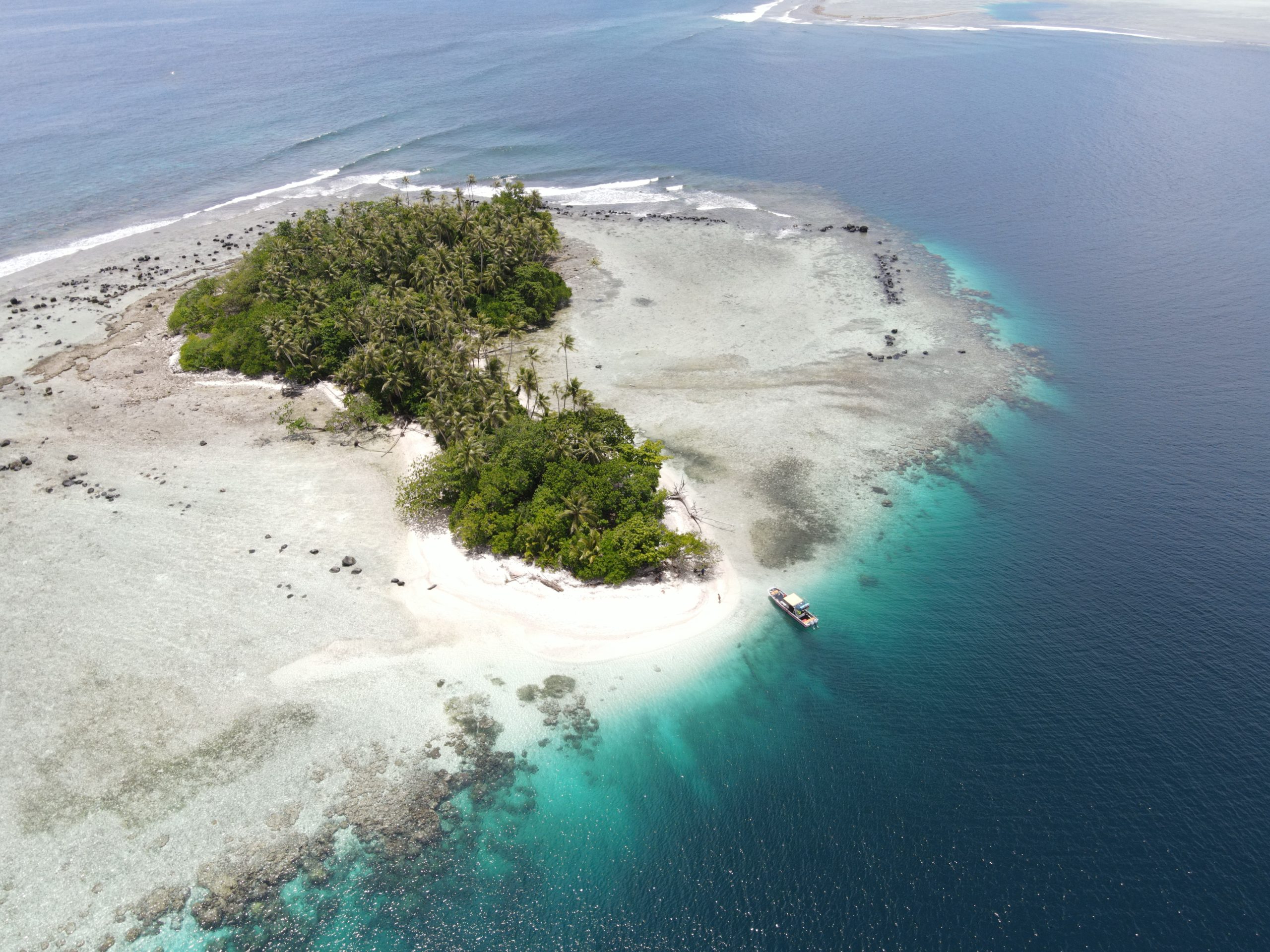
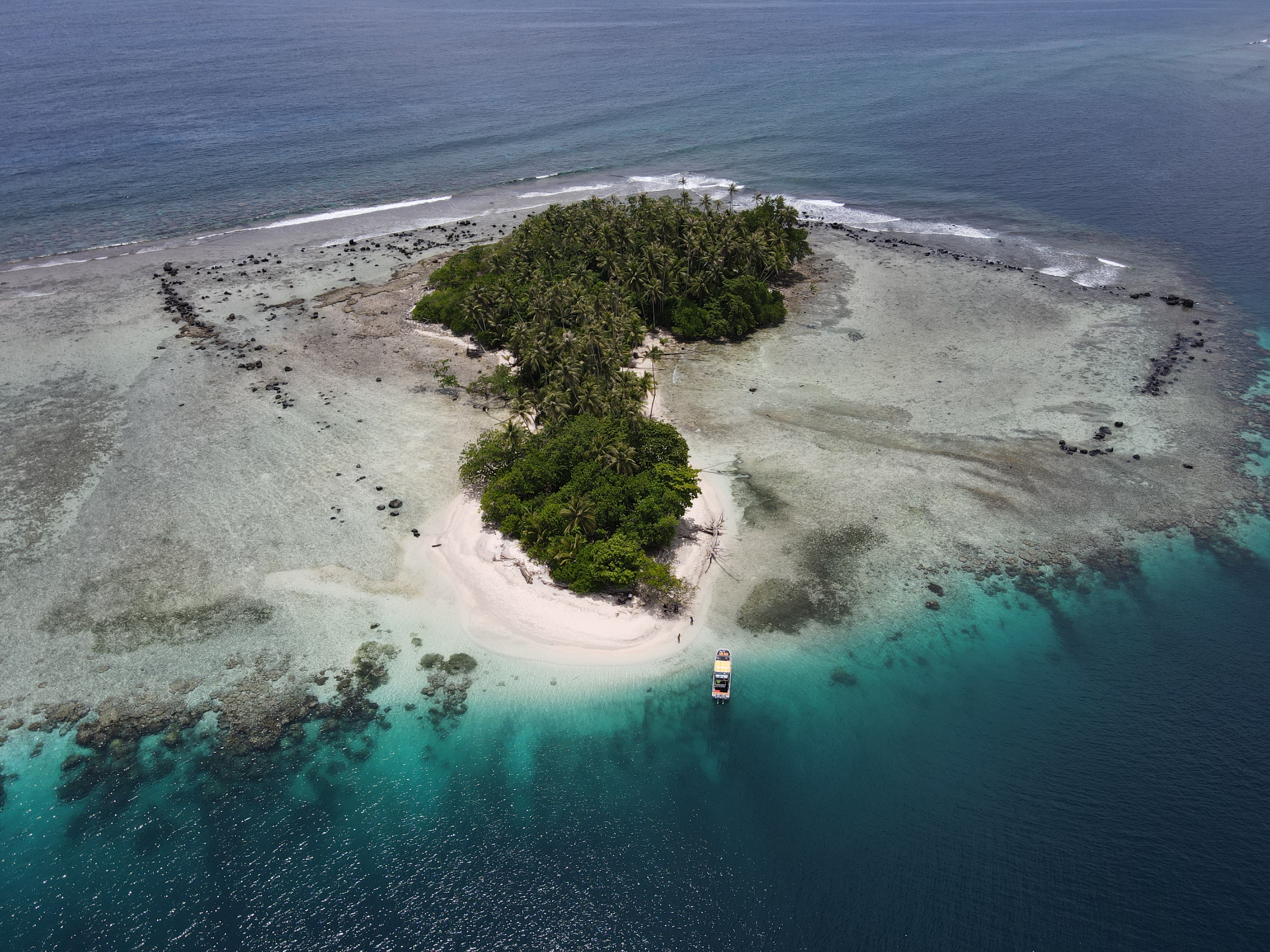
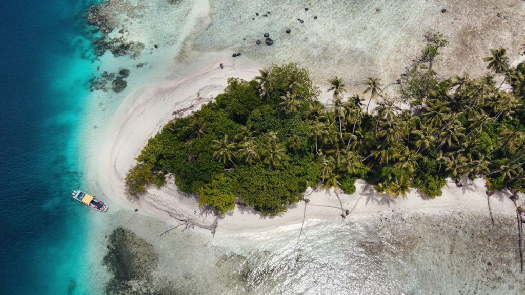
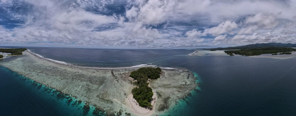
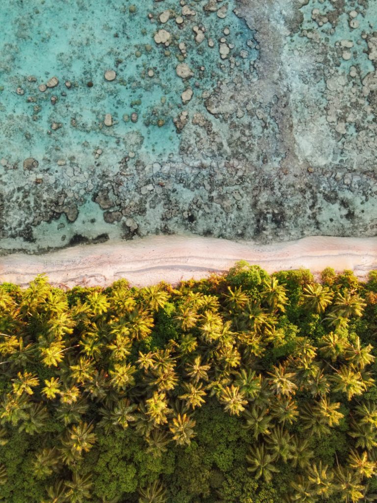
Penieu Island
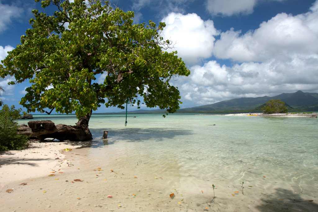
Penieu is a gorgeous reef island in the southeast next to Kepidauen Ne (pass). The island is a major rookery for a colony of noddies and other seabirds, which fill the air with raucous clamor as they swoop around the trees. The primary nesting spot is within a strip of mangroves at the north end of the island (which we’ve dubbed “Noddy City”) and should be given a wide berth to avoid disturbing the habitat of the birds. The island also has a strange, curving sandbar around the north that forms a kind of protected, shallow lagoon with a sandy bottom. This is an excellent place for wading, swimming and playing if you have your kids along, but keep an eye out for stingrays. There are also sandy beaches and good swimming and snorkeling on the west coasts. A pearl farming operation was in progress in the shallow lagoon areas nearby, and a few ramshackle huts were been built on the beach for that purpose (unfortunately, they’re untidy and don’t add much to the scenery). Currents can be quite strong around the eastern side of the island.
- Camping is possible on Penieu, which is owned by the Nahnmwarki of Kitti. Unfortunately, it’s difficult to get him or a family representative on the phone. If you’re interested in visiting, contact the Kitti Municipal Government Office at +691.320.5038, 320.5808, 320.5049, or 320.3257 and ask for assistance.
Nahpali Island
![]()
![]()
![]()
![]()
![]()
![]()
![]()
![]()
![]()
![]()
![]()
![]()
![]()
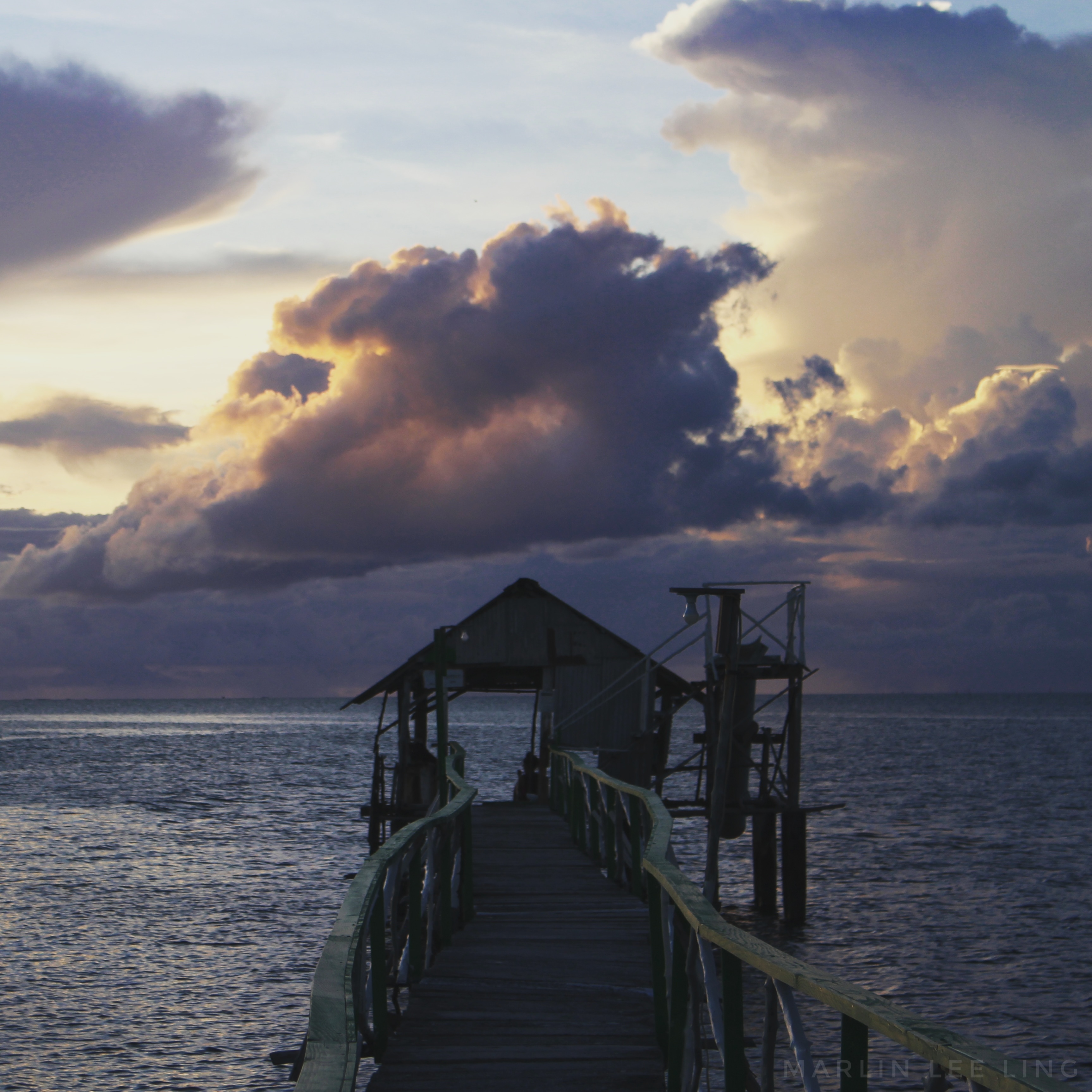
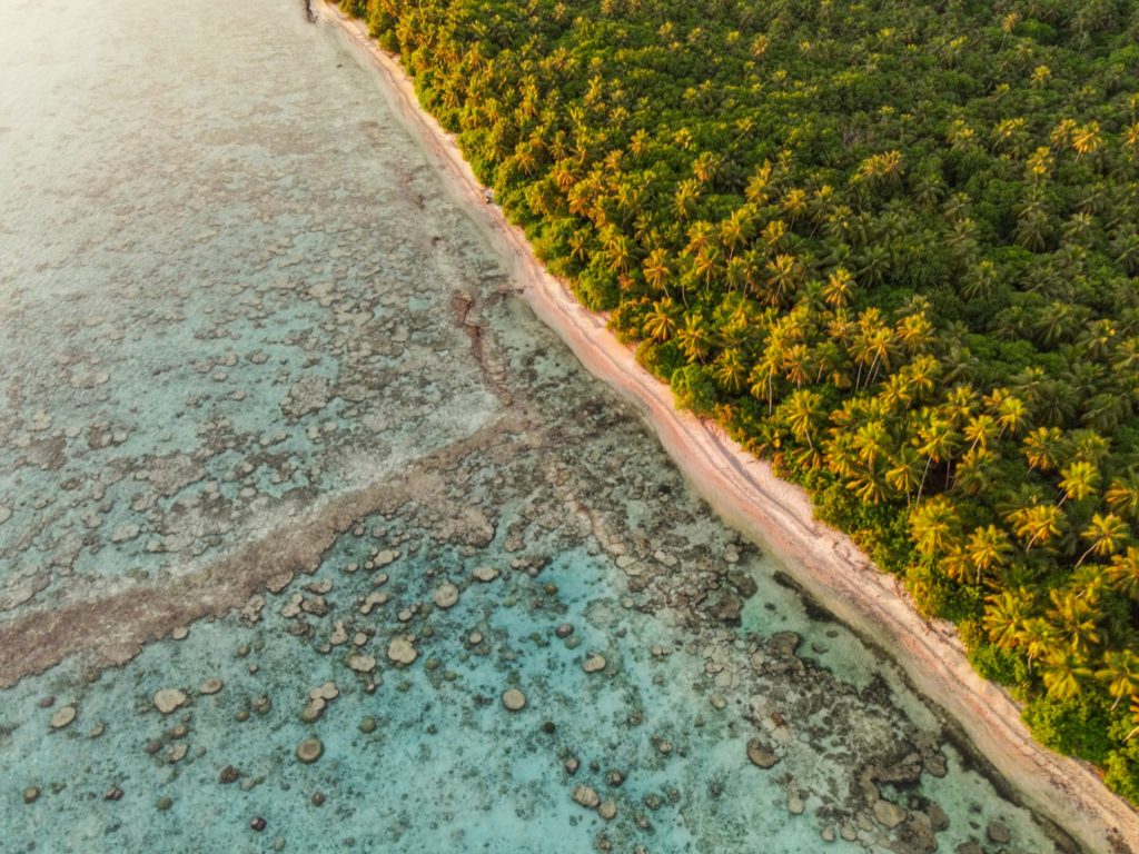
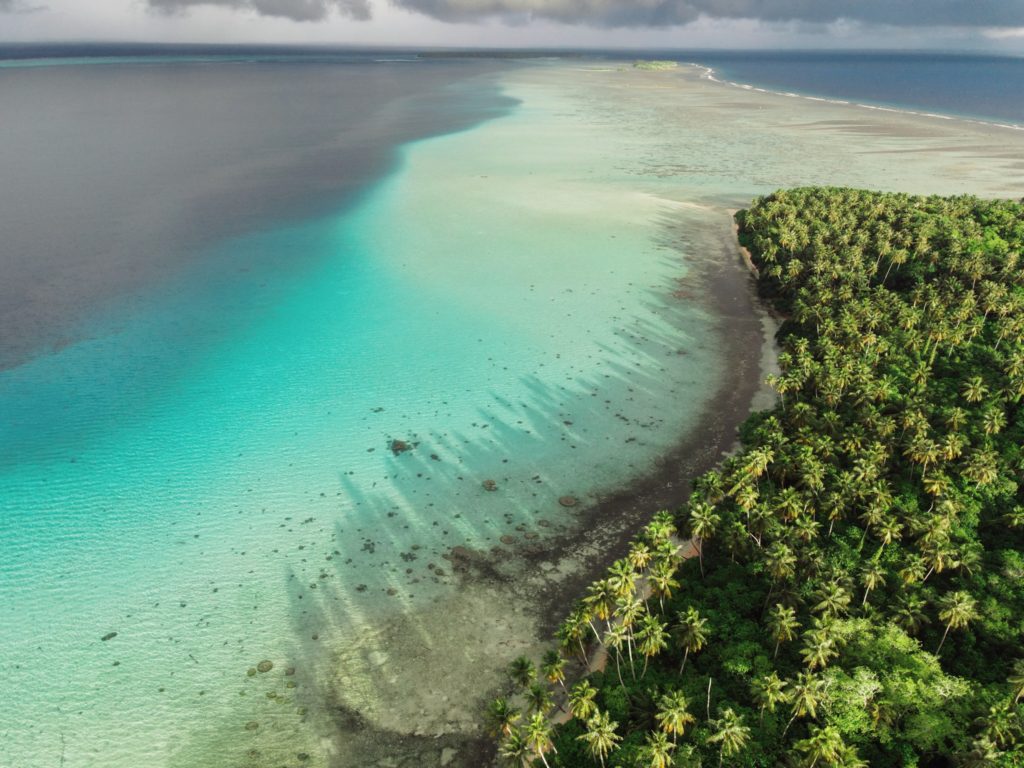
Nahpali is a long, narrow reef island running roughly northeast-southwest and located northeast of Temwen Island in Madolenihmw Municipality. The island is privately owned by the Senda family and has remained largely undeveloped. In 1836, a war that erupted between the crew of a visiting British whaleship, the Nahnmwarki (paramount chief of Madolenihmw), and a rival chief (the Wasai), spilled over onto the island. After the whaleship ran aground, its cargo was transferred to Nahpali, where it was later stolen by the brother of the Nahnmwarki, called Nahnawa. The whalers and Nahnawa’s men fought on the island, where Nahnawa temporarily got the upper hand and killed the captain of the ship and three others. Eventually however, with the help of the Wasai, who was based on Na Island and coveted the Nahnmwarki title, the whalers overcame the Nahnmwarki and his brother and murdered them. During the 1930s, Nahpali was occupied by the Japanese military, which operated a gun battery and searchlight station near the northern end. Today, the island is forested and scattered with the remains of the gun stations and other Japanese structures, including water storage tanks and steps that once led up to an elevated wooden barracks (now long gone). All of the suitable camping areas lie on the western and northern coasts and the swimming and snorkeling is all along the reef wall west of the island, while the eastern side descends into impassable mangrove swamps.
Attractions
110 cm Searchlight
As part of their fortification of Nahpali, the Japanese mounted a 110 cm searchlight at the northeast end of the island, closest to the channel opening. They probably intended to use the light to spot enemy ships attempting to pass inside the reef, but it seems unlikely that they ever got to use it in battle. The May Day bombardment of Pohnpei by American warships focused primarily on the targets of highest import — Kolonia Town, Sokehs Mountain, and Lenger Island — and it’s doubtful that American vessels were anywhere near Nahpali. Allied bombers, however, may have played a part in the destruction of this piece of hardware. The searchlight drum now rests in the sandy shoals north of the concrete platform where it was originally installed. The platform is broken into several pieces, but it’s not clear whether the damage was caused by a bomb blast or just the action of tides, waves, and erosion over nearly 70 years. Other bits of the light are scattered around in the water nearby.
8 cm Gun Stations
Duane Denfeld’s 1979 archaeological overview of Pohnpei’s historical sites indicates four 8 cm gun stations on Nahpali (based on American intelligence gathered through aerial photography rather than an actual visit to the island). During our quick survey of Nahpali, we were only able to locate three of the stations and one of them was severely deteriorated. No guns remain, but the concrete defensive structures are still there — albeit very overgrown.
Other Japanese Structures
Most of the other structures found on the island are clustered around the west side. There’s a series of foundations that might have belonged to a barracks, several hulking cisterns of various types, and a diesel engine.
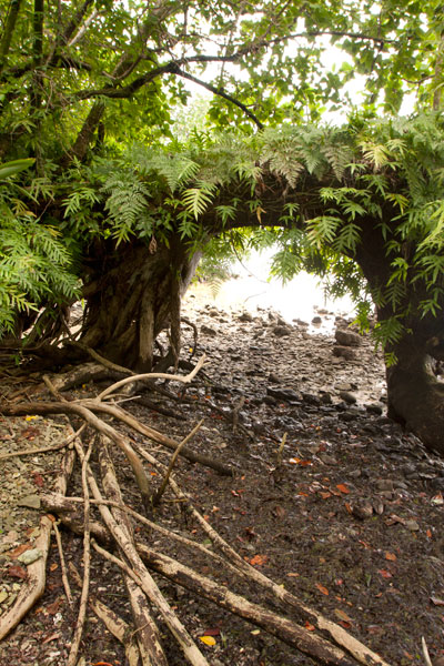
“Gateway Tree”
On the shore just south of the last Japanese structure is a huge tree shaped like an arched gateway. A portion of the tree seems to have bent over and made contact with the ground, where it put down more roots, forming an amazing piece of natural architecture.
Sandy Beaches
Beautiful stretches of fine copper sand are found on Nahpali’s northwestern and northern coasts. The beaches, however, do not extend all the way out to deep water, giving way instead to shoals of coral rubble and seagrass. The best beach is found where the coastline turns to the east near a pile of concrete slabs that might have been part of a wharf or coastal pillbox. Other ruined structures are scattered along the shore below the high-tide level. There is another smaller beach on the western coast at the southern end of the island.
Surfing
One of two surfable reef-breaks in the area lies on the edge of Kepidauen Deleur, northwest of Nahpali. Visit our surfing page for more details.
- To obtain permission for overnight stays, call McKenzie Senda at +691.320.8682 / 7147 / 4062.
Nahkapw Island
Nahkapw is the island directly across from Nan Madol, and if you want to stay overnight and explore the ruins over a couple of days, this is the place to camp. The island is composed of coral rubble and thickly forested. Sandy beaches lie around the north and northeast coasts and there’s a nice protected, shallow place to swim on the west coast inside the boulder break-wall. The latter is believed to have been constructed during the Nan Madol Period or perhaps even before. Legends speak of two ancient stone cities that pre-dated Nan Madol; one of these is said to lie beneath or beyond Nahkapw. Some archaeologists have proposed that the island itself is man-made, but though much of the western and northern coastlines are surrounded by gigantic basalt boulders that are certainly not natural to the area, there doesn’t seem to be any columnar basalt around Nahkapw. The island has an irregular shape. The best swimming is off the north end, where the beach drops straight off into the deeps of Pahn Nahkapw — a huge “blue hole”. The snorkeling and SCUBA diving around the west edge of the reef wall (next to the boulder line) and to the northeast is excellent.
- To obtain permission for overnight stays, call Hentrick Etse at +691.320.8782.

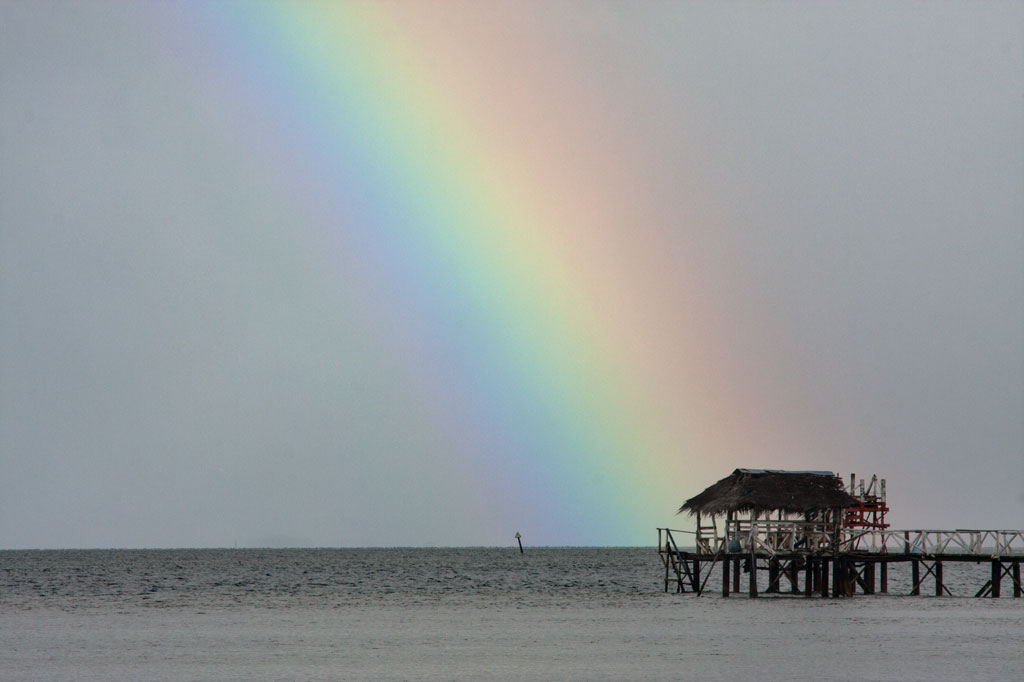
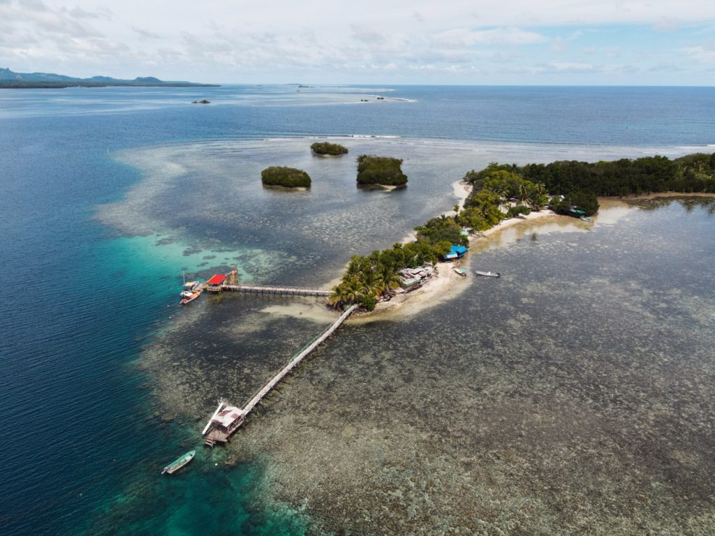
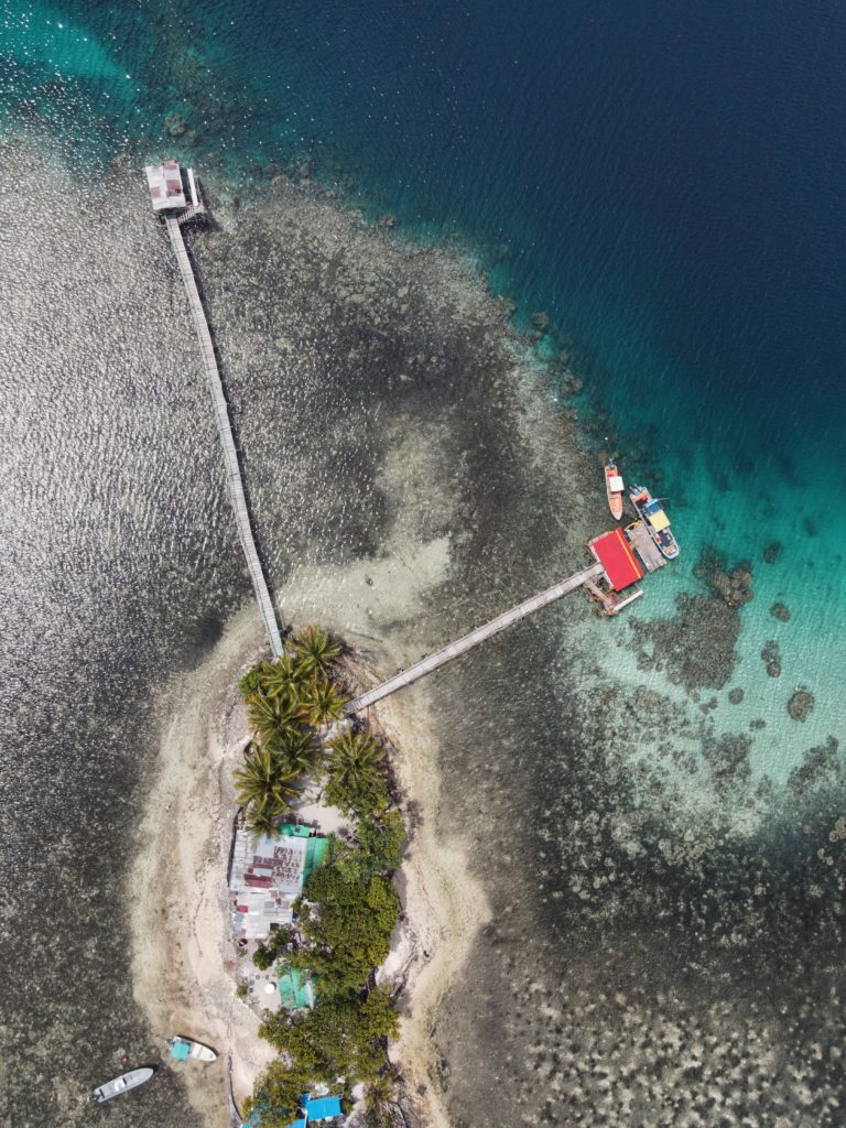
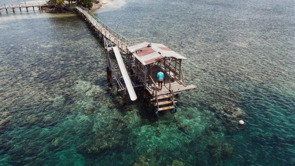
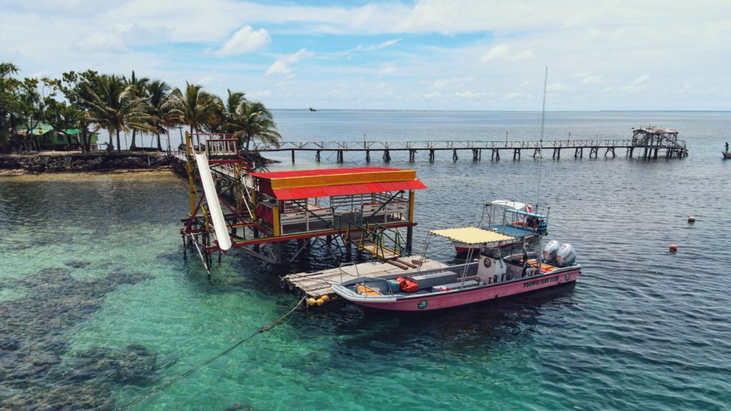
Nahlap Island
")
Nahlap remains one of Pohnpei’s most accessible and popular lagoon getaways, but visitors should be aware of the facilities and island conditions.
Many of the huts have basic amenities, but water access varies. Some huts, including the nahs (traditional meeting houses), currently have limited water systems. Toilets in the nahs are bucket-flush only, and there is no shower water available at those locations. Showers are available at some of the other huts, where water tanks are still functional. The larger green and blue huts appear to be the most maintained, with the blue hut offering the best bathroom facilities (still bucket-flush, but with a larger tank).
The boat service to Nahlap is typical of local lagoon transport — reliable enough but basic, without luxury features and not always the most comfortable ride. Travelers looking for a faster or more comfortable experience might consider working with a tour company or arranging a private charter.
Currently, major reinvestment in the property appears limited. However, Nahlap’s natural beauty still offers plenty for visitors to enjoy. The north end of the island, beyond the small church, feels particularly untouched and peaceful, with dense tropical plant life and mature trees providing shade and a true sense of isolation.
Key Points for Visitors:
• Bring extra drinking water and be prepared for limited freshwater availability.
• Facilities are basic: bucket-flush toilets, limited or no shower water in some huts.
• Boat transport is local-standard; tour companies or private charters may offer alternatives.
• Best suited for travelers seeking a rustic, nature-focused island experience.
Getting there:
Launch at Sekeren Iap in Rohnkitti (~21 km southwest of Kolonia). Continue past the Henry Nanpei Memorial and Rohnkitti Church to the end of the road.
Reservations and Boat Arrangements:
To make reservations or arrange for a boat taxi from Sekeren Iap in Rohnkitti, call +691 925 9797
Or contact the Kitti Municipal Government Office: (+691)320-5038 / 320-5808 / 320-5049 / 320-3257
Ahnd & Pakin Atolls
Pohnpei’s Satellite Atolls
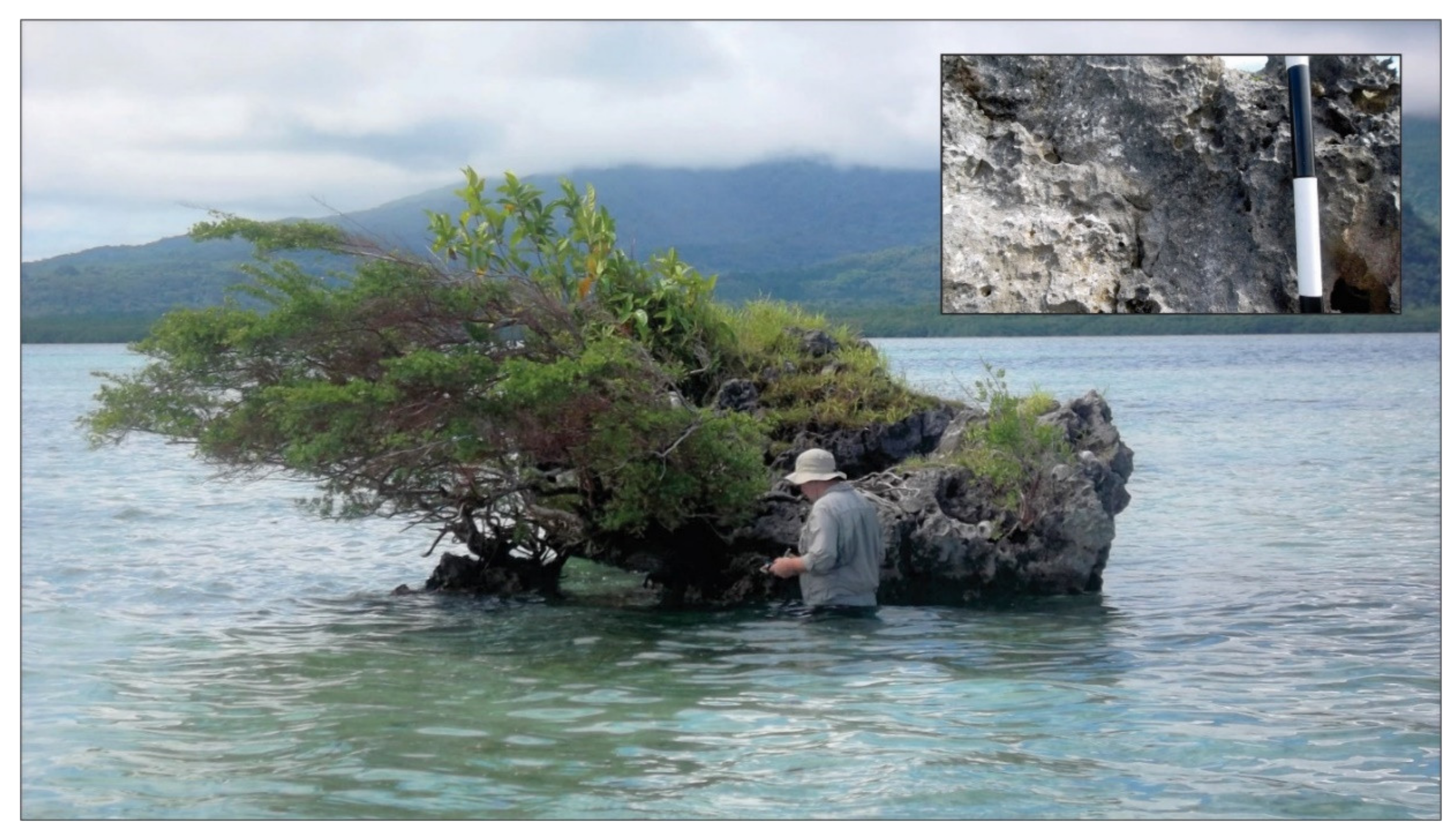
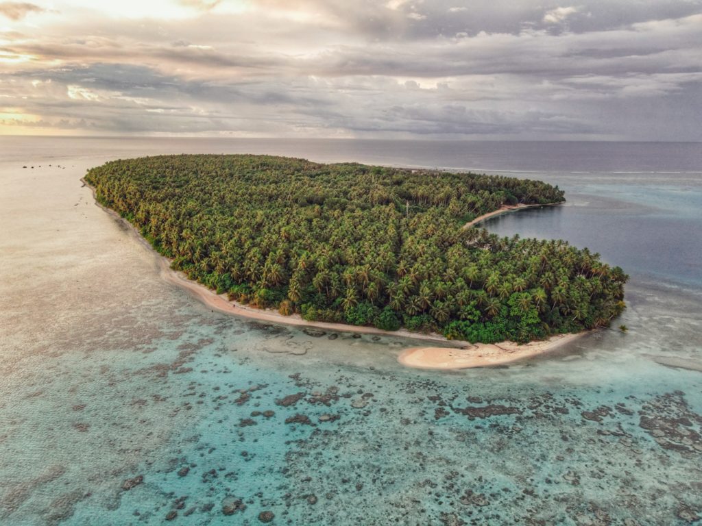
Beyond Pohnpei’s lagoon, the closest land to be found exists on two “satellite atolls” called Ahnd (pronounced änt) and Pakin (pä.keen). An atoll is made up of a number of coralline islets in a ring around a relatively shallow lagoon and is created when a high, volcanic island submerges over millions of years, leaving only the reef that fringed its shores. The islands form as sand, coral rubble, and other detritus collect on the reef and begin to support trees, small plants, and animals. Coral sand accumulates on the lagoon sides of the islands and creates beaches.
")
Ahnd (“Ant”) Atoll
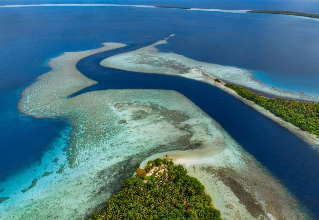
Ahnd Atoll, popularly but erroneously spelled “Ant,” is 16 km (8 mi) southwest of Rohnkitti and consists of 13 low, luxuriant islands 3-4 meters above sea-level and a lagoon of 70 km2 entered by a single passage in the reef.
When the larger-than-life hero Isokelekel voyaged to Pohnpei, intent on overthrowing the rulers of Nan Madol, he came first to Ahnd and lived there for some time, learning about Pohnpeian customs from its inhabitants. In modern times, the entire atoll became the property of a single Pohnpeian family — the descendents of Henry Nanpei, who lived from 1862 to 1928. Nanpei’s shrewd business sense and knack for manipulating local power politics enabled him to acquire the atoll and amass a great deal of other land.
Ahnd Atoll Channel 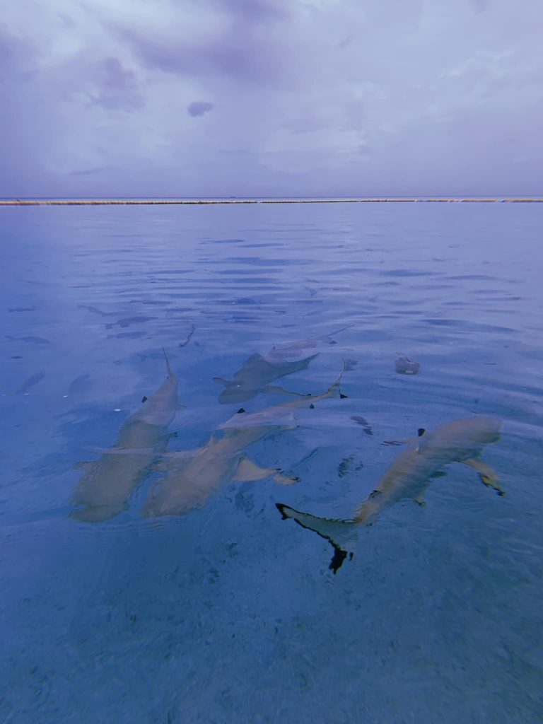
Black tip reef sharks at Ahnd Atoll (PC: Tia Panuelo) 
Ahnd Atoll, Federated States of Micronesia (PC: Alex Zuccarelli) 
Ahnd Atoll, Federated States of Micronesia (PC: Alex Zuccarelli) 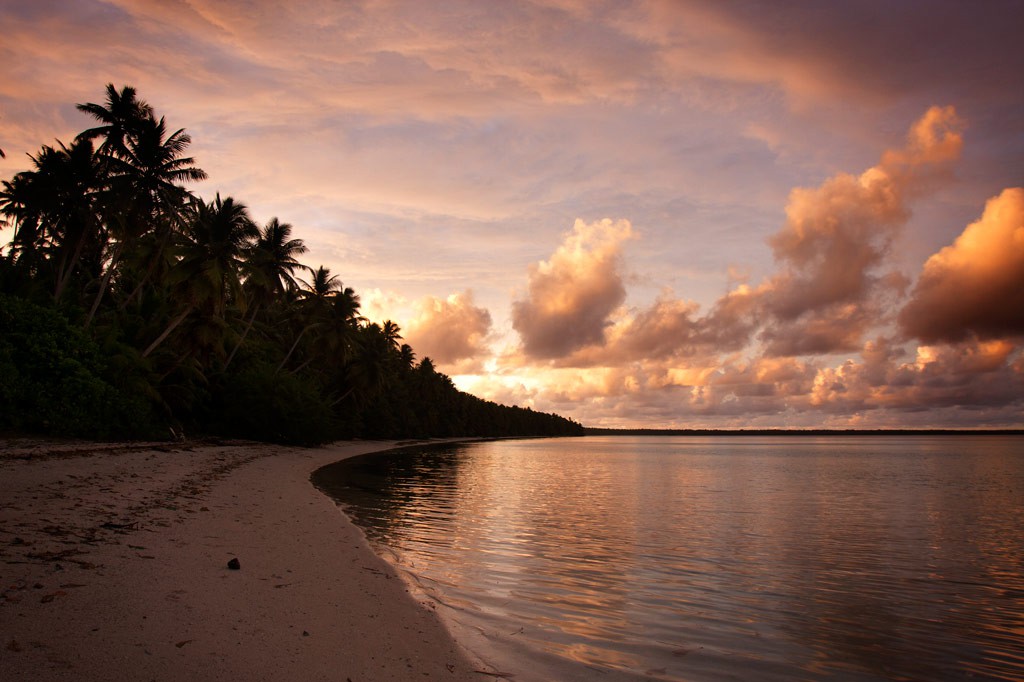
Ahnd Atoll, Federated States of Micronesia (PC: Alex Zuccarelli) 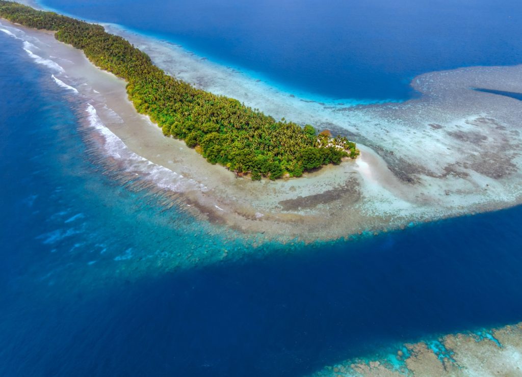
Imwen Sapw Island and channel entrance
Today Ahnd has a few human residents, the biosphere rangers who make sure people do not fish within the protected area. There is also resort run by the Nanpei family located on the island of Pasa (information for booking trips can be found below).
It is home to some of the largest colonies of black noddies, terns, boobies, and frigatebirds in the Pacific as well as a healthy community of gray reef sharks in and around Dauenai (passage).
The most interesting islands to camp on are Pasa, Nikahlap, Dolen Mwuroi, and Nahlos. The former two have long stretches of deserted white-sand beach and excellent swimming. Nan Imwinsapw is closest to Dauenai (passage), where all the best snorkeling and the most accessible diving is found, but it has a big rat problem. Pahn Mwek is near to both excellent snorkeling and some of the rare diving that exists inside the lagoon. For the most part, however, the lagoon is the domain of snorkelers, sandy and punctuated by beautiful coral heads with lots of color and life at low tide.
Dauenai on the south side is where most people go to SCUBA dive. It is known for orange sponges (on the west wall) and large numbers of barracudas, jacks, and sharks throughout. Reef fish populations around the pass, unfortunately, have declined in the last two decades, but hopefully will recover now that the area is protected. Even so, the place still feels busy compared to other locations and you’ll see all the familiar species — unicornfish, triggerfish, wrasses, surgeons, groupers, butterflyfish, angelfish, moorish idols, and more. Moray eels might be spotted on occasion. Spinner dolphins are regularly seen at the mouth of the passage and in the waters around Ahnd. Visibility in the pass, though not as spectacular as outside the reef, can reach 50 meters (164 feet) — certainly nothing to complain about.
In addition to drift-dives on either side of the deep passage, there is stunning (and frequently overlooked) diving on the outer wall of the barrier reef on the northwest side near Olouna (often known as “bird island” for the huge colonies of seabirds that nest there), and north of Pasa. The west wall of the barrier reef plummets to great depths, and because it is more protected from the northeasterly winds and waves, it is marked by an abundance of soft coral, holes, tunnels, and caves — an exciting place for any advanced diver. Giant clams are also common. Visibility on the outside edges can be extraordinary, exceeding 70 meters (230 feet). Currents can be swift both in the pass and around the outer walls.
Visiting Ahnd Atoll / Permission & Protected Areas
Because Ahnd is a privately owned island and UNESCO marine biosphere reserve permission is required from the Nanpei family for visits.
- Contact LP Gas at +691.320.5661 / 2675 to make arrangements.
- You can also book trips to Ahnd Atoll through Pohnpei Surf and Dive Club.
The Tenants of UNESCO Biosphere Reserves
- Core area(s) comprise a strictly protected ecosystem that contributes to the conservation of landscapes, ecosystems, species, and genetic variation.
- A buffer zone surrounds or adjoins the core areas, and is used for activities compatible with sound ecological practices that can reinforce scientific research, monitoring, training, and education.
- The transition area is the part of the reserve where the greatest activity is allowed, fostering economic and human development that is socio-culturally and ecologically sustainable.
Olouna (“Bird Island”)
Landing on Olouna island is prohibited to prevent disruption of the habitats of the seabirds who nest there. If you’d like to take a look at Olouna, consider making a kayak trip around it. You can arrange to pay your boat extra to transport a small ocean kayak or two.
Pakin Atoll
")
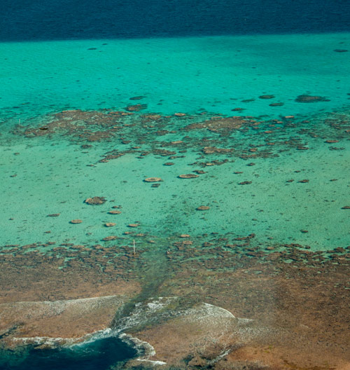
Pakin Atoll is composed of about 16 low islands, 13.6 km2 of reef, and a lagoon of 11 km2. It lies 38 km (24 mi) northwest of Palikir. In the early 1900s, Sokehs residents of Mortlockese descent were allowed to settle on the atoll, where their descendents (about 80) live to this day. Most of the islands are sparsely inhabited and all have excellent beaches, swimming, and nearby snorkeling.
One complication of visiting, however, is that Pakin has no true passage, making entry into the lagoon impossible for large boats and both difficult and dangerous for small boats. Boats enter at high tide at one of two places in the barrier reef (the usual spot is known as Uhrek), where the coral is slightly deeper than elsewhere — by a matter of a few inches. ") The crossing is narrow and complicated by strong surge. Except at the highest tides, the crossing must be carefully timed to correspond with the surge. Boats can easily capsize in the surf or be thrown up on the reef; several locals have been killed at the spot while trying to make the crossing in less than ideal conditions. When planning a visit, make sure that you hire an experienced pilot who knows this particular crossing and is committed to the safety of his passengers. Also, it is important to plan arrivals and departures to coincide with the highest tides.
The crossing is narrow and complicated by strong surge. Except at the highest tides, the crossing must be carefully timed to correspond with the surge. Boats can easily capsize in the surf or be thrown up on the reef; several locals have been killed at the spot while trying to make the crossing in less than ideal conditions. When planning a visit, make sure that you hire an experienced pilot who knows this particular crossing and is committed to the safety of his passengers. Also, it is important to plan arrivals and departures to coincide with the highest tides.
All of the diving and the best snorkeling is on the reef wall outside the lagoon, where water clarity and reef conditions are simply mind-blowing. The wall north of Nikahlap is known for sharks, while the opposite side of the island is home to large schools barracuda. For sea turtle sightings, divers will want to try the walls on the northeast side. Turtles nest on many of the small islets north of Painpwel, Sapangin, Kehrot, and Osetik.
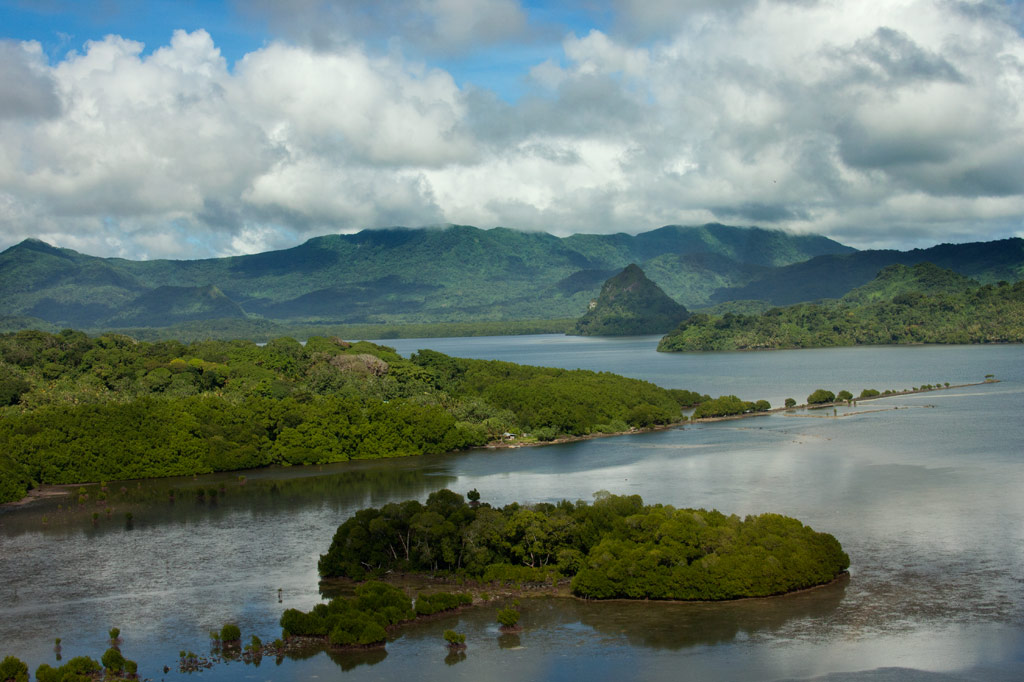
Madolenihmw Bay Area
![]()
![]()
![]()
![]()
![]()
![]()
![]()
![]()
![]()
![]()
![]()
![]()
![]()
![]()
![]()
Dauen Sapwalap / Senipehn Mangrove Reserve
- Visit the Paddling Around Madolenihmw page for a detailed description of this location and the adventures to be had in the area.
- Entering the mangrove reserve requires a permit. Visit our MPA page for details.
Kamau Pwoungapwoung
Though we didn’t map the hike to this destination as part of the eco-adventure map series (for lack of time), it would, never the less, be an exciting adventure to consider. Kamau Pwoungapwoung refers to a freshwater pool and waterfall at the headwaters of the Dipwilap Stream (Pilen Dipwilap), one of the tributaries of the Senipehn River (Pillapen Senipehn). The place is significant as the location where the last battle between the Saudeleur‘s warriors and Isokelekel’s men was fought. Upon being defeated by Isokelekel, the Saudeleur transformed himself into a small blue fish, that inhabits the pool to this day, and leaped into the waterfall. The hike would be a long one from the area around Pahn Sile. The closest access point would probably be from the direction of Nihpit fern meadow (reached from eastern Kitti).
- The absolute best choice for a guide is Relio Lengsi. Give him a call at +691.924.2580 and discuss the best route options and access points for this location. Offer $50.00 for a full-day hike.
Nanpahlap Peak
The 137 m (449 ft) hill to the east of Takaiuh looks as if its top has been lopped off — which fits in with the story about its creation (see Takaiuh below). Though steep in places and somewhat overgrown, the ascent isn’t too strenuous. At the summit are the tumbled ruins of a prehistoric stone structure and a breath-taking view. The whole area around the southern foot of the hill is criss-crossed with Japanese trenches and dotted with tunnels, including at least one very long one leading into the hill. The grid of paddies and irrigation canals where the Japanese successfully cultivated rice (despite Pohnpei’s challenging climate conditions) are found on both sides of the unpaved access road, though you can get closest to the bulk of these fields from another road to the west.
Everything is private land, but no official access fees are charged.
- To hire a guide, ask at the houses in the area or contact Hanke Albert at +691.320.4047. Offer $25.00 for Nanpahlap or a half-day of exploration in the area.
Nanwap Marine Protected Area (MPA)
Nanwap Marine Protected Area is a 3.05 km2 (305 hectare) section of the barrier reef and adjacent lagoon areas on the north side of Kepidauen Deleur (passage). The sanctuary was founded by community members from Metipw and Lukop and their respective chiefs and gained legal status in 2010. It became the first of Pohnpei’s MPAs to have its own formal community-created management plan with the support of the Pohnpei MPA Executive Management Network and the state offices of the Department of Land and Natural Resources, Division of Fish and Wildlife, Office of Fisheries and Aquaculture, and Environmental Protection Agency. Nanwap is a “no-take zone,” which means no fishing or gathering of any kind is allowed within the boundaries. It is regarded as the “most biologically diverse and best preserved spawning and aggregation site” for many of Pohnpei’s core reef fish species. Snorkelers should seek out the protected blue holes on the west side of the reef, while SCUBA divers will want to do a drift dive on the southern wall of the reef during an in-coming tide.
- Entering the MPA requires a permit. Visit our MPA page for details.
Pahn Dieinuh
- Visit the Paddling Around Madolenihmw page for a detailed description of this location.
Peiai
Peiai is a small populated place near the turn-off for Pahn Sile waterfall. During the battle between the warriors of Isokelekel and the army of the last Saudeleur, Peiai was the place where the tide of battle turned dramatically (hence, the name references a situation where the runner-up in a race pulls ahead of the leader — loosely translated “the battle is reversed”). Isokelekel’s men were being beaten down by the forces of Nan Madol when one of the conqueror’s greatest fighting men pinned his own foot to the ground with his spear, refusing to retreat and declaring that he would kill any man who tried to run away from the fight. Isokelekel’s men rallied behind this show of bravery and pushed back the Saudeleur‘s warriors, chasing them up the Senipehn River and eventually to Kamau Pwoungapwoung, a waterfall at the headwaters of the Dipwilap Stream, where the Saudeleur was finally defeated.
Sapwalap
Sapwalap (“large land”) is an expansive region of mostly flat ground that makes up a sizable chunk of central Madolenihmw. The Japanese recognized Sapwalap‘s potential as a site of large-scale agriculture. During the thirty years leading up to World War II, sugarcane was cultivated and processed at a facility near Kitamw (the tower is still partly visible in the jungle off the road) and rice was grown in a patchwork of paddies fed by irrigation canals. Strangely, no one is growing rice these days, but the paddies are still there opposite the gleaming LDS Church. Other fields are found as far east as Lukop.

Tahio
Tahio, on the south side of Nanpahlap, is another place where the Japanese were active. The access road was built by them and the coastal area is full of trenches, rifle pits, dugouts, and tunnels. Everything is overgrown, but anyone who pokes around will be rewarded with interesting finds. Bring a local resident along.
Takaiuh Peak
You can’t visit Madolenihmw without being arrested by the sight of Takaiuh, a 160 m (525 ft) peak shaped like a traffic cone that stands on the north side of the bay and seems to guard the entrance to the Sapwalap estuary. The mythical origin-story of the hill — which bears a striking resemblance to the Biblical tale of the tower of Babel — involves Mwohnmur and Sarapwau, two wily brothers who enter into many Pohnpeian legends (they also created the Sahwar Valley and the rock of Pohnpaip).
How Takaiuh Came to Be
Long ago, two boys named Mwohnmur and Sarapwau were born in Salapwuk (Kitti) to a woman named Lienlama. The boys were always involved in clever schemes and mischief and traveled far and wide doing great works. Once, the brothers took a piece of stone, and using it like a canoe, paddled to Pohndolen Imwinsapw near what is now Tahio in Madolenihmw. There, Mwohnmur and Sarapwau amused themselves by piling up rocks until they had formed a large hill. A local demi-god named Lapongo saw what they were doing and wasn’t pleased, so he threw a stone at their hill and destroyed it. He then challenged the brothers to a competition to see who could build a mountain the fastest. The three set to work, but it soon became apparent that the boys were winning. Their mountain was so tall it had reached the sky. Being a poor loser, Lapongo became enraged. He picked up a stone and threw it at the new mountain, which broke into six pieces. The base of the mountain that remained standing was named Takaiuh (“standing stone”).
This was not the end of the conflicts between the brothers and Lapongo, however. Lapongo mocked and ridiculed the boys whenever he could, and they did not like it. Now, the brothers liked to play at a place called Pahnlikes, below the spot where they had settled on Likes peak west of modern-day Sapwalap. There was a steep slope there that they would slide down for fun, sitting upon the leaf sheaths of the kotop palm (Clinostigma ponapensis). The boys knew that Lapongo had been watching them and was aware of their play place, so they decided to trick him. Lapongo was invited to slide down the slope with the boys, but they chose a spot where the slope ended at the waterside (possibly the southern tributary of Pilen Kitamw). All three began sliding down the hill. When Mwohnmur and Sarapwau reached the bottom, they leaped off their sheaths and dived to safety, but Lapongo went straight and fell into the water. He sank down into the depths, and the brothers threw rocks on top of him to keep him from resurfacing.
Takaiuh is actually an island separated from the coast by a strip of mangrove forest. It was once inhabited, but is no longer. Though the hill is climbable, the ascent is extremely dangerous, characterized by very steep slopes and cliffs prone to rockslides with little or nothing solid to hold on to. For this reason we strongly advise visitors to enjoy Takaiuh from below rather than trying for the summit. Hikers who insist on seeking the summit, do so at their own risk. Distant views of the peak are found along the Circle Island Road, but the best close-up view from land is from the old Japanese road in Kepine. According to residents living in the area, the Japanese abandoned an attempt to build a trail all the way to the top of the hill. Some of the low wall can still be seen on the lower slope.