
Pohnpei Marine Protected Areas (MPA)
Marine Protected Areas (MPA), Sanctuaries, and Forest Reserves
Pohnpei Island currently has thirteen marine protected areas, including three mangrove forest reserves and two stingray sanctuaries. Additionally, Pakin Atoll has five of its own MPAs and all of Ahnd Atoll is a UNESCO Biosphere Reserve.
If you wish to visit a MPA it is best to work with a tour operators as they have the necessary permits that allow entry into these MPAs and biosphere reserves.
Current MPAs
Sapwtik MPA
Sapwtik Marine Protected Area is a 0.83 km2 (0.32 mi2) area encompassing Sapwtik (island), portions of its fringing reef, and sections of the lagoon southwest and northeast of the island.
Dekehos (Mwahnd) MPA
Dekehos Marine Protected Area is a 4.60 km2 (1.78 mi2) area encompassing Mwahnd Passage (Kepidauen Mwahnd) and portions of the barrier reef north of the pass and to the south as far as the fringing reef of Mwahnd Peidak (island).
Dehpehk MPA
Dehpehk Marine Protected Area is a 2.12 km2 (0.82 mi2) area encompassing the eastern and northern coasts of Dehpehk (island) and adjacent fringing reefs.
Nanwap MPA
Nanwap Marine Protected Area is a 3.05 km2 (1.18 mi2) section of the barrier reef and adjacent lagoon areas north of the Madolenihmw Bay passage (Kepidauen Deleur).
Senipehn Mangrove Forest Reserve
Senipehn Mangrove Forest Reserve is a 1.30 km2 (0.5 mi2) area of mangrove forest surrounding Dauen Sapwalap in Madolenihmw.
Namwen Na Stingray Sanctuary
Namwen Na Stingray Sanctuary is a 0.71 km2 (0.27 mi2) area encompassing both shallow reef and deep water areas located north of Na (island) and south of Nahpali (island).
Namwen Nahnningi Stingray Sanctuary
Namwen Nahnningi Stingray Sanctuary is a 0.34 km2 (0.13 mi2) area encompassing four large reef pools and the adjacent reefs northwest of Nahnningi (island).
Nahtik MPA
Nahtik Marine Protected Area is a 0.75 km2 (0.29 mi2) area encompassing Nahtik (island) and all fringing reefs.
Enipein Mangrove Reserve
Enipein Mangrove Reserve is a 9.55 km2 (3.69 mi2) area of mangrove forest located in Enipein, Kitti.
Kehpara MPA
Kehpara Marine Protected Area is a 1.89 km2 (0.73 mi2) area encompassing the three Namwmwour barrier reef islands (including Kehpara) and large sections of the barrier reef both north, south, and east of the islands. This area is completely closed to diving and snorkeling from January 1 to June 30 every year.
Pwudoi Mangrove Sanctuary
Pwudoi Mangrove Sanctuary is a 1.39 km2 (0.52 mi2) area encompassing large sections of mangrove forest in Pwudoi, Kitti, as well as adjacent fringing reefs and portions of the lagoon.

Wahulap MPA
Wahulap Marine Protected Area on Pakin Atoll encompasses Nikahlap Island and all surrounding reefs.
Painpwel MPA
Painpwel Marine Protected Area on Pakin Atoll encompasses Painpwel Island, a number of tiny islands off the north coast where sea turtles nest, and all surrounding reefs.
Palikir MPA
Palikir Marine Protected Area is one of Pohnpei’s largest inner-lagoon sanctuaries. It stretches from the shore of Palikir all the way to Palikir Pass. It is also one of Pohnpei’s most successful MPA’s and in 2020 efforts were made expand the MPA’s borders.
Sapangin MPA
Sapangin Marine Protected Area on Pakin Atoll encompasses Sapangin Island, several tiny islets to the north where sea turtles nest, and all surrounding reefs.
Kehrot MPA
Kehrot Marine Protected Area on Pakin Atoll encompasses Kehrot Island, many tiny islets to the northeast where sea turtles nest, and all surrounding reefs.
Mwahnid MPA
Mwahnid Marine Protected Area on Pakin Atoll encompasses Mwahnid Island and all surrounding reefs.
Marine Attractions GPS Data
Marine Attractions GPS Data
Downloadable GPS Data Files
The following files contain all the packaged GPS data for each feature or attraction on the Marine Attractions guide.
Three file types are provided. KMZ and KML files are compatible with Google Earth. KML is compatible with Google Maps. GPX files can be imported into ArcGIS (a professional mapping application) and some hand-held GPS devices.
[info]NOTE: All files are free to the public and can be used for any purpose without permission.[/info]
Coastline
These lines were drawn during the course of this project from existing aerial photography and satellite imagery.
- Pohnpei Island Coastline (2013) – KMZ format (284 kb)
- Pohnpei Island Coastline (2013) – KML format (753 kb)
- Pohnpei Island Coastline (2013) – GPX format (1.1 mb)
Mangroves
Including all mangrove forests around Pohnpei Island and its lagoon islands; these lines were drawn during the course of this project from existing aerial photography and satellite imagery.
- Mangrove Forests (2014) – KML format (5.3 mb)
- Mangrove Forests (2014) – KMZ format (1.8 mb)
- Mangrove Forests (2014) – GPX format (7.8 mb)
Reefs
These lines were drawn during the course of this project from existing aerial photography and satellite imagery.
- Pohnpei Island Reef System (2014) – KMZ format (3.2 mb)
- Pohnpei Island Reef System (2014) – KML format (9.1 mb)
- Pohnpei Island Reef System (2014) – GPX format (13.3 mb)
Surf Breaks
Locations were marked based on data provided Pohnpei Surf Club.
- Pohnpei Surf Break Locations (2015) – KMZ format (5 kb)
- Pohnpei Surf Break Locations (2015) – KML format (17 kb)
- Pohnpei Surf Break Locations (2015) – GPX format (11 kb)
SCUBA Diving & Snorkeling
Locations were marked based on data provided by knowledgeable local diving guides and our own on-the-ground data gathering experiences.
- Pohnpei SCUBA Diving & Snorkeling (2014) – KMZ format (50 kb)
- Pohnpei SCUBA Diving & Snorkeling (2014) – KML format (188 kb)
- Pohnpei SCUBA Diving & Snorkeling (2014) – GPX format (179 kb)
Swimming Spots
Locations where poor water quality or environmental contamination make them unsafe for swimming have not been included here. This includes all of the watercourses around Mand, Madolenihmw Municipality (with one exception) and almost everything in Sokehs Municipality. Locations are GPS-verified.
- Swimming Spots (2014) – KMZ format (5 kb)
- Swimming Spots (2014) – KML format (40 kb)
- Swimming Spots (2014) – GPX format (8 kb)
Paddling (Suggested Kayaking, Canoeing & Paddleboarding Routes)
All data was gathered first-hand during this project (all of these routes were paddled); routes are GPS-verified.
- Kayaking & Paddleboarding Routes (2014) – KMZ format (539 kb)
- Kayaking & Paddleboarding Routes (2014) – KML format (1.6 mb)
- Kayaking & Paddleboarding Routes (2014) – GPX format (2.2 mb)
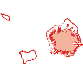
Marine Parks in Awak Pah (2015)
Marine Protected Areas, Mangrove Forest Reserves, and Sanctuaries
Shapes are approximations based on data and maps provided by Conservation Society of Pohnpei (CSP) and were not GPS-verified in the course of this project.
- Pohnpei Marine Protected Areas (2013) – KMZ format (17 kb)
- Pohnpei Marine Protected Areas (2013) – KML format (57 kb)
- Pohnpei Marine Protected Areas (2013) – GPX format (65 kb)
Coordinates
The following coordinates correspond with sites featured on the Marine Attractions Eco-Adventure Map Guide. It is our dream to eventually create a Pohnpei GPS app that could be uploaded to smartphones and other devices, but for now, these points of interest can be entered manually in a hand-held GPS device as needed.
[info]NOTE: All GPS devices have a margin of error. That margin increases with interference — when there is a thick canopy of trees, during bad weather, or when mountains obstruct the satellite link.[/info]
Awak Marine Parks
| Awak Pah MP Entrance | —- | 6.965910° 158.250758° |
| Pein Ahi Entrance | —- | 6.966711° 158.251138° |
| Paieke Entrance | —- | 6.969853° 158.256294° |
| Awak Pah MP Dock | —- | 6.966470° 158.248785° |
| Pein Ahi Fish Pond | —- | 6.967572° 158.249929° |