

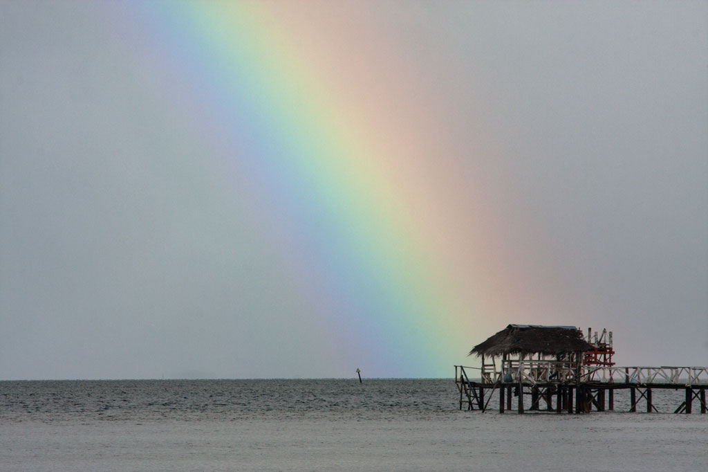
Pahn Sile Waterfall
![]()
![]()
![]()
![]()
![]()
![]()
![]()
![]()
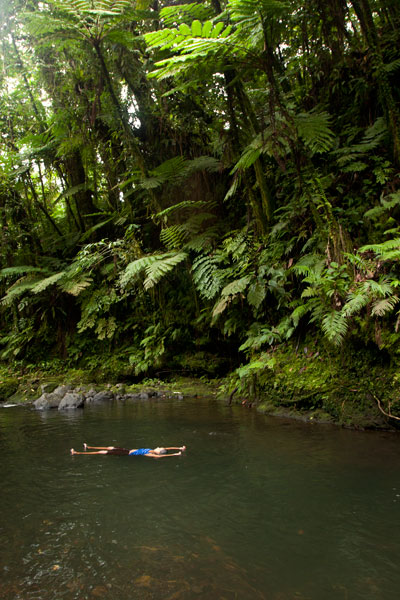
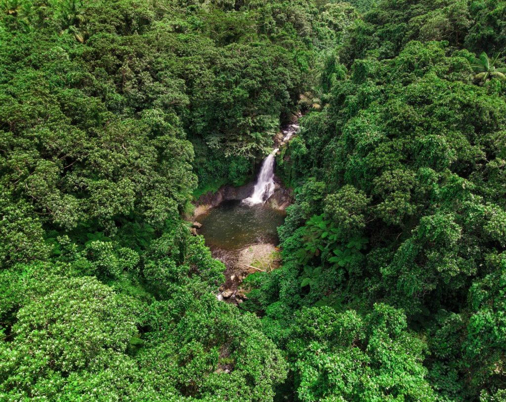
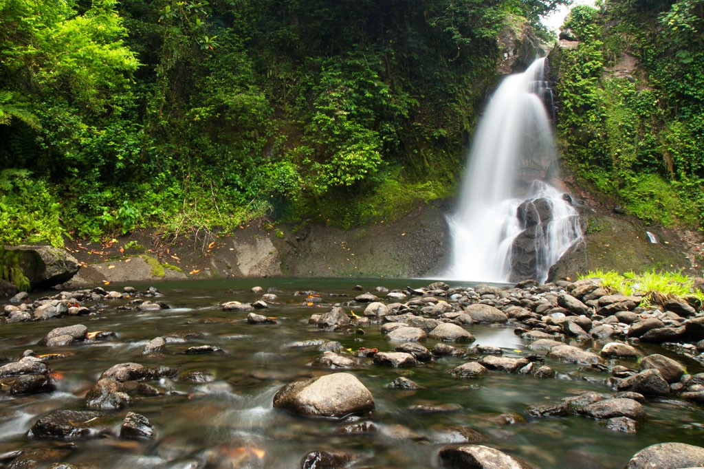
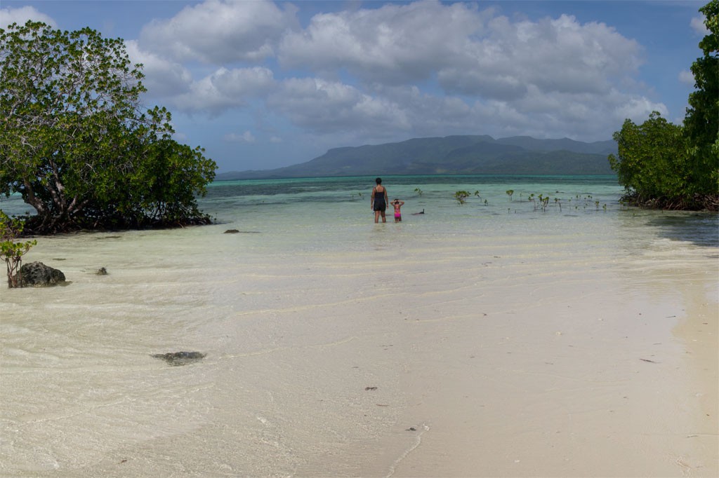
Located on the pristine Senipehn River, Pahn Sile is one of the few waterfalls well into the interior that almost anyone (even small children) can reach without the help of a guide — as long as you keep your eyes open for the branches in the path. A well-maintained trail begins at the end of the unpaved but well-graded coral and gravel road beyond Sapwalap Elementary School and opposite a concrete taxi stop. Houses are found along the path for much of the way, as well as historic rock-lined irrigation canals built by the Japanese. About 0.15 km (164 yd) before reaching the waterfall, a secondary path branches right and descends to a shallow point in the river, where you’ll cross and hug the right bank or walk in the stream as you continue to the falls just around the corner.
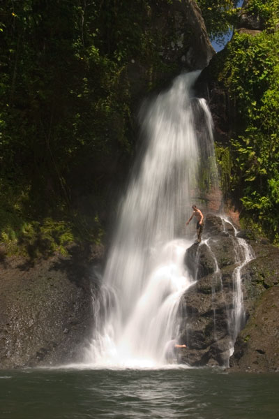
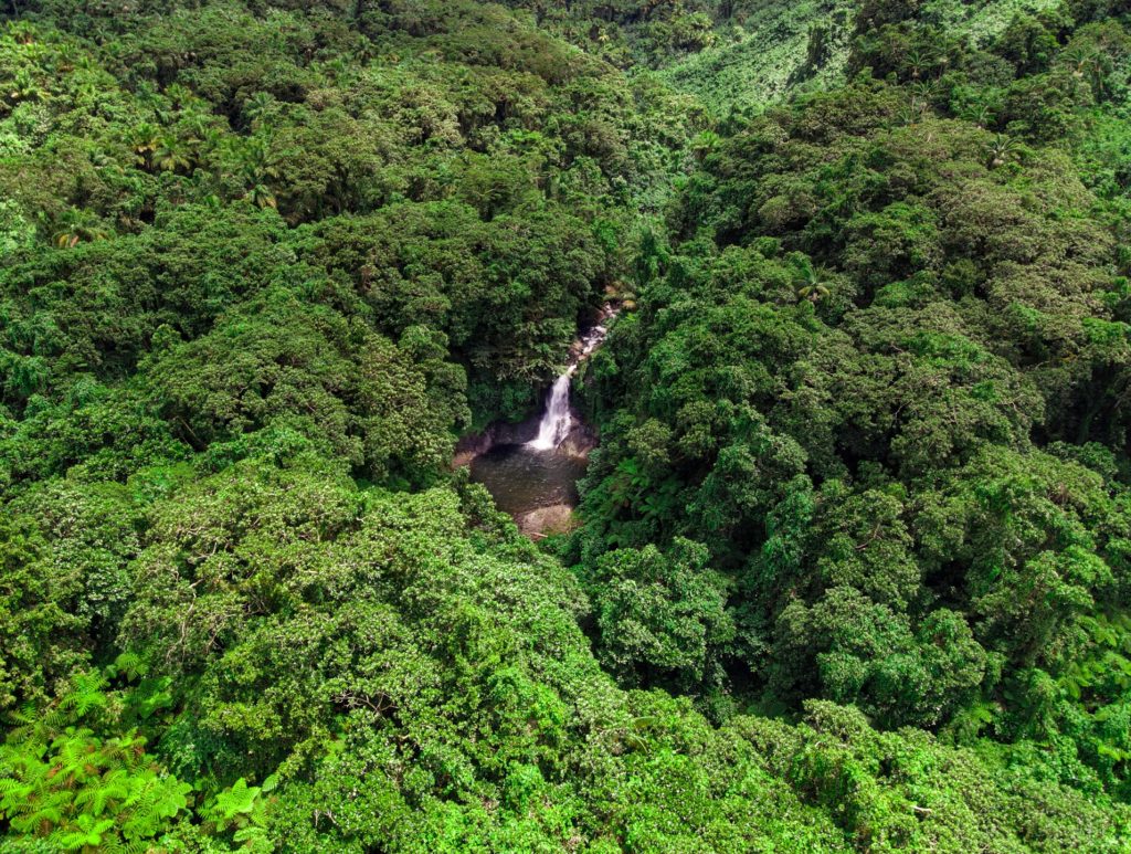
Pahn Sile‘s pool is wide and wonderfully cool, but not especially deep. The falls varies in volume depending on recent rain, gushing through a narrow portal and crashing onto rocks that form the rim of the pool. If you want a view from above the falls, bear left at the branch, proceed for 0.3 km (0.18 mi), and then cut off the trail and head straight toward the sound of the river. There is no path for this last part, but it’s easy enough to move through the forest. There are nice spots for a camp site above the falls in the forest along the path (pack out everything you packed in). In addition to the primary waterfall pool, there’s a small, deep pool just down river that is also an excellent place to swim, shaded by lush ferns and massive trees.
There are no access fees and no permission is needed to visit the falls.
If you would like a guide for the trip to the waterfall contact Raven at (+691)923-1862, he does not charge a fee but we do encourage you to tip him for his time.
- Plan for 3 hours round-trip for this excursion.
Snorkeling Pohnpei’s East Side
![]()
![]()
![]()
![]()
Temwen Vicinity
Pahn Nahkapw Wall
The best snorkeling in the area is west of Nahkapw (island) along the edge of the reef, where a coral wall drops quickly off into Pahn Nahkapw‘s blue hole. Fish are abundant here and the coral is thriving. Start at the north tip of Nahkapw and follow the reef around. To the east you’ll see the massive basalt boulders that make up the island’s Nan Madol-era breakwall.
Kepindausiso
The reef walls north, west, and south of Dekehtik (island), at the northeast end of Pahn Nahkapw, offer plenty of nice underwater views and crystal-clear water. This portion of the hole is referred to as Kepindausiso –“below the noble’s channel”.
Namwen Na Stingray Sanctuary
This reserve lies between Nahpali, Dekehmwahu, and Na (islands). It’s a moderately deep pool in the middle of shallow, sandy reef flats populated by a large number of stingrays (we saw more than fifteen in under an hour). You can swim out to the western edge from the southern tip of Nahpali or explore the eastern side from Na. There can be some strong currents coming from the northeast, so be alert.
Northern Na Island Coast
Na‘s northern coast offers narrow sandy beaches and a swath of beautiful, crystal-clear water over a sandy bottom. Further out, the floor turns to beds of seagrass. There are plenty of stingrays to see in the area. When walking in the shallows, be alert and shuffle your feet to avoid potentially serious accidents.
- Visit our Island page for more about this location.
Nahpali Island
Nahpali‘s underwater sights are all around the west side and most easily accessed from the Japanese Wharf at the edge of the reef.
- Visit our Island page for more about this location.
“Nan Madol”
The water around the northeastern perimeter of Nan Madol is usually too rough and/or murky for sub-surface exploration, but the reef pool southeast of Lemenkau can be nice on calm days and at mid to high tides. At other times, it’s either difficult to reach or has waves breaking over it.
Namwen Nahnningi Stingray Sanctuary
Similar to the reserve near Na, this marine protected area consists of several deep pools in the middle of the reef shelf with sandy bottoms, good visibility, and healthy coral populations around the edge. Stingrays are abundant and reef fish diverse. The pools are a short swim from Nahnningi (island) (a.k.a. “Joy”).
Joy / Nahnningi / Para Nuii
Southeast of Nahnningi is a circular pool on the edge of the fringing reef. There’s a narrow opening on the ocean side that allows water and fish to flow in. Depending on the tides, this place can have amazing numbers of reef fish, but it’s too rough for snorkeling when the Northeasterlies are blowing during the winter. You can snorkel to the pool from Nahnningi.
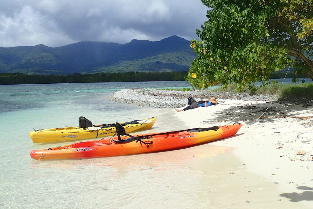
Paddling Lenger & Sapwtik
![]()
![]()
![]()
![]()
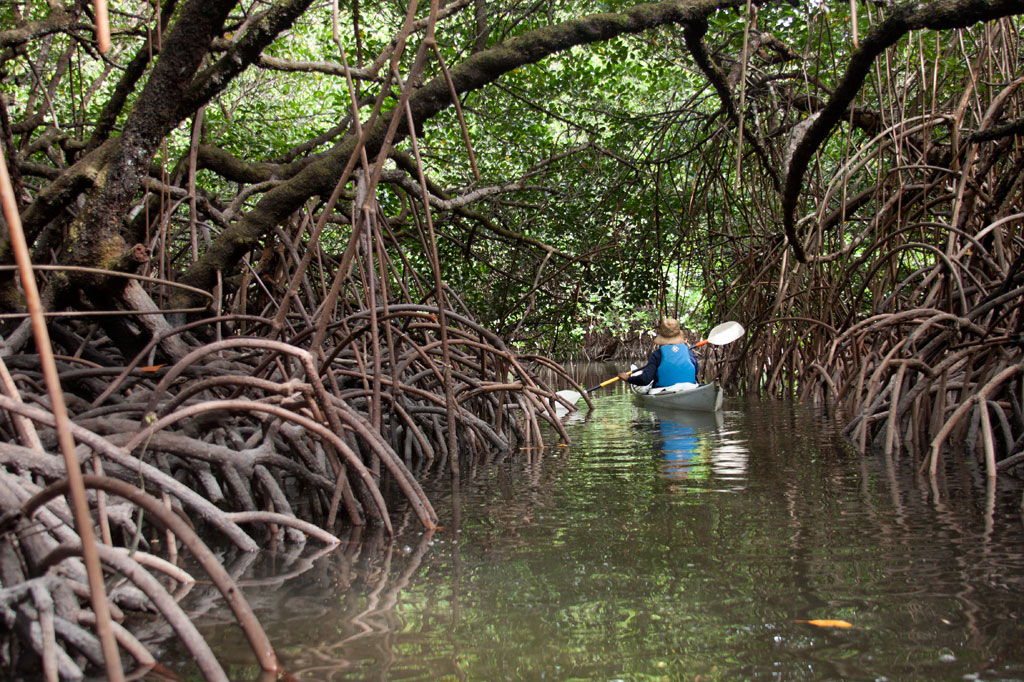
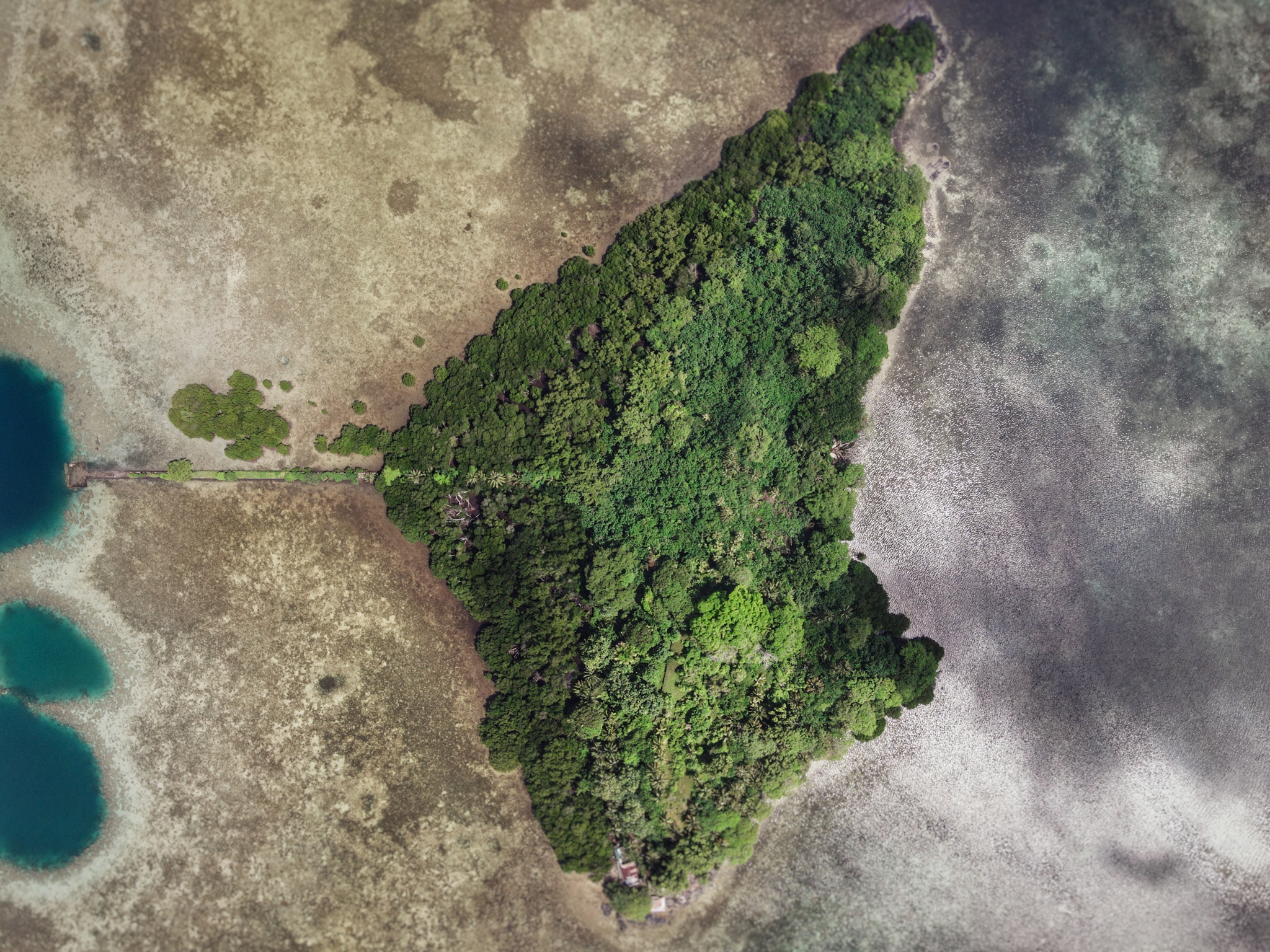
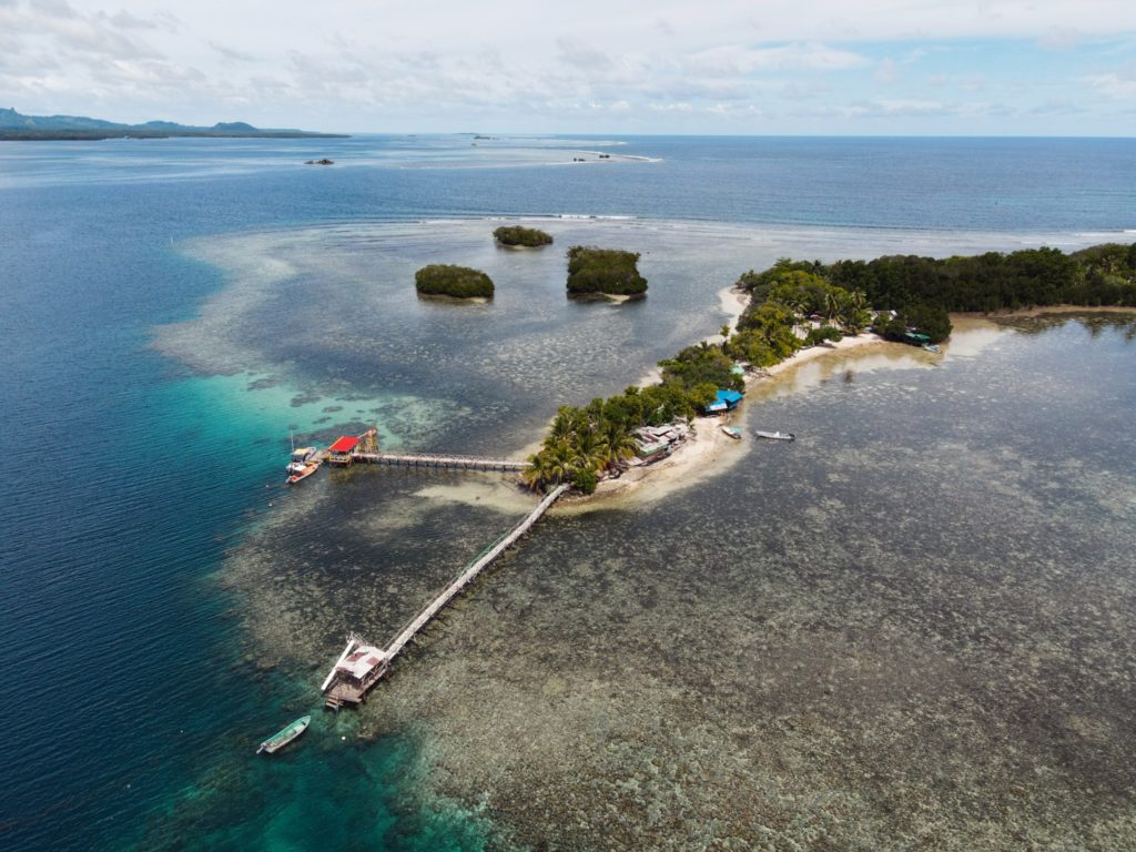
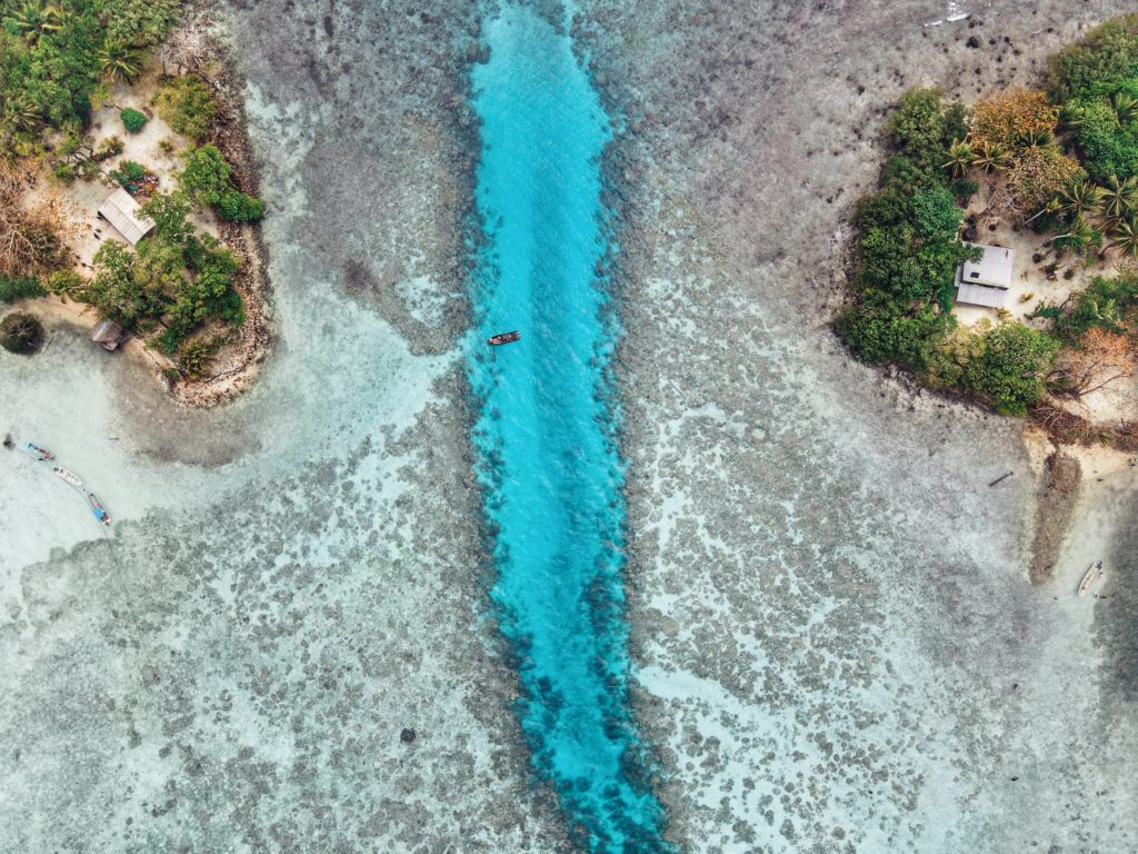
As the closest lagoon islands to Kolonia and with the highest concentration of WWII historical sites anywhere around Pohnpei, Lenger and nearby Sapwtik make fantastic destinations for paddling enthusiasts. In addition to the attractions on each of the two islands, there are mangrove forests and some interesting reef environments to explore.
Around Lenger
Pahnaiau Getaway (Barbosa’s Wharf) to the Seaplane Ramp
This portion of the route is characterized by Lenger’s shallow fringe reef, a sandy, silty expanse dominated by small-scale coral growth, brilliant blue starfish, cowries, sea cucumbers of various types, and scattered beds of seagrass, which Pohnpeian’s call oaloahd. Keep an eye out for the main attraction: stingrays. They generally rest on the bottom in the sand and will shoot off when you approach. Not far beyond the wharf is the Jaluit Cistern, one of the oldest historical sites in Pohnpei State. The cistern was probably constructed in the late 1880s by German traders operating on the coast. A stone wharf originally connected it with the coast, but a few scattered stones are all that are left. Bullet holes in the masonry were caused by Allied strafing during WWII.
If you decide to make a wider arc around the island, you’ll pass over areas where the reef shelf ends and the deep part of the lagoon begins. Small sea turtles are seen on rare occasions near the reef wall. The majority of the reef fish will also be found at this natural boundary. Note, however, that the reef stretches all the way to Sapwtik in the northwest and there is no way around Lenger’s northern end without crossing it. The depth over the shelf varies from a few centimeters to a meter, depending on the time of day and the precise location. Because fragile corals and other organisms are harmed by feet or dragging keels, the northern passage should be attempted at high tide only.
The Seaplane Ramp to the Mangrove Passage
The reef on the eastern side of the island tends to be deeper than in the northwest and has denser beds of seagrass. Larger fish are found in this area, and sometimes juvenile black-tip reef sharks can be seen swishing their way around.
The Mangrove Passage to Barbosa’s Wharf
The tunnel-like mangrove passage winds about a third of a kilometer through a dense section of forest that mostly comprises members of the Rhizophora genus, identified by the arching prop roots that extend out of the water toward the tree trunks. It’s a nice, scenic paddle and a good place to spot shorebirds like the Pacific Reef Heron and Micronesian Kingfisher. Once out of the forest, you can follow the coastline past the ruins of the Japanese-era Kohatsu Wharf and back to Barbosa’s Wharf.
Around Sapwtik
A relatively well-preserved Japanese wharf extends southwest from Sapwtik’s coast all the way to the edge of the reef. This is a wonderful place for a picnic and swim or snorkel. There’s one large tree on the wharf, offering shade. To the west is a maze of mangrove clumps that are fun to paddle through (though they are not as extensive as Lenger’s) before reaching the western terminus of the island. North of the point is an exposed rocky place that’s a perfect pull-out spot for a snack. A little beyond that is the site of the coastal battery and nearby munitions magazine. Conditions north of Sapwtik’s coastline are very similar to Lenger’s northern sector — shallow and characterized by seagrass beds and silt. You shouldn’t try to kayak here except at mid to high tides. All along the coast, you’ll find evidence of Japanese occupation, low walls, foxholes, rifle pits, etc.
| Starting | Ending | Distance (km) | Distance (mi) | |
| St. Peter’s Church, Sokehs | —- | Pahnaiau Getaway, Lenger | 7.93 km | 4.93 mi |
| Misko Beach, Dekehtik Island | —- | Pahnaiau Getaway, Lenger | 4.52 km | 2.8 mi |
| Ice Dock, Kolonia Town | —- | Pahnaiau Getaway, Lenger | 3.53 km | 2.2 mi |
| Nett Point, Nett | —- | Pahnaiau Getaway, Lenger | 1.97 km | 1.22 mi |
| St. Peter’s Church, Sokehs | —- | Japanese Wharf, Sapwtik | 7.75 km | 4.81 mi |
| Misko Beach, Dekehtik Island | —- | Japanese Wharf, Sapwtik | 4.34 km | 2.7 mi |
| Ice Dock, Kolonia Town | —- | Japanese Wharf, Sapwtik | 4.23 km | 2.63 mi |
| Nett Point, Nett | —- | Japanese Wharf, Sapwtik | 2.95 km | 1.83 mi |
| Pahnaiau Getaway, Lenger | —- | Japanese Seaplane Ramp, Lenger* | 1.52 km | 0.95 mi |
| Japanese Seaplane Ramp, Lenger | —- | Mangrove Passage Northern Entrance, Lenger | 0.58 km | 0.36 mi |
| Mangrove Passage Northern Entrance, Lenger | —- | Kohatsu Wharf, Lenger | 0.42 km | 0.26 mi |
| Kohatsu Wharf, Lenger | —- | Pahnaiau Getaway, Lenger | 0.51 km | 0.32 mi |
| Pahnaiau Getaway, Lenger | —- | Japanese Wharf, Sapwtik | 1.29 km | 0.8 mi |
| Japanese Wharf, Sapwtik | —- | Gun Battery, Sapwtik | 0.74 km | 0.46 mi |
*Shallow reef shelf. This segment is only passable at middle to high tides.
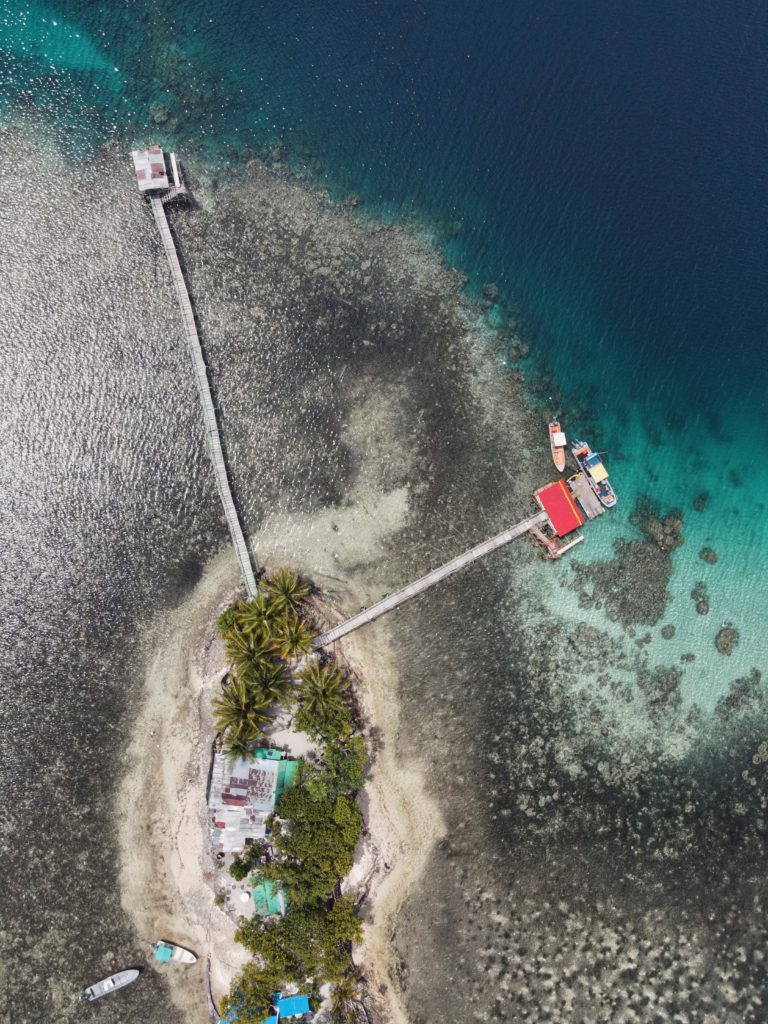
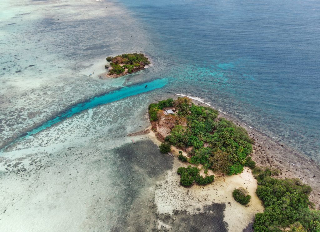
Sapwtik Island
Sapwtik, which means “small land,” is a tiny volcanic island located directly north of Kolonia and 0.5 km northwest of Lenger. Seen in profile, the island resembles a large submarine, leading some locals to nickname it “Submarine Island.” Sapwtik is jointly-owned by the Eschiet family, which has some small houses at the eastern end of island, and their in-laws, the Adams family. During the 1880s, Sapwtik was purchased by Jan Stanisław Kubary, a Polish naturalist and ethnographer, along with a large piece of land east of what is now Kolonia — a place called Mpwoampw. In 1896, after returning from an extended absence and finding his homestead in ruins and his claims on the properties questioned by the Spanish authorities, Kubary committed suicide. Mpwoampw and Sapwtik were then purchased by Dominique Escheit, a Belgian trader who had operated in the Marshall Islands before coming to Pohnpei. Between 1914 and 1945, the Japanese were in charge and a great deal of land was seized by the military for defensive purposes — including Sapwtik. Like its neighbor, Lenger, Sapwtik was fortified in the late 1930s in preparation for an Allied invasion that never came. The primary features are found on the low hilltop and at the western terminus.
Sapwtik Island Attractions

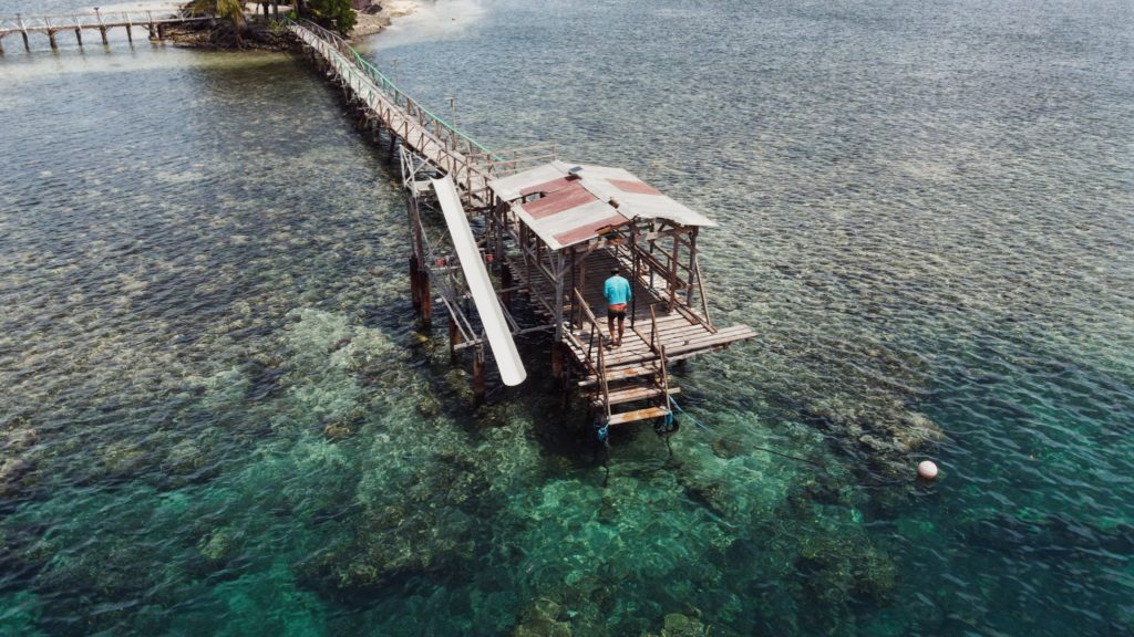
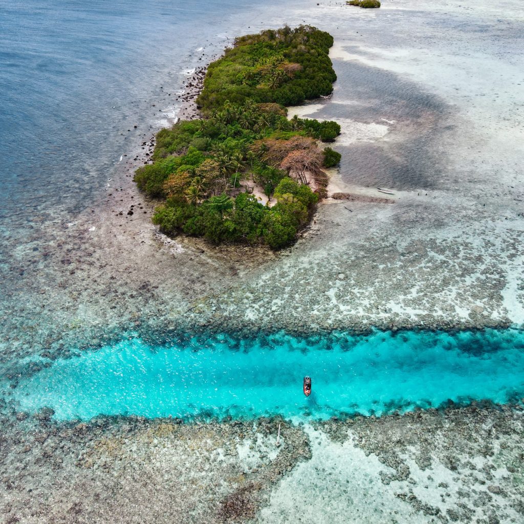
Japanese Wharf
Visitors to Sapwtik will want to make their first stop at the Japanese Wharf, a 296 meter-long (324 yd) basalt structure that juts out from the island’s southwest coast all the way to the edge of the reef. With the exception of the very end, which has sustained some damage from waves, the wharf is in excellent condition almost 80 years after it was built — a testament to the quality of Japanese construction during the colonial period (and the use of the highly stable tanizumi, or herringbone, style of stonework). The wharf connects with the coastal road, also built by the Japanese, which skirts the mangroves from one end of the island to the other. The road is built above a stone retaining wall that stabilizes it against the swampy mangrove environment. Retaining walls also run along the opposite edge to prevent erosion from the steep hillside above.
Snorkeling & Swimming
All the ocean areas around Sapwtik belong to the Sapwtik Marine Protected Area, a sanctuary protected by legislation. The snorkeling off the reef walls at the end of the wharf is quite nice with generally good visibility and lots of fish. Just start at the wharf and follow the reef wall in either direction (the further from the island, the better it gets). The best place to swim is also right off the end of the wharf. Shallow areas on either sides of the wharf are silty.
")
Command Center & Barracks
The central hill is most easily accessed from the maintained Japanese coastal road. About 60 meters east of the wharf, hikers can cut off the road and up the slope (another 60 m) to reach the summit. The Adam’s family keeps the hill extremely tidy, cutting the grass, planting flowers, and keeping the historical features free of vines and brush. The place has a manicured, park-like feel and a stunning view of everything to the south. One of the best preserved yabane-tanizumi style rock walls on Pohnpei runs the length of the hilltop on the south side with two breaks, where earthen ramps lead up to the top. Two foundations were likely a command center and a barracks for personnel stationed on the island. The northern foundation is the largest and has seven sets of steps leading up to where the floor once was. The structure itself would have been wooden, while only the support posts and the lower parts of the walls were concrete. Two large concrete cisterns are connected to the two foundations (check out the bullet holes from Allied strafing). At the north end of the complex, the hill road begins, cutting right through the hill and running all the way to the gun batteries at the northwestern end of the island. Some of the road is currently impassable due to piles of felled trees and branches, but it’s impressive none the less.
To visit the gun batteries, it’s best to return to the coastal road and hike northwest all the way to the end. The road is well-kept and easy to follow.
Magazine Complex / Shell Storage
From the cut-off point for the hilltop, it’s about 150 m (164 yd) along the road to the first point of interest, a high-walled magazine complex for heavy ordnance similar to the one at the coastal gun battery on Lenger. The surrounding basalt rock wall (also tanizumi style) runs north and then curves sharply back to the south to enclose the foundation of the magazine structure, which is about 6 meters long. On the inside of the enclosure, the walls are steeply sloped. There is no roof, but the entire feature may have been covered with canvas and camouflaged during war-time. The entrance is narrow — less than 2 meters wide — and curved.
Coastal Gun Battery
About 12 meters northwest of the magazine is the first of four 75 mm field gun stations. These are similar to the structures on Lenger, though the Sapwtik sites are more primitive with less concrete and more earthen features. No guns remain, and two of the sites may have been decoys that never had guns installed. Guns would have protected the primary entrance to Kolonia at Pweitik Passage (Kepidauen Pweitik) to the northwest. A footpath continues north past the gun emplacements and then turns southeast to follow the contour of the hill. Along this are a few stone rifle pits or machine gun emplacements. Old Japanese beer bottles litter the forest.
[info]NOTE: The ruins of a searchlight and a tunnel, cutting completely through part of the central hill, also exist on Sapwtik, but we did not have the opportunity to locate them during our brief period of fieldwork on the island. If you’re interested in seeing these features, contact Richie Adams at (+691.320.5735). The Pacific Wrecks website has photos of both.[/info]
- To obtain permission to visit, call Richie Adams (Adam’s Brothers Corporation) at +691.320.5735 or call Ace Hardware’s office at +691.320.2723.
ACKNOWLEDGMENTS
The Sapwtik Island information would not exist without the cooperation of the Adams family.
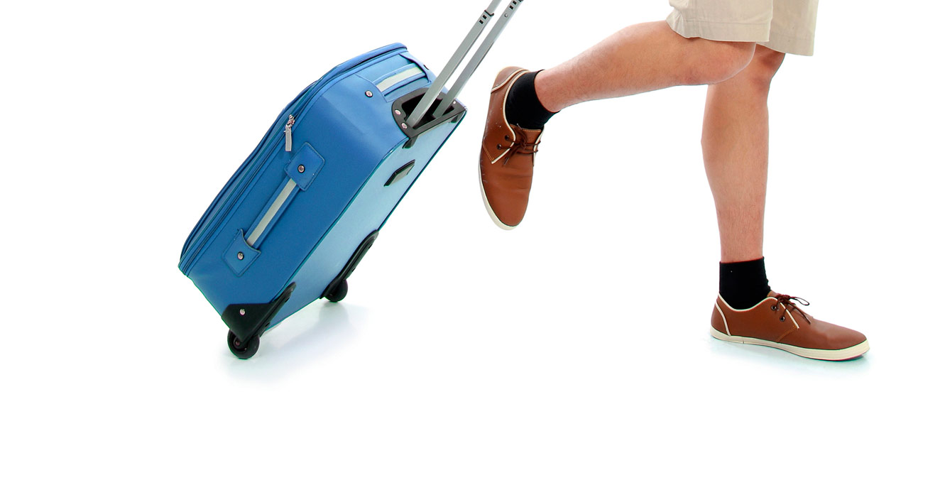
What to Bring
![]() Cash and Visa ATM Card
Cash and Visa ATM Card
Though credit cards have gained a foot-hold with most local hotels, the major stores (Ace Commercial, Ace Hardware, Ace Office Supply, A-One Supermart, Blue Nile, INS and Palm Terrace) and some restaurants, everywhere else cash reigns supreme. Personal checks are rarely accepted. Bank of Guam operates three ATMs in Kolonia that will work (theoretically) with any card inscribed with the Visa logo; two are at the bank branch east of town just past the American Embassy. and the other is at FSMTC HQ. Bank of FSM also has an ATM located right outside of the bank.
![]() Synthetic or Cotton T-shirts
Synthetic or Cotton T-shirts
With daily temperatures ranging between 27 and 32 degrees Celsius (80 and 90 degrees Fahrenheit) and humidity levels upwards of 90%, you’ll want to stick to light clothing on Pohnpei, especially when doing strenuous activities. Cotton is the coolest, but some of the light synthetic materials dry much faster.
![]() Synthetic or Cotton Shorts
Synthetic or Cotton Shorts
Same goes for bottom-wear. Keep it light and loose. Shorts are the best choice for hikes on well-established trails without much surrounding underbrush to tear up your legs.
![]() Synthetic Pants
Synthetic Pants
For any hike not on a high-traffic trail, pants are the best choice for bottom-wear. Bushes, grass, and some very stickery ferns often grow close or partially over a route. If you wear shorts, you’ll be all scratched up in no time. Synthetic materials are best for pants because they stay light when wet, while cotton gets heavy and doesn’t dry in humidity. Make sure they aren’t too tight to give you plenty of room to move and also not so loose that they bag up when wet.
![]()
![]() Swim-wear
Swim-wear
A long history with Puritanical missionaries has made Micronesia a conservative place when it comes to dress — though this is changing slowly (in thanks, partly, to the public pool and Olympic swimming program). Average middle-aged or older residents are still seen swimming fully-clothed. When swimming around Pohnpei’s coastline or in other areas that locals also frequent, dress modestly to avoid offending people. Regular swim shorts or board-shorts are fine for men and women. Women should wear a t-shirt or rash-guard over bikini tops. Bikinis worn openly in public places will attract unwanted attention, but they’re fine at isolated lagoon islands, out on a boat, and on the uninhabited parts of Ahnd and Pakin atolls. Men in Speedo-type swimwear will draw plenty of incredulous stares, though you do see Chinese fishermen swimming in them in public places.
![]() Sunglasses
Sunglasses
The sunglasses sold on-island are the cheap and mostly useless kind. Bring your own to combat those intense UV rays and save your eyes some wear and tear.
![]() High SPF Sunscreen
High SPF Sunscreen
Six degrees north of the equator, the sun is absolutely brutal. It doesn’t matter who you are — everyone burns here, even Pohnpeians. Wearing high-rated sunscreen whenever you’re outside is essential. It should be reapplied often, especially if you’re in and out of the water or sweating heavily. Sunscreen is sold on Pohnpei (try Ace Office Supply or Yoshie Enterprises), but it’s probably cheaper to bring some from home. If your skin is fair, you should be using SPF 50 or higher, reapplying often, and staying covered up as much as possible. Be aware that you can get sunburned just as badly on overcast days as in sunny weather. Wear a shirt when snorkeling.
![]() Hat / Head Protection
Hat / Head Protection
Unless you’re going to be under heavy tree cover all day, bring something solid to keep that noggin from boiling.
![]() Flip-Flops or Thongs
Flip-Flops or Thongs
Flip-flops, thongs, rubber sandals, or as Pohnpeians usually call them — sohri (a loan word from the Japanese zori) — are standard foot-wear on the island. You can bring your own, but they’re also sold at nearly every major store on the island.
![]() Tennis Shoes or Light Hiking Shoes
Tennis Shoes or Light Hiking Shoes
Around town, flip-flops, slippers, or sohri are optimal, but when you’re hiking on Pohnpei, you’ll need something that stays on your feet and holds up to abuse. Tennis shoes or well-ventilated light cloth hiking shoes are a good choice for short hikes on well-maintained trails. They’re absolutely terrible, however, if there’s mud, water, or slippery rocks — which is a good share of the time. Expect your shoes to get really, really dirty.
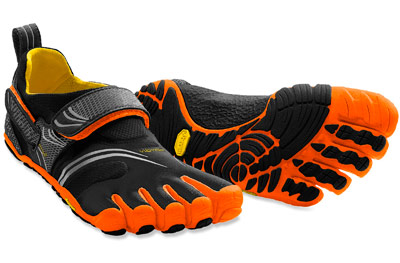
![]() “Five-Finger” Shoes
“Five-Finger” Shoes
After years of hiking on Pohnpei, we’ve concluded that nothing beats FiveFingers. Nothing. Thinner soles allow you to feel the terrain and cling to it better than with tennis shoes or hiking boots. The use of your toes improves balance and makes slips much less frequent on rocks. They stay on your feet in and out of water and mud and work just as well on hard, dry ground. You’re less likely to get blisters than with traditional shoes. There are a million reasons to use them here. A variety of models are available. We recommend the pioneering brand, Vibram. You’ll want to break them in at home before your trip. They take a little getting used to and your feet will have to toughen up a bit.
![]() Dry-Bag or Dry-Backpack
Dry-Bag or Dry-Backpack
Imagine 7.5 meters (25 feet) of water falling over the course of a single year! Pohnpei is an extremely rainy place, and everywhere you go, you should be prepared for the very real possibility that you’re going to get rained on. Luckily, there are many dry-bag and dry-pack models on the market these days that will keep all your important stuff completely dry in torrential down-pours, on boats, and when you’re paddling around. If you plan to do any hiking, boating, or paddling, a roll-top style dry backpack is a must-have. Heavy-duty Ziploc bags work great for small items inside your dry-pack as there are rarely any inside pockets or divisions. If hiking is what you’ll be doing most and you don’t want to invest in a dry-pack, you can use a heavy-duty plastic trash compactor bag as a liner inside your conventional backpack.
![]() Mobile Phone
Mobile Phone
Pohnpei has surprisingly good cellular coverage across the island. You can even use your phones on the top of some mountains and at most of the islands in the lagoon. For the sake of emergency, it’s a good idea to carry a phone with a local SIM card and some credit at all times. CDMA phones don’t work in Micronesia, but pretty much anything that’s unlocked and can take a GSM SIM card will. SIM cards and phone credit can be purchased at the FSM Telecommunications HQ in the middle of town.
![]() First Aid Kit
First Aid Kit
This should be a no-brainer. Accidents happen, and with slippery rocks, rough terrain, pointy tree branches, and razor-sharp coral, for most people it’s just a matter of time. Carry a good kit and know how to use it. It could save your life.
![]() Pocket Knife
Pocket Knife
If you go anywhere with a local guide, he’ll bring at least three things: some betel nut, a bottle of water, and a machete. If you’re hiking without a guide, you’ll want to have your own small knife on-hand, at the very least. Quality stainless steel is a must, as Pohnpei’s very air can cause some metals to corrode.
![]() Water Bottle
Water Bottle
Staying hydrated is key to good health anywhere, but it is especially important in the kinds of climate conditions found on Pohnpei. You should carry water with you everywhere you go (at least 2 liters per person for a full-day hike). We encourage you to GO GREEN and use refillable water bottles rather than contributing to Pohnpei’s formidable trash problem by purchasing disposable bottled water. There is currently no plastic recycling program on the island. If you throw it away, it goes in the landfill — and possibly in the ocean. We recommend Nalgene water bottles. They don’t break or leak and they last practically forever.
![]() Camera
Camera
Pohnpei is a very photogenic place; the natural environment is stunning and the people are warm and colorful. Any camera will do, but consider carefully how you’re going to protect it from moisture, rain, and splashing water. Keep your camera in a Ziploc back or waterproof case with silica gel when you aren’t using it. Be careful of condensation when going from an air-conditioned space to open air.
![]() Compass
Compass
Pohnpei is a small island, so it would seem like it would be hard to get lost, but it’s actually very easy to get disoriented in the forests or on the mountains. A good liquid-filled compass is a must-have companion to your Eco-Adventure Map Guide on any self-led excursion.
![]() Machete
Machete
We don’t recommend that you mess with machetes unless you’re already very comfortable with them. But, if you see this symbol anywhere, it means that the route or trail tends to get over-grown, making a machete a necessity. Furthermore, we’re implying that an excursion of this sort requires a local guide. For locals, the machete is kind of like an extension one’s arm. Machetes are sold at most hardware stores around town.
![]() Technical Climbing Gear
Technical Climbing Gear
If you plan to do any sport-climbing, you’ll need to bring all your own gear, ropes, everything. Absolutely nothing is for sale on-island. REI ships to the FSM, but you’ll have to wait 2-4 weeks for your orders. One option is to ship ahead general delivery and then pick up your box when you arrive.
![]() Binoculars
Binoculars
This is a mandatory item of gear for birders. Pohnpei’s rarest and most sought-after birds are hard to get close to. Binocs will help you tick them off your list. The more water-proof they are, the better. Store them as you would your camera.
Outdoor Sports Gear
Pohnpei has no sporting-goods store (Ace Hardware sells some very basic stuff, but nothing specialized or high quality). If you’re planning on doing any outdoor sports on the island like surfing, kayaking, snorkeling, diving, camping, or biking, you’ll need to bring your own equipment. Pohnpei Surf Club has some surfboards on-hand, but they’re reserved for customers who break all their own during the course of their stay. Visit the respective pages for each of the adventure sports for more information.
![]() Eco-Adventure Map Guide(s)
Eco-Adventure Map Guide(s)
Pick these up when you make land-fall. We think you’ll agree our guides are indispensable. They can obtained at Pohnpei Visitors’ Bureau, the Australian Embassy, hotels, restaurants, the public Library, and many other locations.
Pohnpei Marine Protected Areas (MPA)
Marine Protected Areas (MPA), Sanctuaries, and Forest Reserves
Pohnpei Island currently has thirteen marine protected areas, including three mangrove forest reserves and two stingray sanctuaries. Additionally, Pakin Atoll has five of its own MPAs and all of Ahnd Atoll is a UNESCO Biosphere Reserve.
If you wish to visit a MPA it is best to work with a tour operators as they have the necessary permits that allow entry into these MPAs and biosphere reserves.
Current MPAs
Sapwtik MPA
Sapwtik Marine Protected Area is a 0.83 km2 (0.32 mi2) area encompassing Sapwtik (island), portions of its fringing reef, and sections of the lagoon southwest and northeast of the island.
Dekehos (Mwahnd) MPA
Dekehos Marine Protected Area is a 4.60 km2 (1.78 mi2) area encompassing Mwahnd Passage (Kepidauen Mwahnd) and portions of the barrier reef north of the pass and to the south as far as the fringing reef of Mwahnd Peidak (island).
Dehpehk MPA
Dehpehk Marine Protected Area is a 2.12 km2 (0.82 mi2) area encompassing the eastern and northern coasts of Dehpehk (island) and adjacent fringing reefs.
Nanwap MPA
Nanwap Marine Protected Area is a 3.05 km2 (1.18 mi2) section of the barrier reef and adjacent lagoon areas north of the Madolenihmw Bay passage (Kepidauen Deleur).
Senipehn Mangrove Forest Reserve
Senipehn Mangrove Forest Reserve is a 1.30 km2 (0.5 mi2) area of mangrove forest surrounding Dauen Sapwalap in Madolenihmw.
Namwen Na Stingray Sanctuary
Namwen Na Stingray Sanctuary is a 0.71 km2 (0.27 mi2) area encompassing both shallow reef and deep water areas located north of Na (island) and south of Nahpali (island).
Namwen Nahnningi Stingray Sanctuary
Namwen Nahnningi Stingray Sanctuary is a 0.34 km2 (0.13 mi2) area encompassing four large reef pools and the adjacent reefs northwest of Nahnningi (island).
Nahtik MPA
Nahtik Marine Protected Area is a 0.75 km2 (0.29 mi2) area encompassing Nahtik (island) and all fringing reefs.
Enipein Mangrove Reserve
Enipein Mangrove Reserve is a 9.55 km2 (3.69 mi2) area of mangrove forest located in Enipein, Kitti.
Kehpara MPA
Kehpara Marine Protected Area is a 1.89 km2 (0.73 mi2) area encompassing the three Namwmwour barrier reef islands (including Kehpara) and large sections of the barrier reef both north, south, and east of the islands. This area is completely closed to diving and snorkeling from January 1 to June 30 every year.
Pwudoi Mangrove Sanctuary
Pwudoi Mangrove Sanctuary is a 1.39 km2 (0.52 mi2) area encompassing large sections of mangrove forest in Pwudoi, Kitti, as well as adjacent fringing reefs and portions of the lagoon.

Wahulap MPA
Wahulap Marine Protected Area on Pakin Atoll encompasses Nikahlap Island and all surrounding reefs.
Painpwel MPA
Painpwel Marine Protected Area on Pakin Atoll encompasses Painpwel Island, a number of tiny islands off the north coast where sea turtles nest, and all surrounding reefs.
Palikir MPA
Palikir Marine Protected Area is one of Pohnpei’s largest inner-lagoon sanctuaries. It stretches from the shore of Palikir all the way to Palikir Pass. It is also one of Pohnpei’s most successful MPA’s and in 2020 efforts were made expand the MPA’s borders.
Sapangin MPA
Sapangin Marine Protected Area on Pakin Atoll encompasses Sapangin Island, several tiny islets to the north where sea turtles nest, and all surrounding reefs.
Kehrot MPA
Kehrot Marine Protected Area on Pakin Atoll encompasses Kehrot Island, many tiny islets to the northeast where sea turtles nest, and all surrounding reefs.
Mwahnid MPA
Mwahnid Marine Protected Area on Pakin Atoll encompasses Mwahnid Island and all surrounding reefs.
Ros Island
Ros is another beautiful uninhabited reef island in the south. The long, skinny island seems to be slowly disappearing as it erodes, but there are huge areas of wonderful sand on the west side to lounge about on and a narrow belt of trees. It’s mostly notable as a destination for paddlers, taking a break from exploring mangrove forests nearby, or SCUBA enthusiasts, resting between dives (Kepidauen Ros is one of two locations on Pohnpei famous for manta rays). There is good swimming and snorkeling a few kicks from the island.
- For permission to visit or camp on the island, call +691.320.5896 or the Kitti Municipal Government Office at +691.320.5038, 320.5808, 320.5049, or 320.3257.
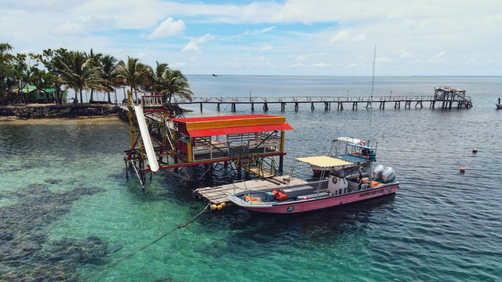
Nahlap Island
")
Nahlap remains one of Pohnpei’s most accessible and popular lagoon getaways, but visitors should be aware of the facilities and island conditions.
Many of the huts have basic amenities, but water access varies. Some huts, including the nahs (traditional meeting houses), currently have limited water systems. Toilets in the nahs are bucket-flush only, and there is no shower water available at those locations. Showers are available at some of the other huts, where water tanks are still functional. The larger green and blue huts appear to be the most maintained, with the blue hut offering the best bathroom facilities (still bucket-flush, but with a larger tank).
The boat service to Nahlap is typical of local lagoon transport — reliable enough but basic, without luxury features and not always the most comfortable ride. Travelers looking for a faster or more comfortable experience might consider working with a tour company or arranging a private charter.
Currently, major reinvestment in the property appears limited. However, Nahlap’s natural beauty still offers plenty for visitors to enjoy. The north end of the island, beyond the small church, feels particularly untouched and peaceful, with dense tropical plant life and mature trees providing shade and a true sense of isolation.
Key Points for Visitors:
• Bring extra drinking water and be prepared for limited freshwater availability.
• Facilities are basic: bucket-flush toilets, limited or no shower water in some huts.
• Boat transport is local-standard; tour companies or private charters may offer alternatives.
• Best suited for travelers seeking a rustic, nature-focused island experience.
Getting there:
Launch at Sekeren Iap in Rohnkitti (~21 km southwest of Kolonia). Continue past the Henry Nanpei Memorial and Rohnkitti Church to the end of the road.
Reservations and Boat Arrangements:
To make reservations or arrange for a boat taxi from Sekeren Iap in Rohnkitti, call +691 925 9797
Or contact the Kitti Municipal Government Office: (+691)320-5038 / 320-5808 / 320-5049 / 320-3257
Kehpara Island
Though not as developed as Black Coral the small thatched huts are adequate for camping trips, the island is equally as shady and much larger than Black Coral, and it actually offers easier access to the excellent snorkeling around Kehpara Pass. It’s cheaper, too. At low tide, there’s a beautiful sandy beach between the two islands. The island has solar lights set up around the island to provide some light at night however we recommend bringing along a lantern and some flashlights to help illuminate inside the huts since they are not rigged with lights.
To make reservations for day visits or overnight stays and arrange for boat pick-up from the launch behind Seinwar Elementary School, call Nickson Abraham (Oaun Kitti) at +691.925.5340 / +691.920.8081 or the Kitti Municipal Government Office at +691.320.5038, 320.5808, 320.5049, or 320.3257.
Footwear
Gear Advice: Footwear for Pohnpei
Zories / Flip-Flops

PROS: They’re ultra-easy to take on and off. Your feet are completely exposed to the air and dry quickly.
CONS: When wet or muddy, your feet slide around from side to side and from front to back. Straps are often too weak to handle rough treatment and frequently break. Zories get sucked right off your feet in swift-moving water, mucky sand, or oozy mud. They have absolutely no traction capabilities. Your feet are completely unprotected.
THE VERDICT: Flip-flops are great when cruising around town or hanging on the boat or beach, and that’s about it.
Tennis Shoes

PROS: They’re light. They breathe better and tend to have more flexible soles than heavier footwear, allowing your feet marginally better traction. The toes, tops, and sides of your feet are better protected from scrapes and bangs than with sandals or FiveFingers.
CONS: Tennis shoes have no ankle support. They inevitably get soaked in Pohnpei’s wet environment, and once wet, your feet stay wet. Furthermore, the shoes aren’t going to dry out between hikes in the humidity — even on sunny days. Though soles are thinner and more flexible than hiking boots or Teva-style sport sandals, the type of sole material and tread varies from shoe to shoe. By and large, tennis shoes don’t have tread that performs well on wet rocks or muddy slopes — the most common type of terrain Pohnpei hikers encounter. Shoes are easily pulled right off your feet in deep mud.
THE VERDICT: Tennis shoes are fine for short, easy hikes on roads or well-established gravely trails.
Cloth Hiking Boots

PROS: They’re only slightly heavier than tennis shoes. Soles and tread tend to be better designed for hiking in rough terrain than tennis shoes or sandals. They provide good ankle support. Your feet and ankles are protected from scrapes and bangs.
CONS: Breath-ability is poor. Your feet get wet and stay wet. The thickness of the soles makes it harder for them to adhere to wet, curved surfaces, such as river rocks. The deeper tread is mostly ineffective in muddy conditions as the grooves simply fill with mud. Just like tennis shoes, in deep mud, they can be pulled right off your feet.
THE VERDICT: Cloth hiking boots aren’t particularly useful on an ultra-wet tropical island. It’s best to leave them at home.
Hard-Shell Hiking Boots

PROS: They provide maximum ankle support and foot and ankle protection.
CONS: They’re unnecessarily heavy and wear you out faster than lighter shoes. The soles are thick and inflexible — highly undesirable when crossing slick rocks in rivers or scrambling up muddy mountainsides. They aren’t breathable at all; even if they’re fully waterproofed, your feet will end up soaked by sweat anyway. They’re absolutely impossible to deal with in deep, oozy mud.
THE VERDICT: Hard-shell boots are a very poor choice for this environment.
Teva-Style Sport Sandals

PROS: The open-air style allows your feet the greatest opportunity to dry out. There are less places for sand and grit to get stuck.
CONS: Your toes, heels, and the sides of your feet are completely unprotected and can be battered by rocks and roots. When wet, feet tend to slide around on the sole. Blisters around the straps are problematic on anything but short hikes. The Velcro fasteners get caught on vines and other things and pulled open. The thick, inflexible soles are nearly as bad as hard-shell boots when it comes to traction. For footwear designed with rivers in mind, they’re remarkably poor at adhering to wet rocks slimed with algae. They tend to become mired in deep mud like what you find in mangrove swamps.
THE VERDICT: Sport sandals work well when paddling, walking around town, or doing short, relatively-flat hikes on roads or well-established trails.
FiveFingers

PROS: The revolutionary design concept centers around research that has shown that balance and traction are significantly improved by having the use of your toes and letting your feet flex and mold themselves to whatever surface they move across. Thin, soft soles allow maximum flexibility and adhere well to wet rocks and other surfaces. “Free” toes can dig into mud for better traction, and because they fit like a second skin, they won’t come off your feet. They’re ultra-light. Thin material or mesh allow your feet plenty of access to air.
CONS: There’s no ankle support and minimal protection from the environment; toes, feet, and ankles can take a brutal beating from rocks and roots. You can’t just jump right into things; you have to break in FiveFingers, take some time to allow your feet to get used to full contact with the terrain, and learn to walk with greater care and precision. They are designed to fit like a glove, and consequently, are very difficult to put on. In sandy conditions, grit gets inside the heels and rubs the skin raw.
[info]OUR RECOMMENDATION: Despite a few disadvantages, FiveFingers out-performed every other type of footwear we tried in a wide range of settings. In our opinion, they are the best choice or hiking and trekking on Pohnpei. FiveFingers are produced by Vibram, which offers an extensive range of models that range from $50 to $150.[/info]