
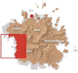
Western Kitti GPS Data
Downloadable GPS Data Files
The following files contain all the packaged GPS data for each of the featured locations in the Western Kitti Eco-Adventure Map Guide.
Three file types are provided. KMZ and KML files are compatible with Google Earth. KML is compatible with Google Maps. GPX files can be imported into ArcGIS (a professional mapping application) and some hand-held GPS devices.
[info]NOTE: All files are free to the public and can be used for any purpose without permission.[/info]
Dolen Uh Hike & Pilen Seleur Eel Pools (2015)
Sahwartik & Sahwarlap Waterfalls Hike (2015)
Six Waterfalls Hike (2015)
Coordinates
The following coordinates correspond with sites featured on the Western Kitti Eco-Adventure Map Guide. It is our dream to eventually create a Pohnpei GPS app that could be uploaded to smartphones and other devices, but for now, these points of interest can be entered manually in a hand-held GPS device as needed.
[info]NOTE: All GPS devices have a margin of error. That margin increases with interference — when there is a thick canopy of trees, during bad weather, or when mountains obstruct the satellite link. The geosynchronous satellites employed when navigating on Pohnpei are located low on the southwestern horizon, such that maintaining a strong connection while hiking on the northeast side of a given mountain range can be difficult. Coordinates on the northeastern slopes of mountains are less accurate than in other locations.[/info]
Coordinates are not yet available for this area. We’re working to get them on-line ASAP. Please check back soon!