
Pwisehn Malek (“Chickenshit”)
")
![]()
![]()
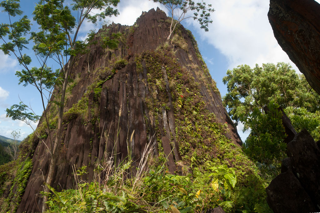
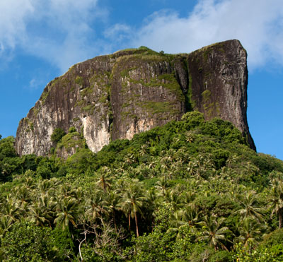
The disputed Sokehs-Kitti border is marked by Pwisehn Malek, a strange hill of columnar basalt rock that resembles a cartoon volcano and looms over the road. According to legend, the formation was created by the droppings of a magical rooster — hence the name, which literally means “chicken shit.” Pwisehn Malek makes a fun little half-day hike with a semi-technical free-climb at the end. The 242 meter trail, which can be followed without a guide, begins in Paies at the edge of the Circle Island Road about 0.6 km (0.37 mi) past the College of Micronesia National Campus. The track is generally easy to discern as it snakes up the steep, grassy hillside without crossing private land. The hill has some scattered trees, but is mostly open to the sky, providing excellent views as one climbs. At the top of the hill, a narrow pinnacle of basalt prisms stabs out of the grass not far from the base of the main rock. If you don’t intend to go further, this is an amazing spot for lunch and photos with a panoramic view of the surrounding landscape, including Temwetemwensekir (mountain), the College of Micronesia campus, and the green, rolling topography of Palikir.
")
The view from the summit is even better, however, so if you’re brave and sure-footed, you might consider the task of scaling it. We can attest that it looks worse than it is. Though the lower pitch seems sheer at first glance, there is actually a series of natural steps created by the vertical basalt prisms, providing excellent hand and footholds. Just take it slow and look around you. Once you get to the top of the first pitch, the remainder is much easier and not so exposed. The summit is rather small and mostly flat. You can see in every direction for miles and miles. We’ve given the climb an informal rating of 5.4X — it is not terribly difficult, but there is no natural protection, and a fall at the wrong place could potentially be fatal. Proceed with extreme caution. It is not advisable to climb on wet days, as the rocks can become slick when wet, or alone, as no one will be there to help you if you hurt yourself. Remember — Pohnpei has fairly basic medical facilities and no rescue service. Use good judgement.
Pwisehn Malek is one of the locations where archaeologists believe stones used in the construction of Nan Madol may have been quarried. How massive basalt prisms were transported from Sokehs all the way around the island to Temwen is anyone’s guess. Bamboo rafts have been proposed, but no one has successfully demonstrated the process with a really large stone. Stones were probably separated from the outcropping using a process of repeated heating and cooling. Fires might have been built at the base of the rock to heat the stones, which were then cooled suddenly with river water, causing them to crack. After that they could be pried off and dragged down the hill.
- Plan for 1 hour for this hike. No fees are charged at this location and the hike can be done without a guide.
Sport-Climbing on Sokehs Island
![]()
![]()
![]()
![]()
")
The Spire
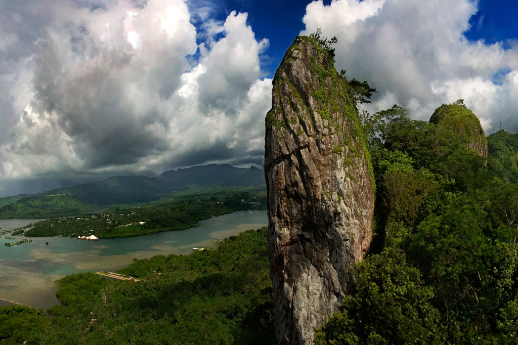
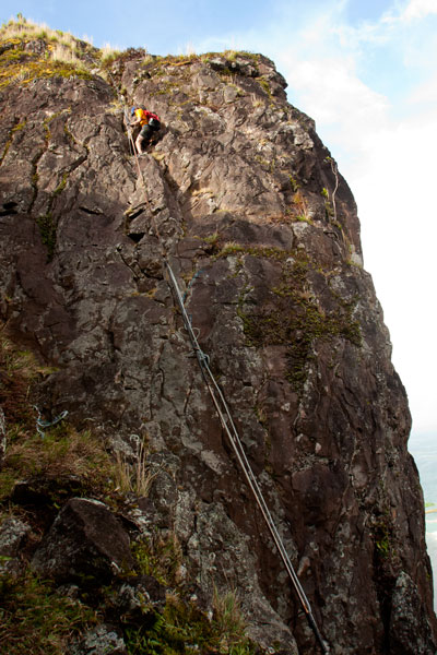
“The Spire” is exactly what it sounds like — a dagger-like basalt pinnacle rising 50 meters (165 ft) above the top of Sokehs Ridge immediately south of Paipalap. Named in 2005 by Daniel Moor, who scaled the rear of the rock and established a single top-rope bolt, “The Spire” is the kind of crag that just begs to be climbed. It was not climbed again, however, until 2011, when local climbers Matthew Mann and Jonathan White began to explore different route possibilities in earnest. Over the course of more than a year, they bolted four single-pitch sport-climbing ascents on the eastern face. Since that time, “The Spire” has been climbed fairly regularly by members of a small community of climbers living and working on Pohnpei. The emergence of the sport on the island even drew the attention of the local newspaper — well-deserved attention, considering the thought and care Mann and White put into creating these world-class routes. “The Spire” is reached by taking the Sokehs Rock Trail up from the paved road in Danipei (0.38 km, 15-30 minutes) and turning south at the top of the slope.
Rock Consistency & Hardware
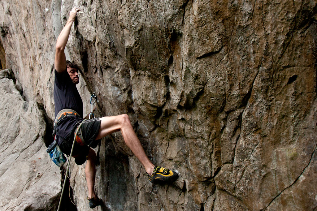
The rock itself has a nice texture to it with plenty of friction, but not so much that it tears up the hands. It tends to be solid, not crumbly, and there are lots of sweet little pockets that formed when air bubbles were trapped in the cooling basalt.
")
Routes
All routes on “The Spire” are well protected with marine-grade bolts and dual double-ring top anchors for top-rope or rappel. Top access is possible via a short route of grade 5.7 which has been bolted on the rear of the rock to provide the means for hauling gear for route-setting and rappel.
| Route | Rating | Length | Hardware in Place | Safety Rating |
| Iron Lungs | 5.12a | 32 m 105 ft |
16 bolts + 2 double-ring top anchors |
G |
| High & Dry | 5.11d | 36.6 m 120 ft |
16 bolts + 2 double-ring top anchors |
G |
| Myxo | 5.12b | 33.5 m 110 ft |
15 bolts + 2 double-ring top anchors |
G |
| No Surprises | 5.11b | 30.5 m 100 ft |
14 bolts + 2 double-ring top anchors |
G |
The Adam’s Apple
Mann and White also discovered a wall about 60 meters south of “The Spire” near Takaien Rikapehd. They named it “The Adam’s Apple“. There are plans to eventually bolt five routes here. As of October 2013, two have been completed. “The Adam’s Apple” routes are short but extreme, as the wall is slightly overhung. This is not a place for beginners.
Routes
| Route | Rating | Length | Hardware in Place | Safety Rating |
| Spies | 5.12b | 15.2 m 50 ft |
5 bolts + 2 double-ring top anchors |
G |
| Genesis | 5.11c | 18.3 m 60 ft |
6 bolts + 2 double-ring top anchors |
G |
")
Why These Climbs Are Awesome
- EASY ACCESS. A 10 minute drive from Kolonia Town + a 20 minute hike from the road = ready to climb.
- NO FEES. Though the Sokehs Rock Trail (which leads to all the sites) begins next to a private residence, the landowners charge nothing for access. Just ask permission, if you see anyone at the house.
- PUBLIC ROUTES. The climbing sites are all on public property and no permission is needed to be there.
- SHELTERED FROM WIND & RAIN. The eastern faces of the rocks, where all the routes lie, are saved from the prevailing winds by the bulk of the ridge and stay mostly dry even after heavy rain.
- SHADE. The routes are in direct sun only early in the morning, so you can sleep in or have a nice, leisurely breakfast before heading up.
- A LITTLE OF EVERYTHING. The rock consists of weathered basalt with all sorts of interesting pockets, jugs, pinches, slopers, cracks, and edges.
- THEY’RE WORLD-CLASS. Route-finders Matthew Mann and Jonathan White were adamant that all routes be of exceptional quality and highly challenging. There are no throw-away climbs. Everything here will test your limits.
- Visit www.pohnpei-adventure.com/rockclimbing for more about climbing on Pohnpei.
Sokehs Rock
![]()
![]()
![]()
![]()
![]()
![]()
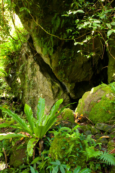
Paipalap, or Sokehs Rock, is without question the most striking feature of Pohnpei’s topography. Over 100 vertical meters (328 ft) of exposed basalt form the upper portion of a gigantic volcanic plug that juts from the north end of Sokehs Mountain and looms over Pohnpei’s harbor and only town, Kolonia. An unmarked trail leading to the Rock, “The Spire”, and “The Adam’s Apple” begins south of a brown house 1.2 km (0.74 mi) beyond Mwalok A-1 Store and just before the Danipei Church (ask permission before hiking). The steep path is well-defined with steep cement steps near the bottom and then a level segment with two
large basalt outcroppings and some cave-like formations. Three quarters of the way along, it begins to follow an electrical conduit running to the beacon on the summit (202 m / 663 ft).
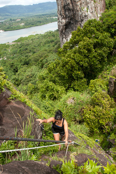
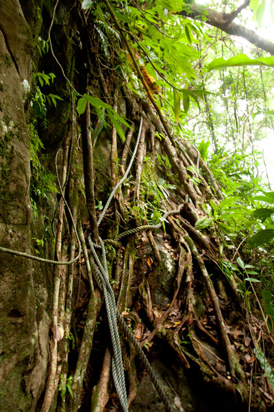
Though not a technical climb, the ascent of the Rock itself is sketchy (triple-pitch, 5.6 R unassisted) and should only be attempted on clear, dry days, as the rocks are treacherous when wet. Pitch 1 begins at the
“Tree Cliff” and skirts a 70° face with the assistance of tree roots, fixed ropes (these you can trust), and the electrical conduit. This section is often underestimated and may, in fact, be the most dangerous part of the endeavor. Several people have been injured in falls at this spot. Pitch 2 starts at the rear foot of the main rock and involves a steep climb with some assistance from the conduit. The crux is a 2-meter section where the conduit has corroded and is no help at all. Climbers must rely on natural holds and a narrow crevice. Ropes also hang along the conduit, but do not trust your weight to any of them as they are in various states of deterioration. Pitch 3 is easier, though no less exposed. Most people straddle the conduit and haul themselves up.
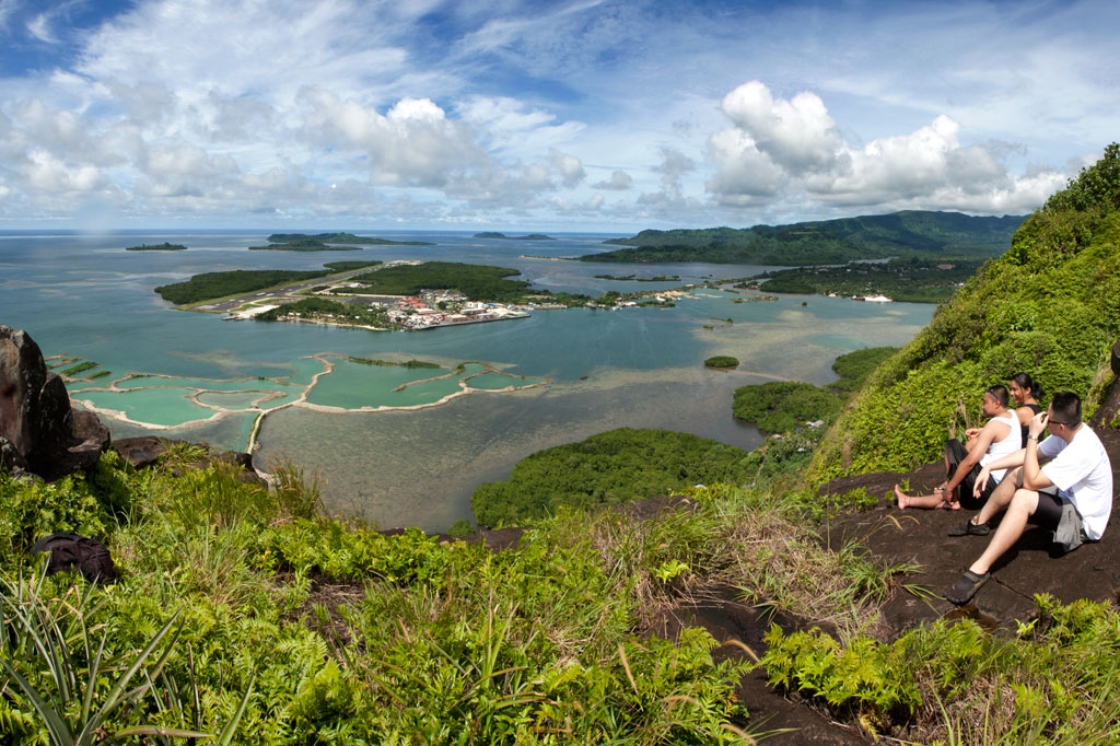
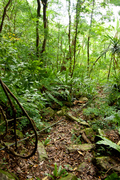
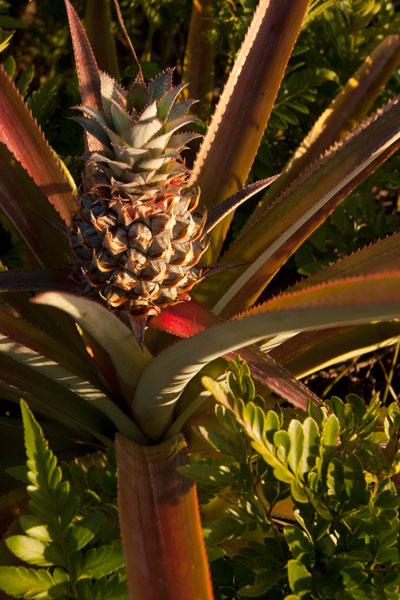
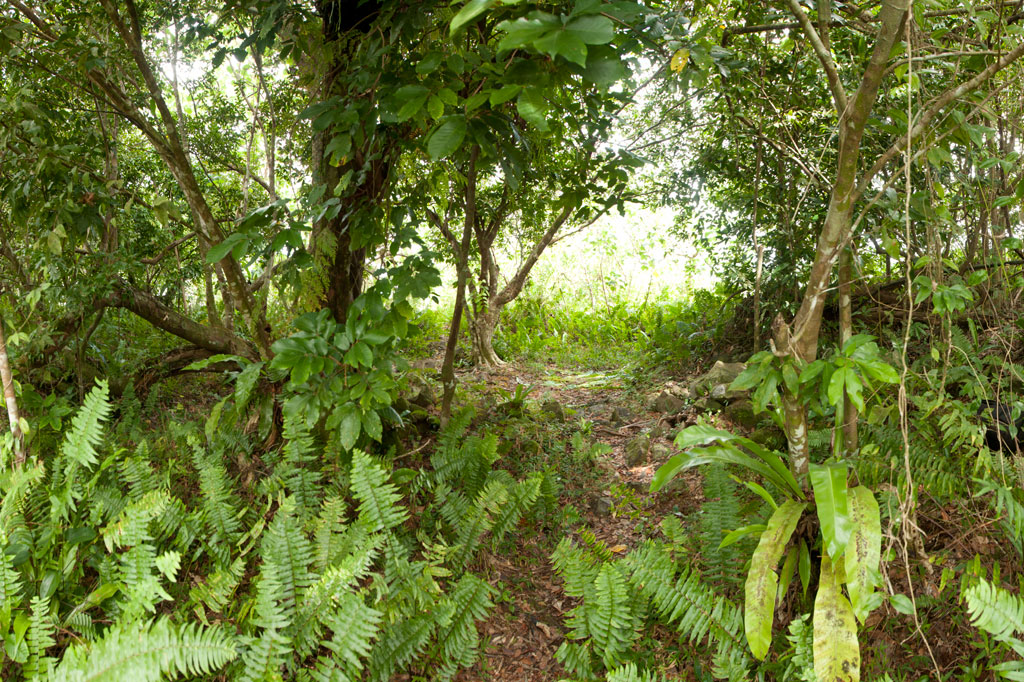
Once on level ground, you can pick out the path that winds through scattered patches of wild pineapples, ferns, and a grove of trees that makes an ideal
campsite before ending at the main cliff on the northern end of the Rock. Spectacular views of the lagoon, reef passes, tuna fleets, and northern islands are found at several spots along the cliff face. On clear days, Pakin Atoll is visible to the west, and you may get a glimpse of Pohnpei’s shy — and perhaps threatened — short-eared owl (Asio flammeus).
The Creation of Sokehs Rock
An ancient Pohnpeian legend states that long ago a man traveling near what is now Sokehs Island was overwhelmed by the force of a geyser-like spring which burst up and swept him all the way to a distant island. There he acquired the help of a powerful magician, who conjured a huge stone and plugged up the spring. Ever after, the rock was known as Paipalap, “the great paip (boulder).” In another version of the story, a Yapese sorcerer named Sou Iap was disturbed by the sound of rushing water and voyaged to Pohnpei to investigate. Upon discovering a great fountain on Sokehs Island, Sou Iap blocked the opening with piles of sea sponges.
Trad Climbing on the Face
The north face of Sokehs Rock has considerable trad climbing potential, though it has yet to be fully explored (several climbers have rappelled down and raved about what they saw there). It is, however, quite extreme and under-cut in places. Note that a top-rope would need to be no less than 200 meters (666 ft) in length. Pioneers are welcome!