
Sokehs Island Paddling
![]()
![]()
![]()
![]()
![]()
Daumwoakote

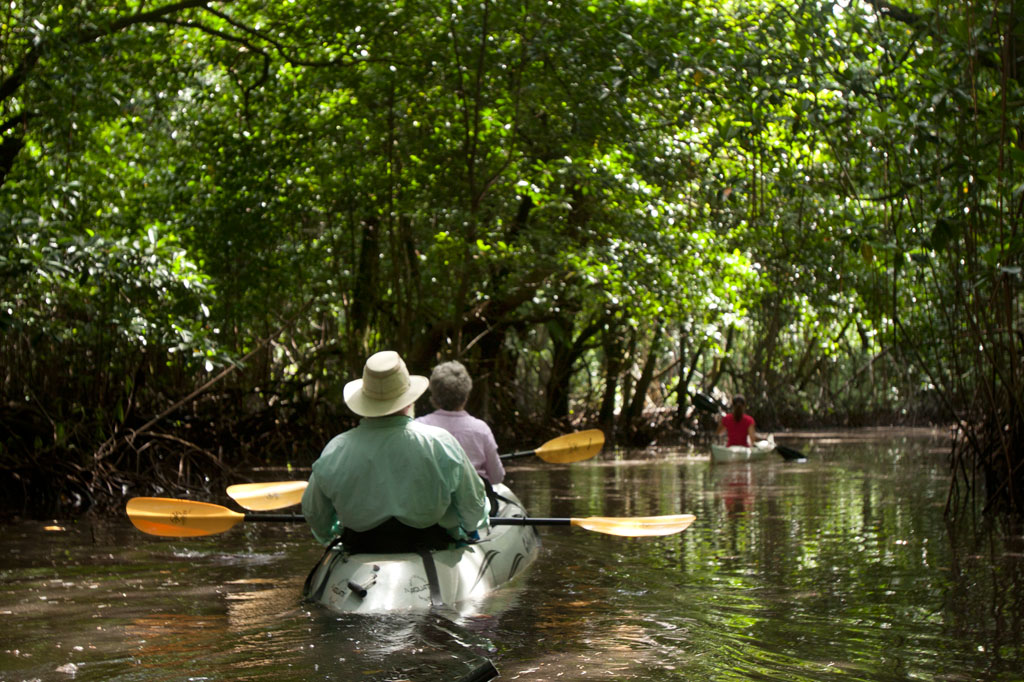
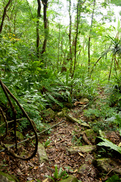
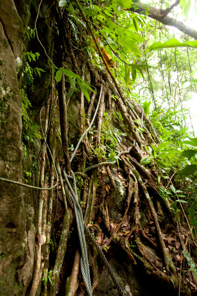
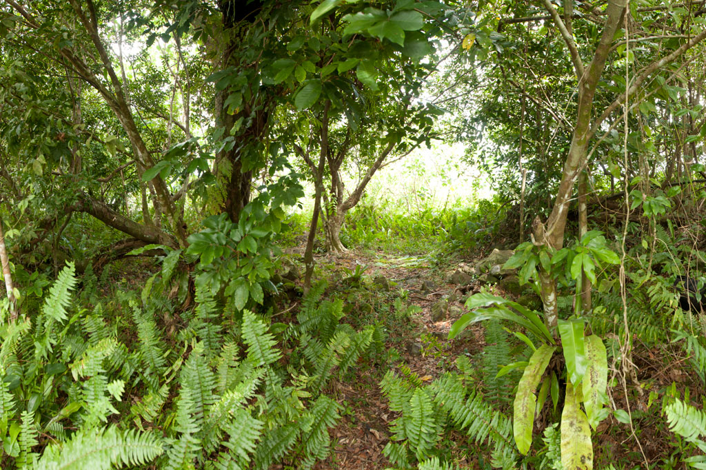
Daumwoakote, the magical 2 km (1.24 mi) mangrove passage running between Sokehs Island and Pohnpei Island, is an absolute must-see for anyone with a heart for adventure and an eye for beauty. If you launch opposite St. Peter’s Church, you can catch the tide and cruise west through the tunnel-like avenue of trees to the accompaniment of a chorus of birds. Early in the morning and late in the afternoon there are so many winged creatures around that the place feels like an aviary. The trees are also bewildering–great twisted wonders with looping prop roots and spiking pneumatophores. The mangroves propagate both by dropping dart-like propagules into the silty mud and by sending down hundreds of dangling extensions that add to the primordial atmosphere. Several species are found in the area. About two-thirds of the way through, you have the option of continuing in the main channel or deviating to one of two smaller passages just wide enough for a kayak or canoe.
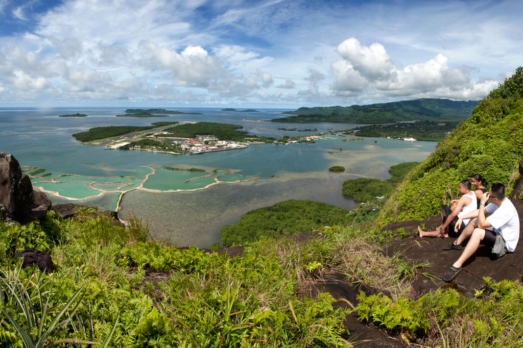
Sokehs Island Circumnavigation
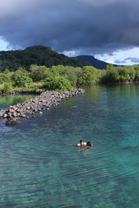
From the west end of Daumwoakote, roughly 10 km (6.2 mi) remain to completely encircle the island. Along the way, you’ll cross emerald reef pools in the bay, skirt dense mangrove forests, and get fantastic views of the green cliffs of Pohndollap. The “Doldrums” at APSCO makes a perfect spot for a rest, a rejuvenating swim, and a snack.
The Labyrinth
")
The “Labyrinth”, located southwest of Daumwoakote at the mouth of the Nankewi River, is composed of hundreds of small mangrove islets growing in a dense cluster. There is no particular route–just paddle in and let yourself wander through the myriad passageways and shallow pools, inhabited by crabs, the occasional black-tip reef shark or hunting snapper, communities of juvenile fish, and a variety of seabirds and shorebirds. The water depth ranges from a half meter to 1.5 meters.
Note that the area between the Sokehs Island Bridge and Daumwoakote is very shallow at low tide, and at high tide, you may find that branches over the water don’t give you much room to move. Most of the routes on this guide, however, should be passable during all but the most freakish of tidal fluctuations.
Paddling Distances Around Sokehs Island
| Starting | Ending | Distance (km) | Distance (mi) | |
| Sokehs Island Bridge* | —- | Daumwoakote West End | 1.97 km | 1.22 mi |
| Daumwoakote West End | —- | The “Doldrums” | 4.41 km | 2.57 mi |
| The “Doldrums” | —- | Danipei Portage Point | 2.49 km | 1.55 mi |
| Danipei Portage Point | —- | Sokehs Island Bridge | 2.91 km | 1.81 mi |
*Silted-in estuary. This segment may be difficult to traverse at low tide.
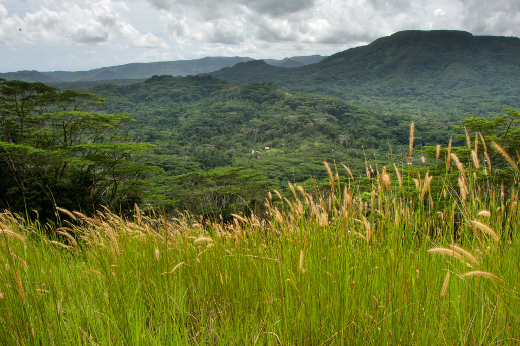
Dolen Palikir
Dolen Palikir (“hill of Palikir“) is a long hill in the middle of Palikir that runs northeast-southwest and has knolls at each end. The southern summit is slightly higher than the other at 250 meters. The Japanese capitalized on Dolen Palikir’s geography as they did with most of the high points on Pohnpei. Trench systems cross the path or run alongside it in several places and there are many small rifle pits. The trail begins at the Hadley residence west of the road leading to Iohl and climbs gently through high, waving grass before entering the trees. There it steepens as it meanders through sakau (kava) plantations (the tallest plants are just below the first summit). Near the summit benchmark is a prehistoric pehi (stone platform) linked to a story about Lepen Palikir — the highest chief in the region, but there’s no clear view of the valley here. The hike to the southern point follows the mostly flat ridge, passing many earthen defensive works, but none with cement or stonework. Near the middle of the ridge, the trees open up and provide a view of the panorama below. The most extensive Japanese structure is at the hill’s highest point and consists of three recessed gun sites with stone retaining walls around them and a trench leading down-slope.
- Plan for 2-4 hours for this hike. Ask at the house for guides Rihlent Hadley or Denster Louis. Offer $20.00.
Temwetemwensekir Peak
Southeast of Palikir, Pohnpei’s primary mountain system makes an almost 90° turn to the south at Temwetemwensekir (594 m), a prominent peak that dominates the topography and feeds six major rivers. The all-day slog to the top begins up an unpaved road opposite the College of Micronesia national campus. Though the route isn’t always clear and the challenge of the climb is increased by rough terrain and a few steep pitches, once one reaches the palm forests on the ridge, it’s smooth sailing. Hikers are afforded some beautiful views of Nanpohnmal, Palikir, and peaks to the south of the summit area. Japanese trenches and an observation post can also be found at the northeastern corner of the plateau.
- Plan for 8 hours for this hike.
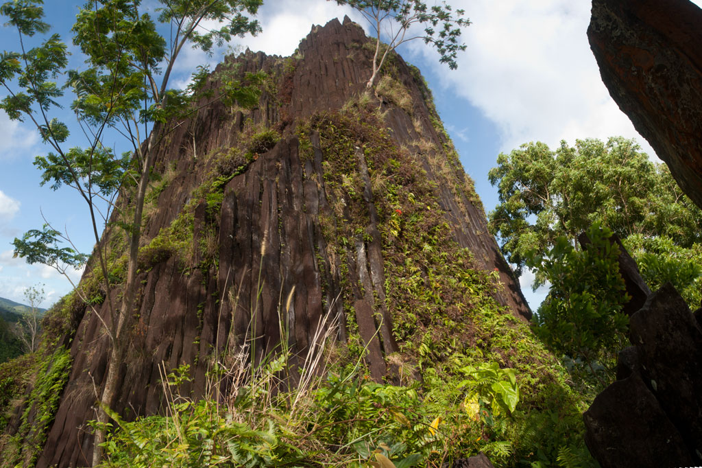
Pwisehn Malek (“Chickenshit”)
")
![]()
![]()
The disputed Sokehs-Kitti border is marked by Pwisehn Malek, a strange hill of columnar basalt rock that resembles a cartoon volcano and looms over the road. According to legend, the formation was created by the droppings of a magical rooster — hence the name, which literally means “chicken shit.” Pwisehn Malek makes a fun little half-day hike with a semi-technical free-climb at the end. The 242 meter trail, which can be followed without a guide, begins in Paies at the edge of the Circle Island Road about 0.6 km (0.37 mi) past the College of Micronesia National Campus. The track is generally easy to discern as it snakes up the steep, grassy hillside without crossing private land. The hill has some scattered trees, but is mostly open to the sky, providing excellent views as one climbs. At the top of the hill, a narrow pinnacle of basalt prisms stabs out of the grass not far from the base of the main rock. If you don’t intend to go further, this is an amazing spot for lunch and photos with a panoramic view of the surrounding landscape, including Temwetemwensekir (mountain), the College of Micronesia campus, and the green, rolling topography of Palikir.
")
The view from the summit is even better, however, so if you’re brave and sure-footed, you might consider the task of scaling it. We can attest that it looks worse than it is. Though the lower pitch seems sheer at first glance, there is actually a series of natural steps created by the vertical basalt prisms, providing excellent hand and footholds. Just take it slow and look around you. Once you get to the top of the first pitch, the remainder is much easier and not so exposed. The summit is rather small and mostly flat. You can see in every direction for miles and miles. We’ve given the climb an informal rating of 5.4X — it is not terribly difficult, but there is no natural protection, and a fall at the wrong place could potentially be fatal. Proceed with extreme caution. It is not advisable to climb on wet days, as the rocks can become slick when wet, or alone, as no one will be there to help you if you hurt yourself. Remember — Pohnpei has fairly basic medical facilities and no rescue service. Use good judgement.
Pwisehn Malek is one of the locations where archaeologists believe stones used in the construction of Nan Madol may have been quarried. How massive basalt prisms were transported from Sokehs all the way around the island to Temwen is anyone’s guess. Bamboo rafts have been proposed, but no one has successfully demonstrated the process with a really large stone. Stones were probably separated from the outcropping using a process of repeated heating and cooling. Fires might have been built at the base of the rock to heat the stones, which were then cooled suddenly with river water, causing them to crack. After that they could be pried off and dragged down the hill.
- Plan for 1 hour for this hike. No fees are charged at this location and the hike can be done without a guide.
Sokehs Japanese Sites & Parpwu Waterfall
Historical Sites in Mainland Sokehs
![]()
![]()
![]()
![]()
![]()
![]()
![]()
“Military Road” Hike / Bike Tour
One of the most rewarding routes for Japanese World War II-era historical sites follows a road 0.46 km (0.29 mi) northeast of the turn-off to the FSM capital. This track was built by the Japanese in the 1930s to access the many military sites in the area and remains unpaved. Whether it is public or private, however, seems to be a matter of some debate. FSM Telecom, which maintains a mobile phone tower near “Radar Station Hill” and uses the road often, says that the road and the areas immediately alongside it belong to the municipality and that people living beyond the Thomas residence are squatters without legal land claims. Even so, a family living on the south side of the road about 1 km (0.62 mi) from the Circle Island Road insists that everything beyond their house is private. There are two ways for visitors to deal with this issue: either (1) hire a knowledgeable local guide to escort you on your hike (you’ll likely find more with them anyway) or (2) visit the house in question and ask permission yourself. During our fieldwork, we used both options successfully. The road, though unpaved, is in pretty good condition, and as it doesn’t climb much, it’s a great choice for either hiking or biking. You can park your vehicle at the beginning near the Circle Island Road and go from there.
")
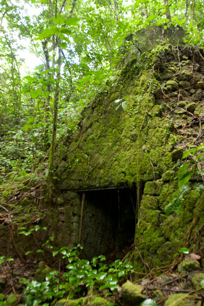
“Bunker Hill”
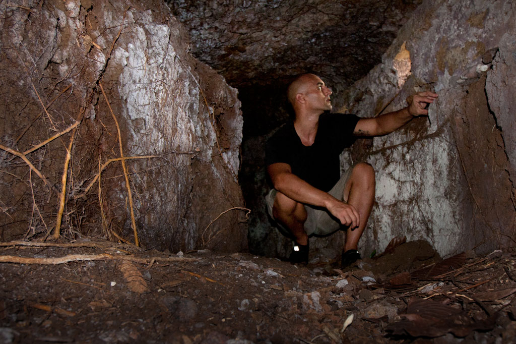
About 100 m (109 yd) from the starting point, you can cut off the road to the right and climb up the grassy hill, making your way toward the landowner’s house about 200 m (219 yd) to the northeast. This is the place to ask for permission to explore in detail. There are several points of interest worth looking into. At the southwest and northeast ends of the hill, there are bunker-like observation stations that consist of curved tunnels with domed concrete roofs and several gun ports. The southern bunker site is well-hidden with the entrance near the base of a large tree that has grown up in recent years. Entering is a dirty job, but once you’re inside, the structure becomes quite roomy. The gun ports allow light inside. The northern site is close to a large cassava plantation and is kept cleared. You can enter easily from either end. These structures were likely manned by a few riflemen and intended to protect the roads on both sides of the hill. In view of the landowner’s house you can also find a zigzag trench and two gun sites, one of which was probably a medium-sized anti-aircraft gun. No guns remain now. Some people believe a gun at this location shot down the American bomber “Love Bug”. Others say it was one on Dolen Pahniepw.
Paul Thomas’s Hill
Another 277 m (303 yd) further down the road, one comes to the residence of a friendly West Virginian native, Paul Thomas, and his local wife. Thomas enjoys a good chat, and if you ask politely, will happily point you in the direction of several interesting sites on the hill above his house. Easily found are two pairs of bunkers similar to those mentioned already, and between these, three small gun sites and several foxholes. Thomas keeps the hill trimmed and neat; all but one of the sites (the first set of bunkers) lie along the crest of the hill over a distance of about 125 m (137 yd). The hill commands sweeping views of the Palikir valley to the west.
- If you want to make arrangements ahead of time, call Paul Thomas at +691.320.4562.
")
Dolen Pahniepw
The next stop is Dolen Pahniepw. An overgrown trail begins off the right side of the road 0.56 km (0.35 mi) past Thomas’s driveway and runs 0.43 km (0.27 mi) to the summit of the hill. About 300 m (328 yd) along the trail, one comes to the ruins of an army barracks, which consists of concrete house posts,
foundations, and a bombed-out cistern. Sets of concrete steps led to the entrances of the wooden buildings. Some scrounging in the jungle around the site should yield some old Japanese beer bottles. At the end of the trail is a large anti-aircraft gun site, which probably housed a medium-sized gun similar to those on Lenger Island. On the northeast side of the hill, you may be able to locate the foundation of a radio tower, some tunnels, and the chassis of a truck.
At the southern end of the hill near the road, you can scramble up the bank and find a pair of unfinished small gun emplacements, some trenches in the woods, and a defused bomb.
“Radar Station Hill”
The road ends near the FSM Telecom cellular phone tower at the summit of a hill. A footpath continues west to a cement platform for a Japanese radar array, two foxholes, and two circular gun sites. A large bomb crater south of the road makes an excellent tent site for campers with unobstructed views of the whole of mainland Sokehs. Back east down the road, an L-shaped cutting leads to a path and eventually to the site of a generator station with a concrete storage alcove built into the embankment and a rusting motor.
- Plan for a half day to full day for this hike/ride, depending on how many sites you want to explore.
- No guide is necessary for the Military Road sites as long as you ask permission wherever private land is an issue. However, you are likely to discover much more of interest with a guide who knows the sites. Please visit the Local Guides & Tour Operators page for a list of experienced guides available for hikes around Sokehs, if desired. Offer $25-50 for a group of five or less.
PBJ-H1 “Love Bug” Bomber Ruins
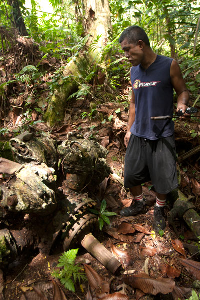
Throughout 1944 and early 1945, the U.S. carried out a brutal bombing campaign of Japanese fortifications on Pohnpei. The only bomber ever shot down was a PBJ-1H (the U.S. Marines version of the Airforce B-25H) nicknamed “Love Bug” and piloted by First Lieutenant William J. Love. On February 6, 1945, while on a mission to destroy targets at the nearby Palikir airfield, the Love Bug was picked out of the sky by an anti-aircraft gun on one of the nearby hills (possibly “Bunker Hill”, Paul Thomas’s hill, or Dolen Pahniepw). The plane burst into flames upon impact, killing the entire crew. After the crash, Japanese soldiers collected the bodies and buried them in a marked grave near the crash site. A monument to the crew used to be found at the burial site, but it was taken apart by looters in the 1980s.
The crew was disinterred and reburied several times during the American Period before coming to rest at Jefferson Barracks National Cemetery in the U.S. — all except Sgt. David Snider, whose whereabouts were unknown until 1948. The wreckage was not positively identified until 2001, when two aviation archaeologists surveyed the area. The tail section and rudder were still visible in the forest in the 1980s, but the site has been heavily looted since and only a few large pieces remain — the port engine (sans prop), landing gear and wheel, and a portion of a stabilizer. Bits of wreckage are strewn across an area of some 7,000 square meters. Three defused bombs are also said to be in the vicinity, but we were unable to locate them during our visits.
It’s easiest to visit the site from the unpaved water tank road behind the FSM presidential housing facility. No guide is necessary, but you’ll have to ask the officer at the security check-point to let you through. The wreck is found on the forested slope a few meters off the north edge of the road before the water tank.
- Plan for 1 hour for this hike. No guide is necessary, but you will need to ask the security guard on the road to let you through.
Nankewi River Vicinity
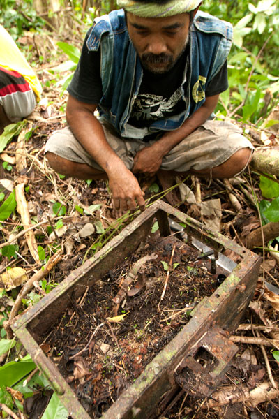
Ethanol Manufacturing Site
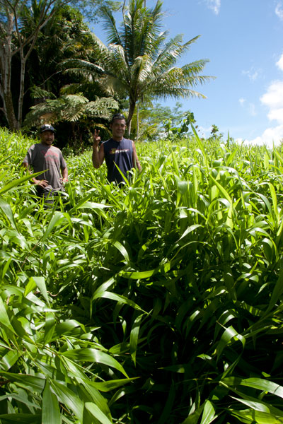
On the banks of Pillapen Nankewi (Nankewi River) the remnants of Japanese industry can still be seen. Neat stone retaining walls frame the river and trenches and pipes form a grid on the north bank. On the south bank are three large fermentation tanks, a variety of other distilling gear, brick ovens built into the hillside, a huge press, a crank, and other rusting machinery. The equipment was likely used to distill ethanol from sugar cane for fuel and other industrial purposes. A great deal of Japanese beer and liquor bottles litter the spot.
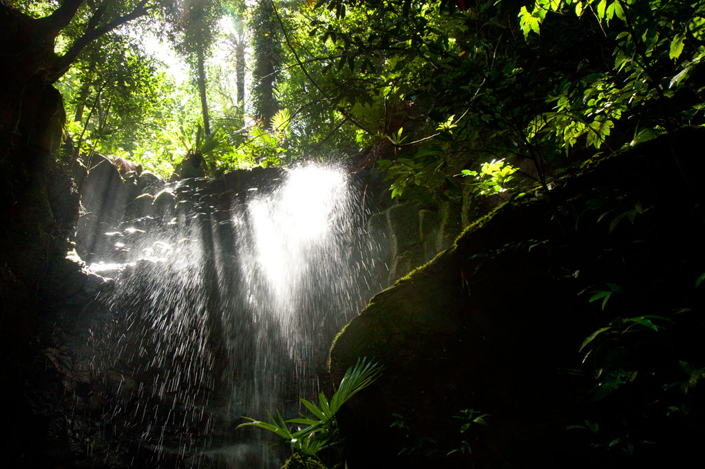
Parpwu Waterfall
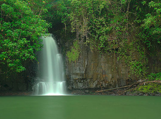
The rather flat terrain in greater Sokehs doesn’t make for a lot of waterfalls, but Parpwu (a.k.a. “Nan Lohlo” or “Nankewi”) — located on the Nankewi River just behind the now deserted Sokehs Shopping Center — is unusual because it’s so close to the coast, almost in the mangroves. In fact, during very high tides, you can kayak all the way from Sokehs Bay to the falls. The waterfall is a beautiful sight, but unfortunately, upstream piggeries have polluted the watercourse and swimming is ill-advised (even though you’ll see local kids from the area doing just that). Photo courtesy of Bill Jaynes.
- Plan for 1 hour for this hike. Its easy to find someone to guide you down to the falls and/or distillery site. Just ask in the area. Offer $6.00.
The Doldrums at APSCO Quarry
![]()
![]()
![]()
![]()
![]()
“The Doldrums”
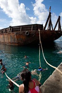
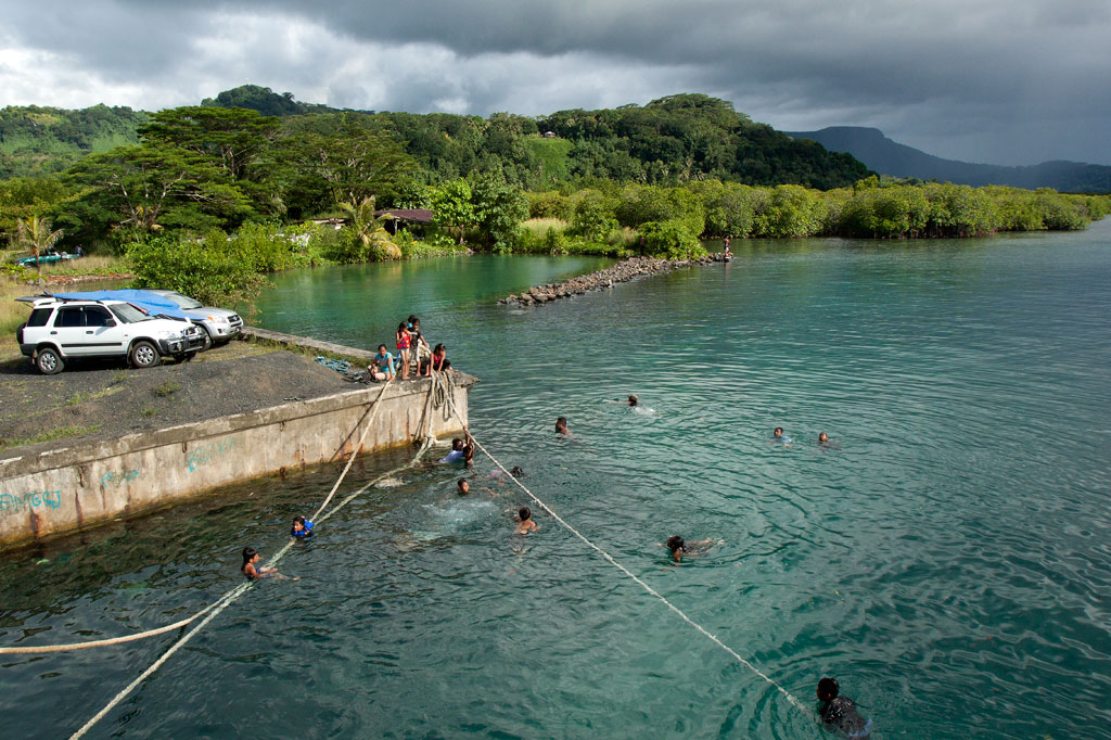
The hottest days call for the coolest swimming holes, and there’s no better place than the “Doldrums” at APSCO Gravel Quarry, owned by the Akinaga family. The quarry property encompasses all of the land around Dolehtik, a small hill at the northern end of Sokehs Island. Across the street is a high cliff where prismatic basalt columns are stripped off the mountain with heavy equipment and later crushed into various grades of gravel. This same site may also have been one of the quarry locations for the stones of Nan Madol.
A large concrete dock 0.46 km (0.29 mi) northwest of the quarry entrance provides access to a beautiful swath of the lagoon. With no residences or pig pens inside this rather large area, the surrounding water is pristine with a visibility of more than 25 meters (80 ft). The spot got its nickname from a giant barge that, until the summer of 2013, was moored just off-shore and functioned as a jungle gym of sorts for local kids and foreigners alike. The barge is no longer there, but the main attraction is still the water itself, which is deep and gets deeper quick. The “Doldrums” is a great picnic destination and an idyllic place to stop in the middle of a paddling excursion around the island. Please keep this location beautiful by taking all of your trash with you when you leave for the day.
The main gate to the quarry is usually open, but visitors must report to the on-site office and ask the security guard to unlock the second gate, leading to the water. The facility is locked down for the night at 6:00 PM every evening. Make sure you’re out in time.
Snorkeling
Though coral development in the area is scarce, there are quite a few reef fish around. If you swim along the coast to the south, you might find some colorful starfish and an urchin or two.
Paddling
Kayaks can be easily launched on either side of the dock where the ground slopes gradually to the water.
Kepindau & Pohn Pillap Waterfalls
![]()
![]()
![]()
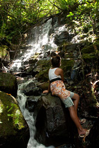
Kepindau Waterfall
The larger of two small waterfalls found on Sokehs Island (the only waterfalls not on the main island of Pohnpei) is known as Kepindau and is located in Tamwarohi Kousapw on the private land of Joe Ferdinand and Dahkar Soulik. The stream and the area around it are also called by the same name, which means “bottom of the mangrove passage”. Kepindau and Pohn Pillap, the next stream to the west, were said to have been created when a giant eel wriggled up the hillside. Freshwater short-fin eels are sacred to Pohnpeians and play a recurring role in local myths; this particular story is just one entry in a greater eel-centric epic. Eels do indeed dwell in Kepindau and are protected and fed by the Ferdinand family. There’s a small pool just below the family’s cookhouse, where the eels can be observed. Bring some canned mackerel and the family will feed the beasts for your entertainment.
The hike follows footpaths that the family members use to get around on their land, climbing more or less straight up the slope on the west side of the stream. The waterfall is in a little rocky alcove that gets some very dramatic light in the morning hours. There is a shallow pool, but the amount of water varies. The best time to visit is a day or so after a period of heavy rain.
Pohn Pillap Waterfall
The second falls, Pohn Pillap, is found just over the border of Ipwal Kousapw on the land of Tony Martin and family. The name means “over the river.” Pohn Pillap is not as visually dramatic as Kepindau, but has a certain ambiance when there’s a lot of water (though there’s no pool here). Martin, who used to work for the Office of Historic Preservation, is extremely knowledgeable about just about everything Pohnpeian and can provide you with many fascinating tidbits about this site and others on Sokehs Island and beyond. He can also arrange for one of his older children to take you up to the falls if he doesn’t feel like guiding you himself. Offer $6-10.00 per group of five people or less.
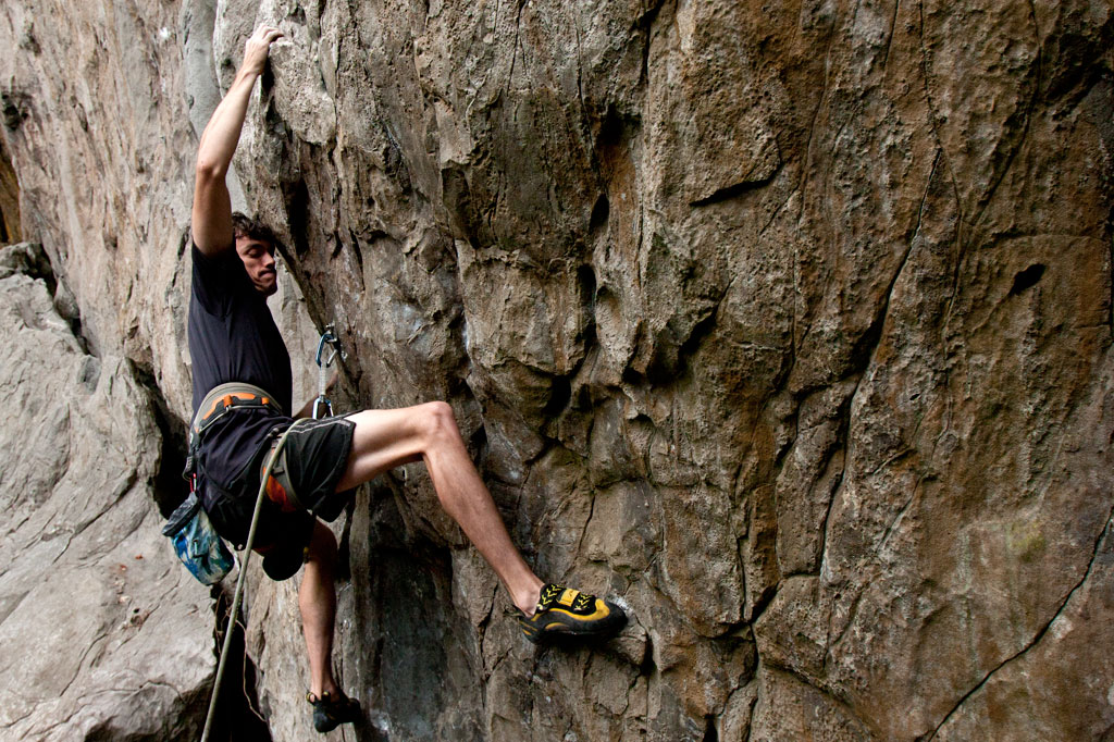
Sport-Climbing on Sokehs Island
![]()
![]()
![]()
![]()
")
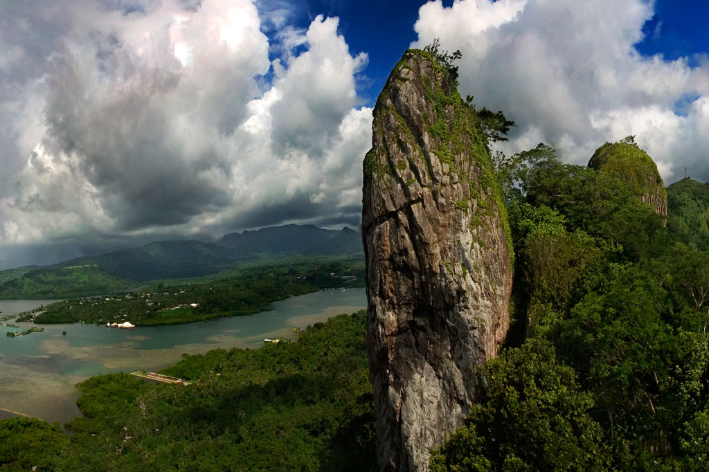
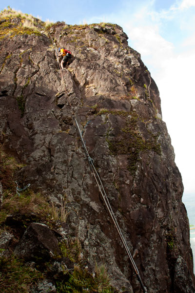
The Spire
“The Spire” is exactly what it sounds like — a dagger-like basalt pinnacle rising 50 meters (165 ft) above the top of Sokehs Ridge immediately south of Paipalap. Named in 2005 by Daniel Moor, who scaled the rear of the rock and established a single top-rope bolt, “The Spire” is the kind of crag that just begs to be climbed. It was not climbed again, however, until 2011, when local climbers Matthew Mann and Jonathan White began to explore different route possibilities in earnest. Over the course of more than a year, they bolted four single-pitch sport-climbing ascents on the eastern face. Since that time, “The Spire” has been climbed fairly regularly by members of a small community of climbers living and working on Pohnpei. The emergence of the sport on the island even drew the attention of the local newspaper — well-deserved attention, considering the thought and care Mann and White put into creating these world-class routes. “The Spire” is reached by taking the Sokehs Rock Trail up from the paved road in Danipei (0.38 km, 15-30 minutes) and turning south at the top of the slope.
Rock Consistency & Hardware
The rock itself has a nice texture to it with plenty of friction, but not so much that it tears up the hands. It tends to be solid, not crumbly, and there are lots of sweet little pockets that formed when air bubbles were trapped in the cooling basalt.
")
Routes
All routes on “The Spire” are well protected with marine-grade bolts and dual double-ring top anchors for top-rope or rappel. Top access is possible via a short route of grade 5.7 which has been bolted on the rear of the rock to provide the means for hauling gear for route-setting and rappel.
| Route | Rating | Length | Hardware in Place | Safety Rating |
| Iron Lungs | 5.12a | 32 m 105 ft |
16 bolts + 2 double-ring top anchors |
G |
| High & Dry | 5.11d | 36.6 m 120 ft |
16 bolts + 2 double-ring top anchors |
G |
| Myxo | 5.12b | 33.5 m 110 ft |
15 bolts + 2 double-ring top anchors |
G |
| No Surprises | 5.11b | 30.5 m 100 ft |
14 bolts + 2 double-ring top anchors |
G |
The Adam’s Apple
Mann and White also discovered a wall about 60 meters south of “The Spire” near Takaien Rikapehd. They named it “The Adam’s Apple“. There are plans to eventually bolt five routes here. As of October 2013, two have been completed. “The Adam’s Apple” routes are short but extreme, as the wall is slightly overhung. This is not a place for beginners.
Routes
| Route | Rating | Length | Hardware in Place | Safety Rating |
| Spies | 5.12b | 15.2 m 50 ft |
5 bolts + 2 double-ring top anchors |
G |
| Genesis | 5.11c | 18.3 m 60 ft |
6 bolts + 2 double-ring top anchors |
G |
")
Why These Climbs Are Awesome
- EASY ACCESS. A 10 minute drive from Kolonia Town + a 20 minute hike from the road = ready to climb.
- NO FEES. Though the Sokehs Rock Trail (which leads to all the sites) begins next to a private residence, the landowners charge nothing for access. Just ask permission, if you see anyone at the house.
- PUBLIC ROUTES. The climbing sites are all on public property and no permission is needed to be there.
- SHELTERED FROM WIND & RAIN. The eastern faces of the rocks, where all the routes lie, are saved from the prevailing winds by the bulk of the ridge and stay mostly dry even after heavy rain.
- SHADE. The routes are in direct sun only early in the morning, so you can sleep in or have a nice, leisurely breakfast before heading up.
- A LITTLE OF EVERYTHING. The rock consists of weathered basalt with all sorts of interesting pockets, jugs, pinches, slopers, cracks, and edges.
- THEY’RE WORLD-CLASS. Route-finders Matthew Mann and Jonathan White were adamant that all routes be of exceptional quality and highly challenging. There are no throw-away climbs. Everything here will test your limits.
- Visit www.pohnpei-adventure.com/rockclimbing for more about climbing on Pohnpei.
Sokehs Rock
![]()
![]()
![]()
![]()
![]()
![]()
Paipalap, or Sokehs Rock, is without question the most striking feature of Pohnpei’s topography. Over 100 vertical meters (328 ft) of exposed basalt form the upper portion of a gigantic volcanic plug that juts from the north end of Sokehs Mountain and looms over Pohnpei’s harbor and only town, Kolonia. An unmarked trail leading to the Rock, “The Spire”, and “The Adam’s Apple” begins south of a brown house 1.2 km (0.74 mi) beyond Mwalok A-1 Store and just before the Danipei Church (ask permission before hiking). The steep path is well-defined with steep cement steps near the bottom and then a level segment with two
large basalt outcroppings and some cave-like formations. Three quarters of the way along, it begins to follow an electrical conduit running to the beacon on the summit (202 m / 663 ft).
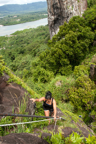
Though not a technical climb, the ascent of the Rock itself is sketchy (triple-pitch, 5.6 R unassisted) and should only be attempted on clear, dry days, as the rocks are treacherous when wet. Pitch 1 begins at the
“Tree Cliff” and skirts a 70° face with the assistance of tree roots, fixed ropes (these you can trust), and the electrical conduit. This section is often underestimated and may, in fact, be the most dangerous part of the endeavor. Several people have been injured in falls at this spot. Pitch 2 starts at the rear foot of the main rock and involves a steep climb with some assistance from the conduit. The crux is a 2-meter section where the conduit has corroded and is no help at all. Climbers must rely on natural holds and a narrow crevice. Ropes also hang along the conduit, but do not trust your weight to any of them as they are in various states of deterioration. Pitch 3 is easier, though no less exposed. Most people straddle the conduit and haul themselves up.
Once on level ground, you can pick out the path that winds through scattered patches of wild pineapples, ferns, and a grove of trees that makes an ideal
campsite before ending at the main cliff on the northern end of the Rock. Spectacular views of the lagoon, reef passes, tuna fleets, and northern islands are found at several spots along the cliff face. On clear days, Pakin Atoll is visible to the west, and you may get a glimpse of Pohnpei’s shy — and perhaps threatened — short-eared owl (Asio flammeus).
The Creation of Sokehs Rock
An ancient Pohnpeian legend states that long ago a man traveling near what is now Sokehs Island was overwhelmed by the force of a geyser-like spring which burst up and swept him all the way to a distant island. There he acquired the help of a powerful magician, who conjured a huge stone and plugged up the spring. Ever after, the rock was known as Paipalap, “the great paip (boulder).” In another version of the story, a Yapese sorcerer named Sou Iap was disturbed by the sound of rushing water and voyaged to Pohnpei to investigate. Upon discovering a great fountain on Sokehs Island, Sou Iap blocked the opening with piles of sea sponges.
Trad Climbing on the Face
The north face of Sokehs Rock has considerable trad climbing potential, though it has yet to be fully explored (several climbers have rappelled down and raved about what they saw there). It is, however, quite extreme and under-cut in places. Note that a top-rope would need to be no less than 200 meters (666 ft) in length. Pioneers are welcome!
Sokehs Mountain
![]()
![]()
![]()
![]()
![]()
![]()
![]()
, Pohnpei, Federated States of Micronesia (FSM)")
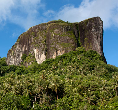
Sokehs Mountain or Pohndollap, which means “on the big hill,” is a long, mostly flat-topped ridge running north-south along the length of Sokehs Island with a knoll-like summit near the middle. The mountain was a refuge for the insurgents of the Sokehs Rebellion and later a key location in the Japanese defense of Pohnpei during World War II. The mountain’s attractions are mostly war-related, though it is also a highly-regarded birding spot.
The hike begins at the end of the paving above the Sokehs Municipal Office and climbs steadily along the rocky Japanese Road (or you can drive to the halfway point). At the top of the mountain, the road turns north next to a terrace on which the Japanese barracks structures originally stood — now the site of a concrete nahs built by the Office of Tourism in the late-2000s. From this point, it’s roughly 0.23 km (0.14 mi) south to the Coastal Battery and 0.78 km (0.48 mi) north to the summit of Dollap (276 m / 906 ft).
Japanese-Era Historical Sites
Command Post & Anti-Aircraft Battery
This site is centered around the Japanese Command Post, from which military operations on the Ridge were directed. There are many structures in the area:
Defensive Trench — This narrow, rock-lined trench has been partially swallowed by a bamboo grove that must have established itself after the war. The trench makes two 90 degree turns around something that is now buried beneath the roots of a massive tree. It’s unclear what the structure was, but electrical cables can still seen coming out of it through the trench wall.
Stone Look-Out — This elevated observation point is found just above the west wall of the Command Post, reached by several concrete steps. From the circular roof-less enclosure at the top, you can look out over Gun #1 and the Command Post foundations.
Personnel Tunnel / Shelter — This L-shaped personnel tunnel is found opposite Gun #1 under what looks like a man-made hill. The tunnel runs southeast and then makes a 90-degree turn before terminating. It’s about 7 meters long in total. The structure was probably intended as a bomb shelter.
Anti-Aircraft Guns — The two guns in the battery are identical: Type 89 12.7 cm twin double-purpose guns, which could pivot 360 degrees on their mounts and also tilt to fire at enemy aircraft overhead. Both guns are surrounded by sloped concrete revetments about 2 meters high with recessed ammunition magazines around the ring (some of which still have large machine springs in them). It took roughly one year for sixteen Pohnpeian laborers to move the guns to the Ridge and install them in their current positions. Gun #1 faces northeast, while Gun #2 points north and is missing its shield. An uncovered shaft lies just to the rear of each of the guns and drops 2 meters into the ground, connecting to a tunnel that housed the gun’s power cables. These shafts are potential hazards, especially when the grass is high. Take special care when walking around the sites to avoid falling into either of the holes!
, Pohnpei, Federated States of Micronesia (FSM)")
Command Post Foundations — Only the concrete basement foundations of the Command Post structure exist today. It seems to have been divided into two rooms. There’s a strange tower-like structure at the north side that TTPI archaeologist Duane Denfeld believed was used for target-bearing. The entrance is on the south side. To the left of the entrance under some trees is a flight of concrete stairs that has tipped partially on its side. It probably led up to the Look-Out and was either damaged by a bomb blast or undermined by erosion.
Machine Gun Pillbox — North of Gun #2 is a large pillbox with similar architecture as the coastal battery bunker. A set of stairs leads down to a stone corridor, which turns left into a circular chamber with slit openings on the front. From the outside, the structure is nearly invisible. The pillbox was probably intended for a machine gun, or more than one. As the chamber stays quite dry even during heavy rain, it’s a nice place to camp.
Mysterious Concrete Shaft — Southwest of the pillbox is a circular concrete shaft with a steel rung ladder leading downward. The shaft is currently flooded and its purpose is unclear. We’re still looking for information about this intriguing feature.
Barracks Area
, Pohnpei, Federated States of Micronesia (FSM)")
The foundations of barracks, a kitchen, and mess hall are found at the north end of the Coastal Battery trail. The largest concentration of foundations is east of the path, indicating at least three large buildings. Concrete steps are found east of the Coastal Battery trail and south of the main road. A large water tank on a rock platform next to the path probably supplied the kitchen area. An identical tank to the east may have been for a washroom. Foundations extend all the way to the Tourism nahs. A slightly-sloped retaining wall built in the Japanese stone masonry style, called uchikomihagi, (unshaped, fitted stones) frames the terrace on which the foundations lie, running east-west along the main road and then turning south. There’s also an unknown foundation isolated from the others north of the main road with earthen revetments on all sides. It might have been a magazine for heavy ordnance, though the design is different from facilities on Lenger and Sapwtik.
Coastal Battery
The Coastal Battery is found at the end of a well-defined trail 0.23 km (0.14 mi) southwest of the cinderblock nahs. There are several notable features:
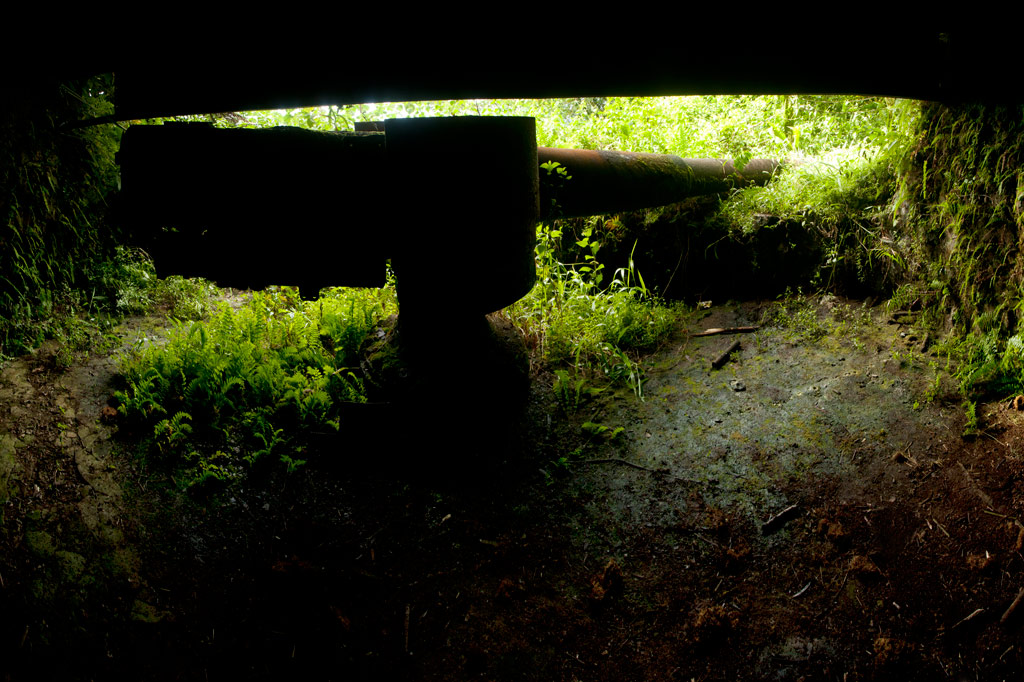
Coastal Gun & Bunker — A 15 cm naval gun is found in a large rock and steel bunker on the western slope of the mountain. The gun was manufactured by the British company Armstrong-Whitworth in 1905 and remains in good condition. It was intended to protect against surface incursions from Palikir Pass, a primary barrier reef passage to the west, but it may not have seen much action. The gun had a range of about 7 kilometers (4.3 mi). The bunker is roughly 8 meters by 6 meters with steel I-beams supporting the concrete ceiling and the dirt that is mounded over it. It would have been difficult to identify the feature from the air. There are two ammunition magazines behind the gun with heavy steel doors. A short corridor connects the rear of the bunker with a prominent trench which runs south for roughly 60 meters (196 ft), ending at a large bomb crater.
, Pohnpei, Federated States of Micronesia (FSM)")
Rifle Pit — Twenty-five meters (82 ft) east of the gun bunker is a P-shaped rifle pit with rock walls. It may have originally been connected to the trench system mentioned above.
South Point
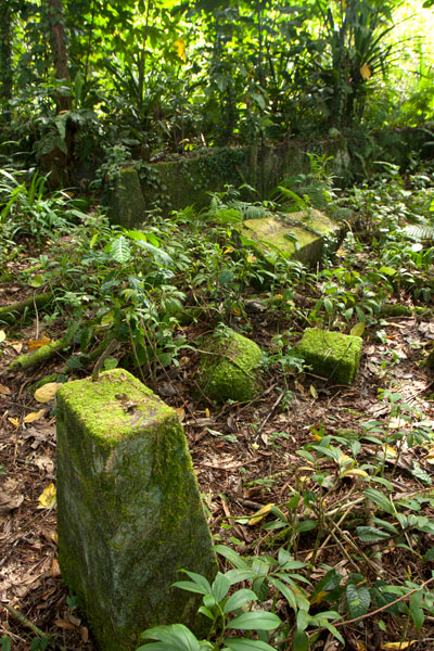
From the top of the Coastal Battery bunker, a trail runs 0.37 km (0.23 mi) south to the end of the Ridge. Along the way it passes scattered foundations, small water tanks, and several stone rifle pits. Little is known about the structures in this area. Bomb craters are obvious in many places. The path terminates at the mountain’s southernmost point–a narrow fin with steep slopes on both sides.
Rifle Pits on Western Slope
West of the Summit Road, 0.28 km (0.17 mi) north of the Command Post, is a complex of small stone rifle pits. Four rifle pits were investigated (two on either side of the path), with the pair to the south being the most extensive. Undoubtedly, there are many structures of this variety around the mountain’s slopes that have yet to be discovered. The area is lower than its surroundings and tends to be very muddy.
Power Station
Immediately east of the Summit Road, just before it begins to climb to the peak, are the remains of a Japanese power station. The most prominent features are a Yanmar 60 KVA generator and three concrete tanks–two for water that cooled the engines and one for fuel. Though the power station building is no more, the steel roof trusses still lie across the ground.
Summit Area
FSM Telecom has claimed the summit of Dollap, and the steel Japanese searchlight platform (about 5 meters in diameter) now supports one of two cellular phone towers. The views from the top of one of the accessible Telecom structures are spectacular and unobstructed. Just below the knoll is an L-shaped defensive trench with rock walls, probably for the men who manned the light. Above this is a small Japanese monument.