
Sokehs Rock
![]()
![]()
![]()
![]()
![]()
![]()
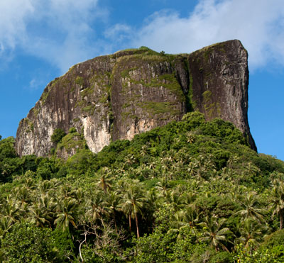
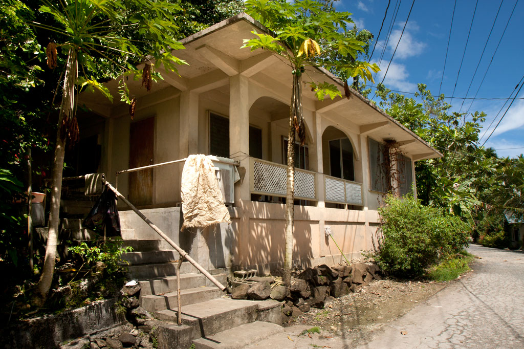
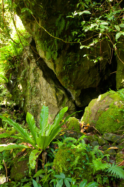
Paipalap, or Sokehs Rock, is without question the most striking feature of Pohnpei’s topography. Over 100 vertical meters (328 ft) of exposed basalt form the upper portion of a gigantic volcanic plug that juts from the north end of Sokehs Mountain and looms over Pohnpei’s harbor and only town, Kolonia. An unmarked trail leading to the Rock, “The Spire”, and “The Adam’s Apple” begins south of a brown house 1.2 km (0.74 mi) beyond Mwalok A-1 Store and just before the Danipei Church (ask permission before hiking). The steep path is well-defined with steep cement steps near the bottom and then a level segment with two
large basalt outcroppings and some cave-like formations. Three quarters of the way along, it begins to follow an electrical conduit running to the beacon on the summit (202 m / 663 ft).
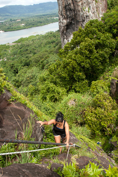
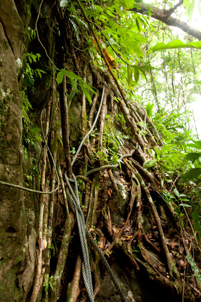
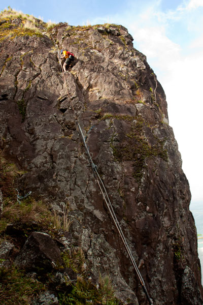
Though not a technical climb, the ascent of the Rock itself is sketchy (triple-pitch, 5.6 R unassisted) and should only be attempted on clear, dry days, as the rocks are treacherous when wet. Pitch 1 begins at the
“Tree Cliff” and skirts a 70° face with the assistance of tree roots, fixed ropes (these you can trust), and the electrical conduit. This section is often underestimated and may, in fact, be the most dangerous part of the endeavor. Several people have been injured in falls at this spot. Pitch 2 starts at the rear foot of the main rock and involves a steep climb with some assistance from the conduit. The crux is a 2-meter section where the conduit has corroded and is no help at all. Climbers must rely on natural holds and a narrow crevice. Ropes also hang along the conduit, but do not trust your weight to any of them as they are in various states of deterioration. Pitch 3 is easier, though no less exposed. Most people straddle the conduit and haul themselves up.
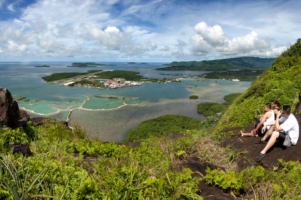
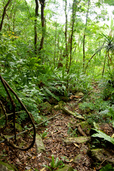
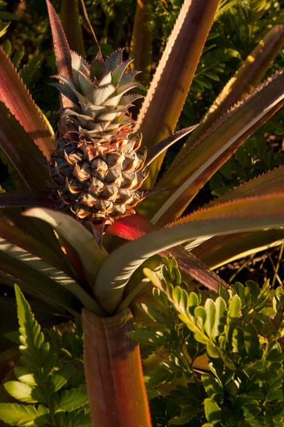
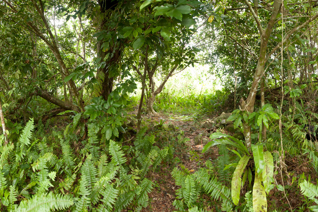
Once on level ground, you can pick out the path that winds through scattered patches of wild pineapples, ferns, and a grove of trees that makes an ideal
campsite before ending at the main cliff on the northern end of the Rock. Spectacular views of the lagoon, reef passes, tuna fleets, and northern islands are found at several spots along the cliff face. On clear days, Pakin Atoll is visible to the west, and you may get a glimpse of Pohnpei’s shy — and perhaps threatened — short-eared owl (Asio flammeus).
The Creation of Sokehs Rock
An ancient Pohnpeian legend states that long ago a man traveling near what is now Sokehs Island was overwhelmed by the force of a geyser-like spring which burst up and swept him all the way to a distant island. There he acquired the help of a powerful magician, who conjured a huge stone and plugged up the spring. Ever after, the rock was known as Paipalap, “the great paip (boulder).” In another version of the story, a Yapese sorcerer named Sou Iap was disturbed by the sound of rushing water and voyaged to Pohnpei to investigate. Upon discovering a great fountain on Sokehs Island, Sou Iap blocked the opening with piles of sea sponges.
Trad Climbing on the Face
The north face of Sokehs Rock has considerable trad climbing potential, though it has yet to be fully explored (several climbers have rappelled down and raved about what they saw there). It is, however, quite extreme and under-cut in places. Note that a top-rope would need to be no less than 200 meters (666 ft) in length. Pioneers are welcome!
Sokehs Mountain
![]()
![]()
![]()
![]()
![]()
![]()
![]()
, Pohnpei, Federated States of Micronesia (FSM)")
Sokehs Mountain or Pohndollap, which means “on the big hill,” is a long, mostly flat-topped ridge running north-south along the length of Sokehs Island with a knoll-like summit near the middle. The mountain was a refuge for the insurgents of the Sokehs Rebellion and later a key location in the Japanese defense of Pohnpei during World War II. The mountain’s attractions are mostly war-related, though it is also a highly-regarded birding spot.
The hike begins at the end of the paving above the Sokehs Municipal Office and climbs steadily along the rocky Japanese Road (or you can drive to the halfway point). At the top of the mountain, the road turns north next to a terrace on which the Japanese barracks structures originally stood — now the site of a concrete nahs built by the Office of Tourism in the late-2000s. From this point, it’s roughly 0.23 km (0.14 mi) south to the Coastal Battery and 0.78 km (0.48 mi) north to the summit of Dollap (276 m / 906 ft).
Japanese-Era Historical Sites
Command Post & Anti-Aircraft Battery
This site is centered around the Japanese Command Post, from which military operations on the Ridge were directed. There are many structures in the area:
Defensive Trench — This narrow, rock-lined trench has been partially swallowed by a bamboo grove that must have established itself after the war. The trench makes two 90 degree turns around something that is now buried beneath the roots of a massive tree. It’s unclear what the structure was, but electrical cables can still seen coming out of it through the trench wall.
Stone Look-Out — This elevated observation point is found just above the west wall of the Command Post, reached by several concrete steps. From the circular roof-less enclosure at the top, you can look out over Gun #1 and the Command Post foundations.
Personnel Tunnel / Shelter — This L-shaped personnel tunnel is found opposite Gun #1 under what looks like a man-made hill. The tunnel runs southeast and then makes a 90-degree turn before terminating. It’s about 7 meters long in total. The structure was probably intended as a bomb shelter.
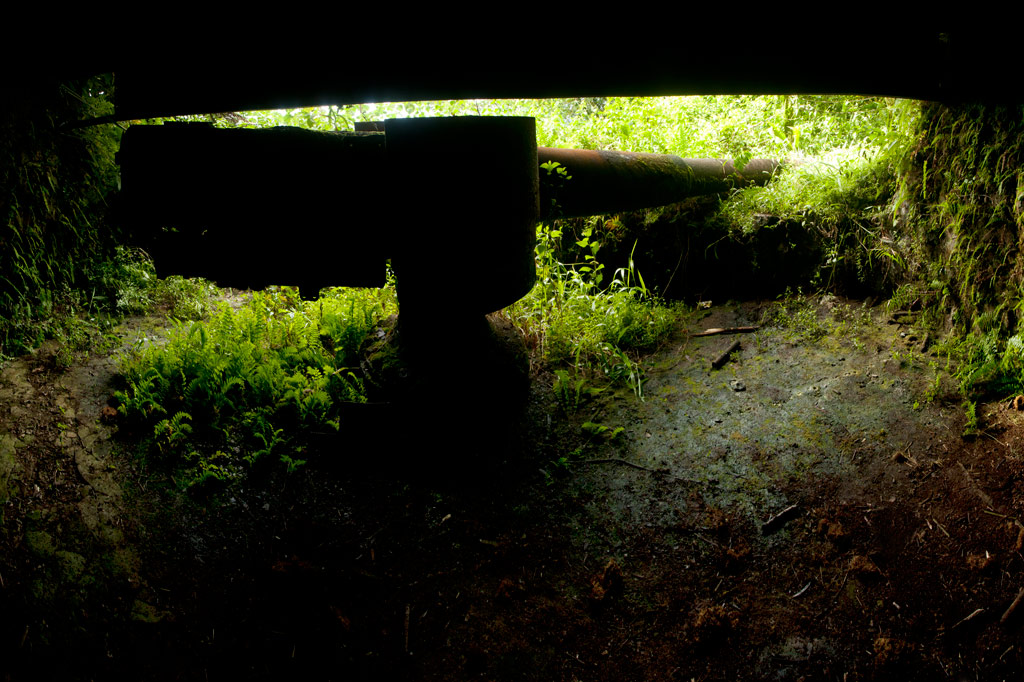
Anti-Aircraft Guns — The two guns in the battery are identical: Type 89 12.7 cm twin double-purpose guns, which could pivot 360 degrees on their mounts and also tilt to fire at enemy aircraft overhead. Both guns are surrounded by sloped concrete revetments about 2 meters high with recessed ammunition magazines around the ring (some of which still have large machine springs in them). It took roughly one year for sixteen Pohnpeian laborers to move the guns to the Ridge and install them in their current positions. Gun #1 faces northeast, while Gun #2 points north and is missing its shield. An uncovered shaft lies just to the rear of each of the guns and drops 2 meters into the ground, connecting to a tunnel that housed the gun’s power cables. These shafts are potential hazards, especially when the grass is high. Take special care when walking around the sites to avoid falling into either of the holes!
, Pohnpei, Federated States of Micronesia (FSM)")
Command Post Foundations — Only the concrete basement foundations of the Command Post structure exist today. It seems to have been divided into two rooms. There’s a strange tower-like structure at the north side that TTPI archaeologist Duane Denfeld believed was used for target-bearing. The entrance is on the south side. To the left of the entrance under some trees is a flight of concrete stairs that has tipped partially on its side. It probably led up to the Look-Out and was either damaged by a bomb blast or undermined by erosion.
Machine Gun Pillbox — North of Gun #2 is a large pillbox with similar architecture as the coastal battery bunker. A set of stairs leads down to a stone corridor, which turns left into a circular chamber with slit openings on the front. From the outside, the structure is nearly invisible. The pillbox was probably intended for a machine gun, or more than one. As the chamber stays quite dry even during heavy rain, it’s a nice place to camp.
Mysterious Concrete Shaft — Southwest of the pillbox is a circular concrete shaft with a steel rung ladder leading downward. The shaft is currently flooded and its purpose is unclear. We’re still looking for information about this intriguing feature.
Barracks Area
, Pohnpei, Federated States of Micronesia (FSM)")
The foundations of barracks, a kitchen, and mess hall are found at the north end of the Coastal Battery trail. The largest concentration of foundations is east of the path, indicating at least three large buildings. Concrete steps are found east of the Coastal Battery trail and south of the main road. A large water tank on a rock platform next to the path probably supplied the kitchen area. An identical tank to the east may have been for a washroom. Foundations extend all the way to the Tourism nahs. A slightly-sloped retaining wall built in the Japanese stone masonry style, called uchikomihagi, (unshaped, fitted stones) frames the terrace on which the foundations lie, running east-west along the main road and then turning south. There’s also an unknown foundation isolated from the others north of the main road with earthen revetments on all sides. It might have been a magazine for heavy ordnance, though the design is different from facilities on Lenger and Sapwtik.
Coastal Battery
The Coastal Battery is found at the end of a well-defined trail 0.23 km (0.14 mi) southwest of the cinderblock nahs. There are several notable features:
Coastal Gun & Bunker — A 15 cm naval gun is found in a large rock and steel bunker on the western slope of the mountain. The gun was manufactured by the British company Armstrong-Whitworth in 1905 and remains in good condition. It was intended to protect against surface incursions from Palikir Pass, a primary barrier reef passage to the west, but it may not have seen much action. The gun had a range of about 7 kilometers (4.3 mi). The bunker is roughly 8 meters by 6 meters with steel I-beams supporting the concrete ceiling and the dirt that is mounded over it. It would have been difficult to identify the feature from the air. There are two ammunition magazines behind the gun with heavy steel doors. A short corridor connects the rear of the bunker with a prominent trench which runs south for roughly 60 meters (196 ft), ending at a large bomb crater.
, Pohnpei, Federated States of Micronesia (FSM)")
Rifle Pit — Twenty-five meters (82 ft) east of the gun bunker is a P-shaped rifle pit with rock walls. It may have originally been connected to the trench system mentioned above.
South Point
From the top of the Coastal Battery bunker, a trail runs 0.37 km (0.23 mi) south to the end of the Ridge. Along the way it passes scattered foundations, small water tanks, and several stone rifle pits. Little is known about the structures in this area. Bomb craters are obvious in many places. The path terminates at the mountain’s southernmost point–a narrow fin with steep slopes on both sides.
Rifle Pits on Western Slope
West of the Summit Road, 0.28 km (0.17 mi) north of the Command Post, is a complex of small stone rifle pits. Four rifle pits were investigated (two on either side of the path), with the pair to the south being the most extensive. Undoubtedly, there are many structures of this variety around the mountain’s slopes that have yet to be discovered. The area is lower than its surroundings and tends to be very muddy.
Power Station
Immediately east of the Summit Road, just before it begins to climb to the peak, are the remains of a Japanese power station. The most prominent features are a Yanmar 60 KVA generator and three concrete tanks–two for water that cooled the engines and one for fuel. Though the power station building is no more, the steel roof trusses still lie across the ground.
Summit Area
FSM Telecom has claimed the summit of Dollap, and the steel Japanese searchlight platform (about 5 meters in diameter) now supports one of two cellular phone towers. The views from the top of one of the accessible Telecom structures are spectacular and unobstructed. Just below the knoll is an L-shaped defensive trench with rock walls, probably for the men who manned the light. Above this is a small Japanese monument.