
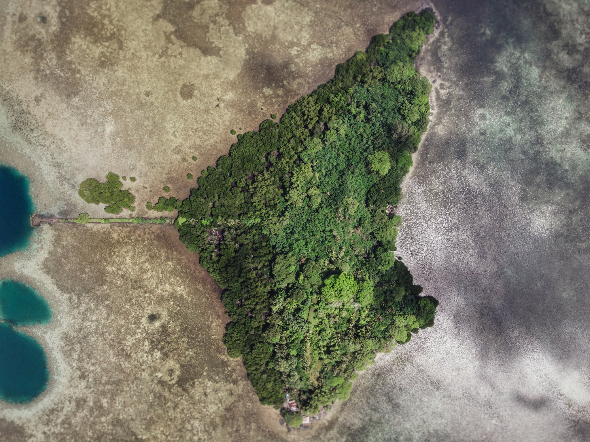
Sapwtik Island
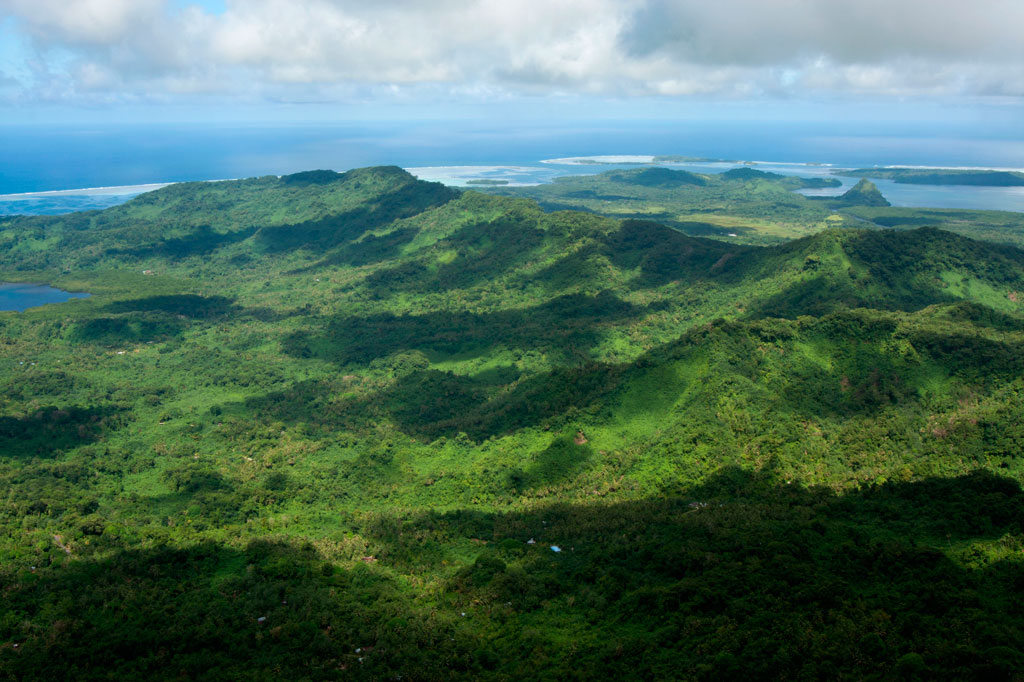
Sapwtik, which means “small land,” is a tiny volcanic island located directly north of Kolonia and 0.5 km northwest of Lenger. Seen in profile, the island resembles a large submarine, leading some locals to nickname it “Submarine Island.” Sapwtik is jointly-owned by the Eschiet family, which has some small houses at the eastern end of island, and their in-laws, the Adams family. During the 1880s, Sapwtik was purchased by Jan Stanisław Kubary, a Polish naturalist and ethnographer, along with a large piece of land east of what is now Kolonia — a place called Mpwoampw. In 1896, after returning from an extended absence and finding his homestead in ruins and his claims on the properties questioned by the Spanish authorities, Kubary committed suicide. Mpwoampw and Sapwtik were then purchased by Dominique Escheit, a Belgian trader who had operated in the Marshall Islands before coming to Pohnpei. Between 1914 and 1945, the Japanese were in charge and a great deal of land was seized by the military for defensive purposes — including Sapwtik. Like its neighbor, Lenger, Sapwtik was fortified in the late 1930s in preparation for an Allied invasion that never came. The primary features are found on the low hilltop and at the western terminus.
Sapwtik Island Attractions

Japanese Wharf
Visitors to Sapwtik will want to make their first stop at the Japanese Wharf, a 296 meter-long (324 yd) basalt structure that juts out from the island’s southwest coast all the way to the edge of the reef. With the exception of the very end, which has sustained some damage from waves, the wharf is in excellent condition almost 80 years after it was built — a testament to the quality of Japanese construction during the colonial period (and the use of the highly stable tanizumi, or herringbone, style of stonework). The wharf connects with the coastal road, also built by the Japanese, which skirts the mangroves from one end of the island to the other. The road is built above a stone retaining wall that stabilizes it against the swampy mangrove environment. Retaining walls also run along the opposite edge to prevent erosion from the steep hillside above.
Snorkeling & Swimming
All the ocean areas around Sapwtik belong to the Sapwtik Marine Protected Area, a sanctuary protected by legislation. The snorkeling off the reef walls at the end of the wharf is quite nice with generally good visibility and lots of fish. Just start at the wharf and follow the reef wall in either direction (the further from the island, the better it gets). The best place to swim is also right off the end of the wharf. Shallow areas on either sides of the wharf are silty.
")
Command Center & Barracks
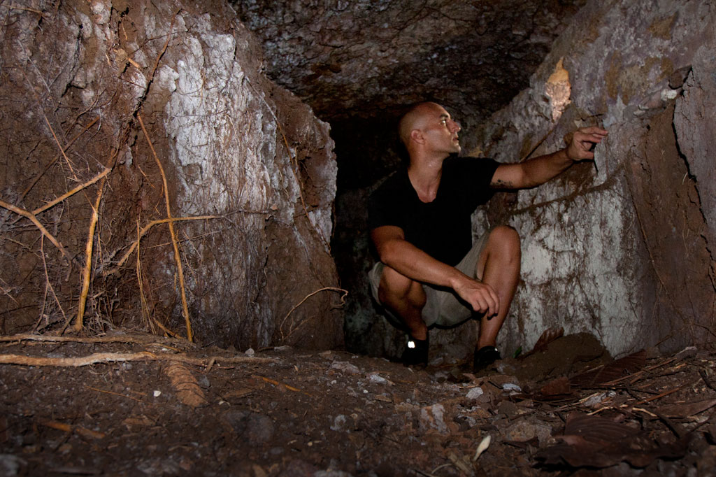
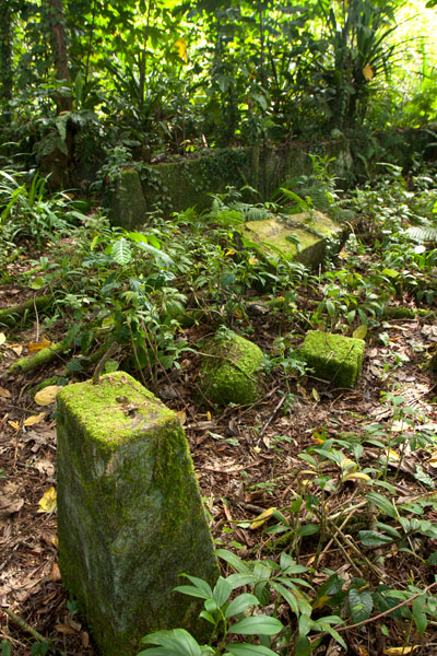
The central hill is most easily accessed from the maintained Japanese coastal road. About 60 meters east of the wharf, hikers can cut off the road and up the slope (another 60 m) to reach the summit. The Adam’s family keeps the hill extremely tidy, cutting the grass, planting flowers, and keeping the historical features free of vines and brush. The place has a manicured, park-like feel and a stunning view of everything to the south. One of the best preserved yabane-tanizumi style rock walls on Pohnpei runs the length of the hilltop on the south side with two breaks, where earthen ramps lead up to the top. Two foundations were likely a command center and a barracks for personnel stationed on the island. The northern foundation is the largest and has seven sets of steps leading up to where the floor once was. The structure itself would have been wooden, while only the support posts and the lower parts of the walls were concrete. Two large concrete cisterns are connected to the two foundations (check out the bullet holes from Allied strafing). At the north end of the complex, the hill road begins, cutting right through the hill and running all the way to the gun batteries at the northwestern end of the island. Some of the road is currently impassable due to piles of felled trees and branches, but it’s impressive none the less.
To visit the gun batteries, it’s best to return to the coastal road and hike northwest all the way to the end. The road is well-kept and easy to follow.
Magazine Complex / Shell Storage
From the cut-off point for the hilltop, it’s about 150 m (164 yd) along the road to the first point of interest, a high-walled magazine complex for heavy ordnance similar to the one at the coastal gun battery on Lenger. The surrounding basalt rock wall (also tanizumi style) runs north and then curves sharply back to the south to enclose the foundation of the magazine structure, which is about 6 meters long. On the inside of the enclosure, the walls are steeply sloped. There is no roof, but the entire feature may have been covered with canvas and camouflaged during war-time. The entrance is narrow — less than 2 meters wide — and curved.
Coastal Gun Battery
About 12 meters northwest of the magazine is the first of four 75 mm field gun stations. These are similar to the structures on Lenger, though the Sapwtik sites are more primitive with less concrete and more earthen features. No guns remain, and two of the sites may have been decoys that never had guns installed. Guns would have protected the primary entrance to Kolonia at Pweitik Passage (Kepidauen Pweitik) to the northwest. A footpath continues north past the gun emplacements and then turns southeast to follow the contour of the hill. Along this are a few stone rifle pits or machine gun emplacements. Old Japanese beer bottles litter the forest.
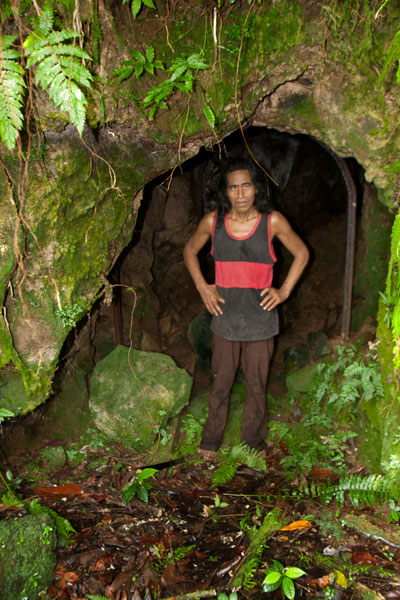
[info]NOTE: The ruins of a searchlight and a tunnel, cutting completely through part of the central hill, also exist on Sapwtik, but we did not have the opportunity to locate them during our brief period of fieldwork on the island. If you’re interested in seeing these features, contact Richie Adams at (+691.320.5735). The Pacific Wrecks website has photos of both.[/info]
- To obtain permission to visit, call Richie Adams (Adam’s Brothers Corporation) at +691.320.5735 or call Ace Hardware’s office at +691.320.2723.
ACKNOWLEDGMENTS
The Sapwtik Island information would not exist without the cooperation of the Adams family.
Nett & Western U GPS Data
Downloadable GPS Data Files
The following files contain all the packaged GPS data for each of the featured locations in Greater Nett & Western U.
Three file types are provided. KMZ and KML files are compatible with Google Earth. KML is compatible with Google Maps. GPX files can be imported into ArcGIS (a professional mapping application) and some hand-held GPS devices.
[info]NOTE: All files are free to the public and can be used for any purpose without permission.[/info]
Marine Parks in Awak Pah (2015)
Dolen Eirike (2015)
Dolen Nahnsapwe (2015)
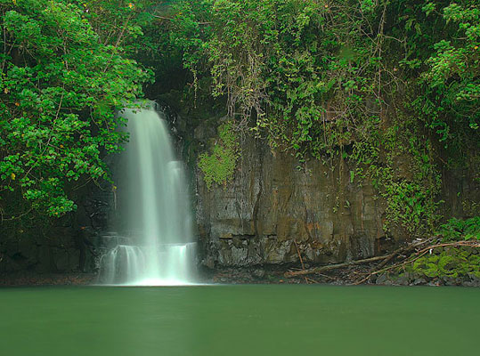
Lou Rahn Cave & Waterfall (2015)
Nan Kiepw & Na Malek Cave (2015)
Nan Koropwung Cliff, Waterfall & Caverns (2015)
Dolen Nett / Pohnlehr (2015)
Nanipil Vicinity (2015)
These files include Liduduhniap, Sengnaip, Likei, Pahn Pwet, and Nan Kiepw waterfalls, the Nanipil Bird Walk, the Swimming Pond, and another popular swimming hole in the area.
Coordinates
The following coordinates correspond with sites featured on the Greater Nett & Western u Eco-Adventure Map Guide. It is our dream to eventually create a Pohnpei GPS app that could be uploaded to smartphones and other devices, but for now, these points of interest can be entered manually in a hand-held GPS device as needed.
[info]NOTE: All GPS devices have a margin of error. That margin increases with interference — when there is a thick canopy of trees, during bad weather, or when mountains obstruct the satellite link. The geosynchronous satellites employed when navigating on Pohnpei are located low on the southwestern horizon, such that maintaining a strong connection while hiking on the northeast side of a given mountain range can be difficult. Coordinates on the northeastern slopes of mountains are less accurate than in other locations.[/info]
Awak Marine Parks
| Awak Pah MP Entrance | —- | 6.965910° 158.250758° |
| Pein Ahi Entrance | —- | 6.966711° 158.251138° |
| Paieke Entrance | —- | 6.969853° 158.256294° |
| Awak Pah MP Dock | —- | 6.966470° 158.248785° |
| Pein Ahi Fish Pond | —- | 6.967572° 158.249929° |
Dolen Eirike
| Relio Lengsi’s Residence | —- | 6.926688° 158.227910° |
| Dolen Eirike Trailhead | —- | 6.919570° 158.227397° |
| Sakau Plantation | —- | 6.917106° 158.227410° |
| Japanese Trench Network | —- | 6.915589° 158.230300° |
| Dolen Eirike Summit | —- | 6.915140° 158.231599° |
| Dol Rakied Summit | —- | 6.906234° 158.237645° |
Dolen Nahnsapwe
| Dolen Nahnsapwe Trailhead – Nett Approach | —- | 6.927169° 158.246675° |
| Dolen Nahnsapwe Trailhead – U Approach | —- | 6.918897° 158.270844° |
| Dolen Nahnsapwe Summit | —- | 6.909546° 158.260936° |
| Dolen Nahnsapwe Turn-Off from Lou Rahn Trail | —- | 6.923336° 158.249283° |
Lou Rahn
| Lou Rahn Trailhead | —- | 6.927169° 158.246675° |
| Lou Rahn Cave & Waterfall | —- | 6.918551° 158.253955° |
Nan Kiepw & Na Malek
| Nan Kiepw / Na Malek / Nahnalaud Nett Trailhead | —- | 6.918179° 158.214601° |
| Stream Crossing | —- | 6.917458° 158.215238° |
| Nahnalaud Turn-Off from Nan Kiepw Trail | —- | 6.910792° 158.217769° |
| Last House along trail | —- | 6.900363° 158.214973° |
| Na Malek Loop Turn-Off from Nan Kiepw Trail | —- | 6.897523° 158.213266° |
| Na Malek Loop Turn-Off from Nan Kiepw Trail | —- | 6.895756° 158.213144° |
| Na Malek Cave | —- | 6.895878° 158.211765° |
| Kiepw Waterfall | —- | 6.889668° 158.211740° |
| Nan Kiepw Overhang & Campsite | —- | 6.889639° 158.211035° |
Nan Koropwung
| Nan Koropwung Trailhead | —- | 6.925729° 158.254909° |
| Cliff & Waterfall | —- | 6.927155° 158.259679° |
| Cave 1 | —- | 6.927513° 158.259859° |
| Cave 2 | —- | 6.927877° 158.259142° |
| Cave 3 | —- | 6.927884° 158.259038° |
Dolen Nett / Pohnlehr
| Dolen Nett Trailhead 1 | —- | 6.968282° 158.230457° |
| Dolen Nett Trailhead 2 | —- | 6.965640° 158.234757° |
| Dolen Nett Trailhead 3 | —- | 6.959650° 158.225124° |
| Dolen Nett Trailhead 4 | —- | 6.969614° 158.228438° |
| Japanese Tunnel Entrance | —- | 6.965840° 158.228329° |
| Yam Plantation | —- | 6.965248° 158.228609° |
| Japanese Defensive Position | —- | 6.964007° 158.229053° |
| Japanese Trench Network | —- | 6.963868° 158.229051° |
| Japanese Trench Network | —- | 6.963073° 158.229706° |
| Japanese Trench Network | —- | 6.963105° 158.229949° |
| Japanese Trench Network | —- | 6.963125° 158.230125° |
| Japanese Trench Network | —- | 6.963025° 158.230332° |
| Pandanus Grove | —- | 6.961883° 158.230662° |
| Coconut Palm Grove | —- | 6.961188° 158.231013° |
| 80 mm Field Gun | —- | 6.958862° 158.233030° |
| Rusted Barrels | —- | 6.958814° 158.233064° |
| 80 mm Gun in Bunker | —- | 6.958838° 158.233535° |
| Machinegun Bunker | —- | 6.958741° 158.233545° |
| Bunker | —- | 6.958765° 158.233415° |
| Pohnlehr Summit | —- | 6.958226° 158.233346° |
| Japanese Mobile Radar Array | —- | 6.958767° 158.232402° |
Sengnaip Waterfalls
| Trailhead | —- | 6.920677° 158.204421° |
| Route Intersection | —- | 6.920647° 158.201060° |
| Sengnaip Cave | —- | 6.917556° 158.200460° |
| Sengnaip Waterfalls | —- | 6.917522° 158.200383° |
Likei & Pahn Pwet Waterfalls
| Trailhead | —- | 6.920677° 158.204421° |
| Route Intersection | —- | 6.920647° 158.201060° |
| Stream Crossing | —- | 6.919559° 158.198878° |
| Log Crossing | —- | 6.916577° 158.198932° |
| Route Intersection | —- | 6.916577° 158.198932° |
| Route Intersection | —- | 6.914373° 158.199648° |
| Route Intersection | —- | 6.904178° 158.192649° |
| Route Intersection | —- | 6.904178° 158.192649° |
| Likei Waterfall | —- | 6.903375° 158.189810° |
| Pahn Pwet Waterfall | —- | 6.902343° 158.192313° |
Nan Kiepw Waterfall
| Trailhead | —- | 6.919873° 158.206230° |
| Route Intersection | —- | 6.914373° 158.199648° |
| Nan Kiepw Waterfall | —- | 6.897512° 158.206958° |
Liduduhniap Waterfalls
| Trailhead | —- | 6.919915° 158.206706° |
| Upper Pool | —- | 6.918893° 158.206592° |
| Upper Falls | —- | 6.918891° 158.206557° |
| Lower Pool | —- | 6.918564° 158.206676° |
| Lower Falls | —- | 6.918695° 158.206572° |
Nanipil Vicinity
| Nanipil Bird Walk Trailhead | —- | 6.920677° 158.204421° |
| Nanipil Bird Walk Trail End | —- | 6.919559° 158.198878° |
| Hydroelectric Building | —- | 6.918222° 158.214670° |
| Japanese Pump Station | —- | 6.918404° 158.214481° |
| Swimming Pond Trailhead | —- | 6.922461° 158.215089° |
| Swimming Pond | —- | 6.922642° 158.215955° |
| Cable Bridge Swimming Hole | —- | 6.932656° 158.216346° |
Dolen Palikir
Dolen Palikir (“hill of Palikir“) is a long hill in the middle of Palikir that runs northeast-southwest and has knolls at each end. The southern summit is slightly higher than the other at 250 meters. The Japanese capitalized on Dolen Palikir’s geography as they did with most of the high points on Pohnpei. Trench systems cross the path or run alongside it in several places and there are many small rifle pits. The trail begins at the Hadley residence west of the road leading to Iohl and climbs gently through high, waving grass before entering the trees. There it steepens as it meanders through sakau (kava) plantations (the tallest plants are just below the first summit). Near the summit benchmark is a prehistoric pehi (stone platform) linked to a story about Lepen Palikir — the highest chief in the region, but there’s no clear view of the valley here. The hike to the southern point follows the mostly flat ridge, passing many earthen defensive works, but none with cement or stonework. Near the middle of the ridge, the trees open up and provide a view of the panorama below. The most extensive Japanese structure is at the hill’s highest point and consists of three recessed gun sites with stone retaining walls around them and a trench leading down-slope.
- Plan for 2-4 hours for this hike. Ask at the house for guides Rihlent Hadley or Denster Louis. Offer $20.00.
Sokehs Japanese Sites & Parpwu Waterfall
Historical Sites in Mainland Sokehs
![]()
![]()
![]()
![]()
![]()
![]()
![]()
“Military Road” Hike / Bike Tour
One of the most rewarding routes for Japanese World War II-era historical sites follows a road 0.46 km (0.29 mi) northeast of the turn-off to the FSM capital. This track was built by the Japanese in the 1930s to access the many military sites in the area and remains unpaved. Whether it is public or private, however, seems to be a matter of some debate. FSM Telecom, which maintains a mobile phone tower near “Radar Station Hill” and uses the road often, says that the road and the areas immediately alongside it belong to the municipality and that people living beyond the Thomas residence are squatters without legal land claims. Even so, a family living on the south side of the road about 1 km (0.62 mi) from the Circle Island Road insists that everything beyond their house is private. There are two ways for visitors to deal with this issue: either (1) hire a knowledgeable local guide to escort you on your hike (you’ll likely find more with them anyway) or (2) visit the house in question and ask permission yourself. During our fieldwork, we used both options successfully. The road, though unpaved, is in pretty good condition, and as it doesn’t climb much, it’s a great choice for either hiking or biking. You can park your vehicle at the beginning near the Circle Island Road and go from there.
")
“Bunker Hill”
About 100 m (109 yd) from the starting point, you can cut off the road to the right and climb up the grassy hill, making your way toward the landowner’s house about 200 m (219 yd) to the northeast. This is the place to ask for permission to explore in detail. There are several points of interest worth looking into. At the southwest and northeast ends of the hill, there are bunker-like observation stations that consist of curved tunnels with domed concrete roofs and several gun ports. The southern bunker site is well-hidden with the entrance near the base of a large tree that has grown up in recent years. Entering is a dirty job, but once you’re inside, the structure becomes quite roomy. The gun ports allow light inside. The northern site is close to a large cassava plantation and is kept cleared. You can enter easily from either end. These structures were likely manned by a few riflemen and intended to protect the roads on both sides of the hill. In view of the landowner’s house you can also find a zigzag trench and two gun sites, one of which was probably a medium-sized anti-aircraft gun. No guns remain now. Some people believe a gun at this location shot down the American bomber “Love Bug”. Others say it was one on Dolen Pahniepw.
Paul Thomas’s Hill
Another 277 m (303 yd) further down the road, one comes to the residence of a friendly West Virginian native, Paul Thomas, and his local wife. Thomas enjoys a good chat, and if you ask politely, will happily point you in the direction of several interesting sites on the hill above his house. Easily found are two pairs of bunkers similar to those mentioned already, and between these, three small gun sites and several foxholes. Thomas keeps the hill trimmed and neat; all but one of the sites (the first set of bunkers) lie along the crest of the hill over a distance of about 125 m (137 yd). The hill commands sweeping views of the Palikir valley to the west.
- If you want to make arrangements ahead of time, call Paul Thomas at +691.320.4562.
")
Dolen Pahniepw
The next stop is Dolen Pahniepw. An overgrown trail begins off the right side of the road 0.56 km (0.35 mi) past Thomas’s driveway and runs 0.43 km (0.27 mi) to the summit of the hill. About 300 m (328 yd) along the trail, one comes to the ruins of an army barracks, which consists of concrete house posts,
foundations, and a bombed-out cistern. Sets of concrete steps led to the entrances of the wooden buildings. Some scrounging in the jungle around the site should yield some old Japanese beer bottles. At the end of the trail is a large anti-aircraft gun site, which probably housed a medium-sized gun similar to those on Lenger Island. On the northeast side of the hill, you may be able to locate the foundation of a radio tower, some tunnels, and the chassis of a truck.
At the southern end of the hill near the road, you can scramble up the bank and find a pair of unfinished small gun emplacements, some trenches in the woods, and a defused bomb.
“Radar Station Hill”
The road ends near the FSM Telecom cellular phone tower at the summit of a hill. A footpath continues west to a cement platform for a Japanese radar array, two foxholes, and two circular gun sites. A large bomb crater south of the road makes an excellent tent site for campers with unobstructed views of the whole of mainland Sokehs. Back east down the road, an L-shaped cutting leads to a path and eventually to the site of a generator station with a concrete storage alcove built into the embankment and a rusting motor.
- Plan for a half day to full day for this hike/ride, depending on how many sites you want to explore.
- No guide is necessary for the Military Road sites as long as you ask permission wherever private land is an issue. However, you are likely to discover much more of interest with a guide who knows the sites. Please visit the Local Guides & Tour Operators page for a list of experienced guides available for hikes around Sokehs, if desired. Offer $25-50 for a group of five or less.
PBJ-H1 “Love Bug” Bomber Ruins
Throughout 1944 and early 1945, the U.S. carried out a brutal bombing campaign of Japanese fortifications on Pohnpei. The only bomber ever shot down was a PBJ-1H (the U.S. Marines version of the Airforce B-25H) nicknamed “Love Bug” and piloted by First Lieutenant William J. Love. On February 6, 1945, while on a mission to destroy targets at the nearby Palikir airfield, the Love Bug was picked out of the sky by an anti-aircraft gun on one of the nearby hills (possibly “Bunker Hill”, Paul Thomas’s hill, or Dolen Pahniepw). The plane burst into flames upon impact, killing the entire crew. After the crash, Japanese soldiers collected the bodies and buried them in a marked grave near the crash site. A monument to the crew used to be found at the burial site, but it was taken apart by looters in the 1980s.
The crew was disinterred and reburied several times during the American Period before coming to rest at Jefferson Barracks National Cemetery in the U.S. — all except Sgt. David Snider, whose whereabouts were unknown until 1948. The wreckage was not positively identified until 2001, when two aviation archaeologists surveyed the area. The tail section and rudder were still visible in the forest in the 1980s, but the site has been heavily looted since and only a few large pieces remain — the port engine (sans prop), landing gear and wheel, and a portion of a stabilizer. Bits of wreckage are strewn across an area of some 7,000 square meters. Three defused bombs are also said to be in the vicinity, but we were unable to locate them during our visits.
It’s easiest to visit the site from the unpaved water tank road behind the FSM presidential housing facility. No guide is necessary, but you’ll have to ask the officer at the security check-point to let you through. The wreck is found on the forested slope a few meters off the north edge of the road before the water tank.
- Plan for 1 hour for this hike. No guide is necessary, but you will need to ask the security guard on the road to let you through.
Nankewi River Vicinity
Ethanol Manufacturing Site
On the banks of Pillapen Nankewi (Nankewi River) the remnants of Japanese industry can still be seen. Neat stone retaining walls frame the river and trenches and pipes form a grid on the north bank. On the south bank are three large fermentation tanks, a variety of other distilling gear, brick ovens built into the hillside, a huge press, a crank, and other rusting machinery. The equipment was likely used to distill ethanol from sugar cane for fuel and other industrial purposes. A great deal of Japanese beer and liquor bottles litter the spot.
Parpwu Waterfall
The rather flat terrain in greater Sokehs doesn’t make for a lot of waterfalls, but Parpwu (a.k.a. “Nan Lohlo” or “Nankewi”) — located on the Nankewi River just behind the now deserted Sokehs Shopping Center — is unusual because it’s so close to the coast, almost in the mangroves. In fact, during very high tides, you can kayak all the way from Sokehs Bay to the falls. The waterfall is a beautiful sight, but unfortunately, upstream piggeries have polluted the watercourse and swimming is ill-advised (even though you’ll see local kids from the area doing just that). Photo courtesy of Bill Jaynes.
- Plan for 1 hour for this hike. Its easy to find someone to guide you down to the falls and/or distillery site. Just ask in the area. Offer $6.00.
Dolopwuropwur Gun Battery
![]()
![]()
![]()
![]()
![]()
The most extensive Japanese gun battery on Pohnpei lies on Temwen’s rounded central hill, Nindol, perched at its 60 meter peak, Dolopwuropwur.

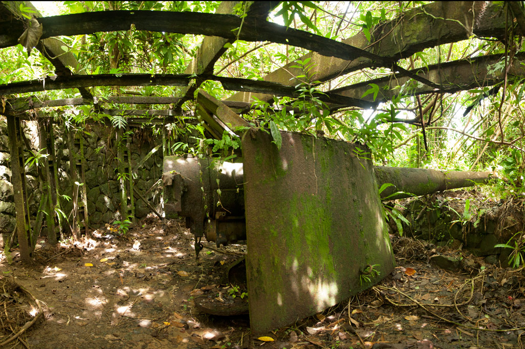
Gun Stations
The four guns at the summit are identical to the one on Sokehs Mountain — British-made 15 cm Armstrong Whitworth naval canons manufactured in 1905. The guns are arranged in pairs with a concrete ammunition magazine between each set of stations. The semi-circular emplacements are constructed of concrete and local stone. There are also stone retaining walls along the corridors that lead to the stations. Steel girders running over Stations 1 and 4 are evidence that these two guns, at the very least, were covered to make them difficult to identify from the air. All of the stations are in relatively good condition, though the embankment around Station 3 has slipped down and partially buried the walls. Guns 1 and 4 point north and southeast, respectively, while Guns 2 and 3 point northeast. In combination, they would have had firing coverage of around 250 degrees. At the time of operation the hill was probably relatively clear of trees, providing an unobstructed view of the area islands and the two possible points of entry into the lagoon at Kepidauen Deleur and Kepidauen Nahkapw.
Stone Tower
West of Station 4 is a stone tower (possibly a look-out for targeting or even a searchlight emplacement). Presumably, the tower was crowned with a platform of wood or metal, but that is no longer present. Now a flight of twenty-odd steps lead to the edge of a gaping hole as deep as the tower is high. We didn’t find a searchlight, but it may lie hidden somewhere in the surrounding area.
Trench Network
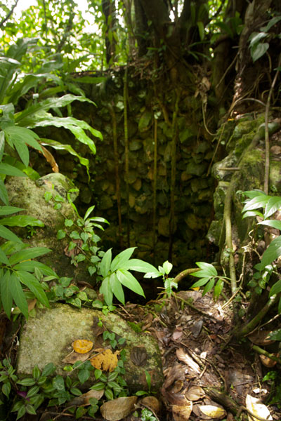
A narrow 0.27 km-long (0.17 mi) trench begins at the tower base and meanders down the hill with short deviations going to a dug-out under the tower itself and a magazine-like structure built into the hillside and currently occupied by a colony of small insectivorous bats. The latter is almost large enough to park a jeep inside, but there’s no evidence of a road leading to it. It was probably additional storage for munitions. It’s possible to climb down into the trench and follow it until it connects with one of the well-trodden footpaths in the Temwen interior.
The 0.3 km (0.19 mi) trail to the battery begins not far from the end of a muddy residential road opposite Temwen Elementary School and can be easily followed without a guide.
The family at the last house on the road charges $3.00 per person to visit Dolopwuropwur.
- Plan for 1-2 hours to fully explore the area and 1 hour (each way) for the drive.
Dolen Merewi
![]()
![]()
![]()
![]()
![]()
")
Dolen Merewi is a flat-topped hill that stands apart from the interior mountains to the west and is highly conspicuous when driving through northeastern Madolenihmw. During the Spanish Period (1886-1898), the hill played a pivotal role in an armed conflict centered around Ohwa. During the fighting, Nahnmwarki Pol, the Protestant leader of Madolenihmw, took refuge on the summit of Dolen Merewi where it was said he prayed in earnest for the Catholics to be defeated. Though the Spanish claimed a victory in the end, they lost a great many men and the better part of their dignity. They never got what they wanted and spent the rest of their administration barricaded inside their dreary colony, Santiago de la Ascencion, at what is now modern-day Kolonia.
An unpaved but well-graded road runs inland right to the base of Dolen Merewi, and almost anyone living in the area can assist visitors in finding a suitable guide on the spot. The ascent takes less than an hour and climbs steeply through upland sakau (Piper methysticum) plantations, karara (Myristica hypargyraea), sadak (Elaeocarpus carolinensis), and other large native hardwoods. At the top of the hill, the forest thins and the trail passes hastily-constructed Japanese foxholes, trenches, and rifle pits. The summit (240 m / 787 ft) is at the north end and has unobstructed views of Kupwuriso to the northwest, Timwen Men to the north, and the glistening bay in the east. Huge flying foxes roost in nearby trees and can be seen soaring low overhead. Birders will find Crimson-Crowned Fruit Doves and Micronesian Ground Doves in plenty. The summit is a nice camp site.
- See the Birding page for more info about bird-watching on Pohnpei.
No access fee is charged.
- Plan for 3 hours round-trip with a nice rest at the summit.
- To hire a guide, ask at the houses in the area or contact Hanke Albert at +691.320.4047. Offer $12.00-15.00.
Timwen Men, Dolakapw & Pohn Tehnmei
North Madolenihmw Hikes
![]()
![]()
![]()
![]()
![]()
The northernmost section of Madolenihmw is separated from the rest of the municipality by a range of low mountains that run east-west from Mesihsou to Alohkapw. This range was fortified by the Japanese army during World War II because it was easily accessible and commanded excellent views of lands both to the north and the south. The hills are riddled with tunnels and man-made caves, and a ridge path runs from the east end and connects with the primary mountain system in the central part of the island. There was a time when Japanese soldiers could travel from Mesihsou all the way to Kupwuriso without ever leaving the mountains. Small 75-80 mm guns were also installed at hidden spots among the hills.
There are many potential hikes one could do in these interesting mountains, but we’ve chosen to focus on three routes leading to small peaks along the ridge: Timwen Men, Dolakapw, and Pohn Tehnmei. All three cross private land.
Timwen Men
The name of this small peak at the western end of the ridge means “beak of the bird,” a reference to the many brown noddies that can be seen flying around the summit. The hike begins at the houses near the end of the road, belonging to the extended family of Eiber Rosario, and passes through the family’s sakau plantation on the slope. Any semblance of a trail vanishes at the foot of the hill, where you have to clamber up the steep, muddy hillside. At the top, there’s an extensive network of Japanese defensive trenches. The Japanese ridge path goes east as far as Mesihsou and west to Kupwuriso, but the problem with hiking the entire distance in one go is that the mountain range is broken up into a number of private parcels owned by different (and sometimes competing) families. The trail is easy to follow as it goes west toward the Timwen Men summit (331 m / 1,086 ft). Along the way, you’ll pass several impressive tunnels that bore into the hill and connect with the trench system. Two circular pits seem to have been either small caliber gun stations (possibly 80 mm) or rifle positions. No guns are found there now. The summit is a little overgrown, but still affords nice views of the valley.
- The hike takes about 3 hours round-trip.
- To arrange for a guide, ask for the colorful Eiber Rosario at the houses near the end of the road. You may also be able to locate Eiber by calling his son-in-law, Colton, at +691.923.6941. Offer $20.
Dolakapw (Edienleng)
This hike starts at the main road opposite a small store, passes through a group of houses, and follows a well-traveled footpath, climbing steadily but never steeply to Dolakapw (“new hill”), a peak in Edienleng. The trail ends at a plantation of sakau and other agroforestry crops. From there the route curves around the south side of the hill (with views of the Sapwalap plain), where two large Japanese tunnels burrow into the slope. The lower one is partially collapsed, the steel rails for a mining car still jutting out of the hole. The roof here is unstable, so it would be unwise to venture inside. The tunnel is about 15 meters long. The second tunnel, a little higher up the hill, is in better shape with U-shaped steel supports holding up the rocky roof. Bats and Caroline Islands swiftlets nest at the rear. The landowner believes that the Japanese intended to connect the two tunnels, but abandoned the project once the Allied bombing campaign began. The semi-open Dolakapw summit (305 m / 1,001 ft) is just above.
- The hike takes about 3 hours round-trip.
- To find a guide, visit the small store on the coastal side of the road and ask for Isaac Fred. Offer $20.
Pohn Tehnmei
This short, strenuous hike begins at the home of brothers Atsent and Romeo Welcher at the end of an intermittently paved road west of Nan Pailong. There isn’t much of a trail; the route just goes straight up the slope behind the house along an eroded track used to drag huge sakau pounding stones, called peitehl, down from the mountaintop. The first thing encountered at the top is the quarry site itself — a collection of pits from which the stones have been dug. There was a time when people came from all over the island to get peitehl at this spot. Currently, the state forbids the practice, but you may get the distinct impression that it’s still going on nonetheless. Not far from the top of the hill, a gigantic peitehl marks the spot where the brothers Olsihpa and Olsohpa looked down and first laid eyes on Sounahleng, the place where they would eventually begin the building of Nan Madol (there’s no view from here now, unfortunately). Also, a trio of large stones slightly to the west are said to have been formed from the bodies of a man, his wife, and their child. From there you can continue west along the ridge to the Pohn Tehnmei summit (347 m / 1,138 ft). The tree cover on the ridge, however, obscures any good views of the lowlands.
- Plan for about 2 to 3 hours round-trip for this adventure.
Japanese Tunnel
At the base of the hill on the Welcher farmstead is a 14 meter-long curving Japanese tunnel. Mining car rails lie along the floor, and though the mouth of the cave is partially collapsed, the rest is supported by U-shaped steel supports. You can enter carefully and walk to the end (bring a headlamp or flashlight and expect some bats).
- Either Atsent or Romeo Welcher (+691.925.8075) can be hired as guides, though Romeo’s English is better. If you can’t get them by phone, just go to the house and ask one of them to take you up. Offer $20.
Lenger WWII Historical Sites
![]()
![]()
![]()
![]()
![]()
Southwest Side
")
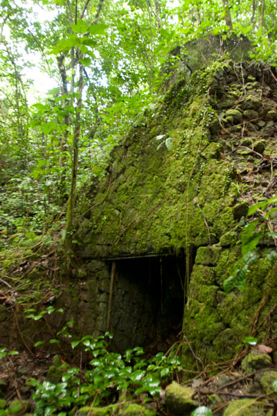
Subterranean Crude Oil Facility (Pahnlenger)
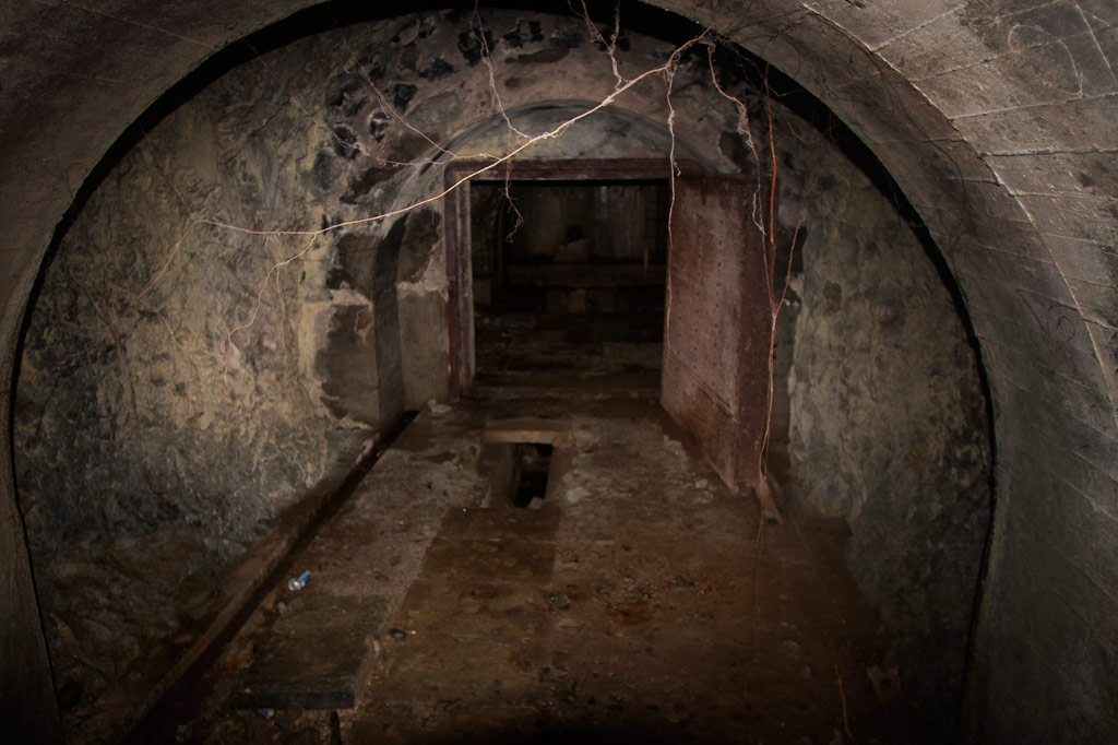
Built beneath Dolen Lenger, the Japanese crude oil storage complex is without question the most impressive of the island’s historical sites. If tight spaces, heights, cobwebs, bats, or the dark make you nervous, this is where you should grab your flashlight and confront your phobias! You don’t want to miss this experience, but do take care where you put your feet and watch out for swiftlets darting about.
The facility is accessed through the first of a trio of steel gates that opens onto a wide rock tunnel lying parallel to the hillside (Gates 2 & 3 are blocked by mud and rock-fall). Steel ladders in alcoves opposite each of the gates run up the wall to concrete lofts from which Japanese personnel could inspect the massive oil tanks. Each tank is 40 meters long and 10 meters wide (131 x 33 ft) with an arched, riveted ceiling and an estimated capacity of 3,300 metric tons. From each loft a second ladder descends 10 meters (33 ft) through a hatch to the floor of the tank. Depending on recent rains, there may between 10 cm and a meter of standing water on the floor, but it’s usually possible to explore without getting too wet. Japanese graffiti on the wall of the first loft reads: “Push forward bravely and strive.” Records seem to indicate that only the third tank was operational. A large diesel engine in front of Tank 3 was probably used to pump the oil in and out. A pipe runs all the way to the coast.
")
Storage Caves (Pahnaiau)
The four caves carved into the slope of Dolen Lenger were probably intended for use as storage facilities (and also for defense as a last resort), but may not have been completed. Cave 1 is tiny (about 6 meters deep). The other three are grouped together 50 meters (164 ft) to the northwest. Cave 2 is 15 meters deep, 8.5 meters across (49 x 28 ft), and nearly as high with a wide entrance sloping steeply to a soggy floor. If you venture down, be careful of broken glass from bottles that might have been meant for Molotov cocktails (gasoline bombs). Cave 3 is slightly larger and deeper with several terraces. A line of rock-filled barrels at the mouth seems to have been added as protection against a land attack, and the third terrace may have been intended for a machine gun. Cave 4 is the largest with a depth of 28 meters. All of the caves are muddy, often have standing water on their floors, and are occupied by colonies of Caroline Islands swiftlets. The name of the area, Pahnaiau, means “under the banyan tree.”
Concrete Plant Equipment (Pahnaiau)
West of the main path to the caves is a ballast mound with a mango tree on top and a cluster of equipment used in the process of making cement: three concrete mixers, a large Yanmar diesel engine, and the 610 mm gauge rail lines that were used to transport dynamited rock from the cave sites along the hillside. A rock-crusher lies 23 meters (75 feet) southwest of the mixers.
South Side
Oil Tank Complex (Pahnkamal)
This large walled complex originally contained two steel tanks for the storage of crude oil, which was pumped in from the coast. The larger tank, with a 1000-liter capacity, was dismantled in the 1970s by a man who needed steel plates for his ship. He was in the process of taking apart the smaller one, when the government intervened. The existing tank can be entered where the lower panels have been removed. The roof is accessible via a ladder on the inside, leading to a manhole. A courtyard wall surrounds the entire facility (now being used by local residents as a pigpen) and concrete channels lead to a pair of rectangular cisterns (currently piled with coconut husks). Large bomb craters from the American bombardment are found on the northwest and south sides.
")
Aviation Fuel Reservoir Tunnel (Pahnkamal)
Northwest of the main path is a subterranean tank that supplied the seaplanes with aviation fuel. A steel door in the hillside opens on a tunnel about 8 meters long (typically flooded with about 20 cm of standing water and silty mud). At the end of the tunnel, the fuel pipes turn to the right and disappear into a concrete wall, behind which the reservoir lies. A ladder runs up to a secondary entrance hatch on the slope, but it is now rusted shut. The Japanese took fuel from this location by truck to the seaplane facility.
East Side
Cisterns & Machines(Nanpeilam)
Footpaths leading toward residences on the eastern coast pass a variety of rusting machine parts and two rectangular concrete cisterns. The southernmost cistern can be entered through a hole knocked in the south wall. A ladder also runs up to the roof.
")
“The Banyan Wheel” (Dausong)
The most photogenic of the island’s attractions is not far from the main path on a terrace cut into the eastern slope of Dolen Lenger. There are several concrete foundations here and on one of them is an unidentified machine (perhaps an engine or rock-crusher) that has been completely absorbed by a huge banyan tree, such that the large machine wheel is permanently fixed on the outside of the tree with two roots growing right through the spokes. Take our word for it: it’s pretty darn cool.
Northeast Side
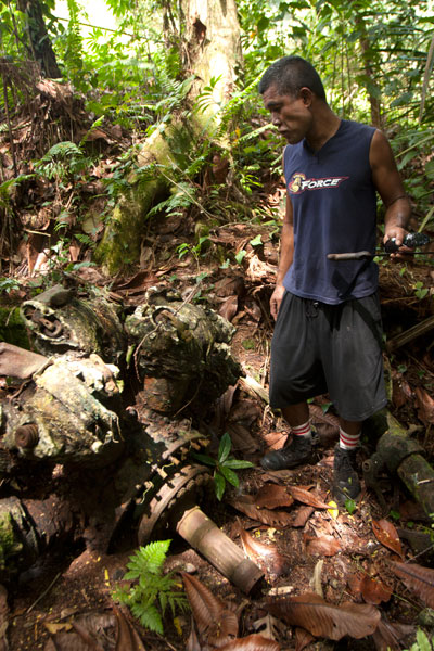
Seaplane Hangar & Aircraft Wreckage (Dietakai)
The hangar on the northeast side of the island once housed the “flying boats” that flew between Chuuk, Pohnpei, and the Marshall Islands and the Naval Type-O Observation seaplanes that were used for recon. ") The structure sustained at least two direct hits from bombs, leaving massive craters at the front and on the southeast wall and possibly contributing to the eventual collapse of most of the braced girder roof in the 1980s (only the rear portion still stands). Near the northeast corner is a half-buried air compressor and just beyond this the engine cylinder of a destroyed aircraft, but the tangled girders make it difficult to move further inside from this direction. A careful search near the east side of the foundation should yield the wreckage of at least one plane (an Aichi E13A1 Jake), including the engine and propeller, portions of a wing, a pontoon, strut, and bits of bulkhead next to one of the carriers used to move the planes. The hangar can be much more easily entered at the rear, where the roof girders are still intact. A pair of carriers — on their way to being devoured by a ficus — were used to transport the seaplanes.
The structure sustained at least two direct hits from bombs, leaving massive craters at the front and on the southeast wall and possibly contributing to the eventual collapse of most of the braced girder roof in the 1980s (only the rear portion still stands). Near the northeast corner is a half-buried air compressor and just beyond this the engine cylinder of a destroyed aircraft, but the tangled girders make it difficult to move further inside from this direction. A careful search near the east side of the foundation should yield the wreckage of at least one plane (an Aichi E13A1 Jake), including the engine and propeller, portions of a wing, a pontoon, strut, and bits of bulkhead next to one of the carriers used to move the planes. The hangar can be much more easily entered at the rear, where the roof girders are still intact. A pair of carriers — on their way to being devoured by a ficus — were used to transport the seaplanes.
Seaplane Ramp & Apron (Dietakai)
The large seaplane ramp and apron dates to 1939 or shortly after and was constructed by a labor force consisting of Japanese, Korean, Pingelapese, Mwoakillese, and Pohnpeian workers. The structure lies on a reclaimed portion of the island and stretches northeast into the sea. The underwater section was made from concrete slabs poured elsewhere and lowered from barges, where they were assembled by divers. Stone seawalls around the perimeter were constructed in the highly stable yabane-tanizumi configuration. Written accounts left by local workers describe slave-labor conditions and harsh punishments for anyone who did not cooperate (one account says men were strung up to bake in the sun). A Pohnpeian marching dance (“Ke Dehr Lemeleme Me Se Ruksang Doadoahk en Kaigun”) composed during the event, commemorates the regular desertions of laborers.
Today, the cratered apron has been claimed by the forest and is difficult to even identify from the ground, but at the time of writing there was a clear path across it. The ramp was repaired by the Americans and used as the primary airstrip until the current airport on Dekehtik was completed. It remains mostly intact, though several structures in the area post-date the Japanese period (including an old hut for picnickers and the concrete tanks from a giant clam hatchery that operated in the 1990s).
Dolen Lenger

Dug-Outs & Tunnels (Dolen Lenger)
The ascent of Dolen Lenger follows the northernmost of two Japanese roads that lead up the hill and eventually intersect. The lower part of the southern road is mostly blocked by trees and mud and is no longer a good way to access the hill, but you can explore the upper section, where several dug-outs cut into the slope on either side. Two of the entrances are connected by a short tunnel.
Gatepost & Barracks Foundations (Dolen Lenger)
A bit further up the northern path, hikers pass a gatepost (its twin has fallen down the hill), adorned with round, colorful river stones imported from Japan. Naval personnel gathered at this spot for their morning meeting. Not far ahead, the foundations of a barracks complex are found on a large terrace in the hillside. The area is littered with Japanese beer bottles, old diesel engines, steel water tanks, and rusting machine parts. A short tunnel worms into the slope to the left of where the path climbs a flight of concrete steps and continues up the hill.
")
Searchlight (Dolen Lenger)
The drum and turn-table of a 110 cm searchlight (probably a Navy Model 92) lie just off the right edge of the path. The light was originally mounted on the rock outcropping five meters (16 ft) west of the its current position and was used to identify targets at night. It was probably dismantled by American personnel after the war.
Small Gun Station (Dolen Lenger)
Further along, a deviation from the main path leads to an unknown battery, probably for a machine gun or small artillery, which was removed after the war. A short stone wall protects the site and contains two ammunition magazines.
Anti-Aircraft Gun Stations (Dolen Lenger)
Two anti-aircraft batteries crown the hill, one to the west and the other at the end of the main path. Both sites consist of concrete rings surrounded by stone and earth revetments and a number of ammunition magazines (nine at the first station and six at the second). Naval 8 cm Type 3 Dual-Purpose Guns were installed at these locations to protect the seaplane base and other important Lenger facilities. Unfortunately, both guns were removed after the war.
Dolen Lenger Summit Area
From the last anti-aircraft gun station, it’s possible to continue another 50 meters (164 ft) or so to the 77 meter summit of the hill (marked with a brass USGS benchmark) and pick your way to the cliff-top for expansive views of Kolonia and the northern lagoon. Bring a machete and take care at the edge of the precipice.
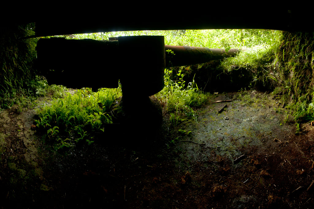
Coastal Battery & 15 cm Naval Gun (Dolen Lenger)
Just north of the searchlight, a branch in the path turns west and descends a series of muddy steps to the coastal batteries and their four naval gun stations. Records disagree as to whether guns were actually installed at all four of the stations or if one station at each battery was a decoy. The only gun remaining on Lenger — a 15 cm 40 caliber British Armstrong-Whitworth naval canon — lies on its side in the mud at the southernmost station not far from the pedestal mount. It was probably thrown there by the detonation of one of the many bombs dropped by Allied aircraft in 1944. The barrel and shield are separated from the jacket and recuperator and partly buried. Japanese records state that the 15 cm gun on Sokehs Mountain was originally installed at Lenger and moved during the war. Lenger’s guns were intended to prevent surface invasions from Pweitik Passage to the northwest and had a range of roughly 7 kilometers (4.3 mi).
Heavy Ordnance Magazine Foundation (Dolen Lenger)
Past the gun stations is the foundation of what was probably a magazine for heavy ordnance surrounded by impressive inclined blast walls of quarried basalt rock. As is true of the best examples of Japanese architecture on Pohnpei, the stones were laid in the alternating diagonal pattern called “herringbone style” (or yabane-tanizumi). The site was most definitely covered during the operational period and camouflaged to make it invisible from the air.
West Side
Coastal Barracks Foundations
The remains of two large barracks are found on the western coast of the island. Both of the structures were wooden pitched-roof buildings raised above the ground on concrete posts and reached by short flights of stairs. Each barracks housed as many as fifty men. Only the posts and stairs remain today. The southern foundation has a nahs built on top of it, which was part of one the island’s two “resorts” in the 1990s.
ACKNOWLEDGMENTS
The Lenger Island guide would not exist without the amazing work and cooperation of archaeologist Takuya Nagaoka, who was the first person to map the historical sites on Lenger. Nagaoka’s meticulous survey maps and exhaustive report (as yet, unpublished) were indispensable in the process of finding and interpreting neglected sites that had become heavily overgrown.
Sokehs Mountain
![]()
![]()
![]()
![]()
![]()
![]()
![]()
, Pohnpei, Federated States of Micronesia (FSM)")
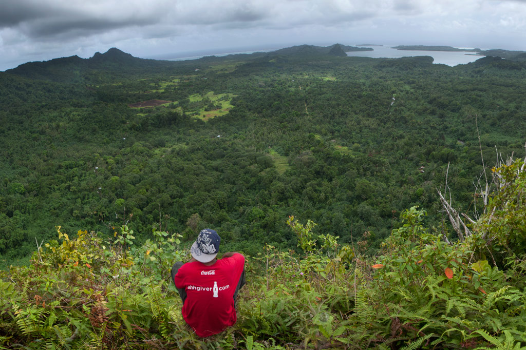
Sokehs Mountain or Pohndollap, which means “on the big hill,” is a long, mostly flat-topped ridge running north-south along the length of Sokehs Island with a knoll-like summit near the middle. The mountain was a refuge for the insurgents of the Sokehs Rebellion and later a key location in the Japanese defense of Pohnpei during World War II. The mountain’s attractions are mostly war-related, though it is also a highly-regarded birding spot.
The hike begins at the end of the paving above the Sokehs Municipal Office and climbs steadily along the rocky Japanese Road (or you can drive to the halfway point). At the top of the mountain, the road turns north next to a terrace on which the Japanese barracks structures originally stood — now the site of a concrete nahs built by the Office of Tourism in the late-2000s. From this point, it’s roughly 0.23 km (0.14 mi) south to the Coastal Battery and 0.78 km (0.48 mi) north to the summit of Dollap (276 m / 906 ft).
Japanese-Era Historical Sites
Command Post & Anti-Aircraft Battery
This site is centered around the Japanese Command Post, from which military operations on the Ridge were directed. There are many structures in the area:
Defensive Trench — This narrow, rock-lined trench has been partially swallowed by a bamboo grove that must have established itself after the war. The trench makes two 90 degree turns around something that is now buried beneath the roots of a massive tree. It’s unclear what the structure was, but electrical cables can still seen coming out of it through the trench wall.
Stone Look-Out — This elevated observation point is found just above the west wall of the Command Post, reached by several concrete steps. From the circular roof-less enclosure at the top, you can look out over Gun #1 and the Command Post foundations.
Personnel Tunnel / Shelter — This L-shaped personnel tunnel is found opposite Gun #1 under what looks like a man-made hill. The tunnel runs southeast and then makes a 90-degree turn before terminating. It’s about 7 meters long in total. The structure was probably intended as a bomb shelter.
Anti-Aircraft Guns — The two guns in the battery are identical: Type 89 12.7 cm twin double-purpose guns, which could pivot 360 degrees on their mounts and also tilt to fire at enemy aircraft overhead. Both guns are surrounded by sloped concrete revetments about 2 meters high with recessed ammunition magazines around the ring (some of which still have large machine springs in them). It took roughly one year for sixteen Pohnpeian laborers to move the guns to the Ridge and install them in their current positions. Gun #1 faces northeast, while Gun #2 points north and is missing its shield. An uncovered shaft lies just to the rear of each of the guns and drops 2 meters into the ground, connecting to a tunnel that housed the gun’s power cables. These shafts are potential hazards, especially when the grass is high. Take special care when walking around the sites to avoid falling into either of the holes!
, Pohnpei, Federated States of Micronesia (FSM)")
Command Post Foundations — Only the concrete basement foundations of the Command Post structure exist today. It seems to have been divided into two rooms. There’s a strange tower-like structure at the north side that TTPI archaeologist Duane Denfeld believed was used for target-bearing. The entrance is on the south side. To the left of the entrance under some trees is a flight of concrete stairs that has tipped partially on its side. It probably led up to the Look-Out and was either damaged by a bomb blast or undermined by erosion.
Machine Gun Pillbox — North of Gun #2 is a large pillbox with similar architecture as the coastal battery bunker. A set of stairs leads down to a stone corridor, which turns left into a circular chamber with slit openings on the front. From the outside, the structure is nearly invisible. The pillbox was probably intended for a machine gun, or more than one. As the chamber stays quite dry even during heavy rain, it’s a nice place to camp.
Mysterious Concrete Shaft — Southwest of the pillbox is a circular concrete shaft with a steel rung ladder leading downward. The shaft is currently flooded and its purpose is unclear. We’re still looking for information about this intriguing feature.
Barracks Area
, Pohnpei, Federated States of Micronesia (FSM)")
The foundations of barracks, a kitchen, and mess hall are found at the north end of the Coastal Battery trail. The largest concentration of foundations is east of the path, indicating at least three large buildings. Concrete steps are found east of the Coastal Battery trail and south of the main road. A large water tank on a rock platform next to the path probably supplied the kitchen area. An identical tank to the east may have been for a washroom. Foundations extend all the way to the Tourism nahs. A slightly-sloped retaining wall built in the Japanese stone masonry style, called uchikomihagi, (unshaped, fitted stones) frames the terrace on which the foundations lie, running east-west along the main road and then turning south. There’s also an unknown foundation isolated from the others north of the main road with earthen revetments on all sides. It might have been a magazine for heavy ordnance, though the design is different from facilities on Lenger and Sapwtik.
Coastal Battery
The Coastal Battery is found at the end of a well-defined trail 0.23 km (0.14 mi) southwest of the cinderblock nahs. There are several notable features:
Coastal Gun & Bunker — A 15 cm naval gun is found in a large rock and steel bunker on the western slope of the mountain. The gun was manufactured by the British company Armstrong-Whitworth in 1905 and remains in good condition. It was intended to protect against surface incursions from Palikir Pass, a primary barrier reef passage to the west, but it may not have seen much action. The gun had a range of about 7 kilometers (4.3 mi). The bunker is roughly 8 meters by 6 meters with steel I-beams supporting the concrete ceiling and the dirt that is mounded over it. It would have been difficult to identify the feature from the air. There are two ammunition magazines behind the gun with heavy steel doors. A short corridor connects the rear of the bunker with a prominent trench which runs south for roughly 60 meters (196 ft), ending at a large bomb crater.
, Pohnpei, Federated States of Micronesia (FSM)")
Rifle Pit — Twenty-five meters (82 ft) east of the gun bunker is a P-shaped rifle pit with rock walls. It may have originally been connected to the trench system mentioned above.
South Point
From the top of the Coastal Battery bunker, a trail runs 0.37 km (0.23 mi) south to the end of the Ridge. Along the way it passes scattered foundations, small water tanks, and several stone rifle pits. Little is known about the structures in this area. Bomb craters are obvious in many places. The path terminates at the mountain’s southernmost point–a narrow fin with steep slopes on both sides.
Rifle Pits on Western Slope
West of the Summit Road, 0.28 km (0.17 mi) north of the Command Post, is a complex of small stone rifle pits. Four rifle pits were investigated (two on either side of the path), with the pair to the south being the most extensive. Undoubtedly, there are many structures of this variety around the mountain’s slopes that have yet to be discovered. The area is lower than its surroundings and tends to be very muddy.
Power Station
Immediately east of the Summit Road, just before it begins to climb to the peak, are the remains of a Japanese power station. The most prominent features are a Yanmar 60 KVA generator and three concrete tanks–two for water that cooled the engines and one for fuel. Though the power station building is no more, the steel roof trusses still lie across the ground.
Summit Area
FSM Telecom has claimed the summit of Dollap, and the steel Japanese searchlight platform (about 5 meters in diameter) now supports one of two cellular phone towers. The views from the top of one of the accessible Telecom structures are spectacular and unobstructed. Just below the knoll is an L-shaped defensive trench with rock walls, probably for the men who manned the light. Above this is a small Japanese monument.