
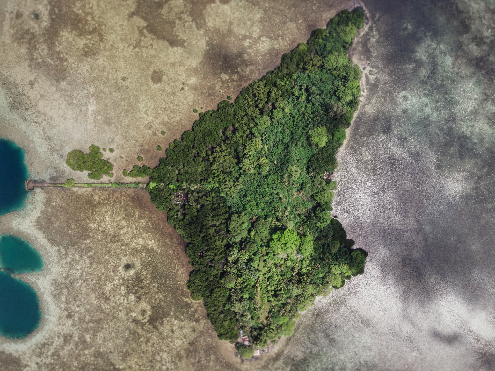
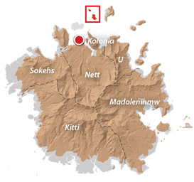
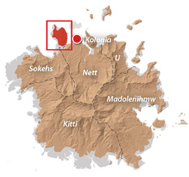
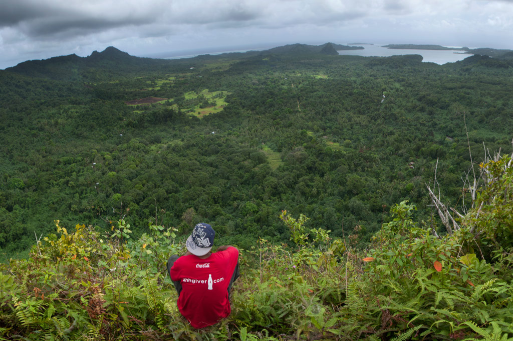
Sapwtik Island
Sapwtik, which means “small land,” is a tiny volcanic island located directly north of Kolonia and 0.5 km northwest of Lenger. Seen in profile, the island resembles a large submarine, leading some locals to nickname it “Submarine Island.” Sapwtik is jointly-owned by the Eschiet family, which has some small houses at the eastern end of island, and their in-laws, the Adams family. During the 1880s, Sapwtik was purchased by Jan Stanisław Kubary, a Polish naturalist and ethnographer, along with a large piece of land east of what is now Kolonia — a place called Mpwoampw. In 1896, after returning from an extended absence and finding his homestead in ruins and his claims on the properties questioned by the Spanish authorities, Kubary committed suicide. Mpwoampw and Sapwtik were then purchased by Dominique Escheit, a Belgian trader who had operated in the Marshall Islands before coming to Pohnpei. Between 1914 and 1945, the Japanese were in charge and a great deal of land was seized by the military for defensive purposes — including Sapwtik. Like its neighbor, Lenger, Sapwtik was fortified in the late 1930s in preparation for an Allied invasion that never came. The primary features are found on the low hilltop and at the western terminus.
Sapwtik Island Attractions

Japanese Wharf
Visitors to Sapwtik will want to make their first stop at the Japanese Wharf, a 296 meter-long (324 yd) basalt structure that juts out from the island’s southwest coast all the way to the edge of the reef. With the exception of the very end, which has sustained some damage from waves, the wharf is in excellent condition almost 80 years after it was built — a testament to the quality of Japanese construction during the colonial period (and the use of the highly stable tanizumi, or herringbone, style of stonework). The wharf connects with the coastal road, also built by the Japanese, which skirts the mangroves from one end of the island to the other. The road is built above a stone retaining wall that stabilizes it against the swampy mangrove environment. Retaining walls also run along the opposite edge to prevent erosion from the steep hillside above.
Snorkeling & Swimming
All the ocean areas around Sapwtik belong to the Sapwtik Marine Protected Area, a sanctuary protected by legislation. The snorkeling off the reef walls at the end of the wharf is quite nice with generally good visibility and lots of fish. Just start at the wharf and follow the reef wall in either direction (the further from the island, the better it gets). The best place to swim is also right off the end of the wharf. Shallow areas on either sides of the wharf are silty.
")
Command Center & Barracks
The central hill is most easily accessed from the maintained Japanese coastal road. About 60 meters east of the wharf, hikers can cut off the road and up the slope (another 60 m) to reach the summit. The Adam’s family keeps the hill extremely tidy, cutting the grass, planting flowers, and keeping the historical features free of vines and brush. The place has a manicured, park-like feel and a stunning view of everything to the south. One of the best preserved yabane-tanizumi style rock walls on Pohnpei runs the length of the hilltop on the south side with two breaks, where earthen ramps lead up to the top. Two foundations were likely a command center and a barracks for personnel stationed on the island. The northern foundation is the largest and has seven sets of steps leading up to where the floor once was. The structure itself would have been wooden, while only the support posts and the lower parts of the walls were concrete. Two large concrete cisterns are connected to the two foundations (check out the bullet holes from Allied strafing). At the north end of the complex, the hill road begins, cutting right through the hill and running all the way to the gun batteries at the northwestern end of the island. Some of the road is currently impassable due to piles of felled trees and branches, but it’s impressive none the less.
To visit the gun batteries, it’s best to return to the coastal road and hike northwest all the way to the end. The road is well-kept and easy to follow.
Magazine Complex / Shell Storage
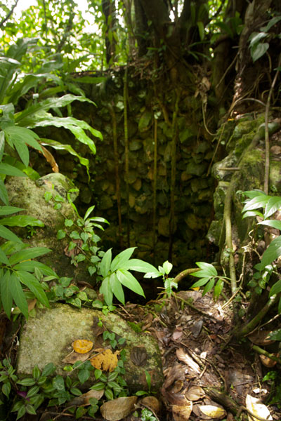
From the cut-off point for the hilltop, it’s about 150 m (164 yd) along the road to the first point of interest, a high-walled magazine complex for heavy ordnance similar to the one at the coastal gun battery on Lenger. The surrounding basalt rock wall (also tanizumi style) runs north and then curves sharply back to the south to enclose the foundation of the magazine structure, which is about 6 meters long. On the inside of the enclosure, the walls are steeply sloped. There is no roof, but the entire feature may have been covered with canvas and camouflaged during war-time. The entrance is narrow — less than 2 meters wide — and curved.
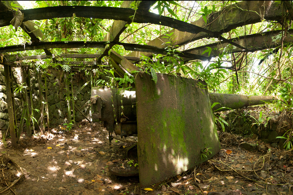
Coastal Gun Battery
About 12 meters northwest of the magazine is the first of four 75 mm field gun stations. These are similar to the structures on Lenger, though the Sapwtik sites are more primitive with less concrete and more earthen features. No guns remain, and two of the sites may have been decoys that never had guns installed. Guns would have protected the primary entrance to Kolonia at Pweitik Passage (Kepidauen Pweitik) to the northwest. A footpath continues north past the gun emplacements and then turns southeast to follow the contour of the hill. Along this are a few stone rifle pits or machine gun emplacements. Old Japanese beer bottles litter the forest.
[info]NOTE: The ruins of a searchlight and a tunnel, cutting completely through part of the central hill, also exist on Sapwtik, but we did not have the opportunity to locate them during our brief period of fieldwork on the island. If you’re interested in seeing these features, contact Richie Adams at (+691.320.5735). The Pacific Wrecks website has photos of both.[/info]
- To obtain permission to visit, call Richie Adams (Adam’s Brothers Corporation) at +691.320.5735 or call Ace Hardware’s office at +691.320.2723.
ACKNOWLEDGMENTS
The Sapwtik Island information would not exist without the cooperation of the Adams family.
(Central) Madolenihmw GPS Data
Downloadable GPS Data Files
The following files contain all the packaged GPS data for each of the featured locations in the (Central) Madolenihmw Eco-Adventure Map Guide.
Three file types are provided. KMZ and KML files are compatible with Google Earth. KML is compatible with Google Maps. GPX files can be imported into ArcGIS (a professional mapping application) and some hand-held GPS devices.
[info]NOTE: All files are free to the public and can be used for any purpose without permission.[/info]
Dolen Merewi Hike (2015)
Madolenihmw Bay Area Attractions (2015)
Nankep Waterfall Hike (2015)
Pahnsapw Waterfalls Hike (2015)
Pahn Sile Waterfall Hike (2015)
Pohnpaip Petroglyphs (2015)
Coordinates
The following coordinates correspond with sites featured on the (Central) Madolenihmw Eco-Adventure Map Guide. It is our dream to eventually create a Pohnpei GPS app that could be uploaded to smartphones and other devices, but for now, these points of interest can be entered manually in a hand-held GPS device as needed.
[info]NOTE: All GPS devices have a margin of error. That margin increases with interference — when there is a thick canopy of trees, during bad weather, or when mountains obstruct the satellite link. The geosynchronous satellites employed when navigating on Pohnpei are located low on the southwestern horizon, such that maintaining a strong connection while hiking on the northeast side of a given mountain range can be difficult. Coordinates on the northeastern slopes of mountains are less accurate than in other locations.[/info]
Dolen Merewi
| Dolen Merewi Turn-Off | —- | 6.882208° 158.290005° |
| Road Branching – bear left | —- | 6.881983° 158.278225° |
| Dolen Merewi Trailhead | —- | 6.880292° 158.274669° |
| Private Residence | —- | 6.880442° 158.274156° |
| Look-Out Point | —- | 6.883006° 158.270929° |
| Dolen Merewi True Summit | —- | 6.882815° 158.270869° |
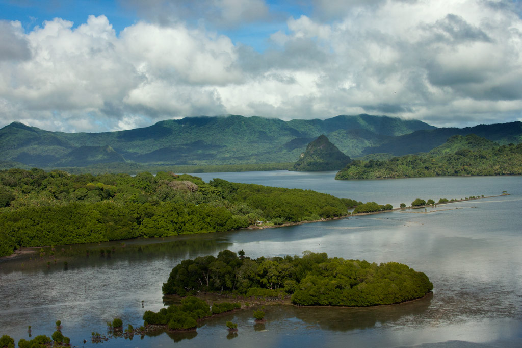
Madolenihmw Bay Area
| Lukop, Metipw & Kepine Turn-Off | —- | 6.898141° 158.315994° |
| Road Branching – bear left for Lukop and Metipw; bear right for Kepine and Takaiuh | —- | 6.889728° 158.314120° |
| Bridge | —- | 6.884719° 158.313625° |
| Japanese Agricultural Plots | —- | 6.886711° 158.311515° |
| Nanpahlap Trailhead | —- | 6.876366° 158.318225° |
| Nanpahlap Summit | —- | 6.875491° 158.315744° |
| Tahio Trailhead | —- | 6.874010° 158.317018° |
| Japanese Dug-Out | —- | 6.873007° 158.316122° |
| Japanese Trench | —- | 6.872754° 158.315133° |
| Japanese Tunnel | —- | 6.873264° 158.314119° |
| Abandoned Community Hut (nahs) | —- | 6.872849° 158.314316° |
| Takaiuh Summit | —- | 6.872128° 158.310713° |
| Rocky Hill | —- | 6.874429° 158.308532° |
| Dauen Sapwalap Entrance | —- | 6.876938° 158.308196° |
| Japanese Rice Paddies Turn-Off | —- | 6.888314° 158.296764° |
| Japanese Rice Paddies & Irrigation Canals | —- | 6.887325° 158.303652° |
| Metipw Causeway / Launch | —- | 6.878051° 158.333074° |
| Mwudokolos Island | —- | 6.883576° 158.336525° |
| Dahu Reirei Island | —- | 6.888759° 158.344288° |
| “Channel Island” | —- | 6.899494° 158.342153° |
| Nanwap Marine Protected Area | —- | 6.872988° 158.353673° |
| Nahpali Island Dock | —- | 6.861877° 158.354457° |
| Salong Point, Temwen Island | —- | 6.856468° 158.322737° |
| MERIP Boathouse | —- | 6.844010° 158.308539° |
| Madolenihmw Ice Dock | —- | 6.849520° 158.302712° |
| Madolenihmw Bay Scenic Point | —- | 6.855273° 158.295686° |
Nankep Waterfall
| Nankep Waterfall Turn-Off | —- | 6.858738° 158.291440° |
| Bridge | —- | 6.858789° 158.291453° |
| Nankep Waterfall Trailhead | —- | 6.859867° 158.286390° |
| Nankep Waterfall | —- | 6.859335° 158.283177° |
Nankepinmerepw Valley
| Nankepinmerepw Turn-Off | —- | 6.873704° 158.286552° |
| Nankepinmerepw Trailhead | —- | 6.875185° 158.273305° |
| Senipehn Footbridge | —- | 6.876110° 158.271732° |
| Private Residence | —- | 6.877294° 158.263737° |
| Small Falls & Swimming Pool | —- | 6.877911° 158.242150° |
| Prismatic Basalt Quarry Site / Falls | —- | 6.878689° 158.240613° |
| Nankepinmerepw Waterfall | —- | 6.880498° 158.239370° |
| Block Waterfall | —- | 6.882766° 158.238850° |
| Trail Branching – bear right for Nahnalaud; bear left for “The Cave.” | —- | 6.888859° 158.288880° |
| “The Cave” | —- | 6.866427° 158.230917° |
| USGS Benchmark | —- | 6.874333° 158.230076° |
| Nahnalaud Look-Out Point #2 | —- | 6.874333° 158.230076° |
| Nahnalaud Look-Out Point #1 / Observed Summit | —- | 6.873876° 158.228524° |
| Nahnalaud True Summit | —- | 6.873323° 158.228724° |
| Nahnalaud Mountain Shelter | —- | 6.874001° 158.227374° |
Pahnsapw Waterfalls
| Pahnsapw Waterfall Turn-Off | —- | 6.871427° 158.285654° |
| Sakau Market | —- | 6.871839° 158.285500° |
| Sakau Market | —- | 6.871234° 158.285637° |
| Road Branching – bear right | —- | 6.870202° 158.282381° |
| Bridge | —- | 6.870052° 158.280071° |
| Road Branching – bear right | —- | 6.870060° 158.280108° |
| Road Branching – bear left | —- | 6.869425° 158.278666° |
| Pahnsapw Trailhead | —- | 6.868207° 158.278527° |
| Silbanuz Residence | —- | 6.867969° 158.278513° |
| Pahnsapw Lower Falls | —- | 6.865171° 158.277289° |
| Hidden Pool | —- | 6.865183° 158.277071° |
| Pahnsapw Upper Falls | —- | 6.864683° 158.277100° |
Pahn Sile Waterfall
| Pahn Sile Waterfall Turn-Off | —- | 6.873704° 158.286552° |
| Taxi Stop | —- | 6.873691° 158.286771° |
| Bridge | —- | 6.873629° 158.286431° |
| Road Branching – bear left | —- | 6.875588° 158.281340° |
| Road Branching – bear left | —- | 6.875802° 158.276411° |
| Road Branching – bear left | —- | 6.875179° 158.273294° |
| Pahn Sile Trailhead | —- | 6.873597° 158.269375° |
| Trail Branching – bear right | —- | 6.873598° 158.269382° |
| Trail Branching – bear left | —- | 6.873662° 158.269032° |
| Japanese Irrigation Canal | —- | 6.871403° 158.266674° |
| Japanese Irrigation Canal | —- | 6.870612° 158.265405° |
| Stream Crossing | —- | 6.866702° 158.264493° |
| Trail Branching – Bear right for waterfall & pool; left to see the falls from above | —- | 6.866048° 158.264342° |
| Senipehn River Crossing | —- | 6.865499° 158.263650° |
| Pahn Sile Waterfall Pool | —- | 6.864499° 158.263151° |
| Pahn Sile Waterfall | —- | 6.864467° 158.263028° |
| Break north From trail to see the falls from above | —- | 6.864209° 158.262860° |
Pohnpaip Petroglyphs
| Pohnpaip Petroglyphs Turn-Off | —- | 6.886941° 158.291017° |
| Bridge | —- | 6.886789° 158.290910° |
| Pohnpaip Trailhead | —- | 6.888161° 158.289097° |
| Herson Residence | —- | 6.887435° 158.288495° |
| Pohnpaip Outcropping | —- | 6.887621° 158.288259° |
| Magical Door of Pohnpaip | —- | 6.887551° 158.288181° |
| Takain Pahsu | —- | 6.888396° 158.288694° |
| “Hindquarters Rock” | —- | 6.888665° 158.288933° |
| “Enveloped Cross Rock” | —- | 6.888859° 158.288880° |
U & Northern Madolenihmw GPS
Downloadable GPS Data Files
The following files contain all the packaged GPS data for each of the featured locations in U & Northern Madolenihmw.
Three file types are provided. KMZ and KML files are compatible with Google Earth. KML is compatible with Google Maps. GPX files can be imported into ArcGIS (a professional mapping application) and some hand-held GPS devices.
[info]NOTE: All files are free to the public and can be used for any purpose without permission.[/info]
Dolen Nahnsapwe Hike (2015)
Kupwuriso Mountain & Japanese Gun Battery Hike (2015)
Marine Parks in Awak Pah (2015)
Pahntakai Caves & Waterfall Hike (2015)
Timwen Men, Dolakapw & Pohn Tehnmei Hikes (2015)
Coordinates
The following coordinates correspond with sites featured on the Greater Nett & Western u Eco-Adventure Map Guide. It is our dream to eventually create a Pohnpei GPS app that could be uploaded to smartphones and other devices, but for now, these points of interest can be entered manually in a hand-held GPS device as needed.
[info]NOTE: All GPS devices have a margin of error. That margin increases with interference — when there is a thick canopy of trees, during bad weather, or when mountains obstruct the satellite link. The geosynchronous satellites employed when navigating on Pohnpei are located low on the southwestern horizon, such that maintaining a strong connection while hiking on the northeast side of a given mountain range can be difficult. Coordinates on the northeastern slopes of mountains are less accurate than in other locations.[/info]
Awak Marine Parks
| Awak Pah MP Entrance | —- | 6.965910° 158.250758° |
| Pein Ahi Entrance | —- | 6.966711° 158.251138° |
| Paieke Entrance | —- | 6.969853° 158.256294° |
| Awak Pah MP Dock | —- | 6.966470° 158.248785° |
| Pein Ahi Fish Pond | —- | 6.967572° 158.249929° |
Dolen Nahnsapwe
| Dolen Nahnsapwe Trailhead – Nett Approach | —- | 6.927169° 158.246675° |
| Dolen Nahnsapwe Trailhead – U Approach | —- | 6.918897° 158.270844° |
| Dolen Nahnsapwe Summit | —- | 6.909546° 158.260936° |
| Dolen Nahnsapwe Turn-Off from Lou Rahn Trail | —- | 6.923336° 158.249283° |
Nett & Western U GPS Data
Downloadable GPS Data Files
The following files contain all the packaged GPS data for each of the featured locations in Greater Nett & Western U.
Three file types are provided. KMZ and KML files are compatible with Google Earth. KML is compatible with Google Maps. GPX files can be imported into ArcGIS (a professional mapping application) and some hand-held GPS devices.
[info]NOTE: All files are free to the public and can be used for any purpose without permission.[/info]
Marine Parks in Awak Pah (2015)
Dolen Eirike (2015)
Dolen Nahnsapwe (2015)
Lou Rahn Cave & Waterfall (2015)
Nan Kiepw & Na Malek Cave (2015)
Nan Koropwung Cliff, Waterfall & Caverns (2015)
Dolen Nett / Pohnlehr (2015)
Nanipil Vicinity (2015)
These files include Liduduhniap, Sengnaip, Likei, Pahn Pwet, and Nan Kiepw waterfalls, the Nanipil Bird Walk, the Swimming Pond, and another popular swimming hole in the area.
Coordinates
The following coordinates correspond with sites featured on the Greater Nett & Western u Eco-Adventure Map Guide. It is our dream to eventually create a Pohnpei GPS app that could be uploaded to smartphones and other devices, but for now, these points of interest can be entered manually in a hand-held GPS device as needed.
[info]NOTE: All GPS devices have a margin of error. That margin increases with interference — when there is a thick canopy of trees, during bad weather, or when mountains obstruct the satellite link. The geosynchronous satellites employed when navigating on Pohnpei are located low on the southwestern horizon, such that maintaining a strong connection while hiking on the northeast side of a given mountain range can be difficult. Coordinates on the northeastern slopes of mountains are less accurate than in other locations.[/info]
Awak Marine Parks
| Awak Pah MP Entrance | —- | 6.965910° 158.250758° |
| Pein Ahi Entrance | —- | 6.966711° 158.251138° |
| Paieke Entrance | —- | 6.969853° 158.256294° |
| Awak Pah MP Dock | —- | 6.966470° 158.248785° |
| Pein Ahi Fish Pond | —- | 6.967572° 158.249929° |
Dolen Eirike
| Relio Lengsi’s Residence | —- | 6.926688° 158.227910° |
| Dolen Eirike Trailhead | —- | 6.919570° 158.227397° |
| Sakau Plantation | —- | 6.917106° 158.227410° |
| Japanese Trench Network | —- | 6.915589° 158.230300° |
| Dolen Eirike Summit | —- | 6.915140° 158.231599° |
| Dol Rakied Summit | —- | 6.906234° 158.237645° |
Dolen Nahnsapwe
| Dolen Nahnsapwe Trailhead – Nett Approach | —- | 6.927169° 158.246675° |
| Dolen Nahnsapwe Trailhead – U Approach | —- | 6.918897° 158.270844° |
| Dolen Nahnsapwe Summit | —- | 6.909546° 158.260936° |
| Dolen Nahnsapwe Turn-Off from Lou Rahn Trail | —- | 6.923336° 158.249283° |
Lou Rahn
| Lou Rahn Trailhead | —- | 6.927169° 158.246675° |
| Lou Rahn Cave & Waterfall | —- | 6.918551° 158.253955° |
Nan Kiepw & Na Malek
| Nan Kiepw / Na Malek / Nahnalaud Nett Trailhead | —- | 6.918179° 158.214601° |
| Stream Crossing | —- | 6.917458° 158.215238° |
| Nahnalaud Turn-Off from Nan Kiepw Trail | —- | 6.910792° 158.217769° |
| Last House along trail | —- | 6.900363° 158.214973° |
| Na Malek Loop Turn-Off from Nan Kiepw Trail | —- | 6.897523° 158.213266° |
| Na Malek Loop Turn-Off from Nan Kiepw Trail | —- | 6.895756° 158.213144° |
| Na Malek Cave | —- | 6.895878° 158.211765° |
| Kiepw Waterfall | —- | 6.889668° 158.211740° |
| Nan Kiepw Overhang & Campsite | —- | 6.889639° 158.211035° |
Nan Koropwung
| Nan Koropwung Trailhead | —- | 6.925729° 158.254909° |
| Cliff & Waterfall | —- | 6.927155° 158.259679° |
| Cave 1 | —- | 6.927513° 158.259859° |
| Cave 2 | —- | 6.927877° 158.259142° |
| Cave 3 | —- | 6.927884° 158.259038° |
Dolen Nett / Pohnlehr
| Dolen Nett Trailhead 1 | —- | 6.968282° 158.230457° |
| Dolen Nett Trailhead 2 | —- | 6.965640° 158.234757° |
| Dolen Nett Trailhead 3 | —- | 6.959650° 158.225124° |
| Dolen Nett Trailhead 4 | —- | 6.969614° 158.228438° |
| Japanese Tunnel Entrance | —- | 6.965840° 158.228329° |
| Yam Plantation | —- | 6.965248° 158.228609° |
| Japanese Defensive Position | —- | 6.964007° 158.229053° |
| Japanese Trench Network | —- | 6.963868° 158.229051° |
| Japanese Trench Network | —- | 6.963073° 158.229706° |
| Japanese Trench Network | —- | 6.963105° 158.229949° |
| Japanese Trench Network | —- | 6.963125° 158.230125° |
| Japanese Trench Network | —- | 6.963025° 158.230332° |
| Pandanus Grove | —- | 6.961883° 158.230662° |
| Coconut Palm Grove | —- | 6.961188° 158.231013° |
| 80 mm Field Gun | —- | 6.958862° 158.233030° |
| Rusted Barrels | —- | 6.958814° 158.233064° |
| 80 mm Gun in Bunker | —- | 6.958838° 158.233535° |
| Machinegun Bunker | —- | 6.958741° 158.233545° |
| Bunker | —- | 6.958765° 158.233415° |
| Pohnlehr Summit | —- | 6.958226° 158.233346° |
| Japanese Mobile Radar Array | —- | 6.958767° 158.232402° |
Sengnaip Waterfalls
| Trailhead | —- | 6.920677° 158.204421° |
| Route Intersection | —- | 6.920647° 158.201060° |
| Sengnaip Cave | —- | 6.917556° 158.200460° |
| Sengnaip Waterfalls | —- | 6.917522° 158.200383° |
Likei & Pahn Pwet Waterfalls
| Trailhead | —- | 6.920677° 158.204421° |
| Route Intersection | —- | 6.920647° 158.201060° |
| Stream Crossing | —- | 6.919559° 158.198878° |
| Log Crossing | —- | 6.916577° 158.198932° |
| Route Intersection | —- | 6.916577° 158.198932° |
| Route Intersection | —- | 6.914373° 158.199648° |
| Route Intersection | —- | 6.904178° 158.192649° |
| Route Intersection | —- | 6.904178° 158.192649° |
| Likei Waterfall | —- | 6.903375° 158.189810° |
| Pahn Pwet Waterfall | —- | 6.902343° 158.192313° |
Nan Kiepw Waterfall
| Trailhead | —- | 6.919873° 158.206230° |
| Route Intersection | —- | 6.914373° 158.199648° |
| Nan Kiepw Waterfall | —- | 6.897512° 158.206958° |
Liduduhniap Waterfalls
| Trailhead | —- | 6.919915° 158.206706° |
| Upper Pool | —- | 6.918893° 158.206592° |
| Upper Falls | —- | 6.918891° 158.206557° |
| Lower Pool | —- | 6.918564° 158.206676° |
| Lower Falls | —- | 6.918695° 158.206572° |
Nanipil Vicinity
| Nanipil Bird Walk Trailhead | —- | 6.920677° 158.204421° |
| Nanipil Bird Walk Trail End | —- | 6.919559° 158.198878° |
| Hydroelectric Building | —- | 6.918222° 158.214670° |
| Japanese Pump Station | —- | 6.918404° 158.214481° |
| Swimming Pond Trailhead | —- | 6.922461° 158.215089° |
| Swimming Pond | —- | 6.922642° 158.215955° |
| Cable Bridge Swimming Hole | —- | 6.932656° 158.216346° |
Lenger Island GPS Data
Downloadable GPS Data Files
The following files contain all the packaged GPS data for the Lenger Island Eco-Adventure Map Guide, including the island’s coastline, ocean depth info, ten meter contour lines, mangrove forests, roads and trails, land divisions, World War II features, modern features, and other points of interest.
Three file types are provided. KMZ and KML files are compatible with Google Earth. KML is compatible with Google Maps. GPX files can be imported into ArcGIS (a professional mapping application) and some hand-held GPS devices.
[info]NOTE: All files are free to the public and can be used for any purpose without permission.[/info]
Lenger Island (2016)
Coordinates
The following coordinates correspond with sites featured on the Lenger Island Eco-Adventure Map Guide. It is our dream to eventually create a Pohnpei GPS app that could be uploaded to smartphones and other devices, but for now, these points of interest can be entered manually in a hand-held GPS device as needed.
[info]NOTE: All GPS devices have a margin of error. That margin increases with interference — when there is a thick canopy of trees, during bad weather, or when mountains obstruct the satellite link. The geosynchronous satellites employed when navigating on Pohnpei are located low on the southwestern horizon, such that maintaining a strong connection while hiking on the northeast side of a given mountain range can be difficult. Coordinates on the northeastern slopes of mountains are less accurate than in other locations.[/info]
Southwestern Lenger
| Barbosa’s Wharf | —- | 6.993799° 158.228531° |
| Former Barbosa Resort Site | —- | 6.994306° 158.229159° |
| Japanese Coastal Warehouse Foundation | —- | 6.994406° 158.229708° |
| Japanese Underground Crude Oil Complex Trailhead | —- | 6.994717° 158.229517° |
| Gate 1 – Crude Oil Complex | —- | 6.995515° 158.230239° |
| Japanese Storage Caves Trailhead | —- | 6.993890° 158.230359° |
| Japanese Concrete Plant Trailhead | —- | 6.994275° 158.230646° |
| Japanese Concrete Plant Equipment | —- | 6.994502° 158.230447° |
| Ballast Hill | —- | 6.994418° 158.230380° |
| Japanese Cave 1 | —- | 6.994567° 158.231047° |
| Japanese Cave 2 | —- | 6.994792° 158.230931° |
| Japanese Cave 3 | —- | 6.994894° 158.230736° |
| Japanese Cave 4 | —- | 6.994950° 158.230661° |
| Japanese Above-Ground Oil Tank | —- | 6.993772° 158.230847° |
| Japanese Above-Ground Oil Tank Foundation | —- | 6.993894° 158.230716° |
| Path Intersection Point | —- | 6.993445° 158.230835° |
Southern Lenger
| Japanese Machine Parts | —- | 6.993100° 158.231317° |
| Japanese Square Cistern | —- | 6.993406° 158.231139° |
| Japanese Aviation Fuel Tank Trailhead | —- | 6.993896° 158.231492° |
| Japanese Aviation Fuel Tank Tunnel Gate | —- | 6.994211° 158.231342° |
| Japanese Rectangular Cistern | —- | 6.994006° 158.231840° |
| Japanese Machinery & Wheels | —- | 6.993628° 158.231561° |
Eastern Lenger
| Stream Crossing | —- | 6.995612° 158.232389° |
| Banyan Wheel | —- | 6.996089° 158.232106° |
| Dolen Lenger Trailhead (Eastern Route) | —- | 6.995896° 158.232360° |
Northeastern Lenger
| Japanese Seaplane Hangar Ruin | —- | 6.997648° 158.232069° |
| Compressor | —- | 6.997654° 158.232009° |
| Japanese Seaplane Strut | —- | 6.997610° 158.231969° |
| Japanese Seaplane Engine & Prop | —- | 6.997646° 158.231922° |
| Japanese Seaplane Carriers | —- | 6.997317° 158.231503° |
| Japanese Seaplane Ramp Trailhead | —- | 6.998005° 158.231864° |
| Japanese Seaplane Ramp | —- | 6.999088° 158.233040° |
Northern Lenger
| Well | —- | 6.998180° 158.231401° |
| Bomb Craters | —- | 6.998240° 158.230883° |
Western Lenger
| Japanese Coastal Barracks Site | —- | 6.996593° 158.228989° |
| Japanese Coastal Barracks Site | —- | 6.997418° 158.228861° |
| Dolen Lenger Trailhead Western Route A | —- | 6.997555° 158.229206° |
| Dolen Lenger Trailhead Western Route B | —- | 6.997874° 158.229242° |
Central Lenger (Hill Area)
| Intersection of Japanese Hill Roads | —- | 6.997592° 158.230367° |
| Tunnel Entrance | —- | 6.997431° 158.230122° |
| Japanese Dug-out 1 | —- | 6.997294° 158.230053° |
| Japanese Dug-out 2 | —- | 6.997325° 158.230153° |
| Japanese Gatepost | —- | 6.997197° 158.230789° |
| Dolen Lenger Japanese Cistern 1 | —- | 6.996967° 158.230894° |
| Cement Steps | —- | 6.996908° 158.230919° |
| Japanese Coastal Battery Trailhead | —- | 6.996659° 158.230743° |
| 15-cm Gun Station 3 | —- | 6.996673° 158.230400° |
| 15-cm Gun Station 4 | —- | 6.996549° 158.230341° |
| 15-cm Gun 4 | —- | 6.996589° 158.230353° |
| Japanese Heavy Ordnance Magazine | —- | 6.996374° 158.230300° |
| Japanese Searchlight Drum | —- | 6.996547° 158.230692° |
| Searchlight Mount | —- | 6.996547° 158.230644° |
| Well | —- | 6.996164° 158.230914° |
| Small Japanese Gun Station | —- | 6.996278° 158.230736° |
| Japanese Anti-Aircraft Gun Station 1 | —- | 6.996000° 158.230706° |
| Cliff-Top Viewpoint | —- | 6.995681° 158.230625° |
| Japanese Anti-Aircraft Gun Station 2 | —- | 6.995547° 158.230878° |
| Cliff-top Viewpoint | —- | 6.995256° 158.231036° |
| Dolen Lenger Summit | —- | 6.995211° 158.231133° |
| Tunnel Entrance | —- | 6.996831° 158.230875° |
| Japanese Hillslope Barracks Foundations | —- | 6.996666° 158.231196° |
| Dolen Lenger Japanese Cistern | —- | 6.996650° 158.231408° |
| Japanese Diesel Engines | —- | 6.996544° 158.231369° |
| Japanese Catchments | —- | 6.996519° 158.231397° |
Around Lenger Island
| Mangrove Channel – North End | —- | 6.994655° 158.233077° |
| Mangrove Channel – South End | —- | 6.992055° 158.232919° |
| Kohatsu Wharf Ruin | —- | 6.991614° 158.232224° |
| Jaluit Cistern | —- | 6.994608° 158.227631° |
Central Sapwtik
| Sapwtik Island Japanese Wharf | —- | 7.002000° 158.223916° |
| Coastal Path Intersection Point | —- | 7.004462° 158.224978° |
| Ascent to Dolen Sapwtik | —- | 7.004270° 158.225460° |
| Japanese Hilltop Wall | —- | 7.004401° 158.225972° |
| Dolen Sapwtik Summit | —- | 7.004317° 158.226247° |
| Japanese Hilltop Foundation 1 | —- | 7.004372° 158.226264° |
| Japanese Hilltop Foundation 2 | —- | 7.004531° 158.226044° |
| Japanese Hilltop Foundation 3 | —- | 7.004643° 158.225894° |
| Great Banyan | —- | 7.004788° 158.225917° |
| Japanese Hilltop Cistern 1 | —- | 7.004421° 158.226434° |
| Japanese Hilltop Cistern 2 | —- | 7.004567° 158.226193° |
Western Sapwtik
| Japanese Heavy Ordnance Magazine | —- | 7.005594° 158.224468° |
| Japanese Coastal Gun Station 1 | —- | 7.005850° 158.224329° |
| Japanese Coastal Gun Station 2 | —- | 7.005976° 158.224384° |
| Japanese Coastal Gun Station 3 | —- | 7.006085° 158.224460° |
| Japanese Coastal Gun Station 4 | —- | 7.006203° 158.224497° |
Northern Sapwtik
| Japanese Hillside Rifle Pit | —- | 7.005679° 158.224880° |
Sokehs Island GPS Data
Downloadable GPS Data Files
The following files contain all the packaged GPS data for each of the featured locations in Sokehs Island.
Three file types are provided. KMZ and KML files are compatible with Google Earth. KML is compatible with Google Maps. GPX files can be imported into ArcGIS (a professional mapping application) and some hand-held GPS devices.
[info]NOTE: All files are free to the public and can be used for any purpose without permission.[/info]
[warning]Google Earth imagery exhibits some scaling errors in this sector (i.e. the GPS track, which was checked multiple times with multiple devices, does not line up with the imagery for the primary road leading up Sokehs Mountain). We are confident that our data is as accurate as possible and that some of the aerial images on Google Earth are incorrectly positioned.[/warning]
Sokehs Island (2013) – All destinations and landmarks
Coordinates
The following coordinates correspond with sites featured on the Sokehs Island Eco-Adventure Map Guide. It is our dream to eventually create a Pohnpei GPS app that could be uploaded to smartphones and other devices, but for now, these points of interest can be entered manually in a hand-held GPS device as needed.
[info]NOTE: All GPS devices have a margin of error. That margin increases with interference — when there is a thick canopy of trees, during bad weather, or when mountains obstruct the satellite link. The geosynchronous satellites employed when navigating on Pohnpei are located low on the southwestern horizon, such that maintaining a strong connection while hiking on the northeast side of a given mountain range can be difficult. Coordinates on the northeastern slopes of mountains are less accurate than in other locations.[/info]
| Sokehs Ridge Trailhead / Parking A | —- | 6.961462° 158.195136° |
| Overlook / Parking B | —- | 6.967450° 158.191733° |
| Japanese Stone Wall | —- | 6.963677° 158.191191° |
| Japanese Foundation | —- | 6.963862° 158.191156° |
| Japanese Lookout Post | —- | 6.963977° 158.190538° |
| Japanese Personnel Tunnel | —- | 6.964164° 158.190475° |
| 12.7 cm Anti-Aircraft Gun 1 | —- | 6.964264° 158.190400° |
| 12.7 cm Anti-Aircraft Gun 2 | —- | 6.964161° 158.190933° |
| Japanese Command Post Entrance | —- | 6.963936° 158.190680° |
| Japanese Command Post Foundations | —- | 6.964045° 158.190628° |
| Japanese Concrete Stairs | —- | 6.963892° 158.190686° |
| Japanese Barracks Foundations | —- | 6.963401° 158.190810° |
| Japanese Stove | —- | 6.963339° 158.190848° |
| Japanese Concrete Cistern | —- | 6.963368° 158.190658° |
| 15 cm Coastal Gun & Bunker | —- | 6.962280° 158.189922° |
| Japanese Rifle Pits | —- | 6.966399° 158.189686° |
| Japanese Defensive Trench & Monument | —- | 6.969568° 158.189515° |
| Dollap Summit | —- | 6.969504° 158.189671° |
Sokehs Rock (Paipalap)
| Sokehs Rock Trailhead | —- | 6.977449° 158.193532° |
| Rock Formations / Bouldering Location | —- | 6.977236° 158.191589° |
| Tree Cliff | —- | 6.976622° 158.190800° |
| Rear Foot, Sokehs Rock | —- | 6.976828° 158.190633° |
| The Spire | —- | 6.976230° 158.190944° |
| The Adam’s Apple | —- | 6.975772° 158.190901° |
| Sokehs Rock Summit | —- | 6.978172° 158.190044° |
Kepindau & Pohn Pillap Waterfalls
| Eel Pool, Kepindau | —- | 6.976746° 158.185047° |
| Kepindau Falls Trailhead | —- | 6.976732° 158.184887° |
| Kepindau Falls | —- | 6.974786° 158.185720° |
| Pohn Pillap Falls Trailhead | —- | 6.976320° 158.183070° |
| Pohn Pillap Falls | —- | 6.975267° 158.182845° |
Around Sokehs Island
| Sokehs Municipal Office | —- | 6.958175° 158.194753° |
| Mwalok A-1 Store | —- | 6.968211° 158.196875° |
| Mwalok Community | —- | 6.968740° 158.196965° |
| Mwalok Congregationalist Church | —- | 6.969022° 158.196926° |
| Danipei Community | —- | 6.978790° 158.192938° |
| Danipei United Church of Christ | —- | 6.978364° 158.193000° |
| Historic Preservation Office Nahs | —- | 6.979906° 158.193745° |
| Portage Point | —- | 6.980388° 158.194301° |
| German Road A East End | —- | 6.979963° 158.191738° |
| German Road A West End | —- | 6.980274° 158.190965° |
| German Road B East End | —- | 6.980830° 158.189582° |
| German Road B West End | —- | 6.981042° 158.188068° |
| Nan Imwinsapw Picnic Area | —- | 6.981113° 158.188154° |
| Plateau Road North End | —- | 6.977893° 158.181932° |
| APSCO Quarry Office | —- | 6.980230° 158.181378° |
| The Doldrums Swimming Spot | —- | 6.983199° 158.176991° |
| Roie Church | —- | 6.970795° 158.176375° |
| Sokehs Pah Launch | —- | 6.969430° 158.176897° |
| Sokehs Pah Volleyball Court | —- | 6.964280° 158.183795° |
| Plateau Road South End | —- | 6.962296° 158.184584° |
| Sokehs Pah Basketball Court | —- | 6.955223° 158.189363° |
| St. Peter’s Launch | —- | 6.956975° 158.196907° |
| Sokehs Island Turn-off | —- | 6.956358° 158.198737° |
| Sokehs Island Bridge | —- | 6.957245° 158.195640° |
| Daumwoakote (Channel) East End | —- | 6.954688° 158.194789° |
| Daumwoakote (Channel) West End | —- | 6.953596° 158.181093° |
| The Labyrinth | —- | 6.951691° 158.177859° |
Dolen Palikir
Dolen Palikir (“hill of Palikir“) is a long hill in the middle of Palikir that runs northeast-southwest and has knolls at each end. The southern summit is slightly higher than the other at 250 meters. The Japanese capitalized on Dolen Palikir’s geography as they did with most of the high points on Pohnpei. Trench systems cross the path or run alongside it in several places and there are many small rifle pits. The trail begins at the Hadley residence west of the road leading to Iohl and climbs gently through high, waving grass before entering the trees. There it steepens as it meanders through sakau (kava) plantations (the tallest plants are just below the first summit). Near the summit benchmark is a prehistoric pehi (stone platform) linked to a story about Lepen Palikir — the highest chief in the region, but there’s no clear view of the valley here. The hike to the southern point follows the mostly flat ridge, passing many earthen defensive works, but none with cement or stonework. Near the middle of the ridge, the trees open up and provide a view of the panorama below. The most extensive Japanese structure is at the hill’s highest point and consists of three recessed gun sites with stone retaining walls around them and a trench leading down-slope.
- Plan for 2-4 hours for this hike. Ask at the house for guides Rihlent Hadley or Denster Louis. Offer $20.00.
Dolopwuropwur Gun Battery
![]()
![]()
![]()
![]()
![]()
The most extensive Japanese gun battery on Pohnpei lies on Temwen’s rounded central hill, Nindol, perched at its 60 meter peak, Dolopwuropwur.

Gun Stations
The four guns at the summit are identical to the one on Sokehs Mountain — British-made 15 cm Armstrong Whitworth naval canons manufactured in 1905. The guns are arranged in pairs with a concrete ammunition magazine between each set of stations. The semi-circular emplacements are constructed of concrete and local stone. There are also stone retaining walls along the corridors that lead to the stations. Steel girders running over Stations 1 and 4 are evidence that these two guns, at the very least, were covered to make them difficult to identify from the air. All of the stations are in relatively good condition, though the embankment around Station 3 has slipped down and partially buried the walls. Guns 1 and 4 point north and southeast, respectively, while Guns 2 and 3 point northeast. In combination, they would have had firing coverage of around 250 degrees. At the time of operation the hill was probably relatively clear of trees, providing an unobstructed view of the area islands and the two possible points of entry into the lagoon at Kepidauen Deleur and Kepidauen Nahkapw.
Stone Tower
West of Station 4 is a stone tower (possibly a look-out for targeting or even a searchlight emplacement). Presumably, the tower was crowned with a platform of wood or metal, but that is no longer present. Now a flight of twenty-odd steps lead to the edge of a gaping hole as deep as the tower is high. We didn’t find a searchlight, but it may lie hidden somewhere in the surrounding area.
Trench Network
A narrow 0.27 km-long (0.17 mi) trench begins at the tower base and meanders down the hill with short deviations going to a dug-out under the tower itself and a magazine-like structure built into the hillside and currently occupied by a colony of small insectivorous bats. The latter is almost large enough to park a jeep inside, but there’s no evidence of a road leading to it. It was probably additional storage for munitions. It’s possible to climb down into the trench and follow it until it connects with one of the well-trodden footpaths in the Temwen interior.
The 0.3 km (0.19 mi) trail to the battery begins not far from the end of a muddy residential road opposite Temwen Elementary School and can be easily followed without a guide.
The family at the last house on the road charges $3.00 per person to visit Dolopwuropwur.
- Plan for 1-2 hours to fully explore the area and 1 hour (each way) for the drive.
Madolenihmw Bay Area
![]()
![]()
![]()
![]()
![]()
![]()
![]()
![]()
![]()
![]()
![]()
![]()
![]()
![]()
![]()
Dauen Sapwalap / Senipehn Mangrove Reserve
- Visit the Paddling Around Madolenihmw page for a detailed description of this location and the adventures to be had in the area.
- Entering the mangrove reserve requires a permit. Visit our MPA page for details.
Kamau Pwoungapwoung
Though we didn’t map the hike to this destination as part of the eco-adventure map series (for lack of time), it would, never the less, be an exciting adventure to consider. Kamau Pwoungapwoung refers to a freshwater pool and waterfall at the headwaters of the Dipwilap Stream (Pilen Dipwilap), one of the tributaries of the Senipehn River (Pillapen Senipehn). The place is significant as the location where the last battle between the Saudeleur‘s warriors and Isokelekel’s men was fought. Upon being defeated by Isokelekel, the Saudeleur transformed himself into a small blue fish, that inhabits the pool to this day, and leaped into the waterfall. The hike would be a long one from the area around Pahn Sile. The closest access point would probably be from the direction of Nihpit fern meadow (reached from eastern Kitti).
- The absolute best choice for a guide is Relio Lengsi. Give him a call at +691.924.2580 and discuss the best route options and access points for this location. Offer $50.00 for a full-day hike.
Nanpahlap Peak
The 137 m (449 ft) hill to the east of Takaiuh looks as if its top has been lopped off — which fits in with the story about its creation (see Takaiuh below). Though steep in places and somewhat overgrown, the ascent isn’t too strenuous. At the summit are the tumbled ruins of a prehistoric stone structure and a breath-taking view. The whole area around the southern foot of the hill is criss-crossed with Japanese trenches and dotted with tunnels, including at least one very long one leading into the hill. The grid of paddies and irrigation canals where the Japanese successfully cultivated rice (despite Pohnpei’s challenging climate conditions) are found on both sides of the unpaved access road, though you can get closest to the bulk of these fields from another road to the west.
Everything is private land, but no official access fees are charged.
- To hire a guide, ask at the houses in the area or contact Hanke Albert at +691.320.4047. Offer $25.00 for Nanpahlap or a half-day of exploration in the area.
Nanwap Marine Protected Area (MPA)
Nanwap Marine Protected Area is a 3.05 km2 (305 hectare) section of the barrier reef and adjacent lagoon areas on the north side of Kepidauen Deleur (passage). The sanctuary was founded by community members from Metipw and Lukop and their respective chiefs and gained legal status in 2010. It became the first of Pohnpei’s MPAs to have its own formal community-created management plan with the support of the Pohnpei MPA Executive Management Network and the state offices of the Department of Land and Natural Resources, Division of Fish and Wildlife, Office of Fisheries and Aquaculture, and Environmental Protection Agency. Nanwap is a “no-take zone,” which means no fishing or gathering of any kind is allowed within the boundaries. It is regarded as the “most biologically diverse and best preserved spawning and aggregation site” for many of Pohnpei’s core reef fish species. Snorkelers should seek out the protected blue holes on the west side of the reef, while SCUBA divers will want to do a drift dive on the southern wall of the reef during an in-coming tide.
- Entering the MPA requires a permit. Visit our MPA page for details.
Pahn Dieinuh
- Visit the Paddling Around Madolenihmw page for a detailed description of this location.
Peiai
Peiai is a small populated place near the turn-off for Pahn Sile waterfall. During the battle between the warriors of Isokelekel and the army of the last Saudeleur, Peiai was the place where the tide of battle turned dramatically (hence, the name references a situation where the runner-up in a race pulls ahead of the leader — loosely translated “the battle is reversed”). Isokelekel’s men were being beaten down by the forces of Nan Madol when one of the conqueror’s greatest fighting men pinned his own foot to the ground with his spear, refusing to retreat and declaring that he would kill any man who tried to run away from the fight. Isokelekel’s men rallied behind this show of bravery and pushed back the Saudeleur‘s warriors, chasing them up the Senipehn River and eventually to Kamau Pwoungapwoung, a waterfall at the headwaters of the Dipwilap Stream, where the Saudeleur was finally defeated.
Sapwalap
Sapwalap (“large land”) is an expansive region of mostly flat ground that makes up a sizable chunk of central Madolenihmw. The Japanese recognized Sapwalap‘s potential as a site of large-scale agriculture. During the thirty years leading up to World War II, sugarcane was cultivated and processed at a facility near Kitamw (the tower is still partly visible in the jungle off the road) and rice was grown in a patchwork of paddies fed by irrigation canals. Strangely, no one is growing rice these days, but the paddies are still there opposite the gleaming LDS Church. Other fields are found as far east as Lukop.

Tahio
Tahio, on the south side of Nanpahlap, is another place where the Japanese were active. The access road was built by them and the coastal area is full of trenches, rifle pits, dugouts, and tunnels. Everything is overgrown, but anyone who pokes around will be rewarded with interesting finds. Bring a local resident along.
Takaiuh Peak
You can’t visit Madolenihmw without being arrested by the sight of Takaiuh, a 160 m (525 ft) peak shaped like a traffic cone that stands on the north side of the bay and seems to guard the entrance to the Sapwalap estuary. The mythical origin-story of the hill — which bears a striking resemblance to the Biblical tale of the tower of Babel — involves Mwohnmur and Sarapwau, two wily brothers who enter into many Pohnpeian legends (they also created the Sahwar Valley and the rock of Pohnpaip).
How Takaiuh Came to Be
Long ago, two boys named Mwohnmur and Sarapwau were born in Salapwuk (Kitti) to a woman named Lienlama. The boys were always involved in clever schemes and mischief and traveled far and wide doing great works. Once, the brothers took a piece of stone, and using it like a canoe, paddled to Pohndolen Imwinsapw near what is now Tahio in Madolenihmw. There, Mwohnmur and Sarapwau amused themselves by piling up rocks until they had formed a large hill. A local demi-god named Lapongo saw what they were doing and wasn’t pleased, so he threw a stone at their hill and destroyed it. He then challenged the brothers to a competition to see who could build a mountain the fastest. The three set to work, but it soon became apparent that the boys were winning. Their mountain was so tall it had reached the sky. Being a poor loser, Lapongo became enraged. He picked up a stone and threw it at the new mountain, which broke into six pieces. The base of the mountain that remained standing was named Takaiuh (“standing stone”).
This was not the end of the conflicts between the brothers and Lapongo, however. Lapongo mocked and ridiculed the boys whenever he could, and they did not like it. Now, the brothers liked to play at a place called Pahnlikes, below the spot where they had settled on Likes peak west of modern-day Sapwalap. There was a steep slope there that they would slide down for fun, sitting upon the leaf sheaths of the kotop palm (Clinostigma ponapensis). The boys knew that Lapongo had been watching them and was aware of their play place, so they decided to trick him. Lapongo was invited to slide down the slope with the boys, but they chose a spot where the slope ended at the waterside (possibly the southern tributary of Pilen Kitamw). All three began sliding down the hill. When Mwohnmur and Sarapwau reached the bottom, they leaped off their sheaths and dived to safety, but Lapongo went straight and fell into the water. He sank down into the depths, and the brothers threw rocks on top of him to keep him from resurfacing.
Takaiuh is actually an island separated from the coast by a strip of mangrove forest. It was once inhabited, but is no longer. Though the hill is climbable, the ascent is extremely dangerous, characterized by very steep slopes and cliffs prone to rockslides with little or nothing solid to hold on to. For this reason we strongly advise visitors to enjoy Takaiuh from below rather than trying for the summit. Hikers who insist on seeking the summit, do so at their own risk. Distant views of the peak are found along the Circle Island Road, but the best close-up view from land is from the old Japanese road in Kepine. According to residents living in the area, the Japanese abandoned an attempt to build a trail all the way to the top of the hill. Some of the low wall can still be seen on the lower slope.
Dolen Merewi
![]()
![]()
![]()
![]()
![]()
")
Dolen Merewi is a flat-topped hill that stands apart from the interior mountains to the west and is highly conspicuous when driving through northeastern Madolenihmw. During the Spanish Period (1886-1898), the hill played a pivotal role in an armed conflict centered around Ohwa. During the fighting, Nahnmwarki Pol, the Protestant leader of Madolenihmw, took refuge on the summit of Dolen Merewi where it was said he prayed in earnest for the Catholics to be defeated. Though the Spanish claimed a victory in the end, they lost a great many men and the better part of their dignity. They never got what they wanted and spent the rest of their administration barricaded inside their dreary colony, Santiago de la Ascencion, at what is now modern-day Kolonia.
An unpaved but well-graded road runs inland right to the base of Dolen Merewi, and almost anyone living in the area can assist visitors in finding a suitable guide on the spot. The ascent takes less than an hour and climbs steeply through upland sakau (Piper methysticum) plantations, karara (Myristica hypargyraea), sadak (Elaeocarpus carolinensis), and other large native hardwoods. At the top of the hill, the forest thins and the trail passes hastily-constructed Japanese foxholes, trenches, and rifle pits. The summit (240 m / 787 ft) is at the north end and has unobstructed views of Kupwuriso to the northwest, Timwen Men to the north, and the glistening bay in the east. Huge flying foxes roost in nearby trees and can be seen soaring low overhead. Birders will find Crimson-Crowned Fruit Doves and Micronesian Ground Doves in plenty. The summit is a nice camp site.
- See the Birding page for more info about bird-watching on Pohnpei.
No access fee is charged.
- Plan for 3 hours round-trip with a nice rest at the summit.
- To hire a guide, ask at the houses in the area or contact Hanke Albert at +691.320.4047. Offer $12.00-15.00.