
Nankepinmerepw River Valley
![]()
![]()
![]()
![]()
This route passes through the gorgeous valley of Nankepinmerepw, following the upper tributaries of the Nan Riohk Stream (Pilen Nan Riohk) and eventually arriving north of Nahnalaud on an arm of the major mountain system. One guide stated that the valley’s name refers to the mworopw tree (Inocarpus fagifer), also known as the Polynesian chestnut — though the spelling is clearly different. Nankepin means “in the bottom of”; the mworopw leaf has a deep trough in the middle where the primary vein bisects the blade, mirroring the way the stream bisects the deep, narrow valley.
The hike begins at a rutted turn-off from the well-graded (but unpaved) road to Pahn Sile Waterfall, leads to a metal footbridge over the Senipehn River (Pillapen Senipehn) — the only bridge like it on the island — and connects with a path on the far side. From there, the trail meanders northwest not far from the Nan Riohk and more or less parallel to it.
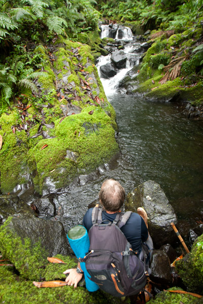
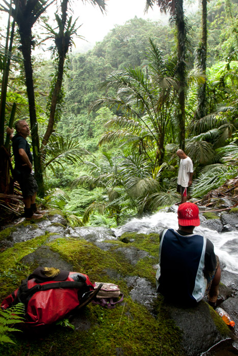
The first kilometer or so cuts through cultivated lands. Then it begins to follow the water more closely as it passes into the wilder riverine forests. There are at least nine major stream crossings in this next segment, some of which may be difficult or impossible if there has been a lot of recent rain. Above the last major Nan Riohk tributary, where the name of the stream changes to Nankepinmerepw, hikers take to the stream bed itself, which is certainly the most challenging aspect of the route (13% slope average). The algae-slimed rocks are slick and dangerous and hikers may find that they have to go very slow and use both hands to avoid disastrous slips; it would be easy to snap an ankle or shatter a kneecap in this place. Despite the rough terrain, the scenery in the hidden valley, often fenced on both sides by high rocky walls, is terrific. At times, the trail passes along the tops of vertical prismatic basalt columns.
The first few points of interest are beautiful pools that will tempt any overheated hiker — and why resist? A bit further is a small waterfall near an outcropping of prismatic basalt. Informants in the area say that this location was one of many where prismatic basalt columns were quarried for use in the building of Nan Madol. Abandoned prisms can be found lying in the stream bed in several places — the largest just below the falls. How exactly the massive prisms were hauled down to the coast over such distances and through such rough terrain is anyone’s guess.
After a short, steep section (22% slope average), the valley terminates at a huge “horsetail” waterfall that the route crosses above (you can scramble down the eastern slope without too much difficulty for a better view from the side). The shallow pools above the falls are an excellent place for a look at Pohnpei’s native crayfish. This is the turn-around point for day-hikers.
Past the big waterfall, the stream narrows until it reaches a third waterfall — this one short and wide, falling over a straight lip (usually called a “block falls” or “sheet falls”) — and then diminishes to a trickle. Those who wish to go further, will climb to the west (29% slope average) and then south again to follow the ridgeline (18% slope average) toward Nahnalaud.
- Please visit the Local Guides & Tour Operators page for a list of experienced guides available for hikes to Nankepinmerepw.