

Pahn Sile Waterfall
![]()
![]()
![]()
![]()
![]()
![]()
![]()
![]()
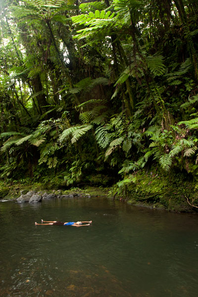
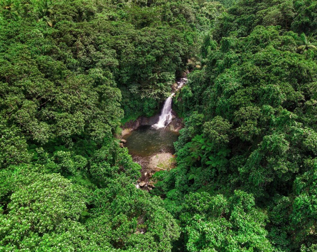
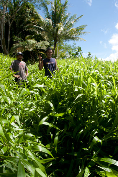
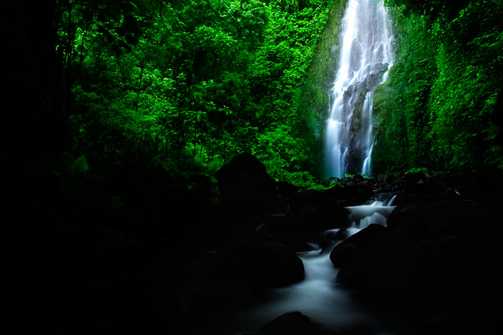
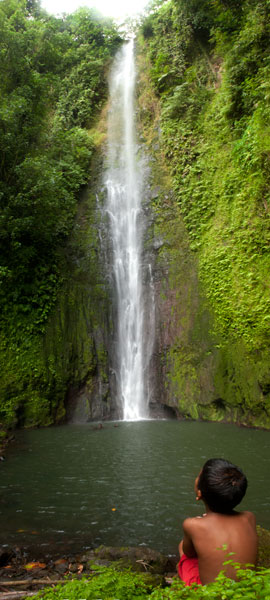
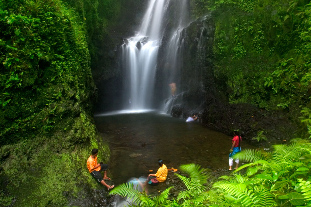
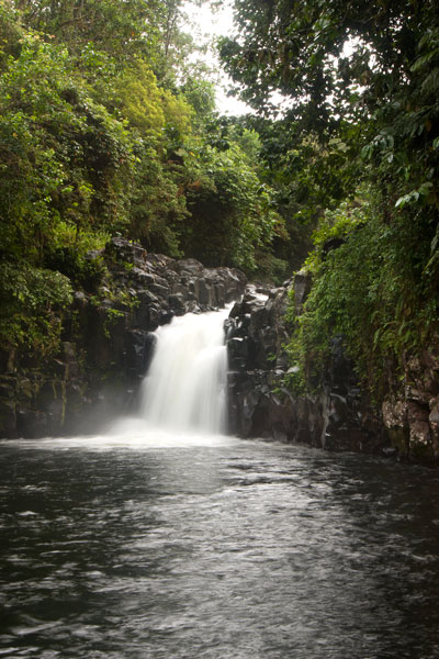
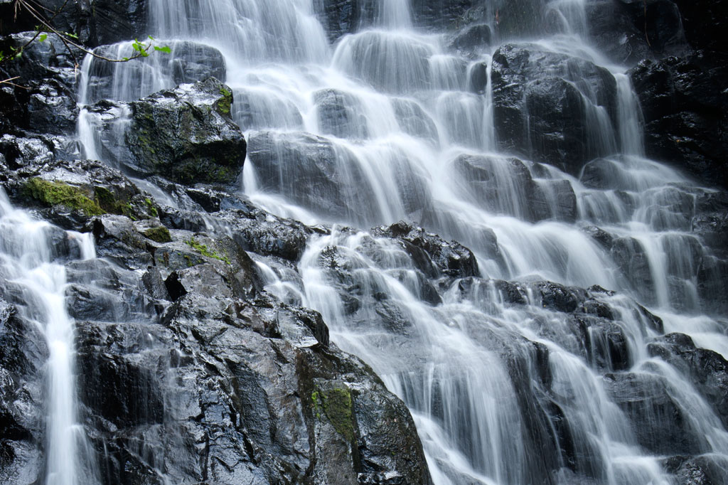
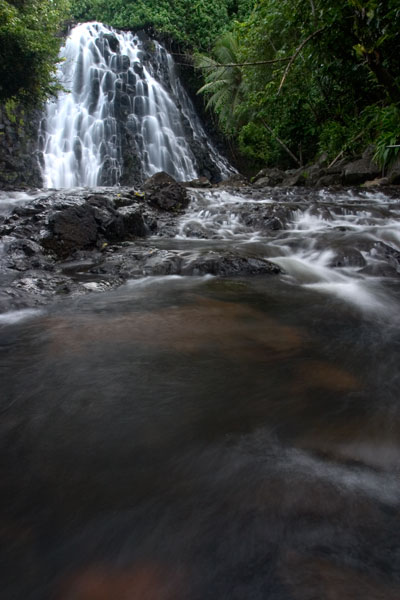
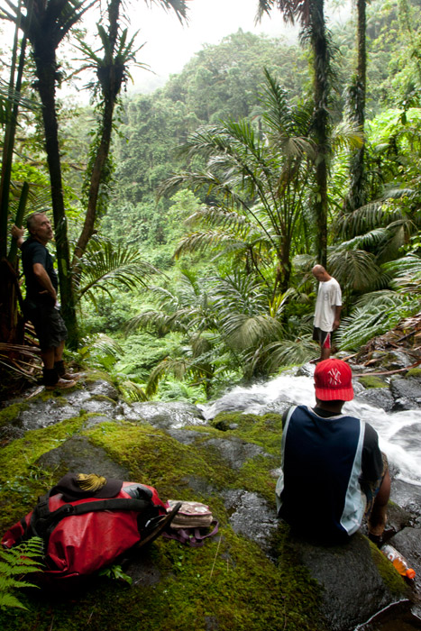
Located on the pristine Senipehn River, Pahn Sile is one of the few waterfalls well into the interior that almost anyone (even small children) can reach without the help of a guide — as long as you keep your eyes open for the branches in the path. A well-maintained trail begins at the end of the unpaved but well-graded coral and gravel road beyond Sapwalap Elementary School and opposite a concrete taxi stop. Houses are found along the path for much of the way, as well as historic rock-lined irrigation canals built by the Japanese. About 0.15 km (164 yd) before reaching the waterfall, a secondary path branches right and descends to a shallow point in the river, where you’ll cross and hug the right bank or walk in the stream as you continue to the falls just around the corner.
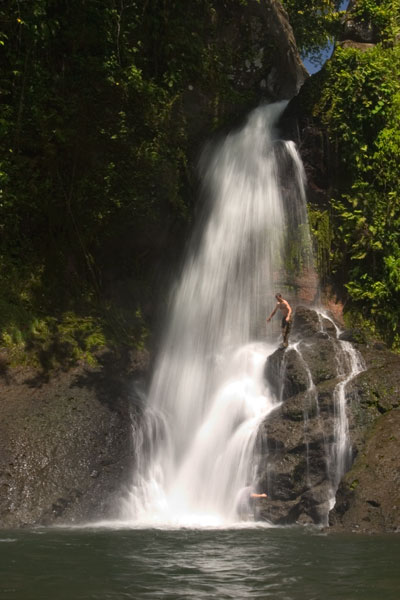
Pahn Sile‘s pool is wide and wonderfully cool, but not especially deep. The falls varies in volume depending on recent rain, gushing through a narrow portal and crashing onto rocks that form the rim of the pool. If you want a view from above the falls, bear left at the branch, proceed for 0.3 km (0.18 mi), and then cut off the trail and head straight toward the sound of the river. There is no path for this last part, but it’s easy enough to move through the forest. There are nice spots for a camp site above the falls in the forest along the path (pack out everything you packed in). In addition to the primary waterfall pool, there’s a small, deep pool just down river that is also an excellent place to swim, shaded by lush ferns and massive trees.
There are no access fees and no permission is needed to visit the falls.
If you would like a guide for the trip to the waterfall contact Raven at (+691)923-1862, he does not charge a fee but we do encourage you to tip him for his time.
- Plan for 3 hours round-trip for this excursion.
Sokehs Japanese Sites & Parpwu Waterfall
Historical Sites in Mainland Sokehs
![]()
![]()
![]()
![]()
![]()
![]()
![]()
“Military Road” Hike / Bike Tour
One of the most rewarding routes for Japanese World War II-era historical sites follows a road 0.46 km (0.29 mi) northeast of the turn-off to the FSM capital. This track was built by the Japanese in the 1930s to access the many military sites in the area and remains unpaved. Whether it is public or private, however, seems to be a matter of some debate. FSM Telecom, which maintains a mobile phone tower near “Radar Station Hill” and uses the road often, says that the road and the areas immediately alongside it belong to the municipality and that people living beyond the Thomas residence are squatters without legal land claims. Even so, a family living on the south side of the road about 1 km (0.62 mi) from the Circle Island Road insists that everything beyond their house is private. There are two ways for visitors to deal with this issue: either (1) hire a knowledgeable local guide to escort you on your hike (you’ll likely find more with them anyway) or (2) visit the house in question and ask permission yourself. During our fieldwork, we used both options successfully. The road, though unpaved, is in pretty good condition, and as it doesn’t climb much, it’s a great choice for either hiking or biking. You can park your vehicle at the beginning near the Circle Island Road and go from there.
")
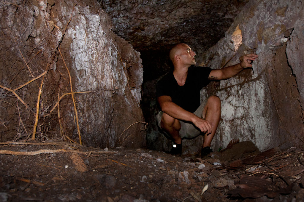
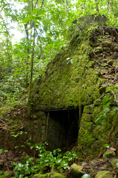
“Bunker Hill”
About 100 m (109 yd) from the starting point, you can cut off the road to the right and climb up the grassy hill, making your way toward the landowner’s house about 200 m (219 yd) to the northeast. This is the place to ask for permission to explore in detail. There are several points of interest worth looking into. At the southwest and northeast ends of the hill, there are bunker-like observation stations that consist of curved tunnels with domed concrete roofs and several gun ports. The southern bunker site is well-hidden with the entrance near the base of a large tree that has grown up in recent years. Entering is a dirty job, but once you’re inside, the structure becomes quite roomy. The gun ports allow light inside. The northern site is close to a large cassava plantation and is kept cleared. You can enter easily from either end. These structures were likely manned by a few riflemen and intended to protect the roads on both sides of the hill. In view of the landowner’s house you can also find a zigzag trench and two gun sites, one of which was probably a medium-sized anti-aircraft gun. No guns remain now. Some people believe a gun at this location shot down the American bomber “Love Bug”. Others say it was one on Dolen Pahniepw.
Paul Thomas’s Hill
Another 277 m (303 yd) further down the road, one comes to the residence of a friendly West Virginian native, Paul Thomas, and his local wife. Thomas enjoys a good chat, and if you ask politely, will happily point you in the direction of several interesting sites on the hill above his house. Easily found are two pairs of bunkers similar to those mentioned already, and between these, three small gun sites and several foxholes. Thomas keeps the hill trimmed and neat; all but one of the sites (the first set of bunkers) lie along the crest of the hill over a distance of about 125 m (137 yd). The hill commands sweeping views of the Palikir valley to the west.
- If you want to make arrangements ahead of time, call Paul Thomas at +691.320.4562.
")
Dolen Pahniepw
The next stop is Dolen Pahniepw. An overgrown trail begins off the right side of the road 0.56 km (0.35 mi) past Thomas’s driveway and runs 0.43 km (0.27 mi) to the summit of the hill. About 300 m (328 yd) along the trail, one comes to the ruins of an army barracks, which consists of concrete house posts,
foundations, and a bombed-out cistern. Sets of concrete steps led to the entrances of the wooden buildings. Some scrounging in the jungle around the site should yield some old Japanese beer bottles. At the end of the trail is a large anti-aircraft gun site, which probably housed a medium-sized gun similar to those on Lenger Island. On the northeast side of the hill, you may be able to locate the foundation of a radio tower, some tunnels, and the chassis of a truck.
At the southern end of the hill near the road, you can scramble up the bank and find a pair of unfinished small gun emplacements, some trenches in the woods, and a defused bomb.
“Radar Station Hill”
The road ends near the FSM Telecom cellular phone tower at the summit of a hill. A footpath continues west to a cement platform for a Japanese radar array, two foxholes, and two circular gun sites. A large bomb crater south of the road makes an excellent tent site for campers with unobstructed views of the whole of mainland Sokehs. Back east down the road, an L-shaped cutting leads to a path and eventually to the site of a generator station with a concrete storage alcove built into the embankment and a rusting motor.
- Plan for a half day to full day for this hike/ride, depending on how many sites you want to explore.
- No guide is necessary for the Military Road sites as long as you ask permission wherever private land is an issue. However, you are likely to discover much more of interest with a guide who knows the sites. Please visit the Local Guides & Tour Operators page for a list of experienced guides available for hikes around Sokehs, if desired. Offer $25-50 for a group of five or less.
PBJ-H1 “Love Bug” Bomber Ruins
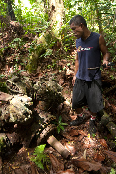
Throughout 1944 and early 1945, the U.S. carried out a brutal bombing campaign of Japanese fortifications on Pohnpei. The only bomber ever shot down was a PBJ-1H (the U.S. Marines version of the Airforce B-25H) nicknamed “Love Bug” and piloted by First Lieutenant William J. Love. On February 6, 1945, while on a mission to destroy targets at the nearby Palikir airfield, the Love Bug was picked out of the sky by an anti-aircraft gun on one of the nearby hills (possibly “Bunker Hill”, Paul Thomas’s hill, or Dolen Pahniepw). The plane burst into flames upon impact, killing the entire crew. After the crash, Japanese soldiers collected the bodies and buried them in a marked grave near the crash site. A monument to the crew used to be found at the burial site, but it was taken apart by looters in the 1980s.
The crew was disinterred and reburied several times during the American Period before coming to rest at Jefferson Barracks National Cemetery in the U.S. — all except Sgt. David Snider, whose whereabouts were unknown until 1948. The wreckage was not positively identified until 2001, when two aviation archaeologists surveyed the area. The tail section and rudder were still visible in the forest in the 1980s, but the site has been heavily looted since and only a few large pieces remain — the port engine (sans prop), landing gear and wheel, and a portion of a stabilizer. Bits of wreckage are strewn across an area of some 7,000 square meters. Three defused bombs are also said to be in the vicinity, but we were unable to locate them during our visits.
It’s easiest to visit the site from the unpaved water tank road behind the FSM presidential housing facility. No guide is necessary, but you’ll have to ask the officer at the security check-point to let you through. The wreck is found on the forested slope a few meters off the north edge of the road before the water tank.
- Plan for 1 hour for this hike. No guide is necessary, but you will need to ask the security guard on the road to let you through.
Nankewi River Vicinity
Ethanol Manufacturing Site
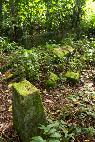
On the banks of Pillapen Nankewi (Nankewi River) the remnants of Japanese industry can still be seen. Neat stone retaining walls frame the river and trenches and pipes form a grid on the north bank. On the south bank are three large fermentation tanks, a variety of other distilling gear, brick ovens built into the hillside, a huge press, a crank, and other rusting machinery. The equipment was likely used to distill ethanol from sugar cane for fuel and other industrial purposes. A great deal of Japanese beer and liquor bottles litter the spot.
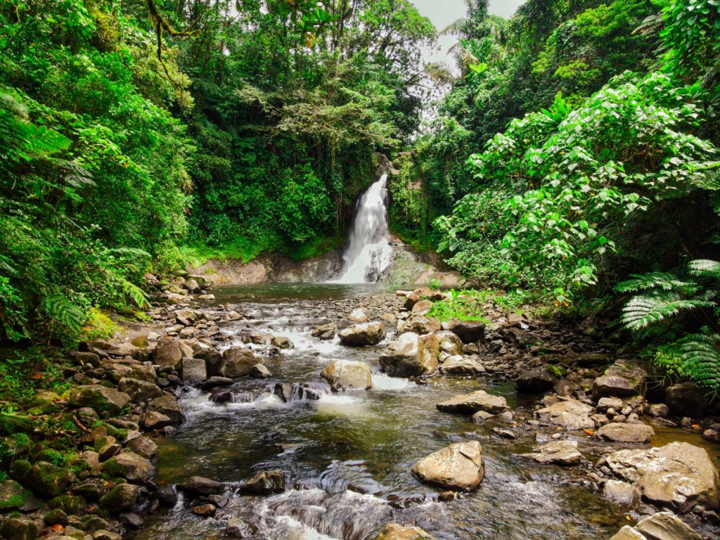
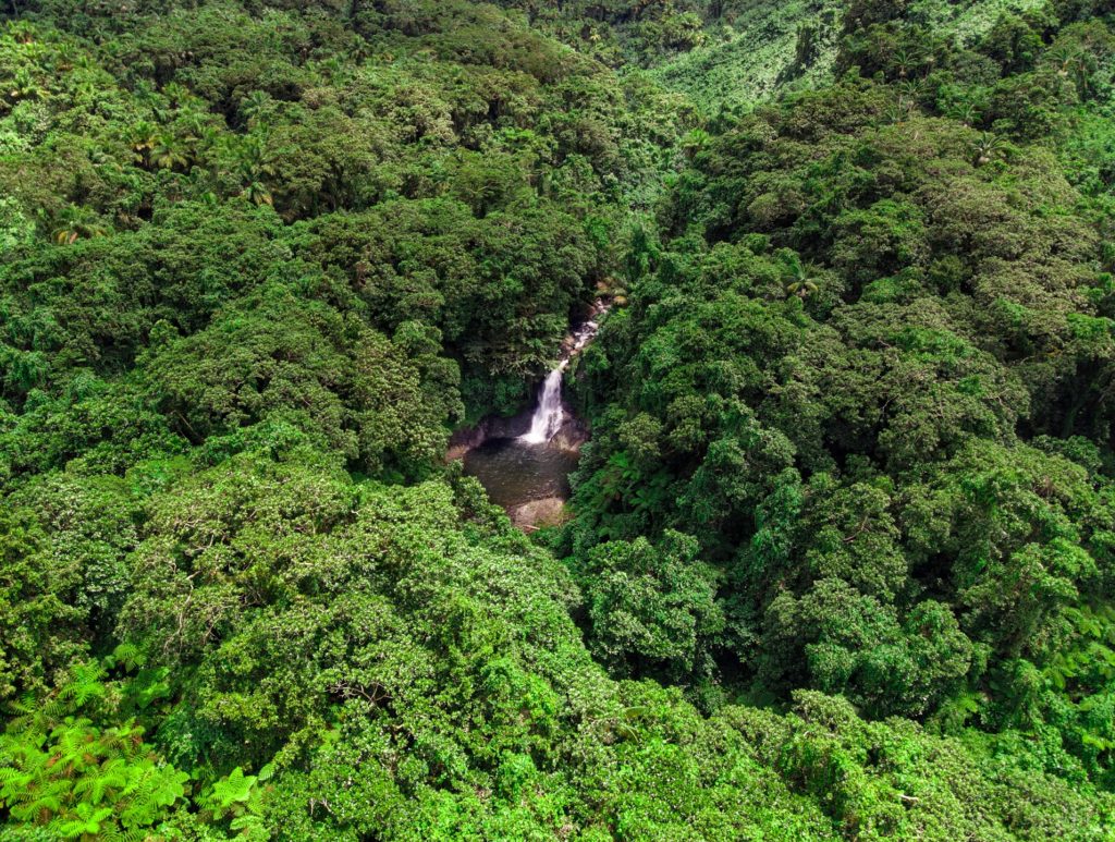
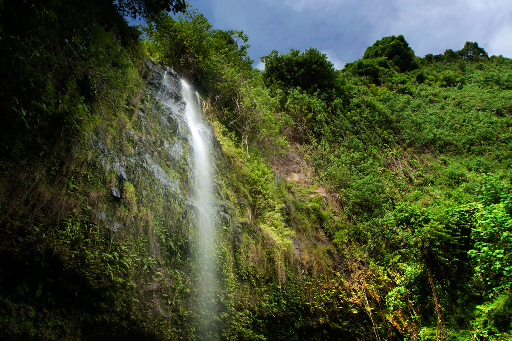
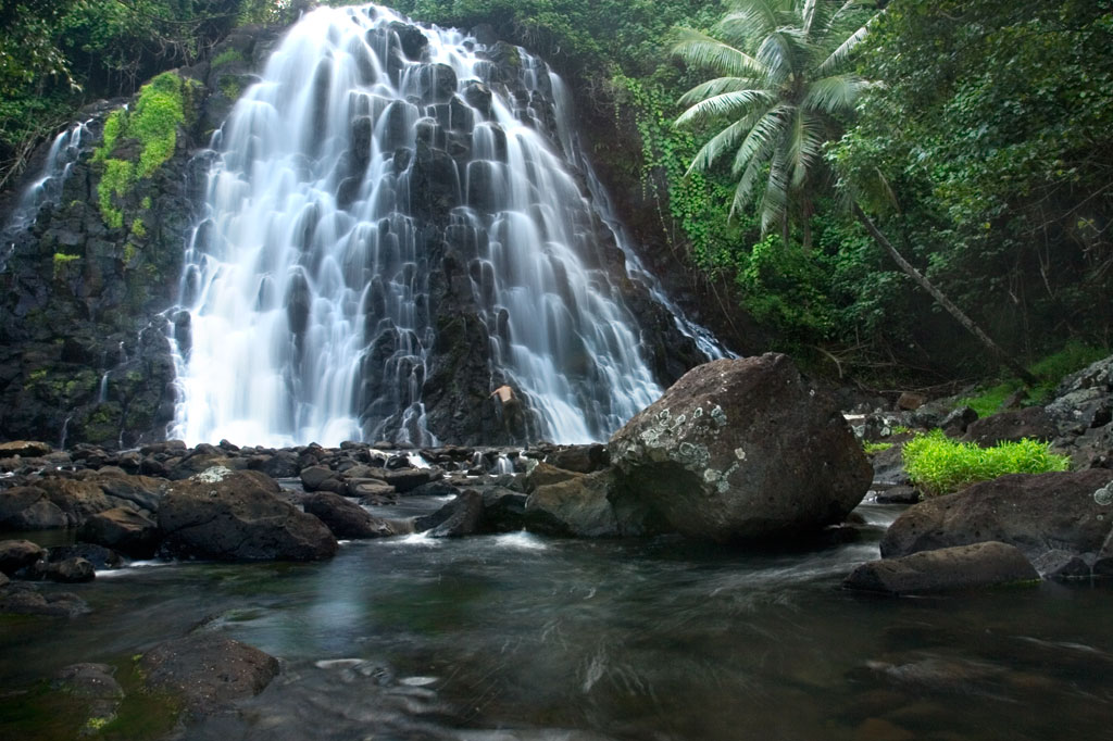
Parpwu Waterfall
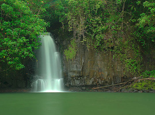
The rather flat terrain in greater Sokehs doesn’t make for a lot of waterfalls, but Parpwu (a.k.a. “Nan Lohlo” or “Nankewi”) — located on the Nankewi River just behind the now deserted Sokehs Shopping Center — is unusual because it’s so close to the coast, almost in the mangroves. In fact, during very high tides, you can kayak all the way from Sokehs Bay to the falls. The waterfall is a beautiful sight, but unfortunately, upstream piggeries have polluted the watercourse and swimming is ill-advised (even though you’ll see local kids from the area doing just that). Photo courtesy of Bill Jaynes.
- Plan for 1 hour for this hike. Its easy to find someone to guide you down to the falls and/or distillery site. Just ask in the area. Offer $6.00.
Sahwartik & Sahwarlap Waterfalls
![]()
![]()
![]()
![]()
![]()
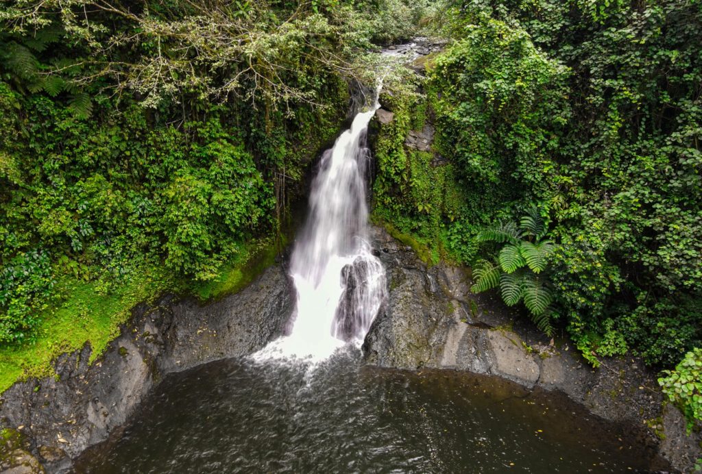
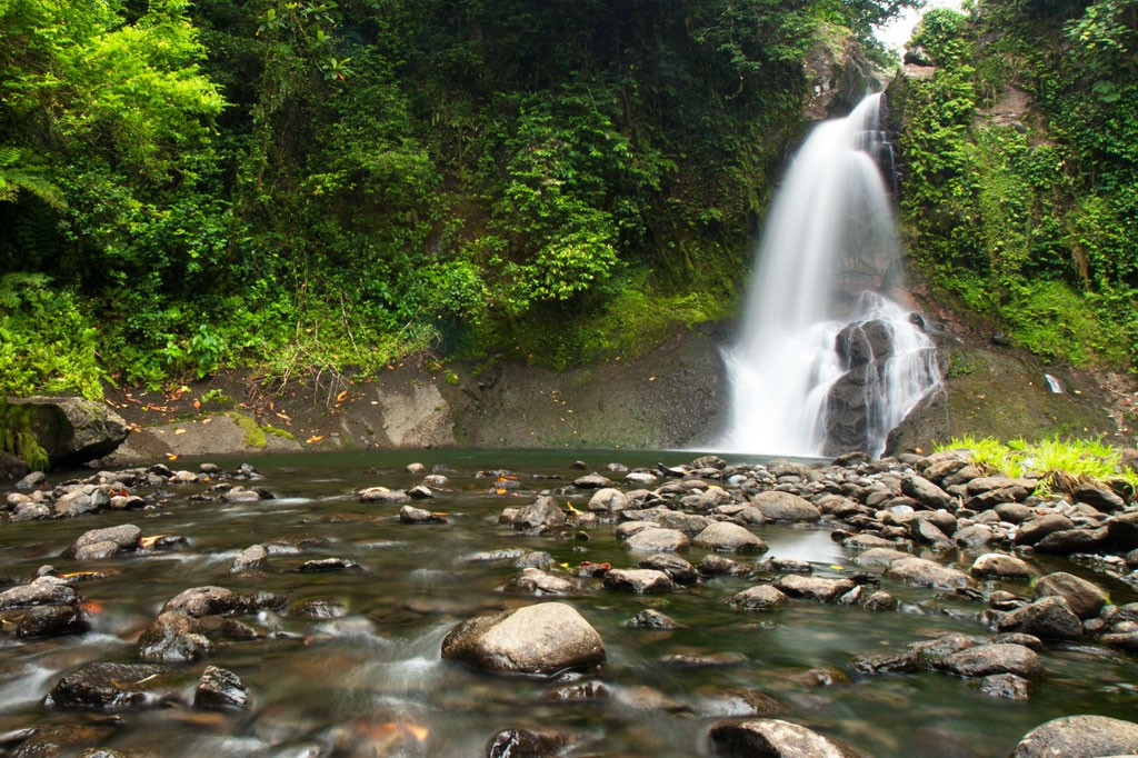
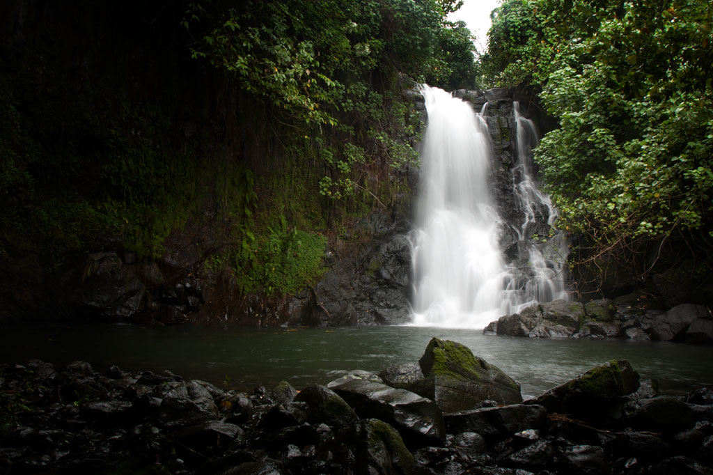
Located on converging streams within Salapwuk’s deep Sahwar Gorge, Sahwartik and Sahwarlap are a pair of waterfalls whose splendor and grace defy reality. The wider falls is named Sahwarlap, which means “shining brightly,” and its tall, thin neighbor is called Sahwartik (“shining faintly”). Sahwartik, a “horsetail” falls, is the more picturesque of the pair and is probably the tallest waterfall on Pohnpei at about 20-24 meters (65-80 ft). It lies at the terminus of the gorge, hidden in a fern-carpeted niche with a sizable plunge pool and enough flow to create its own misty breeze. The water is very clean and often quite chilly — amazingly refreshing after a hot hike. Sahwarlap’s stream angles into Sahwartik’s from the northwest. The falls is wider and shorter than Sahwartik and has a much shallower pool. Both waterfalls are great for a mid-hike swim, but Sahwarlap‘s pool is shallow, while Sahwartik‘s is relatively deep.
The trek begins east of the road that leads to Salapwuk Elementary School, just before the paving ends (park under the trees on the east side of the road). After crossing the landowner’s property, a well-maintained trail begins at the rim of the gorge with inspiring views of both waterfalls, then descends in a zigzag along the slope to the stream bed. The slope trail is generally well-tended, but without any railing on the outer edge. Hikers should move slowly and with care. In a few places there are rough steps that can deteriorate after heavy rain.
Once one reaches the bottom of the gorge, there’s no obvious trail, but the way is clear. Merely head up-stream and stick close to the water — a collection of little streamlets. There are no deviations from the valley, so it’s impossible to lose your way before hitting Sahwartik. Sahwarlap can be a little trickier to locate. Hug the west side of the stream bed and keep your eyes peeled for a path near where the Sahwarlap Stream (Pilen Sahwarlap) flows into the larger watercourse (Pilen Sahwar). This footpath climbs over a little hillock, from the top of which the falls is visible through the trees.
Note that sakau (known elsewhere as kava) is heavily cultivated throughout the west side of the valley and along the slope trail. The large shrub with its heart-shaped leaves and thick, knobby branches — sometimes pure green, but more often mottled — is easy to identify. The plants have great value to their owners. Hikers should treat them with respect and avoid breaking branches or otherwise damaging them as they pass.
The Sesiwo family charges $5.00 per person for access. No guide is necessary for this hike, but if you want one, the family can scare up some kids to go with you. Offer $5.00 and make sure that everyone is clear that you’re paying one person, even if a whole group of kids trail along behind.
- Plan for 90 minutes to 3 hours round-trip with a swimming session at each waterfall.
How the Sahwar Valley was Formed
There was once a woman in Salapwuk named Lienlama who had two sons named Mwohnmur and Sarapwau. The boys had many adventures and became notorious in Pohnpeian legend, being responsible for the creation of a number of interesting geographical features including Takaiuh (hill), Pohnpaip (rock), and the island of Takaieu. The boys were eternally curious, and one time they took their mother’s loom stick (made from a sword fern) and dug in the earth to see what was below it. The hole that they dug was so deep that they reached the Underworld, and because they could see the shining lights of that other world through the hole, the gorge was named Sahwar, which means “shining” or “flashing.”
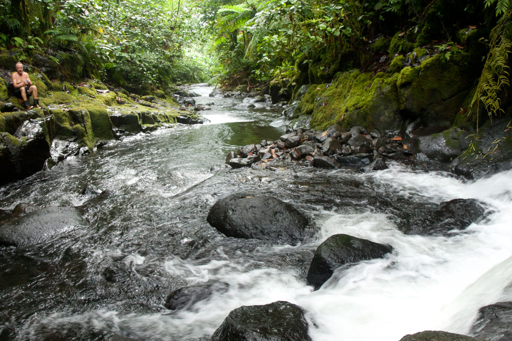
The Six Waterfalls Hike
![]()
![]()
![]()
![]()
![]()
")
Because Pohnpei’s rainforested terrain is so challenging to move through, inexperienced hikers might think a jaunt into the wild interior of the island is out of reach. It isn’t. Almost anyone in relatively good physical condition can handle the “Six Waterfalls Hike”, which delves into the verdant forests and lush raparian environment of the remote Nanmeir Valley above Salapwuk.
The adventure begins near Salapwuk Elementary School. The early part of the hike follows a wide, mostly flat track through the trees. This is a good place to look for Asian waterbuffalo, or carabao, which some of the Salapwuk residents use as beasts of burden. The large, big-horned animals, which were brought to Pohnpei from the Philippines by the Spanish in the 1890s, may look fearsome, but are actually quite shy, gentle creatures. You might see one lolling about in a patch of mud or plodding along with a smiling child perched on its back.
")
Over time the track becomes a narrow footpath and begins to roll up and down as it passes through hilly native forests. Shortly after crossing the Sihngar Stream (Pilen Sihngar), there’s a fork in the trail. Continuing straight will keep you above and west of the river, while the eastern way leads down toward the upper Lehnmesi River and Pahnairlap, a serene punchbowl falls with a great little pool beneath it.
The rest of the hike follows along the banks of the river and occasionally crosses over it, stopping at four more waterfalls — Nikotoapw, Olotong, Iro, and Nan Emp — each with its own unique character. This segment is quite difficult, as hikers must traverse the round, jumbled stones that line the riverbed and its banks. Go slow, use your hands, and watch your footing.
Nikotoapw Waterfall is found a bit to the east of the river, above where the Nikotoapw Stream (Pilen Nikotoapw) joins the Lehnmesi. The site is screened by a pool with a wide “block falls” behind it, which hikers must circumvent. On the other side, the stream issues from a narrow slot. Continue through this and one comes to an enclosure mostly hidden from outside. There lies the falls and its sizable pool. If you swim under the falls and climb up on the rocks behind, you’ll find a cave.
")
The third falls, Olotong, is found on the opposite side of the Lehnmesi from Nikotoapwpw. This is followed by plenty of hiking in the riverbed and one segment where the trail leaves the river and cuts through the forest before coming back to the watercourse. Iro and Nan Emp are both found on the west side of the river not too far apart.
The sixth falls, called Lipwentiak, is also hidden from view by the topography. At one point the river narrows and passes through a high-walled slot. Though there is a way up and around, the easiest and safest way past is to swim through the slot. On the other side, the walls open up to reveal a large pool with high walls on all sides, an island of cobbles, and beyond all that, a tiered “horsetail falls” that flows from a vaguely heart-shaped portal of dark rock. It’s very dramatic.
In all, the trek offers tons of great swimming and truly unreal scenery. Good footwear is a must.
- Plan for 6-8 hours round-trip with short swim breaks at each waterfall.
- Please visit the Local Guides & Tour Operators page for a list of experienced guides available for the Six Waterfalls Hike.
The Story of the Eel of Pahdol
A long time ago, a couple from Wene came to live in a place called Iro. One day there was a great storm and the heavy rains resulted in a huge flood. Two women in the area went out to fish in the flood, and while they were fishing, a starling flew over and dropped a small stone. The women took the stone home and gave it to the couple from Wene. Later, at a place called Pahnkipar (“under the pandanus tree”), the stone broke apart and from it was hatched a tiny freshwater eel. The couple kept the eel as their pet and allowed it to live in a pool at Pahdol (“under the hill”) in Pahnais. When the eel grew up, however, it began to act in sinister ways. At night, the eel would escape from its pool and sneak into the house, where it would stare at the sleeping couple. The couple became uncomfortable and decided to kill and eat the eel, but the eel overheard their plan, came into the house, and attacked them. The couple fled into the forest and hid under a huge rock, where they believed they’d be safe. The eel discovered the hiding place and ambushed the couple, devouring them alive.
The eel then traveled into the Nanmeir Valley in Pohnpei’s interior and followed the Lehnmesi River source. There she met Kiroun Meir, a high-titled man, who brought her to live with him at his home. The two became lovers and the eel was impregnated. She was restless, however, and departed, continuing to follow the river. At Lipwentiak, the eel encountered a hunter named Kiroun Mand, killing and eating eels. Recoiling at this sight, she created a sharp turn in the river with the writhing of her body. Soon after, she gave birth to her first daughter, the matriarch of the Sounlipwentiak subclan. She had other children later who became the founders of the Lasiadohng (“eels of the dohng tree”) and Lasiakotop (“eels of the kotop palm”) subclans. After that, the eel went to live in Dauen Sapwalap, where she terrorized the local inhabitants, devouring so many that the land became mostly deserted. When the monster finally died, her body formed Dolen Nett.
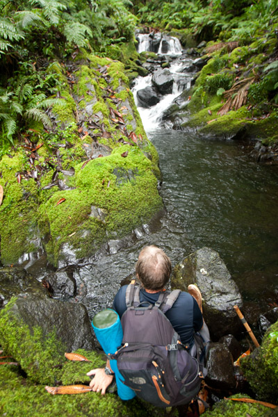
Lehnpaipohn Waterfall
Kitti has a lot of waterfalls, but one of the most fun to visit is Lehnpaipohn between Salapwuk and Pwoaipwoai districts (at least two kousapw claim the falls area). It is neither the tallest waterfall on Pohnpei nor the most picturesque, but what Lehnpaipohn does have is the largest freshwater pool on the island (about 80 by 30 meters) and the highest jumping-off spot. The pool is leaf-shaped, very deep, and surrounded by high cliffs with a sizable island of river cobbles in the center. The water is typically quite chilly, which is a good thing after the hike. The waterfall itself is not much more than 4 meters (13 ft) tall and has a platform of rock behind it that you can stand on. Swimming to it is difficult, however, because of the strong current coming away from the falls. The best tactic is to swim along the edge and use the rocks to pull yourself forward.
The trail is only 0.53 km (0.33 mi) from the unpaved secondary road, but that road’s conditions are so bad that you’ll want to park your vehicle way down at the end of the paving 0.4 km (0.25 mi) above the Circle Island Road and walk up (5-15% slope with an average of about 7%). Look for the unmarked footpath on the left 2.18 km (1.4 mi) beyond the paving and 117 meters (128 yd) past the last visible residence on the right. The path is well-defined, relatively easy to follow, and downhill almost the whole way to the river (12% slope average). It stays under the trees and is rocky except at one point, where there’s a swampy section to cross or navigate around. About 216 meters (236 yd) along, the path branches; stay to the left. Another 200 m (219 yd) brings hikers to a small stream crossing. From this point, there’s only another 89 m (97 yd) to go. The final descent to the pool is exposed and a bit sketchy (especially when descending); make sure you have good footwear (FiveFingers are best, but good tennis shoes will work, too) and take special care on wet days.
No fees are charged and the trail is on public land. You can do this hike without a guide.
Camping
You can camp under the trees at the top of the eastern cliff — also the spot from which swimmers leap. Pack out everything you brought in and leave the site as you found it.
- Plan for 3-4 hours for this hike including some quality time to swim and relax.
Woaloahmw Waterfall (Rohi)
![]()
![]()
![]()
![]()
Rohi, the first district in Kitti after passing over the border from Madolenihmw, is host to an obscure, but beautiful, waterfall that few people — other than those who live practically at its feet and some Peace Corps volunteers stationed in the neighborhood — seem to know about. The high, sometimes wispy, falls plummets over a sheer wall hung with ferns and other climbing plants and is reminiscent of Sahwartik in Salapwuk, but with a much smaller and shallower pool and less volume overall. It’s unclear whether it has an official name; local residents mostly call it the “Rohi Waterfall” after the district within which it lies or “Nan Rohi Waterfall”, after the name of the river, or “Woaloahmw Waterfall”.
To reach it, it’s best to park near the turn-off from the Circle Island Road, walk up the steep gravel secondary road, and continue to the houses at the end (bear left at the one major branch). Along the way is a stunning stand of huge hardwoods that are well-worth a good look. Once you reach the houses, you’ll want to ask permission to proceed, as the footpath crosses through several families’ front yards. The residents in the area, however, are welcoming and will likely be happy to show you to the falls or at the very least point you in the right direction. Once the path reaches the watercourse, the waterfall is evident just a bit upstream and one has merely to scramble along the rocky bank to the pool. The water is very clean and cool, and the spot is excellent for a short swim.
No fees are charged for this hike.
- Plan for 1 hour round-trip with some swimming time at the falls.

Nanpohnmweli Waterfall
")
![]()
![]()
![]()
Though you can reach the top of Nanpohnmweli from Mand, the best way to access this falls (also known as “Kerenis” Waterfall) is from the Circle Island Road in Sapwehrek Kousapw. The walk begins at Benford Etse’s residence immediately south of the bridge and the sign for the Senipehn River Reserve and takes less than 10 minutes each way, following a well-trodden path that the family uses for planting sakau.
It’s hard not to be impressed by the place, even if you’ve already seen many of Pohnpei’s waterfalls. Like Kepirohi, the water tumbles over a gently sloping basalt wall rather than falling straight down over a cliff, but this falls is narrower.
[warning]Unfortunately, testing in April 2013 indicated that this site had 2.5 times more E. coli than is considered safe for swimming, so you’ll want to stay out of the water.[/warning]
The Etse family doesn’t charge an access fee to visit the falls, but since you’ll need someone to show you the way through their property, offer $5.00.
- Plan for 45 minutes round-trip with some time to admire the view of the falls.
Mand Area Attractions
![]()
![]()
![]()
![]()
![]()
Mand is a little community of Pingelapese people who were given a parcel of land by the Nahnmwarki of Madolenihmw in Pohnpei’s modern past. You can’t call it a town, but it feels more connected than many of the island’s Pohnpeian communities. In addition to the Pingelapese who live in Mand Proper, there’s a small village to the north inhabited by Kapingamarangi islanders, who settled in the area very recently (Kapingamarangi is a distant atoll that is culturally and linguistically Polynesian but politically a part of Pohnpei State). The center of Mand consists of the elementary school and church. Next to the church is a monument which lists the names of the first settlers from Pingelap Atoll — the founding members of the community.
Kokomaru Waterfall
Most local people outside of Mand have never heard of Kokomaru, which is strange, because it is a gorgeous spot and worth visiting. The route to the waterfall, which lies just downstream from the Mand community, begins at the end of an unpaved road next to the Latter-Day Saints (LDS) Church, passes through a plot of private land, and then cuts through the forest to the river. The trail tends to be overgrown, as the falls is rarely visited except by an odd kid or two from the community. Once at the riverbed, you can get a good look at the waterfall, which is similar visually to Liduduhniap. Some of the kids in the area will tell you that the rock behind the falls looks like a heart from certain angles (we didn’t see it). The cliff on the south side of the waterfall pool is the nesting site for a huge colony of Caroline Islands swiftlets which seem to fill the air when they leave their nests.
[warning]Despite Kokomaru’s charms, you can’t swim here — riverside pig pens in Mand have severely contaminated the stream. Testing in April 2013 indicated that the water below Piladad had five times more E. coli than is considered safe for swimming. Don’t be fooled by the clarity of the stream; this is sadly in the top ten most polluted watercourses on Pohnpei Island. Even the Mand kids don’t swim there.[/warning]
- Plan for 45 minutes round-trip for this excursion.
Piladad Pool
There is only one place you can safely swim in the Mand area and that’s at a sweet little pond known as Piladad, which lies up-stream from the last inhabited house and pigpen. The pool, which was once a gauging station for the watershed (the gauge apparatus is still there), is large and pristine with enough depth in the middle for the fun rope swing that dangles from an overhanging tree. There are also two small waterfalls. Piladad is a great place to go on hot days; the spot is close to the feet of the mountains and the water tends to be quite chilly. This also means there’s some potential for flash floods, so it would be wise to avoid the spot when rain clouds lie over the mountains. A narrow, but well-used, 0.4 km footpath to the pool begins on the south bank of the river next to Mand Elementary School. At the one branch in the path, bear toward the river.
Almost any kid you see in the area can guide you to either location. Offer $10 for a group of five or less.
- The hike takes about 10 minutes each way.
Nanpohnmweli (“Kerenis”) Waterfall
This very tall waterfall on the Sapwehrek stream can be reached by following the unpaved road 1.24 km (0.77 mi) north and east from Mand through a tidy Kapingamarangi settlement to the next stream over. The problem with visiting the falls from this access point, however, is that you end up at the top, where you can’t really see much. The rocks are treacherously slippery and there’s a long — certainly fatal — fall for anyone who makes a mistake. A local girl was killed when she fell from this spot a few years back. The nickname of the waterfall is derived from the Kapingamarangi pronunciation of the English word “Greenwich”, which is what sailors called Kapingamarangi Atoll during the whaling period. To visit this waterfall from the bottom, visit the Nanpohnmweli Waterfall page.
- This walk takes 15-20 minutes each way.
Kepirohi Waterfall
Kepirohi, which lies on the lower Mand Stream (Pilen Mand) in Kepirohi Kousapw, is certainly Pohnpei’s most famous and most photographed waterfall and makes a nice picnic stop after a visit to the ruins of Nan Madol just a few minutes away. Here a large volume of water (the most of any waterfall on Pohnpei) cascades over a wide, sloped pyramid of basalt rock and fills a shallow pool before running down toward the coast, giving the spot a singular look. A well-maintained — and in places rock-paved — path begins near Adalina Johnny’s residence and skirts the right side of the river to the falls. It’s an easy, level walk. Unfortunately, the landowners decided a few years back to construct an unsightly concrete viewing platform just to one side of the falls, detracting considerably from the aesthetic and natural appeal of the location.
There’s an old, weather-worn sign out on the Circle Island Road that marks the turn-off and limited parking on either side of the landowner’s driveway.
Visitors can pay the admission fee ($3 per adult and $1.50 per child) at Johnny’s house on the right or at the small store near the trailhead. No guide is needed for this hike.
- Plan for 1 hour for this hike.
[warning]As is true of many of the streams in this part of Madolenihmw, the water at Kepirohi is highly polluted by animal waste; visitors are advised not to swim.[/warning]
Nankepinmerepw River Valley
![]()
![]()
![]()
![]()
This route passes through the gorgeous valley of Nankepinmerepw, following the upper tributaries of the Nan Riohk Stream (Pilen Nan Riohk) and eventually arriving north of Nahnalaud on an arm of the major mountain system. One guide stated that the valley’s name refers to the mworopw tree (Inocarpus fagifer), also known as the Polynesian chestnut — though the spelling is clearly different. Nankepin means “in the bottom of”; the mworopw leaf has a deep trough in the middle where the primary vein bisects the blade, mirroring the way the stream bisects the deep, narrow valley.
The hike begins at a rutted turn-off from the well-graded (but unpaved) road to Pahn Sile Waterfall, leads to a metal footbridge over the Senipehn River (Pillapen Senipehn) — the only bridge like it on the island — and connects with a path on the far side. From there, the trail meanders northwest not far from the Nan Riohk and more or less parallel to it.
The first kilometer or so cuts through cultivated lands. Then it begins to follow the water more closely as it passes into the wilder riverine forests. There are at least nine major stream crossings in this next segment, some of which may be difficult or impossible if there has been a lot of recent rain. Above the last major Nan Riohk tributary, where the name of the stream changes to Nankepinmerepw, hikers take to the stream bed itself, which is certainly the most challenging aspect of the route (13% slope average). The algae-slimed rocks are slick and dangerous and hikers may find that they have to go very slow and use both hands to avoid disastrous slips; it would be easy to snap an ankle or shatter a kneecap in this place. Despite the rough terrain, the scenery in the hidden valley, often fenced on both sides by high rocky walls, is terrific. At times, the trail passes along the tops of vertical prismatic basalt columns.
The first few points of interest are beautiful pools that will tempt any overheated hiker — and why resist? A bit further is a small waterfall near an outcropping of prismatic basalt. Informants in the area say that this location was one of many where prismatic basalt columns were quarried for use in the building of Nan Madol. Abandoned prisms can be found lying in the stream bed in several places — the largest just below the falls. How exactly the massive prisms were hauled down to the coast over such distances and through such rough terrain is anyone’s guess.
After a short, steep section (22% slope average), the valley terminates at a huge “horsetail” waterfall that the route crosses above (you can scramble down the eastern slope without too much difficulty for a better view from the side). The shallow pools above the falls are an excellent place for a look at Pohnpei’s native crayfish. This is the turn-around point for day-hikers.
Past the big waterfall, the stream narrows until it reaches a third waterfall — this one short and wide, falling over a straight lip (usually called a “block falls” or “sheet falls”) — and then diminishes to a trickle. Those who wish to go further, will climb to the west (29% slope average) and then south again to follow the ridgeline (18% slope average) toward Nahnalaud.
- Please visit the Local Guides & Tour Operators page for a list of experienced guides available for hikes to Nankepinmerepw.