
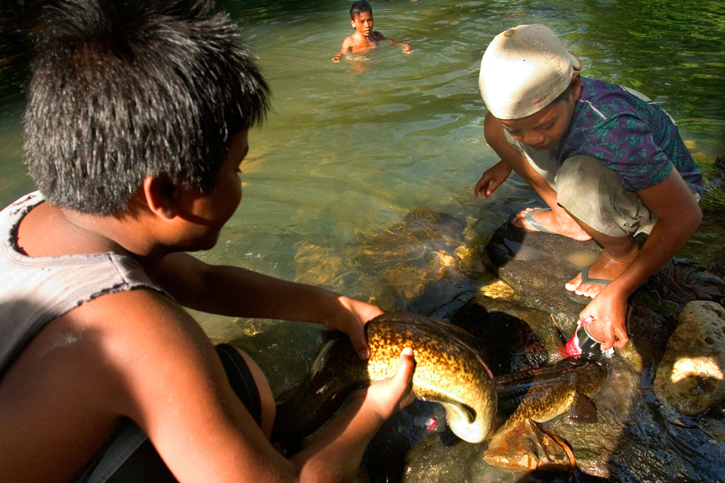
Pilen Seleur Eel Pools

Waterfalls and mountains can be visited in many places, but the experience to be had at Pilen Seleur in Pwudoi is uniquely Pohnpeian. River pools on either side of the road are home to scores of huge Marbled Eels — also called Giant Mottled Eels (Anguilla marmorata). The eels are sacred on Pohnpei and figure prominently in local mythology. Members of the Lasialap (Great Eel Clan) consider the mottled beasts to be their extended family, protecting and feeding them (Pohnpeians have a taboo on eating freshwater eels, though they are eaten in nearby Kosrae). Visitors can walk down to either pool and watch local men and boys stroke the eels, pick them up, or entice them with cans of mackerel to slither entirely out of the water. Some of the creatures are more than a meter long. You can even try handling one yourself; don’t worry — the eels are quite docile and rarely bite.
The pool on the west side of the road is large, deep, and picturesque. It’s a popular swimming spot for the young members of the family living there. There tend to be larger eels at this spot, but because the water gets waist-deep pretty quick, you can’t easily wade in. The pool on the east side is small and rarely more than a foot deep — it’s the best place if you’re interested in trying to pick up an eel yourself. Treat the beasts with respect and care.
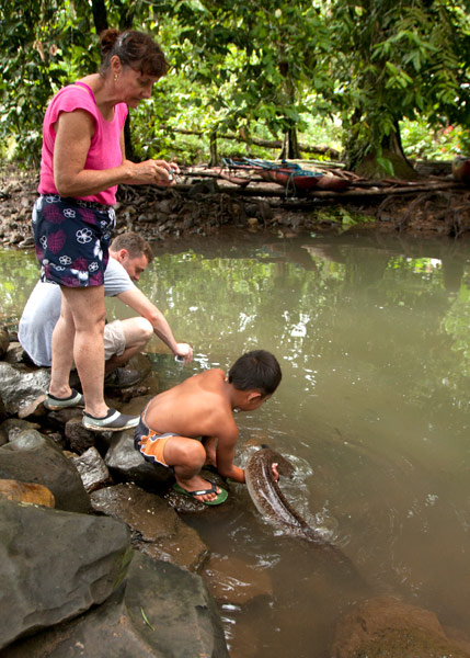
- Plan for 30 min to 1 hour at the location. The families living next to each of the two pools charge $3.00 per person. You’ll also want to purchase a can or two of mackerel at a nearby store to feed the sinuous creatures.
More About the Giant Mottled Eel
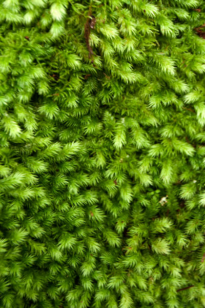
The species of eel found on Pohnpei has a wide distribution and exists in tropical environments ranging from East Africa to French Polynesia. It’s also found in southern Japan and Taiwan (where it is endangered). Young eels usually have yellowish or light brown backs and become darker as they age. The largest eels are dark brown mottled with black with cream-colored bellies. They have tiny rows of teeth and protruding lower jaws. Mature females have been known to grow up to 2 meters (6.5 ft) in length.
Mottled eels have two distinct phases to their life-cycle. After spending as long as 20 years in freshwater streams or estuaries, the eels leave their homes and migrate westward across the Pacific to an area in the open ocean west of the Mariana Islands (in the case of Pohnpei’s eels, this is a distance of more than 1,600 kilometers / 990 miles). There they breed, lay eggs, and die. After hatching, juveniles journey to find land, where they swim up rivers and streams and establish themselves in deep pools.
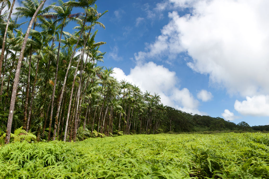
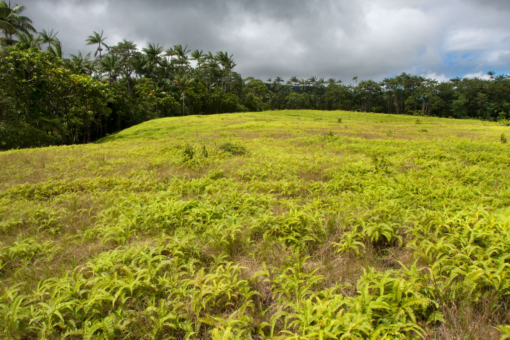
Nihpit Plateau Savannahs
Mallen Nihpit & Mallen Pitetik
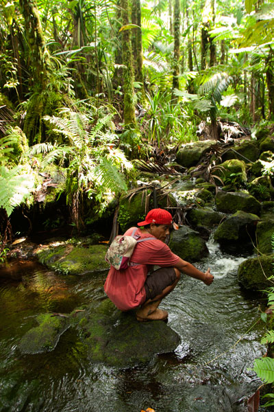
On the large upland plateau of Nihpit in the mountains above Mwoakot are two expansive savannahs or fern meadows. Upland savannahs of this sort usually exist because the bedrock is shallow, but they are also periodically burned by residents, inhibiting the growth of larger shrubs and trees. Hunters say that the Philippine sambar deer that live in Pohnpei’s interior — probably introduced by the Germans from the Mariana Islands — are attracted to the ash. One hunting tactic is to lie hidden at such sites and wait for the deer to creep from the forest in the early dawn (photographers might use the same method). Both of the savannahs soak up rain and feed tributaries of the Ne Stream (Pilen Ne). The northernmost and the larger of the two meadows — about a half kilometer in length — is usually referred to as Mallen Nihpit. The other savannah is Mallen Pitetik. Birders and photographers will find this a wonderful place to camp and observe fauna rarely disturbed by human activity. The palm forests around the edge provide plenty of shade, and drinking water can be filtered at the stream about 100 meters away.
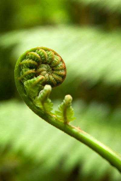
The hike begins on the right side of the unpaved secondary road opposite the track leading to the Wene Latter-Day Saints Church — 0.92 km (0.57 mi) past the Nanwou Stream bridge — and leads up to a farmstead. Your guide will stop at a cluster of residential buildings to ask permission to cross the family’s land before leading you on. About 160 m beyond this is the first of two major stream crossings — one on a log and the other across a covered wooden bridge. After the second bridge, the trail climbs steadily for 1.47 km (0.9 mi) at a 25% slope average into forests full of huge Terminalia carolinensis (kehma) — found only on Pohnpei and Kosrae — and Atuna racemosa, a tall, straight hardwood locally called ais. The latter have many uses including treatment of diarrhea and dysentery. The white nut inside the ais fruit is ground and mixed with red soil to produce paint for canoes, while the extremely hard and termite-resistant lumber is a favored building material. If you hike in the evening, keep an eye out for eerie salengen eni (Filoboletus manipularis), bioluminescent mushrooms said to grow in areas where ghosts reside (the name means “ghost’s ear”). The tiny fungus often grows from rotten logs and looks like clusters of eyes in the dark. Interestingly, some Pohnpeian parents are known to control misbehaving youngers by threatening to send them to places where the mushrooms thrive. At this point, hikers have reached the edge of the plateau and the remaining 1.08 km (0.67 mi) is relatively flat with a 6% slope average. There are four small stream crossings along the hike. The first three come down from Mallen Pitetik and converge, forming a high waterfall as they drop off the plateau; follow the second stream up for 0.34 km (0.2 mi) to reach that savannah. The last stream originates in Mallen Nihpit and makes a good place to filter/purify water when camping in the area.
- Plan for 8 hours for this hike.
- Please visit the Local Guides & Tour Operators page for a list of experienced guides available for hikes to Nihpit. Offer $50.00 for a group of five or less.
Wou Kutoahr
![]()
![]()
![]()
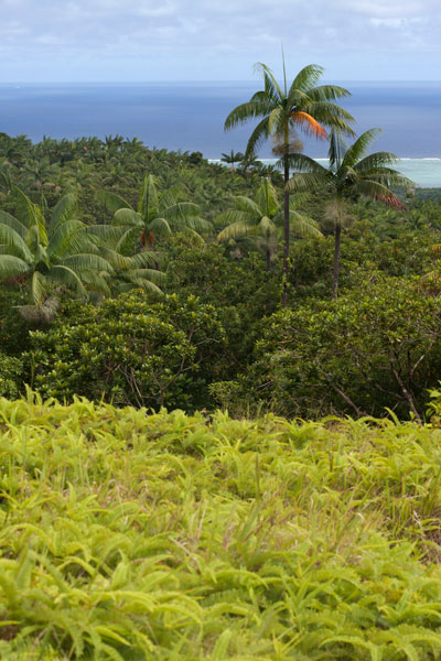
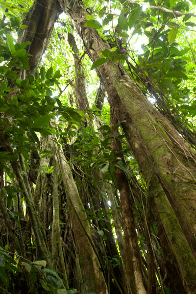
Today, the name Wou Kutoahr is used to refer to a large area of upland fern meadows, palm forests, giant tree fern stands, and denser hardwood forests, though it actually means “kingfisher valley” and originally referenced a specific feature nearby. There’s a little bit of everything here for hikers and birders. Most of the birding is to be had in the forests below the Nan Peienlam meadow. All of the common species can be seen, as well as rarer birds like the Micronesian pigeon, ground dove, crimson-crowned fruit dove, and long-billed white-eye. There are also some interesting species of plants to be found in the same spots, including native mace (Myristica fragrans), which produces walnut-sized seeds covered by a rubbery bright-red skin. These trees were introduced from Sulawesi by the Japanese in the 1920s. Pohnpei’s endemic palm, called kotop, is common around the fringes of the meadows and on some of the nearby slopes.
You can begin your hike wherever necessary along the unpaved road leading up from the FSM-Chinese Pilot Farm near the Circle Island Road, though most vehicles will need to park further down due to the extremely poor condition of the track. Wherever you start, follow the road up until it narrows to a footpath. This path climbs gradually with an 9-10% slope and to the first savannah. If you walk out among the ferns to the south, you can get some decent views on a clear day. The path continues to climb at the same rate from there, passing into a section of forest dominated by giant tree ferns and beautiful hardwoods. This the key place for birders. In the middle of the forest segment, the trail levels off to about a 4% slope, eventually leaves the forest, and arrives at the second set of fern meadows. A knoll to the south offers excellent views of the lower forests and ocean. Other trails continue 0.74 km from Nan Peienlam to Dolekole (363 m) and 0.67 km to the Mese Stream (Pilen Mese) from the middle of the forested section.
Camping
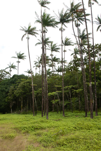
The kotop (Clinostigma ponapensis) stand on the edge of the upper meadow is a wonderful place to camp with amazing scenery all around and some protection from wind. The nearest fresh water is at Pilen Mese (purify or filter it) about 1.2 km north. Leave the area exactly as you found it and pack out everything you brought in.
No fees are charged for this hike. You can do this hike without a guide.
- Plan for 4 hours round-trip for this hike.