
Dolen Uh & Other Treeless Hills
Treeless Hills & Fern Meadows
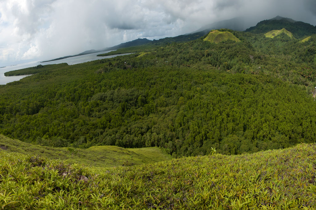
One of the most visually distinctive features of the area between Pehleng and Pwudoi involves the fern meadows that crown the tops of several treeless hills on both sides of the main road. These features exist where shallow bedrock and repeated burnings inhibit tree growth.
Dolen Uh
One rounded hill, called Dolen Uh (“standing hill”), lies immediately west of the road in Pwudoi and offers a nice hike that anyone can manage. Begin next to the road 0.22 km (0.14 mi) after the Pilen Seleur eel pools and follow the footpath through the woods and past three utility poles to the FSM Telecom tower at the 94 m summit. The roof of a small concrete hut is a nice spot for a picnic or for enjoying the sunset. Panoramic views are found in all directions. This hike can be done without a guide and without any special permission. With the exception of one small, scrubby tree next to the concrete hut, the rest of the hill is covered with low spreading plants with tiny flowers, called “yellow grass,” and a variety of Lycopodiella fern routinely found in meadows of this type.
Tents can be pitched in many places around the gentle slopes, though there is no water on the hill and it’s exposed to off-shore winds (pack out ALL garbage — leave nothing behind).
No access fee is charged.
- Plan for 45 to 90 min with some leisure time at the top.
Mallen Loange Peidak
Another interesting fern-topped hill is located northeast of Dolen Uh and is easily accessible from the same road taken to reach the Dolmweir / Pekenuht / Nahnalaud trailhead in Pehleng. The turn-off for this road is 3.2 km (2 mi) north of the Dolen Uh trailhead just before a basketball court. The meadow, or savannah, on the hill’s crest is known as Mallen Loange Peidak (mal means “meadow”) and offers commanding views of the western coasts, Nan Lapahu Stream valley and Woun Oapoaro — another valley. Drive to the end of the access road (1.72 km / 1.1 mi) and walk about 0.42 km (0.26 mi) up the footpath until coming to a clearing on the south side of the path, where a second footpath leads southwest to the hill (0.22 km / 0.14 mi). Anyone living nearby can point you in the right direction, and children in the neighborhood will act as guides for a couple of bucks.
- Plan for 45 min to 1 hour for this hike.
Pohn Dollap
A third hill, called Pohn Dollap (“on the big hill”), is found between the Circle Island Road and Mallen Loange Peidak. To find a guide (offer $12.00) and obtain permission to cross private land around the hill, ask at the houses along the inland side of the road 1.8 km (1.1 mi) south of the Mallen Loange Peidak / Nahnalaud access road.
- Plan for 2 to 2 1/2 hours round-trip.
Pohn Pehnmen Savannah
Mallen Pohn Pehnmen
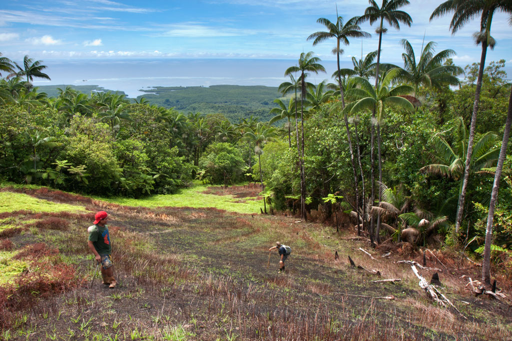
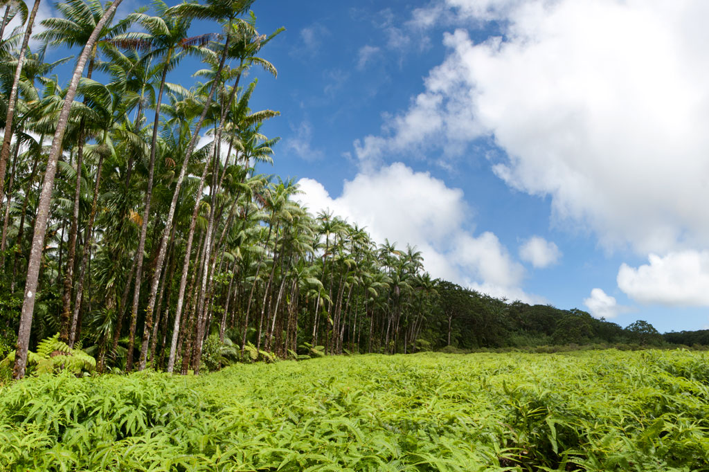
In the remote mountainous area called Pohn Pehnmen is an upland savannah similar to those on the Nihpit plateau, but smaller and at a much higher elevation. The meadow, reached by deviating west from the Enipein Powe trail to Nahnalaud, has a strong slope to it with a central hill and an open view of the ocean and lowlands. Most of the area is covered by low, spreading ferns and club moss, while giant tree ferns and endemic kotop palms (Clinostigma ponapensis) are clustered along the fringe.
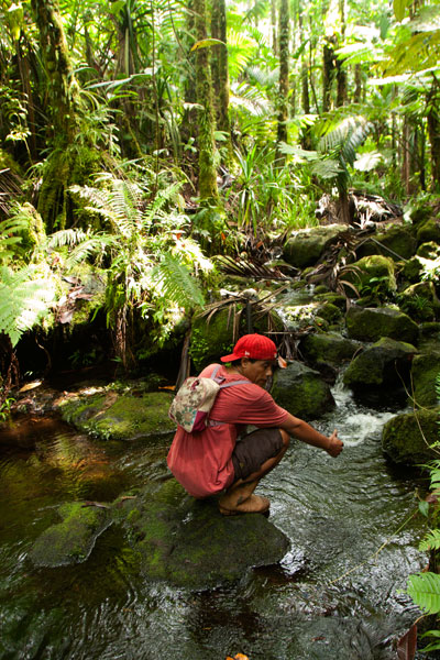
Like Nihpit, the moderately difficult, but rarely steep, trail is dominated by groves of Atuna racemosa, which Pohnpeians call ais. This tree’s unusually hard wood, termite-resistant quality, and straightness makes it a popular choice for construction projects on the island. The fruit are also used medicinally and to create the red paint commonly used on Pohnpei canoe hulls. You’ll see bio-luminescent salengen eni (“ghost’s ear”) mushrooms, many types of bracket fungi, including one that has sadly been the target of poaching by visitors from at least one Asian nation, and a startling diversity of bryophitic growths on trees and logs. There are a number of small stream crossings. Birders will find a lot to look at both in the forests on the way up and around the meadow.
The hike begins at the end of the road near the FSM Telecom mobile phone tower, cuts through a grassy clearing, and enters the first. The 0.26 km (0.16 mi) to the first branch in the path is mostly flat; bear right. After that it climbs pretty steadily for 1.4 km (0.87 mi) at about a 17-18% slope. There’s another branch about 0.52 km (0.32 mi) from the top; again, bear right.
- Plan for 5-8 hours for this hike.
- Please visit the Local Guides & Tour Operators page for a list of experienced guides available for hikes to Mallen Pohn Pehnmen. Offer $25-50.00 for a group of five or less.
Nihpit Plateau Savannahs
Mallen Nihpit & Mallen Pitetik
On the large upland plateau of Nihpit in the mountains above Mwoakot are two expansive savannahs or fern meadows. Upland savannahs of this sort usually exist because the bedrock is shallow, but they are also periodically burned by residents, inhibiting the growth of larger shrubs and trees. Hunters say that the Philippine sambar deer that live in Pohnpei’s interior — probably introduced by the Germans from the Mariana Islands — are attracted to the ash. One hunting tactic is to lie hidden at such sites and wait for the deer to creep from the forest in the early dawn (photographers might use the same method). Both of the savannahs soak up rain and feed tributaries of the Ne Stream (Pilen Ne). The northernmost and the larger of the two meadows — about a half kilometer in length — is usually referred to as Mallen Nihpit. The other savannah is Mallen Pitetik. Birders and photographers will find this a wonderful place to camp and observe fauna rarely disturbed by human activity. The palm forests around the edge provide plenty of shade, and drinking water can be filtered at the stream about 100 meters away.
The hike begins on the right side of the unpaved secondary road opposite the track leading to the Wene Latter-Day Saints Church — 0.92 km (0.57 mi) past the Nanwou Stream bridge — and leads up to a farmstead. Your guide will stop at a cluster of residential buildings to ask permission to cross the family’s land before leading you on. About 160 m beyond this is the first of two major stream crossings — one on a log and the other across a covered wooden bridge. After the second bridge, the trail climbs steadily for 1.47 km (0.9 mi) at a 25% slope average into forests full of huge Terminalia carolinensis (kehma) — found only on Pohnpei and Kosrae — and Atuna racemosa, a tall, straight hardwood locally called ais. The latter have many uses including treatment of diarrhea and dysentery. The white nut inside the ais fruit is ground and mixed with red soil to produce paint for canoes, while the extremely hard and termite-resistant lumber is a favored building material. If you hike in the evening, keep an eye out for eerie salengen eni (Filoboletus manipularis), bioluminescent mushrooms said to grow in areas where ghosts reside (the name means “ghost’s ear”). The tiny fungus often grows from rotten logs and looks like clusters of eyes in the dark. Interestingly, some Pohnpeian parents are known to control misbehaving youngers by threatening to send them to places where the mushrooms thrive. At this point, hikers have reached the edge of the plateau and the remaining 1.08 km (0.67 mi) is relatively flat with a 6% slope average. There are four small stream crossings along the hike. The first three come down from Mallen Pitetik and converge, forming a high waterfall as they drop off the plateau; follow the second stream up for 0.34 km (0.2 mi) to reach that savannah. The last stream originates in Mallen Nihpit and makes a good place to filter/purify water when camping in the area.
- Plan for 8 hours for this hike.
- Please visit the Local Guides & Tour Operators page for a list of experienced guides available for hikes to Nihpit. Offer $50.00 for a group of five or less.