
Dolen Palikir
Dolen Palikir (“hill of Palikir“) is a long hill in the middle of Palikir that runs northeast-southwest and has knolls at each end. The southern summit is slightly higher than the other at 250 meters. The Japanese capitalized on Dolen Palikir’s geography as they did with most of the high points on Pohnpei. Trench systems cross the path or run alongside it in several places and there are many small rifle pits. The trail begins at the Hadley residence west of the road leading to Iohl and climbs gently through high, waving grass before entering the trees. There it steepens as it meanders through sakau (kava) plantations (the tallest plants are just below the first summit). Near the summit benchmark is a prehistoric pehi (stone platform) linked to a story about Lepen Palikir — the highest chief in the region, but there’s no clear view of the valley here. The hike to the southern point follows the mostly flat ridge, passing many earthen defensive works, but none with cement or stonework. Near the middle of the ridge, the trees open up and provide a view of the panorama below. The most extensive Japanese structure is at the hill’s highest point and consists of three recessed gun sites with stone retaining walls around them and a trench leading down-slope.
- Plan for 2-4 hours for this hike. Ask at the house for guides Rihlent Hadley or Denster Louis. Offer $20.00.
Temwetemwensekir Peak
Southeast of Palikir, Pohnpei’s primary mountain system makes an almost 90° turn to the south at Temwetemwensekir (594 m), a prominent peak that dominates the topography and feeds six major rivers. The all-day slog to the top begins up an unpaved road opposite the College of Micronesia national campus. Though the route isn’t always clear and the challenge of the climb is increased by rough terrain and a few steep pitches, once one reaches the palm forests on the ridge, it’s smooth sailing. Hikers are afforded some beautiful views of Nanpohnmal, Palikir, and peaks to the south of the summit area. Japanese trenches and an observation post can also be found at the northeastern corner of the plateau.
- Plan for 8 hours for this hike.
Dolen Uh & Other Treeless Hills
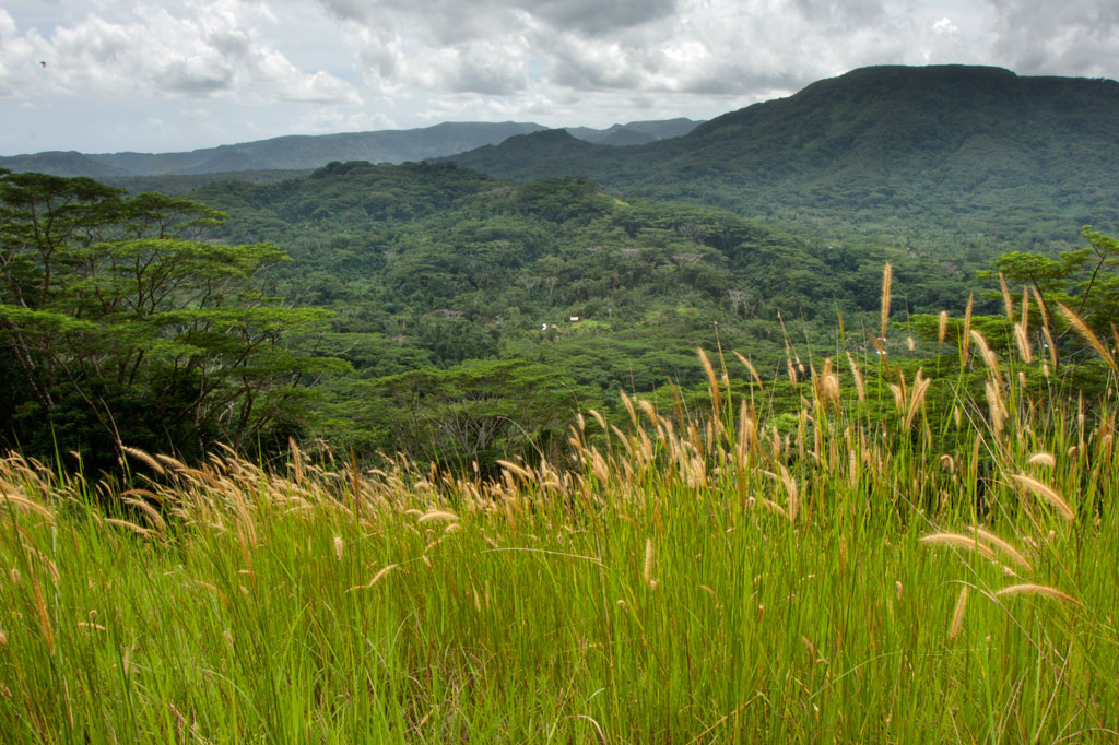
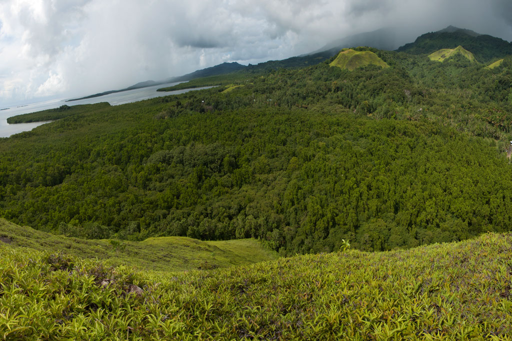
Treeless Hills & Fern Meadows
One of the most visually distinctive features of the area between Pehleng and Pwudoi involves the fern meadows that crown the tops of several treeless hills on both sides of the main road. These features exist where shallow bedrock and repeated burnings inhibit tree growth.
Dolen Uh
One rounded hill, called Dolen Uh (“standing hill”), lies immediately west of the road in Pwudoi and offers a nice hike that anyone can manage. Begin next to the road 0.22 km (0.14 mi) after the Pilen Seleur eel pools and follow the footpath through the woods and past three utility poles to the FSM Telecom tower at the 94 m summit. The roof of a small concrete hut is a nice spot for a picnic or for enjoying the sunset. Panoramic views are found in all directions. This hike can be done without a guide and without any special permission. With the exception of one small, scrubby tree next to the concrete hut, the rest of the hill is covered with low spreading plants with tiny flowers, called “yellow grass,” and a variety of Lycopodiella fern routinely found in meadows of this type.
Tents can be pitched in many places around the gentle slopes, though there is no water on the hill and it’s exposed to off-shore winds (pack out ALL garbage — leave nothing behind).
No access fee is charged.
- Plan for 45 to 90 min with some leisure time at the top.
Mallen Loange Peidak
Another interesting fern-topped hill is located northeast of Dolen Uh and is easily accessible from the same road taken to reach the Dolmweir / Pekenuht / Nahnalaud trailhead in Pehleng. The turn-off for this road is 3.2 km (2 mi) north of the Dolen Uh trailhead just before a basketball court. The meadow, or savannah, on the hill’s crest is known as Mallen Loange Peidak (mal means “meadow”) and offers commanding views of the western coasts, Nan Lapahu Stream valley and Woun Oapoaro — another valley. Drive to the end of the access road (1.72 km / 1.1 mi) and walk about 0.42 km (0.26 mi) up the footpath until coming to a clearing on the south side of the path, where a second footpath leads southwest to the hill (0.22 km / 0.14 mi). Anyone living nearby can point you in the right direction, and children in the neighborhood will act as guides for a couple of bucks.
- Plan for 45 min to 1 hour for this hike.
Pohn Dollap
A third hill, called Pohn Dollap (“on the big hill”), is found between the Circle Island Road and Mallen Loange Peidak. To find a guide (offer $12.00) and obtain permission to cross private land around the hill, ask at the houses along the inland side of the road 1.8 km (1.1 mi) south of the Mallen Loange Peidak / Nahnalaud access road.
- Plan for 2 to 2 1/2 hours round-trip.