
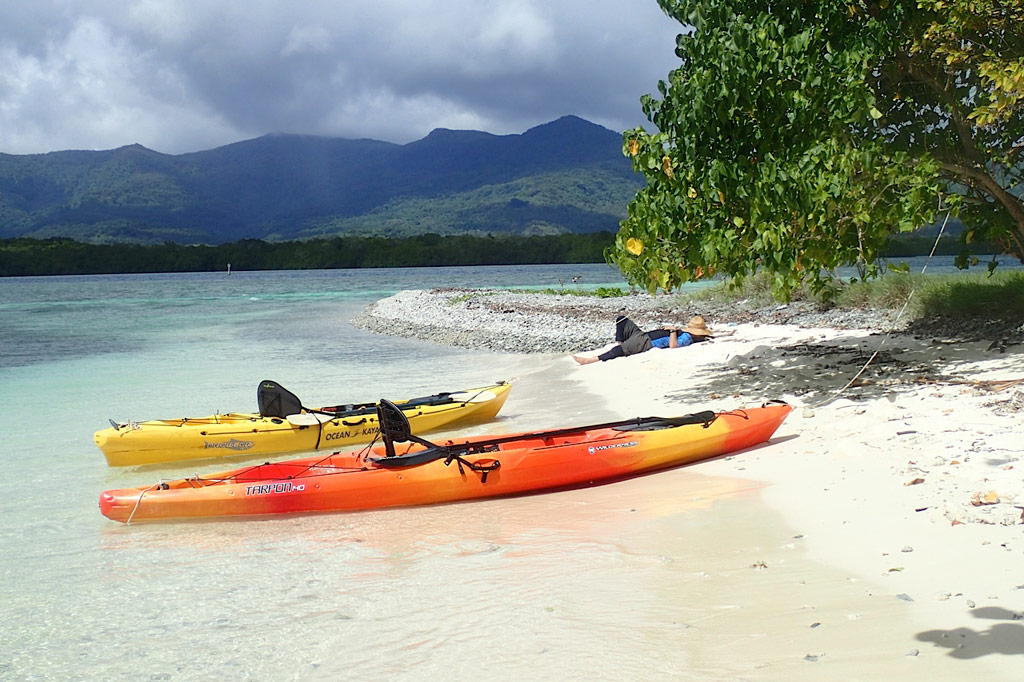
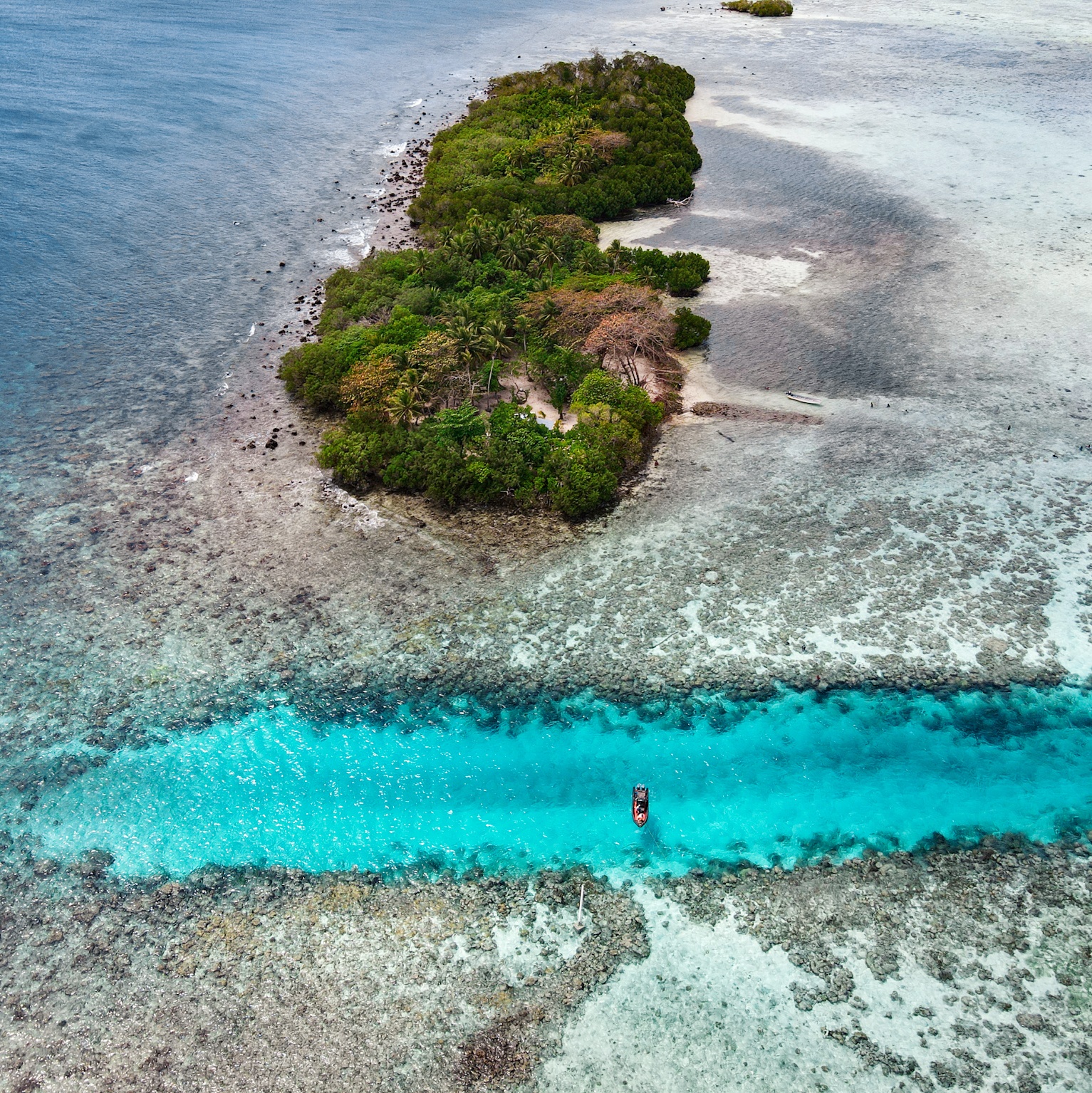
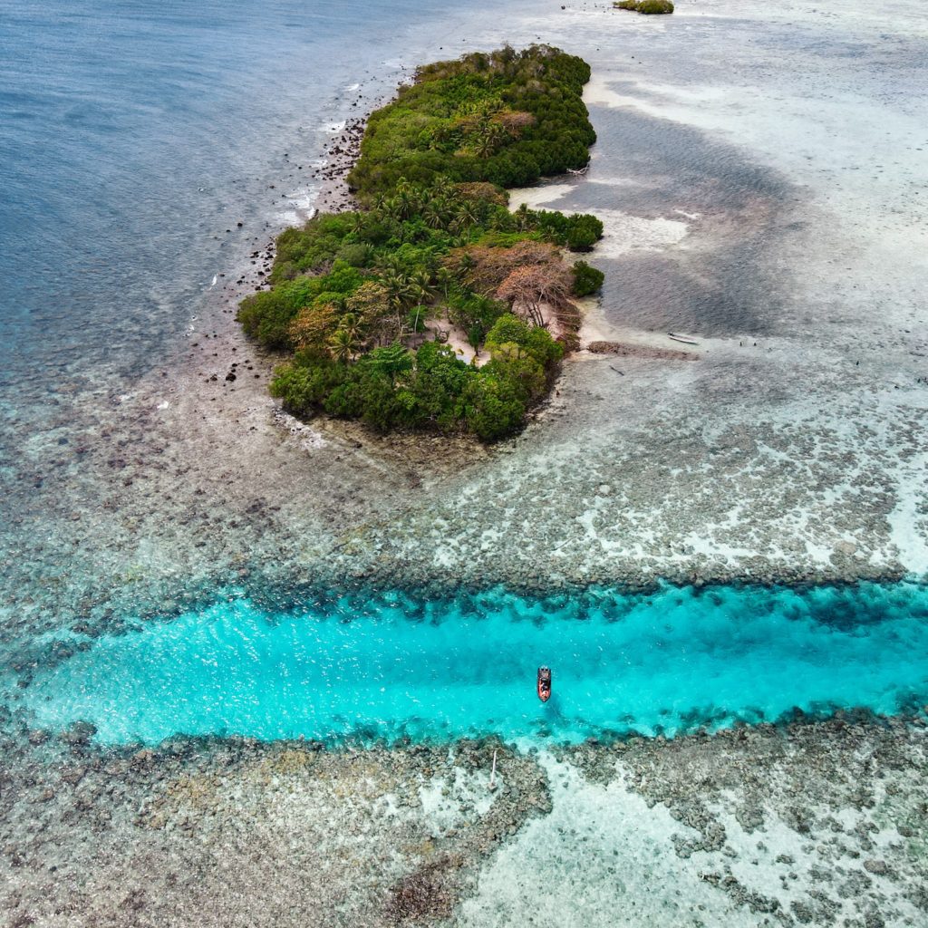
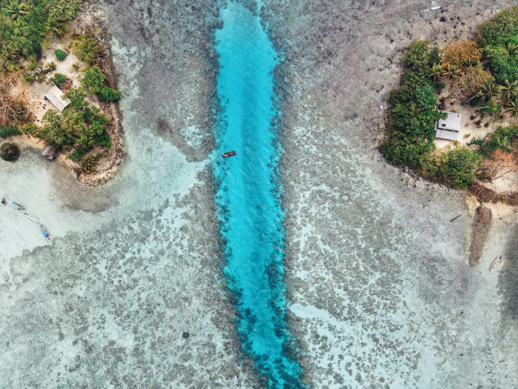
Ros Island
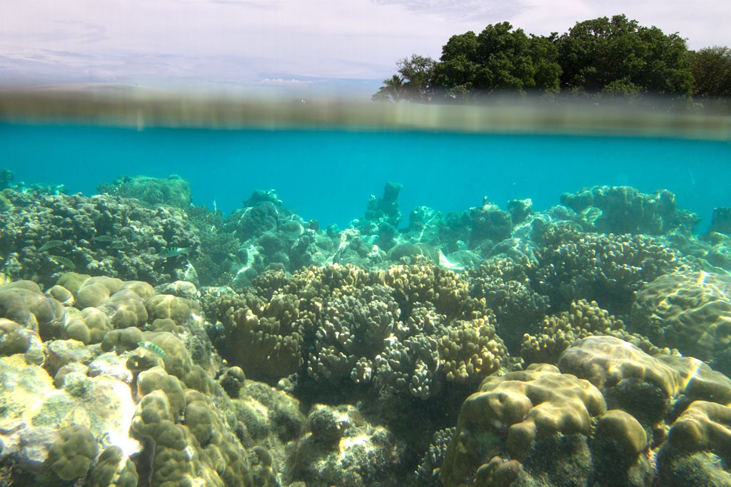
Ros is another beautiful uninhabited reef island in the south. The long, skinny island seems to be slowly disappearing as it erodes, but there are huge areas of wonderful sand on the west side to lounge about on and a narrow belt of trees. It’s mostly notable as a destination for paddlers, taking a break from exploring mangrove forests nearby, or SCUBA enthusiasts, resting between dives (Kepidauen Ros is one of two locations on Pohnpei famous for manta rays). There is good swimming and snorkeling a few kicks from the island.
- For permission to visit or camp on the island, call +691.320.5896 or the Kitti Municipal Government Office at +691.320.5038, 320.5808, 320.5049, or 320.3257.
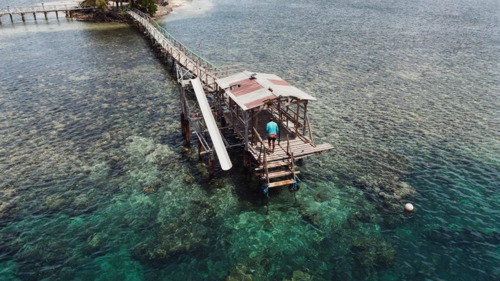
Nahlap Island
")
Nahlap remains one of Pohnpei’s most accessible and popular lagoon getaways, but visitors should be aware of the facilities and island conditions.
Many of the huts have basic amenities, but water access varies. Some huts, including the nahs (traditional meeting houses), currently have limited water systems. Toilets in the nahs are bucket-flush only, and there is no shower water available at those locations. Showers are available at some of the other huts, where water tanks are still functional. The larger green and blue huts appear to be the most maintained, with the blue hut offering the best bathroom facilities (still bucket-flush, but with a larger tank).
The boat service to Nahlap is typical of local lagoon transport — reliable enough but basic, without luxury features and not always the most comfortable ride. Travelers looking for a faster or more comfortable experience might consider working with a tour company or arranging a private charter.
Currently, major reinvestment in the property appears limited. However, Nahlap’s natural beauty still offers plenty for visitors to enjoy. The north end of the island, beyond the small church, feels particularly untouched and peaceful, with dense tropical plant life and mature trees providing shade and a true sense of isolation.
Key Points for Visitors:
• Bring extra drinking water and be prepared for limited freshwater availability.
• Facilities are basic: bucket-flush toilets, limited or no shower water in some huts.
• Boat transport is local-standard; tour companies or private charters may offer alternatives.
• Best suited for travelers seeking a rustic, nature-focused island experience.
Getting there:
Launch at Sekeren Iap in Rohnkitti (~21 km southwest of Kolonia). Continue past the Henry Nanpei Memorial and Rohnkitti Church to the end of the road.
Reservations and Boat Arrangements:
To make reservations or arrange for a boat taxi from Sekeren Iap in Rohnkitti, call +691 925 9797
Or contact the Kitti Municipal Government Office: (+691)320-5038 / 320-5808 / 320-5049 / 320-3257
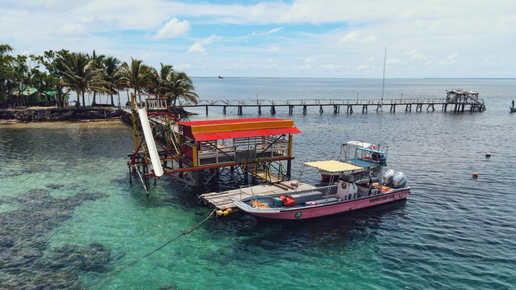
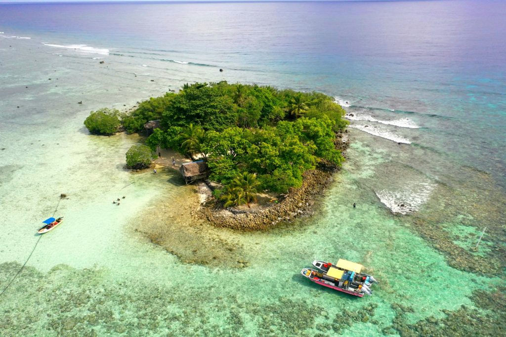
Kehpara Island
Though not as developed as Black Coral the small thatched huts are adequate for camping trips, the island is equally as shady and much larger than Black Coral, and it actually offers easier access to the excellent snorkeling around Kehpara Pass. It’s cheaper, too. At low tide, there’s a beautiful sandy beach between the two islands. The island has solar lights set up around the island to provide some light at night however we recommend bringing along a lantern and some flashlights to help illuminate inside the huts since they are not rigged with lights.
To make reservations for day visits or overnight stays and arrange for boat pick-up from the launch behind Seinwar Elementary School, call Nickson Abraham (Oaun Kitti) at +691.925.5340 / +691.920.8081 or the Kitti Municipal Government Office at +691.320.5038, 320.5808, 320.5049, or 320.3257.
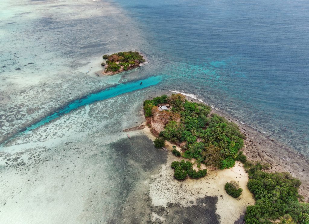

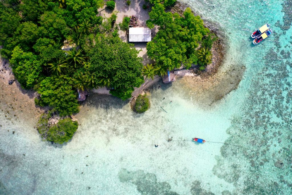
Black Coral Island
“Black Coral” is the southernmost islet in the Namwmour chain of islands that straddles Kehpara Pass (Dauen Kehpara) on the southwest corner of Pohnpei’s barrier reef. It’s true name is said to be Kehpara, but hardly anyone calls it that. Instead, Kehpara is usually used to refer to the island on the opposite side of the pass (island on lower right side of top image). In the mid-1600s, the conquering hero, Isokelekel, first entered Pohnpei’s barrier reef through Kehpara Pass on his way from Ahnd Atoll to Nan Madol. The sandy and well-shaded coral island, which lies within the Kehpara Marine Protected Area (MPA), is currently owned by the Adams family (the proprietors of Ace Hardware and Ace Office Supply). Black Coral is immaculately maintained with serpentine footpaths running here and there through large sprawling trees and several simple, wooden huts for overnight camping. Good snorkeling is located off the eastern shore and in the pass to the north, where white-tip and black-tip reef sharks, spotted eagle rays, and other marine wonders can often be seen. The best SCUBA diving is along the outer edge of the barrier reef north of the pass, a spot called Kehpara Wall. The area is a spawning ground for several varieties of protected grouper. Though some sandy areas appear at low tide along the inner coast, Black Coral doesn’t have any true beaches.
To make reservations for day visits or night stays and to arrange boat transport from the Seinwar Launch behind Seinwar Elementary School call ACE at +691.320.8279 / 5637.
Pohnpei Diving – West Side Sites
“Dauahk Wall”
This drift-dive follows the outer barrier reef wall north of Kepidauen Dauahk. Things to see here include eagle rays, napoleon wrasse, gray reef sharks, and schools of dog-tooth tuna. 10-40 meters. Best on an in-coming tide. Advanced.
“Dauahk Bridge”
This is one of the best dive spots on Pohnpei, following the reef bridge across the mouth of Kepidauen Dauahk. It offers the same things as the “Palikir Pass Bridge”, but at less depth. Large congregations of gray reef sharks, spotted eagle rays, and massive schools of black snappers, red snappers, and barracuda are regularly encountered. The snappers mate in late summer and early fall. Down to 36 meters. Best at 18-24 meters on an in-coming tide. Advanced.
“Pehleng Wall”
This drift dive-along the outer wall north of Kepidauen Pehleng is notable for gray reef sharks and the less-common silver-tip sharks, huge napoleon wrasse, schools of jacks, lionfish, and an abundance of soft coral. 10-40 meters. Best on an in-coming tide. Advanced.
“Pehleng Corner”
This spot is located at the prominent southern corner of Kepidauen Pehleng. Commonly seen are sweetlips, lionfish, and huge schools of both black and red snappers, jacks, and sometimes tuna. The reef wall is encrusted with nudibranchs and anemones. 6-40 meters. Best on an out-going tide. Advanced.
“Kehpara Wall”
This is a drift-dive along the outer reef wall north of Dauen Kehpara within the boundaries of the Kehpara Marine Protected Area (MPA). Sights include wrasse, jacks, groupers, barracudas, silver-tip sharks, and both black-tip and white-tip reef sharks. Lobsters, giant clams (tridacna), conchs, sea fans, and sponges are also prevalent. The island to the south, nicknamed “Black Coral,” gets its name from a variety of purplish, branching coral found in the area. This is one of the primary spawning grounds for local groupers. 6-37 meters. Best on an in-coming tide. Intermediate.
- Entering the MPA requires a permit. Visit our MPA page for details. Kehpara MPA is closed to snorkeling and diving from January 1 to June 30 each year.
ACKNOWLEDGMENTS
We’d like to extend a big kalahngan to Mike Viti, John Ranahan, and Karino Olpet for sharing their in-depth, first-hand knowledge about SCUBA diving on Pohnpei — without which this page could not have been created. Images licensed from www.shutterstock.com.
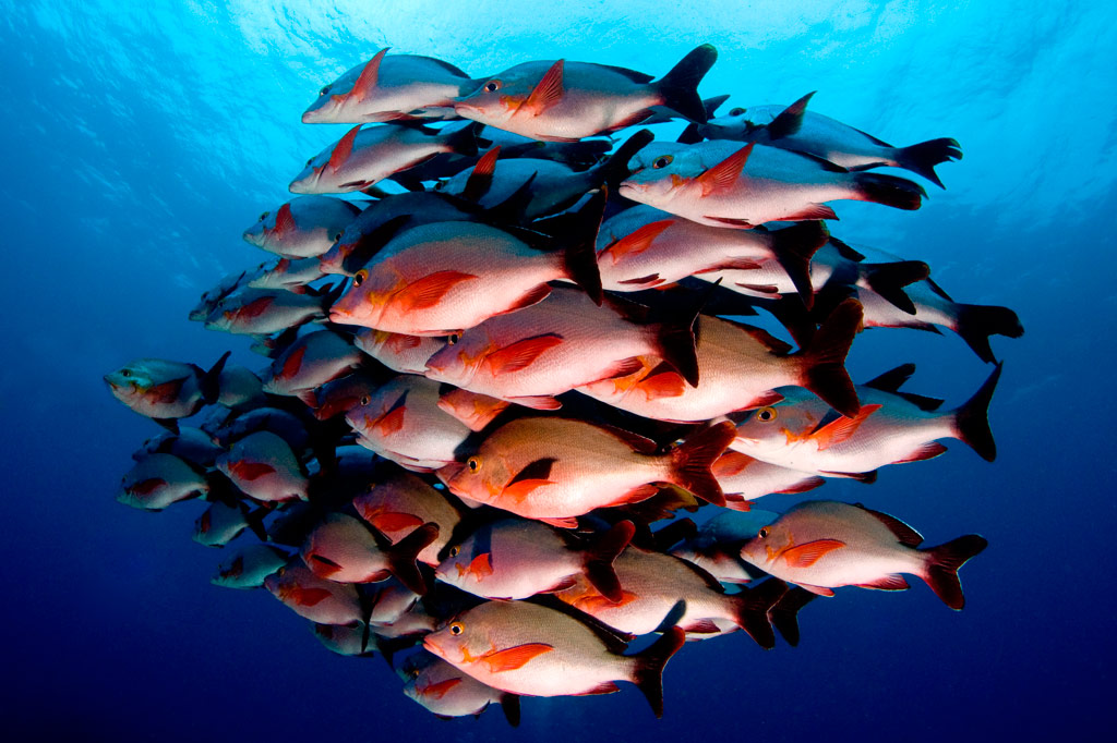
Pohnpei Diving – South Side Sites
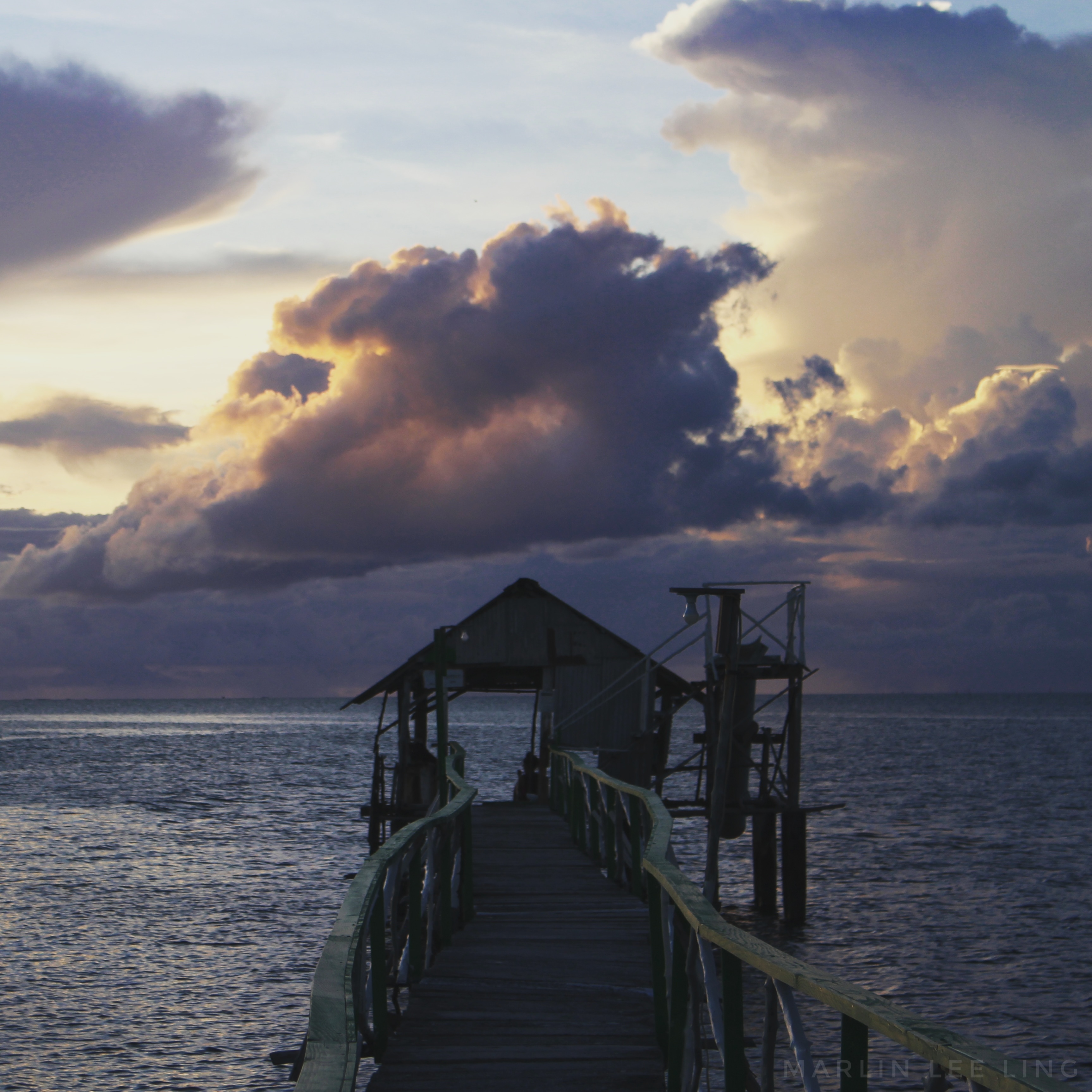
“Nahlap”
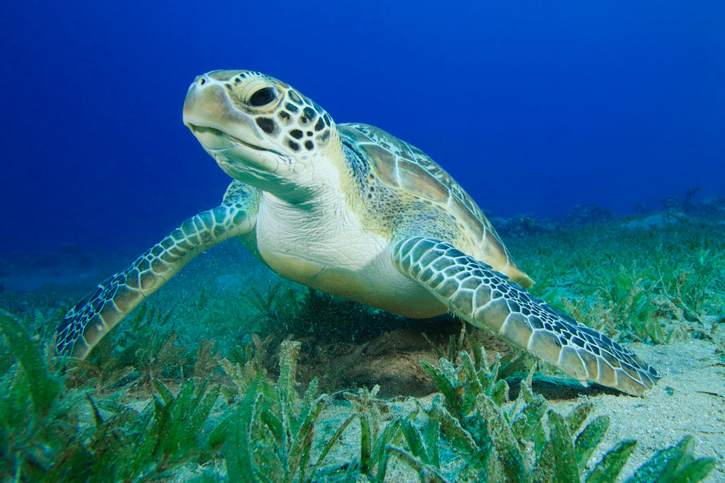
This dive curves around the corner of the reef east of Nahlap (island). It’s best known for sponges and schools of mackerel, jacks, and rainbow runners. Reef sharks and turtles are also occasionally seen. 9-40 meters. Best on an in-coming tide. Intermediate.
“Laiap Bridge”
This dive follows the bridge across the entrance to Kepidauen Laiap southeast of Laiap (island) and offer opportunity to see plenty of pelagics, sharks, and sometimes turtles. 2-34 meters. Best at 15-25 meters on an in-coming tide. Intermediate.
“Nahtik Bridge”
This dive follows another bridge across the entrance to Kepidauen Nahtik southeast of tiny Nahtik (island) with similar sights as “Laiap Bridge.” 2-34 meters. Best at 15-25 meters on an in-coming tide. Intermediate.
“Ros”
The prime attraction in this narrow pass east of Ros (island) is the manta rays, which can congregate in unbelievable numbers (as many as 40). The main reason the site isn’t as frequently visited as “Manta Road” is that its so far from Kolonia. Schools of jacks, snappers, and barracuda are also common and occasionally green turtles. 5-40 meters. Best at 18-24 meters around the full moon. Intermediate.
“Penieu Corner”
This dive begins on the outer reef wall east of Kepidauen Ne opposite Penieu (island) and then follows the reef west and south, through the pass, and into the lagoon. 3-40 meters. Best at 18-35 meters on an in-coming tide. Currents are often strong here. Advanced.
“Lohd Bridge” (also known as “Lohd Harbor”)
This dive follows a bridge across the entrance to a small barrier reef passage east of Kepidauen Ne (pass). There are lots of sharks here. 2-35 meters. Best at 18-35 meters on an in-coming tide. Currents can be intense. Advanced.
ACKNOWLEDGMENTS
We’d like to extend a big kalahngan to Mike Viti, John Ranahan, and Karino Olpet for sharing their in-depth, first-hand knowledge about SCUBA diving on Pohnpei — without which this page could not have been created. Images licensed from www.shutterstock.com.
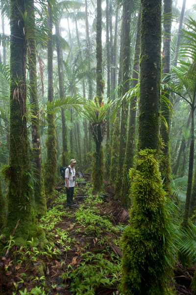
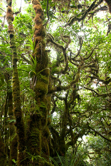
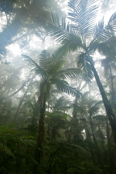
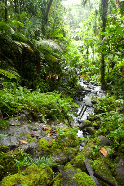
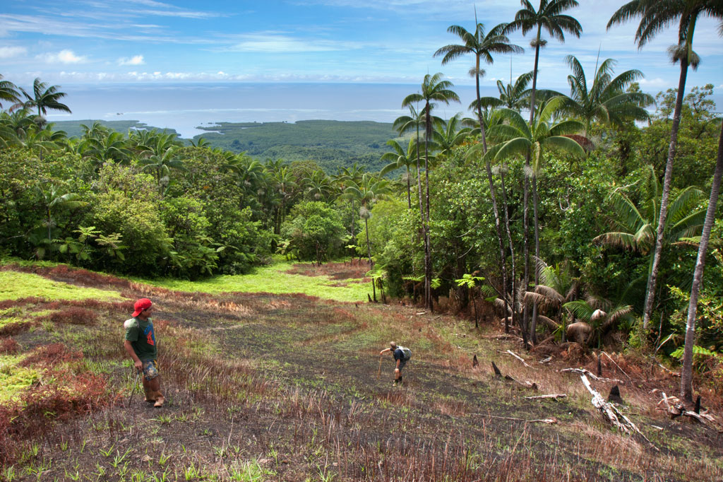
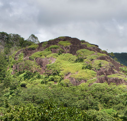
Nahnalaud — the Big Mountain
The Big Mountain
![]()
![]()
![]()
![]()
![]()
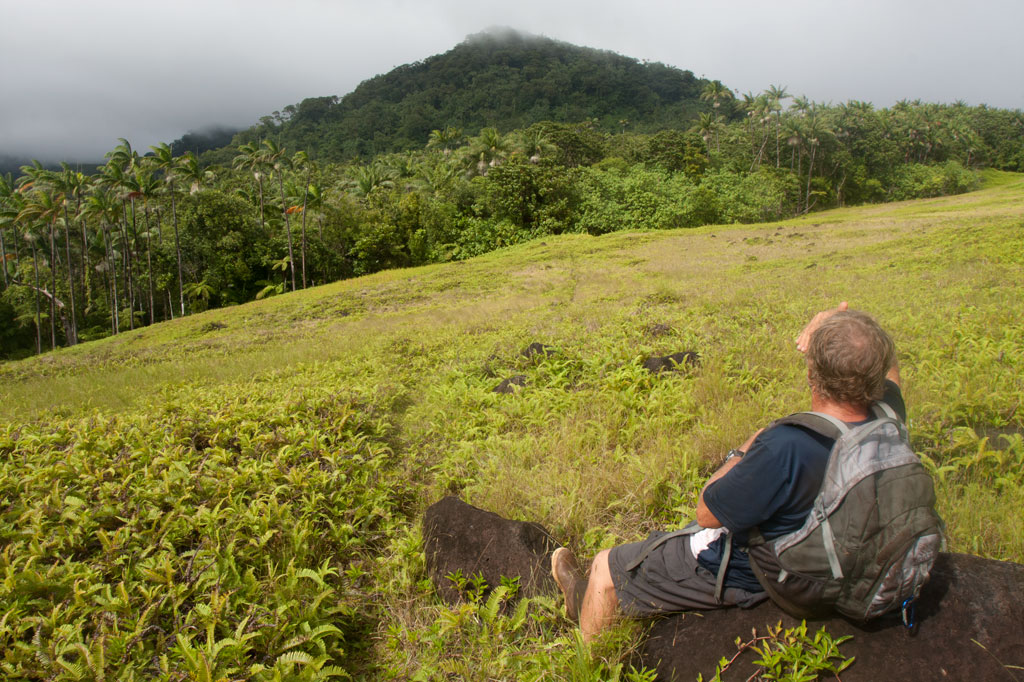
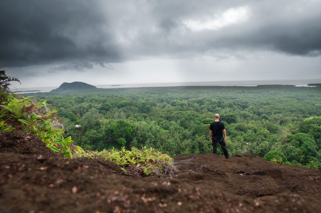
The highest mountain in the Federated States of Micronesia (FSM) is called Nahnalaud (which means “big mountain”) and is located almost in the exact middle of Pohnpei Island. Pohnpeians consider the mountain sacred and regard it with respect and reverence, though most people have never been there because of the long, difficult hike involved. Local deer hunters and upland sakau farmers are the most frequent visitors to the highland region. A limited number of foreigners also attempt the summit.
In reality, Nahnalaud is not a single mountain but rather the highest peak in Pohnpei’s contiguous central mountain system, which separates the five chiefdoms. The primary central ridge runs from west to east and then curves north toward U not far beyond Nahnalaud. Additionally, a secondary ridge runs south, leading to Pohnpei’s second highest peak, Ngihneni, and then turning sharply to the west. The two ridges fence in the long, narrow Nanmeir Valley — the most remote region on the island.
The exact elevation at the Nahnalaud summit is a matter of debate as the survey methods used in the 1970s to map the island have a significant margin of error. The official number is 772 meters (2,533 ft), but the peak may actually be higher than that — likely close to 780 m. Ngihneni (“spirit’s tooth”) is nearly the same elevation (a difference of a few meters), which has generated a long-running dispute about which is actually the highest point. Nett, Kitti, and Madolenihmw have also argued about which chiefdom can claim Nahnalaud, but according to the municipal boundary lines on the 1983 USGS map, each of these municipalities has a piece of the peak.
Hikers should be careful not to underestimate the mountain. Though the distance is not extreme, the terrain is. Experienced trekkers will find all of the approaches challenging merely because of the very rugged nature of Pohnpei’s interior mountains. The concept of switchbacks is little known on Pohnpei; trails are rough, rocky, and often go straight up the slope. Hikers who plan to tackle Nahnalaud should be prepared to walk along narrow ridges with steep slopes on either side; cross jumbles of broken, slippery rocks; ford medium-sized rivers (particularly on the Nett and Madolenihmw routes); walk in shallow, rocky riverbeds; ascend and descend slopes of 50 degrees or steeper; wade through muddy mires; cross slick logs; and push through high grass or ferns.
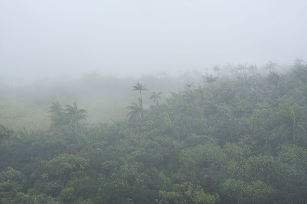
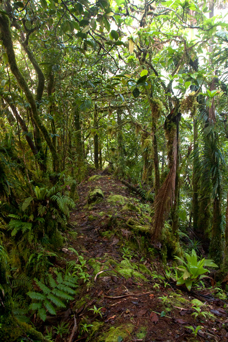
Despite the difficulty in getting to the top, the trip is well worth it. Those who have never visited a cloud forest before will be awed by the otherworldly beauty of the ridge, a perpetually dripping wonderland of stunted, hoary trees, air plants, and bryophytic growth. Virtually every surface is covered with a thick layer of spongy golden moss and the ground is composed of layer upon layer of damp, decayed matter. The area, which never dries out, gets at least 8.3 meters (325 in) of rain every year and is shrouded in thick fog much of the time, making clear views from the summit a rare occurrence.
[tabs]
[tab title=”Pehleng”]
Pehleng Approach (Western Kitti)
This well-defined trail up to the primary ridge and eventually to Nahnalaud was first promoted in 2013 by a local business calling itself Pohnpei Trailways. The idea was that this trail, starting in Pehleng, could be hiked by tourists without the assistance of a local guide. We strongly recommend that you do NOT do it that way. In fact, we think it’s a very a bad idea. Though at the time of writing (2014) the entire length of the trail was marked with pink flagging tied to tree branches, there is still plenty of potential for visitors to go astray. Furthermore, accidents or injuries without a local guide present could result in disaster. Remember that Pohnpei has no search and rescue service.
The true ascent begins after passing through a cluster of houses (ask permission) 0.95 km beyond the trailhead. After that, the trail is wide and true as it climbs steadily for 1.45 km (20% slope average) through the forest to the open fern meadow atop Dolen Salapwuk (510 m), where there are some good views in clear weather. The trail then re-enters the forest and begins to climb again for 4.6 km (13% slope average), narrowing as it comes up to the main ridge (696 m). Just before Shelter 1 (Dolmweir), there’s a 315 meter-long segment that is less than a meter wide with precipitous slopes on both sides; we’ve dubbed it the “Knife Edge.”
Shelter 1 is located at Dolmweir, where an appendage of the mountain thrusts north from the main ridge. There is no flowing water nearby. The privy is located 22 m to the north. After Shelter 1, the trail descends steeply by about 62 m on the south side of the ridge and skirts the base of a rocky cliff before climbing back to the ridge-top. From there it goes up and down for 2.94 km before reaching Mountain Shelter 2 roughly 5 minutes below the Nahnalaud summit.
- Plan for 5-7 hours from the trailhead to Shelter 1 and 3-4 hours from there to the summit.
[warning]NOTE: As of February 2014, the pandanus-thatch roofs of the two ridge shelters were in very bad shape, heavily deteriorated and leaky. Plan accordingly.[/warning]
The Origin of the Yap Banana
In the westward land of Sapani, a woman named Lienpwel (“woman of earth”) had two daughters, Lisoumokaiap and Lisoumokalang. The daughters decided to take a canoe and look for new land in the east and brought with them some “underworld yams”, banana shoots, and a stone called the Stone of Sahwar. The sisters eventually landed at a place in what is now Pwoaipwoai district (at that time the island was smaller and Pwoaipwoai lay near the coast). There they placed the stone and planted the yams. The stone was highly reflective, and when the sun would hit it, it would shine brightly (hence the name Sahwar, which means “shining” or “flashing”).
The younger of the two sisters, Lisoumokalang, eventually returned home to Sapani. On the way she visited the islands of Yap and propagated a new type of banana, which thrived and became the tallest of all banana varieties. Some time later, a Pohnpeian man who lived in a place called Loangen Kitti was looking west toward the sunset and he saw the tall banana plant in the distance. The ripe fruit were attracting many birds, so he found two starlings – one a common Micronesian starling (sioahk) and the other a Pohnpei mountain starling (sie) – and he took them up to a high mountain in Pehleng. The Micronesian starling was a lazy flier, but the mountain starling was clever and efficient. He sent both flying toward Yap. The Micronesian starling was distracted on the way and diverted from its course. Only the Pohnpei mountain starling reached its destination. It joined the other birds in eating the bananas, and while it did so, a seed became lodged in its feathers. Both birds eventually flew back to Pohnpei and landed at the peak of Pekenuht (which, appropriately, means “banana feces”). The seed carried by the mountain starling fell to the ground and propagated utin iap (the Yap banana).
[/tab]
[tab title=”Enipein Powe”]
Enipein Powe Approach (Kitti)
This route begins at the end of an unpaved road in Enipein Powe and climbs gradually on a well-defined footpath up an out-thrust from the southern ridge. At the top, the trail passes through a saddle between Nahnan Pwoaipwoai and Dolen Uhd, then descends slightly along the inside of the ridge slope, finally arriving at a massive overhanging rock known by local guides as “the cave.” The cave has nice views through the trees of the Nanmeir Valley at the Lehnmesi River source below. You can also see Nahnalaud to the northwest and make a guess at the direction of Ngihneni to the east. The cave is an excellent place to camp with a cushioned fern-lined floor (that stays dry in wet weather) and usually some dry firewood stowed by hunters in the vicinity (replace what you use).
From the cave, the trail continues along the inner slope below Ngihneni, crosses several small streams, and then climbs steeply (20% slope average) to the top of the main ridge. At this point it’s just a short walk west along the ridge path to the first open viewpoint near a USGS benchmark. The spot people typically consider to be the summit is 5-10 minutes further, and Shelter 2 is just below that.
- Plan for 6-8 hours from the trailhead to the cave and 90 minutes to 3 hours from there to the summit.
[/tab]
[tab title=”Salapwuk”]
Salapwuk Approach (Kitti)
There are many ways to Nahnalaud from Salapwuk but they all begin at the end of the road beyond Salapwuk Elementary School. The early part of the hike uses the same trail as the Six Waterfalls, but at the place where one would turn toward the river to encounter Falls #1 (Pahnairlap), one instead follows a trail going northeast. This trail stays north of the river, crossing above Iro, Nan Emp, and Lipwentiak waterfalls. The latter is the most spectacular, located where the river gets funneled into a narrow channel and makes a hairpin turn. According to legend, this feature of the river was created when the matriarch of the Great Eel Clan encountered an eel hunter and writhed violently in horror at the sight of the dead eels he was carrying. Small pools above the falls are home to Pohnpei’s endemic freshwater shrimp, which the guides might be willing to catch for dinner. After that, the trail only meets the river again twice, where it cuts through a wide loop in the watercourse. It then turns north and climbs 362 meters in elevation to the primary ridge, not far from the summit.
[/tab]
[tab title=”Nanipil”]
Nanipil Approach (Nett)
Though slightly shorter, the Nanipil approach to Nahnalaud is certainly challenging. It’s significantly steeper than the other routes (except Salapwuk) and the trail is not well-maintained once you reach the rear of the valley. The hike starts at the house next to the hydroelectric building at the end of Nanipil River Road. Immediately behind the house, hikers must cross a river and then shortly after that a small stream. An easy segment follows with a well-defined residential path leading to the last house in this part of the valley (1.39 km), where an old man lives alone.
Past the house, the route continues on a fairly well-defined path that crosses the river several times (these crossings can be tricky if there has been a lot of recent rain). In a few places, you have to walk in the river itself, which can be quite difficult given the slickness of the rocks. Finally, after 2.94 km (3% slope average), the trail begins to climb out of the valley on the east side of the river and follows a sub-ridge up from there (3.16 km with a 22% slope average).
The climb has several pitches with small, flat rest areas in between. The first stop has a conspicuous tree of gigantic proportions entwined with vines almost as massive. The second stop is frequently used as a camp site by hunters and is one of the few places on the mountain with mobile phone reception. The final segment leading to the primary ridge is steep and often muddy. In places it follows the natural pathway of small streamlets (keep an eye out for a small waterfall high up on the slope). Once reaching the main ridge (754 m elevation), it’s an easy 0.56 km walk east to Shelter 2, a typical nahs-style thatched hut that can sleep ten or so.
[warning]NOTE: As of February 2014, a large part of the roof of this shelter had rotted away, leaving the central part of the hut exposed to the elements.[/warning]
[/tab]
[tab title=”Nankepinmerepw”]
Nankepinmerepw Approach (Madolenihmw)
This route passes through the gorgeous valley of Nankepinmerepw, following the upper tributaries of the Nan Riohk Stream and eventually arriving north of Nahnalaud on an arm of the primary mountain system.
The hike begins at a rutted turn-off from the well-graded (but unpaved) road to Pahn Sile Waterfall, leads to a metal footbridge over the Senipehn River — the only bridge like it on the island — and connects with a path on the far side. From there, the trail meanders northwest not far from the Nan Riohk and more or less parallel to it.
The first kilometer or so cuts through cultivated lands. Then it begins to follow the water more closely as it passes into the wilder riverine forests. There are at least nine major stream crossings in this next segment, some of which may be difficult or impossible if there has been a lot of recent rain. Above the last major Nan Riohk tributary, where the name of the stream changes to Nankepinmerepw, hikers take to the stream bed itself, which is certainly the most challenging aspect of the route (13% slope average). The algae-slimed rocks are slick and dangerous and hikers may find that they have to go very slow and use both hands to avoid disastrous slips; it would be easy to snap an ankle or shatter a kneecap in this place. Despite the rough terrain, the scenery in this narrow valley, often fenced on both sides by high rocky walls, is terrific. At times, the trail passes along the tops of vertical prismatic basalt columns.
The first few points of interest are beautiful pools that will tempt any overheated hiker — and why resist? A bit further is a small waterfall near a prismatic basalt quarry site for Nan Madol. Abandoned prisms can be found lying in the stream bed in several places — the largest just below the falls. How exactly prisms were hauled down to the coast from this site is anyone’s guess. After a short, steep section (22% slope average), the valley terminates at a huge “horsetail” waterfall that the route crosses above (you can scramble down the eastern slope without too much difficulty for a better view from the side). The shallow pools above the falls are also an excellent place for a look at Pohnpei’s native crayfish.
Past the big waterfall, the stream narrows until it reaches a third waterfall — this one short and wide, falling over a straight lip (usually called a “block falls” or “sheet falls”) — and then diminishes to a trickle. From this point, the hike climbs west (29% slope average) and then south again as it follows the ridgeline (18% slope average) toward the Nahnalaud summit.
[/tab]
[/tabs]
How Long Will It Take?
Though it is possible to hike up and down Nahnalaud in one day, as we did during one of the many data-gathering excursions, we don’t recommend that you put yourself through that kind of torture. Hiking to Nahnalaud should be considered a 2-day affair with one night spent either at the cave, one of the mountain shelters, or somewhere else on the ridge. Inexperienced or out-of-shape hikers may need three days or more.
Hiring a Local Guide
All of the routes up to Nahnalaud require an experienced local guide.
You should offer your guide no less than $160 if there are five or less in your group and at least $220 if there are more than five (plus tips). If you do the math, you’ll see that this is quite reasonable. With five people, each hiker pays just $32 plus tips — a super bargain. If you can’t assemble a group, you’ll still only pay $80 per person with two hikers, which is less than you’d pay for two dives at virtually any SCUBA company in the world (and this is two days and one night). Obviously, if you plan to take a slower pace and do the hike over three or more days, you’ll need to pay your guide more.
Your guide is your lifeline; you will depend on him to keep you safe and on the right track throughout the duration of your hike. Guides provide other useful services as well, such as making campfires in damp weather. If you expect your guide to cook meals for the group or carry any gear for you, he should be paid extra. Agree on a price beforehand.
- Please visit the Local Guides & Tour Operators page for a list of experienced guides available for hikes to Nahnalaud.
Pohn Pehnmen Savannah
Mallen Pohn Pehnmen
In the remote mountainous area called Pohn Pehnmen is an upland savannah similar to those on the Nihpit plateau, but smaller and at a much higher elevation. The meadow, reached by deviating west from the Enipein Powe trail to Nahnalaud, has a strong slope to it with a central hill and an open view of the ocean and lowlands. Most of the area is covered by low, spreading ferns and club moss, while giant tree ferns and endemic kotop palms (Clinostigma ponapensis) are clustered along the fringe.
Like Nihpit, the moderately difficult, but rarely steep, trail is dominated by groves of Atuna racemosa, which Pohnpeians call ais. This tree’s unusually hard wood, termite-resistant quality, and straightness makes it a popular choice for construction projects on the island. The fruit are also used medicinally and to create the red paint commonly used on Pohnpei canoe hulls. You’ll see bio-luminescent salengen eni (“ghost’s ear”) mushrooms, many types of bracket fungi, including one that has sadly been the target of poaching by visitors from at least one Asian nation, and a startling diversity of bryophitic growths on trees and logs. There are a number of small stream crossings. Birders will find a lot to look at both in the forests on the way up and around the meadow.
The hike begins at the end of the road near the FSM Telecom mobile phone tower, cuts through a grassy clearing, and enters the first. The 0.26 km (0.16 mi) to the first branch in the path is mostly flat; bear right. After that it climbs pretty steadily for 1.4 km (0.87 mi) at about a 17-18% slope. There’s another branch about 0.52 km (0.32 mi) from the top; again, bear right.
- Plan for 5-8 hours for this hike.
- Please visit the Local Guides & Tour Operators page for a list of experienced guides available for hikes to Mallen Pohn Pehnmen. Offer $25-50.00 for a group of five or less.
Dolotomw Summit
Dolotomw is the highest peak in the region of Kitti once known as Onohnleng. Its prominence led Russian explore Fedor Lütke, in 1828, to incorrectly conclude that it was the highest point on the island. The Spanish called the peak Montesante (“saint mountain”). Pohnpeians originally called it Dolen Ne, but the name was later changed to Dolotomw (see legend below).
The challenging hike to the overgrown summit begins on the north side of an unpaved secondary road in Pahnais, west of the turn-off for Nipai Rock and climbs a total of 2.47 km (1.5 mi) to the peak, crossing an open savannah in the region of Lukeileng about half-way along. This spot, in itself, is worth visiting even if you don’t plan to continue up the mountain. There are great views and there’s plenty of space to pitch a tent, though no fresh water nearby.
At the beginning, the trail runs north for 0.3 km (0.18 mi) at a steady slope of 17% before reaching a group of residential buildings, where your guide will ask permission to proceed. The trail then angles northeast and steepens to about 20-22% for the 0.68 km to the upland meadow in Lukeileng. From the middle of the meadow to the base of the mountain is another 0.9 km (0.56 mi) with a more moderate slope of about 13%. Here, there’s a branch in the path. The eastern branch leads to a tiny cave. Stay on the northern track for the summit. At this point, the real climb begins and is quite steep and grubby much of the way (40-44%). The trail vanishes. Hikers must follow their guide more or less straight up the hillside, using natural hand and footholds — rocks, tree roots, etc. There’s a false summit about 130 m (142 yd) from the top, but trees and bushes obscure the views. The true summit is behind a knoll and is criss-crossed with WWII-era Japanese trenches.
- Plan for 8 hours for this hike.
- Please visit the Local Guides & Tour Operators page for a list of experienced guides available for hikes to Dolotomw. Offer $50.00 for a group of five or less.
The Story of Apology Peak
Long ago, a man named Manendolenne (“man of leg hill”) lived at the summit of what is now called Dolotomw. He had a little house there and felt secure, because he was isolated from other people who might wish to cause him harm. Now, there was a demon who lived on Penieu Island and it had a fishpond there stocked with butterfly fish. Manendolenne could see the sun glinting on the surface of the pond from the top of the mountain and became curious about it. One day, while the demon was away, he went down to Penieu and stole some fish from the pond, took them back to his home, and ate them. When the demon saw that someone had stolen his fish, he immediately suspected Manendolenne and went looking for him. Manendolenne heard that the demon was looking for him and prepared pounded taro balls with coconut cream as an offering of apology for what he’d done. When the demon arrived, Manendolenne offered the food to the demon. Ever after, the peak was known, not as Dolen Ne (“leg hill”) but as Dolotomw (“apology peak”).
Nipai Rock
Unlike some of the other unusual rock formations on Pohnpei, the massive rock of Nipai is easy to miss. Obscuring trees prevent it from having the prominent visibility on the Circle Island Road that would make it an eye-catcher, even though it’s only about 230 meters north of the asphalt. Never the less, this utterly huge 160 by 120 meter basalt outcropping in Enipein Powe is wholly unique, easy to access, and absolutely a must-see for any adventurer. The rounded shape of the rock and its many terraces are probably a result of erosion and may indicate that the feature is much older than other more jagged outcroppings like Pwisehn Malek and Sokehs Rock.
The unpaved turn-off on the inland side of the road is 2.2 km (1.37 mi) east of Enipein Pah Elementary School or 1.34 km (0.83 mi) east of the Semwei River bridge. From there, it’s an easy 0.37 km (0.23 mi) walk along the dirt road to the last house (9-17% slope), where a 0.2 km (0.12 mi) footpath leads east (4% slope average), crosses the small Nanwou Stream (Pilen Nanwou) and arrives at the western base of rock. 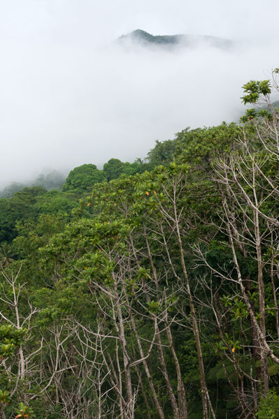 The slope is not too steep here and there is a corridor (36% slope average) where you can find your way up without much difficulty or danger. Once on top, the levels of the rock can be explored and the spectacular view enjoyed in full.
Camping
Many locations on the terraces are perfect for tent camping, and you can filter water at the Nanwou Stream (Pilen Nanwou).
The area in which the trailhead resides is known locally as “Palkalou” and belongs to the Palasko Family. The first house on the left after crossing the bridge heading to Pahntehlap is the residence of the landowners (marked on the map with a yellow star). An access fee is charged by the landowners for non-resident visitors, all visitors must ask permission at the house before hiking on or camping.
- Plan for 2 hours for this hike.
- Contact: John Palasko – (691) 921-3814