
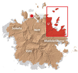
Takaieu & Dehpehk Islands
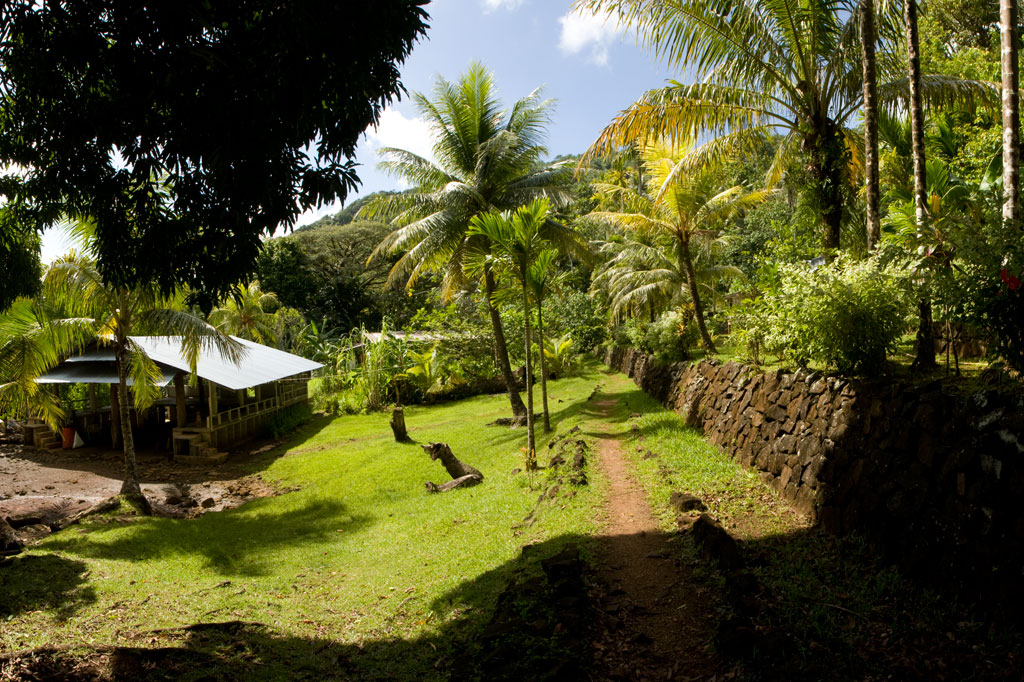
Takaieu and Dehpehk are two large volcanic islands connected by a bridge and linked to the coast of U by a causeway. Most of the local residents live around the eastern and northern coasts of Takaieu and the western coast of Dehpehk and commute to and from Pohnpei by boat. The islands are fun to explore if you want to get a glimpse of old-style Pohnpeian life sans roads and electricity. A seaward turn just before the Madolenihmw border brings one to the unpaved causeway. A well-maintained footpath runs east around Takaieu, crosses the Dehpehk-Takaieu Bridge, continues on the west coast of Dehpehk, and then wraps around the eastern coast, where it connects with another trail going over the interior hill. The marine areas along the eastern coast belong to the Dehpehk Marine Protected Area (MPA). No permission is needed to visit either island, but do be respectful and stay on the main paths around the inhabited areas.
")
Takaieu Island
Takaieu figures into a well-known local myth about two magical brothers. The island is said to have been created when these brothers dragged a large rock all the way from Yap — hence the name, which means “one rock.” The causeway road ends not far along the south coast and is replaced by a tidy rock footpath (vehicles can be parked on the side of the road near the trailhead). From there, the path bends around the mangrove-fringed eastern coastline, passing neatly maintained farmsteads here and there. Mwelling marks the spot of one of the megalithic structures built by Olsihpa and Olsohpa before they founded Nan Madol. The site is impressive, but is easier to reach by boat than from land. About halfway across the north side of the island, the path turns and connects with Dehpehk via a small concrete footbridge.
The Origin of Takaieu Island
There was once a woman in Salapwuk named Lienlama who had two sons named Mwohnmur and Sarapwau. The boys were quite mischievous and had many adventures that figure into Pohnpeian myth. In one story, the brothers went to the islands of Yap and used a magic spell to make a stone fly from that place to Pohnpei. They flew the stone to Wenik (modern-day U) and set it down in the lagoon, naming it Takaieu (“one stone”). They had brought some southern yams with them and they cooked these up, but threw the parts that were underdone into the forests of Alohkapw and Edienleng. And so they southern yam was first propagated in those places.
Dehpehk Island
Dehpehk is long and skinny with a low ridge running along its length. Like Takaieu, it forms its own sub-division, or kousapw, The trail on the west coast is narrow, but heavily used as there are many residences on this side. Once you’ve reached the northern extreme of Dehpehk, however, there’s little reason to go further as the trail gets steadily harder to follow where many of the houses have been abandoned. If you do want to continue, you’ll end up at a homestead with a large piggery. Here the path turns west and climbs over the central hill, reconnecting with the western coastal trail. There’s a nice elevated view from a point just below Dolen Dehpehk (100 m).
- Plan for 7-8 hours for this hike.
- To obtain a guide who can show you around both islands contact Pohnpei Surf Club as one of their boat drivers / dive masters is from the area and can provide assistance with exploring the islands.
U & Northern Madolenihmw GPS
Downloadable GPS Data Files
The following files contain all the packaged GPS data for each of the featured locations in U & Northern Madolenihmw.
Three file types are provided. KMZ and KML files are compatible with Google Earth. KML is compatible with Google Maps. GPX files can be imported into ArcGIS (a professional mapping application) and some hand-held GPS devices.
[info]NOTE: All files are free to the public and can be used for any purpose without permission.[/info]
Dolen Nahnsapwe Hike (2015)
Kupwuriso Mountain & Japanese Gun Battery Hike (2015)
Marine Parks in Awak Pah (2015)
Pahntakai Caves & Waterfall Hike (2015)
Timwen Men, Dolakapw & Pohn Tehnmei Hikes (2015)
Coordinates
The following coordinates correspond with sites featured on the Greater Nett & Western u Eco-Adventure Map Guide. It is our dream to eventually create a Pohnpei GPS app that could be uploaded to smartphones and other devices, but for now, these points of interest can be entered manually in a hand-held GPS device as needed.
[info]NOTE: All GPS devices have a margin of error. That margin increases with interference — when there is a thick canopy of trees, during bad weather, or when mountains obstruct the satellite link. The geosynchronous satellites employed when navigating on Pohnpei are located low on the southwestern horizon, such that maintaining a strong connection while hiking on the northeast side of a given mountain range can be difficult. Coordinates on the northeastern slopes of mountains are less accurate than in other locations.[/info]
Awak Marine Parks
| Awak Pah MP Entrance | —- | 6.965910° 158.250758° |
| Pein Ahi Entrance | —- | 6.966711° 158.251138° |
| Paieke Entrance | —- | 6.969853° 158.256294° |
| Awak Pah MP Dock | —- | 6.966470° 158.248785° |
| Pein Ahi Fish Pond | —- | 6.967572° 158.249929° |
Dolen Nahnsapwe
| Dolen Nahnsapwe Trailhead – Nett Approach | —- | 6.927169° 158.246675° |
| Dolen Nahnsapwe Trailhead – U Approach | —- | 6.918897° 158.270844° |
| Dolen Nahnsapwe Summit | —- | 6.909546° 158.260936° |
| Dolen Nahnsapwe Turn-Off from Lou Rahn Trail | —- | 6.923336° 158.249283° |