
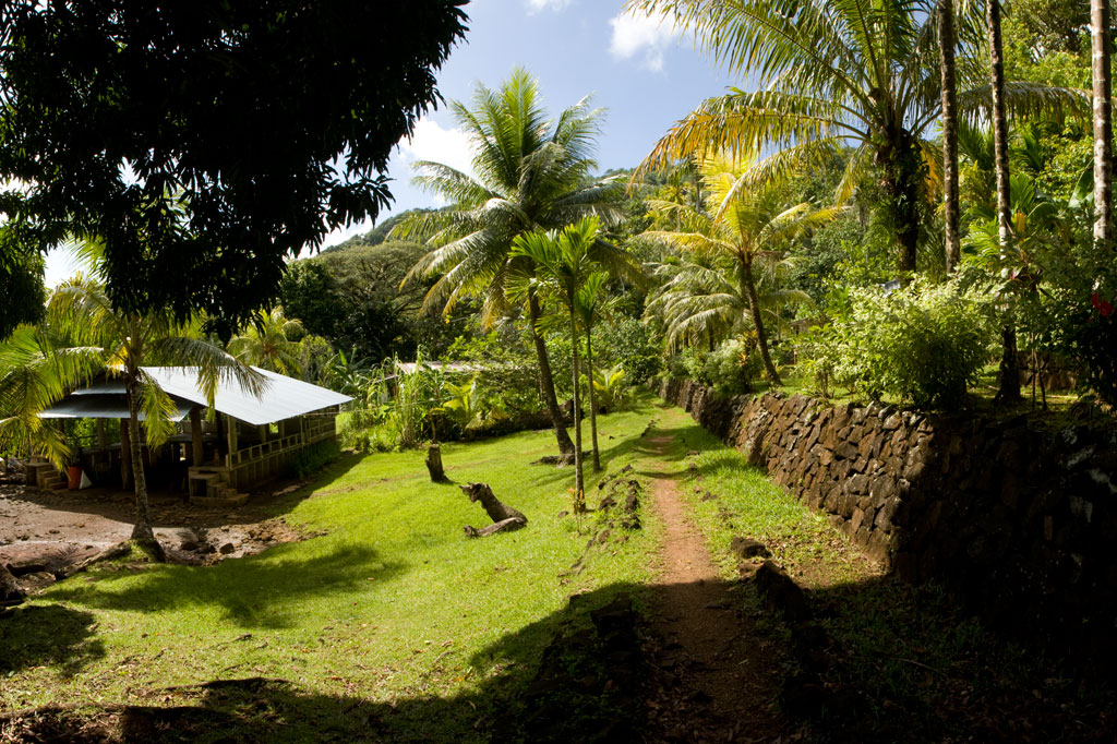
Takaieu & Dehpehk Islands
Takaieu and Dehpehk are two large volcanic islands connected by a bridge and linked to the coast of U by a causeway. Most of the local residents live around the eastern and northern coasts of Takaieu and the western coast of Dehpehk and commute to and from Pohnpei by boat. The islands are fun to explore if you want to get a glimpse of old-style Pohnpeian life sans roads and electricity. A seaward turn just before the Madolenihmw border brings one to the unpaved causeway. A well-maintained footpath runs east around Takaieu, crosses the Dehpehk-Takaieu Bridge, continues on the west coast of Dehpehk, and then wraps around the eastern coast, where it connects with another trail going over the interior hill. The marine areas along the eastern coast belong to the Dehpehk Marine Protected Area (MPA). No permission is needed to visit either island, but do be respectful and stay on the main paths around the inhabited areas.
")
Takaieu Island
Takaieu figures into a well-known local myth about two magical brothers. The island is said to have been created when these brothers dragged a large rock all the way from Yap — hence the name, which means “one rock.” The causeway road ends not far along the south coast and is replaced by a tidy rock footpath (vehicles can be parked on the side of the road near the trailhead). From there, the path bends around the mangrove-fringed eastern coastline, passing neatly maintained farmsteads here and there. Mwelling marks the spot of one of the megalithic structures built by Olsihpa and Olsohpa before they founded Nan Madol. The site is impressive, but is easier to reach by boat than from land. About halfway across the north side of the island, the path turns and connects with Dehpehk via a small concrete footbridge.
The Origin of Takaieu Island
There was once a woman in Salapwuk named Lienlama who had two sons named Mwohnmur and Sarapwau. The boys were quite mischievous and had many adventures that figure into Pohnpeian myth. In one story, the brothers went to the islands of Yap and used a magic spell to make a stone fly from that place to Pohnpei. They flew the stone to Wenik (modern-day U) and set it down in the lagoon, naming it Takaieu (“one stone”). They had brought some southern yams with them and they cooked these up, but threw the parts that were underdone into the forests of Alohkapw and Edienleng. And so they southern yam was first propagated in those places.
Dehpehk Island
Dehpehk is long and skinny with a low ridge running along its length. Like Takaieu, it forms its own sub-division, or kousapw, The trail on the west coast is narrow, but heavily used as there are many residences on this side. Once you’ve reached the northern extreme of Dehpehk, however, there’s little reason to go further as the trail gets steadily harder to follow where many of the houses have been abandoned. If you do want to continue, you’ll end up at a homestead with a large piggery. Here the path turns west and climbs over the central hill, reconnecting with the western coastal trail. There’s a nice elevated view from a point just below Dolen Dehpehk (100 m).
- Plan for 7-8 hours for this hike.
- To obtain a guide who can show you around both islands contact Pohnpei Surf Club as one of their boat drivers / dive masters is from the area and can provide assistance with exploring the islands.
U & Northern Madolenihmw GPS
Downloadable GPS Data Files
The following files contain all the packaged GPS data for each of the featured locations in U & Northern Madolenihmw.
Three file types are provided. KMZ and KML files are compatible with Google Earth. KML is compatible with Google Maps. GPX files can be imported into ArcGIS (a professional mapping application) and some hand-held GPS devices.
[info]NOTE: All files are free to the public and can be used for any purpose without permission.[/info]
Dolen Nahnsapwe Hike (2015)
Kupwuriso Mountain & Japanese Gun Battery Hike (2015)
Marine Parks in Awak Pah (2015)
Pahntakai Caves & Waterfall Hike (2015)
Timwen Men, Dolakapw & Pohn Tehnmei Hikes (2015)
Coordinates
The following coordinates correspond with sites featured on the Greater Nett & Western u Eco-Adventure Map Guide. It is our dream to eventually create a Pohnpei GPS app that could be uploaded to smartphones and other devices, but for now, these points of interest can be entered manually in a hand-held GPS device as needed.
[info]NOTE: All GPS devices have a margin of error. That margin increases with interference — when there is a thick canopy of trees, during bad weather, or when mountains obstruct the satellite link. The geosynchronous satellites employed when navigating on Pohnpei are located low on the southwestern horizon, such that maintaining a strong connection while hiking on the northeast side of a given mountain range can be difficult. Coordinates on the northeastern slopes of mountains are less accurate than in other locations.[/info]
Awak Marine Parks
| Awak Pah MP Entrance | —- | 6.965910° 158.250758° |
| Pein Ahi Entrance | —- | 6.966711° 158.251138° |
| Paieke Entrance | —- | 6.969853° 158.256294° |
| Awak Pah MP Dock | —- | 6.966470° 158.248785° |
| Pein Ahi Fish Pond | —- | 6.967572° 158.249929° |
Dolen Nahnsapwe
| Dolen Nahnsapwe Trailhead – Nett Approach | —- | 6.927169° 158.246675° |
| Dolen Nahnsapwe Trailhead – U Approach | —- | 6.918897° 158.270844° |
| Dolen Nahnsapwe Summit | —- | 6.909546° 158.260936° |
| Dolen Nahnsapwe Turn-Off from Lou Rahn Trail | —- | 6.923336° 158.249283° |
Pohnpei Diving – East Side Sites
“Straight Wall”
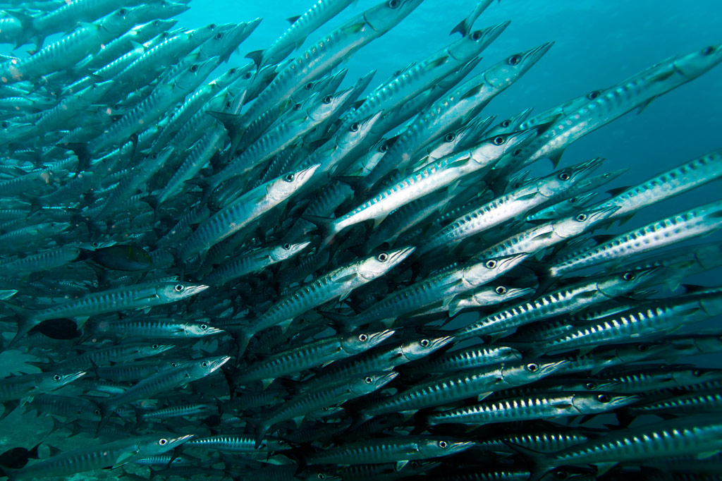
This dive is on the outer edge of the long, straight fringing reef east of Nahnningi (Joy) Island. It’s a good place to see schools of tuna and barracuda hanging out beyond the wall. It’s also one of the few places you might spot sea turtles. This side of the island is very exposed to winds, so summer is the best bet for good conditions. 1-37 meters. Advanced.
“Joy / Nahnningi”
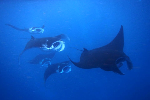
This spot is known by most people as “Joy,” which used to be the name of the island nearby (the local name of the island is Nahnningi). The dive is actually in the small bay-like channel south of Nahnningi on the outer edge of the barrier reef. One informant reported seeing huge mantas here, larger than any at “Manta Road” or “Ros”. Other sights include schools of barracuda and the occasional sea turtle. 1-37 meters. Intermediate.
“Nan Madol” (Kahnimweiso)
This is spot, east of the ruins of Nan Madol (not far beyond Kerian islet), garnered fame when divers apparently discovered a line of pillars on the bottom that they believed were related to the story of Kahnimweiso — a fabled stone city that is said to have pre-dated Nan Madol. The pillars were later proved to be natural coral formations, but the site is still intriguing. Anemones, pipefish, hydroids, and a whole lot of other reef fish can be found in the area. The problem is that the visibility is often terrible and the water can be very rough. 3-21 meters. Best at 18-21 meters. Advanced.
“Pahn Nahkapw”
This dive begins in front of the boulder break-wall off Nahkapw‘s western shore and follows the steep reef wall as it curves around to the east toward Kepidauen Nahkapw. Water clarity at this spot can be absolutely incredible and the reef is alive with fish of many types. Shark sightings are a strong possibility in this incredibly deep blue hole — especially below 18 meters. 2-30 meters. Any tide. Novice.
“Na”
This wall dive is located east of Na on the outer slope of the reef. Staghorn and elkhorn coral, sting rays, sharks, manta rays, and the usual gamut of reef fish are what to look for. The water can be very rough in this area as it’s directly exposed to the northeasterlies, so winter diving is out of the question. 2-29 meters. Advanced.
“Nanwap Corner”
This wall dive in the Nanwap Marine Protected Area is located on the north side of Kepidauen Deleur, on the opposite side of the pass from Nahpali. This is a great place for sharks and rays, but it’s also one of the healthiest spawning sites for reef fish in Pohnpei. However, the pass (and the general area) has a reputation for rough water, and the currents can be intense. Mid-summer diving, when winds are minimal, is the safest. Best on an in-coming tide. Advanced.
There’s also good diving and snorkeling around the blue holes in the inner reef, where you’re more protected from waves and current. The coral is nice here and there are usually plenty of fish around. Best at slack-tide. Intermediate.
- Entering the MPA requires a permit. Visit our MPA page for details.
“Areu North / South” (Kepidauen Alohkapw)
Drift-dives can be done on either the north or south edges of Alohkapw Pass (Kepidauen Alohkapw), beginning along the outer barrier reef walls and moving in to the inner reef. There have been reports of large of schools of reef sharks below 30 meters. Best on an in-coming tide. Advanced.
“Areu Wall”
Located along the wall of one of the inner reefs west of Kepidauen Alohkapw, this site is about the little creatures — invertebrates, small reef fish, sponges, tunicates, anemones, and soft coral. You can also find sea fans (18-24 meters), sea whips, white-tip reef sharks, and barracuda here. 2-34 meters. Currents can be strong at times. Best at 6-18 meters on an in-coming tide. Novice-Intermediate.
“Areu Avenue”
This is another inner lagoon wall-dive similar to “Areu Wall” but in a different location nearer to Kepidauen Alohkapw. Many of the same sights can be found, including sea fans at depth. 2-30 meters. Currents can be strong at times. Best at 6-18 meters on an in-coming tide. Intermediate.
ACKNOWLEDGMENTS
We’d like to extend a big kalahngan to Mike Viti, John Ranahan, and Karino Olpet for sharing their in-depth, first-hand knowledge about SCUBA diving on Pohnpei — without which this page could not have been created. Images licensed from www.shutterstock.com.
Pohnpei Diving – North Side Sites
“Manta Road”
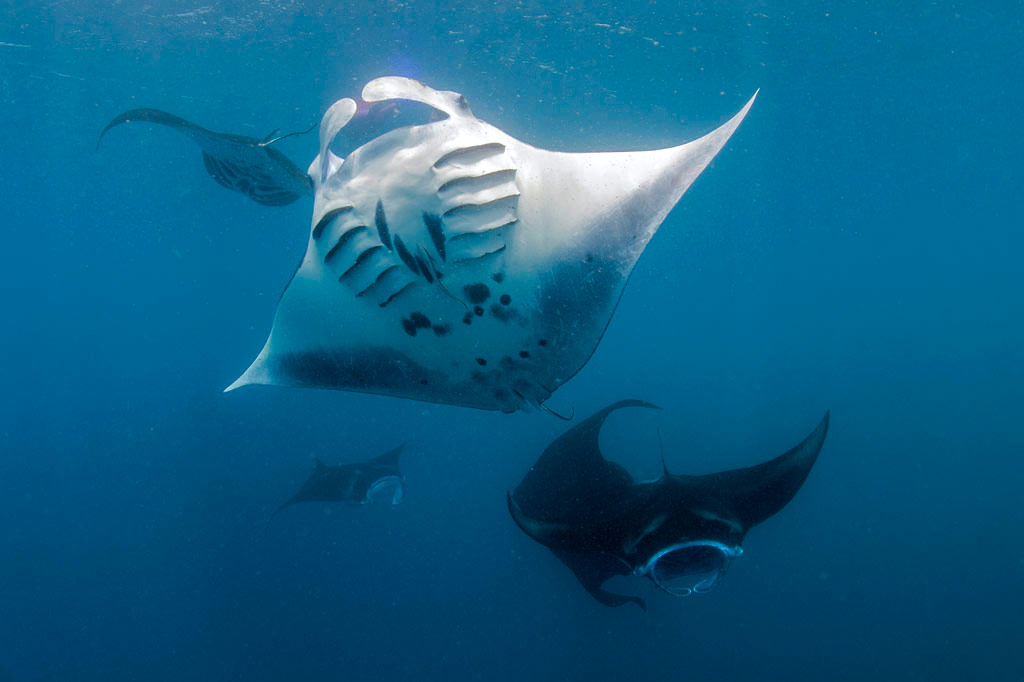
Manta Road is easily Pohnpei’s most famous dive spot due to its resident community of manta rays (including the all-black Black Morph variety) that cruise back and forth through the narrow channel as they filter-feed. The site is located between the fringing reef at the north end of Mwahnd Peidak (island) and a long strip of reef running northwest-southeast (2.75 km southeast of Kepidauen Mwahnd). The mantas mate between January and April, which is a good time of year to visit. Aim for the last hour of the out-going tide a few days on either side of the full moon. The channel has very strong currents — up to 7 knots — (which the mantas love), but which make diving and snorkeling tricky. You’ll want to avoid the spot on flood tides. The water can be crystal clear, but usually there are more mantas around when the visibility isn’t very good. Huge schools of fusiliers and jacks, as well as black-tip and white-tip reef sharks are common in the area. Small turtles are occasionally spotted. 3-24 meters. Best at about 16 meters. Advanced.
- Entering the MPA requires a permit. Visit our MPA page for details.
“Tubastrea Gardens”
This spot is located at a bridge about 17 meters down in the lagoon and about halfway between Parem and Mwahnd Peidak islands. The area is known for brightly-colored tubastrea (tube coral or sun coral) on the south side of the bridge. There are also a great many fish, though visibility is sometimes lacking. 15-20 meters. Best on an in-coming tide. Novice.
“Mwahnd Peidak”
This spot off the northeast side of Mwahnd Peidak’s fringing reef is notable for huge schools of parrotfish — a family of fish that is becoming relatively scarce in general. 3-18 meters. Best on an in-coming tide. Novice.
“Mwahnd Wall”
This drift-dive on the inner edge of the barrier reef south of Kepidauen Mwahnd is notable for the health and variety of corals and for reef sharks. The attractions go all the way down to 36 meters, which is where you’re most likely to find the sharks. Best on an in-coming tide. Advanced.
- Entering the MPA requires a permit. Visit our MPA page for details.
“Mwahnd Pass”
This drift-dive on the west side of Mwahnd Pass (Kepidauen Mwahnd) is known for its whip coral, gorgonian fans (below 30 meters), tree coral, and macro life. It’s also a good place for eagle rays, reef sharks, crinoids, feather stars, and napoleon wrasse. The wreck of a catamaran lies at the edge of the channel. 3-30 meters. Best at 12-15 meters on an in-coming tide. Advanced.
- Entering the MPA requires a permit. Visit our MPA page for details.
“Mwahnd Cove”
This drift-dive is on the southeast side of Mwahnd Pass (Kepidauen Mwahnd), beginning along the outer barrier reef wall and following the contour of the reef inside to a little coral bay dubbed “The Cove.” Attractions sometimes seen here include multitudes of mating eagle rays, moray eels, schools of barracuda (24 meters), whip coral, shrimp, and loads of white-tip reef sharks resting on the sandy bottom at about 30 meters. You might even be lucky enough to spot resident leopard sharks. 15-30 meters. Best at 24-30 meters on an in-coming tide. Advanced.
- Entering the MPA requires a permit. Visit our MPA page for details.
“Inner Mwahnd”
This spot is on the inside edge of the barrier reef south and east of Kepidauen Mwahnd (pass). The coral is abundant on the wall. Reef sharks, barracuda, and plenty of reef fish are also found in the area. 3-20 meters. Best on an in-coming tide. Intermediate.
- Entering the MPA requires a permit. Visit our MPA page for details.
“North Point”
Located at a sharp bend on the outside of the barrier reef, this wall dive is about sharks and large schools of pelagic fish. It’s quite a ways from any of the passes and the wind-exposed nature of the location means that the spot is only accessible during the summer. Down to 36 meters. Advanced.
“Lighthouse”
Sharks, pelagics, and more. This is a standard Pohnpei drift-dive that starts along the northern barrier reef wall and curves south into Kepidauen Pweitik (“Old Main Pass”). Best on an in-coming tide. Advanced.
“Lenger”
The areas north, south, and east of the Japanese seaplane ramp offer plenty for beginning divers. A variety of small reef fish, including gobies, angels, and parrots, octopi, sting rays, and lots of soft coral are found in the shallow coral grottoes. Visibility can range from terrible to very good. Best on a late in-coming tide. Novice.
“Parem”
This area on the fringing reef off the northwest end of Parem (island) offers more of the same kinds of attractions seen at Lenger. Visibility fluctuates greatly. Best on a late in-coming tide. Novice.
“Middle Pass” (Kepidauen Kiepw)
This spot is on the eastern corner of a narrow channel, called Kepidauen Kiepw, between Peinmen and Kepidauen Pweitik. The drift-dive starts on the outer edge of the reef wall and follows the reef south and east. This is a good place to see reef sharks. Best on an in-coming tide. Intermediate.
“Main Pass” (Peinmen)
This drift-dive begins along the northern edge of the barrier reef wall and follows the reef into Peinmen (Passage). Attractions include schools of black-tip and gray reef sharks (below 24 meters), occasional lemon sharks, schools of dog-tooth tuna, and sweetlips on the reef shelf at 24-30 meters. 5-30 meters. Best below 20 meters on an in-coming tide. Advanced.
“Sokehs Side Pass”
This little known spot in the narrow channel next to Peinmen is worth mentioning for the schools of large remoras that frequent the area. Best on an in-coming tide. Intermediate.
“Sandy Bottoms”
This blue hole on the inside edge of the barrier reef between “Main Pass” (Peinmen) and Palikir Pass (Kepidauen Palikir) is a great place for beginners to explore. Best on an in-coming tide. Novice.
“Palikir Bridge”
This is a deep dive that follows the reef bridge across the mouth of Kepidauen Palikir. It’s most famous for its schools of large pelagics, like tuna and wahoo, gorgonian fans, jacks, barracuda, humphead parrotfish, and huge schools of gray reef sharks. It’s also one of the places you might get a glimpse of Pohnpei’s little-seen tiger sharks. Currents can be strong. Best on an in-coming tide at 30-36 meters. Advanced.
“Palikir Wall”
This dive along the outer barrier reef wall west of Kepidauen Palikir is characterized by giant clams, triton’s trumpets, white-tip reef sharks, triggerfish, soft coral, and anemones. 9-37 meters. Best on an in-coming tide below 20 meters. Advanced.
ACKNOWLEDGMENTS
We’d like to extend a big kalahngan to Mike Viti, John Ranahan, and Karino Olpet for sharing their in-depth, first-hand knowledge about SCUBA diving on Pohnpei — without which this page could not have been created. Image Credits: Manta Road (Whitney McCurdie). All others licensed from www.shutterstock.com.
Paddling in Nett, U & Northern Madolenihmw
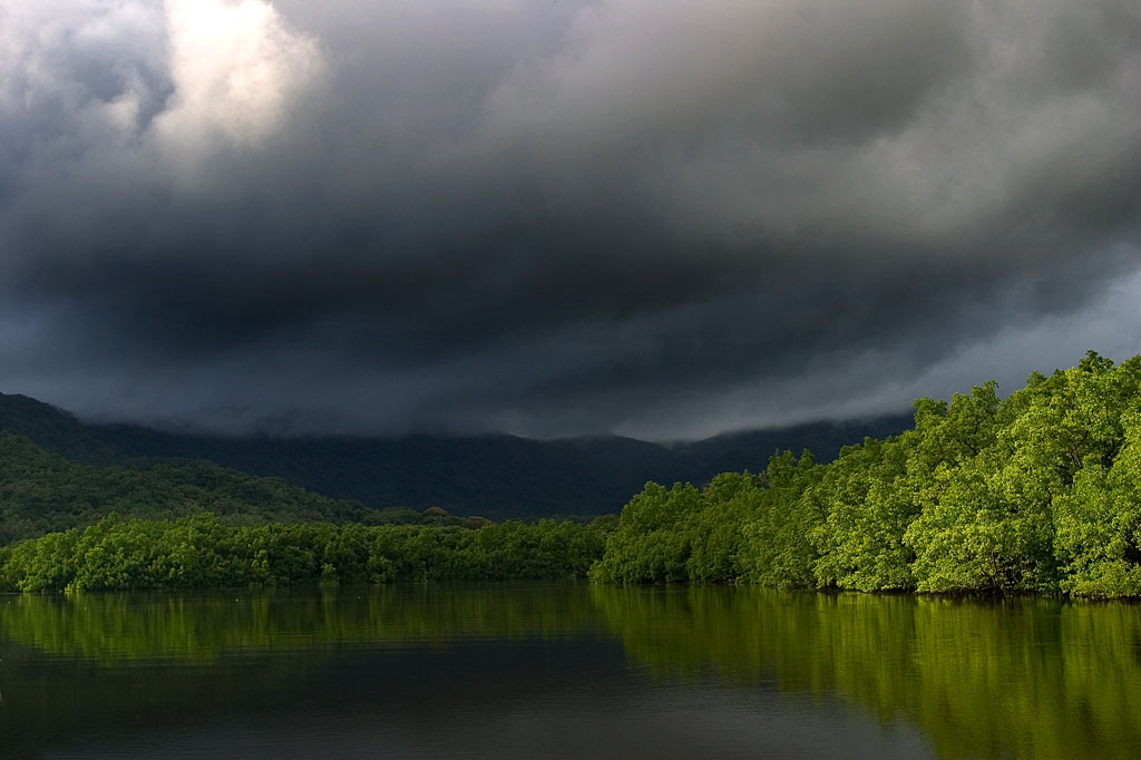
Dausokele Estuary
As paddling goes in the Nett region, Dausokele estuary (“channel of the dwarves”) is the crown jewel, a long, gorgeous inlet that lies between Kolonia and the leaf-shaped Nett Peninsula and serves as the mouth of a number of high-volume rivers and streams. The scenery is stunning, especially on days where rain threatens, with high, sheer cliffs to the east, the heights of Dolen Nett in the north, and the pyramid-like peak of Dolen Eirike in the south. Depending on where you begin, you can go as far as 4.5 km (2.8 miles) inland before having to turn around. Most of the way, mangrove forests skirt the coast, so there’s nowhere to land and get out. The final 0.7 km (0.4 mi) follows meandering, narrow natural channels through the swamp forests, where you’re liable to meet locals and traditional outrigger canoes and young kids having a swim. The route tends to be well-protected from both currents and wind, so it’s a nice, leisurely paddle, allowing plenty of time to soak up the scenery. There are multiple places to launch on the Airport Causeway as well as the “Ice Dock” near the Kolonia Public Market building, and next to the PAMI building.
Nett Point
Another great paddling destination is Nett Point, Kolonia’s best swimming spot and the closest thing to a beach Pohnpei Island has to offer. Lidakika Launch point on the Airport Causeway is the most practical place to begin.
- Visit the Nett Point page for detailed information about this location.
Dolen Nett Peninsula Circumnavigation
If you want to try something a little longer and more challenging, you can continue past Nett Point, explore the east coast of the peninsula (which includes one of the locations where the mythical builders of Nan Madol were said to have briefly settled), and then cross the beautiful little bay to the quaint picnic and swimming area at Awak Pah Marine Park. Note that strong winds can be a problem along the eastern coastal section. If you’re plan is a there-and-back-again, you’re looking at around 17 km (10.6 mi) round-trip.
Lenger & Sapwtik Islands
Two of the most interesting islands on Pohnpei are found directly north of Kolonia and can be reached quite easily via paddle-power. Both islands offer a wealth of Japanese fortifications from WWII and earlier, as well as other historical sites, swimming, and snorkeling.
- The islands are covered in detail on the Lenger Island & Sapwtik paddling page.
Parem Island
The largest island in the northern lagoon is Parem, which is large enough to have its own elementary school. Like nearby Lenger and Sapwtik, the Japanese fortified the island prior to WWII. In fact, the coastal gun on Sokehs Mountain may have once been positioned at the top of Dolen Parem before being moved to its present location.
With the exception of a portion of the eastern coast, Parem is completely surrounded by mangrove forests — some of them quite extensive. There are two good channels to explore on the west side where the mangroves are at their widest — one 0.7 km (0.4 mi) long and the other 0.4 km (0.25 mi). Both reach all the way to solid ground at high tide and are beautiful places to scope out the local birds. You can also do a complete circumnavigation of the island, which is 7.9 km (4.9 mi) in total. On the east coast there’s a long stone wharf jutting out from the shore, suitable for a little break, a snack and a dip.
Paddling Distances Around Nett, U & Northern Madolenihmw
| Starting | Ending | Distance (km) | Distance (mi) | |
| Lidakika Launch Point | —- | Causeway Tunnel | 1.5 km | 0.9 mi |
| Causeway Tunnel | —- | Dausokele Bridge | 2.4 km | 1.5 mi |
| Dausokele Bridge | —- | Inlet Terminus | 2.24 km | 1.4 mi |
| Causeway Tunnel | —- | Nett Point | 2.3 km | 1.4 mi |
| Nett Point, Nett | —- | Awak Pah Marine Park (along the coast) | 4.75 km | 3 mi |
| Nett Point, Nett | —- | Awak Pah Marine Park (as the crow flies) | 2.8 km | 1.7 mi |
| Lidakika Launch Point | —- | Awak Pah Marine Park | 17 km | 10.6 mi |
| Misko Beach, Dekehtik Island | —- | Barbosa’s Wharf, Lenger | 4.52 km | 2.8 mi |
| Ice Dock, Kolonia Town | —- | Barbosa’s Wharf, Lenger | 3.53 km | 2.2 mi |
| Nett Point, Nett | —- | Barbosa’s Wharf, Lenger | 1.97 km | 1.22 mi |
| Nett Point, Nett | —- | South Point, Parem | 2.5 km | 1.6 mi |
| South Point, Parem | —- | South Point, Parem (Loop) | 7.9 km | 4.9 mi |
*Silted-in reef. This segment may be difficult or impossible to traverse at low tide.
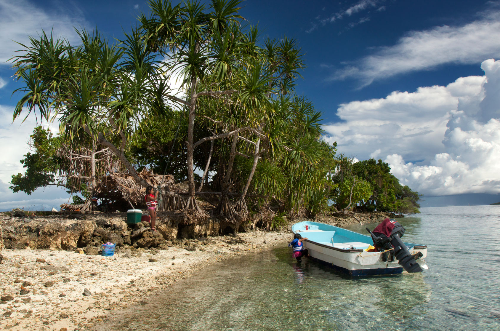
Lepin Dau Island
This island is claimed by the same family as Dahu Reirei and has no true name, but as it lies adjacent to the primary channel every boat in the area uses to go from Areu and Ohwa to Madolenihmw Bay, it’s known by most people as Lepin Dau (or sometimes “Channel Island”). Lepin Dau is larger and higher than Dahu Reirei and has some welcoming tree-cover. The reef pass on the west side is a nice spot to snorkel at slack tide, but at other times, the current can be so strong that snorkelers and swimmers run a strong risk of being swept away. A better spot for snorkeling is in the blue holes around the southeast side — well out of the path of the current. Here you can find beautiful coral grottoes, schools of needlefish, barracuda, cuttlefish, trumpetfish, angelfish, and parrotfish, an odd seasnake (the latter are venomous, but so passive that they pose little danger to snorkelers), and from time to time even eagle rays and small green turtles.
- To obtain permission for overnight stays or to arrange boat transport from Ninleu, call +691.924.2229.
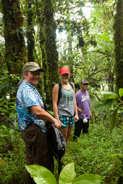
Timwen Men, Dolakapw & Pohn Tehnmei
North Madolenihmw Hikes
![]()
![]()
![]()
![]()
![]()
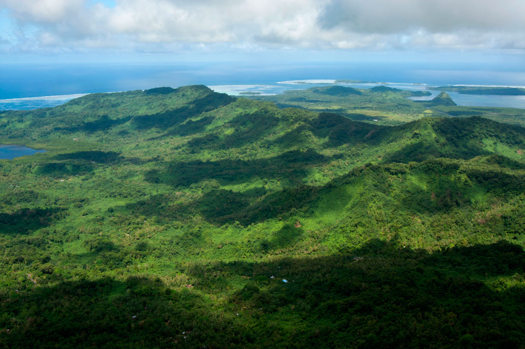
The northernmost section of Madolenihmw is separated from the rest of the municipality by a range of low mountains that run east-west from Mesihsou to Alohkapw. This range was fortified by the Japanese army during World War II because it was easily accessible and commanded excellent views of lands both to the north and the south. The hills are riddled with tunnels and man-made caves, and a ridge path runs from the east end and connects with the primary mountain system in the central part of the island. There was a time when Japanese soldiers could travel from Mesihsou all the way to Kupwuriso without ever leaving the mountains. Small 75-80 mm guns were also installed at hidden spots among the hills.
There are many potential hikes one could do in these interesting mountains, but we’ve chosen to focus on three routes leading to small peaks along the ridge: Timwen Men, Dolakapw, and Pohn Tehnmei. All three cross private land.
Timwen Men
The name of this small peak at the western end of the ridge means “beak of the bird,” a reference to the many brown noddies that can be seen flying around the summit. The hike begins at the houses near the end of the road, belonging to the extended family of Eiber Rosario, and passes through the family’s sakau plantation on the slope. Any semblance of a trail vanishes at the foot of the hill, where you have to clamber up the steep, muddy hillside. At the top, there’s an extensive network of Japanese defensive trenches. The Japanese ridge path goes east as far as Mesihsou and west to Kupwuriso, but the problem with hiking the entire distance in one go is that the mountain range is broken up into a number of private parcels owned by different (and sometimes competing) families. The trail is easy to follow as it goes west toward the Timwen Men summit (331 m / 1,086 ft). Along the way, you’ll pass several impressive tunnels that bore into the hill and connect with the trench system. Two circular pits seem to have been either small caliber gun stations (possibly 80 mm) or rifle positions. No guns are found there now. The summit is a little overgrown, but still affords nice views of the valley.
- The hike takes about 3 hours round-trip.
- To arrange for a guide, ask for the colorful Eiber Rosario at the houses near the end of the road. You may also be able to locate Eiber by calling his son-in-law, Colton, at +691.923.6941. Offer $20.
Dolakapw (Edienleng)
This hike starts at the main road opposite a small store, passes through a group of houses, and follows a well-traveled footpath, climbing steadily but never steeply to Dolakapw (“new hill”), a peak in Edienleng. The trail ends at a plantation of sakau and other agroforestry crops. From there the route curves around the south side of the hill (with views of the Sapwalap plain), where two large Japanese tunnels burrow into the slope. The lower one is partially collapsed, the steel rails for a mining car still jutting out of the hole. The roof here is unstable, so it would be unwise to venture inside. The tunnel is about 15 meters long. The second tunnel, a little higher up the hill, is in better shape with U-shaped steel supports holding up the rocky roof. Bats and Caroline Islands swiftlets nest at the rear. The landowner believes that the Japanese intended to connect the two tunnels, but abandoned the project once the Allied bombing campaign began. The semi-open Dolakapw summit (305 m / 1,001 ft) is just above.
- The hike takes about 3 hours round-trip.
- To find a guide, visit the small store on the coastal side of the road and ask for Isaac Fred. Offer $20.
Pohn Tehnmei
This short, strenuous hike begins at the home of brothers Atsent and Romeo Welcher at the end of an intermittently paved road west of Nan Pailong. There isn’t much of a trail; the route just goes straight up the slope behind the house along an eroded track used to drag huge sakau pounding stones, called peitehl, down from the mountaintop. The first thing encountered at the top is the quarry site itself — a collection of pits from which the stones have been dug. There was a time when people came from all over the island to get peitehl at this spot. Currently, the state forbids the practice, but you may get the distinct impression that it’s still going on nonetheless. Not far from the top of the hill, a gigantic peitehl marks the spot where the brothers Olsihpa and Olsohpa looked down and first laid eyes on Sounahleng, the place where they would eventually begin the building of Nan Madol (there’s no view from here now, unfortunately). Also, a trio of large stones slightly to the west are said to have been formed from the bodies of a man, his wife, and their child. From there you can continue west along the ridge to the Pohn Tehnmei summit (347 m / 1,138 ft). The tree cover on the ridge, however, obscures any good views of the lowlands.
- Plan for about 2 to 3 hours round-trip for this adventure.
Japanese Tunnel
At the base of the hill on the Welcher farmstead is a 14 meter-long curving Japanese tunnel. Mining car rails lie along the floor, and though the mouth of the cave is partially collapsed, the rest is supported by U-shaped steel supports. You can enter carefully and walk to the end (bring a headlamp or flashlight and expect some bats).
- Either Atsent or Romeo Welcher (+691.925.8075) can be hired as guides, though Romeo’s English is better. If you can’t get them by phone, just go to the house and ask one of them to take you up. Offer $20.
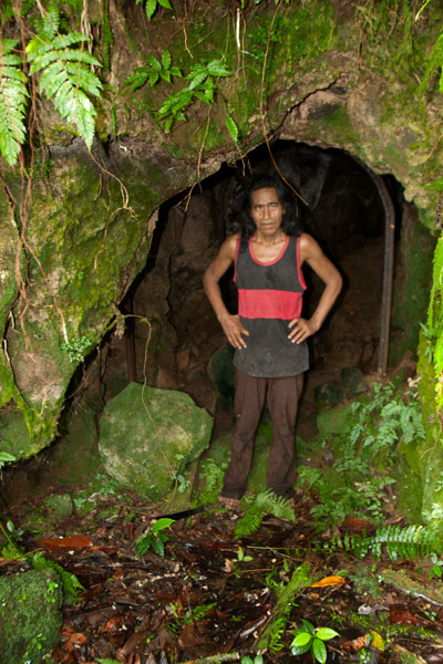
Pahntakai Cave & Waterfall
![]()
![]()
![]()
![]()
![]()
![]()
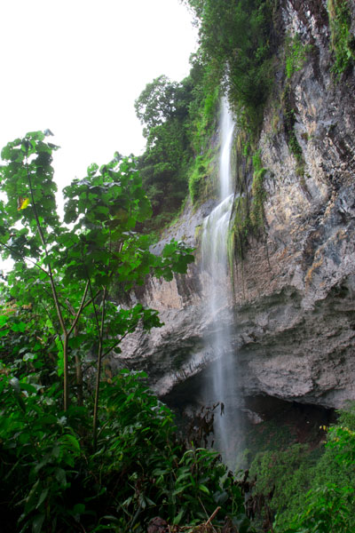
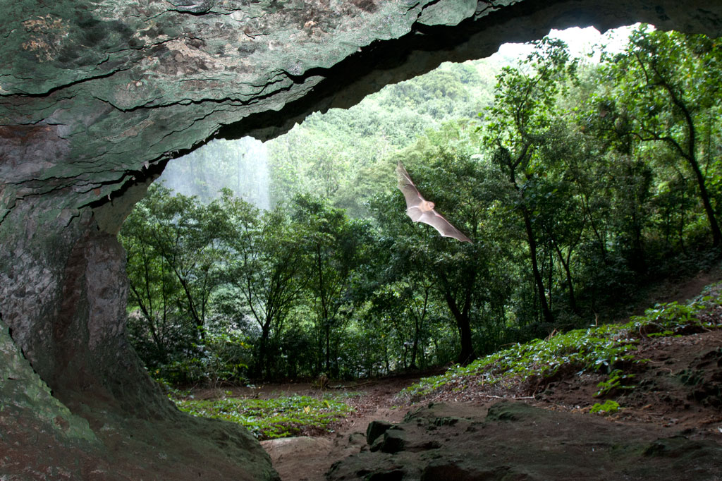
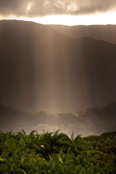
Pahntakai literally means “under the rock” and one visit makes it immediately apparent why this geologically-unique location was given its name. A thin waterfall plummets over a concave cliff-wall more than 30 meters high, which shelters a wide strip of mostly flat ground. You can walk all the way across beneath the cliff to where the ledge widens even more and a small, rocky hill rises up north of the waterfall. Yawning caverns behind the falls host colonies of small insect-eating bats and Caroline Islands Swiftlets that hurry out at dusk to hunt for insects. If you want a closer look, you can climb up through the mounds of guano to the cave openings.
The waterfall itself varies greatly in volume, depending on rain, crashing onto jumbles of rocks below the ledge. It is possible to climb down the slope and stand under the water, but the rocks are slippery and dangerous and there is no pool.
The trail is found at the end of the road and is well-maintained and fairly level most of the way to the cave, skirted by several varieties of sakau (kava) and affording stunning views of the deep gorge below the falls, small huts on the steep hillsides, and the blue sea far out beyond the green of the island. Though you do not need a guide or any special permission to do this hike, the site is private property and the family at the last house on the road charges an entry fee of $3.00 per visitor. Make sure you bear left at the trailhead, rather than taking the path to the right which goes steeply downhill and eventually leads to a house. The hike takes a leisurely 40 minutes round-trip, but Pahntakai is so magical you’ll probably want to hang around and soak up the atmosphere.
Camping
The landowner, Pedro Marvis, permits visitors to camp overnight at Pahntakai, provided they are quiet and respectful of the place and take all their garbage with them afterward. The price per person is the same as when making a day visit — $3.00. The best place to camp is at the northwest end of the trail, where the strip of ground under the cliff is wide and flat. There’s a rock fire-pit there and sometimes some dry firewood left lying around. Because of the overhanging nature of the cliff, things stay dry even during heavy rain. There is one small stream that crosses the main trail about half-way from the trailhead — a good place to filter drinking water if you’re going to stay at Pahntakai a while.
Kupwuriso
![]()
![]()
![]()
![]()
![]()
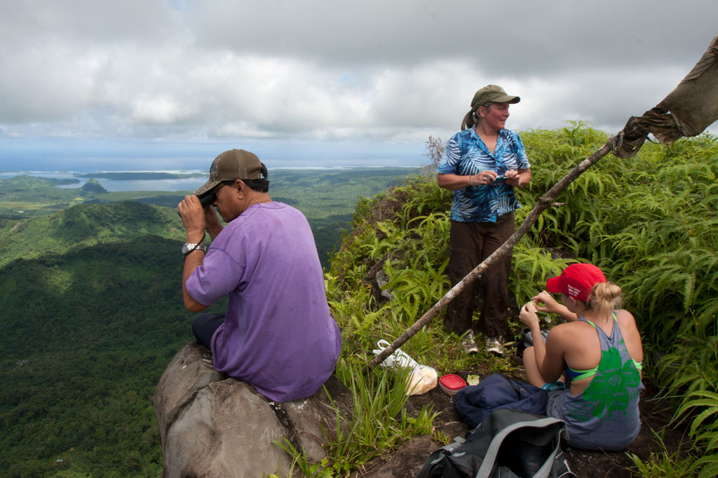
Kupwuriso, Pohnpei’s fifth highest mountain (depending on how you count them), is impossible to miss when driving through eastern U, where it towers over everything, its precipitous slopes clad in groves of endemic palms called kotop (Clinostigma ponapensis). When the Pohnpeian hero Isokelekel sailed around the island in the mid-1600s on a mission to overthrow the Saudeleur dynasty, he initially balked at the sight of the mountain palms which he mistook for an army of giant warriors dressed in grass skirts. It was not until he returned to And Atoll, that a local woman pointed out his mistake. Giants or no, the mountain has an ominous look and feel. It’s unusually close to the coast and rises up very steeply, making it appear much taller than it really is (630 m / 2,067 ft). The name means “stomach.”
Awak Valley Approach
There are two major routes to the small, rocky summit (630 m). The first begins not far from the end of the primary paved road at the rear of the Awak Valley. To protect Mwahnd and Alohkapw (Areu) Passages from invasion, the Japanese decided to place two 15 cm naval canons just below the summit of Kupwuriso at a place called Dol Reirei (“long hill”). To get the massive weapons up the mountain, they constructed a road that climbs up on the south side of the Awak Valley and follows the ridge north. The hike uses this track for most of the way, starting on a rocky private footpath to the right of the road. The steepest section comes at the beginning. Once on the ridge, things mostly flatten out, though there are some gentle ups and downs. The terrain is fairly tame the rest of the way, passing through upland groves of kotop palm, wild banana plants (utin wel), and gnarled stands of campnosperma (dohng) and elaeocarpus (sadak) — trees used to make canoe hulls.
One of the benefits of climbing Kupwuriso is that you’re more likely to get a clear view from the summit than from Nahnalaud. The perspective is better, too; Nahnalaud’s summit sits on a wide plateau, while Kupwuriso’s looks down to the valley from the top of a cliff. Sometimes, however, the mountain is fog-bound — especially from about noon to 2 PM. Plan for 4-6 hours round-trip.
Rohi Approach
The second route starts in Rohi district at the end of a paved road. This way is shorter but considerably more strenuous, shooting 1.3 km (0.82 mi) straight up the side of the mountain. It should be noted that a number of hikers have sustained injuries on this approach, so hire a good guide, go slow, and watch for loose rocks! The route begins in the inhabited lowland agroforest, which Pohnpeians call nansapw, and quickly ascends to the mid-level forests (nanwel), populated by giant hardwoods and tree-ferns. Beyond, the forest opens up and kotop palms abound. Once the slope starts to even out, you’ve entered the cloud forest — a fantasy world of stunted, twisting trees and air plants. It’s always wet here, and every surface is covered with a thick layer of bryophytic growth. Plan for 4-6 hours round-trip.
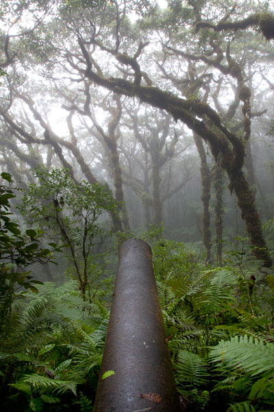
Japanese Gun Battery
The two guns are the British Armstrong Whitworth naval type identical to the one on Sokehs Mountain. Both are housed in steel and concrete bunkers and separated by a pillbox, where machine guns were placed. The battery was installed in 1943 and took fifty-five local men eight months to complete. At 580 meters (1,903 ft), these are the highest guns on Pohnpei Island. The gnarled forest that has grown up in front of the gun sites is mesmerizing, especially in foggy conditions.
Bird-Watching
Birders will find much to look at on the way up the mountain. Besides the typical honey-eaters, starlings, and lorikeets, this is a good place to look for the Crimson-Crowned Fruit Dove, Imperial Pigeon, and Pohnpei Cicadabird. Swiftlets are common at the summit.
- Please visit the Birding page for additional information.
Ridge Camping
There’s a fantastic place to camp at 593 meters not far from the gun sites with a beautiful, unobstructed view of the valley. Bring your own water, dry tender, a tarp or heavy-duty rainfly, and stakes for your tent and tarp (high winds are a distinct possibility at such elevations). Remember to leave your site exactly as you found it. Pack out everything you packed in and properly bury all human waste.
Hiring a Local Guide
A lot of people know the way up Kupwuriso, so finding a guide is not difficult. If you want to tackle the Rohi approach, Miller Benjamin (from Saladak) is a good choice. From Awak, we recommend Relio Lengsi. Conservation Society of Pohnpei (CSP) can also assist you in finding a guide. Offer $40-50 for a group of five hikers or less (plus tips). Agree on a price beforehand.
- Please visit the Local Guides & Tour Operators page for guide contact information.