
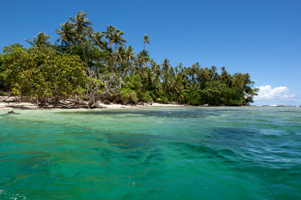
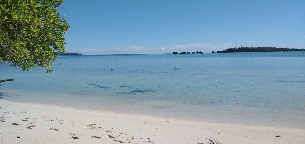
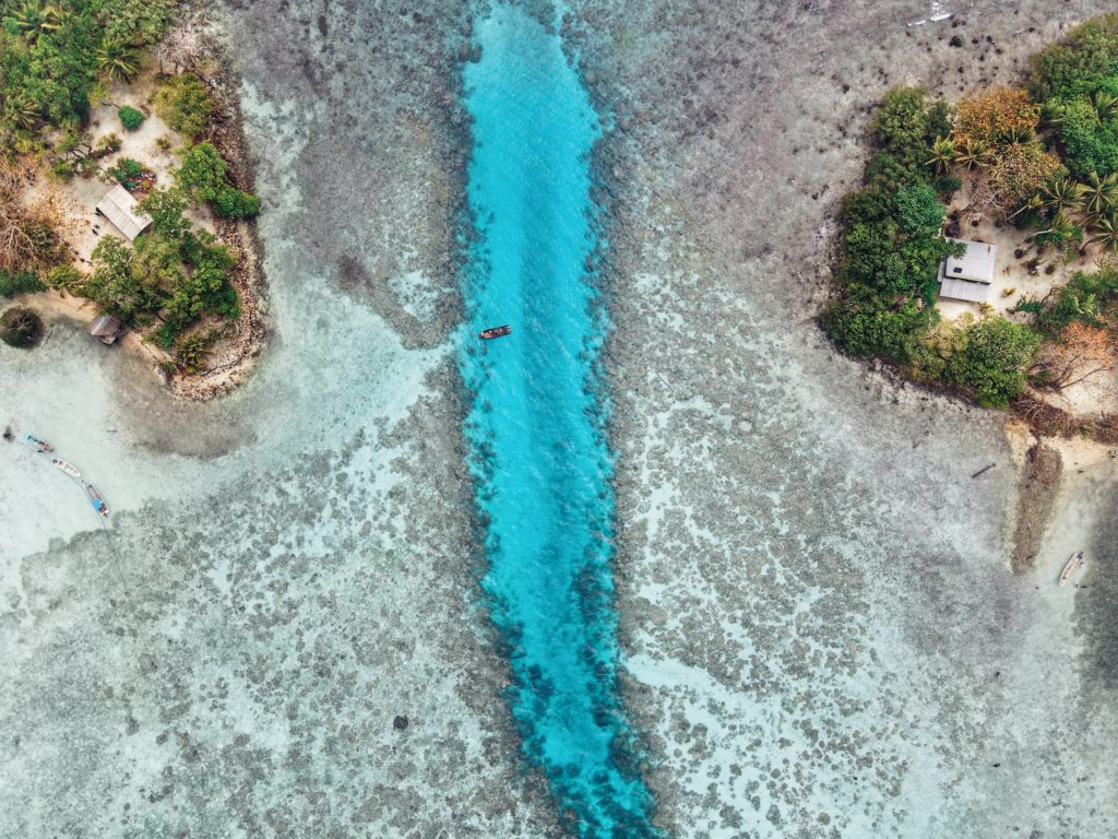
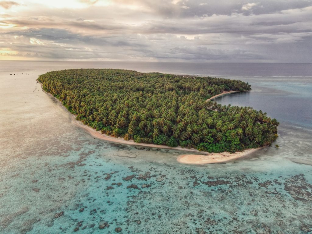
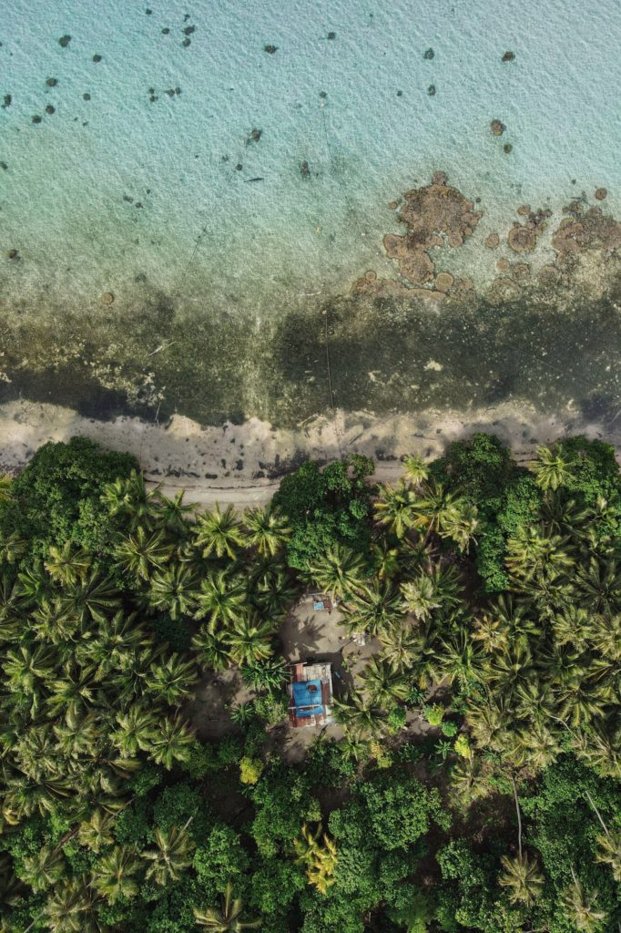
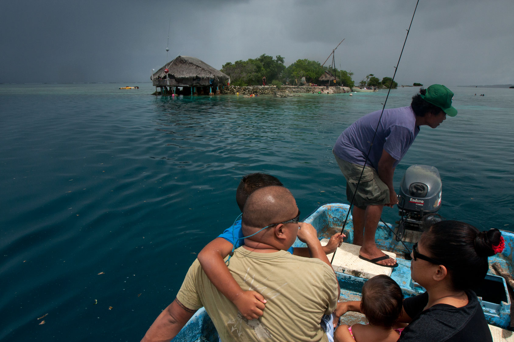
Dekehtik Island (Sand Island)
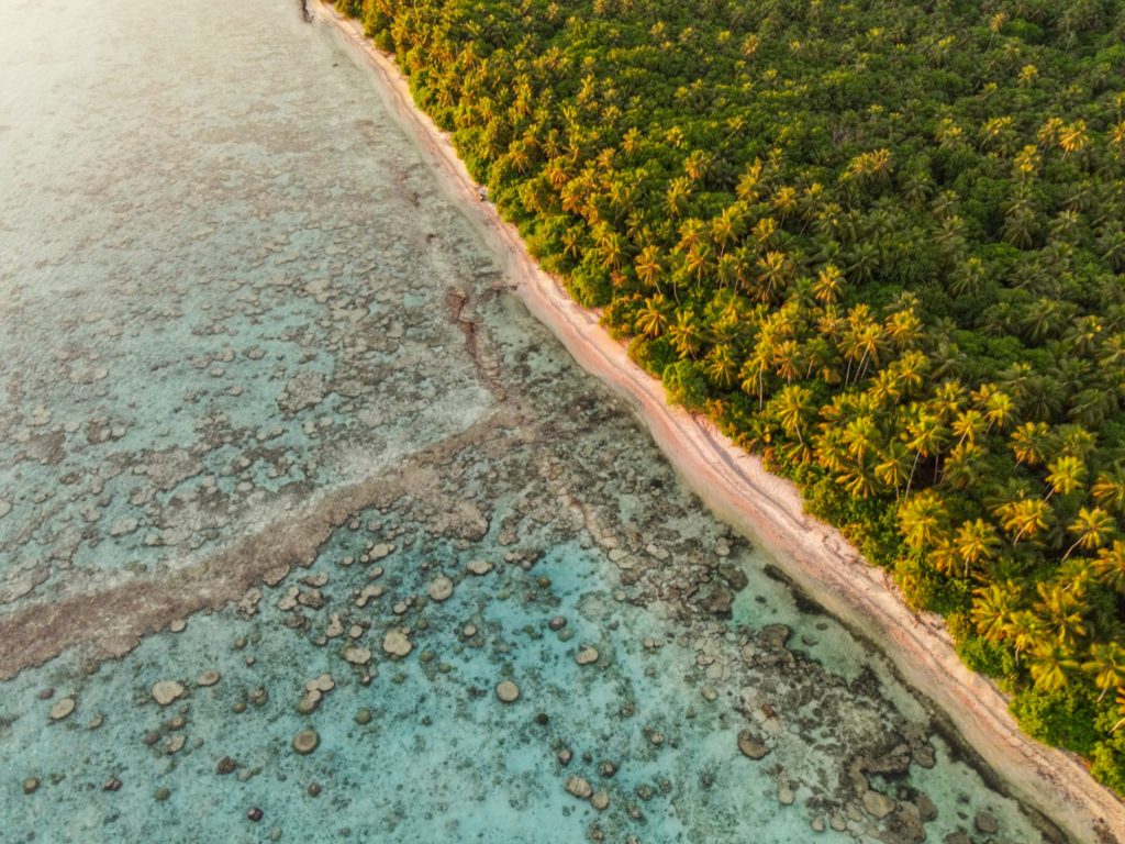
Dekehtik, which means “small island”, also called Sand Island is an uninhabited coral islet west of Na, of which it was once a part (not be confused with the island of the same name on which the airport is located). The north coast is most suitable for camping with some sandy beaches at low tide and stunningly clear water for swimming and ogling the many stingrays in the area. There are huts on the island for people to stay in while on the island. The island is currently owned by the Adams family (the proprietors of Ace Hardware and Ace Office Supply). The best snorkeling is northwest of the island along the edge of the deep, blue hole of Pahn Nahkapw. The island itself is characterized by thickets of shrubby vegetation and coconut palms. Sandy beaches form on the north coast at low tide.
To make reservations for day visits or night stays and to arrange boat transport call ACE at +691.320.8279 / 5637.
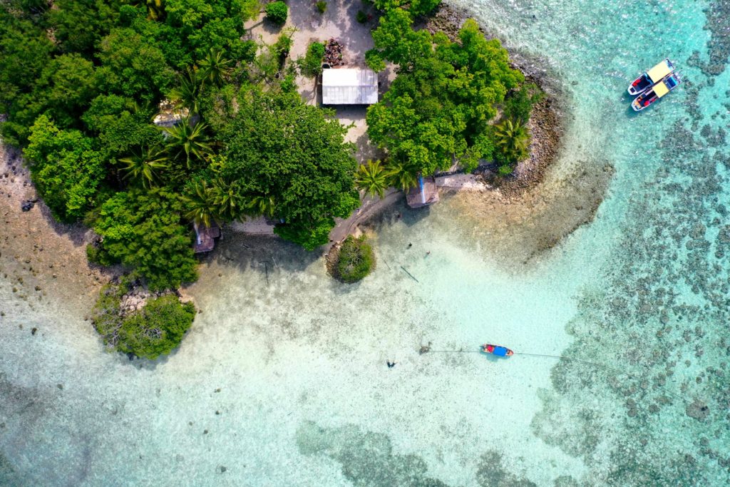
Kehpara Island
Though not as developed as Black Coral the small thatched huts are adequate for camping trips, the island is equally as shady and much larger than Black Coral, and it actually offers easier access to the excellent snorkeling around Kehpara Pass. It’s cheaper, too. At low tide, there’s a beautiful sandy beach between the two islands. The island has solar lights set up around the island to provide some light at night however we recommend bringing along a lantern and some flashlights to help illuminate inside the huts since they are not rigged with lights.
To make reservations for day visits or overnight stays and arrange for boat pick-up from the launch behind Seinwar Elementary School, call Nickson Abraham (Oaun Kitti) at +691.925.5340 / +691.920.8081 or the Kitti Municipal Government Office at +691.320.5038, 320.5808, 320.5049, or 320.3257.
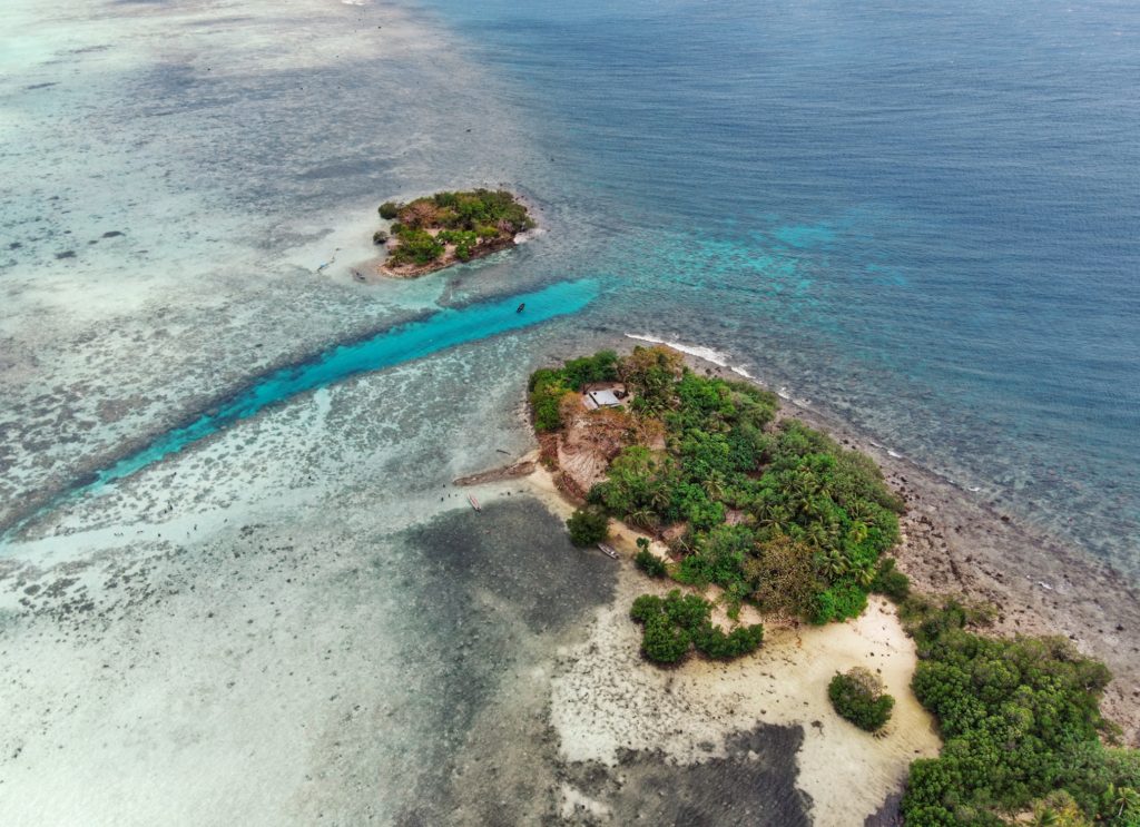
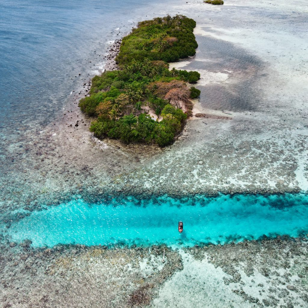

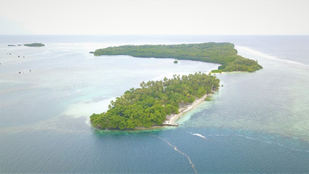
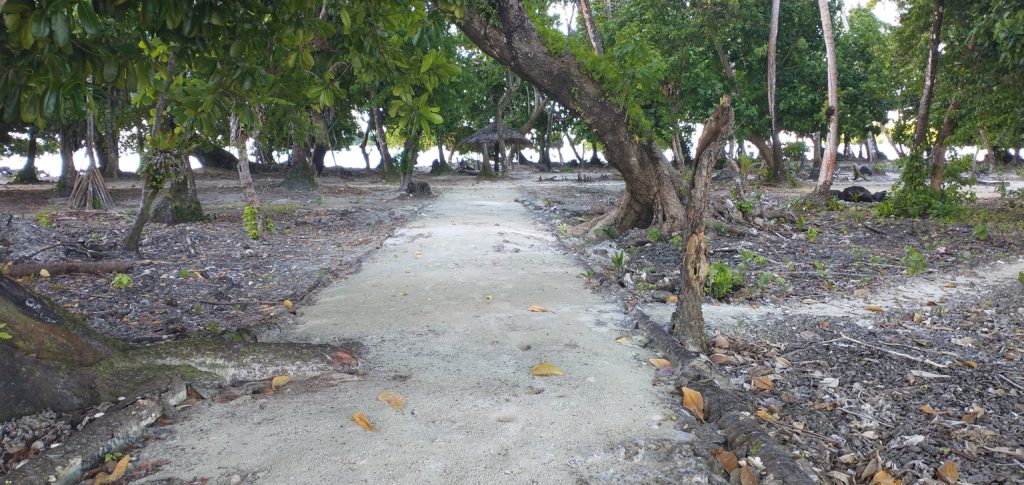
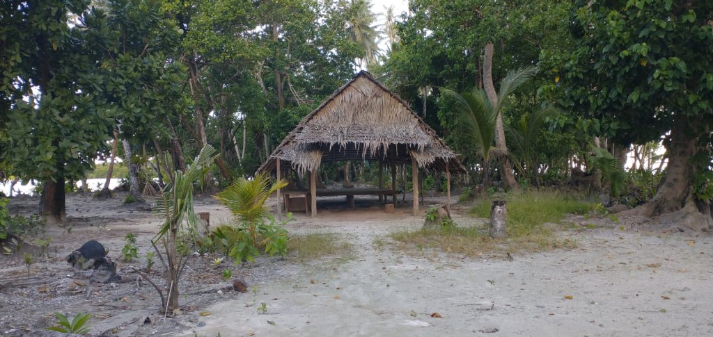
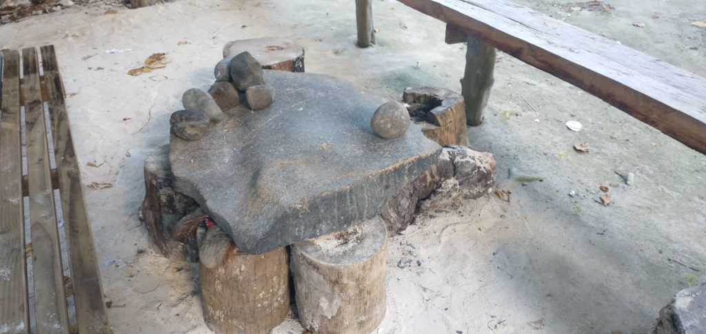
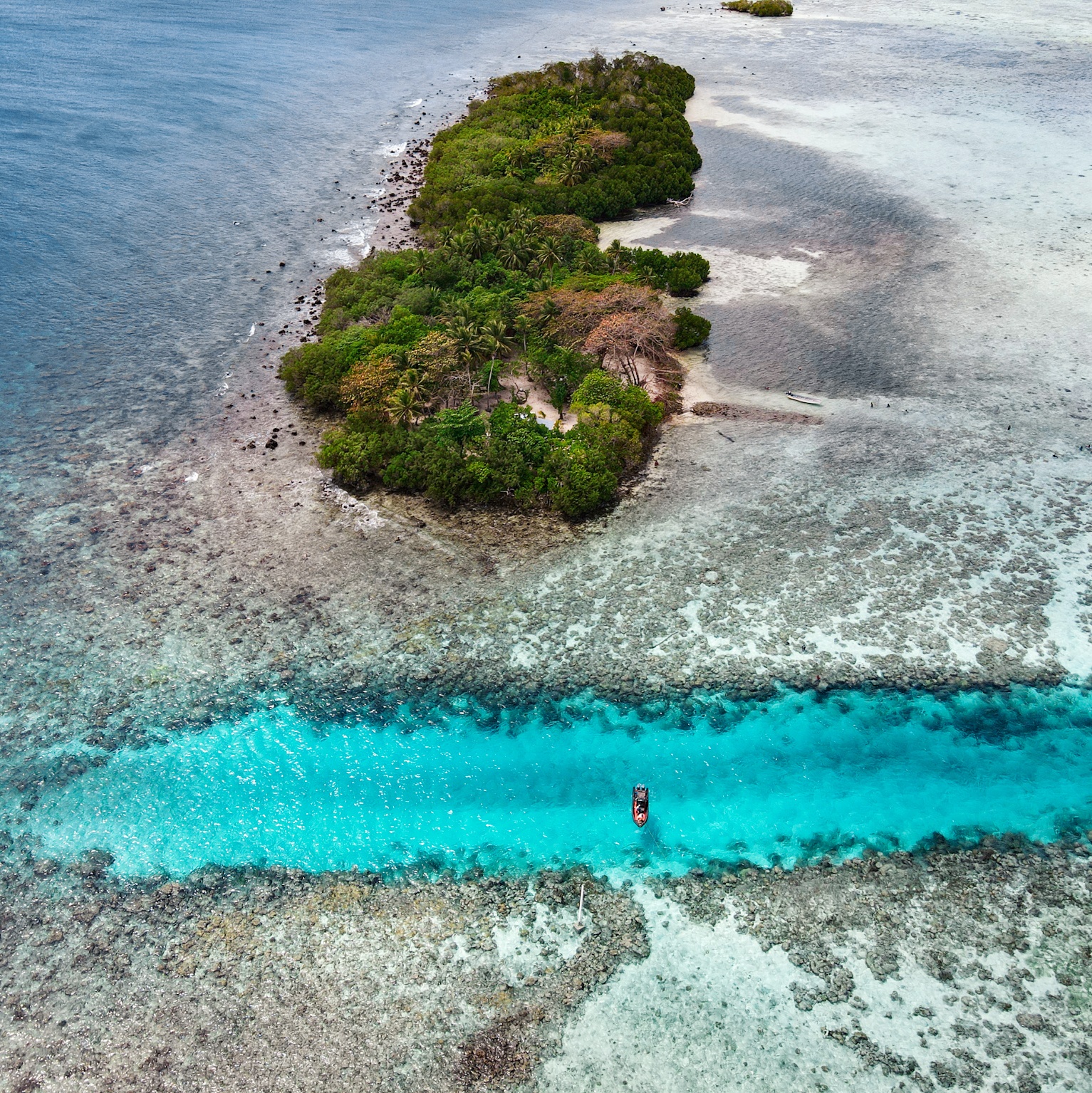
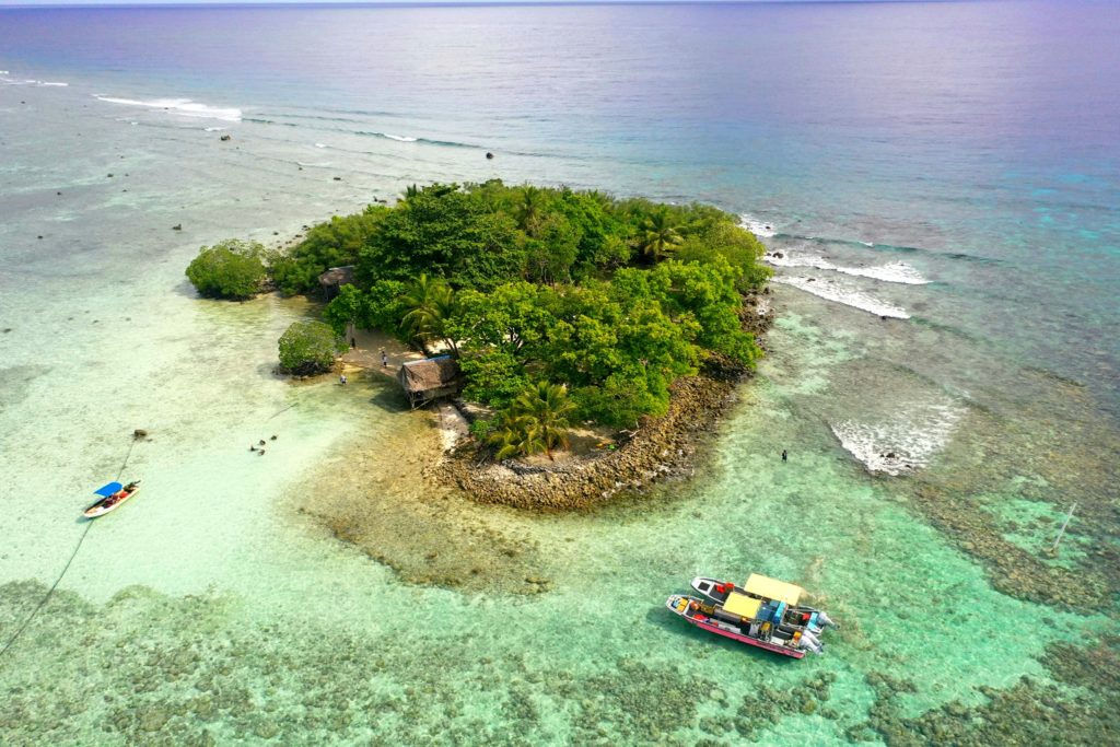
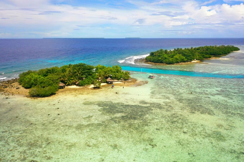
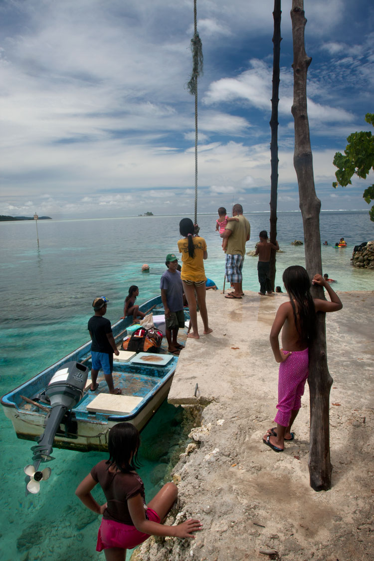
Black Coral Island
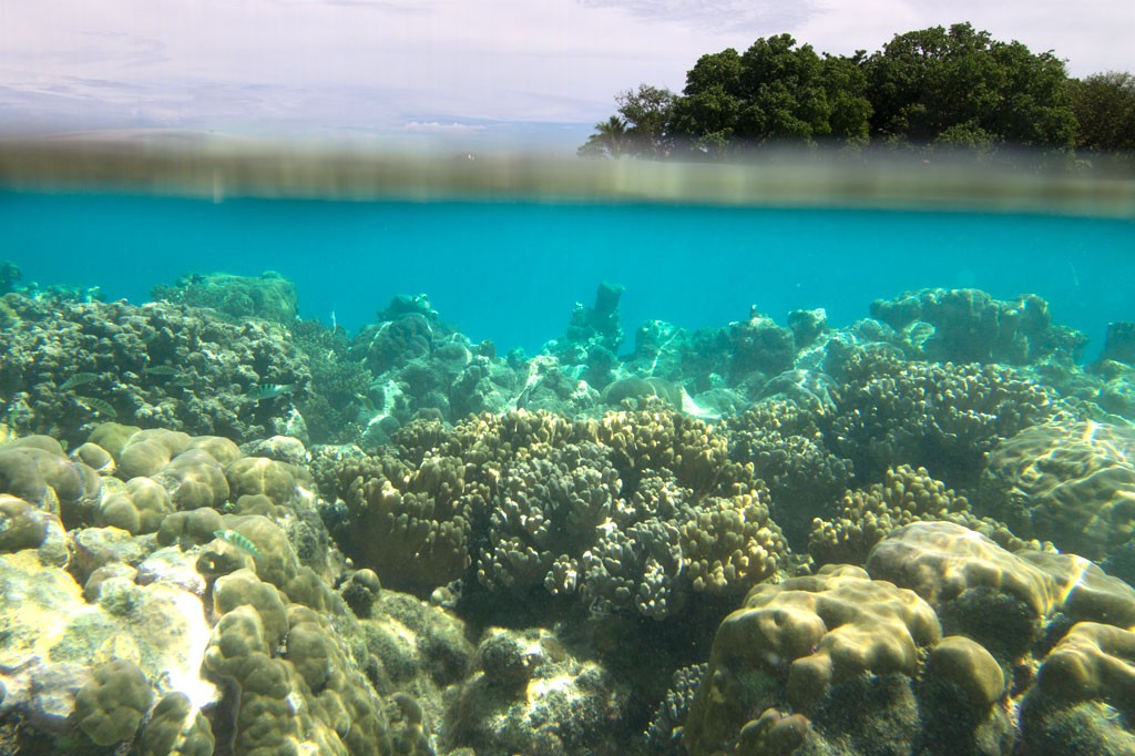
“Black Coral” is the southernmost islet in the Namwmour chain of islands that straddles Kehpara Pass (Dauen Kehpara) on the southwest corner of Pohnpei’s barrier reef. It’s true name is said to be Kehpara, but hardly anyone calls it that. Instead, Kehpara is usually used to refer to the island on the opposite side of the pass (island on lower right side of top image). In the mid-1600s, the conquering hero, Isokelekel, first entered Pohnpei’s barrier reef through Kehpara Pass on his way from Ahnd Atoll to Nan Madol. The sandy and well-shaded coral island, which lies within the Kehpara Marine Protected Area (MPA), is currently owned by the Adams family (the proprietors of Ace Hardware and Ace Office Supply). Black Coral is immaculately maintained with serpentine footpaths running here and there through large sprawling trees and several simple, wooden huts for overnight camping. Good snorkeling is located off the eastern shore and in the pass to the north, where white-tip and black-tip reef sharks, spotted eagle rays, and other marine wonders can often be seen. The best SCUBA diving is along the outer edge of the barrier reef north of the pass, a spot called Kehpara Wall. The area is a spawning ground for several varieties of protected grouper. Though some sandy areas appear at low tide along the inner coast, Black Coral doesn’t have any true beaches.
To make reservations for day visits or night stays and to arrange boat transport from the Seinwar Launch behind Seinwar Elementary School call ACE at +691.320.8279 / 5637.
Ahnd & Pakin Atolls
Pohnpei’s Satellite Atolls
Beyond Pohnpei’s lagoon, the closest land to be found exists on two “satellite atolls” called Ahnd (pronounced änt) and Pakin (pä.keen). An atoll is made up of a number of coralline islets in a ring around a relatively shallow lagoon and is created when a high, volcanic island submerges over millions of years, leaving only the reef that fringed its shores. The islands form as sand, coral rubble, and other detritus collect on the reef and begin to support trees, small plants, and animals. Coral sand accumulates on the lagoon sides of the islands and creates beaches.
")
Ahnd (“Ant”) Atoll
Ahnd Atoll, popularly but erroneously spelled “Ant,” is 16 km (8 mi) southwest of Rohnkitti and consists of 13 low, luxuriant islands 3-4 meters above sea-level and a lagoon of 70 km2 entered by a single passage in the reef.
When the larger-than-life hero Isokelekel voyaged to Pohnpei, intent on overthrowing the rulers of Nan Madol, he came first to Ahnd and lived there for some time, learning about Pohnpeian customs from its inhabitants. In modern times, the entire atoll became the property of a single Pohnpeian family — the descendents of Henry Nanpei, who lived from 1862 to 1928. Nanpei’s shrewd business sense and knack for manipulating local power politics enabled him to acquire the atoll and amass a great deal of other land.
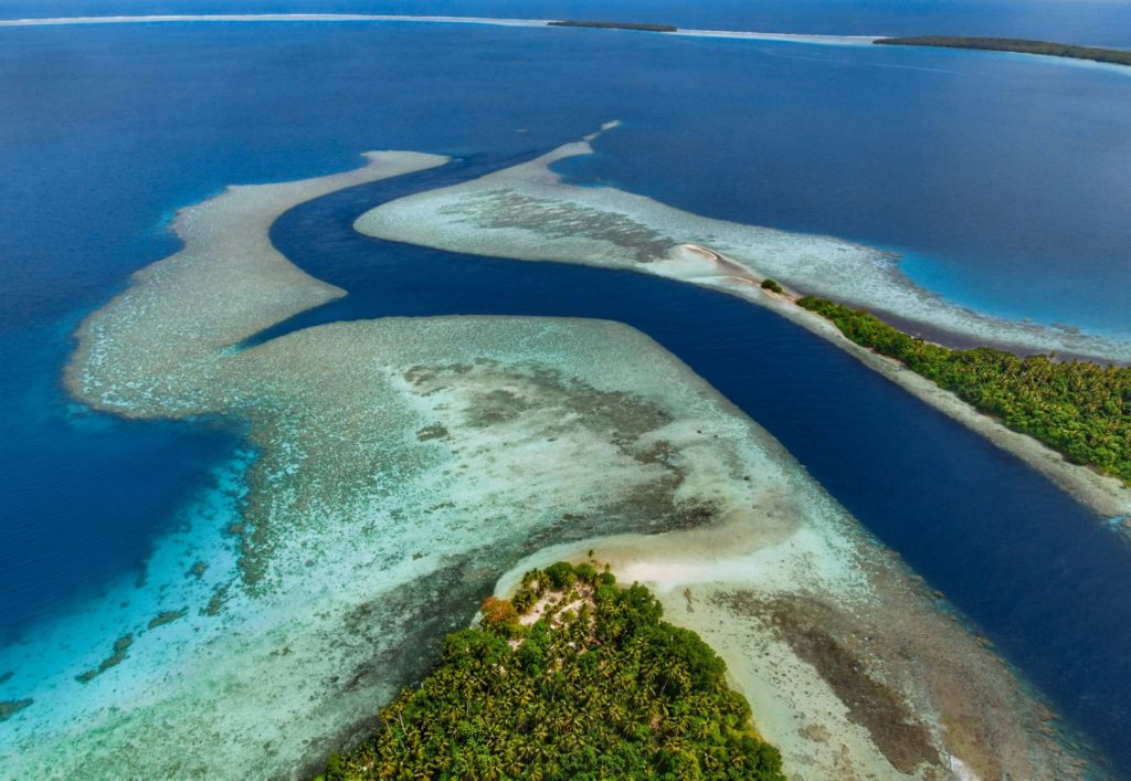
Ahnd Atoll Channel 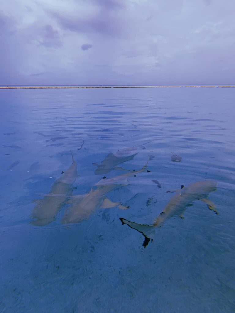
Black tip reef sharks at Ahnd Atoll (PC: Tia Panuelo) 
Ahnd Atoll, Federated States of Micronesia (PC: Alex Zuccarelli) 
Ahnd Atoll, Federated States of Micronesia (PC: Alex Zuccarelli) 
Ahnd Atoll, Federated States of Micronesia (PC: Alex Zuccarelli) 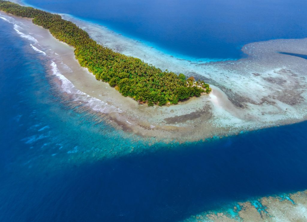
Imwen Sapw Island and channel entrance
Today Ahnd has a few human residents, the biosphere rangers who make sure people do not fish within the protected area. There is also resort run by the Nanpei family located on the island of Pasa (information for booking trips can be found below).
It is home to some of the largest colonies of black noddies, terns, boobies, and frigatebirds in the Pacific as well as a healthy community of gray reef sharks in and around Dauenai (passage).
The most interesting islands to camp on are Pasa, Nikahlap, Dolen Mwuroi, and Nahlos. The former two have long stretches of deserted white-sand beach and excellent swimming. Nan Imwinsapw is closest to Dauenai (passage), where all the best snorkeling and the most accessible diving is found, but it has a big rat problem. Pahn Mwek is near to both excellent snorkeling and some of the rare diving that exists inside the lagoon. For the most part, however, the lagoon is the domain of snorkelers, sandy and punctuated by beautiful coral heads with lots of color and life at low tide.
Dauenai on the south side is where most people go to SCUBA dive. It is known for orange sponges (on the west wall) and large numbers of barracudas, jacks, and sharks throughout. Reef fish populations around the pass, unfortunately, have declined in the last two decades, but hopefully will recover now that the area is protected. Even so, the place still feels busy compared to other locations and you’ll see all the familiar species — unicornfish, triggerfish, wrasses, surgeons, groupers, butterflyfish, angelfish, moorish idols, and more. Moray eels might be spotted on occasion. Spinner dolphins are regularly seen at the mouth of the passage and in the waters around Ahnd. Visibility in the pass, though not as spectacular as outside the reef, can reach 50 meters (164 feet) — certainly nothing to complain about.
In addition to drift-dives on either side of the deep passage, there is stunning (and frequently overlooked) diving on the outer wall of the barrier reef on the northwest side near Olouna (often known as “bird island” for the huge colonies of seabirds that nest there), and north of Pasa. The west wall of the barrier reef plummets to great depths, and because it is more protected from the northeasterly winds and waves, it is marked by an abundance of soft coral, holes, tunnels, and caves — an exciting place for any advanced diver. Giant clams are also common. Visibility on the outside edges can be extraordinary, exceeding 70 meters (230 feet). Currents can be swift both in the pass and around the outer walls.
Visiting Ahnd Atoll / Permission & Protected Areas
Because Ahnd is a privately owned island and UNESCO marine biosphere reserve permission is required from the Nanpei family for visits.
- Contact LP Gas at +691.320.5661 / 2675 to make arrangements.
- You can also book trips to Ahnd Atoll through Pohnpei Surf and Dive Club.
The Tenants of UNESCO Biosphere Reserves
- Core area(s) comprise a strictly protected ecosystem that contributes to the conservation of landscapes, ecosystems, species, and genetic variation.
- A buffer zone surrounds or adjoins the core areas, and is used for activities compatible with sound ecological practices that can reinforce scientific research, monitoring, training, and education.
- The transition area is the part of the reserve where the greatest activity is allowed, fostering economic and human development that is socio-culturally and ecologically sustainable.
Olouna (“Bird Island”)
Landing on Olouna island is prohibited to prevent disruption of the habitats of the seabirds who nest there. If you’d like to take a look at Olouna, consider making a kayak trip around it. You can arrange to pay your boat extra to transport a small ocean kayak or two.
Pakin Atoll
")
Pakin Atoll is composed of about 16 low islands, 13.6 km2 of reef, and a lagoon of 11 km2. It lies 38 km (24 mi) northwest of Palikir. In the early 1900s, Sokehs residents of Mortlockese descent were allowed to settle on the atoll, where their descendents (about 80) live to this day. Most of the islands are sparsely inhabited and all have excellent beaches, swimming, and nearby snorkeling.
One complication of visiting, however, is that Pakin has no true passage, making entry into the lagoon impossible for large boats and both difficult and dangerous for small boats. Boats enter at high tide at one of two places in the barrier reef (the usual spot is known as Uhrek), where the coral is slightly deeper than elsewhere — by a matter of a few inches. ") The crossing is narrow and complicated by strong surge. Except at the highest tides, the crossing must be carefully timed to correspond with the surge. Boats can easily capsize in the surf or be thrown up on the reef; several locals have been killed at the spot while trying to make the crossing in less than ideal conditions. When planning a visit, make sure that you hire an experienced pilot who knows this particular crossing and is committed to the safety of his passengers. Also, it is important to plan arrivals and departures to coincide with the highest tides.
The crossing is narrow and complicated by strong surge. Except at the highest tides, the crossing must be carefully timed to correspond with the surge. Boats can easily capsize in the surf or be thrown up on the reef; several locals have been killed at the spot while trying to make the crossing in less than ideal conditions. When planning a visit, make sure that you hire an experienced pilot who knows this particular crossing and is committed to the safety of his passengers. Also, it is important to plan arrivals and departures to coincide with the highest tides.
All of the diving and the best snorkeling is on the reef wall outside the lagoon, where water clarity and reef conditions are simply mind-blowing. The wall north of Nikahlap is known for sharks, while the opposite side of the island is home to large schools barracuda. For sea turtle sightings, divers will want to try the walls on the northeast side. Turtles nest on many of the small islets north of Painpwel, Sapangin, Kehrot, and Osetik.
Mwudokolos Island
Mwudokolos is found a half-kilometer (0.33 mi) northeast of Metipw and easily accessed from the coral-dredged causeway/dock found there (ask at the nearest house for permission to launch if you’re paddling out). The privately owned, but uninhabited, island has prehistoric stone structures that date to the Nahnmwarki Period of Nan Madol (post-1700). Glass beads, sherds, and clay pipes have also been found there by archaeologists, suggesting that Mwudokolos was occupied by foreign traders in the late 1800s. There’s some nice swimming and snorkeling northeast of the island.
Lepin Dau Island
This island is claimed by the same family as Dahu Reirei and has no true name, but as it lies adjacent to the primary channel every boat in the area uses to go from Areu and Ohwa to Madolenihmw Bay, it’s known by most people as Lepin Dau (or sometimes “Channel Island”). Lepin Dau is larger and higher than Dahu Reirei and has some welcoming tree-cover. The reef pass on the west side is a nice spot to snorkel at slack tide, but at other times, the current can be so strong that snorkelers and swimmers run a strong risk of being swept away. A better spot for snorkeling is in the blue holes around the southeast side — well out of the path of the current. Here you can find beautiful coral grottoes, schools of needlefish, barracuda, cuttlefish, trumpetfish, angelfish, and parrotfish, an odd seasnake (the latter are venomous, but so passive that they pose little danger to snorkelers), and from time to time even eagle rays and small green turtles.
- To obtain permission for overnight stays or to arrange boat transport from Ninleu, call +691.924.2229.
Dekehmwahu Island
Uninhabited little Dekehmwahu (“good island”) is located just east of Nahpali in Madolenihmw Municipality. It’s a rough oval with a couple of small, sandy beaches and a few places to pitch a tent. The best beach is at the northwestern end, while the most practical camp site is on the southeast coast. Mangroves skirt most of the western coast. With a few exceptions, the surrounding ocean is shallow and covered with beds of seagrass, but good snorkeling can be found not far to the south at the Namwen Na Stingray Sanctuary (a short swim away). Surrounding shallow reefs make the island difficult to reach by boat, except at the highest tides, but it’s a great place for kayakers to visit. Currents can be extremely strong in the area at certain times.
- To obtain permission for overnight stays, call McKenzie Senda at +691.320.8682 / 7147 / 4062.
Dau Reirei Island
Dahu Reirei (“long channel”) is a long, narrow, man-made islet constructed on a shallow reef with several huts for picnickers and campers and lots of pleasant swimming and snorkeling nearby. The tiny place can get uncomfortably crowded on weekends and holidays, but is wonderful at other times. One of Dahu Reirei‘s biggest draws is its namesake — the crystal-clear channel along the west side, which is host to many varieties of staghorn coral and swarms of reef fish; it’s a magical place to swim. The reef walls north of the island, however, are better for snorkeling (follow the reef as it curves east and north). Note that Dahu Reirei is really about being IN the water as the island itself isn’t much of anything. And in the water is exactly where you’ll want to be when the temperatures soar (there is little shade) and when the land shrinks at high tide (the island is hardly a meter above sea level). The family of the owner lives in a stilt-hut at the north end of the island.
- To make reservations for day visits or overnight stays and to arrange boat transport from Ninleu, call +691.924.2229. There is an admission fee for the island so be sure to ask for quote if you would like to book a trip.
Sahwartik & Sahwarlap Waterfalls
![]()
![]()
![]()
![]()
![]()
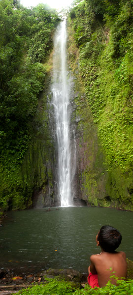
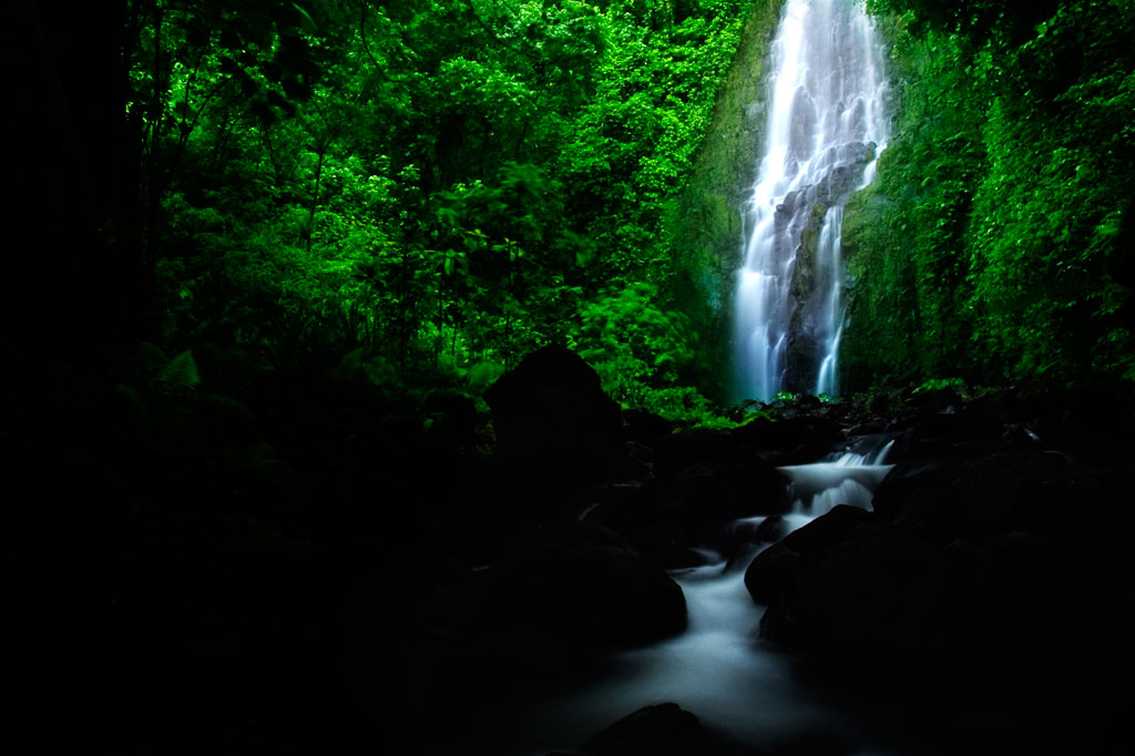
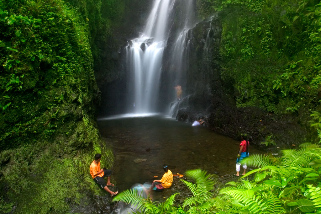
Located on converging streams within Salapwuk’s deep Sahwar Gorge, Sahwartik and Sahwarlap are a pair of waterfalls whose splendor and grace defy reality. The wider falls is named Sahwarlap, which means “shining brightly,” and its tall, thin neighbor is called Sahwartik (“shining faintly”). Sahwartik, a “horsetail” falls, is the more picturesque of the pair and is probably the tallest waterfall on Pohnpei at about 20-24 meters (65-80 ft). It lies at the terminus of the gorge, hidden in a fern-carpeted niche with a sizable plunge pool and enough flow to create its own misty breeze. The water is very clean and often quite chilly — amazingly refreshing after a hot hike. Sahwarlap’s stream angles into Sahwartik’s from the northwest. The falls is wider and shorter than Sahwartik and has a much shallower pool. Both waterfalls are great for a mid-hike swim, but Sahwarlap‘s pool is shallow, while Sahwartik‘s is relatively deep.
The trek begins east of the road that leads to Salapwuk Elementary School, just before the paving ends (park under the trees on the east side of the road). After crossing the landowner’s property, a well-maintained trail begins at the rim of the gorge with inspiring views of both waterfalls, then descends in a zigzag along the slope to the stream bed. The slope trail is generally well-tended, but without any railing on the outer edge. Hikers should move slowly and with care. In a few places there are rough steps that can deteriorate after heavy rain.
Once one reaches the bottom of the gorge, there’s no obvious trail, but the way is clear. Merely head up-stream and stick close to the water — a collection of little streamlets. There are no deviations from the valley, so it’s impossible to lose your way before hitting Sahwartik. Sahwarlap can be a little trickier to locate. Hug the west side of the stream bed and keep your eyes peeled for a path near where the Sahwarlap Stream (Pilen Sahwarlap) flows into the larger watercourse (Pilen Sahwar). This footpath climbs over a little hillock, from the top of which the falls is visible through the trees.
Note that sakau (known elsewhere as kava) is heavily cultivated throughout the west side of the valley and along the slope trail. The large shrub with its heart-shaped leaves and thick, knobby branches — sometimes pure green, but more often mottled — is easy to identify. The plants have great value to their owners. Hikers should treat them with respect and avoid breaking branches or otherwise damaging them as they pass.
The Sesiwo family charges $5.00 per person for access. No guide is necessary for this hike, but if you want one, the family can scare up some kids to go with you. Offer $5.00 and make sure that everyone is clear that you’re paying one person, even if a whole group of kids trail along behind.
- Plan for 90 minutes to 3 hours round-trip with a swimming session at each waterfall.
How the Sahwar Valley was Formed
There was once a woman in Salapwuk named Lienlama who had two sons named Mwohnmur and Sarapwau. The boys had many adventures and became notorious in Pohnpeian legend, being responsible for the creation of a number of interesting geographical features including Takaiuh (hill), Pohnpaip (rock), and the island of Takaieu. The boys were eternally curious, and one time they took their mother’s loom stick (made from a sword fern) and dug in the earth to see what was below it. The hole that they dug was so deep that they reached the Underworld, and because they could see the shining lights of that other world through the hole, the gorge was named Sahwar, which means “shining” or “flashing.”
The Six Waterfalls Hike
![]()
![]()
![]()
![]()
![]()
")
Because Pohnpei’s rainforested terrain is so challenging to move through, inexperienced hikers might think a jaunt into the wild interior of the island is out of reach. It isn’t. Almost anyone in relatively good physical condition can handle the “Six Waterfalls Hike”, which delves into the verdant forests and lush raparian environment of the remote Nanmeir Valley above Salapwuk.
The adventure begins near Salapwuk Elementary School. The early part of the hike follows a wide, mostly flat track through the trees. This is a good place to look for Asian waterbuffalo, or carabao, which some of the Salapwuk residents use as beasts of burden. The large, big-horned animals, which were brought to Pohnpei from the Philippines by the Spanish in the 1890s, may look fearsome, but are actually quite shy, gentle creatures. You might see one lolling about in a patch of mud or plodding along with a smiling child perched on its back.
")
Over time the track becomes a narrow footpath and begins to roll up and down as it passes through hilly native forests. Shortly after crossing the Sihngar Stream (Pilen Sihngar), there’s a fork in the trail. Continuing straight will keep you above and west of the river, while the eastern way leads down toward the upper Lehnmesi River and Pahnairlap, a serene punchbowl falls with a great little pool beneath it.
The rest of the hike follows along the banks of the river and occasionally crosses over it, stopping at four more waterfalls — Nikotoapw, Olotong, Iro, and Nan Emp — each with its own unique character. This segment is quite difficult, as hikers must traverse the round, jumbled stones that line the riverbed and its banks. Go slow, use your hands, and watch your footing.
Nikotoapw Waterfall is found a bit to the east of the river, above where the Nikotoapw Stream (Pilen Nikotoapw) joins the Lehnmesi. The site is screened by a pool with a wide “block falls” behind it, which hikers must circumvent. On the other side, the stream issues from a narrow slot. Continue through this and one comes to an enclosure mostly hidden from outside. There lies the falls and its sizable pool. If you swim under the falls and climb up on the rocks behind, you’ll find a cave.
")
The third falls, Olotong, is found on the opposite side of the Lehnmesi from Nikotoapwpw. This is followed by plenty of hiking in the riverbed and one segment where the trail leaves the river and cuts through the forest before coming back to the watercourse. Iro and Nan Emp are both found on the west side of the river not too far apart.
The sixth falls, called Lipwentiak, is also hidden from view by the topography. At one point the river narrows and passes through a high-walled slot. Though there is a way up and around, the easiest and safest way past is to swim through the slot. On the other side, the walls open up to reveal a large pool with high walls on all sides, an island of cobbles, and beyond all that, a tiered “horsetail falls” that flows from a vaguely heart-shaped portal of dark rock. It’s very dramatic.
In all, the trek offers tons of great swimming and truly unreal scenery. Good footwear is a must.
- Plan for 6-8 hours round-trip with short swim breaks at each waterfall.
- Please visit the Local Guides & Tour Operators page for a list of experienced guides available for the Six Waterfalls Hike.
The Story of the Eel of Pahdol
A long time ago, a couple from Wene came to live in a place called Iro. One day there was a great storm and the heavy rains resulted in a huge flood. Two women in the area went out to fish in the flood, and while they were fishing, a starling flew over and dropped a small stone. The women took the stone home and gave it to the couple from Wene. Later, at a place called Pahnkipar (“under the pandanus tree”), the stone broke apart and from it was hatched a tiny freshwater eel. The couple kept the eel as their pet and allowed it to live in a pool at Pahdol (“under the hill”) in Pahnais. When the eel grew up, however, it began to act in sinister ways. At night, the eel would escape from its pool and sneak into the house, where it would stare at the sleeping couple. The couple became uncomfortable and decided to kill and eat the eel, but the eel overheard their plan, came into the house, and attacked them. The couple fled into the forest and hid under a huge rock, where they believed they’d be safe. The eel discovered the hiding place and ambushed the couple, devouring them alive.
The eel then traveled into the Nanmeir Valley in Pohnpei’s interior and followed the Lehnmesi River source. There she met Kiroun Meir, a high-titled man, who brought her to live with him at his home. The two became lovers and the eel was impregnated. She was restless, however, and departed, continuing to follow the river. At Lipwentiak, the eel encountered a hunter named Kiroun Mand, killing and eating eels. Recoiling at this sight, she created a sharp turn in the river with the writhing of her body. Soon after, she gave birth to her first daughter, the matriarch of the Sounlipwentiak subclan. She had other children later who became the founders of the Lasiadohng (“eels of the dohng tree”) and Lasiakotop (“eels of the kotop palm”) subclans. After that, the eel went to live in Dauen Sapwalap, where she terrorized the local inhabitants, devouring so many that the land became mostly deserted. When the monster finally died, her body formed Dolen Nett.