
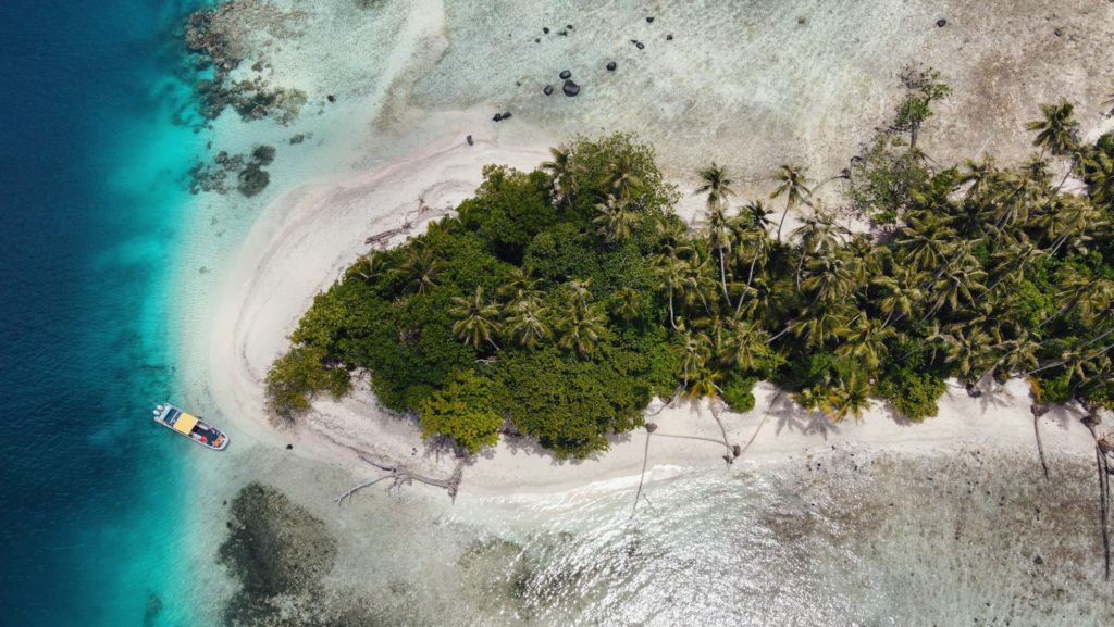
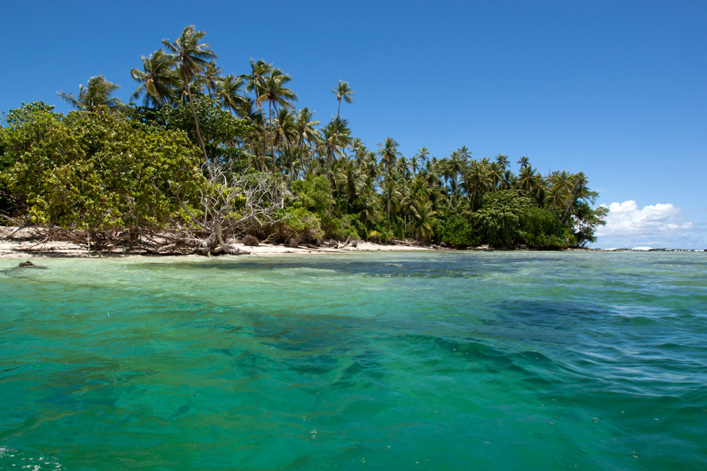
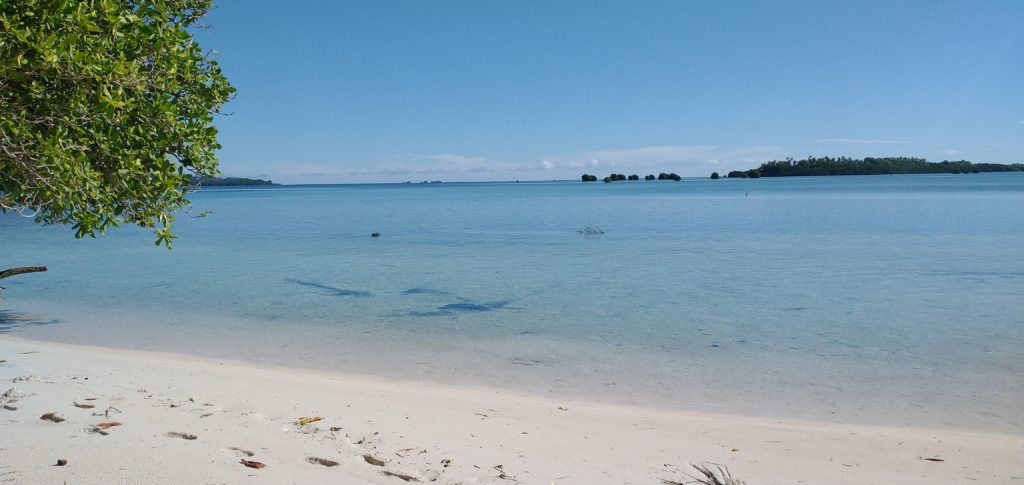
Snorkeling Pohnpei’s East Side
![]()
![]()
![]()
![]()
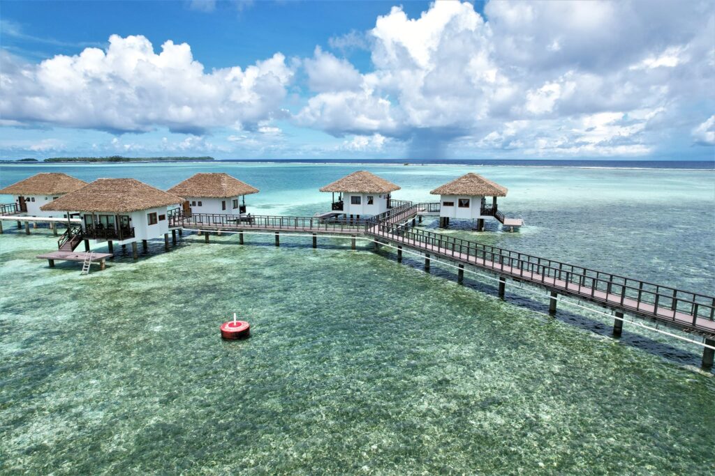
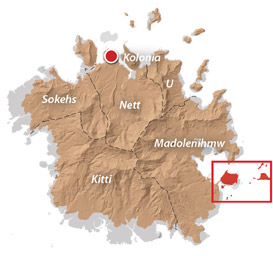
Temwen Vicinity
Pahn Nahkapw Wall
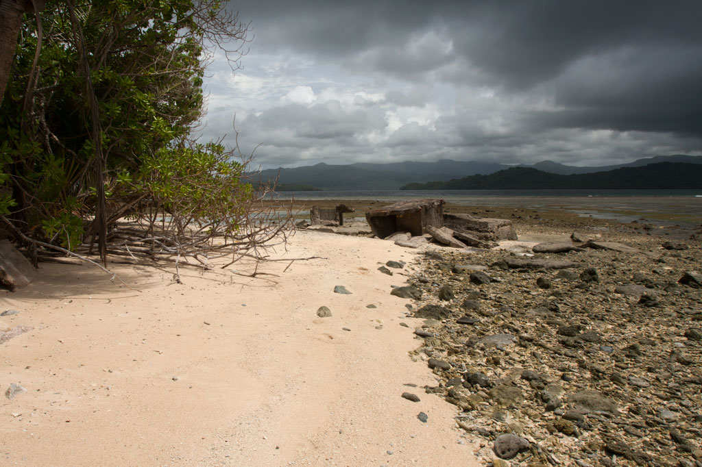
The best snorkeling in the area is west of Nahkapw (island) along the edge of the reef, where a coral wall drops quickly off into Pahn Nahkapw‘s blue hole. Fish are abundant here and the coral is thriving. Start at the north tip of Nahkapw and follow the reef around. To the east you’ll see the massive basalt boulders that make up the island’s Nan Madol-era breakwall.
Kepindausiso
The reef walls north, west, and south of Dekehtik (island), at the northeast end of Pahn Nahkapw, offer plenty of nice underwater views and crystal-clear water. This portion of the hole is referred to as Kepindausiso –“below the noble’s channel”.
Namwen Na Stingray Sanctuary
This reserve lies between Nahpali, Dekehmwahu, and Na (islands). It’s a moderately deep pool in the middle of shallow, sandy reef flats populated by a large number of stingrays (we saw more than fifteen in under an hour). You can swim out to the western edge from the southern tip of Nahpali or explore the eastern side from Na. There can be some strong currents coming from the northeast, so be alert.
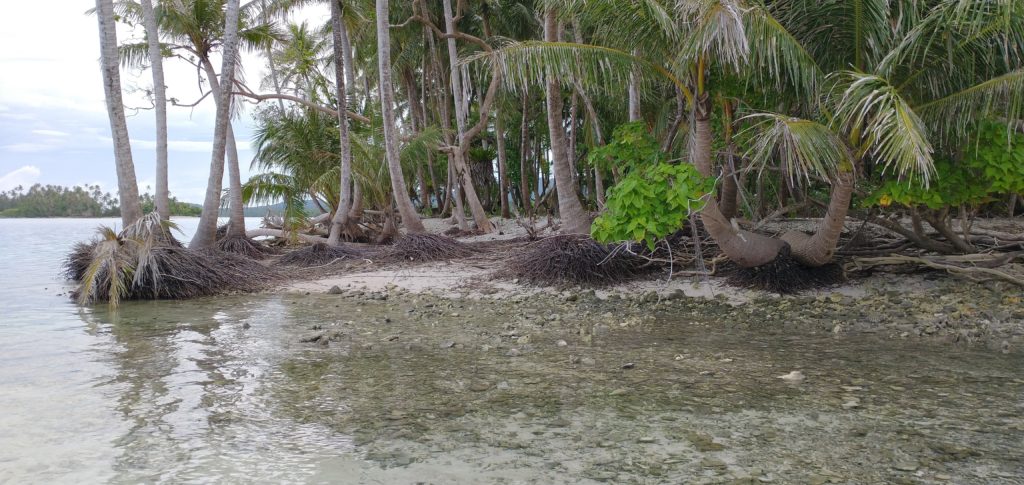
Northern Na Island Coast
Na‘s northern coast offers narrow sandy beaches and a swath of beautiful, crystal-clear water over a sandy bottom. Further out, the floor turns to beds of seagrass. There are plenty of stingrays to see in the area. When walking in the shallows, be alert and shuffle your feet to avoid potentially serious accidents.
- Visit our Island page for more about this location.
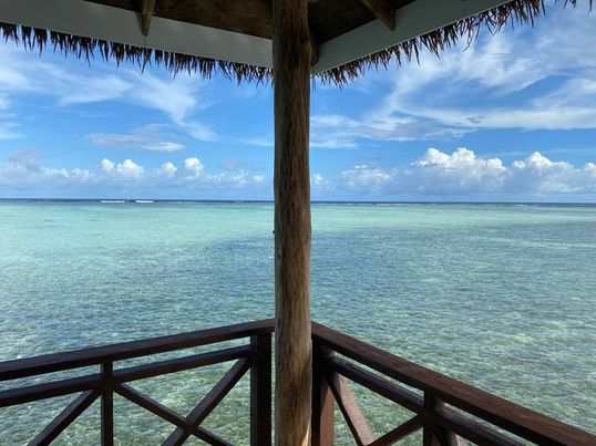
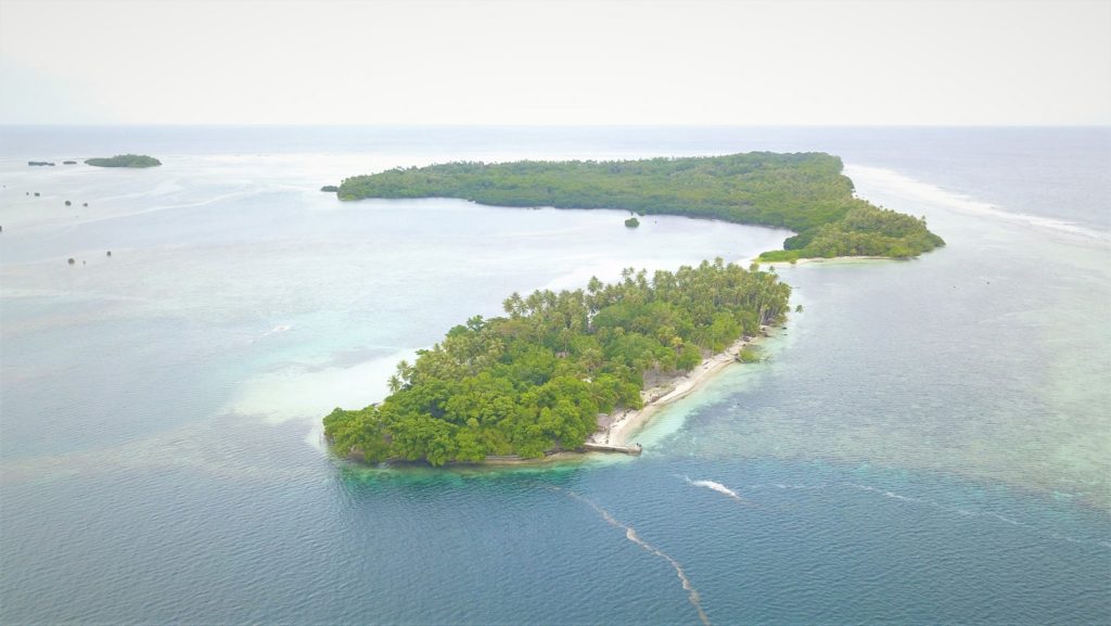
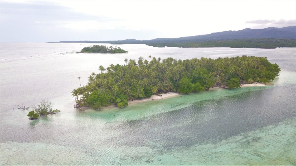
Nahpali Island
Nahpali‘s underwater sights are all around the west side and most easily accessed from the Japanese Wharf at the edge of the reef.
- Visit our Island page for more about this location.
“Nan Madol”
The water around the northeastern perimeter of Nan Madol is usually too rough and/or murky for sub-surface exploration, but the reef pool southeast of Lemenkau can be nice on calm days and at mid to high tides. At other times, it’s either difficult to reach or has waves breaking over it.
Namwen Nahnningi Stingray Sanctuary
Similar to the reserve near Na, this marine protected area consists of several deep pools in the middle of the reef shelf with sandy bottoms, good visibility, and healthy coral populations around the edge. Stingrays are abundant and reef fish diverse. The pools are a short swim from Nahnningi (island) (a.k.a. “Joy”).
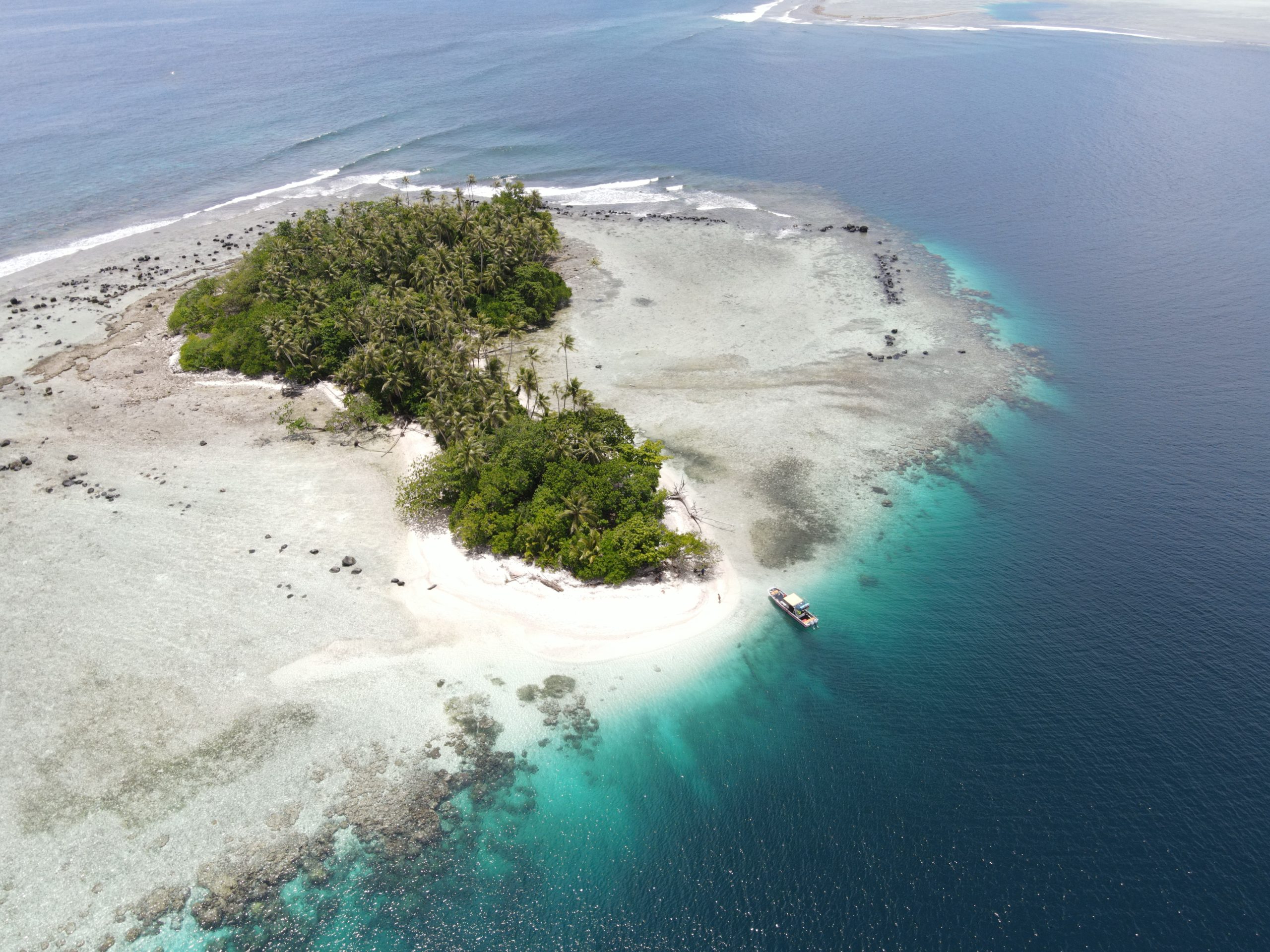
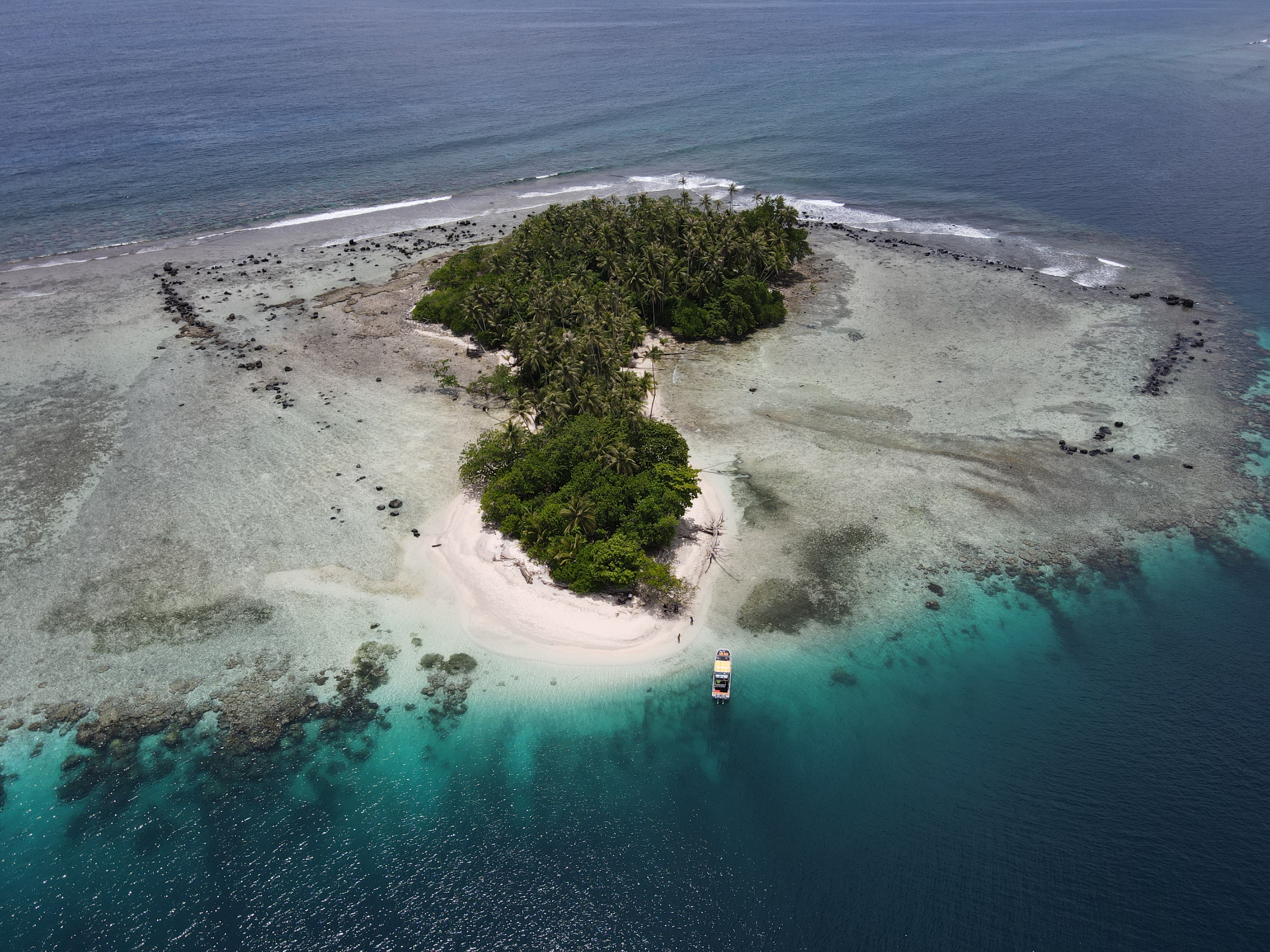
Joy / Nahnningi / Para Nuii
Southeast of Nahnningi is a circular pool on the edge of the fringing reef. There’s a narrow opening on the ocean side that allows water and fish to flow in. Depending on the tides, this place can have amazing numbers of reef fish, but it’s too rough for snorkeling when the Northeasterlies are blowing during the winter. You can snorkel to the pool from Nahnningi.
Nahpali Island
![]()
![]()
![]()
![]()
![]()
![]()
![]()
![]()
![]()
![]()
![]()
![]()
![]()
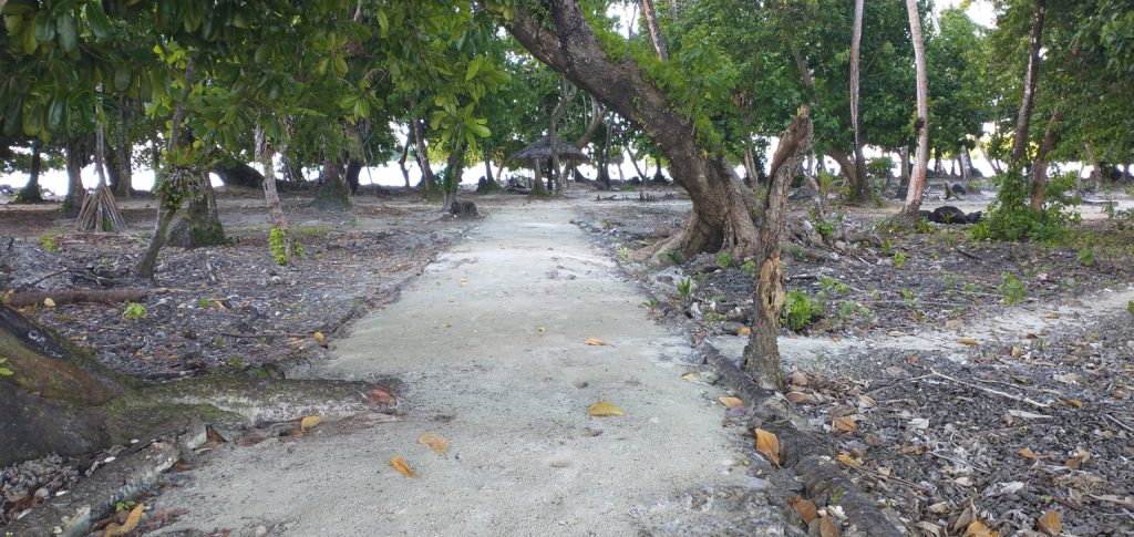
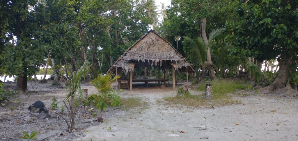
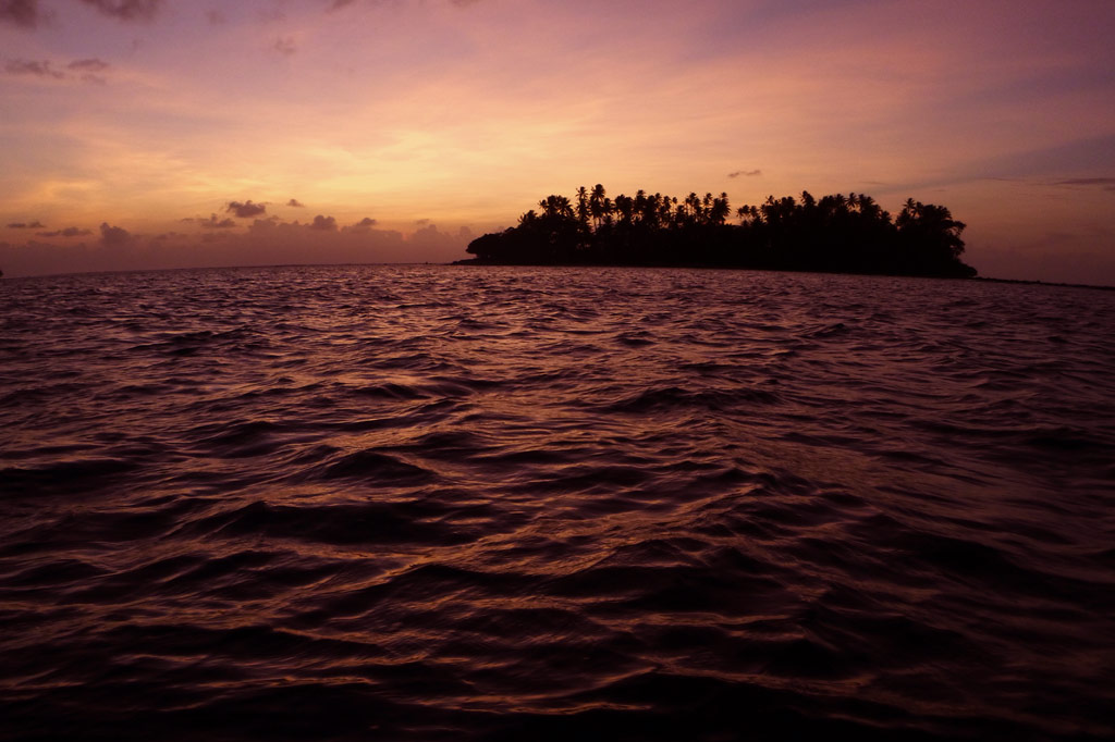
Nahpali is a long, narrow reef island running roughly northeast-southwest and located northeast of Temwen Island in Madolenihmw Municipality. The island is privately owned by the Senda family and has remained largely undeveloped. In 1836, a war that erupted between the crew of a visiting British whaleship, the Nahnmwarki (paramount chief of Madolenihmw), and a rival chief (the Wasai), spilled over onto the island. After the whaleship ran aground, its cargo was transferred to Nahpali, where it was later stolen by the brother of the Nahnmwarki, called Nahnawa. The whalers and Nahnawa’s men fought on the island, where Nahnawa temporarily got the upper hand and killed the captain of the ship and three others. Eventually however, with the help of the Wasai, who was based on Na Island and coveted the Nahnmwarki title, the whalers overcame the Nahnmwarki and his brother and murdered them. During the 1930s, Nahpali was occupied by the Japanese military, which operated a gun battery and searchlight station near the northern end. Today, the island is forested and scattered with the remains of the gun stations and other Japanese structures, including water storage tanks and steps that once led up to an elevated wooden barracks (now long gone). All of the suitable camping areas lie on the western and northern coasts and the swimming and snorkeling is all along the reef wall west of the island, while the eastern side descends into impassable mangrove swamps.
Attractions
110 cm Searchlight
As part of their fortification of Nahpali, the Japanese mounted a 110 cm searchlight at the northeast end of the island, closest to the channel opening. They probably intended to use the light to spot enemy ships attempting to pass inside the reef, but it seems unlikely that they ever got to use it in battle. The May Day bombardment of Pohnpei by American warships focused primarily on the targets of highest import — Kolonia Town, Sokehs Mountain, and Lenger Island — and it’s doubtful that American vessels were anywhere near Nahpali. Allied bombers, however, may have played a part in the destruction of this piece of hardware. The searchlight drum now rests in the sandy shoals north of the concrete platform where it was originally installed. The platform is broken into several pieces, but it’s not clear whether the damage was caused by a bomb blast or just the action of tides, waves, and erosion over nearly 70 years. Other bits of the light are scattered around in the water nearby.
8 cm Gun Stations
Duane Denfeld’s 1979 archaeological overview of Pohnpei’s historical sites indicates four 8 cm gun stations on Nahpali (based on American intelligence gathered through aerial photography rather than an actual visit to the island). During our quick survey of Nahpali, we were only able to locate three of the stations and one of them was severely deteriorated. No guns remain, but the concrete defensive structures are still there — albeit very overgrown.
Other Japanese Structures
Most of the other structures found on the island are clustered around the west side. There’s a series of foundations that might have belonged to a barracks, several hulking cisterns of various types, and a diesel engine.
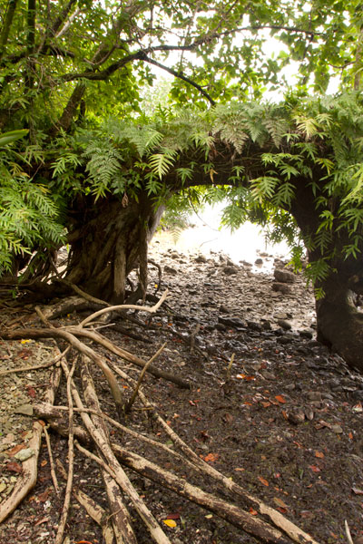
“Gateway Tree”
On the shore just south of the last Japanese structure is a huge tree shaped like an arched gateway. A portion of the tree seems to have bent over and made contact with the ground, where it put down more roots, forming an amazing piece of natural architecture.
Sandy Beaches
Beautiful stretches of fine copper sand are found on Nahpali’s northwestern and northern coasts. The beaches, however, do not extend all the way out to deep water, giving way instead to shoals of coral rubble and seagrass. The best beach is found where the coastline turns to the east near a pile of concrete slabs that might have been part of a wharf or coastal pillbox. Other ruined structures are scattered along the shore below the high-tide level. There is another smaller beach on the western coast at the southern end of the island.
Surfing
One of two surfable reef-breaks in the area lies on the edge of Kepidauen Deleur, northwest of Nahpali. Visit our surfing page for more details.
- To obtain permission for overnight stays, call McKenzie Senda at +691.320.8682 / 7147 / 4062.
Na Island

Na appears to be the largest island in Madolenihmw after Temwen, although it mostly consists of mangrove forests. In the mid-1830s, Na was home to a renegade Pohnpeian chief — the Wasai — who joined a group of foreign whalers in a fight against the Nahnmwarki of Madolenihmw and his brother, Nahnawa. The violent conflict ended with the murders of the Nahnmwarki and Nahnawa at the hands of the whalers, and the Wasai became the new Nahnmwarki (beginning a long cycle of violent power struggles in the district).
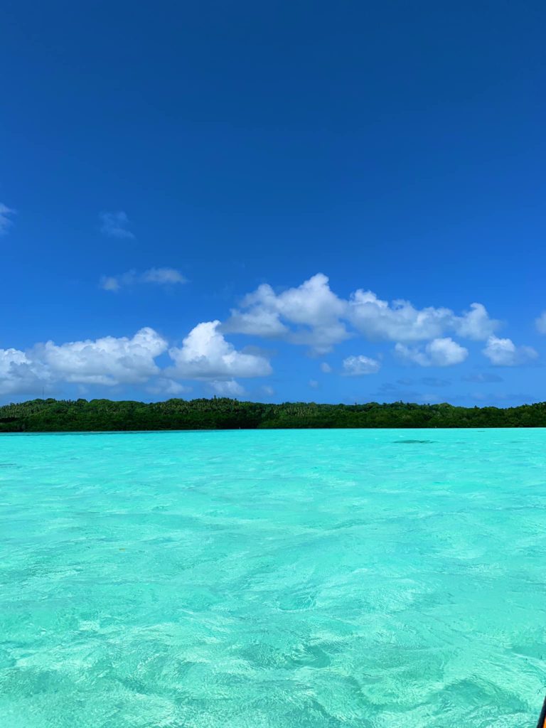
Currently Na is uninhabited. Though seagrass beds characterize the areas further out, there’s a beautiful swath of shallow, crystal clear water between them and the northern coastline. The bottom is sandy and a fantastic place to observe resident stingrays. The island itself is little more than a long, curving sandbar that has collected trees over its lifetime — mostly coconut palms. All the potential camp sites are on the northern coast as well as the beaches and best swimming. Snorkeling spots include Namwen Na Stingray Sanctuary to the north and the reef walls at the eastern edge of Pahn Nahkapw south of the island. The closest SCUBA diving is located on the reef wall around the eastern end of the island (boat access from outside the reef only). Divers usually begin there and drift on an in-coming tide along the wall as it curves west. Due to exposure to the prevailing winds, which cause heavy seas, the site is only an option during the middle of summer.
Nahkapw Island
Nahkapw is the island directly across from Nan Madol, and if you want to stay overnight and explore the ruins over a couple of days, this is the place to camp. The island is composed of coral rubble and thickly forested. Sandy beaches lie around the north and northeast coasts and there’s a nice protected, shallow place to swim on the west coast inside the boulder break-wall. The latter is believed to have been constructed during the Nan Madol Period or perhaps even before. Legends speak of two ancient stone cities that pre-dated Nan Madol; one of these is said to lie beneath or beyond Nahkapw. Some archaeologists have proposed that the island itself is man-made, but though much of the western and northern coastlines are surrounded by gigantic basalt boulders that are certainly not natural to the area, there doesn’t seem to be any columnar basalt around Nahkapw. The island has an irregular shape. The best swimming is off the north end, where the beach drops straight off into the deeps of Pahn Nahkapw — a huge “blue hole”. The snorkeling and SCUBA diving around the west edge of the reef wall (next to the boulder line) and to the northeast is excellent.
- To obtain permission for overnight stays, call Hentrick Etse at +691.320.8782.

Mall Island
Mall is located just to the south of Nahnningi, and though it looks larger, about half of the island’s area is mangroves. The most interesting feature on Mall (also known as ‘Small Island’) is a prehistoric stone tomb located at the north end. According to oral history, the island was home to two brothers named Semen Pwei Tikitik and Semen Pwei Lapalap. Dissatisfied with the greed of the reigning Saudeleur, the brothers left Pohnpei and sailed for another land. Only the younger of the two survived the journey. Eventually, Semen Pwei Tikitik returned, armed with the knowledge he’d gathered during his travels. He went to Nan Madol and shared what he’d learned about the more egalitarian culture he’d visited. The Saudeleur, however, refused to see reason, so Semen Pwei Tikitik killed him. Unfortunately, the assassination did not end the dynasty and the dead Sau was soon replace by a new leader.
- To obtain permission to visit, call William Hawley — the Rosa — at +691.320.2111 / 5050. Or contact the family run business, LP Gas, and inquire about visiting the island +691.320.5661 / 2675
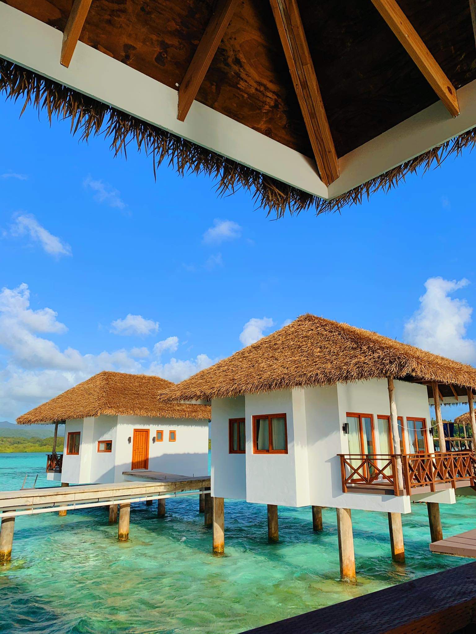
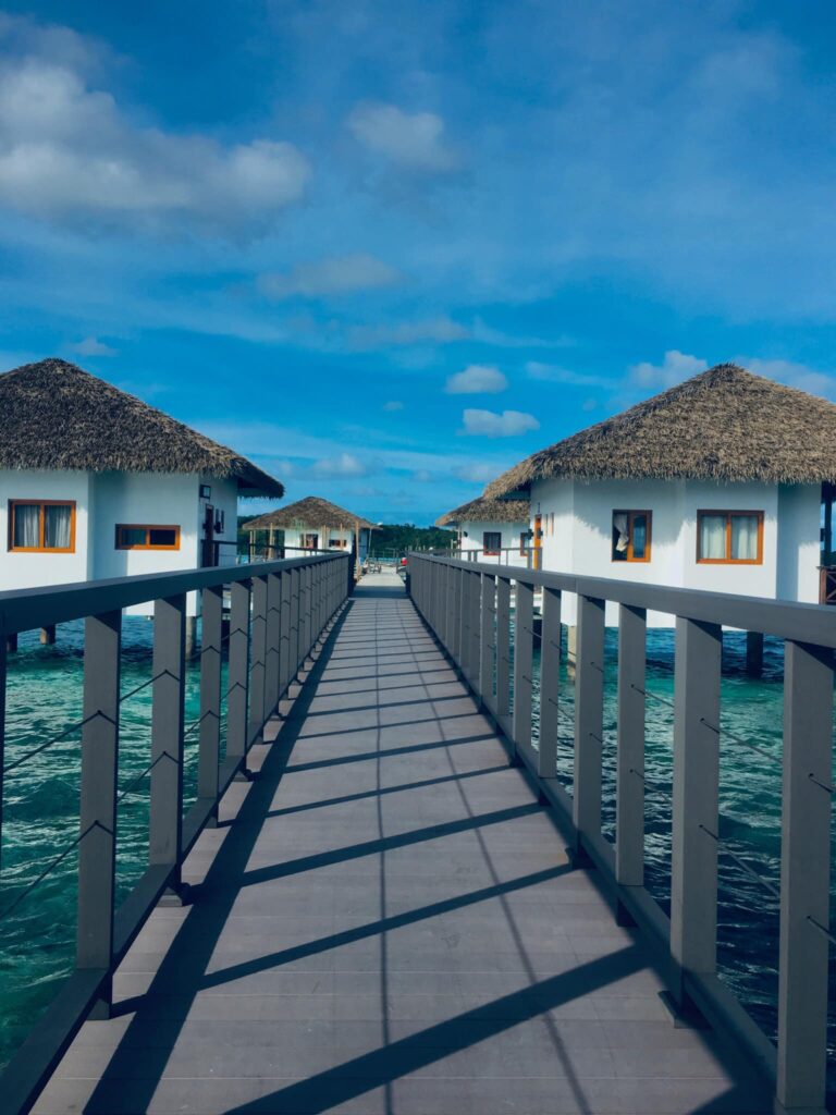
Nahnningi Island (Para Nuii Island Resort)
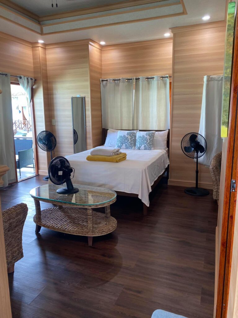
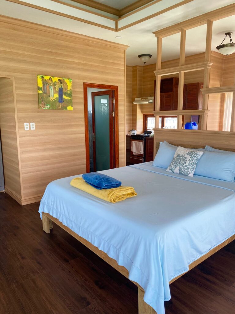
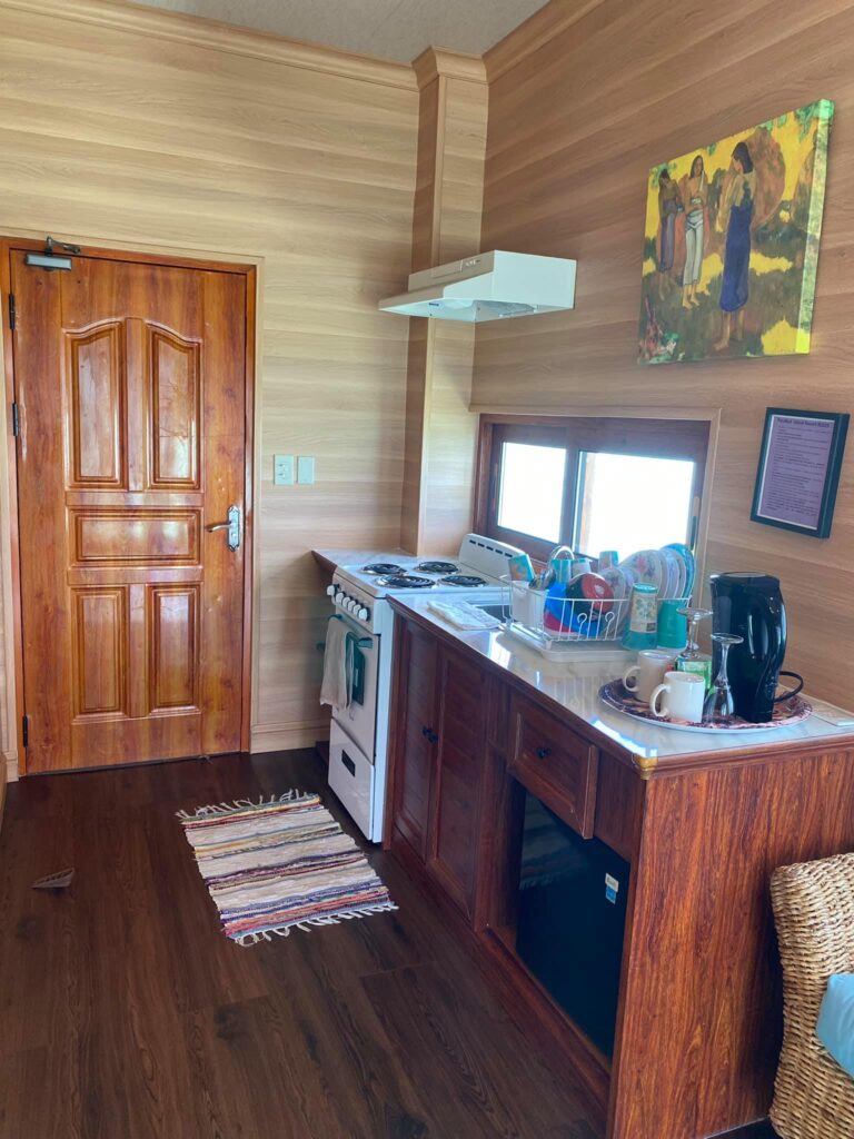
Nahnningi is known by most as “Joy Island”. There used to be a popular camping operation there in the 1990s, but for many years the island was not open to tourists. Recently it has become available again, but even more developed and open for both locals and tourists. The island is now called Para Nuii and is home to one of Pohnpei’s best picnic spots. The appeal of the island has to do with the shallow sandy areas around it, which are great for swimming and stingray-watching (beaches form at low tide) as well as housing situation. Para Nuii has fully furnished bungalows that stretch our from the northern end of the island. It is definitely “higher class” than most housing situations on the other islands, however because of this it does come with a steeper price tag than the other lagoon islands. There’s good snorkeling and SCUBA diving to the northeast along the outer reef and at a small channel near Mall. The Namwen Nahnningi Stingray Sanctuary is also within a close distance of the island.
Most archaeologists agree that Nahnningi is man-made and was constructed during the Nan Madol Period (it’s square and has low columnar basalt walls around much of its coastline). Purchase the Temwen Vicinity Eco-Adventure Map Guide for detailed maps and additional info.
To book a reservation for Para Nuii contact One World Plaza’s office located on the 1st floor of One World Plaza building or via their website listed below.
- Paranuii Website
- +691.320.2909 / 8085
- resort@paranuiiresort.com
Picture Credit: Tia Panuelo and Lee Arkhie Perez
Dekehtik Island (Sand Island)
Dekehtik, which means “small island”, also called Sand Island is an uninhabited coral islet west of Na, of which it was once a part (not be confused with the island of the same name on which the airport is located). The north coast is most suitable for camping with some sandy beaches at low tide and stunningly clear water for swimming and ogling the many stingrays in the area. There are huts on the island for people to stay in while on the island. The island is currently owned by the Adams family (the proprietors of Ace Hardware and Ace Office Supply). The best snorkeling is northwest of the island along the edge of the deep, blue hole of Pahn Nahkapw. The island itself is characterized by thickets of shrubby vegetation and coconut palms. Sandy beaches form on the north coast at low tide.
To make reservations for day visits or night stays and to arrange boat transport call ACE at +691.320.8279 / 5637.
Temwen Vicinity GPS Data
Downloadable GPS Data Files
The following files contain all the packaged GPS data for each of the featured locations in the Temwen Vicinity Eco-Adventure Map Guide.
Three file types are provided. KMZ and KML files are compatible with Google Earth. KML is compatible with Google Maps. GPX files can be imported into ArcGIS (a professional mapping application) and some hand-held GPS devices.
[info]NOTE: All files are free to the public and can be used for any purpose without permission.[/info]
Temwen Island Coastline (2015)
- Temwen Coastline (2015) – temwen-island.kmz (36 kb)
- Temwen Coastline (2015) – temwen-island.gpx (143 kb)
Temwen Island Mangroves (2015)
- Temwen Mangroves (2015) – temwen-mangroves.kmz (298 kb)
- Temwen Mangroves (2015) – temwen-mangroves.gpx (1.3 mb)
Temwen Island Contour Lines (2015)
- Temwen Island Contour Lines (2015) – temwen-contour.kmz (21 kb)
- Temwen Island Contour Lines (2015) – temwen-contour.gpx (78 kb)
Temwen Island Roads (2015)
- Temwen Island Roads (2015) – temwen-roads.kmz (8 kb)
- Temwen Island Roads (2015) – temwen-roads.gpx (24 kb)
Temwen Island Trails & Routes (2015)
- Temwen Island Trails & Routes (2015) – temwen-routes.kmz (13 kb)
- Temwen Island Trails & Routes (2015) – temwen-routes.gpx (49 kb)
Temwen Island Points of Interest (2015)
- Temwen Island Points of Interest (2015) – temwen-places.kmz (33 kb)
- Temwen Island Points of Interest (2015) – temwen-places.gpx (118 kb)
Dolopwuropwur Gun Battery (2015)
Coordinates
The following coordinates correspond with sites featured on the Temwen Vicinity Eco-Adventure Map Guide. It is our dream to eventually create a Pohnpei GPS app that could be uploaded to smartphones and other devices, but for now, these points of interest can be entered manually in a hand-held GPS device as needed.
[info]NOTE: All GPS devices have a margin of error. That margin increases with interference — when there is a thick canopy of trees, during bad weather, or when mountains obstruct the satellite link. The geosynchronous satellites employed when navigating on Pohnpei are located low on the southwestern horizon, such that maintaining a strong connection while hiking on the northeast side of a given mountain range can be difficult. Coordinates on the northeastern slopes of mountains are less accurate than in other locations.[/info]
Temwen Island
| Temwen Causeway South Bridge | —- | 6.843731° 158.313411° |
| Temwen Causeway North Bridge | —- | 6.845294° 158.314911° |
| Peipas Island (Approx. location) | —- | 6.848979° 158.315855° |
| Salong Point | —- | 6.856344° 158.322675° |
| Temwen Elementary School | —- | 6.851509° 158.329239° |
| Current Nahnmwarki’s Residence | —- | 6.851064° 158.332056° |
| Japanese Wharf | —- | 6.855733° 158.332092° |
| Turn-Off to Nan Madol Trail | —- | 6.846941° 158.328562° |
| Nan Madol Trail Parking | —- | 6.845865° 158.330689° |
| Nan Madol Trailhead | —- | 6.844408° 158.330671° |
| End of Temwen Road / Beginning of Footpath | —- | 6.846342° 158.319744° |
| Causeway Store | —- | 6.845268° 158.314783° |
Nan Madol Ruins
| Nan Madol Trailhead | —- | 6.844408° 158.330671° |
| Peinkitel Perimeter Wall North Corner | —- | 6.844326° 158.331118° |
| Peinkitel Entrance | —- | 6.844018° 158.330501° |
| Peinkitel Tomb | —- | 6.844041° 158.330894° |
| Central Peidoh Islet | —- | 6.844092° 158.331846° |
| Sapwohng Islet West Corner | —- | 6.843660° 158.332228° |
| Huge Tree | —- | 6.843828° 158.333042° |
| Central Peilapalap Islet | —- | 6.842964° 158.332899° |
| Central Rasalap Islet | —- | 6.843384° 158.333474° |
| Central Pahseid Islet | —- | 6.843888° 158.333827° |
| Central Usendau Islet | —- | 6.844284° 158.334102° |
| Central Dau Islet | —- | 6.844609° 158.335067° |
| Nan Douwas Islet Entrance | —- | 6.844533° 158.335524° |
| Nan Douwas Islet Sakau Stones | —- | 6.844560° 158.335479° |
| Nan Douwas Islet Sakau Stone | —- | 6.844547° 158.335663° |
| Nan Douwas Islet Central Tomb | —- | 6.844535° 158.335799° |
| Nan Douwas Islet North Tomb | —- | 6.844698° 158.335777° |
| Nan Douwas Islet South Tomb | —- | 6.844390° 158.335724° |
| Central Pohn Douwas Islet | —- | 6.845042° 158.335810° |
| Central Kohnderek Islet | —- | 6.845558° 158.335205° |
| Central Pwalahng Islet | —- | 6.845051° 158.334678° |
| Kahnimweiso Gate (approx.) | —- | 6.843599° 158.337261° |
| Nan Mwoluhsei Sea-wall Entrance | —- | 6.844190° 158.336966° |
| Central Peikapw Sapwawas Islet | —- | 6.843553° 158.334780° |
| Central Pwilak Islet | —- | 6.843159° 158.333909° |
| Central Peinior Islet | —- | 6.842824° 158.334263° |
| Peinering Islet Entrance | —- | 6.842123° 158.333784° |
| Central Perektuhke Islet | —- | 6.841853° 158.332661° |
| Central Pahn Katau Islet | —- | 6.841491° 158.332450° |
| Central Dapahu Islet | —- | 6.842452° 158.332358° |
| Central Usennamw Islet | —- | 6.842585° 158.331411° |
| Central Peitaup Islet | —- | 6.841846° 158.331174° |
| Central Dekehtik Islet | —- | 6.841530° 158.331148° |
| Dorong Islet Perimeter Wall North Corner | —- | 6.840986° 158.329394° |
| Lehnkei (Pool) | —- | 6.840853° 158.331381° |
| Central Peikapw Islet | —- | 6.841907° 158.330170° |
| Idehd Islet Northwest Entrance | —- | 6.841308° 158.330293° |
| Dolen Idehd / Midden | —- | 6.841081° 158.330336° |
| Nan Samwol’s Hole, Idehd | —- | 6.841252° 158.330532° |
| Idehd Islet Northeast Entrance | —- | 6.841288° 158.330555° |
| Isokelekel’s Slingstones, Idehd | —- | 6.841194° 158.330428° |
| Pahn Kadira Islet Sokehs Corner | —- | 6.841195° 158.329971° |
| Pahn Kadira Islet Katau Corner | —- | 6.840766° 158.329374° |
| Pahn Kadira Islet House Foundation | —- | 6.840986° 158.329394° |
| Temple of Nankieilmwahu, Pahn Kadira | —- | 6.841427° 158.329366° |
| Saudeleur’s House Foundation, Pahn Kadira | —- | 6.841484° 158.328948° |
| Pahn Kadira Islet Southwest Entrance | —- | 6.841074° 158.329119° |
| Pahn Kadira Islet Sakau Stone | —- | 6.841186° 158.329195° |
| Pahn Kadira Islet Sakau Stone | —- | 6.841220° 158.329145° |
| Pahn Kadira Islet Sakau Stone | —- | 6.841266° 158.329161° |
| Pahn Kadira Islet Sakau Stone | —- | 6.841305° 158.329112° |
| Pahn Kadira Islet Sakau Stone | —- | 6.841333° 158.329119° |
| Pahn Kadira Islet Madolenihmw (Likapwar) Corner | —- | 6.841558° 158.328740° |
| Pahn Kadira Islet Kitti Corner | —- | 6.842035° 158.329364° |
| Saudeleur’s Bathing Area, Pahn Kadira | —- | 6.841207° 158.329844° |
| Central Pahn Kadira Islet Annex | —- | 6.841268° 158.328655° |
| Central Wasao Islet | —- | 6.841982° 158.328645° |
| Central Reitik Islet | —- | 6.841565° 158.328299° |
| Central Peilam Islet | —- | 6.840527° 158.328599° |
| Central Kelepwel Islet | —- | 6.840592° 158.329081° |
| Central Peinmwek Islet | —- | 6.840670° 158.329624° |
| Central Palakapw Islet | —- | 6.840433° 158.330480° |
| Central Pohnkeimw Islet | —- | 6.840469° 158.326021° |
| Mweiden Kitti (Opening) | —- | 6.839358° 158.327282° |
| Central Pahnmweid Islet | —- | 6.839566° 158.326991° |
| Central Mweid Islet | —- | 6.838856° 158.327817° |
| Boulder Wall, Pahnwi Islet | —- | 6.837491° 158.328793° |
| Upper Pahnwi Islet | —- | 6.838243° 158.329723° |
| Mweiden Weliwel (Opening) | —- | 6.838459° 158.330260° |
| Kepinehd Islet | —- | 6.838917° 158.330884° |
| Mweiden Nahnsapwe (Opening) | —- | 6.839264° 158.331517° |
| Pikalap Islet | —- | 6.839387° 158.331645° |
| Mweidalap (Opening) | —- | 6.839462° 158.331846° |
| Lemensai Islet | —- | 6.839657° 158.331986° |
| Namwenkau (Pool) | —- | 6.839964° 158.332334° |
| Central Lemenkau Islet & Sakau Stones | —- | 6.840380° 158.332956° |
| Lemenkau Islet West Entrance | —- | 6.840332° 158.332482° |
| Pahn Mwasangapw Burial Chamber | —- | 6.841272° 158.334303° |
| Angeir Burial Chamber | —- | 6.841597° 158.334853° |
| Sapwuhtik Burial Chamber | —- | 6.841978° 158.335596° |
| Lukepen Kerian | —- | 6.842601° 158.336477° |
| Kerian Islet Southwest Entrance | —- | 6.842727° 158.336632° |
| Kerian Islet Central Tomb | —- | 6.842821° 158.336771° |
| Kerian Islet North Tomb | —- | 6.842859° 158.336748° |
| Kerian Islet South Tomb | —- | 6.842776° 158.336799° |
| Barge Wreck, Kerian | —- | 6.842461° 158.336651° |
| Huge Sakau Stone, Kerian | —- | 6.842687° 158.336623° |
Dolopwuropwur Battery
| Turn-off to Dolopwuropwur Trailhead | —- | 6.850746° 158.329126° |
| Dolopwuropwur Trailhead | —- | 6.848025° 158.325991° |
| 15 cm Gun #1 | —- | 6.849032° 158.325672° |
| 15 cm Gun #2 | —- | 6.848915° 158.325796° |
| 15 cm Gun #3 | —- | 6.848777° 158.325841° |
| 15 cm Gun #4 | —- | 6.848569° 158.325807° |
| Northern Ammunition Magazine | —- | 6.848901° 158.325669° |
| Southern Ammunition Magazine | —- | 6.848668° 158.325755° |
| Unknown Japanese Foundation | —- | 6.848775° 158.325632° |
| Stone Tower Steps | —- | 6.848635° 158.325571° |
| Japanese Stone Tower | —- | 6.848609° 158.325540° |
| Dug-Out | —- | 6.848583° 158.325497° |
| Japanese Trench North End | —- | 6.848767° 158.325589° |
| Japanese Trench Intersection | —- | 6.848156° 158.324919° |
| Unknown Japanese Structure | —- | 6.848138° 158.325148° |
| Japanese Trench South End / Path Intersection | —- | 6.847964° 158.323712° |
| Cross Island Footpath South End | —- | 6.846107° 158.322737° |
| Cross Island Footpath North End | —- | 6.851214° 158.325296° |
| Dolopwuropwur Peak | —- | 6.848742° 158.325911° |
Around Temwen
| Pohnpei Agriculture & Trade School (PATS) | —- | 6.843103° 158.307976° |
| Marine Environmental Research Institute of Pohnpei (MERIP) | —- | 6.843932° 158.308811° |
| MERIP Apartments | —- | 6.843340° 158.308811° |
| Mwudoketik Island | —- | 6.841213° 158.319636° |
| Mwudokalap Island | —- | 6.839816° 158.317841° |
| Ulidei Island | —- | 6.841085° 158.316101° |
| Dauen Moahk (Channel) West End | —- | 6.845671° 158.314698° |
| Dauen Moahk (Channel) East End | —- | 6.840842° 158.328417° |
| Namwen Nahnningi Stingray Reserve | —- | 6.833504° 158.322414° |
| Nahnningi Island | —- | 6.831781° 158.326057° |
| Mall Island | —- | 6.829152° 158.322269° |
| Nahnningi Snorkeling Pool | —- | 6.828426° 158.326448° |
| Nahnningi Dive Site | —- | 6.826786° 158.324659° |
| Straight Wall Dive Site | —- | 6.832236° 158.334271° |
| Pahn Nahkapw Bridge Dive Site | —- | 6.840180° 158.342650° |
| Kepidauen Nahkapw (Reef Passage) | —- | 6.840793° 158.342252° |
| Nahkapw Island | —- | 6.843777° 158.344200° |
| Pahn Nahkapw Wall Dive Site & Snorkeling | —- | 6.843689° 158.342220° |
| Nipaden Nahkapw Snorkeling Spot | —- | 6.846010° 158.346045° |
| Dekehtik Island | —- | 6.848340° 158.348134° |
| Dekehtik Island Snorkeling Spot | —- | 6.847929° 158.346902° |
| Namwen Na Stingray Reserve | —- | 6.853543° 158.352856° |
| Na North Coast Camping, Swimming & Snorkeling | —- | 6.852748° 158.356608° |
| Nahpali Island | —- | 6.861427° 158.355330° |
| Dekehmwahu Island | —- | 6.860339° 158.359588° |
| Nahpali Island Snorkeling | —- | 6.860600° 158.353214° |
| Nahpali Island Searchlight Drum | —- | 6.862617° 158.356630° |
| Nahpali Island Gun Station #3 | —- | 6.862775° 158.356153° |
| Nahpali Island Gun Station #2 | —- | 6.862848° 158.355992° |
| Nahpali Island Gun Station #1 | —- | 6.862914° 158.355861° |
| Nahpali Island Japanes Coastal Foundation | —- | 6.862591° 158.355395° |
| Nahpali Island Beach | —- | 6.862192° 158.354946° |
| Nahpali Island Beach | —- | 6.863028° 158.355964° |
| Nahpali Island Japanese Coastal Foundation | —- | 6.862075° 158.354758° |
| Nahpali Island Japanese Diesel Engine | —- | 6.861961° 158.354814° |
| Nahpali Island Japanese Foundations | —- | 6.861690° 158.354699° |
| Nahpali Island Japanese Foundation | —- | 6.861393° 158.354617° |
| Nahpali Island Japanese Water Tank | —- | 6.861250° 158.354561° |
| Nahpali Island Japanese Coastal Water Tank | —- | 6.861402° 158.354411° |
| Nahpali Island Gateway Tree | —- | 6.861229° 158.354377° |
| Nahpali Island Japanese Cistern | —- | 6.861601° 158.354808° |
| Dekehmwahu Beach | —- | 6.861424° 158.359777° |
| Na Dive Site | —- | 6.846678° 158.365113° |
| Nanwap Corner Dive Site | —- | 6.871079° 158.356093° |
| Kepidauen Deleur (Reef Passage) | —- | 6.863361° 158.343756° |
| Madolenihmw Bay | —- | 6.861248° 158.306274° |
| Nahpali Surf Break | —- | 6.867134° 158.361762° |
| Nan Madol (Kepidauen Nahkapw) Surf Break | —- | 6.839137° 158.340387° |
Pohnpei Diving – East Side Sites
“Straight Wall”
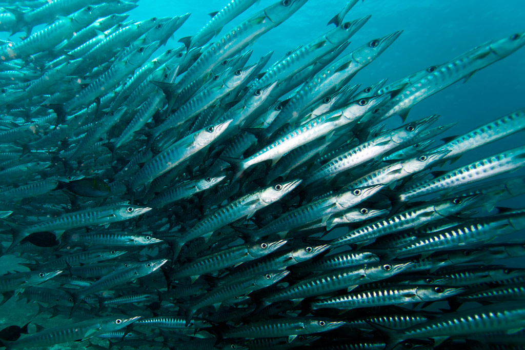
This dive is on the outer edge of the long, straight fringing reef east of Nahnningi (Joy) Island. It’s a good place to see schools of tuna and barracuda hanging out beyond the wall. It’s also one of the few places you might spot sea turtles. This side of the island is very exposed to winds, so summer is the best bet for good conditions. 1-37 meters. Advanced.
“Joy / Nahnningi”
This spot is known by most people as “Joy,” which used to be the name of the island nearby (the local name of the island is Nahnningi). The dive is actually in the small bay-like channel south of Nahnningi on the outer edge of the barrier reef. One informant reported seeing huge mantas here, larger than any at “Manta Road” or “Ros”. Other sights include schools of barracuda and the occasional sea turtle. 1-37 meters. Intermediate.
“Nan Madol” (Kahnimweiso)
This is spot, east of the ruins of Nan Madol (not far beyond Kerian islet), garnered fame when divers apparently discovered a line of pillars on the bottom that they believed were related to the story of Kahnimweiso — a fabled stone city that is said to have pre-dated Nan Madol. The pillars were later proved to be natural coral formations, but the site is still intriguing. Anemones, pipefish, hydroids, and a whole lot of other reef fish can be found in the area. The problem is that the visibility is often terrible and the water can be very rough. 3-21 meters. Best at 18-21 meters. Advanced.
“Pahn Nahkapw”
This dive begins in front of the boulder break-wall off Nahkapw‘s western shore and follows the steep reef wall as it curves around to the east toward Kepidauen Nahkapw. Water clarity at this spot can be absolutely incredible and the reef is alive with fish of many types. Shark sightings are a strong possibility in this incredibly deep blue hole — especially below 18 meters. 2-30 meters. Any tide. Novice.
“Na”
This wall dive is located east of Na on the outer slope of the reef. Staghorn and elkhorn coral, sting rays, sharks, manta rays, and the usual gamut of reef fish are what to look for. The water can be very rough in this area as it’s directly exposed to the northeasterlies, so winter diving is out of the question. 2-29 meters. Advanced.
“Nanwap Corner”
This wall dive in the Nanwap Marine Protected Area is located on the north side of Kepidauen Deleur, on the opposite side of the pass from Nahpali. This is a great place for sharks and rays, but it’s also one of the healthiest spawning sites for reef fish in Pohnpei. However, the pass (and the general area) has a reputation for rough water, and the currents can be intense. Mid-summer diving, when winds are minimal, is the safest. Best on an in-coming tide. Advanced.
There’s also good diving and snorkeling around the blue holes in the inner reef, where you’re more protected from waves and current. The coral is nice here and there are usually plenty of fish around. Best at slack-tide. Intermediate.
- Entering the MPA requires a permit. Visit our MPA page for details.
“Areu North / South” (Kepidauen Alohkapw)
Drift-dives can be done on either the north or south edges of Alohkapw Pass (Kepidauen Alohkapw), beginning along the outer barrier reef walls and moving in to the inner reef. There have been reports of large of schools of reef sharks below 30 meters. Best on an in-coming tide. Advanced.
“Areu Wall”
Located along the wall of one of the inner reefs west of Kepidauen Alohkapw, this site is about the little creatures — invertebrates, small reef fish, sponges, tunicates, anemones, and soft coral. You can also find sea fans (18-24 meters), sea whips, white-tip reef sharks, and barracuda here. 2-34 meters. Currents can be strong at times. Best at 6-18 meters on an in-coming tide. Novice-Intermediate.
“Areu Avenue”
This is another inner lagoon wall-dive similar to “Areu Wall” but in a different location nearer to Kepidauen Alohkapw. Many of the same sights can be found, including sea fans at depth. 2-30 meters. Currents can be strong at times. Best at 6-18 meters on an in-coming tide. Intermediate.
ACKNOWLEDGMENTS
We’d like to extend a big kalahngan to Mike Viti, John Ranahan, and Karino Olpet for sharing their in-depth, first-hand knowledge about SCUBA diving on Pohnpei — without which this page could not have been created. Images licensed from www.shutterstock.com.
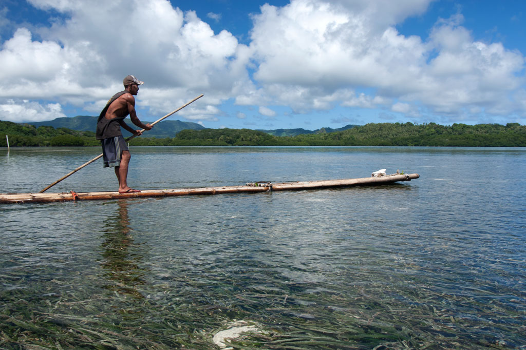
Temwen Vicinity Paddling
![]()
![]()
![]()
![]()
![]()
![]()
![]()
![]()
![]()
![]()
![]()
")
If Nan Madol is your primary destination, the southern route around Temwen is the shortest, following the tranquil passage of Dauen Moahk (a meditative way to begin or end the day). Note, however, that east-bound passage under the two bridges at Temwen Causeway is extremely difficult or impossible when the tide is coming in. The current flowing into the bay can be as powerful as a river.
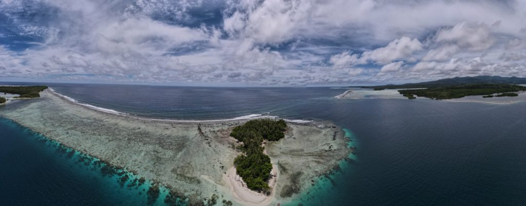
Temwen Island Circumnavigation
For people that want an upper-body workout, the 8.9 km (5.3 mi) paddle around Temwen is an interesting journey with a variety of different sights along the way. Be informed on the tides before starting as the reefs on the northeast and northwest sides are only inches deep at low tide.
Heading north, there are wonderful views of scenic (but murky) Madolenihmw Bay and nearby Takaiuh and Nahnpahlap hills. Peipas Island, a man-made basalt burial structure that is probably related to Nan Madol, is hidden among the mangroves of Temwen’s western coast. ") Further on, stony Salong Point juts north almost to the edge of the channel. Unusual eroded rock formations and a complete lack of mangroves make the place visually unique and worth a look. There’s also a small sea-cave and a portal in the topography that frames conical Takaiuh. Depending on tides and recent rain, the sheltered bay east of the point is sometimes a nice place for a dip, though there isn’t enough coral in the area for snorkeling.
Further on, stony Salong Point juts north almost to the edge of the channel. Unusual eroded rock formations and a complete lack of mangroves make the place visually unique and worth a look. There’s also a small sea-cave and a portal in the topography that frames conical Takaiuh. Depending on tides and recent rain, the sheltered bay east of the point is sometimes a nice place for a dip, though there isn’t enough coral in the area for snorkeling.
The segment between Salong Point and the Japanese Wharf can be a challenging paddle as Kepidauen Deleur is known for its rough water. This is apparently due to two seamounts in the area, called Mwudokendil and Mwudokensepehl. From the Japanese Wharf, it’s another 1.4 km (0.87 mi) to Nan Douwas. Enter the ruins from the north between Temwen and Peniot.
On the southern side of Temwen, you have the choice of several different channels through the mangroves, though all except Dauen Moahk are heavily silted in and impassable at low tide. The two largest islands between Temwen and Pohnpei — Mwudokalap and Mwudoketik — both host prehistoric stone structures related to Nan Madol. The former was the place where Isokelekel first encountered his estranged son, Nahlepenien, who would eventually become the first Nahnken and later the Nahnmwarki of U.
")
Nahnningi & Mall Islands
South of Temwen are Nahnningi (believed to be a man-made island from the Nan Madol era) and Mall islands. The latter has a stone tomb at the northern end. The Namwen Nahnningi Stingray Sanctuary lies northwest of the islands.
- Visit the Islands page for more information about these locations.
Other Islands
Five islands are found northeast of Temwen at the edge of the massive reef shelf called Mad Pahra. Nahpali is littered with Japanese-era historical sites and has a couple of nice sandy beaches. Little Dekehmwahu also has a nice, secluded beach, but to get to it, you’ll have to paddle around Nahpali’s southern side. Na island’s nicest coasts are on the north side. The same is true of Dekehtik. Nahkapw is a little apart from the others with easy access to the best snorkeling in the area.
- Visit the Islands page for more information about these locations.
Pahn Nahkapw & Kahnimweiso
The deep water between Nan Madol and Nahkapw at first appears to be a wide channel leading to the open ocean, but may in fact be something called a “blue hole.” It has been hypothesized that this trench is actually a collapsed portion of the reef shelf. Pohnpei oral histories speak of another stone city, called Kahnimweiso, that pre-dated Nan Madol and was said to lie where Pahn Nakapw is now. One theory proposes that the weight of the basalt constructions coupled with the undermining of the limestone reef shelf by freshwater run-off, could have caused a collapse and sent Kahnimweiso plummeting 65 meters to the bottom. When you see how the sandy shore at Nahkapw’s north end drops straight off into deep blue or experience the odd currents in the area, it’s not hard to believe that the site is special. To date, the theories have not been properly tested and Pahn Nahkapw has retained its secrets and its eerie feel.
")
Nan Madol
If coming from the south, enter the ruins through Dauen Moahk, the first mangrove channel encountered (high tide only). The first stops include Pahn Kadira and Kelepwel islets. From there, you can venture northeast up the canal to Peikapw, Idehd, Dorong, and Peneiring. Further north, notable sites include Kerian, Peikapw Sapwawas, Dau, Pahn Douwas, Pohn Douwas, Nan Douwas, and Konderek. On the return trip south, catch Lemenkau and adjacent Namwenkau (pool) and the huge boulder wall of Pahnwi at the southwest corner. The upper portion of Mweiden Kitti is silted in and nearly closed off by encroaching mangrove trees; it’s impassable even at high tide. All of the entrances on Madol Pah‘s southwest perimeter are now dead-ends, but provide nice sandy spots to picnic.
From the north, it’s easiest to enter Nan Madol at Dauen Nankieilmwahu between Temwen and Peniot islet — especially when surge and choppy seas in Pahn Nahkapw make the narrow gap at Nan Mwoluhsei too risky.
Paddling Distances Around Temwen Island
| Starting | Ending | Distance (km) | Distance (mi) | |
| MERIP | —- | Temwen Causeway | 0.59 km | 0.37 mi |
| Temwen Causeway | —- | Pahn Kadira islet* | 1.7 km | 1.0 mi |
| Dauen Moahk | —- | Pahnwi islet | 0.89 km | 0.55 mi |
| Pahnwi islet | —- | Lemenkau islet* | 0.58 km | 0.36 mi |
| Lemenkau islet | —- | Dorong islet* | 0.62 km | 0.39 mi |
| Lemenkau islet | —- | Peinering islet* | 0.39 km | 0.25 mi |
| Peinering islet | —- | Kerian islet* | 0.42 km | 0.26 mi |
| Peinering islet | —- | Nan Douwas islet* | 0.41 km | 0.25 mi |
| MERIP | —- | Salong Point | 2.2 km | 1.37 mi |
| Salong Point | —- | Japanese Wharf | 1.0 km | 0.64 mi |
| Japanese Wharf | —- | Nan Douwas islet* | 1.4 km | 0.87 mi |
| Japanese Wharf | —- | Nahpali Island | 2.63 km | 1.63 mi |
| Nahpali Island | —- | Dekehmwahu Island | 2.00 km | 1.5 mi |
| Kerian islet | —- | Nahkapw Island | 0.89 km | 0.55 mi |
| Nahkapw Island | —- | Dekehtik Island | 0.52 km | 0.32 mi |
| Dekehtik Island | —- | Northern Na Island | 2.9 km | 1.8 mi |
| Northern Na Island | —- | Dekehmwahu Island | 0.77 km | 0.48 mi |
| Mweiden Kitti | —- | Nahnningi Island | 0.69 km | 0.43 mi |
| Nahnningi Island | —- | Mall Island | 0.42 km | 0.26 mi |
*Silted-in estuary. This segment may be difficult or impossible to traverse at low tide.