Lehnpaipohn Waterfall

Lehnpaipohn Waterfall, Pohnpei, Federated States of Micronesia (FSM)

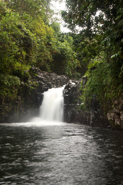
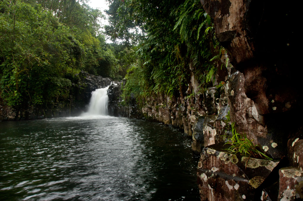
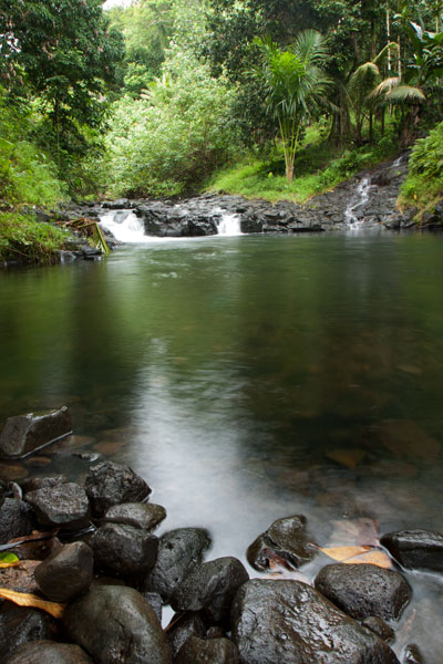
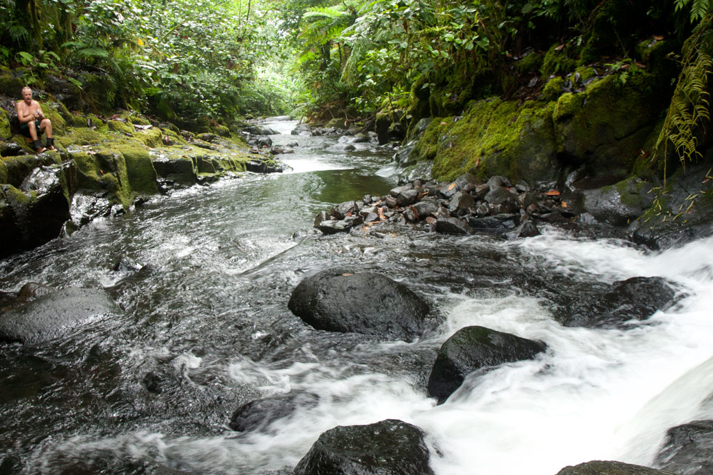
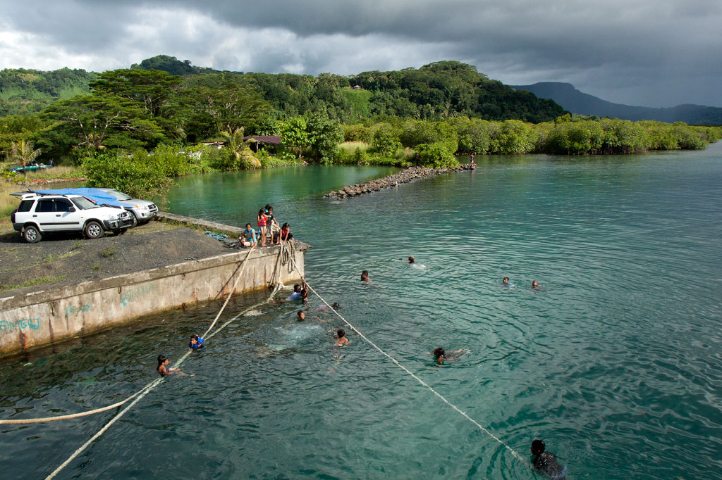
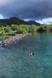
Kitti has a lot of waterfalls, but one of the most fun to visit is Lehnpaipohn between Salapwuk and Pwoaipwoai districts (at least two kousapw claim the falls area). It is neither the tallest waterfall on Pohnpei nor the most picturesque, but what Lehnpaipohn does have is the largest freshwater pool on the island (about 80 by 30 meters) and the highest jumping-off spot. The pool is leaf-shaped, very deep, and surrounded by high cliffs with a sizable island of river cobbles in the center. The water is typically quite chilly, which is a good thing after the hike. The waterfall itself is not much more than 4 meters (13 ft) tall and has a platform of rock behind it that you can stand on. Swimming to it is difficult, however, because of the strong current coming away from the falls. The best tactic is to swim along the edge and use the rocks to pull yourself forward.

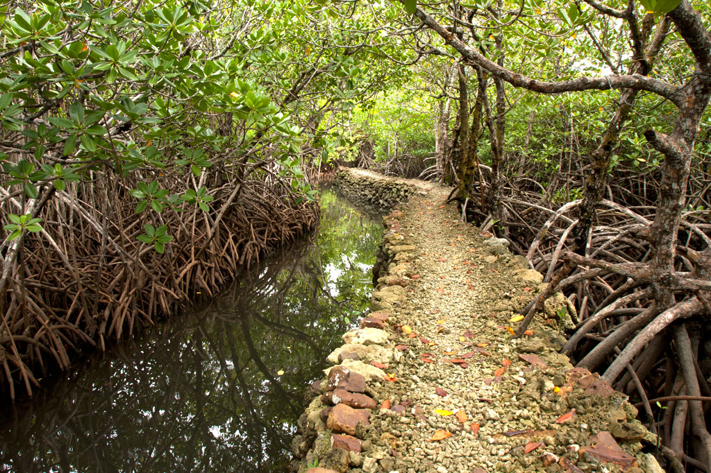
The trail is only 0.53 km (0.33 mi) from the unpaved secondary road, but that road’s conditions are so bad that you’ll want to park your vehicle way down at the end of the paving 0.4 km (0.25 mi) above the Circle Island Road and walk up (5-15% slope with an average of about 7%). Look for the unmarked footpath on the left 2.18 km (1.4 mi) beyond the paving and 117 meters (128 yd) past the last visible residence on the right. The path is well-defined, relatively easy to follow, and downhill almost the whole way to the river (12% slope average). It stays under the trees and is rocky except at one point, where there’s a swampy section to cross or navigate around. About 216 meters (236 yd) along, the path branches; stay to the left. Another 200 m (219 yd) brings hikers to a small stream crossing. From this point, there’s only another 89 m (97 yd) to go. The final descent to the pool is exposed and a bit sketchy (especially when descending); make sure you have good footwear (FiveFingers are best, but good tennis shoes will work, too) and take special care on wet days.

No fees are charged and the trail is on public land. You can do this hike without a guide.

Camping

You can camp under the trees at the top of the eastern cliff — also the spot from which swimmers leap. Pack out everything you brought in and leave the site as you found it.

  • Plan for 3-4 hours for this hike including some quality time to swim and relax.

Map Guides >> Southern Kitti >> Lehnpaipohn Waterfall

Rohi Waterfall

Gel ginger in Rohi, Pohnpei, Federated States of Micronesia (FSM)

Hiking / TrekkingWaterfallSwimmingPicnicking

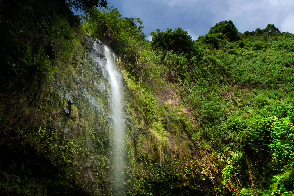
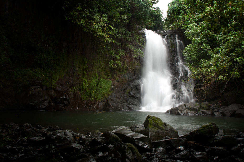
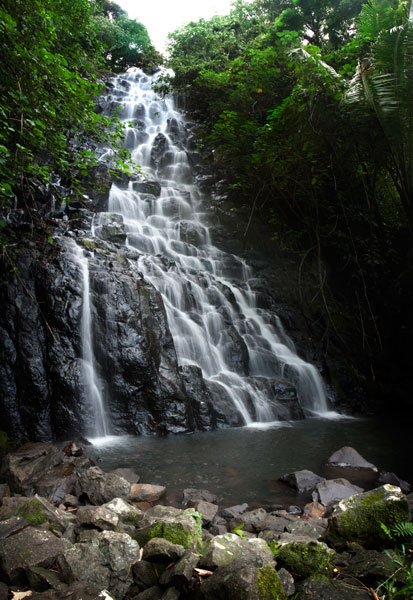
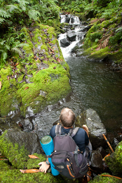
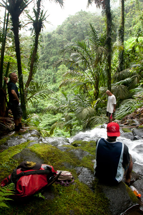
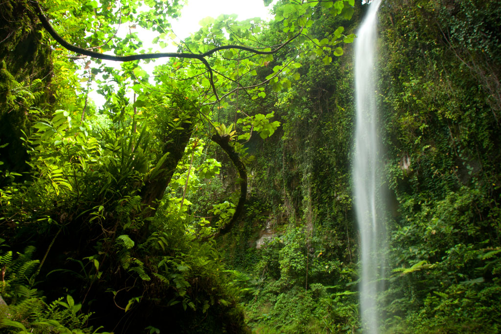
Rohi, the first district in Kitti after passing over the border from Madolenihmw, is host to an obscure, but beautiful, waterfall that few people — other than those who live practically at its feet and some Peace Corps volunteers stationed in the neighborhood — seem to know about. The high, sometimes wispy, falls plummets over a sheer wall hung with ferns and other climbing plants and is reminiscent of Sahwartik in Salapwuk, but with a much smaller and shallower pool and less volume overall. It’s unclear whether it has an official name; local residents mostly call it the “Rohi Waterfall” after the district within which it lies or “Nan Rohi Waterfall” after the name of the river.

Hardwood forest in Rohi, Pohnpei, Federated States of Micronesia (FSM)

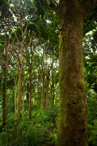
To reach it, it’s best to park near the turn-off from the Circle Island Road, walk up the steep gravel secondary road, and continue to the houses at the end (bear left at the one major branch). Along the way is a stunning stand of huge hardwoods that are well-worth a good look. Once you reach the houses, you’ll want to ask permission to proceed, as the footpath crosses through several families’ front yards. The residents in the area, however, are welcoming and will likely be happy to show you to the falls or at the very least point you in the right direction. Once the path reaches the watercourse, the waterfall is evident just a bit upstream and one has merely to scramble along the rocky bank to the pool. The water is very clean and cool, and the spot is excellent for a short swim.

No fees are charged for this hike.

  • Plan for 1 hour round-trip with some swimming time at the falls.

Map Guides >> Southern Madolenihmw >> Rohi Waterfall

Mand Area Attractions

BikingHiking / TrekkingWaterfallSwimmingPicnicking

Mand is a little community of Pingelapese people who were given a parcel of land by the Nahnmwarki of Madolenihmw in Pohnpei’s modern past. You can’t call it a town, but it feels more connected than many of the island’s Pohnpeian communities. In addition to the Pingelapese who live in Mand Proper, there’s a small village to the north inhabited by Kapingamarangi islanders, who settled in the area very recently (Kapingamarangi is a distant atoll that is culturally and linguistically Polynesian but politically a part of Pohnpei State). The center of Mand consists of the elementary school and church. Next to the church is a monument which lists the names of the first settlers from Pingelap Atoll — the founding members of the community.

Kokomaru Waterfall

Most local people outside of Mand have never heard of Kokomaru, which is strange, because it is a gorgeous spot and worth visiting. The route to the waterfall, which lies just downstream from the Mand community, begins at the end of an unpaved road next to the Latter-Day Saints (LDS) Church, passes through a plot of private land, and then cuts through the forest to the river. The trail tends to be overgrown, as the falls is rarely visited except by an odd kid or two from the community. Once at the riverbed, you can get a good look at the waterfall, which is similar visually to Liduduhniap. Some of the kids in the area will tell you that the rock behind the falls looks like a heart from certain angles (we didn’t see it). The cliff on the south side of the waterfall pool is the nesting site for a huge colony of Caroline Islands swiftlets which seem to fill the air when they leave their nests.

Despite Kokomaru’s charms, you can’t swim here — riverside pig pens in Mand have severely contaminated the stream. Testing in April 2013 indicated that the water below Piladad had five times more E. coli than is considered safe for swimming. Don’t be fooled by the clarity of the stream; this is sadly in the top ten most polluted watercourses on Pohnpei Island. Even the Mand kids don’t swim there.
  • Plan for 45 minutes round-trip for this excursion.

Piladad Pool

Piladad pool in Mand, Pohnpei, Federated States of Micronesia (FSM)

There is only one place you can safely swim in the Mand area and that’s at a sweet little pond known as Piladad, which lies up-stream from the last inhabited house and pigpen. The pool, which was once a gauging station for the watershed (the gauge apparatus is still there), is large and pristine with enough depth in the middle for the fun rope swing that dangles from an overhanging tree. There are also two small waterfalls. Piladad is a great place to go on hot days; the spot is close to the feet of the mountains and the water tends to be quite chilly. This also means there’s some potential for flash floods, so it would be wise to avoid the spot when rain clouds lie over the mountains. A narrow, but well-used, 0.4 km footpath to the pool begins on the south bank of the river next to Mand Elementary School. At the one branch in the path, bear toward the river.

Almost any kid you see in the area can guide you to either location. Offer $10 for a group of five or less.

  • The hike takes about 10 minutes each way.

Nanpohnmweli (“Kerenis”) Waterfall

Nanpohnmweli Waterfall, Pohnpei, Federated States of Micronesia (FSM)

This very tall waterfall on the Sapwehrek stream can be reached by following the unpaved road 1.24 km (0.77 mi) north and east from Mand through a tidy Kapingamarangi settlement to the next stream over. The problem with visiting the falls from this access point, however, is that you end up at the top, where you can’t really see much. The rocks are treacherously slippery and there’s a long — certainly fatal — fall for anyone who makes a mistake. A local girl was killed when she fell from this spot a few years back. The nickname of the waterfall is derived from the Kapingamarangi pronunciation of the English word “Greenwich”, which is what sailors called Kapingamarangi Atoll during the whaling period. To visit this waterfall from the bottom, visit the Nanpohnmweli Waterfall page.

  • This walk takes 15-20 minutes each way.

Map Guides >> Southern Madolenihmw >> Mand Area Attractions

Nankepinmerepw River Valley

Hiking / TrekkingWaterfallBird-WatchingCamping

Hikers in the Nankepinmerepw Valley, Pohnpei, Federated States of Micronesia (FSM)
This route passes through the gorgeous valley of Nankepinmerepw, following the upper tributaries of the Nan Riohk Stream (Pilen Nan Riohk) and eventually arriving north of Nahnalaud on an arm of the major mountain system. One guide stated that the valley’s name refers to the mworopw tree (Inocarpus fagifer), also known as the Polynesian chestnut — though the spelling is clearly different. Nankepin means “in the bottom of”; the mworopw leaf has a deep trough in the middle where the primary vein bisects the blade, mirroring the way the stream bisects the deep, narrow valley.

The hike begins at a rutted turn-off from the well-graded (but unpaved) road to Pahn Sile Waterfall, leads to a metal footbridge over the Senipehn River (Pillapen Senipehn) — the only bridge like it on the island — and connects with a path on the far side. From there, the trail meanders northwest not far from the Nan Riohk and more or less parallel to it.

The first kilometer or so cuts through cultivated lands. Then it begins to follow the water more closely as it passes into the wilder riverine forests. There are at least nine major stream crossings in this next segment, some of which may be difficult or impossible if there has been a lot of recent rain. Above the last major Nan Riohk tributary, where the name of the stream changes to Nankepinmerepw, hikers take to the stream bed itself, which is certainly the most challenging aspect of the route (13% slope average). The algae-slimed rocks are slick and dangerous and hikers may find that they have to go very slow and use both hands to avoid disastrous slips; it would be easy to snap an ankle or shatter a kneecap in this place. Despite the rough terrain, the scenery in the hidden valley, often fenced on both sides by high rocky walls, is terrific. At times, the trail passes along the tops of vertical prismatic basalt columns.

Above Nankepinmerepw Waterfall, Pohnpei, Federated States of Micronesia (FSM)
The first few points of interest are beautiful pools that will tempt any overheated hiker — and why resist? A bit further is a small waterfall near an outcropping of prismatic basalt. Informants in the area say that this location was one of many where prismatic basalt columns were quarried for use in the building of Nan Madol. Abandoned prisms can be found lying in the stream bed in several places — the largest just below the falls. How exactly the massive prisms were hauled down to the coast over such distances and through such rough terrain is anyone’s guess.

After a short, steep section (22% slope average), the valley terminates at a huge “horsetail” waterfall that the route crosses above (you can scramble down the eastern slope without too much difficulty for a better view from the side). The shallow pools above the falls are an excellent place for a look at Pohnpei’s native crayfish. This is the turn-around point for day-hikers.

Past the big waterfall, the stream narrows until it reaches a third waterfall — this one short and wide, falling over a straight lip (usually called a “block falls” or “sheet falls”) — and then diminishes to a trickle. Those who wish to go further, will climb to the west (29% slope average) and then south again to follow the ridgeline (18% slope average) toward Nahnalaud.

Map Guides >> (Central) Madolenihmw >> Nankepinmerepw

Pahnsapw & Nankep Waterfalls

BikingHiking / TrekkingWaterfallSwimmingPicnicking

Lower Pahnsapw Falls, Pohnauleng, Pohnpei, Federated States of Micronesia (FSM)

Pahnsapw, which means “beneath the land,” refers to a pair of tall, majestic waterfalls which plummet off the edge of a high plateau in central Madolenihmw (it’s also the name of the farmstead). Both waterfalls are found on the land of the Silbanuz family (relatives of the people at the Nan Madol trailhead) — the smaller falls is lower down and hidden from view until you get up-stream, but the upper falls can be seen from the Circle Island Road.

The hike starts at the end of an unpaved road and criss-crosses the stream or runs along the bank up to the first falls, which is about 4 to 6 meters (13-20 ft) high and has a beautiful shallow pool at the base, excellent for a quick, cool swim. Unless you’re in good physical condition and don’t mind getting dirty, this is where you should stop.

Upper Pahnsapw Falls, Pohnauleng, Pohnpei, Federated States of Micronesia (FSM)

To reach the second falls, the route climbs straight up an extremely steep (and sometimes muddy) slope to the right of the lower waterfall with little to hold on to, turns horizontally across the slope face, and then returns to the river, where there’s a secluded pool in a shady nook. It might be a good idea to bring a length of rope and have the guide secure it to something at the top of the slope prior to scrambling up. Five minutes up-stream is the second waterfall, which is about 18 meters (60 ft) tall and falls into a large, deep pool. The water at both waterfalls is cool and very clean.

The Silbanuz family charges an access fee of $2.00 per person. Any of the teenagers around the house can be hired as guides. Offer $12.00.

  • Plan for 2 hours round-trip with some leisure time at both of the waterfall pools.

Nankep Waterfall

The next waterfall going south is known as Nankep. People living in the area say the name means “inlet” or “in the cup” (depending on who you talk to). The latter seems logical, except that the Pohnpeian word kep is a loaner from English and wouldn’t date back beyond the early 1800s. The site may have had a different name prior to that time or it has picked up new meaning over the years. The road to this trailhead is steeper and more rutted than the one to Pahnsapw, so it’s best to park at the bottom near the Circle Island Road and walk to the end, where the trail begins on Waltis Herdinand’s land — an area referred to as Elilpei. The hike is short and relatively easy, concluding in a hidden nook with a small plunge pool. The best time to visit Nankep is after a period of heavy rain as it can be nothing more than a tiny ribbon of water at other times. Some people believe that the falls will be dry if all the members of the visiting group are male, so mix it up.

No official access fee is charged.

  • Plan for 90 minutes round-trip with time to swim at the falls.
  • To hire a guide, ask at the houses in the area, contact Hanke Albert at +691.320.4047, or call the owner of the land around the falls, Waltis Herdinand, at +691.320.2909. Offer $12.00.

Map Guides >> Central Madolenihmw >> Pahnsapw & Nankep Waterfalls

Marine Parks

CampingSwimmingSnorkelingKayaking / CanoeingPicnicking

Awak Pah Marine Park

A swimmer leaps from the wall at Awak Pah Marine Park, Pohnpei, Federated States of Micronesia (FSM)
Awak Pah Marine Park is the most well-known of the parks in the area and has a nice big sign right out on the main road. From the parking area near the owner’s house, a 0.2 km (0.12 mi) coral and concrete walkway leads to the water through a dense section of mangrove forests. At the end, there’s a tiny picnic area by the water, a large nahs, and a few other huts that can be rented at an extra cost. The water is shallow and a bit silty on the south side and deep on the west and northwest side where a huge pair of PVC rings have been anchored (a good place to swim). The rock wall by the water is a fun place to jump from, but it can be difficult to climb back out. Snorkeling can be pretty good to the west along the reef wall with lots of small fish and some interesting coral growth. Unfortunately, local visitors have been careless with their garbage and the beautiful reef scenery is frequently ruined by the presence of discarded aluminum soda cans or flashlight batteries — a sad trend on Pohnpei. Water clarity varies from crystal clear to murky depending on the tides; it’s best to visit on an in-coming tide. You can visit Awak Marine Park without making arrangements beforehand.

Shallows at Paieke, Pohnpei, Federated States of Micronesia (FSM)

Paieke Marine Park

Owned by Bryan Damarlane, this pleasant, breezy swim-picnic-camp park is located on a network of dredged coral causeways that extend out into the lagoon at the point where the road begins to turn east toward the Awak valley. A number of thatched residential huts varying in size and a nahs (meeting hut) or two are positioned around the water’s edge for guests at an extra cost. The swimming is good all along the west side, though the shallows tend to be silty rather than sandy. Snorkelers should follow the edge of the reef further out into the lagoon for best results. The kids will love tinkering around in the shallows under the shady trees. Paieke operates on a reservation-only basis.

  • To make reservations for day visits or overnight stays, call Bryan Damarlane at +691.925.0382.

Pein Ahi Marine Park

This charming, but little-known, park (pictured at top) is found just after Awak Marine Park, but as it lacks a sign, most people drive right by without realizing it’s there. From the road, a beautiful 0.16 km (0.1 mi) stone and coral walkway winds through the picturesque mangrove forests and ends at a grassy picnic area with a nahs and a large fish pond. The family keeps some very curious pufferfish and a few other reef fish in the pond, mostly for the amusement of visiting local children. The swimming all around the outside of the pond walls is excellent with consistently good water clarity. There’s a relatively shallow area on the south side that works well for kids or beginning swimmers and deeper water on the west and north. They also have a pair of large bamboo-pontoon rafts that are fun to cruise around the mangrove fringe on. Except on big holidays, you can usually visit without making any prior arrangements.

Nihco Marine Park

Rainbow over the beach at Nihco Marine Park, Pohnpei, Federated States of Micronesia (FSM)
Nihco Marine Park, on the southwest coast of scenic Sokehs Bay is an appealing place for people of all ages to swim, barbecue, and soak up the sun. The park is comprised of a narrow, man-made semi-circle of sand with a placid lagoon in the middle where turtles and reef fish are kept. There’s a white-sand beach on the outer edge and simple thatched huts for either day or overnight visits. Small kayaks can be rented for a few dollars. The place can be packed on weekends and holidays.

  • To make reservations for day visits or overnight stays, call +691.320.2135 / 2659

Nihco Surf

Nihco Bungalows, Sokehs, Pohnpei, Federated States of Micronesia (FSM)

Nihco Surf is one of two thriving operations that cater to foreign surfers and tap into the radical power of the now world-famous reef-break at Palikir Pass. The locally owned and managed camp, situated inside Nihco Marine Park, offers six air-conditioned wifi-equipped bungalows that look out over Sokehs Bay; an on-site restaurant; kayak-rental; boat tours; And Atoll trips; and daily excursions to P-Pass, Lighthouse Break, and Mwahnd Pass.

Map Guides >> Greater Nett & Western U >> Marine Parks

Nett Point

BikingSwimmingSnorkelingKayaking / CanoeingPicnickingBeaches

Nearly all of Pohnpei’s coastline is surrounded by mangroves, and though these otherworldly swamp forests are incredible to explore by kayak, canoe, or paddleboard, they tend not to make good swimming spots. As a result, Nett Point — a long man-made strip of dredged coral and concrete at the north end of the Nett Peninsula — is currently the closest thing Pohnpei Island has to a beach. During the American Period, the place used to be the primary commercial dock. Supply ships would anchor at the end and a barge would carry cargo into Kolonia Harbor (the barge now rusts on the edge of the mangroves just south of Nett Point). The problem, however, was that lots of shallow reefs made Kolonia Harbor and the areas in the lagoon to the north risky for ships to navigate through. Sokehs Passage (Peinmen), to the west, was deeper and better protected. Once the modern commercial harbor and dock were established on the west coast of Dekehtik Island and big ships started using Peinmen (now called “Main Pass”) instead of Kepidauen Pweitik, Nett Point was abandoned. Over the years, the buildings and dock have been used for a variety of purposes, including storing outrigger canoes for the Nett paddling team and, most recently, as part of a clam hatchery operation. However, the point has simultaneously been a popular swimming and picnicking location for decades. The dock area has nice deep water for serious swimming and jumping and the sandy man-made beaches are perfect for kids. Some of the large trees overhanging the water have ropes attached that local kids like to swing around on. If you start near the dock and swim out along the edges of the nearby reefs, you can find some decent snorkeling. Many people barbecue on the east edge of the causeway or on the dock. Overall, Nett Point is a great place to swim, relax, and get to know some locals on a sunny day. Shade is scarce, so bring a hat. Depending on tides and recent rains (best during mid to late in-coming tide), the water is usually clean and clear with a visibility of more than ten meters.

In 2011, the Office of Tourism and the Nett Municipal Government attempted to improve the spot by cleaning it up, dumping large quantities of white sand along the western edge of the causeway, and planting trees. Further developments were announced — sand volleyball courts, public restrooms, and more were said to be in the works and it was announced that the municipality would be charging a small entry fee. After several accidents involving local boats and swimmers, a new channel was dredged not far away and all traffic was encouraged to completely by-pass the areas where people swim. When boats continued to zip through the channel without regard to people in the water, a buoy line was finally placed at the north entrance to the channel and the south end was partially blocked by a causeway. Though these changes solved the boat problem, they created another — inhibiting the natural flow of the tide through the area and reducing the water quality significantly. A small set of outhouse-style restrooms were eventually slapped together near the main road, but these were quickly destroyed by local kids. No fee was ever charged, and it’s unclear how the money would have been collected anyway. Things are very much still in flux. What Nett Point will look like in the future is anyone’s guess.

  • It’s easy to spend a 4-6 hours at Nett Point, when the conditions are good.

Map Guides >> Nett & Western U >> Nett Point

The Doldrums at APSCO Quarry

SwimmingSnorkelingSCUBA divingKayaking / CanoeingPicnicking

“The Doldrums”

Doldrums at APSCO Quarry, Pohnpei, Federated States of Micronesia (FSM)

The hottest days call for the coolest swimming holes, and there’s no better place than the “Doldrums” at APSCO Gravel Quarry, owned by the Akinaga family. The quarry property encompasses all of the land around Dolehtik, a small hill at the northern end of Sokehs Island. Across the street is a high cliff where prismatic basalt columns are stripped off the mountain with heavy equipment and later crushed into various grades of gravel. This same site may also have been one of the quarry locations for the stones of Nan Madol.

A large concrete dock 0.46 km (0.29 mi) northwest of the quarry entrance provides access to a beautiful swath of the lagoon. With no residences or pig pens inside this rather large area, the surrounding water is pristine with a visibility of more than 25 meters (80 ft). The spot got its nickname from a giant barge that, until the summer of 2013, was moored just off-shore and functioned as a jungle gym of sorts for local kids and foreigners alike. The barge is no longer there, but the main attraction is still the water itself, which is deep and gets deeper quick. The “Doldrums” is a great picnic destination and an idyllic place to stop in the middle of a paddling excursion around the island. Please keep this location beautiful by taking all of your trash with you when you leave for the day.

APSCO Quarry, Pohnpei, Federated States of Micronesia (FSM)

The main gate to the quarry is usually open, but visitors must report to the on-site office and ask the security guard to unlock the second gate, leading to the water. The facility is locked down for the night at 6:00 PM every evening. Make sure you’re out in time.

Snorkeling

Though coral development in the area is scarce, there are quite a few reef fish around. If you swim along the coast to the south, you might find some colorful starfish and an urchin or two.

Paddling

Kayaks can be easily launched on either side of the dock where the ground slopes gradually to the water.

Map Guides >> Sokehs Island >> The Doldrums at APSCO

Scroll to top