
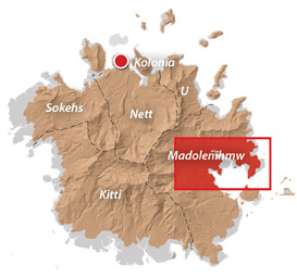
(Central) Madolenihmw GPS Data
Downloadable GPS Data Files
The following files contain all the packaged GPS data for each of the featured locations in the (Central) Madolenihmw Eco-Adventure Map Guide.
Three file types are provided. KMZ and KML files are compatible with Google Earth. KML is compatible with Google Maps. GPX files can be imported into ArcGIS (a professional mapping application) and some hand-held GPS devices.
[info]NOTE: All files are free to the public and can be used for any purpose without permission.[/info]
Dolen Merewi Hike (2015)
Madolenihmw Bay Area Attractions (2015)
Nankep Waterfall Hike (2015)
Pahnsapw Waterfalls Hike (2015)
Pahn Sile Waterfall Hike (2015)
Pohnpaip Petroglyphs (2015)
Coordinates
The following coordinates correspond with sites featured on the (Central) Madolenihmw Eco-Adventure Map Guide. It is our dream to eventually create a Pohnpei GPS app that could be uploaded to smartphones and other devices, but for now, these points of interest can be entered manually in a hand-held GPS device as needed.
[info]NOTE: All GPS devices have a margin of error. That margin increases with interference — when there is a thick canopy of trees, during bad weather, or when mountains obstruct the satellite link. The geosynchronous satellites employed when navigating on Pohnpei are located low on the southwestern horizon, such that maintaining a strong connection while hiking on the northeast side of a given mountain range can be difficult. Coordinates on the northeastern slopes of mountains are less accurate than in other locations.[/info]
Dolen Merewi
| Dolen Merewi Turn-Off | —- | 6.882208° 158.290005° |
| Road Branching – bear left | —- | 6.881983° 158.278225° |
| Dolen Merewi Trailhead | —- | 6.880292° 158.274669° |
| Private Residence | —- | 6.880442° 158.274156° |
| Look-Out Point | —- | 6.883006° 158.270929° |
| Dolen Merewi True Summit | —- | 6.882815° 158.270869° |
Madolenihmw Bay Area
| Lukop, Metipw & Kepine Turn-Off | —- | 6.898141° 158.315994° |
| Road Branching – bear left for Lukop and Metipw; bear right for Kepine and Takaiuh | —- | 6.889728° 158.314120° |
| Bridge | —- | 6.884719° 158.313625° |
| Japanese Agricultural Plots | —- | 6.886711° 158.311515° |
| Nanpahlap Trailhead | —- | 6.876366° 158.318225° |
| Nanpahlap Summit | —- | 6.875491° 158.315744° |
| Tahio Trailhead | —- | 6.874010° 158.317018° |
| Japanese Dug-Out | —- | 6.873007° 158.316122° |
| Japanese Trench | —- | 6.872754° 158.315133° |
| Japanese Tunnel | —- | 6.873264° 158.314119° |
| Abandoned Community Hut (nahs) | —- | 6.872849° 158.314316° |
| Takaiuh Summit | —- | 6.872128° 158.310713° |
| Rocky Hill | —- | 6.874429° 158.308532° |
| Dauen Sapwalap Entrance | —- | 6.876938° 158.308196° |
| Japanese Rice Paddies Turn-Off | —- | 6.888314° 158.296764° |
| Japanese Rice Paddies & Irrigation Canals | —- | 6.887325° 158.303652° |
| Metipw Causeway / Launch | —- | 6.878051° 158.333074° |
| Mwudokolos Island | —- | 6.883576° 158.336525° |
| Dahu Reirei Island | —- | 6.888759° 158.344288° |
| “Channel Island” | —- | 6.899494° 158.342153° |
| Nanwap Marine Protected Area | —- | 6.872988° 158.353673° |
| Nahpali Island Dock | —- | 6.861877° 158.354457° |
| Salong Point, Temwen Island | —- | 6.856468° 158.322737° |
| MERIP Boathouse | —- | 6.844010° 158.308539° |
| Madolenihmw Ice Dock | —- | 6.849520° 158.302712° |
| Madolenihmw Bay Scenic Point | —- | 6.855273° 158.295686° |
Nankep Waterfall
| Nankep Waterfall Turn-Off | —- | 6.858738° 158.291440° |
| Bridge | —- | 6.858789° 158.291453° |
| Nankep Waterfall Trailhead | —- | 6.859867° 158.286390° |
| Nankep Waterfall | —- | 6.859335° 158.283177° |
Nankepinmerepw Valley
| Nankepinmerepw Turn-Off | —- | 6.873704° 158.286552° |
| Nankepinmerepw Trailhead | —- | 6.875185° 158.273305° |
| Senipehn Footbridge | —- | 6.876110° 158.271732° |
| Private Residence | —- | 6.877294° 158.263737° |
| Small Falls & Swimming Pool | —- | 6.877911° 158.242150° |
| Prismatic Basalt Quarry Site / Falls | —- | 6.878689° 158.240613° |
| Nankepinmerepw Waterfall | —- | 6.880498° 158.239370° |
| Block Waterfall | —- | 6.882766° 158.238850° |
| Trail Branching – bear right for Nahnalaud; bear left for “The Cave.” | —- | 6.888859° 158.288880° |
| “The Cave” | —- | 6.866427° 158.230917° |
| USGS Benchmark | —- | 6.874333° 158.230076° |
| Nahnalaud Look-Out Point #2 | —- | 6.874333° 158.230076° |
| Nahnalaud Look-Out Point #1 / Observed Summit | —- | 6.873876° 158.228524° |
| Nahnalaud True Summit | —- | 6.873323° 158.228724° |
| Nahnalaud Mountain Shelter | —- | 6.874001° 158.227374° |
Pahnsapw Waterfalls
| Pahnsapw Waterfall Turn-Off | —- | 6.871427° 158.285654° |
| Sakau Market | —- | 6.871839° 158.285500° |
| Sakau Market | —- | 6.871234° 158.285637° |
| Road Branching – bear right | —- | 6.870202° 158.282381° |
| Bridge | —- | 6.870052° 158.280071° |
| Road Branching – bear right | —- | 6.870060° 158.280108° |
| Road Branching – bear left | —- | 6.869425° 158.278666° |
| Pahnsapw Trailhead | —- | 6.868207° 158.278527° |
| Silbanuz Residence | —- | 6.867969° 158.278513° |
| Pahnsapw Lower Falls | —- | 6.865171° 158.277289° |
| Hidden Pool | —- | 6.865183° 158.277071° |
| Pahnsapw Upper Falls | —- | 6.864683° 158.277100° |
Pahn Sile Waterfall
| Pahn Sile Waterfall Turn-Off | —- | 6.873704° 158.286552° |
| Taxi Stop | —- | 6.873691° 158.286771° |
| Bridge | —- | 6.873629° 158.286431° |
| Road Branching – bear left | —- | 6.875588° 158.281340° |
| Road Branching – bear left | —- | 6.875802° 158.276411° |
| Road Branching – bear left | —- | 6.875179° 158.273294° |
| Pahn Sile Trailhead | —- | 6.873597° 158.269375° |
| Trail Branching – bear right | —- | 6.873598° 158.269382° |
| Trail Branching – bear left | —- | 6.873662° 158.269032° |
| Japanese Irrigation Canal | —- | 6.871403° 158.266674° |
| Japanese Irrigation Canal | —- | 6.870612° 158.265405° |
| Stream Crossing | —- | 6.866702° 158.264493° |
| Trail Branching – Bear right for waterfall & pool; left to see the falls from above | —- | 6.866048° 158.264342° |
| Senipehn River Crossing | —- | 6.865499° 158.263650° |
| Pahn Sile Waterfall Pool | —- | 6.864499° 158.263151° |
| Pahn Sile Waterfall | —- | 6.864467° 158.263028° |
| Break north From trail to see the falls from above | —- | 6.864209° 158.262860° |
Pohnpaip Petroglyphs
| Pohnpaip Petroglyphs Turn-Off | —- | 6.886941° 158.291017° |
| Bridge | —- | 6.886789° 158.290910° |
| Pohnpaip Trailhead | —- | 6.888161° 158.289097° |
| Herson Residence | —- | 6.887435° 158.288495° |
| Pohnpaip Outcropping | —- | 6.887621° 158.288259° |
| Magical Door of Pohnpaip | —- | 6.887551° 158.288181° |
| Takain Pahsu | —- | 6.888396° 158.288694° |
| “Hindquarters Rock” | —- | 6.888665° 158.288933° |
| “Enveloped Cross Rock” | —- | 6.888859° 158.288880° |
Dolen Merewi
![]()
![]()
![]()
![]()
![]()
")
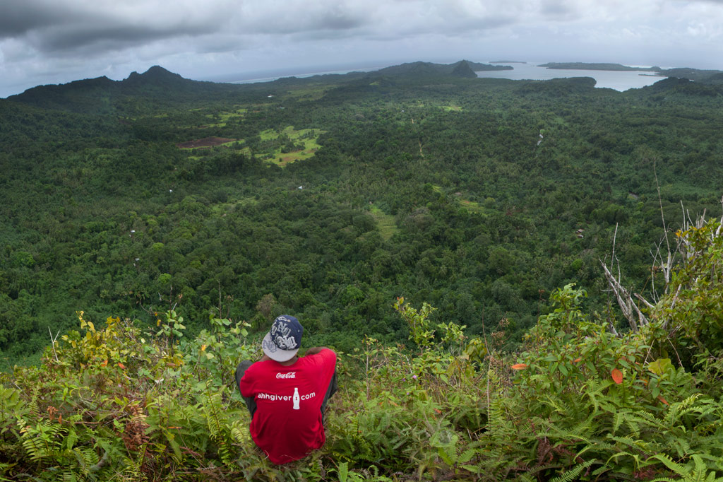
Dolen Merewi is a flat-topped hill that stands apart from the interior mountains to the west and is highly conspicuous when driving through northeastern Madolenihmw. During the Spanish Period (1886-1898), the hill played a pivotal role in an armed conflict centered around Ohwa. During the fighting, Nahnmwarki Pol, the Protestant leader of Madolenihmw, took refuge on the summit of Dolen Merewi where it was said he prayed in earnest for the Catholics to be defeated. Though the Spanish claimed a victory in the end, they lost a great many men and the better part of their dignity. They never got what they wanted and spent the rest of their administration barricaded inside their dreary colony, Santiago de la Ascencion, at what is now modern-day Kolonia.
An unpaved but well-graded road runs inland right to the base of Dolen Merewi, and almost anyone living in the area can assist visitors in finding a suitable guide on the spot. The ascent takes less than an hour and climbs steeply through upland sakau (Piper methysticum) plantations, karara (Myristica hypargyraea), sadak (Elaeocarpus carolinensis), and other large native hardwoods. At the top of the hill, the forest thins and the trail passes hastily-constructed Japanese foxholes, trenches, and rifle pits. The summit (240 m / 787 ft) is at the north end and has unobstructed views of Kupwuriso to the northwest, Timwen Men to the north, and the glistening bay in the east. Huge flying foxes roost in nearby trees and can be seen soaring low overhead. Birders will find Crimson-Crowned Fruit Doves and Micronesian Ground Doves in plenty. The summit is a nice camp site.
- See the Birding page for more info about bird-watching on Pohnpei.
No access fee is charged.
- Plan for 3 hours round-trip with a nice rest at the summit.
- To hire a guide, ask at the houses in the area or contact Hanke Albert at +691.320.4047. Offer $12.00-15.00.