
Nan Kiepw & Na Malek
Nan Kiepw
![]()
![]()
![]()
![]()
![]()
Nan Kiepw
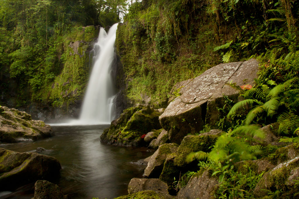
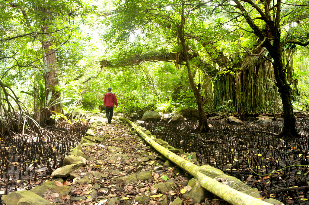
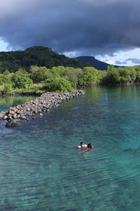
Nan Kiepw, which means “in the lilies,” is a hillside overshadowed by Dolmweir peak. A Pohnpeian myth tells of a Yapese magician, named Sou Iap, who voyaged to Pohnpei and was responsible for the creation of Sokehs Rock). One of Sou Iap‘s companions, Souliken And, noticed a girl collecting clams on a reef north of Sokehs Island, and thinking her very attractive, chased her deep into Nett, carrying an ihd leaf with him. On the hillside below Dolmweir peak, Souliken And lost his leaf and named the place after a species of white lily he saw there.
During the Sokehs Rebellion in 1910, Pohnpeian rebels fleeing from German and Melanesian troops briefly took refuge at Nan Kiepw, rebuilding some earthen fortifications from the Spanish Period and repelling a small attack.
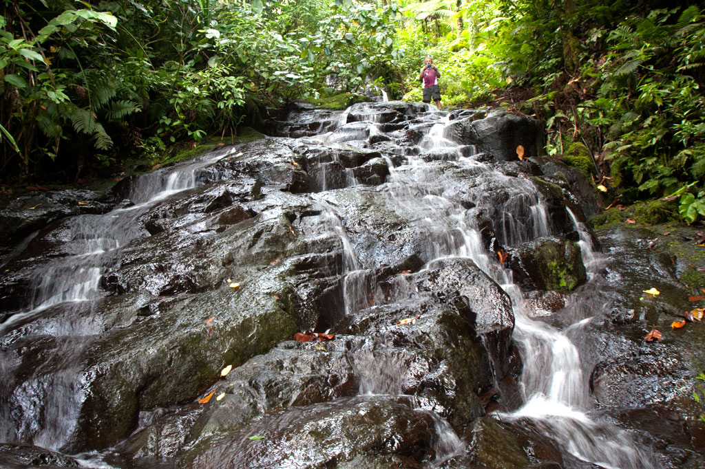
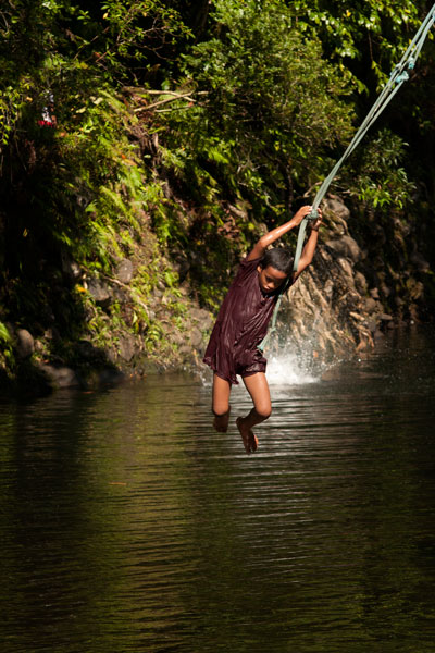
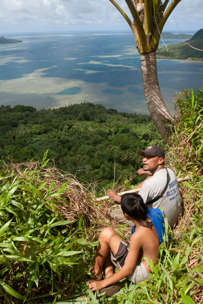
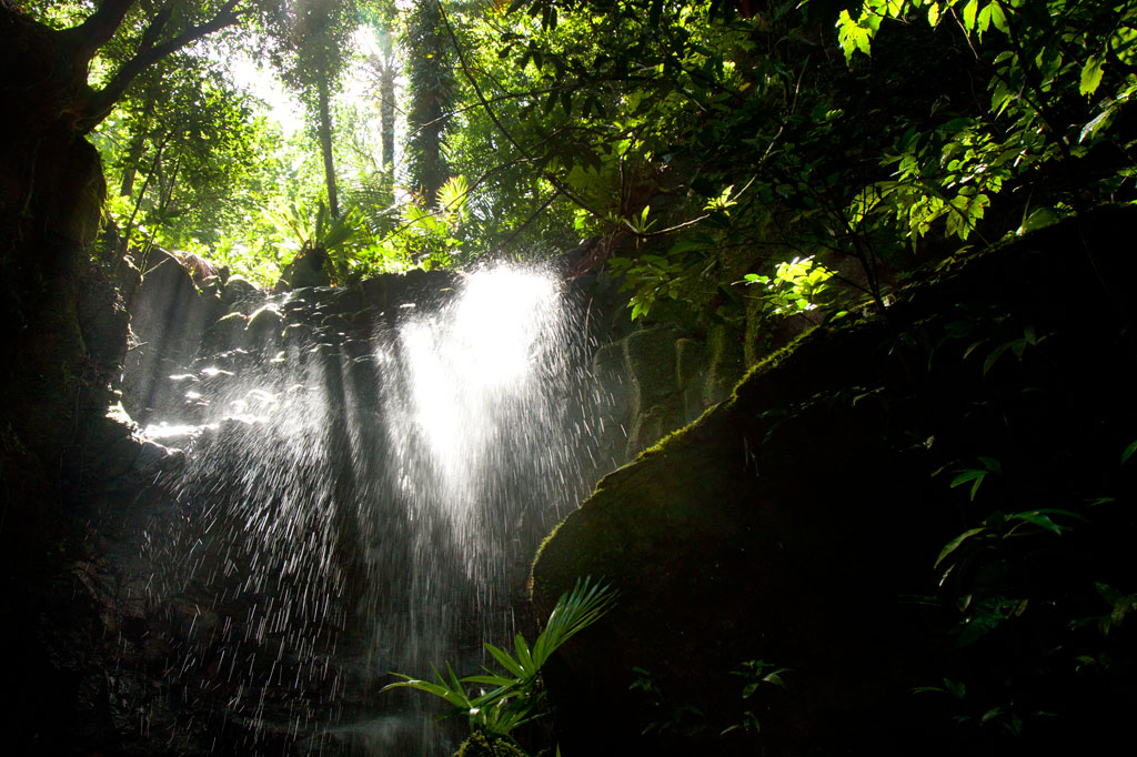
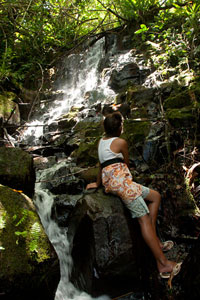
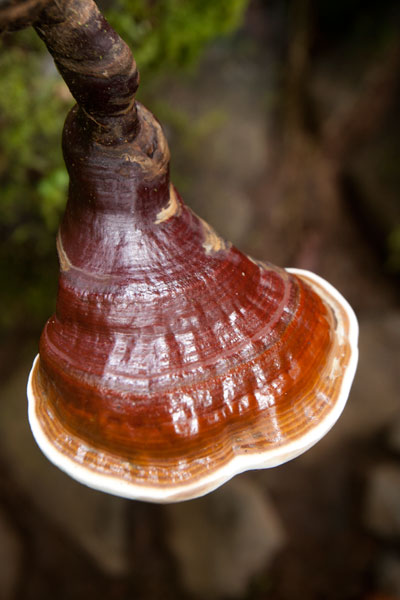
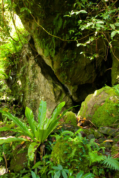
Today, Nan Kiepw maintains a pristine beauty that betrays no sign of past violence. A tributary of the Nanipil River (Pillapen Nanipil) runs through the area, forming a wide gentle cascade, some small pools (though none big enough for swimming), and a “horsetail” waterfall before winding into the valley. Upstream is a basalt outcropping — really a great boulder — that forms an overhang where a few people can comfortably camp out of wind and rain. Huge ivory nut trees, red sandlewood, and a variety of hardwoods dominate the lush native forest, and there are many unusual varieties of fungi to be seen.
The Origin of the Ivory Nut Palm
On the fourth voyage to Pohnpei after its founding, a man came named Mederiap, bringing with him the ivory nut palm and propagating it on the island. Prior to this time people had mostly lived in caves, because they had nothing to use for roofing material, but ever afterward, the fronds of the ivory nut palm were woven together to produce roof thatch for houses.
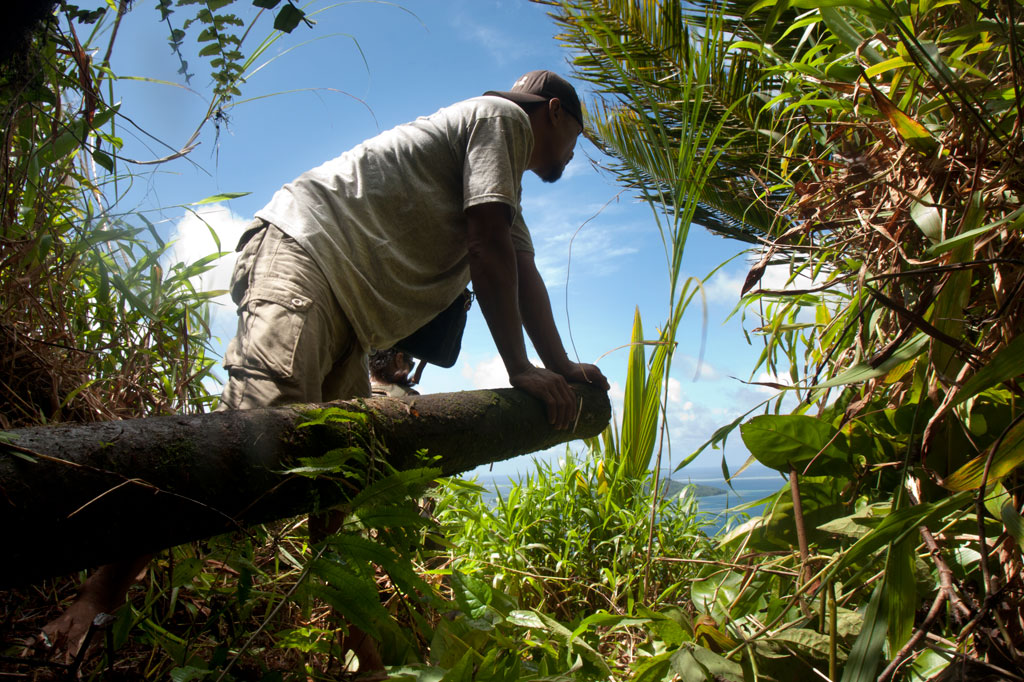
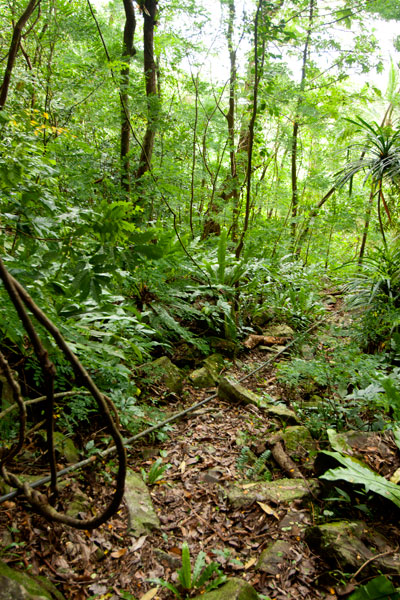
The moderately challenging trail begins behind a house near the Nett hydroelectic building at the end of the Nanipil River Road (the same trailhead for Nahnalaud). Hikers cross the Nanipil River directly and walk along a well-maintained footpath for 0.99 km / 0.61 mi (5% slope avg) before coming to the first major branch. The left (east) branch leads on toward Nahnalaud, while the right (west) branch heads to Nan Kiepw. From this point it’s 1.4 km / 0.87 mi (14% slope avg) to the last residence along the trail at 265 meters of elevation, and then another 1.8 km (1.12 mi) to the waterfall. This last segment has two little ascents with slope averages of about 20% and 26% and a more moderate bit in between (11% slope avg). Sakau (kava) plantations are found on both sides of the trail much of the way. Hikers should take care to avoid damaging these valuable plants.
[info], Pohnpei, Federated States of Micronesia (FSM)")
Crab’s Eye Vs. Red Sandlewood: What to Know and Why it Matters
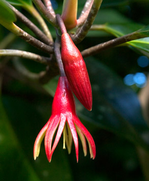
Two species of trees found both in inhabited areas and in the upland forests of Pohnpei produce small brilliant red seeds about the size of popcorn kernels. These can be seen scattered across the forest floor and often on the trail leading to Nan Kiepw. Red seeds with a single black dot on them belong to Abrus precatorius (Crab’s Eye Seed or John Crow Bead), while solid red seeds come from Adenanthera pavonina (Red sandlewood). The first type of seed (with the black dot) contains a compound, called abrin, that is 75 times more toxic than ricin and can be fatal if ingested; the fatal dose is about 0.1 mg for an adult of roughly 68 kg (150 lbs). Symptoms of poisoning include nausea, vomiting, convulsions, liver failure, and death after several days. The second type of seed (all red) is harmless when cooked and is sometimes eaten as a snack by Pohnpeian children. Strangely, the same Pohnpeian name — kaikes — is used to identify the two species of trees. Both Abrus precatorius and Adenanthera pavonina originate on the Indian subcontinent. Seeds are sometimes used to make necklaces and other jewelry.[/info]
Na Malek
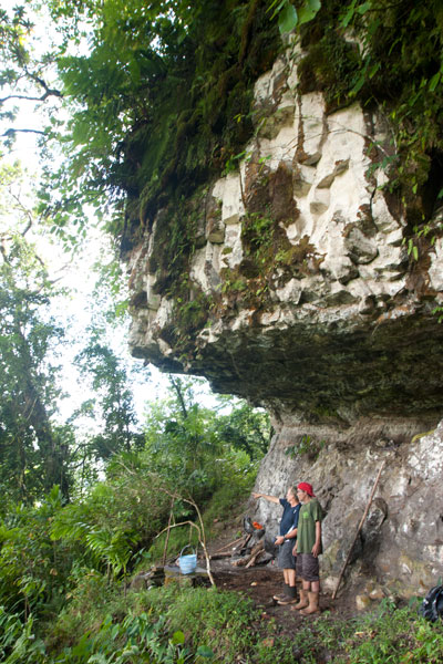
Na Malek (“his chickens”) is a rock overhang and cave — located in the part of upland Nett once known as Nansokele — said in myth to have been the home of the demon Taimuan. The site, which has excellent views of the valley, Dolen Eirike, and Dol Rakied, is reached via a steep loop of path (0.61 km / 0.38 mi with a 42% slope average) that branches off from the Nan Kiepw trail. The overhang is large enough to provide a protected camping spot, and the elevated cave is bone-dry, flat-floored, and suitable for sleeping. Water running off the rock can be filtered for drinking. This is a relaxing and beautiful place to watch birds, including the Grey White-eye and rare Long-billed White-eye.
- Plan for 8 hours for both Nan Kiepw and Na Malek.
- Please visit the Local Guides & Tour Operators page for a list of experienced guides available for hikes to Nan Kiepw. Offer $50.00 for a group of five or less.
The Tale of Taimuan
A well-known Pohnpeian myth states that Na Malek was the the home of a hideous old demon, named Taimuan, and his sister, Litapinmalekelek. Taimuan had a hankering for human flesh and was, in particular, interested in the beautiful daughter of the Saudeleur — the supreme ruler that reigned from Nan Madol. Deciding that he wished to devour the girl, Taimuan set out for Nan Madol, transforming himself into a handsome young man along the way and leaving his old parts at different points in the mangroves — his white hair, swollen legs, swollen testicles, sagging eyelids, etc. When Taimuan arrived at Nan Madol and presented himself to the Saudeleur, both the girl — who was called Kisin Ntamwahu (“a little bit of good blood”) — and her father were impressed with the young suitor. Kisin Ntamwahu fell for Taimuan and begged her father to let them marry. Soon the two were married and given a home on Pahn Kadira.
After residing at Pahn Kadira for a while, however, Taimuan obtained permission from the Saudeleur to take Kisin Ntamwahu back to Na Malek. On the way, he picked up all his old parts from the mangroves and was restored to his prior appearance. Kisin Ntamwahu realized she had been tricked, but Taimuan carried her away against her will and confined the girl inside the cave at Na Malek. Then he climbed to the top of the mountains to invite all the other demons in the area to join him in feasting on the girl. While he was away, his sister, Litapinmalekelek, discovered Kisin Ntamwahu and felt sorry for her. She began to dig the girl out of her prison and encouraged Kisin Ntamwahu to turn herself into an ant, in order to escape, and flee into the forest. She warned the girl not to pass any plants without greeting them politely. As Kisin Ntamwahu ran, she greeted all the plants, big and small. All except one. Feeling a sudden need to urinate, she relieved herself in the forest and didn’t realize she’d done so on a plant called kampanial.
When Taimuan found that Kisin Ntamwahu was gone, he confronted Litapinmalekelek, but she claimed to know nothing. In a rage, Taimuan showered his sister with obscenities (specifically, he shouted, “Your vagina! My penis!” — a highly offensive reference to an act of incest) and then took off into the forest to catch Kisin Ntamwahu. He questioned each plant he passed, but none would tell him anything until he came upon the kampanial, which told Taimuan which way Kisin Ntamwahu had gone. Shortly thereafter, Taimuan met two worms on the path. He asked them where the girl had gone and they promised they would tell him if he pulled down his eyelids. He did so, and the worms threw dirt in his eyes. When Taimuan tried to wash his eyes out in a nearby streamlet, the worms muddied the water upstream, causing him to go blind and eventually die.
- Please visit the Local Guides & Tour Operators page for a list of experienced guides available for hikes to Nan Kiepw.
Lou Rahn Cave & Waterfall
![]()
![]()
![]()
![]()
![]()
![]()
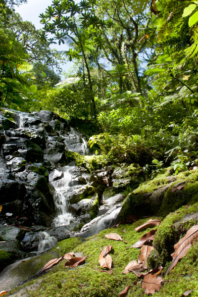
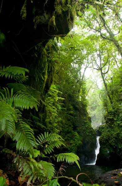
Tucked away in the little-seen Nett hinterlands is one of Pohnpei’s most beautiful hiking destinations. Uluhlen Lou Rahn, a fence-like ridge, extends northwest from the place where the mountains of U meet those of Nett, hiding from view the verdant valley of the Pwong Stream (Pilen Pwong). Cutting through this gorge from its source below Dolen Nahnsapwe, the stream spills over a high cliff to form a thundering waterfall next to a large cave with a view of the misty valley floor. Though there is no quick way down to the bottom of the waterfall from the cave (you can backtrack a ways and make your way down the slope to the stream), there is a gorgeous pool for swimming just up-stream with cool, crystal-clear water.
 at Lou Rahn, Pohnpei, Federated States of Micronesia (FSM)")
The trail to the site begins off the unpaved but well-graded road in Paremkep and sees plenty of traffic from sakau farmers and residents on the first 0.6 km (0.37 mi) leading toward the spur (12% slope avg). Once it reaches the ridge, it cuts east and passes along Lou Rahn’s inside slope rather than following the ridgeline (0.92 km / 0.57 mi, 19% slope avg). The hardest aspect of this full-day hike is the treacherous footing, as much of the last leg of the route crosses the sharp, jumbled rocks of old landslides now obscured by high grass. Take care and watch each step; a fall into one of the hidden crevices could result in a serious sprain or fracture — not a good thing to have way out in the forest on Pohnpei. There are also a great many sakau (kava) plants in the area — a massive number, in fact — which hikers must take care to avoid damaging. The roots of the plant are used to make Pohnpei’s potent ceremonial drink. Large plants can be twenty years old or more. Small huts, which farmers use while working on their plants, are passed at several places along the route.
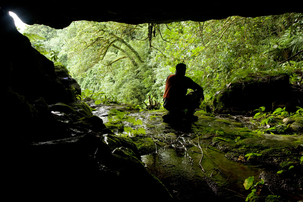
The cave sits just to one side of the falls with a stunning view of the hidden valley. The roof is a bit low in places, but it’s quite a fair size none the less. Though a thin stream of water flows across one side of the cave floor, the rest is dry and makes an excellent camping location. Hunters often use it, and you may notice their cooking pots stored in crevices at the rear of the cave.
- Plan for 6-8 hours for this hike.
- Please visit the Local Guides & Tour Operators page for a list of experienced guides available for hikes to Lou Rahn. Offer $37-50.00 for a group of five or less.
Liduduhniap Waterfall, Nanipil & Nan Madap Attractions
![]()
![]()
![]()
![]()
![]()
![]()
![]()
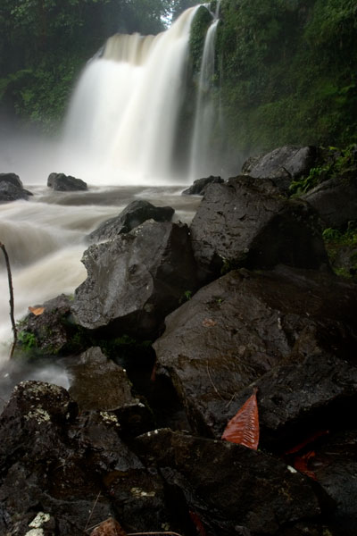
Liduduhniap Waterfalls
The easiest waterfalls to visit on Pohnpei (no hiking required) are the tiered “horse-tail” falls, Liduhduhniap, just a few kilometers from Kolonia. When the Greater Nett Eco-Adventure Guide was published in 2015, we wrote of Liduduhniap:
“Some might consider accessibility to be a red flag and assume that a location so close to town would be completely spoiled by a constant flow of visitors and thoughtless development. That’s not the case here.”
Unfortunately, things have changed recently (2017). Under the direction of Pohnpei’s new tourism department, the landowners at Liduduhniap have chosen to severely undermine the natural integrity of the site by replacing the dirt path to the lower falls with an unsightly series of concrete steps and a concrete hut near the edge of the pool. Toilets have also been built on the site. For those of us who knew the place before this “development”, it will never be quite the same again, but Liduduhniap is still a beautiful spot — not just the two waterfalls themselves, but the greater area, which is lush, rugged, and often partially enshrouded in thick mists that drift down from the steep mountains. The population around the site is relatively sparse, and it is hoped that most of the land will remain as it has for decades — green and wild.
The Liduduhniap Waterfalls lie on a portion of the Nanipil River (Pillapen Nanipil) located right at the feet of the mountains and fed by a great deal of rain (the primary dam and reservoir that supplies the town with water is just a bit upstream). The upper falls cascades 4 meters (13 ft) into a deep basalt plunge pool with a jaw-dropping elevated view of the river valley and the slopes of the mountains. From there it spills over the lip and plummets another 8 meters or so (26 ft) into a larger, but shallower pool. Swimming is excellent at both pools, though the first is more difficult to get in and out of. Most people simply opt to take a flying leap off the rocks, but you can also carefully cross the river above the falls and climb down to the pool from the far side without too much trouble (go barefoot or wear five-fingers to avoid losing your flip-flops in the swampy sections). The water is crystal clear — except immediately after heavy rains — and always on the chilly side, making it a great escape for oppressively hot and humid Pohnpei days. The deep, narrow valley funnels air along so that there’s always a bit of a breeze, too, which keeps the ferns waving hypnotically and the temps down. No one is quite sure how deep the upper pool is, but it’s deep — deeper than you’ll ever sink after a jump. However, one must still take care to scan the water before leaping; flash floods sometimes wash tree trunks and other debris down from the mountains and these can become wedged in the pool below the surface. Depending on how high the river is, you may be able to swim up and get behind the falls, where there’s a small depression in the rock. There’s also a large cavern on the eastern side of the pool. The lower pool is too shallow for jumping.
The well-manicured and landscaped gravel trail to the site begins left of a large nahs (community hut) near the unpaved road and opposite the landowners’ house, meandering past blossoming hibiscus shrubs, plumeria trees, and ginger until it reaches a couple of ramshackle huts above the river. These make nice spots for a picnic lunch, while in the evenings the family uses them for pounding and drinking Pohnpei’s dizzying ceremonial drink, sakau (kava). Turn right by the huts and scramble down to the river to visit the upper falls. Note the mortar holes on the north side of the pool rim, where sakau was pounded in ancient times. To reach the lower pool and waterfall, continue along the main trail and down a series of concrete steps. The family charges an access fee of $1.00 per person to visit the falls. Occasionally they may ask you for $5.00 if it looks like you plan to take a lot of photos of the site.
[warning]Be advised that there have been many injuries and several fatalities at Liduduhniap! The spot is extremely prone to flash floods. In 1999, two Pohnpeians were swept away by a flash flood and carried over both falls to their deaths. In 2002, three visiting Palauan athletes were also killed by a flash flood; there’s a monument to them next to the trailhead. Danger from slips and falls is another issue. In 2012, an American educational volunteer fell to her death from the upper falls, which prompted the landowners to install a dodgy rope ladder on one side of the upper pool. Read the Safety Considerations in the right column and BE CAREFUL.[/warning]
- Plan for 30 min – 2 hours to enjoy the waterfalls.
Upper Nanipil Bird Walk
If you continue up the road from Liduduhniap, you’ll soon pass the dam and reservoir on the left. Just beyond this, also on the left, a footpath leads into the forest and runs through the woods above the stream for 1.1 km (0.68 mi). Among birders, this scenic walk is second only to Sokehs Mountain in terms of the variety and prevalence of species that can be seen. It’s easy to get to and doesn’t require any huffing and puffing, and the forests are rich and unspoiled and full of birds. There are no houses along the trail, which means that traffic and noise are at a minimum. You can see many species on the walk, but highlights include the Pohnpei Cicadabird (Coracina insperata), Pohnpei Fantail (Rhipidura kubaryi), Pohnpei Flycatcher (Myiagra pluto), and Crimson-Crowned Fruit Dove (Ptilinopus porphyraceus). We suggest you hire a local birding guide and bring a pair of binoculars. Stick to the path to avoid damaging this pristine watershed.
- Plan for 2-3 hours for this walk.
- Visit our Birding page to learn how to find birding guides.
Sengnaip Waterfall
This little-known two-tiered waterfall is located about 400 m (0.25 mi) south of the Nanipil Bird Walk described above. If you cut off the path and continue down the slope for about 170 m (186 yd), you’ll hit the main stream, which you can follow up for another 144 m (157 yd). At this point, you reach a large basalt pool that narrows on the far side and disappears into a rocky slot. You can get a great view and wonderful pictures of the falls from the rocks on the east side of the pool, but there’s no easy way to go further without swimming. If you do the latter, you’ll end up in a small plunge pool enclosed on three sides by high rock walls. There’s a cave just above the water level on the east side. The spot is unbelievably peaceful and has been seen by very few people. Treat it with utmost respect.
[warning]Like Liduduhniap downstream, this location has extreme flash flood potential. Read the Safety Considerations in the right column.[/warning]
- Plan for 2-3 hours for this excursion.
- Visit our Guides & Tour Operators page for a list of guides who can be hired for this hike.
Likei & Pahn Pwet Waterfalls
If you hire a knowledgeable guide and continue hiking south at the conclusion of the Nanipil Bird Walk (where the trail crosses a stream on a large log), you’ll soon strike the main river again. The route stays with the watercourse for 1.5 km (0.93 mi) with very gentle elevation gain (4% slope avg). At the end of this segment, the river is joined by another stream coming from the southeast. Following either course for about a third of a kilometer will lead you to a waterfall. The western route continues 0.37 km (0.23 mi) up a slope, where the hike steepens to about a 25% slope average before coming to Likei Waterfall. The eastern course leads 0.23 km (0.14 mi) with a 18% slope average to Pahn Pwet Waterfall. The two waterfalls are quite dramatic and little-known both by visitors and by local people. This area, called Nan Madap, is actually disputed territory; both Sokehs and Kitti claim it, though the municipal boundaries as they are typically drawn seem to place the location within Sokehs.
- Plan for 5-7 hours for this hike.
- Visit our Guides & Tour Operators page for a list of guides who can be hired for this hike.
Nan Kiepw Waterfall
Also with a local guide, a third falls can be accessed from a completely different route, beginning just west of the community hut by the Liduduhniap trailhead. This hike climbs up the mountain slopes fairly steadily for 3 km (1.86 mi). The first two thirds of the distance is relatively easy with a slope average of about 12%, but then the slope steepens considerably to about 41%. Nan Kiepw Waterfall is high up at about 500 meters of elevation (it may be one of the highest falls on the island), just below the summit of Dolen Nanikep and off the east side of the trail. Sometimes you can see this falls from the lagoon after heavy rain.
Serious trekkers have the option of continuing past the waterfall, up to Dolen Kiepw (610 m), and on to Dolmweir (735 m), where a thatched shelter was built for hikers in 2013 (note that the roof of the hut was already deteriorating when we visited only six months or so after it was constructed). This is an admittedly tough hike with slopes ranging from 25% to 40% and very rough terrain. The shelter is 1.5 km (0.93 mi) beyond Nan Kiepw falls. From the shelter, trails run west to Pekenuht (705 m) and down into Pehleng or east to Nahnalaud (772 m).
- Plan for 5-7 hours for this hike.
- Visit our Guides & Tour Operators page for a list of guides who can be hired for this hike.
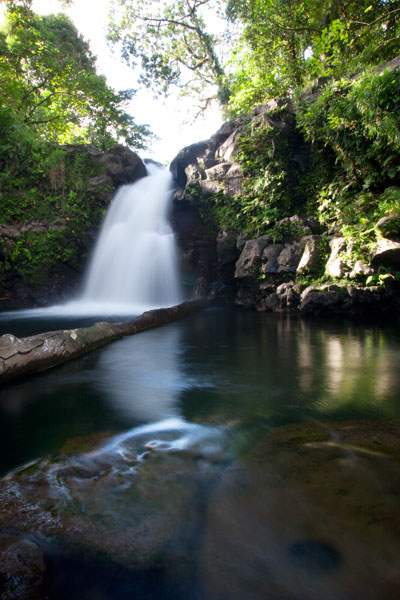
Nanipil River Swimming Holes
“Cable Bridge Hole”
This is by far the most popular swimming spot on the Nanipil River located 4 km (2.5 mi) from downtown Kolonia, where the watercourse turns sharply away from the Nanipil River Road and forms two deep, placid pools. There used to be a cable footbridge that crossed this portion of the stream, but now all that remains are a couple rusting cables strung high above the water. The water at the site is clean and quite cool — an excellent place to freshen up on a sweltering afternoon. Avoid the site, however, during or immediately after heavy rain, as the water gets muddy from all the sediment washing into the valley upstream. Cars can be parked on the opposite side of the road.
“The Swimming Pond”
This is a favorite with young kids in the area, located 5.3 km (3.3 mi) from downtown Kolonia. A short walk from the Nanipil River Road leads to a long, deep pool with a steep slope on the far bank. Rope swings are often strung up on both sides of the pool, and there are some grassy spots to picnic and a tiny hut or two. The landowners, who live in a house on the side of the road opposite the trailhead, charge visitors $1.00 per person.
[warning]Flash floods are an issue at both sites, due to Nanipil Valley’s narrowness and the volume of rain that can fall in a short period of time in the steep mountains to the rear. Be wary.[/warning]
Dolen Nett / Pohnlehr
![]()
![]()
![]()
![]()
![]()
Dolen Nett (“hill of Nett”) is a steep-sided mountain running the length of the Nett Point peninsula. Leaf-shaped, this peninsula juts north into the lagoon east of Kolonia and is said, in myth, to have been formed by the corpse of the same monster eel that founded the Lasialap clan, created Lipwentiak, and lived in the Lehdau River for many years. When the creature finally died, her carcass became Dolen Nett.
Like Sokehs Mountain, Dolen Nett is mostly flat on top, as if the peak was sliced off. From town, this plateau — known as Pohn Dolen Nett (“on the hill of Nett“) — looks like a manicured lawn, which has inspired the mistaken belief that it was once used as an airfield by the Japanese. In truth, there were only three Japanese airstrips on Pohnpei: one at Nanpohnmal, one in Palikir that never became fully operational, and the seaplane base on Lenger Island. There are hardwood forests around the edges of the plateau, but the central landscape of Pohn Dolen Nett is nearly treeless. Most of this open terrain consists of very resistant, and in many places, shoulder-high paddle grass and Dicranopteris ferns with swampy mires and sections of jagged basalt scattered throughout. It should be noted that the aforementioned ferns can be brutal on bare legs if you’re forcing your way through them for any length of time. That’s cat o’ nine tails brutal. Flay the flesh right off your shinbones brutal. We learned the hard way once, while mapping the location. One humble suggestion: hike in pants. Heat-stroke, too, can be an issue on the hill; with so little tree-cover, sunny days are blistering.
Japanese World War II Sites
As is true of all the high points around Pohnpei’s coasts, the Japanese fortified Dolen Nett in the late 1930s, anticipating an eventual attack by Allied forces (which came in the form of intense bombing raids rather than the expected surface-based assault). The most interesting war features are grouped together at the southern end near the true summit (an area called Pohnlehr) and include some steel drums, the barrel of a disassembled 75 mm canon lying in the woods, rock walls, two stone machine gun pillboxes, and a concrete and steel bunker that houses a second 75 mm gun in situ. To access the latter, which has excellent views of the bay between Nett and Awak, you have to move along a precipice, often partially or completely obscured by high grass. Let your guide go first to clear a path — unless you want to find yourself plummeting through empty space. The bunker itself can be entered, but it’s a bit of a grubby venture as the roof has partially collapsed and is now supported by the breech of the gun itself.
The other major site on the south side is a mobile radar array that sits on a low stone platform in the woods about 126 meters (138 yd) northwest of the gun bunker. The radar was mounted on a rotating turret in the center of a truck chassis (still intact) and the operator turned a wheel to position it. There are some large depressions in the surrounding forests that may be bomb craters, but none of the major features on the hill appear to have sustained direct damage from the bombing runs. More likely, these posts were simply abandoned, as they would not have been very effective against an aerial attack.
The woods pick up again on the north end of the mountain, and here, also, are some Japanese military features, including a large network of narrow defensive trenches, a few stone rifle pits, and machine gun emplacements.
Featured Routes
There are many ways to get to the top of Dolen Nett. We have covered four routes on the Greater Nett & Western U Eco-Adventure Map.
(1) The most practical route starts behind a house next to the road in Weipowe 1.2 km (0.75 mi) south of the Nett Point turn-off. Just ask at the houses on the inland side of the road for guides. The trail is well-maintained as far as the family’s private sakau (kava) and yam plantations on the slope. The steepest bit of the climb is at the beginning — 0.4 km / 0.26 mi, 33% slope avg. Near the top of the ridge, the trail passes the entrance to a long Japanese tunnel, well worth exploring — but bring a headlamp. From there, it continues up the forested slope and eventually comes to the open fern meadows, called nanmal (0.4 km / 0.3 mi, 22% slope avg).
(2) Another trail begins 0.6 km (0.37 mi) south of Trailhead 1 (look for a narrow concrete driveway next to a giant mango tree). This may have been the primary Japanese trail, but it is now difficult to follow above the point where farmers plant their sakau. About 0.56 km (0.35 mi) along (26% slope avg), the trail collides with an impassable basalt wall over which a thin waterfall can form after heavy rain. Here the trail turns south and continues about 0.29 km (0.18 mi) with a 17% slope avg, running parallel to the wall until it ends. Then it begins to climb again, briefly emerges in a small meadow, passes through some light forest, and emerges again at a rare grove of coconut palms (185 m / 202 yd).
(3) A third route begins at the edge of the road in Paliais 0.7 km (0.43 mi) north of the Dausokele Bridge. The route is about 0.7 km (0.43 mi) to the top with a 26% slope avg.
(4) The fourth route starts on the edge of the road 1 km (0.62 mi) south of the Nett Point turn-off. It climbs fairly straight 0.27 km (0.17 mi) with an 18% slope avg up to the ridge, which is much lower here. It then turns south and follows the ridge 0.43 km (0.27 mi) until it connects with Route 1 at the Japanese tunnel entrance.
Pohnpei Short-Eared Owl

The lonely meadows and forests on the mountaintop are prime habitat for Pohnpei’s shy short-eared owl, Asio flammeus. This species has been pushed up to the mountainsides by building projects — such as the State Hospital — which destroyed its native grasslands habitat. Late afternoon is a good time to look for the large bird rising from its hidden abode as it sweeps out to hunt (we spotted it on three out of five trips).
Camping
There are many fine places to camp on Dolen Nett. The nanmal is excellent on clear nights, where you can gaze both on the star field above and the twinkling lights of Kolonia below. If you want more cover or perhaps some trees to tie a tarp or hammock to, try the forests at the southern end. Bring plenty of water — none is found on the mountaintop — and take everything you brought with you when you leave. A good campsite is one that leaves no trace.
- Plan for 6-8 hours for this hike, if you want to see all the WWII features.
- Please visit the Local Guides & Tour Operators page for a list of experienced guides available for hikes to Dolen Nett. Offer $37-50.00 for a group of five or less.
The Story of the Eel of Pahdol
A long time ago, a couple from Wene came to live in a place called Iro. One day there was a great storm and the heavy rains resulted in a huge flood. Two women in the area went out to fish in the flood, and while they were fishing, a starling flew over and dropped a small stone. The women took the stone home and gave it to the couple from Wene. Later, at a place called Pahnkipar (“under the pandanus tree”), the stone broke apart and from it was hatched a tiny freshwater eel. The couple kept the eel as their pet and allowed it to live in a pool at Pahdol (“under the hill”) in Pahnais. When the eel grew up, however, it began to act in sinister ways. At night, the eel would escape from its pool and sneak into the house, where it would stare at the sleeping couple. The couple became uncomfortable and decided to kill and eat the eel, but the eel overheard their plan, came into the house, and attacked them. The couple fled into the forest and hid under a huge rock, where they believed they’d be safe. The eel discovered the hiding place and ambushed the couple, devouring them alive.
The eel then traveled into the Nanmeir Valley in Pohnpei’s interior and followed the Lehnmesi River source. There she met Kiroun Meir, a high-titled man, who brought her to live with him at his home. The two became lovers and the eel was impregnated. She was restless, however, and departed, continuing to follow the river. At Lipwentiak, the eel encountered a hunter named Kiroun Mand, killing and eating eels. Recoiling at this sight, she created a sharp turn in the river with the writhing of her body. Soon after, she gave birth to her first daughter, the matriarch of the Sounlipwentiak subclan. She had other children later who became the founders of the Lasiadohng (“eels of the dohng tree”) and Lasiakotop (“eels of the kotop palm”) subclans. After that, the eel went to live in Dauen Sapwalap, where she terrorized the local inhabitants, devouring so many that the land became mostly deserted. When the monster finally died, her body formed Dolen Nett.
Lenger WWII Historical Sites
![]()
![]()
![]()
![]()
![]()
Southwest Side
")
Subterranean Crude Oil Facility (Pahnlenger)
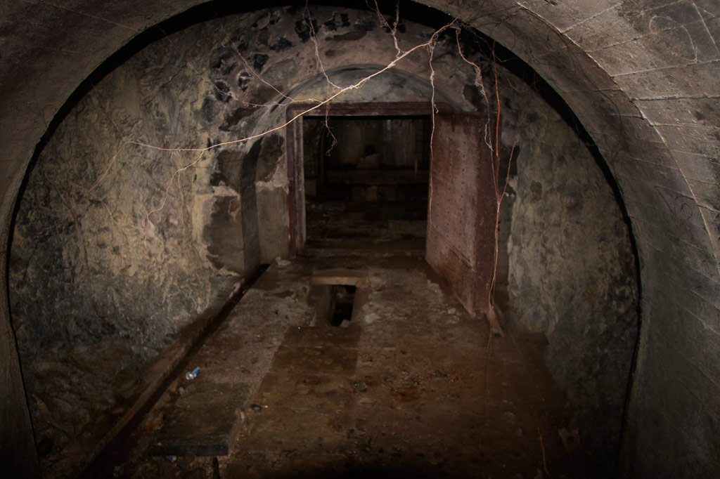
Built beneath Dolen Lenger, the Japanese crude oil storage complex is without question the most impressive of the island’s historical sites. If tight spaces, heights, cobwebs, bats, or the dark make you nervous, this is where you should grab your flashlight and confront your phobias! You don’t want to miss this experience, but do take care where you put your feet and watch out for swiftlets darting about.
The facility is accessed through the first of a trio of steel gates that opens onto a wide rock tunnel lying parallel to the hillside (Gates 2 & 3 are blocked by mud and rock-fall). Steel ladders in alcoves opposite each of the gates run up the wall to concrete lofts from which Japanese personnel could inspect the massive oil tanks. Each tank is 40 meters long and 10 meters wide (131 x 33 ft) with an arched, riveted ceiling and an estimated capacity of 3,300 metric tons. From each loft a second ladder descends 10 meters (33 ft) through a hatch to the floor of the tank. Depending on recent rains, there may between 10 cm and a meter of standing water on the floor, but it’s usually possible to explore without getting too wet. Japanese graffiti on the wall of the first loft reads: “Push forward bravely and strive.” Records seem to indicate that only the third tank was operational. A large diesel engine in front of Tank 3 was probably used to pump the oil in and out. A pipe runs all the way to the coast.
")
Storage Caves (Pahnaiau)
The four caves carved into the slope of Dolen Lenger were probably intended for use as storage facilities (and also for defense as a last resort), but may not have been completed. Cave 1 is tiny (about 6 meters deep). The other three are grouped together 50 meters (164 ft) to the northwest. Cave 2 is 15 meters deep, 8.5 meters across (49 x 28 ft), and nearly as high with a wide entrance sloping steeply to a soggy floor. If you venture down, be careful of broken glass from bottles that might have been meant for Molotov cocktails (gasoline bombs). Cave 3 is slightly larger and deeper with several terraces. A line of rock-filled barrels at the mouth seems to have been added as protection against a land attack, and the third terrace may have been intended for a machine gun. Cave 4 is the largest with a depth of 28 meters. All of the caves are muddy, often have standing water on their floors, and are occupied by colonies of Caroline Islands swiftlets. The name of the area, Pahnaiau, means “under the banyan tree.”
Concrete Plant Equipment (Pahnaiau)
West of the main path to the caves is a ballast mound with a mango tree on top and a cluster of equipment used in the process of making cement: three concrete mixers, a large Yanmar diesel engine, and the 610 mm gauge rail lines that were used to transport dynamited rock from the cave sites along the hillside. A rock-crusher lies 23 meters (75 feet) southwest of the mixers.
South Side
Oil Tank Complex (Pahnkamal)
This large walled complex originally contained two steel tanks for the storage of crude oil, which was pumped in from the coast. The larger tank, with a 1000-liter capacity, was dismantled in the 1970s by a man who needed steel plates for his ship. He was in the process of taking apart the smaller one, when the government intervened. The existing tank can be entered where the lower panels have been removed. The roof is accessible via a ladder on the inside, leading to a manhole. A courtyard wall surrounds the entire facility (now being used by local residents as a pigpen) and concrete channels lead to a pair of rectangular cisterns (currently piled with coconut husks). Large bomb craters from the American bombardment are found on the northwest and south sides.
")
Aviation Fuel Reservoir Tunnel (Pahnkamal)
Northwest of the main path is a subterranean tank that supplied the seaplanes with aviation fuel. A steel door in the hillside opens on a tunnel about 8 meters long (typically flooded with about 20 cm of standing water and silty mud). At the end of the tunnel, the fuel pipes turn to the right and disappear into a concrete wall, behind which the reservoir lies. A ladder runs up to a secondary entrance hatch on the slope, but it is now rusted shut. The Japanese took fuel from this location by truck to the seaplane facility.
East Side
Cisterns & Machines(Nanpeilam)
Footpaths leading toward residences on the eastern coast pass a variety of rusting machine parts and two rectangular concrete cisterns. The southernmost cistern can be entered through a hole knocked in the south wall. A ladder also runs up to the roof.
")
“The Banyan Wheel” (Dausong)
The most photogenic of the island’s attractions is not far from the main path on a terrace cut into the eastern slope of Dolen Lenger. There are several concrete foundations here and on one of them is an unidentified machine (perhaps an engine or rock-crusher) that has been completely absorbed by a huge banyan tree, such that the large machine wheel is permanently fixed on the outside of the tree with two roots growing right through the spokes. Take our word for it: it’s pretty darn cool.
Northeast Side
Seaplane Hangar & Aircraft Wreckage (Dietakai)
The hangar on the northeast side of the island once housed the “flying boats” that flew between Chuuk, Pohnpei, and the Marshall Islands and the Naval Type-O Observation seaplanes that were used for recon. ") The structure sustained at least two direct hits from bombs, leaving massive craters at the front and on the southeast wall and possibly contributing to the eventual collapse of most of the braced girder roof in the 1980s (only the rear portion still stands). Near the northeast corner is a half-buried air compressor and just beyond this the engine cylinder of a destroyed aircraft, but the tangled girders make it difficult to move further inside from this direction. A careful search near the east side of the foundation should yield the wreckage of at least one plane (an Aichi E13A1 Jake), including the engine and propeller, portions of a wing, a pontoon, strut, and bits of bulkhead next to one of the carriers used to move the planes. The hangar can be much more easily entered at the rear, where the roof girders are still intact. A pair of carriers — on their way to being devoured by a ficus — were used to transport the seaplanes.
The structure sustained at least two direct hits from bombs, leaving massive craters at the front and on the southeast wall and possibly contributing to the eventual collapse of most of the braced girder roof in the 1980s (only the rear portion still stands). Near the northeast corner is a half-buried air compressor and just beyond this the engine cylinder of a destroyed aircraft, but the tangled girders make it difficult to move further inside from this direction. A careful search near the east side of the foundation should yield the wreckage of at least one plane (an Aichi E13A1 Jake), including the engine and propeller, portions of a wing, a pontoon, strut, and bits of bulkhead next to one of the carriers used to move the planes. The hangar can be much more easily entered at the rear, where the roof girders are still intact. A pair of carriers — on their way to being devoured by a ficus — were used to transport the seaplanes.
Seaplane Ramp & Apron (Dietakai)
The large seaplane ramp and apron dates to 1939 or shortly after and was constructed by a labor force consisting of Japanese, Korean, Pingelapese, Mwoakillese, and Pohnpeian workers. The structure lies on a reclaimed portion of the island and stretches northeast into the sea. The underwater section was made from concrete slabs poured elsewhere and lowered from barges, where they were assembled by divers. Stone seawalls around the perimeter were constructed in the highly stable yabane-tanizumi configuration. Written accounts left by local workers describe slave-labor conditions and harsh punishments for anyone who did not cooperate (one account says men were strung up to bake in the sun). A Pohnpeian marching dance (“Ke Dehr Lemeleme Me Se Ruksang Doadoahk en Kaigun”) composed during the event, commemorates the regular desertions of laborers.
Today, the cratered apron has been claimed by the forest and is difficult to even identify from the ground, but at the time of writing there was a clear path across it. The ramp was repaired by the Americans and used as the primary airstrip until the current airport on Dekehtik was completed. It remains mostly intact, though several structures in the area post-date the Japanese period (including an old hut for picnickers and the concrete tanks from a giant clam hatchery that operated in the 1990s).
Dolen Lenger

Dug-Outs & Tunnels (Dolen Lenger)
The ascent of Dolen Lenger follows the northernmost of two Japanese roads that lead up the hill and eventually intersect. The lower part of the southern road is mostly blocked by trees and mud and is no longer a good way to access the hill, but you can explore the upper section, where several dug-outs cut into the slope on either side. Two of the entrances are connected by a short tunnel.
Gatepost & Barracks Foundations (Dolen Lenger)
A bit further up the northern path, hikers pass a gatepost (its twin has fallen down the hill), adorned with round, colorful river stones imported from Japan. Naval personnel gathered at this spot for their morning meeting. Not far ahead, the foundations of a barracks complex are found on a large terrace in the hillside. The area is littered with Japanese beer bottles, old diesel engines, steel water tanks, and rusting machine parts. A short tunnel worms into the slope to the left of where the path climbs a flight of concrete steps and continues up the hill.
")
Searchlight (Dolen Lenger)
The drum and turn-table of a 110 cm searchlight (probably a Navy Model 92) lie just off the right edge of the path. The light was originally mounted on the rock outcropping five meters (16 ft) west of the its current position and was used to identify targets at night. It was probably dismantled by American personnel after the war.
Small Gun Station (Dolen Lenger)
Further along, a deviation from the main path leads to an unknown battery, probably for a machine gun or small artillery, which was removed after the war. A short stone wall protects the site and contains two ammunition magazines.
Anti-Aircraft Gun Stations (Dolen Lenger)
Two anti-aircraft batteries crown the hill, one to the west and the other at the end of the main path. Both sites consist of concrete rings surrounded by stone and earth revetments and a number of ammunition magazines (nine at the first station and six at the second). Naval 8 cm Type 3 Dual-Purpose Guns were installed at these locations to protect the seaplane base and other important Lenger facilities. Unfortunately, both guns were removed after the war.
Dolen Lenger Summit Area
From the last anti-aircraft gun station, it’s possible to continue another 50 meters (164 ft) or so to the 77 meter summit of the hill (marked with a brass USGS benchmark) and pick your way to the cliff-top for expansive views of Kolonia and the northern lagoon. Bring a machete and take care at the edge of the precipice.
Coastal Battery & 15 cm Naval Gun (Dolen Lenger)
Just north of the searchlight, a branch in the path turns west and descends a series of muddy steps to the coastal batteries and their four naval gun stations. Records disagree as to whether guns were actually installed at all four of the stations or if one station at each battery was a decoy. The only gun remaining on Lenger — a 15 cm 40 caliber British Armstrong-Whitworth naval canon — lies on its side in the mud at the southernmost station not far from the pedestal mount. It was probably thrown there by the detonation of one of the many bombs dropped by Allied aircraft in 1944. The barrel and shield are separated from the jacket and recuperator and partly buried. Japanese records state that the 15 cm gun on Sokehs Mountain was originally installed at Lenger and moved during the war. Lenger’s guns were intended to prevent surface invasions from Pweitik Passage to the northwest and had a range of roughly 7 kilometers (4.3 mi).
Heavy Ordnance Magazine Foundation (Dolen Lenger)
Past the gun stations is the foundation of what was probably a magazine for heavy ordnance surrounded by impressive inclined blast walls of quarried basalt rock. As is true of the best examples of Japanese architecture on Pohnpei, the stones were laid in the alternating diagonal pattern called “herringbone style” (or yabane-tanizumi). The site was most definitely covered during the operational period and camouflaged to make it invisible from the air.
West Side
Coastal Barracks Foundations
The remains of two large barracks are found on the western coast of the island. Both of the structures were wooden pitched-roof buildings raised above the ground on concrete posts and reached by short flights of stairs. Each barracks housed as many as fifty men. Only the posts and stairs remain today. The southern foundation has a nahs built on top of it, which was part of one the island’s two “resorts” in the 1990s.
ACKNOWLEDGMENTS
The Lenger Island guide would not exist without the amazing work and cooperation of archaeologist Takuya Nagaoka, who was the first person to map the historical sites on Lenger. Nagaoka’s meticulous survey maps and exhaustive report (as yet, unpublished) were indispensable in the process of finding and interpreting neglected sites that had become heavily overgrown.
The German Road
![]()
![]()
![]()
In 1909, the German colonial government tried to force the residents of Sokehs to build a road around the northern end of Sokehs Island. When the people didn’t cooperate, they were beaten and humiliated. Ultimately, this sparked the Sokehs Rebellion, Pohnpei’s last and most famous insurrection. The German administrator Gustav Boeder was murdered near Mwalok along with a few of his men, and the rebels, under the leadership of a lesser chief titled Soumadau, then gathered strength, attacked, and besieged Kolonia. The Germans imported 400 Melanesian soldiers to hunt down the insurgents, and several German warships shelled the rebel refuge on Sokehs Mountain, forcing the rebels to flee to other sites. Within a few months, all of the rebels had either surrendered or been captured. The leaders of the rebellion were executed at a spot near the northernmost tip of Kolonia (called Kumwunlaid) and the people of Sokehs were exiled by force to mining camps in Palau and Yap, their lands given to immigrants from Pohnpei and Chuuk’s outer islands.
Portions of the “road” (which is actually a stone foot-path) can still be seen, winding through the mangroves not far from the current road. The longest and most accessible segment begins opposite the Nan Imwinsapw Park and runs east for 0.26 km (0.16 mi). One of the best times to do the walk is during high tide, when the mangrove trees are reflected in the still waters of the swamp forest. The German Road is one of the few registered historical sites in the State.
Nan Imwinsapw en Epwel
Nan Imwinsapw is a name that is found in several places around Pohnpei, roughly translating as “cape” or “point” and more literally “in the tip of the land.” In the case of Sokehs Island, the area is significant because of the presence of a large number of prehistoric stone ruins at the foot of the mountain and because of an association with important myths, including the story of a Yapese magician named Sou Iap (not to be confused with Soupaip, the ancient name of Sokehs Island and also Sokehs Rock). Nan Imwinsapw en Epwel is also said to be the only location in all of Sokehs Island where coconut crabs can be found. A small, ill-conceived park / picnic area near the coast commemorates the spot.
The Doldrums at APSCO Quarry
![]()
![]()
![]()
![]()
![]()
“The Doldrums”
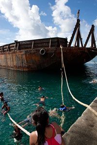
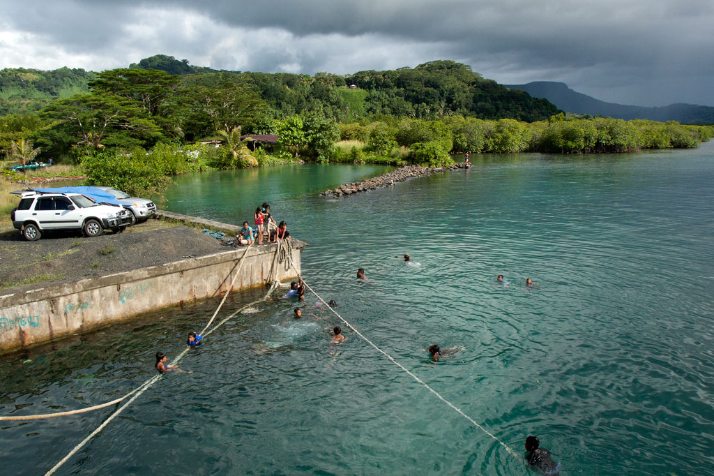
The hottest days call for the coolest swimming holes, and there’s no better place than the “Doldrums” at APSCO Gravel Quarry, owned by the Akinaga family. The quarry property encompasses all of the land around Dolehtik, a small hill at the northern end of Sokehs Island. Across the street is a high cliff where prismatic basalt columns are stripped off the mountain with heavy equipment and later crushed into various grades of gravel. This same site may also have been one of the quarry locations for the stones of Nan Madol.
A large concrete dock 0.46 km (0.29 mi) northwest of the quarry entrance provides access to a beautiful swath of the lagoon. With no residences or pig pens inside this rather large area, the surrounding water is pristine with a visibility of more than 25 meters (80 ft). The spot got its nickname from a giant barge that, until the summer of 2013, was moored just off-shore and functioned as a jungle gym of sorts for local kids and foreigners alike. The barge is no longer there, but the main attraction is still the water itself, which is deep and gets deeper quick. The “Doldrums” is a great picnic destination and an idyllic place to stop in the middle of a paddling excursion around the island. Please keep this location beautiful by taking all of your trash with you when you leave for the day.
The main gate to the quarry is usually open, but visitors must report to the on-site office and ask the security guard to unlock the second gate, leading to the water. The facility is locked down for the night at 6:00 PM every evening. Make sure you’re out in time.
Snorkeling
Though coral development in the area is scarce, there are quite a few reef fish around. If you swim along the coast to the south, you might find some colorful starfish and an urchin or two.
Paddling
Kayaks can be easily launched on either side of the dock where the ground slopes gradually to the water.
Kepindau & Pohn Pillap Waterfalls
![]()
![]()
![]()
Kepindau Waterfall
The larger of two small waterfalls found on Sokehs Island (the only waterfalls not on the main island of Pohnpei) is known as Kepindau and is located in Tamwarohi Kousapw on the private land of Joe Ferdinand and Dahkar Soulik. The stream and the area around it are also called by the same name, which means “bottom of the mangrove passage”. Kepindau and Pohn Pillap, the next stream to the west, were said to have been created when a giant eel wriggled up the hillside. Freshwater short-fin eels are sacred to Pohnpeians and play a recurring role in local myths; this particular story is just one entry in a greater eel-centric epic. Eels do indeed dwell in Kepindau and are protected and fed by the Ferdinand family. There’s a small pool just below the family’s cookhouse, where the eels can be observed. Bring some canned mackerel and the family will feed the beasts for your entertainment.
The hike follows footpaths that the family members use to get around on their land, climbing more or less straight up the slope on the west side of the stream. The waterfall is in a little rocky alcove that gets some very dramatic light in the morning hours. There is a shallow pool, but the amount of water varies. The best time to visit is a day or so after a period of heavy rain.
Pohn Pillap Waterfall
The second falls, Pohn Pillap, is found just over the border of Ipwal Kousapw on the land of Tony Martin and family. The name means “over the river.” Pohn Pillap is not as visually dramatic as Kepindau, but has a certain ambiance when there’s a lot of water (though there’s no pool here). Martin, who used to work for the Office of Historic Preservation, is extremely knowledgeable about just about everything Pohnpeian and can provide you with many fascinating tidbits about this site and others on Sokehs Island and beyond. He can also arrange for one of his older children to take you up to the falls if he doesn’t feel like guiding you himself. Offer $6-10.00 per group of five people or less.
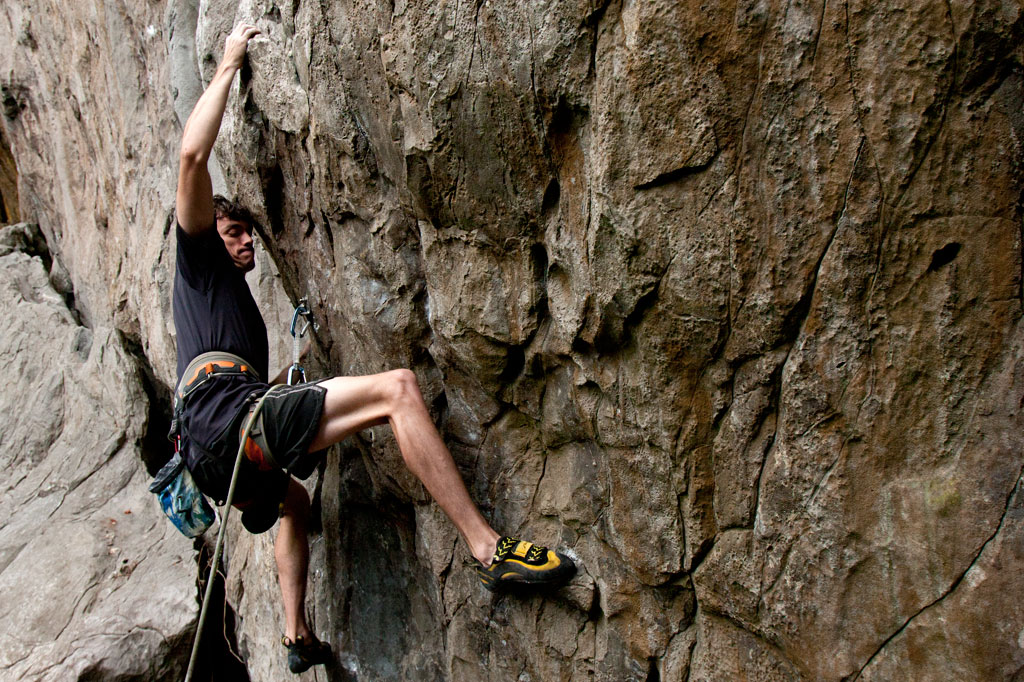
Sport-Climbing on Sokehs Island
![]()
![]()
![]()
![]()
")
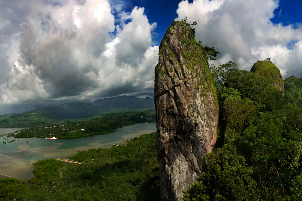
The Spire
“The Spire” is exactly what it sounds like — a dagger-like basalt pinnacle rising 50 meters (165 ft) above the top of Sokehs Ridge immediately south of Paipalap. Named in 2005 by Daniel Moor, who scaled the rear of the rock and established a single top-rope bolt, “The Spire” is the kind of crag that just begs to be climbed. It was not climbed again, however, until 2011, when local climbers Matthew Mann and Jonathan White began to explore different route possibilities in earnest. Over the course of more than a year, they bolted four single-pitch sport-climbing ascents on the eastern face. Since that time, “The Spire” has been climbed fairly regularly by members of a small community of climbers living and working on Pohnpei. The emergence of the sport on the island even drew the attention of the local newspaper — well-deserved attention, considering the thought and care Mann and White put into creating these world-class routes. “The Spire” is reached by taking the Sokehs Rock Trail up from the paved road in Danipei (0.38 km, 15-30 minutes) and turning south at the top of the slope.
Rock Consistency & Hardware
The rock itself has a nice texture to it with plenty of friction, but not so much that it tears up the hands. It tends to be solid, not crumbly, and there are lots of sweet little pockets that formed when air bubbles were trapped in the cooling basalt.
")
Routes
All routes on “The Spire” are well protected with marine-grade bolts and dual double-ring top anchors for top-rope or rappel. Top access is possible via a short route of grade 5.7 which has been bolted on the rear of the rock to provide the means for hauling gear for route-setting and rappel.
| Route | Rating | Length | Hardware in Place | Safety Rating |
| Iron Lungs | 5.12a | 32 m 105 ft |
16 bolts + 2 double-ring top anchors |
G |
| High & Dry | 5.11d | 36.6 m 120 ft |
16 bolts + 2 double-ring top anchors |
G |
| Myxo | 5.12b | 33.5 m 110 ft |
15 bolts + 2 double-ring top anchors |
G |
| No Surprises | 5.11b | 30.5 m 100 ft |
14 bolts + 2 double-ring top anchors |
G |
The Adam’s Apple
Mann and White also discovered a wall about 60 meters south of “The Spire” near Takaien Rikapehd. They named it “The Adam’s Apple“. There are plans to eventually bolt five routes here. As of October 2013, two have been completed. “The Adam’s Apple” routes are short but extreme, as the wall is slightly overhung. This is not a place for beginners.
Routes
| Route | Rating | Length | Hardware in Place | Safety Rating |
| Spies | 5.12b | 15.2 m 50 ft |
5 bolts + 2 double-ring top anchors |
G |
| Genesis | 5.11c | 18.3 m 60 ft |
6 bolts + 2 double-ring top anchors |
G |
")
Why These Climbs Are Awesome
- EASY ACCESS. A 10 minute drive from Kolonia Town + a 20 minute hike from the road = ready to climb.
- NO FEES. Though the Sokehs Rock Trail (which leads to all the sites) begins next to a private residence, the landowners charge nothing for access. Just ask permission, if you see anyone at the house.
- PUBLIC ROUTES. The climbing sites are all on public property and no permission is needed to be there.
- SHELTERED FROM WIND & RAIN. The eastern faces of the rocks, where all the routes lie, are saved from the prevailing winds by the bulk of the ridge and stay mostly dry even after heavy rain.
- SHADE. The routes are in direct sun only early in the morning, so you can sleep in or have a nice, leisurely breakfast before heading up.
- A LITTLE OF EVERYTHING. The rock consists of weathered basalt with all sorts of interesting pockets, jugs, pinches, slopers, cracks, and edges.
- THEY’RE WORLD-CLASS. Route-finders Matthew Mann and Jonathan White were adamant that all routes be of exceptional quality and highly challenging. There are no throw-away climbs. Everything here will test your limits.
- Visit www.pohnpei-adventure.com/rockclimbing for more about climbing on Pohnpei.
Sokehs Rock
![]()
![]()
![]()
![]()
![]()
![]()
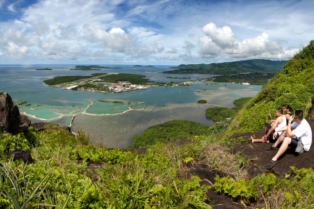
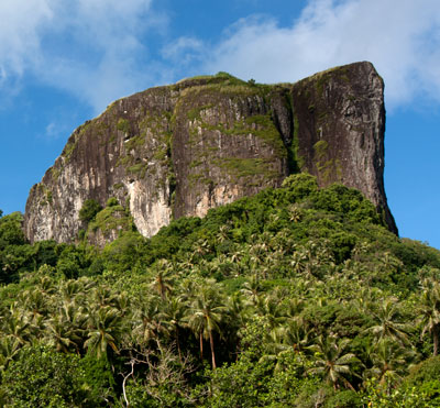
Paipalap, or Sokehs Rock, is without question the most striking feature of Pohnpei’s topography. Over 100 vertical meters (328 ft) of exposed basalt form the upper portion of a gigantic volcanic plug that juts from the north end of Sokehs Mountain and looms over Pohnpei’s harbor and only town, Kolonia. An unmarked trail leading to the Rock, “The Spire”, and “The Adam’s Apple” begins south of a brown house 1.2 km (0.74 mi) beyond Mwalok A-1 Store and just before the Danipei Church (ask permission before hiking). The steep path is well-defined with steep cement steps near the bottom and then a level segment with two
large basalt outcroppings and some cave-like formations. Three quarters of the way along, it begins to follow an electrical conduit running to the beacon on the summit (202 m / 663 ft).
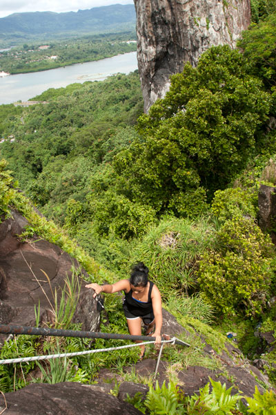
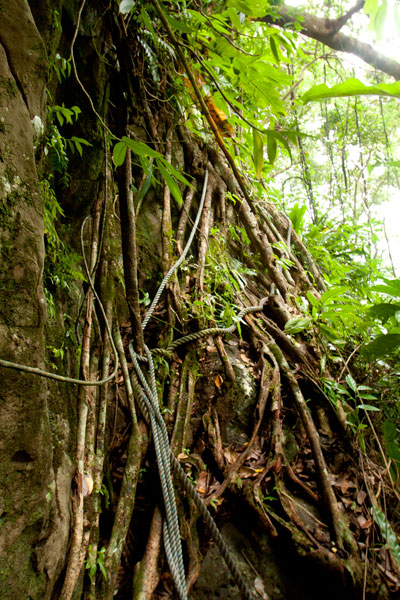
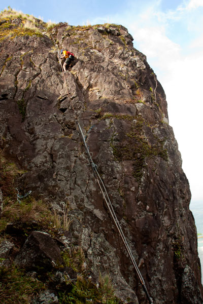
Though not a technical climb, the ascent of the Rock itself is sketchy (triple-pitch, 5.6 R unassisted) and should only be attempted on clear, dry days, as the rocks are treacherous when wet. Pitch 1 begins at the
“Tree Cliff” and skirts a 70° face with the assistance of tree roots, fixed ropes (these you can trust), and the electrical conduit. This section is often underestimated and may, in fact, be the most dangerous part of the endeavor. Several people have been injured in falls at this spot. Pitch 2 starts at the rear foot of the main rock and involves a steep climb with some assistance from the conduit. The crux is a 2-meter section where the conduit has corroded and is no help at all. Climbers must rely on natural holds and a narrow crevice. Ropes also hang along the conduit, but do not trust your weight to any of them as they are in various states of deterioration. Pitch 3 is easier, though no less exposed. Most people straddle the conduit and haul themselves up.
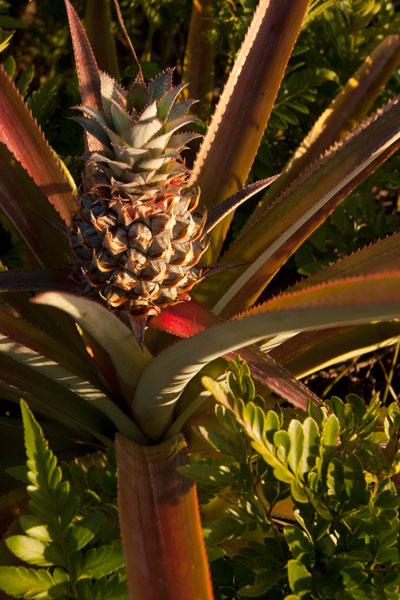
Once on level ground, you can pick out the path that winds through scattered patches of wild pineapples, ferns, and a grove of trees that makes an ideal
campsite before ending at the main cliff on the northern end of the Rock. Spectacular views of the lagoon, reef passes, tuna fleets, and northern islands are found at several spots along the cliff face. On clear days, Pakin Atoll is visible to the west, and you may get a glimpse of Pohnpei’s shy — and perhaps threatened — short-eared owl (Asio flammeus).
The Creation of Sokehs Rock
An ancient Pohnpeian legend states that long ago a man traveling near what is now Sokehs Island was overwhelmed by the force of a geyser-like spring which burst up and swept him all the way to a distant island. There he acquired the help of a powerful magician, who conjured a huge stone and plugged up the spring. Ever after, the rock was known as Paipalap, “the great paip (boulder).” In another version of the story, a Yapese sorcerer named Sou Iap was disturbed by the sound of rushing water and voyaged to Pohnpei to investigate. Upon discovering a great fountain on Sokehs Island, Sou Iap blocked the opening with piles of sea sponges.
Trad Climbing on the Face
The north face of Sokehs Rock has considerable trad climbing potential, though it has yet to be fully explored (several climbers have rappelled down and raved about what they saw there). It is, however, quite extreme and under-cut in places. Note that a top-rope would need to be no less than 200 meters (666 ft) in length. Pioneers are welcome!