
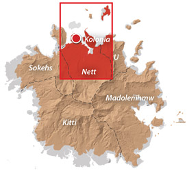
Nett & Western U GPS Data
Downloadable GPS Data Files
The following files contain all the packaged GPS data for each of the featured locations in Greater Nett & Western U.
Three file types are provided. KMZ and KML files are compatible with Google Earth. KML is compatible with Google Maps. GPX files can be imported into ArcGIS (a professional mapping application) and some hand-held GPS devices.
[info]NOTE: All files are free to the public and can be used for any purpose without permission.[/info]
Marine Parks in Awak Pah (2015)
Dolen Eirike (2015)
Dolen Nahnsapwe (2015)
Lou Rahn Cave & Waterfall (2015)
Nan Kiepw & Na Malek Cave (2015)
Nan Koropwung Cliff, Waterfall & Caverns (2015)
Dolen Nett / Pohnlehr (2015)
Nanipil Vicinity (2015)
These files include Liduduhniap, Sengnaip, Likei, Pahn Pwet, and Nan Kiepw waterfalls, the Nanipil Bird Walk, the Swimming Pond, and another popular swimming hole in the area.
Coordinates
The following coordinates correspond with sites featured on the Greater Nett & Western u Eco-Adventure Map Guide. It is our dream to eventually create a Pohnpei GPS app that could be uploaded to smartphones and other devices, but for now, these points of interest can be entered manually in a hand-held GPS device as needed.
[info]NOTE: All GPS devices have a margin of error. That margin increases with interference — when there is a thick canopy of trees, during bad weather, or when mountains obstruct the satellite link. The geosynchronous satellites employed when navigating on Pohnpei are located low on the southwestern horizon, such that maintaining a strong connection while hiking on the northeast side of a given mountain range can be difficult. Coordinates on the northeastern slopes of mountains are less accurate than in other locations.[/info]
Awak Marine Parks
| Awak Pah MP Entrance | —- | 6.965910° 158.250758° |
| Pein Ahi Entrance | —- | 6.966711° 158.251138° |
| Paieke Entrance | —- | 6.969853° 158.256294° |
| Awak Pah MP Dock | —- | 6.966470° 158.248785° |
| Pein Ahi Fish Pond | —- | 6.967572° 158.249929° |
Dolen Eirike
| Relio Lengsi’s Residence | —- | 6.926688° 158.227910° |
| Dolen Eirike Trailhead | —- | 6.919570° 158.227397° |
| Sakau Plantation | —- | 6.917106° 158.227410° |
| Japanese Trench Network | —- | 6.915589° 158.230300° |
| Dolen Eirike Summit | —- | 6.915140° 158.231599° |
| Dol Rakied Summit | —- | 6.906234° 158.237645° |
Dolen Nahnsapwe
| Dolen Nahnsapwe Trailhead – Nett Approach | —- | 6.927169° 158.246675° |
| Dolen Nahnsapwe Trailhead – U Approach | —- | 6.918897° 158.270844° |
| Dolen Nahnsapwe Summit | —- | 6.909546° 158.260936° |
| Dolen Nahnsapwe Turn-Off from Lou Rahn Trail | —- | 6.923336° 158.249283° |
Lou Rahn
| Lou Rahn Trailhead | —- | 6.927169° 158.246675° |
| Lou Rahn Cave & Waterfall | —- | 6.918551° 158.253955° |
Nan Kiepw & Na Malek
| Nan Kiepw / Na Malek / Nahnalaud Nett Trailhead | —- | 6.918179° 158.214601° |
| Stream Crossing | —- | 6.917458° 158.215238° |
| Nahnalaud Turn-Off from Nan Kiepw Trail | —- | 6.910792° 158.217769° |
| Last House along trail | —- | 6.900363° 158.214973° |
| Na Malek Loop Turn-Off from Nan Kiepw Trail | —- | 6.897523° 158.213266° |
| Na Malek Loop Turn-Off from Nan Kiepw Trail | —- | 6.895756° 158.213144° |
| Na Malek Cave | —- | 6.895878° 158.211765° |
| Kiepw Waterfall | —- | 6.889668° 158.211740° |
| Nan Kiepw Overhang & Campsite | —- | 6.889639° 158.211035° |
Nan Koropwung
| Nan Koropwung Trailhead | —- | 6.925729° 158.254909° |
| Cliff & Waterfall | —- | 6.927155° 158.259679° |
| Cave 1 | —- | 6.927513° 158.259859° |
| Cave 2 | —- | 6.927877° 158.259142° |
| Cave 3 | —- | 6.927884° 158.259038° |
Dolen Nett / Pohnlehr
| Dolen Nett Trailhead 1 | —- | 6.968282° 158.230457° |
| Dolen Nett Trailhead 2 | —- | 6.965640° 158.234757° |
| Dolen Nett Trailhead 3 | —- | 6.959650° 158.225124° |
| Dolen Nett Trailhead 4 | —- | 6.969614° 158.228438° |
| Japanese Tunnel Entrance | —- | 6.965840° 158.228329° |
| Yam Plantation | —- | 6.965248° 158.228609° |
| Japanese Defensive Position | —- | 6.964007° 158.229053° |
| Japanese Trench Network | —- | 6.963868° 158.229051° |
| Japanese Trench Network | —- | 6.963073° 158.229706° |
| Japanese Trench Network | —- | 6.963105° 158.229949° |
| Japanese Trench Network | —- | 6.963125° 158.230125° |
| Japanese Trench Network | —- | 6.963025° 158.230332° |
| Pandanus Grove | —- | 6.961883° 158.230662° |
| Coconut Palm Grove | —- | 6.961188° 158.231013° |
| 80 mm Field Gun | —- | 6.958862° 158.233030° |
| Rusted Barrels | —- | 6.958814° 158.233064° |
| 80 mm Gun in Bunker | —- | 6.958838° 158.233535° |
| Machinegun Bunker | —- | 6.958741° 158.233545° |
| Bunker | —- | 6.958765° 158.233415° |
| Pohnlehr Summit | —- | 6.958226° 158.233346° |
| Japanese Mobile Radar Array | —- | 6.958767° 158.232402° |
Sengnaip Waterfalls
| Trailhead | —- | 6.920677° 158.204421° |
| Route Intersection | —- | 6.920647° 158.201060° |
| Sengnaip Cave | —- | 6.917556° 158.200460° |
| Sengnaip Waterfalls | —- | 6.917522° 158.200383° |
Likei & Pahn Pwet Waterfalls
| Trailhead | —- | 6.920677° 158.204421° |
| Route Intersection | —- | 6.920647° 158.201060° |
| Stream Crossing | —- | 6.919559° 158.198878° |
| Log Crossing | —- | 6.916577° 158.198932° |
| Route Intersection | —- | 6.916577° 158.198932° |
| Route Intersection | —- | 6.914373° 158.199648° |
| Route Intersection | —- | 6.904178° 158.192649° |
| Route Intersection | —- | 6.904178° 158.192649° |
| Likei Waterfall | —- | 6.903375° 158.189810° |
| Pahn Pwet Waterfall | —- | 6.902343° 158.192313° |
Nan Kiepw Waterfall
| Trailhead | —- | 6.919873° 158.206230° |
| Route Intersection | —- | 6.914373° 158.199648° |
| Nan Kiepw Waterfall | —- | 6.897512° 158.206958° |
Liduduhniap Waterfalls
| Trailhead | —- | 6.919915° 158.206706° |
| Upper Pool | —- | 6.918893° 158.206592° |
| Upper Falls | —- | 6.918891° 158.206557° |
| Lower Pool | —- | 6.918564° 158.206676° |
| Lower Falls | —- | 6.918695° 158.206572° |
Nanipil Vicinity
| Nanipil Bird Walk Trailhead | —- | 6.920677° 158.204421° |
| Nanipil Bird Walk Trail End | —- | 6.919559° 158.198878° |
| Hydroelectric Building | —- | 6.918222° 158.214670° |
| Japanese Pump Station | —- | 6.918404° 158.214481° |
| Swimming Pond Trailhead | —- | 6.922461° 158.215089° |
| Swimming Pond | —- | 6.922642° 158.215955° |
| Cable Bridge Swimming Hole | —- | 6.932656° 158.216346° |
Paddling in Nett, U & Northern Madolenihmw
Dausokele Estuary
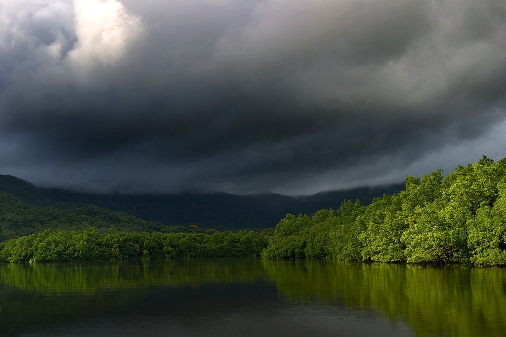
As paddling goes in the Nett region, Dausokele estuary (“channel of the dwarves”) is the crown jewel, a long, gorgeous inlet that lies between Kolonia and the leaf-shaped Nett Peninsula and serves as the mouth of a number of high-volume rivers and streams. The scenery is stunning, especially on days where rain threatens, with high, sheer cliffs to the east, the heights of Dolen Nett in the north, and the pyramid-like peak of Dolen Eirike in the south. Depending on where you begin, you can go as far as 4.5 km (2.8 miles) inland before having to turn around. Most of the way, mangrove forests skirt the coast, so there’s nowhere to land and get out. The final 0.7 km (0.4 mi) follows meandering, narrow natural channels through the swamp forests, where you’re liable to meet locals and traditional outrigger canoes and young kids having a swim. The route tends to be well-protected from both currents and wind, so it’s a nice, leisurely paddle, allowing plenty of time to soak up the scenery. There are multiple places to launch on the Airport Causeway as well as the “Ice Dock” near the Kolonia Public Market building, and next to the PAMI building.
Nett Point
Another great paddling destination is Nett Point, Kolonia’s best swimming spot and the closest thing to a beach Pohnpei Island has to offer. Lidakika Launch point on the Airport Causeway is the most practical place to begin.
- Visit the Nett Point page for detailed information about this location.
Dolen Nett Peninsula Circumnavigation
If you want to try something a little longer and more challenging, you can continue past Nett Point, explore the east coast of the peninsula (which includes one of the locations where the mythical builders of Nan Madol were said to have briefly settled), and then cross the beautiful little bay to the quaint picnic and swimming area at Awak Pah Marine Park. Note that strong winds can be a problem along the eastern coastal section. If you’re plan is a there-and-back-again, you’re looking at around 17 km (10.6 mi) round-trip.
Lenger & Sapwtik Islands
Two of the most interesting islands on Pohnpei are found directly north of Kolonia and can be reached quite easily via paddle-power. Both islands offer a wealth of Japanese fortifications from WWII and earlier, as well as other historical sites, swimming, and snorkeling.
- The islands are covered in detail on the Lenger Island & Sapwtik paddling page.
Parem Island
The largest island in the northern lagoon is Parem, which is large enough to have its own elementary school. Like nearby Lenger and Sapwtik, the Japanese fortified the island prior to WWII. In fact, the coastal gun on Sokehs Mountain may have once been positioned at the top of Dolen Parem before being moved to its present location.
With the exception of a portion of the eastern coast, Parem is completely surrounded by mangrove forests — some of them quite extensive. There are two good channels to explore on the west side where the mangroves are at their widest — one 0.7 km (0.4 mi) long and the other 0.4 km (0.25 mi). Both reach all the way to solid ground at high tide and are beautiful places to scope out the local birds. You can also do a complete circumnavigation of the island, which is 7.9 km (4.9 mi) in total. On the east coast there’s a long stone wharf jutting out from the shore, suitable for a little break, a snack and a dip.
Paddling Distances Around Nett, U & Northern Madolenihmw
| Starting | Ending | Distance (km) | Distance (mi) | |
| Lidakika Launch Point | —- | Causeway Tunnel | 1.5 km | 0.9 mi |
| Causeway Tunnel | —- | Dausokele Bridge | 2.4 km | 1.5 mi |
| Dausokele Bridge | —- | Inlet Terminus | 2.24 km | 1.4 mi |
| Causeway Tunnel | —- | Nett Point | 2.3 km | 1.4 mi |
| Nett Point, Nett | —- | Awak Pah Marine Park (along the coast) | 4.75 km | 3 mi |
| Nett Point, Nett | —- | Awak Pah Marine Park (as the crow flies) | 2.8 km | 1.7 mi |
| Lidakika Launch Point | —- | Awak Pah Marine Park | 17 km | 10.6 mi |
| Misko Beach, Dekehtik Island | —- | Barbosa’s Wharf, Lenger | 4.52 km | 2.8 mi |
| Ice Dock, Kolonia Town | —- | Barbosa’s Wharf, Lenger | 3.53 km | 2.2 mi |
| Nett Point, Nett | —- | Barbosa’s Wharf, Lenger | 1.97 km | 1.22 mi |
| Nett Point, Nett | —- | South Point, Parem | 2.5 km | 1.6 mi |
| South Point, Parem | —- | South Point, Parem (Loop) | 7.9 km | 4.9 mi |
*Silted-in reef. This segment may be difficult or impossible to traverse at low tide.
Dolen Nahnsapwe
![]()
![]()
![]()
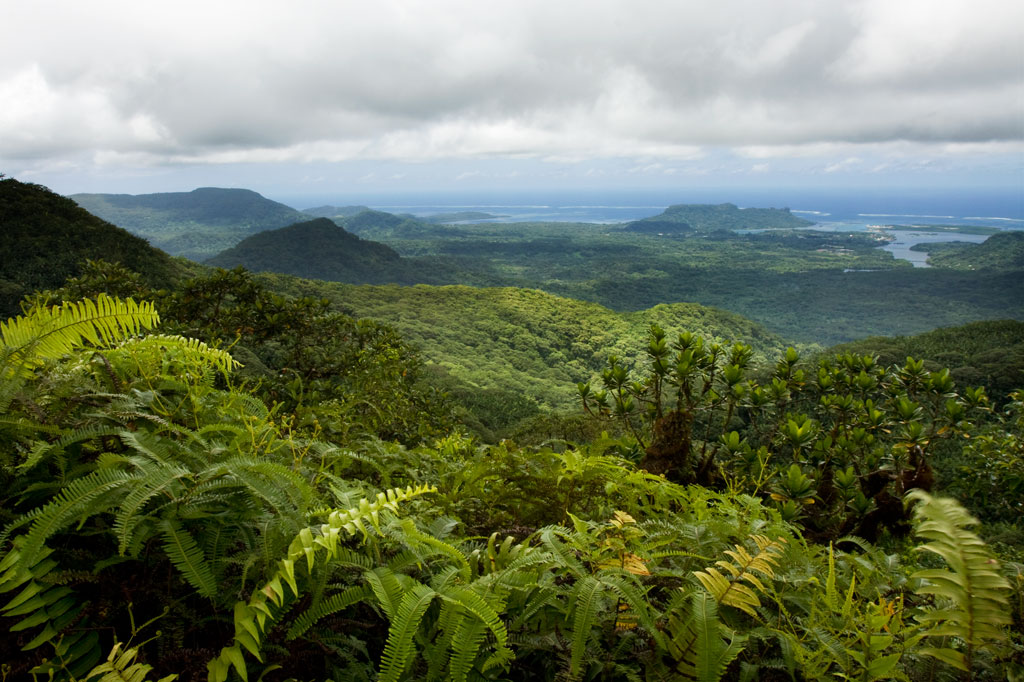
Dolen Nahnsapwe, “hill of thunder,” is a small peak near the Nett–U border. As the crow flies, it’s about 1.3 km (0.8 mi) southwest of the Kupwuriso summit. Though rarely visited and not the highest point in the area, Dolen Nahnsapwe is intriguing because it’s associated with stories about the traditional thunder god, Nahnsapwe, and is said to be the place where thunder storms originate. It’s also the source of the Pwong-Kapwungapwung watercourse, a stream that forms a waterfall below the Lou Rahn ridge in Nett. It’s a challenging climb that follows a trail only part of the way, but the pay-offs come in the form of soaring vistas and gorgeous upland forests. You can approach the peak from either Nett or U or do a full traverse (6.75 km / 4.2 mi) from one side to the other.
Nett Approach
The Nett approach to Dolen Nahnsapwe feels wilder and is steeper and more strenuous. It begins on the side of an unpaved road in Paremkep. The first 0.6 km (0.37 mi) follows the same track that goes to Lou Rahn waterfall and cave with a gentle slope average of about 12%. After that, it branches off and climbs more steeply along the Lou Rahn ridgeline for 2.65 km (1.65 mi) with a slope average ranging between 20% and 25%. This brings hikers to the foot of the peak — a swampy area dominated by thickets of kotop (Clinostigma ponapensis) palms.
U Approach
The way up from U begins behind a cluster of houses at the end of the last road before the Madolenihmw border. On this side, things are much more developed and the trail is clear and well-maintained nearly to the top of the pass north of the peak. One conservation worker told us that sakau farmers from U frequently use this route to access illegal plots in the watershed on the Nett side. The 3.2 km (2 mi) trail meanders through inhabited areas and past a number of a small huts and residences (23% slope avg).
The last bit up to the tiny summit (593 m) is an over-grown, steep (46% slope avg), grubby, and sometimes unnerving scramble from the northwest side. The summit is tiny, and the ground up there has a springy, unstable feel as if you’re actually standing on layers upon layers of ferns and moss rather than solid ground — which may be the case. The effort and unease, however, are rewarded with a truly marvelous 300-degree view. Sokehs Mountain (276 m), Kolonia Town, the open summit of Kupwuriso (630 m), and Dolen Saldenre (629 m) are all visible — weather permitting.
You can do this climb as a day-hike, but a better option is to camp somewhere along the upper Pwong Stream (Pilen Pwong). Remember to pack out everything you packed in. A responsible camp site is one that is invisible once its occupants depart.
- Plan for 8 hours for this hike.
- Please visit the Local Guides & Tour Operators page for a list of experienced guides available for hikes to Dolen Nahnsapwe. Offer $50.00 for a group of five or less.
Marine Parks
Nihco Marine Park
Nihco Marine Park, on the southwest coast of scenic Sokehs Bay is an appealing place for people of all ages to swim, barbecue, and soak up the sun. The park is comprised of a narrow, man-made semi-circle of sand with a placid lagoon in the middle where turtles and reef fish are kept. There’s a white-sand beach on the outer edge and simple thatched huts for either day or overnight visits. Small kayaks can be rented for a few dollars. The place can be packed on weekends and holidays.
- To make reservations for day visits, call +691.320.2135 / 4659.
Awak Pah Marine Park
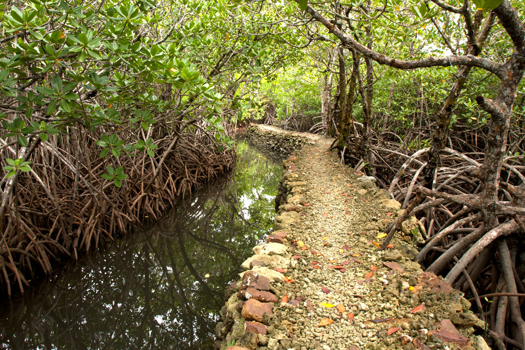
Awak Pah Marine Park is the most well-known of the parks in the area and has a nice big sign right out on the main road. From the parking area near the owner’s house, a 0.2 km (0.12 mi) coral and concrete walkway leads to the water through a dense section of mangrove forests. At the end, there’s a tiny picnic area by the water, a large nahs, and a few other huts that can be rented at an extra cost. The water is shallow and a bit silty on the south side and deep on the west and northwest side where a huge pair of PVC rings have been anchored (a good place to swim). The rock wall by the water is a fun place to jump from, but it can be difficult to climb back out. Snorkeling can be pretty good to the west along the reef wall with lots of small fish and some interesting coral growth. Unfortunately, local visitors have been careless with their garbage and the beautiful reef scenery is frequently ruined by the presence of discarded aluminum soda cans or flashlight batteries — a sad trend on Pohnpei. Water clarity varies from crystal clear to murky depending on the tides; it’s best to visit on an in-coming tide. You can visit Awak Marine Park without making arrangements beforehand.
Paieke Marine Park

This pleasant, breezy swim-picnic-camp park is located on a network of dredged coral causeways that extend out into the lagoon at the point where the road begins to turn east toward the Awak valley. A number of thatched residential huts varying in size and a nahs (meeting hut) or two are positioned around the water’s edge for guests at an extra cost. The swimming is good all along the west side, though the shallows tend to be silty rather than sandy. Snorkelers should follow the edge of the reef further out into the lagoon for best results. The kids will love tinkering around in the shallows under the shady trees. Paieke operates on a reservation-only basis.
- To make reservations for visits call +691.925.0382.
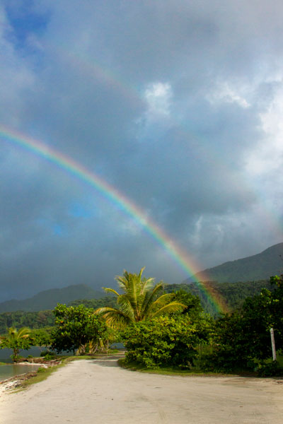
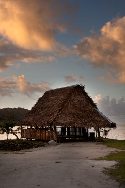
Pein Ahi Marine Park
This charming, but little-known, park (pictured at top) is found just after Awak Marine Park, but as it lacks a sign, most people drive right by without realizing it’s there. From the road, a beautiful 0.16 km (0.1 mi) stone and coral walkway winds through the picturesque mangrove forests and ends at a grassy picnic area with a nahs and a large fish pond. The family keeps some very curious pufferfish and a few other reef fish in the pond, mostly for the amusement of visiting local children. The swimming all around the outside of the pond walls is excellent with consistently good water clarity. There’s a relatively shallow area on the south side that works well for kids or beginning swimmers and deeper water on the west and north. They also have a pair of large bamboo-pontoon rafts that are fun to cruise around the mangrove fringe on. Except on big holidays, you can usually visit without making any prior arrangements.
Nett Point
![]()
![]()
![]()
![]()
![]()
![]()
Nearly all of Pohnpei’s coastline is surrounded by mangroves, and though these otherworldly swamp forests are incredible to explore by kayak, canoe, or paddleboard, they tend not to make good swimming spots. As a result, Nett Point — a long man-made strip of dredged coral and concrete at the north end of the Nett Peninsula — is currently the closest thing Pohnpei Island has to a beach. During the American Period, the place used to be the primary commercial dock. Supply ships would anchor at the end and a barge would carry cargo into Kolonia Harbor (the barge now rusts on the edge of the mangroves just south of Nett Point). The problem, however, was that lots of shallow reefs made Kolonia Harbor and the areas in the lagoon to the north risky for ships to navigate through. Sokehs Passage (Peinmen), to the west, was deeper and better protected. Once the modern commercial harbor and dock were established on the west coast of Dekehtik Island and big ships started using Peinmen (now called “Main Pass”) instead of Kepidauen Pweitik, Nett Point was abandoned. Over the years, the buildings and dock have been used for a variety of purposes, including storing outrigger canoes for the Nett paddling team and, most recently, as part of a clam hatchery operation. However, the point has simultaneously been a popular swimming and picnicking location for decades. The dock area has nice deep water for serious swimming and jumping and the sandy man-made beaches are perfect for kids. Some of the large trees overhanging the water have ropes attached that local kids like to swing around on. If you start near the dock and swim out along the edges of the nearby reefs, you can find some decent snorkeling. Many people barbecue on the east edge of the causeway or on the dock. Overall, Nett Point is a great place to swim, relax, and get to know some locals on a sunny day. Shade is scarce, so bring a hat. Depending on tides and recent rains (best during mid to late in-coming tide), the water is usually clean and clear with a visibility of more than ten meters.
In 2011, the Office of Tourism and the Nett Municipal Government attempted to improve the spot by cleaning it up, dumping large quantities of white sand along the western edge of the causeway, and planting trees. Further developments were announced — sand volleyball courts, public restrooms, and more were said to be in the works and it was announced that the municipality would be charging a small entry fee. After several accidents involving local boats and swimmers, a new channel was dredged not far away and all traffic was encouraged to completely by-pass the areas where people swim. When boats continued to zip through the channel without regard to people in the water, a buoy line was finally placed at the north entrance to the channel and the south end was partially blocked by a causeway. Though these changes solved the boat problem, they created another — inhibiting the natural flow of the tide through the area and reducing the water quality significantly. A small set of outhouse-style restrooms were eventually slapped together near the main road, but these were quickly destroyed by local kids. No fee was ever charged, and it’s unclear how the money would have been collected anyway. Things are very much still in flux. What Nett Point will look like in the future is anyone’s guess.
- It’s easy to spend a 4-6 hours at Nett Point, when the conditions are good.
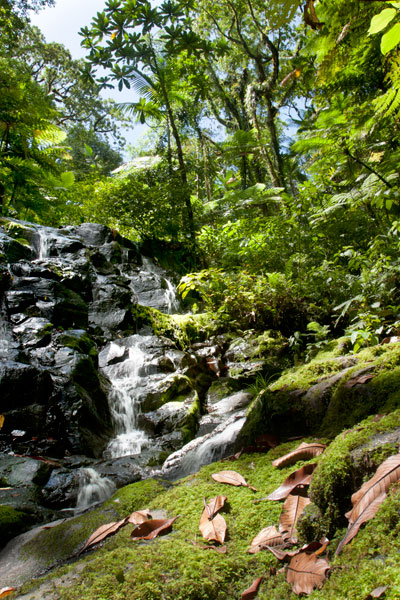
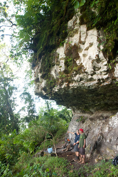
Nan Koropwung Cliff & Caverns
![]()
![]()
![]()
![]()
![]()
")
Anyone who takes a good look at the mountains on the eastern border of Nett will note a dark patch of naked basalt amid the otherwise unvarying green of the steep hillsides. This is the cliff-wall and caverns of Nan Koropwung. The trail to this spectacular and little-known site begins at the end of the unpaved but well-graded road in Paremkep and meanders up the heavily-wooded slope with some rather steep and brushy sections. Eventually, one comes to a towering wall of prismatic basalt columns overrun by a waterfall, which can be dramatic after heavy rain, but is most often thin and misty. Below the falls, the bare rock is in the process of decomposition, smooth and crumbly.
The first 164 m / 180 yd (12% slope avg) from the trailhead brings hikers to a small sakau hut in the woods. The narrow stream crosses the path 57 m (62 yd) further (16% slope avg). After that, the path fades into obscurity and it’s a challenging 489 m (0.3 mi) bush-whack scramble to the cliff and waterfall (47% slope avg). That’s not the end, however, by a long shot. If you pick your way across the rocks under the falls and along the slope for about 80 m (87 yd), you’ll come to the first cave of three. Partially hidden by a curtain of vines, this cave is well-protected from the elements and makes a good campsite. There are great views of Nett and Kolonia and some flat, dry ground.
About 130 m (142 yd) further is a second cave — this one forming a low, tunnel-like passage parallel to the hillside. Swiftlets nest on the roof and their guano covers the floor. Scramble through and you find yourself in the final cave, which is like a bay window looking out over the serene landscapes of Nett and eastern Sokehs. There’s really nothing like this spot on the island. Take care, however — the cavern opens onto a sheer (certainly fatal) drop to the valley below.
- Plan for 3-6 hours for this hike.
- Please visit the Local Guides & Tour Operators page for a list of experienced guides available for hikes to Nan Koropwung. Offer $25-37.00 for a group of five or less.
Dolen Eirike
![]()
![]()
![]()
![]()
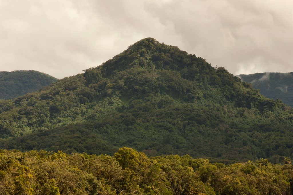
Dolen Eirike (“hill of Eirike”) is a prominent pyramid-shaped peak in Eirike district at the rear of Nett — easily visible from Kolonia and standing out from everything else as one drives south from the coast.
The ascent to the summit makes for a nice half to full-day excursion. A paved road runs through Kahmar, crosses the Pilen Kahmar bridge, and then climbs up and along a low ridge in Eirike before dipping back down again. Along the drive, you’ll pass rows of gorgeous Mindinao gums and Terminalia carolinensis trees (a species found only on Pohnpei and Kosrae) and several spots with wonderful views of the river valleys on both sides. The Eirike road, however, has some bad spots near the turn-off, so you’ll need to go slow and have a vehicle that isn’t too low to the ground.
The trailhead is located at the end of the paved road just beyond the last house and at the foot of the mountain. During the Japanese period, Catholic missionaries working in Kolonia were forceably relocated to a camp in this vicinity, though it’s not clear exactly where. Now the area is mostly small farmsteads, sakau plots, and jungle.
")
The well-trodden lower 0.28 km (0.17 mi) of the trail winds upwards through large areas of sakau cultivation with an average slope of about 23%. As you begin to move above the cultivated areas, the forest thickens and provides cover from the sun but not much relief from the stifling heat. The rest of the climb to the summit is a pretty consistent slope of about 38%. Giant tree ferns with blood-red sap, wild banana plants (utin wel), elaeocarpus, and ivory nut palms are abundant on the slopes.
Slightly less than a half kilometer from the top, you’ll pass a series of Japanese World War II trenches that cross the path. Historical records seem to indicate that anti-aircraft guns were also installed nearby, but they aren’t there now.
The summit itself is often overgrown, but you can get some nice views of Kolonia Town and Sokehs Island through the trees. There’s plenty of flat ground for a campsite and enough trees for protection against any wind.
- Plan for 4-8 hours for this hike.
- Please visit the Local Guides & Tour Operators page for a list of experienced guides available for hikes to Dolen Eirike. Offer $25-50.00 for a group of five or less.
The Story of the Tree of Nansokele
Eirike was part of the ancient region of Nansokele before the chiefdom of Nett split off from Sokehs. As is told in one famous legend, shortly after the fall of the Saudeleurs, some men were trying to cut down a large Terminalia carolinensis tree (kehma) near Dolen Eirike with the intention of building a canoe. No matter what they tried, however, the tree would not fall down. The high priest of Wene was called for and used a special adze to chop through the stubborn trunk, but instead of toppling over, the tree rose up and vanished into the clouds. Soon after, word spread that a canoe made from the wood of the same tree had descended from heaven and hovered over the ocean at a spot near Temwen Island (Sounahleng). The people took this to be a divine omen, and a great meeting followed at Poasoile on Temwen Island, where the paramount chief system that exists today was established.
Nan Kiepw & Na Malek
Nan Kiepw
![]()
![]()
![]()
![]()
![]()
Nan Kiepw
Nan Kiepw, which means “in the lilies,” is a hillside overshadowed by Dolmweir peak. A Pohnpeian myth tells of a Yapese magician, named Sou Iap, who voyaged to Pohnpei and was responsible for the creation of Sokehs Rock). One of Sou Iap‘s companions, Souliken And, noticed a girl collecting clams on a reef north of Sokehs Island, and thinking her very attractive, chased her deep into Nett, carrying an ihd leaf with him. On the hillside below Dolmweir peak, Souliken And lost his leaf and named the place after a species of white lily he saw there.
During the Sokehs Rebellion in 1910, Pohnpeian rebels fleeing from German and Melanesian troops briefly took refuge at Nan Kiepw, rebuilding some earthen fortifications from the Spanish Period and repelling a small attack.
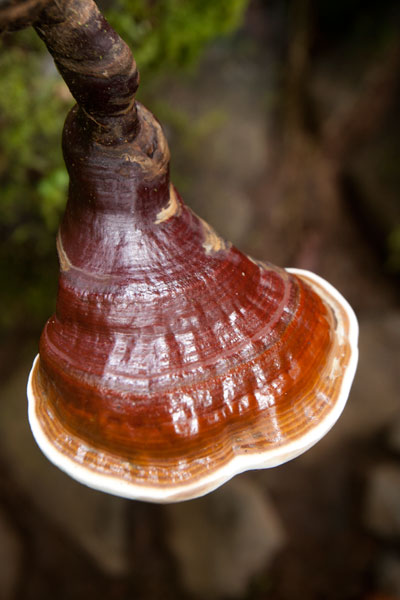
Today, Nan Kiepw maintains a pristine beauty that betrays no sign of past violence. A tributary of the Nanipil River (Pillapen Nanipil) runs through the area, forming a wide gentle cascade, some small pools (though none big enough for swimming), and a “horsetail” waterfall before winding into the valley. Upstream is a basalt outcropping — really a great boulder — that forms an overhang where a few people can comfortably camp out of wind and rain. Huge ivory nut trees, red sandlewood, and a variety of hardwoods dominate the lush native forest, and there are many unusual varieties of fungi to be seen.
The Origin of the Ivory Nut Palm
On the fourth voyage to Pohnpei after its founding, a man came named Mederiap, bringing with him the ivory nut palm and propagating it on the island. Prior to this time people had mostly lived in caves, because they had nothing to use for roofing material, but ever afterward, the fronds of the ivory nut palm were woven together to produce roof thatch for houses.
The moderately challenging trail begins behind a house near the Nett hydroelectic building at the end of the Nanipil River Road (the same trailhead for Nahnalaud). Hikers cross the Nanipil River directly and walk along a well-maintained footpath for 0.99 km / 0.61 mi (5% slope avg) before coming to the first major branch. The left (east) branch leads on toward Nahnalaud, while the right (west) branch heads to Nan Kiepw. From this point it’s 1.4 km / 0.87 mi (14% slope avg) to the last residence along the trail at 265 meters of elevation, and then another 1.8 km (1.12 mi) to the waterfall. This last segment has two little ascents with slope averages of about 20% and 26% and a more moderate bit in between (11% slope avg). Sakau (kava) plantations are found on both sides of the trail much of the way. Hikers should take care to avoid damaging these valuable plants.
[info], Pohnpei, Federated States of Micronesia (FSM)")
Crab’s Eye Vs. Red Sandlewood: What to Know and Why it Matters
Two species of trees found both in inhabited areas and in the upland forests of Pohnpei produce small brilliant red seeds about the size of popcorn kernels. These can be seen scattered across the forest floor and often on the trail leading to Nan Kiepw. Red seeds with a single black dot on them belong to Abrus precatorius (Crab’s Eye Seed or John Crow Bead), while solid red seeds come from Adenanthera pavonina (Red sandlewood). The first type of seed (with the black dot) contains a compound, called abrin, that is 75 times more toxic than ricin and can be fatal if ingested; the fatal dose is about 0.1 mg for an adult of roughly 68 kg (150 lbs). Symptoms of poisoning include nausea, vomiting, convulsions, liver failure, and death after several days. The second type of seed (all red) is harmless when cooked and is sometimes eaten as a snack by Pohnpeian children. Strangely, the same Pohnpeian name — kaikes — is used to identify the two species of trees. Both Abrus precatorius and Adenanthera pavonina originate on the Indian subcontinent. Seeds are sometimes used to make necklaces and other jewelry.[/info]
Na Malek
Na Malek (“his chickens”) is a rock overhang and cave — located in the part of upland Nett once known as Nansokele — said in myth to have been the home of the demon Taimuan. The site, which has excellent views of the valley, Dolen Eirike, and Dol Rakied, is reached via a steep loop of path (0.61 km / 0.38 mi with a 42% slope average) that branches off from the Nan Kiepw trail. The overhang is large enough to provide a protected camping spot, and the elevated cave is bone-dry, flat-floored, and suitable for sleeping. Water running off the rock can be filtered for drinking. This is a relaxing and beautiful place to watch birds, including the Grey White-eye and rare Long-billed White-eye.
- Plan for 8 hours for both Nan Kiepw and Na Malek.
- Please visit the Local Guides & Tour Operators page for a list of experienced guides available for hikes to Nan Kiepw. Offer $50.00 for a group of five or less.
The Tale of Taimuan
A well-known Pohnpeian myth states that Na Malek was the the home of a hideous old demon, named Taimuan, and his sister, Litapinmalekelek. Taimuan had a hankering for human flesh and was, in particular, interested in the beautiful daughter of the Saudeleur — the supreme ruler that reigned from Nan Madol. Deciding that he wished to devour the girl, Taimuan set out for Nan Madol, transforming himself into a handsome young man along the way and leaving his old parts at different points in the mangroves — his white hair, swollen legs, swollen testicles, sagging eyelids, etc. When Taimuan arrived at Nan Madol and presented himself to the Saudeleur, both the girl — who was called Kisin Ntamwahu (“a little bit of good blood”) — and her father were impressed with the young suitor. Kisin Ntamwahu fell for Taimuan and begged her father to let them marry. Soon the two were married and given a home on Pahn Kadira.
After residing at Pahn Kadira for a while, however, Taimuan obtained permission from the Saudeleur to take Kisin Ntamwahu back to Na Malek. On the way, he picked up all his old parts from the mangroves and was restored to his prior appearance. Kisin Ntamwahu realized she had been tricked, but Taimuan carried her away against her will and confined the girl inside the cave at Na Malek. Then he climbed to the top of the mountains to invite all the other demons in the area to join him in feasting on the girl. While he was away, his sister, Litapinmalekelek, discovered Kisin Ntamwahu and felt sorry for her. She began to dig the girl out of her prison and encouraged Kisin Ntamwahu to turn herself into an ant, in order to escape, and flee into the forest. She warned the girl not to pass any plants without greeting them politely. As Kisin Ntamwahu ran, she greeted all the plants, big and small. All except one. Feeling a sudden need to urinate, she relieved herself in the forest and didn’t realize she’d done so on a plant called kampanial.
When Taimuan found that Kisin Ntamwahu was gone, he confronted Litapinmalekelek, but she claimed to know nothing. In a rage, Taimuan showered his sister with obscenities (specifically, he shouted, “Your vagina! My penis!” — a highly offensive reference to an act of incest) and then took off into the forest to catch Kisin Ntamwahu. He questioned each plant he passed, but none would tell him anything until he came upon the kampanial, which told Taimuan which way Kisin Ntamwahu had gone. Shortly thereafter, Taimuan met two worms on the path. He asked them where the girl had gone and they promised they would tell him if he pulled down his eyelids. He did so, and the worms threw dirt in his eyes. When Taimuan tried to wash his eyes out in a nearby streamlet, the worms muddied the water upstream, causing him to go blind and eventually die.
- Please visit the Local Guides & Tour Operators page for a list of experienced guides available for hikes to Nan Kiepw.
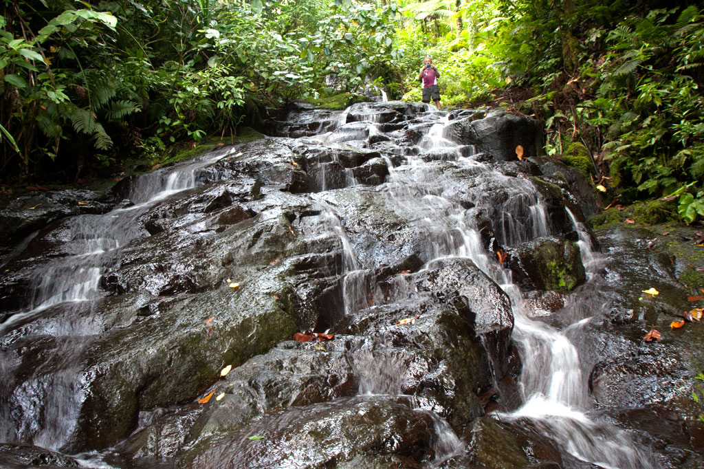
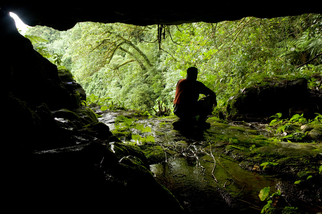
Lou Rahn Cave & Waterfall
![]()
![]()
![]()
![]()
![]()
![]()
Tucked away in the little-seen Nett hinterlands is one of Pohnpei’s most beautiful hiking destinations. Uluhlen Lou Rahn, a fence-like ridge, extends northwest from the place where the mountains of U meet those of Nett, hiding from view the verdant valley of the Pwong Stream (Pilen Pwong). Cutting through this gorge from its source below Dolen Nahnsapwe, the stream spills over a high cliff to form a thundering waterfall next to a large cave with a view of the misty valley floor. Though there is no quick way down to the bottom of the waterfall from the cave (you can backtrack a ways and make your way down the slope to the stream), there is a gorgeous pool for swimming just up-stream with cool, crystal-clear water.
 at Lou Rahn, Pohnpei, Federated States of Micronesia (FSM)")
The trail to the site begins off the unpaved but well-graded road in Paremkep and sees plenty of traffic from sakau farmers and residents on the first 0.6 km (0.37 mi) leading toward the spur (12% slope avg). Once it reaches the ridge, it cuts east and passes along Lou Rahn’s inside slope rather than following the ridgeline (0.92 km / 0.57 mi, 19% slope avg). The hardest aspect of this full-day hike is the treacherous footing, as much of the last leg of the route crosses the sharp, jumbled rocks of old landslides now obscured by high grass. Take care and watch each step; a fall into one of the hidden crevices could result in a serious sprain or fracture — not a good thing to have way out in the forest on Pohnpei. There are also a great many sakau (kava) plants in the area — a massive number, in fact — which hikers must take care to avoid damaging. The roots of the plant are used to make Pohnpei’s potent ceremonial drink. Large plants can be twenty years old or more. Small huts, which farmers use while working on their plants, are passed at several places along the route.
The cave sits just to one side of the falls with a stunning view of the hidden valley. The roof is a bit low in places, but it’s quite a fair size none the less. Though a thin stream of water flows across one side of the cave floor, the rest is dry and makes an excellent camping location. Hunters often use it, and you may notice their cooking pots stored in crevices at the rear of the cave.
- Plan for 6-8 hours for this hike.
- Please visit the Local Guides & Tour Operators page for a list of experienced guides available for hikes to Lou Rahn. Offer $37-50.00 for a group of five or less.