Pohnpei Diving – Pakin Atoll

Pakin Atoll, Pohnpei, Federated States of Micronesia (FSM) Map
Pakin has similar features and conditions as And, except that the atoll has no true passage into the lagoon — which is limiting. Divers will mostly want to stay outside the lagoon. Small boats can enter only at high tide at one of two locations along the west side of the barrier reef. Both of these spots are sketchy with very narrow areas to maneuver, extremely shallow conditions, and dangerous currents and surge. Local residents have been killed attempting to enter when the conditions were less than ideal. The reefs on the west side drop off extremely deep — straight down. Hard coral and excellent visibility (often exceeding 60 meters) can be found all around the outside and in the lagoon as well. Most of the sites offer the same sorts of attractions, including large pelagic species, barracuda, jacks, tuna, whitetip and blacktip reef sharks, and sea turtles. Diving at Pakin is possible from May through October, but the best conditions are usually September-October.

“Turtle Gardens”

The many small islets around Painpwel, Sapangin, and Kehrot are nesting sites for sea turtles. Consequently, the outer reef wall northwest of Painpwel is famous for turtle sightings. Best at 10-35 meters.. Advanced.

“Barracuda Cove”

As the name suggests, this spot on the edge of the reef wall southwest of Nikahlap (Island) is a good place to see large schools of barracudas (among other things). Best at 10-30 meters.. Advanced.

  • “Barracude Cove” is inside an MPA and requires a permit. Visit our MPA page for details.

“Shark Bay”

This drift follows the reef wall north of Nikahlap (island) and is known for large congregations of reef sharks and occasional oceanic species. Best at 18-40 meters.. Advanced.

  • “Shark Bay” is inside an MPA and requires a permit. Visit our MPA page for details.

“East Wall,” “Mwahnid Wall” & “West Wall”

These are all outer reef drift-dives that can offer everything from fabulous hard and soft coral colonies and macro-life to large pelagics, sharks, eagle rays, and turtles. “East Wall” is east of Olamwun (Island), “Mwahnid Wall” is south of Mwahnid (Island), and “West Wall” is east of the primary point of entrance into the lagoon. Best at 18-40 meters.. Advanced.

  • “Mwahnid Wall” is inside an MPA and requires a permit. Visit our MPA page for details.

ACKNOWLEDGMENTS

We’d like to extend a big kalahngan to Mike Viti, John Ranahan, and Karino Olpet for sharing their in-depth, first-hand knowledge about SCUBA diving on Pohnpei — without which this page could not have been created. Images licensed from www.shutterstock.com.

Map Guides >> Marine Attractions Eco-Adventure Guide >> SCUBA Diving >> Pakin Atoll SCUBA Diving

Pohnpei Diving – And Atoll

And (Ant) Atoll, Pohnpei, Federated States of Micronesia (FSM) Map
And has steep outer reef walls that drop off into very deep conditions, especially on the west side. Currents can be swift anywhere outside the lagoon and in Dauenai (Pass), but particularly on the east wall. Visibility can reach 50 meters (164 feet). You’ll need a boat to get to all of the dive sites except “Turtle Canyons,” which you can access from the beach at Pahn Mwek (island). The channel between Pohnpei and And is notoriously rough during the winter. Diving at And is possible from May through October, but the best conditions are usually September-October.

“Bird Island”

This drift begins on the outer reef corner north of Olouna (nicknamed “Bird Island” for its huge seabird rookery) and goes south. Sharks, tuna, barracuda, turtles, and other large pelagic species may be seen. Best at 18-40 meters. Advanced.

“West Wall”

This drift runs either way along the western outer reef wall and features lots of hard and soft coral variety, caves, tunnels, holes, reef fish, and sharks. Best at 18-40 meters. Advanced.

“Turtle Canyons”

This spot in the lagoon north of Pahn Mwek (island) features shallow coral grottoes, lots of reef fish, and a strong likelihood of sea turtle sightings. Best at 10-23 meters on a late in-coming tide. Novice.

“Triggerfish Cove”

This is a spot on the outer reef wall south of Sakarawi (Island) known for triggerfish. Best at 18-40 meters. Advanced.

“Orange Wall / West Dauenai”

This drift begins outside and to the west of Dauenai (passage) and then follows the west wall of the passage north into the lagoon. The spot gets its nickname from the large orange elephant ear sponges that are prevalent along the wall, but this is a great place to see And’s gray reef sharks, a lot of beautiful hard and soft corals, and macro-life. Best at 18-40 meters on an in-coming tide. Advanced.

“Dauenai Pass (East)”

This drift begins outside and to the east of Dauenai (passage) and then follows the eastern passage wall north into the lagoon, featuring huge groupers, wrasse, turtles, rays, congregations of gray reef sharks, whitetip and blacktip reef sharks, large schools of barracuda, jacks, and occasionally billfish or dolphins around the mouth. Best at 18-40 meters on an in-coming tide. Advanced.

“Itol Rock”

This is a spot on the outer eastern reef wall between Pasa (island) and Nikahlap (island), which is sometimes considered part of the next drift-dive on this list. Soft coral, rays, and lots of pelagics are to be seen here. Currents can be intense. Best at 18-40 meters. Advanced.

“Nikahlap Wall”

This is a drift-dive starting at “Itol Rock” and running south along the contour of the reef wall. See Itol Rock for features. Currents can be very strong. Best at 18-40 meters. Advanced.

“Pasa North”

This is a drift-dive running in either direction along the outer reef wall north of Pasa (island) and featuring the usual And Atoll gamut of large pelagics, turtles, and sharks as well as blossoming coral on the wall. There are often strong currents here. Best at 18-40 meters. Advanced.

ACKNOWLEDGMENTS

We’d like to extend a big kalahngan to Mike Viti, John Ranahan, and Karino Olpet for sharing their in-depth, first-hand knowledge about SCUBA diving on Pohnpei — without which this page could not have been created. Images licensed from www.shutterstock.com.

Map Guides >> Marine Attractions Eco-Adventure Guide >> SCUBA Diving >> And Atoll SCUBA Diving

Pohnpei Diving – West Side Sites

“Dauahk Wall”

This drift-dive follows the outer barrier reef wall north of Kepidauen Dauahk. Things to see here include eagle rays, napoleon wrasse, gray reef sharks, and schools of dog-tooth tuna. 10-40 meters. Best on an in-coming tide. Advanced.

“Dauahk Bridge”

This is one of the best dive spots on Pohnpei, following the reef bridge across the mouth of Kepidauen Dauahk. It offers the same things as the “Palikir Pass Bridge”, but at less depth. Large congregations of gray reef sharks, spotted eagle rays, and massive schools of black snappers, red snappers, and barracuda are regularly encountered. The snappers mate in late summer and early fall. Down to 36 meters. Best at 18-24 meters on an in-coming tide. Advanced.

“Pehleng Wall”

This drift dive-along the outer wall north of Kepidauen Pehleng is notable for gray reef sharks and the less-common silver-tip sharks, huge napoleon wrasse, schools of jacks, lionfish, and an abundance of soft coral. 10-40 meters. Best on an in-coming tide. Advanced.

“Pehleng Corner”

This spot is located at the prominent southern corner of Kepidauen Pehleng. Commonly seen are sweetlips, lionfish, and huge schools of both black and red snappers, jacks, and sometimes tuna. The reef wall is encrusted with nudibranchs and anemones. 6-40 meters. Best on an out-going tide. Advanced.

“Kehpara Wall”

This is a drift-dive along the outer reef wall north of Dauen Kehpara within the boundaries of the Kehpara Marine Protected Area (MPA). Sights include wrasse, jacks, groupers, barracudas, silver-tip sharks, and both black-tip and white-tip reef sharks. Lobsters, giant clams (tridacna), conchs, sea fans, and sponges are also prevalent. The island to the south, nicknamed “Black Coral,” gets its name from a variety of purplish, branching coral found in the area. This is one of the primary spawning grounds for local groupers. 6-37 meters. Best on an in-coming tide. Intermediate.

  • Entering the MPA requires a permit. Visit our MPA page for details. Kehpara MPA is closed to snorkeling and diving from January 1 to June 30 each year.

ACKNOWLEDGMENTS

We’d like to extend a big kalahngan to Mike Viti, John Ranahan, and Karino Olpet for sharing their in-depth, first-hand knowledge about SCUBA diving on Pohnpei — without which this page could not have been created. Images licensed from www.shutterstock.com.

Map Guides >> Marine Attractions Eco-Adventure Guide >> SCUBA Diving >> SCUBA Diving Pohnpei’s West Side

Pohnpei Diving – South Side Sites

“Nahlap”

This dive curves around the corner of the reef east of Nahlap (island). It’s best known for sponges and schools of mackerel, jacks, and rainbow runners. Reef sharks and turtles are also occasionally seen. 9-40 meters. Best on an in-coming tide. Intermediate.

“Laiap Bridge”

This dive follows the bridge across the entrance to Kepidauen Laiap southeast of Laiap (island) and offer opportunity to see plenty of pelagics, sharks, and sometimes turtles. 2-34 meters. Best at 15-25 meters on an in-coming tide. Intermediate.

“Nahtik Bridge”

This dive follows another bridge across the entrance to Kepidauen Nahtik southeast of tiny Nahtik (island) with similar sights as “Laiap Bridge.” 2-34 meters. Best at 15-25 meters on an in-coming tide. Intermediate.

“Ros”

The prime attraction in this narrow pass east of Ros (island) is the manta rays, which can congregate in unbelievable numbers (as many as 40). The main reason the site isn’t as frequently visited as “Manta Road” is that its so far from Kolonia. Schools of jacks, snappers, and barracuda are also common and occasionally green turtles. 5-40 meters. Best at 18-24 meters around the full moon. Intermediate.

“Penieu Corner”

This dive begins on the outer reef wall east of Kepidauen Ne opposite Penieu (island) and then follows the reef west and south, through the pass, and into the lagoon. 3-40 meters. Best at 18-35 meters on an in-coming tide. Currents are often strong here. Advanced.

“Lohd Bridge” (also known as “Lohd Harbor”)

This dive follows a bridge across the entrance to a small barrier reef passage east of Kepidauen Ne (pass). There are lots of sharks here. 2-35 meters. Best at 18-35 meters on an in-coming tide. Currents can be intense. Advanced.

ACKNOWLEDGMENTS

We’d like to extend a big kalahngan to Mike Viti, John Ranahan, and Karino Olpet for sharing their in-depth, first-hand knowledge about SCUBA diving on Pohnpei — without which this page could not have been created. Images licensed from www.shutterstock.com.

Map Guides >> Marine Attractions Eco-Adventure Guide >> SCUBA Diving >> SCUBA Diving Pohnpei’s South Side

Pohnpei Diving – East Side Sites

“Straight Wall”

This dive is on the outer edge of the long, straight fringing reef east of Nahnningi (Joy) Island. It’s a good place to see schools of tuna and barracuda hanging out beyond the wall. It’s also one of the few places you might spot sea turtles. This side of the island is very exposed to winds, so summer is the best bet for good conditions. 1-37 meters. Advanced.

“Joy / Nahnningi”

This spot is known by most people as “Joy,” which used to be the name of the island nearby (the local name of the island is Nahnningi). The dive is actually in the small bay-like channel south of Nahnningi on the outer edge of the barrier reef. One informant reported seeing huge mantas here, larger than any at “Manta Road” or “Ros”. Other sights include schools of barracuda and the occasional sea turtle. 1-37 meters. Intermediate.

“Nan Madol” (Kahnimweiso)

This is spot, east of the ruins of Nan Madol (not far beyond Kerian islet), garnered fame when divers apparently discovered a line of pillars on the bottom that they believed were related to the story of Kahnimweiso — a fabled stone city that is said to have pre-dated Nan Madol. The pillars were later proved to be natural coral formations, but the site is still intriguing. Anemones, pipefish, hydroids, and a whole lot of other reef fish can be found in the area. The problem is that the visibility is often terrible and the water can be very rough. 3-21 meters. Best at 18-21 meters. Advanced.

“Pahn Nahkapw”

This dive begins in front of the boulder break-wall off Nahkapw‘s western shore and follows the steep reef wall as it curves around to the east toward Kepidauen Nahkapw. Water clarity at this spot can be absolutely incredible and the reef is alive with fish of many types. Shark sightings are a strong possibility in this incredibly deep blue hole — especially below 18 meters. 2-30 meters. Any tide. Novice.

“Na”

This wall dive is located east of Na on the outer slope of the reef. Staghorn and elkhorn coral, sting rays, sharks, manta rays, and the usual gamut of reef fish are what to look for. The water can be very rough in this area as it’s directly exposed to the northeasterlies, so winter diving is out of the question. 2-29 meters. Advanced.

“Nanwap Corner”

This wall dive in the Nanwap Marine Protected Area is located on the north side of Kepidauen Deleur, on the opposite side of the pass from Nahpali. This is a great place for sharks and rays, but it’s also one of the healthiest spawning sites for reef fish in Pohnpei. However, the pass (and the general area) has a reputation for rough water, and the currents can be intense. Mid-summer diving, when winds are minimal, is the safest. Best on an in-coming tide. Advanced.

There’s also good diving and snorkeling around the blue holes in the inner reef, where you’re more protected from waves and current. The coral is nice here and there are usually plenty of fish around. Best at slack-tide. Intermediate.

  • Entering the MPA requires a permit. Visit our MPA page for details.

“Areu North / South” (Kepidauen Alohkapw)

Drift-dives can be done on either the north or south edges of Alohkapw Pass (Kepidauen Alohkapw), beginning along the outer barrier reef walls and moving in to the inner reef. There have been reports of large of schools of reef sharks below 30 meters. Best on an in-coming tide. Advanced.

“Areu Wall”

Located along the wall of one of the inner reefs west of Kepidauen Alohkapw, this site is about the little creatures — invertebrates, small reef fish, sponges, tunicates, anemones, and soft coral. You can also find sea fans (18-24 meters), sea whips, white-tip reef sharks, and barracuda here. 2-34 meters. Currents can be strong at times. Best at 6-18 meters on an in-coming tide. Novice-Intermediate.

“Areu Avenue”

This is another inner lagoon wall-dive similar to “Areu Wall” but in a different location nearer to Kepidauen Alohkapw. Many of the same sights can be found, including sea fans at depth. 2-30 meters. Currents can be strong at times. Best at 6-18 meters on an in-coming tide. Intermediate.

ACKNOWLEDGMENTS

We’d like to extend a big kalahngan to Mike Viti, John Ranahan, and Karino Olpet for sharing their in-depth, first-hand knowledge about SCUBA diving on Pohnpei — without which this page could not have been created. Images licensed from www.shutterstock.com.

Map Guides >> Marine Attractions Eco-Adventure Guide >> SCUBA Diving >> SCUBA Diving Pohnpei’s East Side

Pohnpei Diving – North Side Sites

“Manta Road”

Manta Rays at Manta Road in U, Pohnpei, Federated States of Micronesia (Photo by Whitney McCurdie)
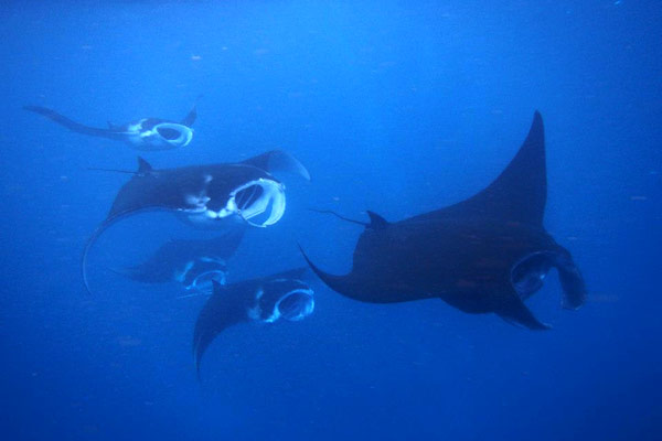
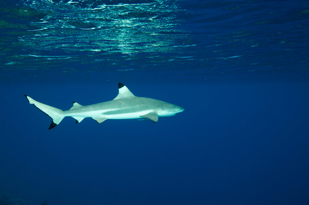
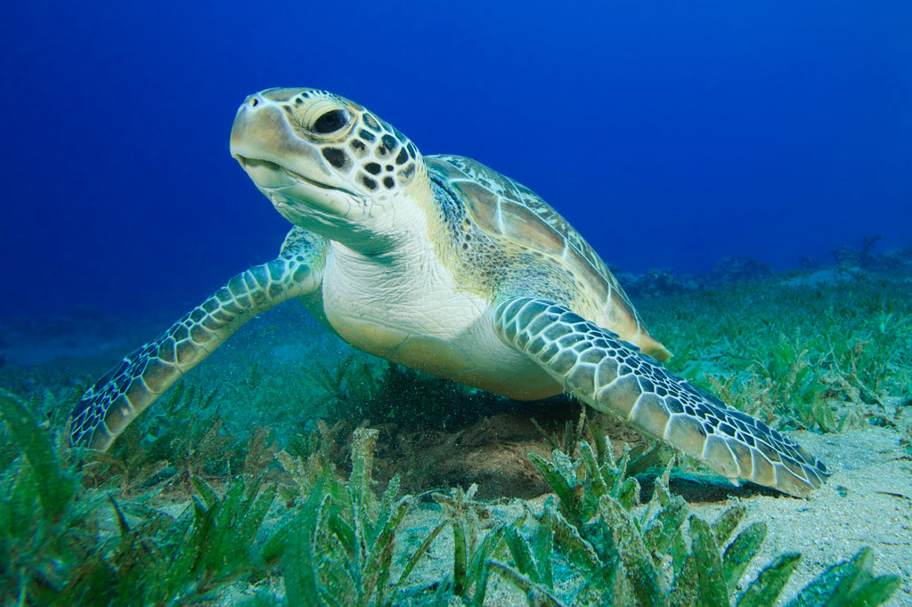
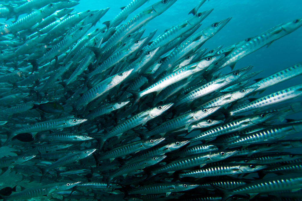
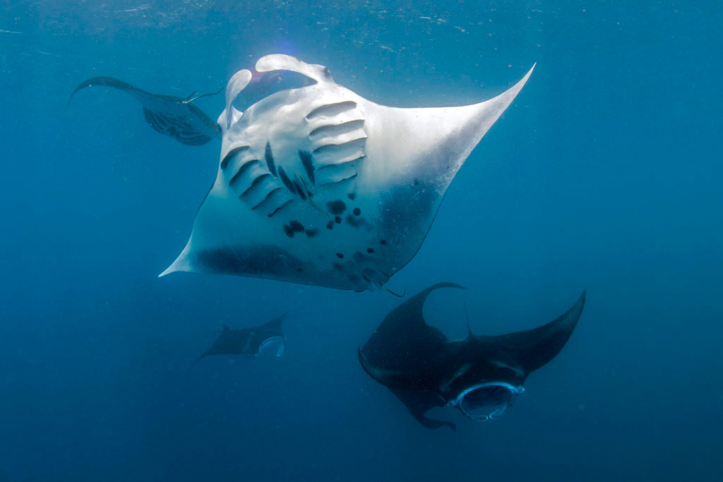
Manta Road is easily Pohnpei’s most famous dive spot due to its resident community of manta rays (including the all-black Black Morph variety) that cruise back and forth through the narrow channel as they filter-feed. The site is located between the fringing reef at the north end of Mwahnd Peidak (island) and a long strip of reef running northwest-southeast (2.75 km southeast of Kepidauen Mwahnd). The mantas mate between January and April, which is a good time of year to visit. Aim for the last hour of the out-going tide a few days on either side of the full moon. The channel has very strong currents — up to 7 knots — (which the mantas love), but which make diving and snorkeling tricky. You’ll want to avoid the spot on flood tides. The water can be crystal clear, but usually there are more mantas around when the visibility isn’t very good. Huge schools of fusiliers and jacks, as well as black-tip and white-tip reef sharks are common in the area. Small turtles are occasionally spotted. 3-24 meters. Best at about 16 meters. Advanced.

  • Entering the MPA requires a permit. Visit our MPA page for details.

“Tubastrea Gardens”

This spot is located at a bridge about 17 meters down in the lagoon and about halfway between Parem and Mwahnd Peidak islands. The area is known for brightly-colored tubastrea (tube coral or sun coral) on the south side of the bridge. There are also a great many fish, though visibility is sometimes lacking. 15-20 meters. Best on an in-coming tide. Novice.

“Mwahnd Peidak”

This spot off the northeast side of Mwahnd Peidak’s fringing reef is notable for huge schools of parrotfish — a family of fish that is becoming relatively scarce in general. 3-18 meters. Best on an in-coming tide. Novice.

“Mwahnd Wall”

This drift-dive on the inner edge of the barrier reef south of Kepidauen Mwahnd is notable for the health and variety of corals and for reef sharks. The attractions go all the way down to 36 meters, which is where you’re most likely to find the sharks. Best on an in-coming tide. Advanced.

  • Entering the MPA requires a permit. Visit our MPA page for details.

“Mwahnd Pass”

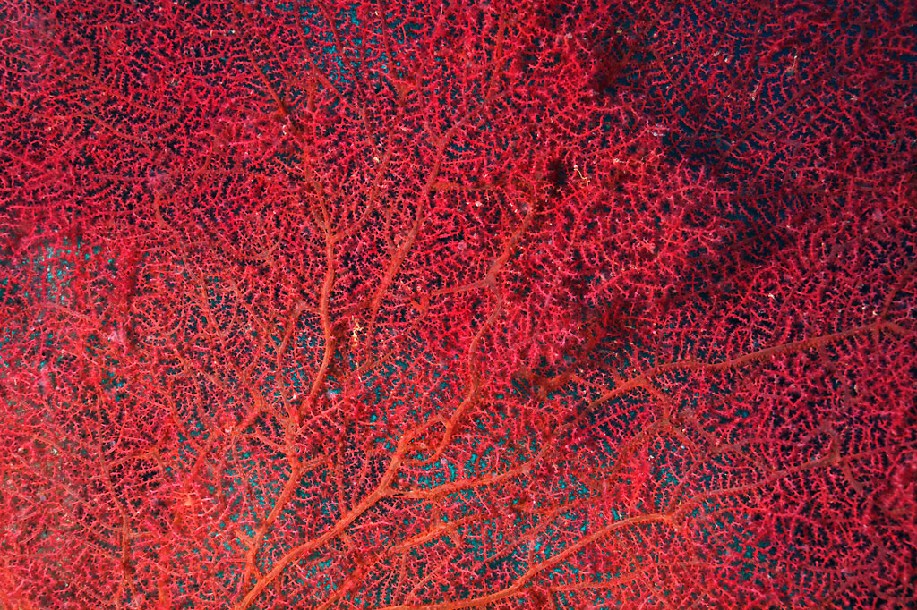
This drift-dive on the west side of Mwahnd Pass (Kepidauen Mwahnd) is known for its whip coral, gorgonian fans (below 30 meters), tree coral, and macro life. It’s also a good place for eagle rays, reef sharks, crinoids, feather stars, and napoleon wrasse. The wreck of a catamaran lies at the edge of the channel. 3-30 meters. Best at 12-15 meters on an in-coming tide. Advanced.

  • Entering the MPA requires a permit. Visit our MPA page for details.

“Mwahnd Cove”

This drift-dive is on the southeast side of Mwahnd Pass (Kepidauen Mwahnd), beginning along the outer barrier reef wall and following the contour of the reef inside to a little coral bay dubbed “The Cove.” Attractions sometimes seen here include multitudes of mating eagle rays, moray eels, schools of barracuda (24 meters), whip coral, shrimp, and loads of white-tip reef sharks resting on the sandy bottom at about 30 meters. You might even be lucky enough to spot resident leopard sharks. 15-30 meters. Best at 24-30 meters on an in-coming tide. Advanced.

  • Entering the MPA requires a permit. Visit our MPA page for details.

“Inner Mwahnd”

This spot is on the inside edge of the barrier reef south and east of Kepidauen Mwahnd (pass). The coral is abundant on the wall. Reef sharks, barracuda, and plenty of reef fish are also found in the area. 3-20 meters. Best on an in-coming tide. Intermediate.

  • Entering the MPA requires a permit. Visit our MPA page for details.

“North Point”

Located at a sharp bend on the outside of the barrier reef, this wall dive is about sharks and large schools of pelagic fish. It’s quite a ways from any of the passes and the wind-exposed nature of the location means that the spot is only accessible during the summer. Down to 36 meters. Advanced.

“Lighthouse”

Sharks, pelagics, and more. This is a standard Pohnpei drift-dive that starts along the northern barrier reef wall and curves south into Kepidauen Pweitik (“Old Main Pass”). Best on an in-coming tide. Advanced.

“Lenger”

The areas north, south, and east of the Japanese seaplane ramp offer plenty for beginning divers. A variety of small reef fish, including gobies, angels, and parrots, octopi, sting rays, and lots of soft coral are found in the shallow coral grottoes. Visibility can range from terrible to very good. Best on a late in-coming tide. Novice.

“Parem”

This area on the fringing reef off the northwest end of Parem (island) offers more of the same kinds of attractions seen at Lenger. Visibility fluctuates greatly. Best on a late in-coming tide. Novice.

“Middle Pass” (Kepidauen Kiepw)

This spot is on the eastern corner of a narrow channel, called Kepidauen Kiepw, between Peinmen and Kepidauen Pweitik. The drift-dive starts on the outer edge of the reef wall and follows the reef south and east. This is a good place to see reef sharks. Best on an in-coming tide. Intermediate.

“Main Pass” (Peinmen)

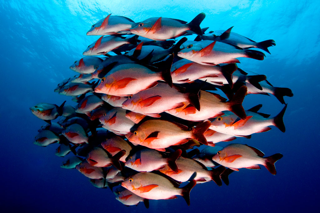
This drift-dive begins along the northern edge of the barrier reef wall and follows the reef into Peinmen (Passage). Attractions include schools of black-tip and gray reef sharks (below 24 meters), occasional lemon sharks, schools of dog-tooth tuna, and sweetlips on the reef shelf at 24-30 meters. 5-30 meters. Best below 20 meters on an in-coming tide. Advanced.

“Sokehs Side Pass”

This little known spot in the narrow channel next to Peinmen is worth mentioning for the schools of large remoras that frequent the area. Best on an in-coming tide. Intermediate.

“Sandy Bottoms”

This blue hole on the inside edge of the barrier reef between “Main Pass” (Peinmen) and Palikir Pass (Kepidauen Palikir) is a great place for beginners to explore. Best on an in-coming tide. Novice.

“Palikir Bridge”

This is a deep dive that follows the reef bridge across the mouth of Kepidauen Palikir. It’s most famous for its schools of large pelagics, like tuna and wahoo, gorgonian fans, jacks, barracuda, humphead parrotfish, and huge schools of gray reef sharks. It’s also one of the places you might get a glimpse of Pohnpei’s little-seen tiger sharks. Currents can be strong. Best on an in-coming tide at 30-36 meters. Advanced.

“Palikir Wall”

This dive along the outer barrier reef wall west of Kepidauen Palikir is characterized by giant clams, triton’s trumpets, white-tip reef sharks, triggerfish, soft coral, and anemones. 9-37 meters. Best on an in-coming tide below 20 meters. Advanced.

ACKNOWLEDGMENTS

We’d like to extend a big kalahngan to Mike Viti, John Ranahan, and Karino Olpet for sharing their in-depth, first-hand knowledge about SCUBA diving on Pohnpei — without which this page could not have been created. Image Credits: Manta Road (Whitney McCurdie). All others licensed from www.shutterstock.com.

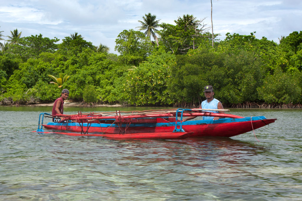
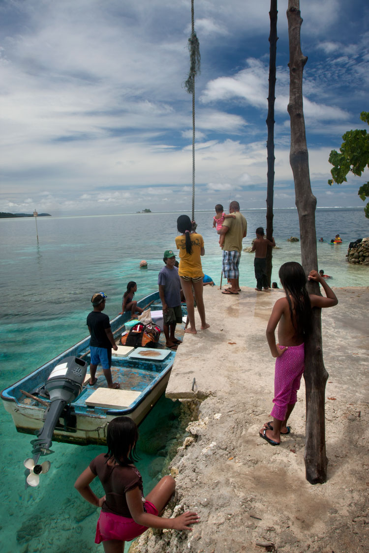
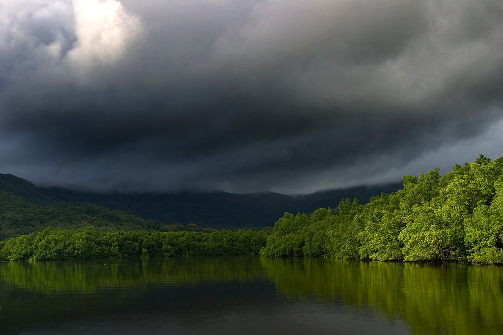
Map Guides >> Marine Attractions Eco-Adventure Guide >> SCUBA Diving >> SCUBA Diving Pohnpei’s North Side

Paddling Around Western Kitti

Pwudoi Mangrove Sanctuary

This small reserve covers an area of 1.39 km2 and includes the pristine mangrove forests around Pwudoi (north of Dolen Uh) and some of the adjacent lagoon and fringing reef. There are two major mangrove channels that run through the sanctuary. One goes 0.69 km (0.43 mi) up to Pilen Seleur — the same watercourse where the eel pools are located. The other channel is 0.61 km (0.38 mi) long. Both are excellent, scenic paddles with plenty of seabirds to scope out. The launch at Seinwar is a good point of access for this area.

  • Entering the MPA requires a permit. Visit our MPA page for details.

Mangrove Channels & Coastline

Western Kitti doesn’t have an abundance of long mangrove channels to paddle through, but it does have lots of smaller ones. The best of these are in the north. One interesting loop cuts around a chunk of mangrove forest, combining the 0.68 km (0.42 mi) of Dauen Tomwara with another 0.7 km (0.44 mi) segment. Another loop encircles Kiparalap Island with a 0.48 km (0.3 mi) segment through the mangroves. If you put in near the Sakartik Stream bridge (Pilen Sakartik), you can also experience this 0.89 km (0.55 mi) channel leading to the lagoon. Dauen Nansakar offers another 0.83 km (0.52 mi) of channel to explore.

Nearby Islands

Two single islands in the north — Kiparalap and Pohn Lahpar — and two island chains make great destinations for paddlers. You can get to the coast of Kiparalap from the south side and Pohn Lahpar from the east side. Otherwise, both islands are surrounded by mangrove forests. A string of small islands and mangrove clumps on the barrier reef south of Dauahk Passage (Kepidauen Dauahk) are roughly 5.5 km (3.42 mi) west of the community launch in Dien. It’s a fairly long paddle, but the islands make a nice spot for a rest and some lunch. The snorkeling on the inner reef walls in the area is sublime. Finally, the beautiful islands of Kehpara and “Black Coral” lie 6.58 km (4.1 mi) southwest of the Seinwar launch. There are primitive shelters on both islands for camping and incredible snorkeling in the pass that runs between. Kehpara has a beautiful white sand beach at one end.

  • Visit the Islands page for more information about Kehpara and Black Coral islands and how to book huts for overnight stays in either location.
  • Entering Kehpara MPA requires a permit. Visit our MPA page for details.

Paddling Distances Around Western Kitti

Starting Ending Distance (km) Distance (mi)
Dien Launch —- Pohn Lahpar Island East Coast 1.9 km 1.18 mi
Dien Launch —- Kiparalap Island South Coast 2.4 km 1.5 mi
Kiparalap Loop —- 2 km 1.24 mi
Dien Launch —- Dauen Tomwara (Channel) 1 km 0.62 mi
Dien Launch —- Kepidauen Dauahk (Passage) 7.2 km 4.47 mi
Dien Launch —- Dauen Soundau (Channel) Launch 5.8 km 3.6 mi
Dauen Tomwara (Channel) Loop —- 2.9 km 1.8 mi
Kiparalap Channel East End —- Kiparalap Channel West End 0.48 km 0.3 mi
Dien Launch —- Kepidauen Pehleng (Passage) 6.67 km 4.1 mi
Dien Launch —- Dauahk Islands 5.5 km 3.4 mi
Sakartik Bridge Launch* —- Lagoon 0.89 km 0.55 mi
Sakartik Bridge Launch* —- Dauen Nansakar (Channel) East End* 1.27 km 0.79 mi
Sakartik Bridge Launch* —- Pwel Weita Launch* 4.8 km 3 mi
Pwel Weita Launch* —- Pilen Seleur East End* 3.97 km 2.5 mi
Pwel Weita Launch* —- Unnamed Island North Coast 2 km 1.24 mi
Seinwar Launch —- Pilen Seleur East End* 1.97 km 1.22 mi
Pwel Weita Launch* —- Seinwar Launch 4.53 km 2.8 mi
Seinwar Launch —- Sekeren Iap Launch 4.9 km 3 mi
Seinwar Launch —- Kehpara / Black Coral islands 6.58 km 4.1 mi

*This segment may be difficult or impossible to traverse at low tide.

Map Guides >> Western Kitti >> Paddling Around Western Kitti

Temwen Vicinity Paddling

Hiking / TrekkingWorld War II FortificationsArchaeology Site / RuinBird-WatchingCampingSwimmingSnorkelingKayaking / CanoingPicnickingBeachesMarine Reserve

Dauen Moahk, Temwen Island, Pohnpei, Federated States of Micronesia (FSM)

If Nan Madol is your primary destination, the southern route around Temwen is the shortest, following the tranquil passage of Dauen Moahk (a meditative way to begin or end the day). Note, however, that east-bound passage under the two bridges at Temwen Causeway is extremely difficult or impossible when the tide is coming in. The current flowing into the bay can be as powerful as a river.

Temwen Island Circumnavigation

For people that want an upper-body workout, the 8.9 km (5.3 mi) paddle around Temwen is an interesting journey with a variety of different sights along the way. Be informed on the tides before starting as the reefs on the northeast and northwest sides are only inches deep at low tide.

Heading north, there are wonderful views of scenic (but murky) Madolenihmw Bay and nearby Takaiuh and Nahnpahlap hills. Peipas Island, a man-made basalt burial structure that is probably related to Nan Madol, is hidden among the mangroves of Temwen’s western coast. Salong Point, Temwen Island, Pohnpei, Federated States of Micronesia (FSM)Further on, stony Salong Point juts north almost to the edge of the channel. Unusual eroded rock formations and a complete lack of mangroves make the place visually unique and worth a look. There’s also a small sea-cave and a portal in the topography that frames conical Takaiuh. Depending on tides and recent rain, the sheltered bay east of the point is sometimes a nice place for a dip, though there isn’t enough coral in the area for snorkeling.

The segment between Salong Point and the Japanese Wharf can be a challenging paddle as Kepidauen Deleur is known for its rough water. This is apparently due to two seamounts in the area, called Mwudokendil and Mwudokensepehl. From the Japanese Wharf, it’s another 1.4 km (0.87 mi) to Nan Douwas. Enter the ruins from the north between Temwen and Peniot.

On the southern side of Temwen, you have the choice of several different channels through the mangroves, though all except Dauen Moahk are heavily silted in and impassable at low tide. The two largest islands between Temwen and Pohnpei — Mwudokalap and Mwudoketik — both host prehistoric stone structures related to Nan Madol. The former was the place where Isokelekel first encountered his estranged son, Nahlepenien, who would eventually become the first Nahnken and later the Nahnmwarki of U.

Rainbow over Nahnningi Island, Pohnpei, Federated States of Micronesia (FSM)

Nahnningi & Mall Islands

South of Temwen are Nahnningi (believed to be a man-made island from the Nan Madol era) and Mall islands. The latter has a stone tomb at the northern end. The Namwen Nahnningi Stingray Sanctuary lies northwest of the islands.

  • Visit the Islands page for more information about these locations.

Other Islands

Five islands are found northeast of Temwen at the edge of the massive reef shelf called Mad Pahra. Nahpali is littered with Japanese-era historical sites and has a couple of nice sandy beaches. Little Dekehmwahu also has a nice, secluded beach, but to get to it, you’ll have to paddle around Nahpali’s southern side. Na island’s nicest coasts are on the north side. The same is true of Dekehtik. Nahkapw is a little apart from the others with easy access to the best snorkeling in the area.

  • Visit the Islands page for more information about these locations.

Pahn Nahkapw & Kahnimweiso

The deep water between Nan Madol and Nahkapw at first appears to be a wide channel leading to the open ocean, but may in fact be something called a “blue hole.” It has been hypothesized that this trench is actually a collapsed portion of the reef shelf. Pohnpei oral histories speak of another stone city, called Kahnimweiso, that pre-dated Nan Madol and was said to lie where Pahn Nakapw is now. One theory proposes that the weight of the basalt constructions coupled with the undermining of the limestone reef shelf by freshwater run-off, could have caused a collapse and sent Kahnimweiso plummeting 65 meters to the bottom. When you see how the sandy shore at Nahkapw’s north end drops straight off into deep blue or experience the odd currents in the area, it’s not hard to believe that the site is special. To date, the theories have not been properly tested and Pahn Nahkapw has retained its secrets and its eerie feel.

Southeast wall of Peikapw, Nan Madol, Pohnpei, Federated States of Micronesia (FSM)

Nan Madol

If coming from the south, enter the ruins through Dauen Moahk, the first mangrove channel encountered (high tide only). The first stops include Pahn Kadira and Kelepwel islets. From there, you can venture northeast up the canal to Peikapw, Idehd, Dorong, and Peneiring. Further north, notable sites include Kerian, Peikapw Sapwawas, Dau, Pahn Douwas, Pohn Douwas, Nan Douwas, and Konderek. On the return trip south, catch Lemenkau and adjacent Namwenkau (pool) and the huge boulder wall of Pahnwi at the southwest corner. The upper portion of Mweiden Kitti is silted in and nearly closed off by encroaching mangrove trees; it’s impassable even at high tide. All of the entrances on Madol Pah‘s southwest perimeter are now dead-ends, but provide nice sandy spots to picnic.

From the north, it’s easiest to enter Nan Madol at Dauen Nankieilmwahu between Temwen and Peniot islet — especially when surge and choppy seas in Pahn Nahkapw make the narrow gap at Nan Mwoluhsei too risky.

Paddling Distances Around Temwen Island

Starting Ending Distance (km) Distance (mi)
MERIP —- Temwen Causeway 0.59 km 0.37 mi
Temwen Causeway —- Pahn Kadira islet* 1.7 km 1.0 mi
Dauen Moahk —- Pahnwi islet 0.89 km 0.55 mi
Pahnwi islet —- Lemenkau islet* 0.58 km 0.36 mi
Lemenkau islet —- Dorong islet* 0.62 km 0.39 mi
Lemenkau islet —- Peinering islet* 0.39 km 0.25 mi
Peinering islet —- Kerian islet* 0.42 km 0.26 mi
Peinering islet —- Nan Douwas islet* 0.41 km 0.25 mi
MERIP —- Salong Point 2.2 km 1.37 mi
Salong Point —- Japanese Wharf 1.0 km 0.64 mi
Japanese Wharf —- Nan Douwas islet* 1.4 km 0.87 mi
Japanese Wharf —- Nahpali Island 2.63 km 1.63 mi
Nahpali Island —- Dekehmwahu Island 2.00 km 1.5 mi
Kerian islet —- Nahkapw Island 0.89 km 0.55 mi
Nahkapw Island —- Dekehtik Island 0.52 km 0.32 mi
Dekehtik Island —- Northern Na Island 2.9 km 1.8 mi
Northern Na Island —- Dekehmwahu Island 0.77 km 0.48 mi
Mweiden Kitti —- Nahnningi Island 0.69 km 0.43 mi
Nahnningi Island —- Mall Island 0.42 km 0.26 mi

*Silted-in estuary. This segment may be difficult or impossible to traverse at low tide.

Map Guides >> Temwen Vicinity >> Temwen Vicinity Paddling

Paddling Around Central Madolenihmw

Hiking / TrekkingWorld War II FortificationsArchaeology Site / RuinBird-WatchingCampingSwimmingSnorkelingKayaking / CanoingPicnickingBeachesMarine Reserve

Dauen Sapwalap / Senipehn Mangrove Reserve

Dauen Sapwalap is the largest drainage in Madolenihmw, a wide, meandering channel that cuts through the mangrove forests from Kitamw and eventually empties into Madolenihmw Bay. Although the Lehdau River (Pillapen Lehdau) is probably the largest contributor to this major estuary, the two are not synonymous; the channel is also fed by three other watercourses, including the Kitamw Stream (Pilen Kitamw), Pwadapwad Stream (Pilen Pwadapwad), and River of Sekere Riau (Pillapen Sekere Riau). According to legend, a powerful demi-god named Lapongo — the same character involved in the story of Takaiuh peak — dug out the channel with his penis. The matriarch of the Lasialap Clan — a great eel responsible for the creation of Lipwentiak in Kitti and whose tail formed the great mountain in Nett, Pohnlehr — was also said to have dwelt in this channel for many years, terrorizing the local inhabitants.

During the 1889-1890 wars between the Spanish and Pohnpeians, which began in Ohwa and concluded in Kitamw, two contingents of Spanish troops were dispatched at the mouth of Dauen Sapwalap and attempted to move up both banks of the Pillapen Lehdau (Lehdau River) to reach a small half-finished fort built on a low hill by the Pohnpeian fighters. The first group of soldiers got terribly lost in the tangled forests and happened upon the fort only by mere chance. The second group was forced off-route by a seemingly supernatural flood and also ended up lost, camping overnight at Elieliwi before joining the fray. The assault cost the Spanish 21 men, and in the end the Pohnpeians merely withdrew and yielded a position that had meant little to them from the beginning.

In the last decade, the estuary became part of the Senipehn Mangrove Forest Reserve and afforded some environmental protections; tree-cutting, fishing, and gathering of other natural resources in the area is prohibited in most circumstances. Paddlers can explore the 2.6 km (1.62 mi) primary channel and its side passages by launching near the Lehdau River bridge, at the end of the road near Tahio, at the Madolenihmw “Ice Dock”, or at the MERIP boathouse.

  • Entering the mangrove reserve requires a permit. Visit our MPA page for details.

Takaiuh peak, Madolenihmw, Pohnpei Island, Federated States of Micronesia (FSM)

Takaiuh Peak

While Sokehs Rock is the stand-out natural feature in the north, in Madolenihmw that title certainly goes to Takaiuh (“standing rock”), a majestic conical hill-island on the north side of the bay. Westerners called this feature “Sugarloaf” after the molded cones of sugar that were popular in Western Europe as early as 1470, but the local name and its story are much more interesting (see Madolenihmw Bay Area page for more).

Paddlers can get right up close to the iconic hill for a view from the water that is better than from anywhere on land. There’s also good fun to be had noodling around in the mangrove forests on the eastern shore (at high tide). A sweet spot to stop for a picnic lunch is the top of an exposed rocky rise 0.36 km (0.22 mi) northwest of the peak (no mangroves skirt this bit of the shore).

Pahn Dieinuh

Pahn Dieinuh, the southern point of the Dolopwail peninsula, is significant historically for the 1836 conflict that began there between the visiting British whaleship Falcon and two rival Pohnpeian chiefs — Luhk en Kesik ( the Nahnmwarki) and the Wasai, the first and second ranking men in the royal line, respectively. Things got ugly when the Nahnmwarki made a move to seize the ship and its cargo. When the ship attempted to flee, it ran up on the reef. The cargo was transferred to Nahpali Island and then stolen a month later by the Nahnmwarki‘s brother, Nahnawa. A battle ensued on Nahpali between Nahnawa‘s party and the whalers, ending in the deaths of the ship’s captain and three other sailors. The Wasai, who had been challenging the Nahnmwarki‘s authority for some time, seized this opportunity to rid the land of his enemy by joining the crews of other whaleships in hunting down both Nahnawa and the Nahnmwarki. Fighting continued for several days until the Nahnmwarki was shot and Nahnawa captured and hanged from the yardarm of the whaleship Lambton. Both bodies were buried at Pahn Dieinuh, and the Wasai assumed the position of the Nahnmwarki. There isn’t much of anything to see at Pahn Dieinuh now, but it’s a good spot for a break mid-route. The closest launch points are MERIP boathouse, the “Ice Dock”, and the Metipw launch.

Mwudokolos Island

In addition to the seven islands (Nahpali, Dekemwahu, Na, Dehketik, Nahkapw, Nahnningi, and Mall) found around Temwen, there are three small islands to the north that shouldn’t be missed. The first of these — Mwudokolos — is found a half-kilometer (0.33 mi) northeast of Metipw and easily accessed from the coral-dredged causeway/dock found there (ask at the nearest house for permission to launch). Archaeologist Arthur Saxe believed that the island was tied to Nan Madol in some way and that it might even be a man-made island, but Japanese archaeologists working on the island in recent years have found no hard evidence to support that idea. They did discover prehistoric stone structures and a house platform that dates to the Nahnmwarki Period of Nan Madol (post-1700). Glass beads, sherds, and clay pipes were also found, suggesting that Mwudokolos was occupied by foreign traders in the late 1800s. The island is privately owned, but unoccupied.

  • To obtain permission for day visits or overnight stays, call Sesuko Hadley at +691.320.2540.

Dahu Reirei Island, Pohnpei, Federated States of Micronesia (FSM)

Dahu Reirei Island

From Mwudokolos, paddlers can continue 1.8 km (1.13 mi) further north through the easternmost of two dredged reef channels to reach Dahu Reirei (“long channel”), a narrow, man-made islet with huts for picnickers and campers and lots of pleasant swimming and snorkeling. When we say this island is narrow, we mean narrow (10 meters wide). Unless you like being crammed together elbow-to-elbow, avoid the place on weekends and holidays. It’s also not a place to be on intensely hot days (there are no trees large enough to provide shade) or during bad weather (the island is hardly a meter above sea level at high tide). On partly-cloudy weekdays, however, it can be heavenly. The surrounding water is generally crystal-clear and the reefs, which consist mainly of varieties of staghorn coral, are surprisingly healthy and relatively well-populated with reef fish. Small thatched huts along the length of the strip can be rented for the day or overnight.

  • To make reservations for day visits or overnight stays and to arrange boat transport, call Joseph Helgenberger at +691.320.2229.

Lepin Dau (“Channel Island”)

The final island covered in this sector (it’s just off the edge of the Central Madolenihmw map, but appears on the U & Northern Madolenihmw map) is claimed by the same family as Dahu Reirei and has no official name, but as it lies adjacent to the primary channel every boat in the area uses to go from Areu and Ohwa to Madolenihmw Bay, it’s known as Lepin Dau or “Channel Island.” This island is larger and higher than Dahu Reirei and has some welcoming tree-cover (mostly pandanus). The channel on the west side is a nice spot to snorkel at slack tide, but at other times, the current can be so strong that snorkelers and swimmers run a strong risk of being swept away. A better spot for snorkeling is in the blue holes around the southeast side — well out of the path of the current. Here you can find beautiful coral grottoes, huge schools of needlefish, barracuda, cuttlefish, trumpetfish, angelfish, and parrotfish, an odd seasnake (the latter are venomous, but so passive that they pose little danger to snorkelers), and from time to time even eagle rays and small green turtles. It’s a fantastic picnic destination for paddlers.

  • You don’t really need to get permission to make day visits to “Channel Island,” but overnighters should call Joseph Helgenberger at +691.320.2229.

Nanwap Marine Protected Area

The reefs on the north side of Kepidauen Deleur make up the Nanwap Marine Protected Area (MPA), a marine reserve with excellent snorkeling and diving. The best place to snorkel is about 1.3 km east of Metipw in a protected reef hole, but watch for strong currents.

Paddling Distances Around Central Madolenihmw

Starting Ending Distance (km) Distance (mi)
“Ice Dock” —- Tahio* 3.12 km 1.94 mi
“Ice Dock” —- Sekeren Senipehn 2.5 km 1.6 mi
Sekeren Senipehn —- Dauen Wetiak 1.7 km 1.0 mi
Dauen Wetiak —- Dauen Sapwalap 1.3 km 0.8 mi
Dauen Sapwalap —- Pilen Kitamw (Kitamw Stream) Bridge 2.6 km 1.6 mi
“Ice Dock” —- Takaiuh Shore* 2.45 km 1.5 mi
“Ice Dock” —- Pahn Dieinuh* 2.6 km 1.62 mi
Takaiuh Shore* —- Diadi 3.44 km 2.1 mi
Japanese Wharf, Temwen Is. —- Diadi 0.99 km 0.61 mi
MERIP* —- Pahn Dieinuh 2.48 km 1.54 mi
MERIP* —- Salong Point, Temwen Is. 2.2 km 1.4 mi
Salong Point, Temwen Is. —- Japanese Wharf, Temwen Is. 1.0 km 0.64 mi
Japanese Wharf, Temwen Is. —- Nahpali Island 2.63 km 1.63 mi
Nahpali Island —- Metipw Launch 2.59 km 1.61 mi
Diadi —- Metipw Launch 2.8 km 1.75 mi
Kepidauen Deleur —- Nanwap Marine Protected Area (MPA) 1.24 km 0.77 mi
Metipw Launch —- Mwudokolos Is. Circumnavigation 1.4 km 0.9 mi
Metipw Launch —- Dahu Reirei Is. 1.86 km 1.2 mi
Dahu Reirei Is. —- “Channel Island” (see U Municipality & Northern Madolenihmw guide) 1.53 km 0.95 mi
Metipw Launch —- Pilen Semwei 2.61 km 1.62 mi

*Silted-in reef. This segment may be difficult or impossible to traverse at low tide.

Map Guides >> (Central) Madolenihmw >> Paddling Around Madolenihmw

Paddling in Nett, U & Northern Madolenihmw

Dausokele Estuary

As paddling goes in the Nett region, Dausokele estuary (“channel of the dwarves”) is the crown jewel, a long, gorgeous inlet that lies between Kolonia and the leaf-shaped Nett Peninsula and serves as the mouth of a number of high-volume rivers and streams. The scenery is stunning, especially on days where rain threatens, with high, sheer cliffs to the east, the heights of Dolen Nett in the north, and the pyramid-like peak of Dolen Eirike in the south. Depending on where you begin, you can go as far as 4.5 km (2.8 miles) inland before having to turn around. Most of the way, mangrove forests skirt the coast, so there’s nowhere to land and get out. The final 0.7 km (0.4 mi) follows meandering, narrow natural channels through the swamp forests, where you’re liable to meet locals and traditional outrigger canoes and young kids having a swim. The route tends to be well-protected from both currents and wind, so it’s a nice, leisurely paddle, allowing plenty of time to soak up the scenery. There are multiple places to launch on the Airport Causeway as well as the “Ice Dock” near the Kolonia Public Market building, and next to the PAMI building.

Nett Point

Another great paddling destination is Nett Point, Kolonia’s best swimming spot and the closest thing to a beach Pohnpei Island has to offer. Lidakika Launch point on the Airport Causeway is the most practical place to begin.

  • Visit the Nett Point page for detailed information about this location.

Dolen Nett Peninsula Circumnavigation

If you want to try something a little longer and more challenging, you can continue past Nett Point, explore the east coast of the peninsula (which includes one of the locations where the mythical builders of Nan Madol were said to have briefly settled), and then cross the beautiful little bay to the quaint picnic and swimming area at Awak Pah Marine Park. Note that strong winds can be a problem along the eastern coastal section. If you’re plan is a there-and-back-again, you’re looking at around 17 km (10.6 mi) round-trip.

Lenger & Sapwtik Islands

Two of the most interesting islands on Pohnpei are found directly north of Kolonia and can be reached quite easily via paddle-power. Both islands offer a wealth of Japanese fortifications from WWII and earlier, as well as other historical sites, swimming, and snorkeling.

Parem Island

The largest island in the northern lagoon is Parem, which is large enough to have its own elementary school. Like nearby Lenger and Sapwtik, the Japanese fortified the island prior to WWII. In fact, the coastal gun on Sokehs Mountain may have once been positioned at the top of Dolen Parem before being moved to its present location.

With the exception of a portion of the eastern coast, Parem is completely surrounded by mangrove forests — some of them quite extensive. There are two good channels to explore on the west side where the mangroves are at their widest — one 0.7 km (0.4 mi) long and the other 0.4 km (0.25 mi). Both reach all the way to solid ground at high tide and are beautiful places to scope out the local birds. You can also do a complete circumnavigation of the island, which is 7.9 km (4.9 mi) in total. On the east coast there’s a long stone wharf jutting out from the shore, suitable for a little break, a snack and a dip.

Paddling Distances Around Nett, U & Northern Madolenihmw

Starting Ending Distance (km) Distance (mi)
Lidakika Launch Point —- Causeway Tunnel 1.5 km 0.9 mi
Causeway Tunnel —- Dausokele Bridge 2.4 km 1.5 mi
Dausokele Bridge —- Inlet Terminus 2.24 km 1.4 mi
Causeway Tunnel —- Nett Point 2.3 km 1.4 mi
Nett Point, Nett —- Awak Pah Marine Park (along the coast) 4.75 km 3 mi
Nett Point, Nett —- Awak Pah Marine Park (as the crow flies) 2.8 km 1.7 mi
Lidakika Launch Point —- Awak Pah Marine Park 17 km 10.6 mi
Misko Beach, Dekehtik Island —- Barbosa’s Wharf, Lenger 4.52 km 2.8 mi
Ice Dock, Kolonia Town —- Barbosa’s Wharf, Lenger 3.53 km 2.2 mi
Nett Point, Nett —- Barbosa’s Wharf, Lenger 1.97 km 1.22 mi
Nett Point, Nett —- South Point, Parem 2.5 km 1.6 mi
South Point, Parem —- South Point, Parem (Loop) 7.9 km 4.9 mi

*Silted-in reef. This segment may be difficult or impossible to traverse at low tide.

Map Guides >> Greater Nett & Western U >> Nett & Western U Paddling

Scroll to top