
Lehnpaipohn Waterfall
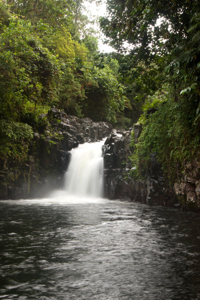
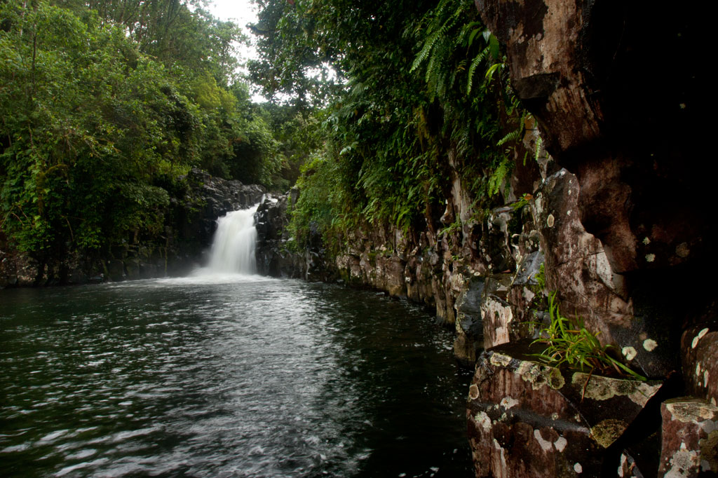
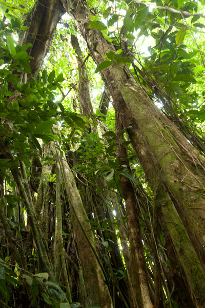
Kitti has a lot of waterfalls, but one of the most fun to visit is Lehnpaipohn between Salapwuk and Pwoaipwoai districts (at least two kousapw claim the falls area). It is neither the tallest waterfall on Pohnpei nor the most picturesque, but what Lehnpaipohn does have is the largest freshwater pool on the island (about 80 by 30 meters) and the highest jumping-off spot. The pool is leaf-shaped, very deep, and surrounded by high cliffs with a sizable island of river cobbles in the center. The water is typically quite chilly, which is a good thing after the hike. The waterfall itself is not much more than 4 meters (13 ft) tall and has a platform of rock behind it that you can stand on. Swimming to it is difficult, however, because of the strong current coming away from the falls. The best tactic is to swim along the edge and use the rocks to pull yourself forward.
The trail is only 0.53 km (0.33 mi) from the unpaved secondary road, but that road’s conditions are so bad that you’ll want to park your vehicle way down at the end of the paving 0.4 km (0.25 mi) above the Circle Island Road and walk up (5-15% slope with an average of about 7%). Look for the unmarked footpath on the left 2.18 km (1.4 mi) beyond the paving and 117 meters (128 yd) past the last visible residence on the right. The path is well-defined, relatively easy to follow, and downhill almost the whole way to the river (12% slope average). It stays under the trees and is rocky except at one point, where there’s a swampy section to cross or navigate around. About 216 meters (236 yd) along, the path branches; stay to the left. Another 200 m (219 yd) brings hikers to a small stream crossing. From this point, there’s only another 89 m (97 yd) to go. The final descent to the pool is exposed and a bit sketchy (especially when descending); make sure you have good footwear (FiveFingers are best, but good tennis shoes will work, too) and take special care on wet days.
No fees are charged and the trail is on public land. You can do this hike without a guide.
Camping
You can camp under the trees at the top of the eastern cliff — also the spot from which swimmers leap. Pack out everything you brought in and leave the site as you found it.
- Plan for 3-4 hours for this hike including some quality time to swim and relax.
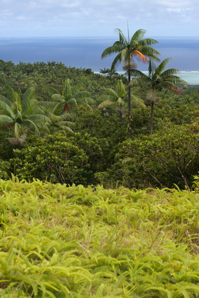
Nihpit Plateau Savannahs
Mallen Nihpit & Mallen Pitetik
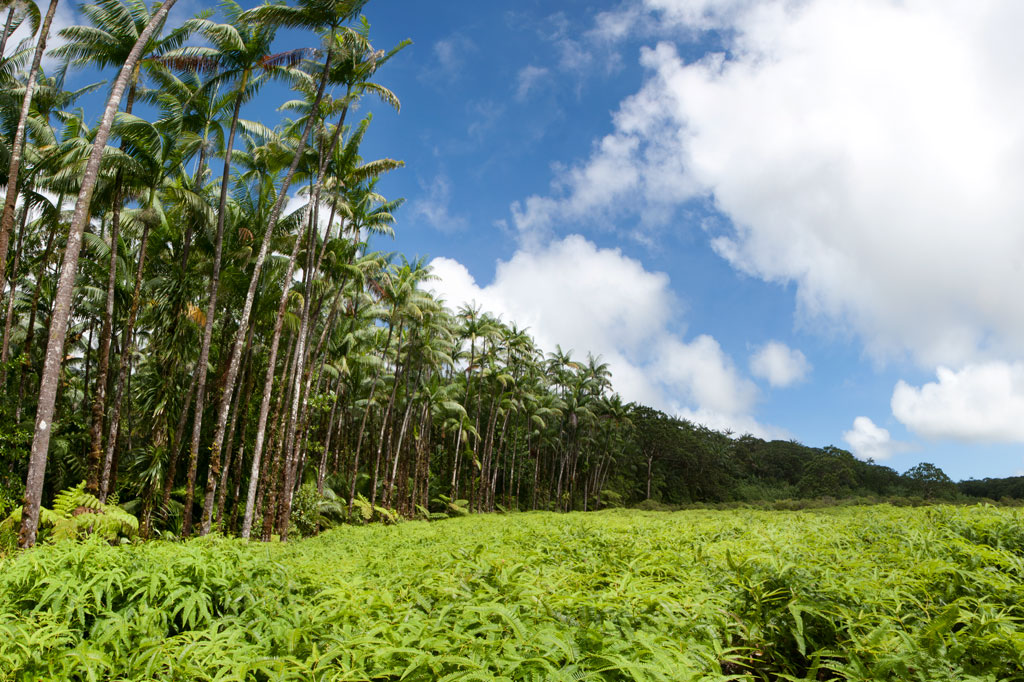
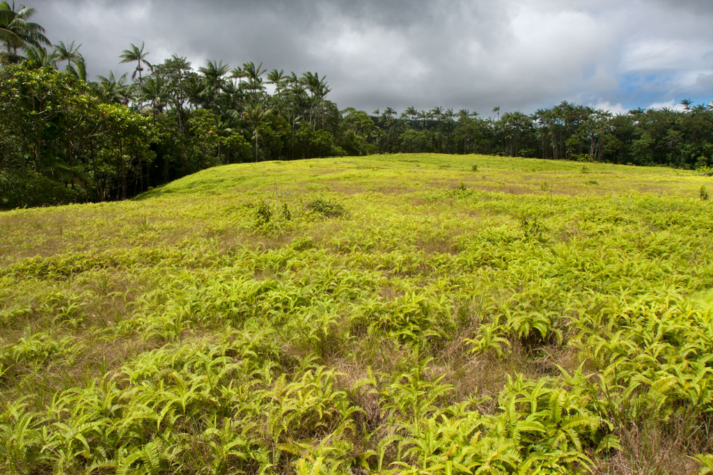
On the large upland plateau of Nihpit in the mountains above Mwoakot are two expansive savannahs or fern meadows. Upland savannahs of this sort usually exist because the bedrock is shallow, but they are also periodically burned by residents, inhibiting the growth of larger shrubs and trees. Hunters say that the Philippine sambar deer that live in Pohnpei’s interior — probably introduced by the Germans from the Mariana Islands — are attracted to the ash. One hunting tactic is to lie hidden at such sites and wait for the deer to creep from the forest in the early dawn (photographers might use the same method). Both of the savannahs soak up rain and feed tributaries of the Ne Stream (Pilen Ne). The northernmost and the larger of the two meadows — about a half kilometer in length — is usually referred to as Mallen Nihpit. The other savannah is Mallen Pitetik. Birders and photographers will find this a wonderful place to camp and observe fauna rarely disturbed by human activity. The palm forests around the edge provide plenty of shade, and drinking water can be filtered at the stream about 100 meters away.
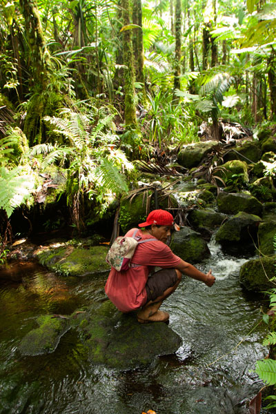
The hike begins on the right side of the unpaved secondary road opposite the track leading to the Wene Latter-Day Saints Church — 0.92 km (0.57 mi) past the Nanwou Stream bridge — and leads up to a farmstead. Your guide will stop at a cluster of residential buildings to ask permission to cross the family’s land before leading you on. About 160 m beyond this is the first of two major stream crossings — one on a log and the other across a covered wooden bridge. After the second bridge, the trail climbs steadily for 1.47 km (0.9 mi) at a 25% slope average into forests full of huge Terminalia carolinensis (kehma) — found only on Pohnpei and Kosrae — and Atuna racemosa, a tall, straight hardwood locally called ais. The latter have many uses including treatment of diarrhea and dysentery. The white nut inside the ais fruit is ground and mixed with red soil to produce paint for canoes, while the extremely hard and termite-resistant lumber is a favored building material. If you hike in the evening, keep an eye out for eerie salengen eni (Filoboletus manipularis), bioluminescent mushrooms said to grow in areas where ghosts reside (the name means “ghost’s ear”). The tiny fungus often grows from rotten logs and looks like clusters of eyes in the dark. Interestingly, some Pohnpeian parents are known to control misbehaving youngers by threatening to send them to places where the mushrooms thrive. At this point, hikers have reached the edge of the plateau and the remaining 1.08 km (0.67 mi) is relatively flat with a 6% slope average. There are four small stream crossings along the hike. The first three come down from Mallen Pitetik and converge, forming a high waterfall as they drop off the plateau; follow the second stream up for 0.34 km (0.2 mi) to reach that savannah. The last stream originates in Mallen Nihpit and makes a good place to filter/purify water when camping in the area.
- Plan for 8 hours for this hike.
- Please visit the Local Guides & Tour Operators page for a list of experienced guides available for hikes to Nihpit. Offer $50.00 for a group of five or less.
Protected: Nan Keptor Ruins
Woaloahmw Waterfall (Rohi)
![]()
![]()
![]()
![]()
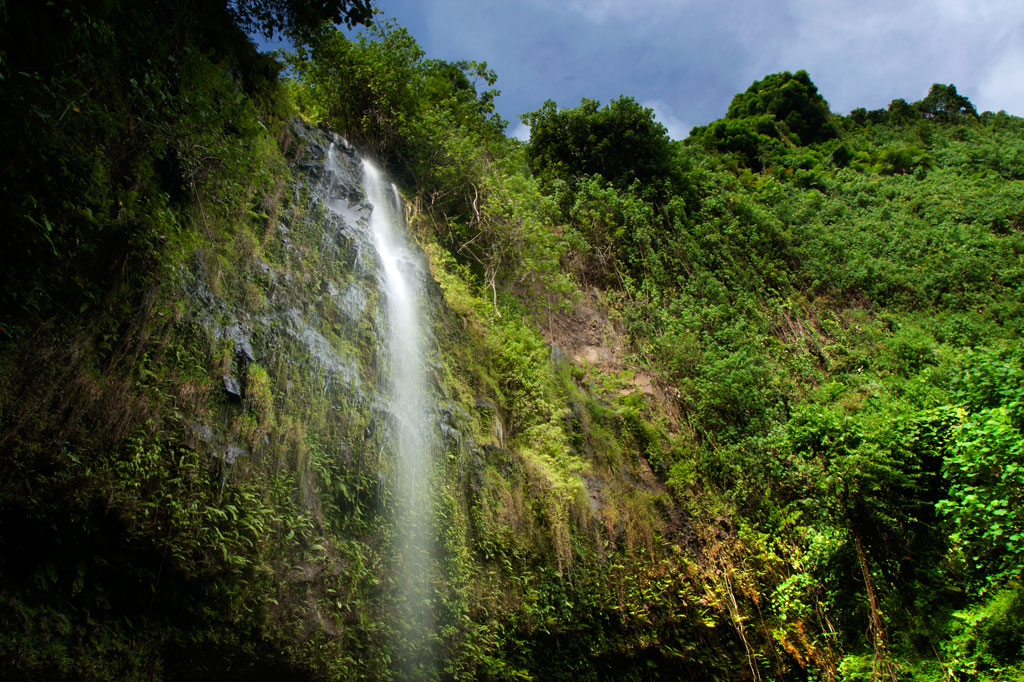
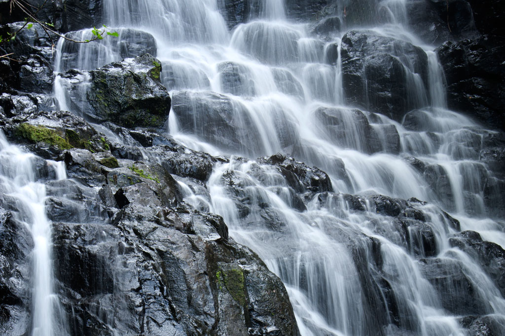
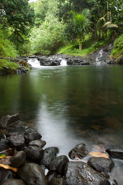
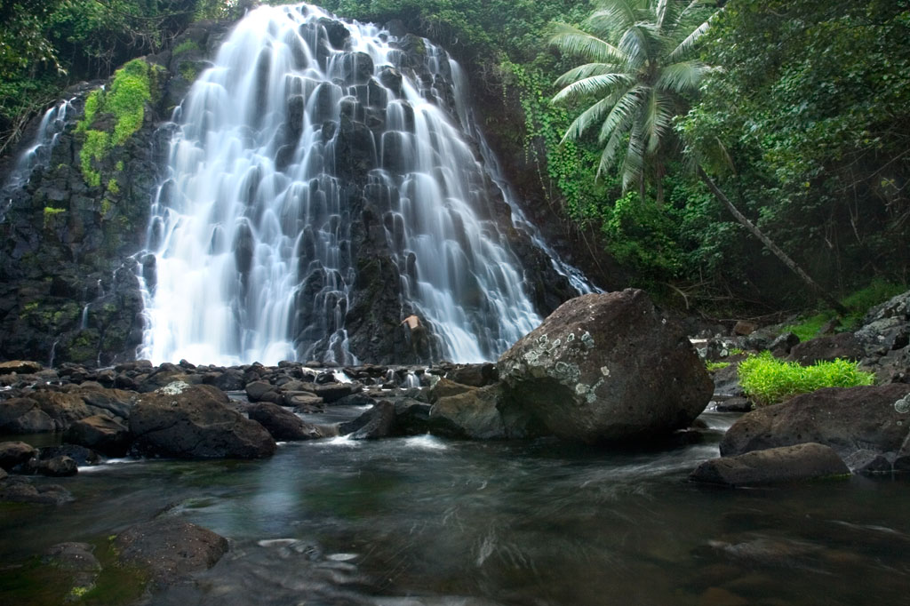
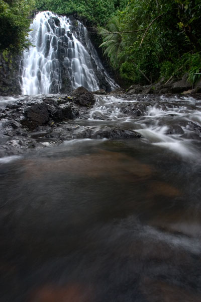
Rohi, the first district in Kitti after passing over the border from Madolenihmw, is host to an obscure, but beautiful, waterfall that few people — other than those who live practically at its feet and some Peace Corps volunteers stationed in the neighborhood — seem to know about. The high, sometimes wispy, falls plummets over a sheer wall hung with ferns and other climbing plants and is reminiscent of Sahwartik in Salapwuk, but with a much smaller and shallower pool and less volume overall. It’s unclear whether it has an official name; local residents mostly call it the “Rohi Waterfall” after the district within which it lies or “Nan Rohi Waterfall”, after the name of the river, or “Woaloahmw Waterfall”.
To reach it, it’s best to park near the turn-off from the Circle Island Road, walk up the steep gravel secondary road, and continue to the houses at the end (bear left at the one major branch). Along the way is a stunning stand of huge hardwoods that are well-worth a good look. Once you reach the houses, you’ll want to ask permission to proceed, as the footpath crosses through several families’ front yards. The residents in the area, however, are welcoming and will likely be happy to show you to the falls or at the very least point you in the right direction. Once the path reaches the watercourse, the waterfall is evident just a bit upstream and one has merely to scramble along the rocky bank to the pool. The water is very clean and cool, and the spot is excellent for a short swim.
No fees are charged for this hike.
- Plan for 1 hour round-trip with some swimming time at the falls.

Nanpohnmweli Waterfall
")
![]()
![]()
![]()
Though you can reach the top of Nanpohnmweli from Mand, the best way to access this falls (also known as “Kerenis” Waterfall) is from the Circle Island Road in Sapwehrek Kousapw. The walk begins at Benford Etse’s residence immediately south of the bridge and the sign for the Senipehn River Reserve and takes less than 10 minutes each way, following a well-trodden path that the family uses for planting sakau.
It’s hard not to be impressed by the place, even if you’ve already seen many of Pohnpei’s waterfalls. Like Kepirohi, the water tumbles over a gently sloping basalt wall rather than falling straight down over a cliff, but this falls is narrower.
[warning]Unfortunately, testing in April 2013 indicated that this site had 2.5 times more E. coli than is considered safe for swimming, so you’ll want to stay out of the water.[/warning]
The Etse family doesn’t charge an access fee to visit the falls, but since you’ll need someone to show you the way through their property, offer $5.00.
- Plan for 45 minutes round-trip with some time to admire the view of the falls.
The Rock of Silehu
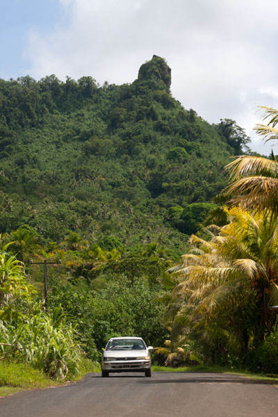
Southern Kitti’s most obvious natural feature is the Rock of Silehu — a spire of basalt rock that stabs out from the hills above Nintok. Because of its phallic shape, some have jokingly referred to the rock as the “giant’s penis,” but there is little to suggest that the idea has any basis in Pohnpei’s traditional myths, and it is more likely a transplant inspired by Kosrae’s well-known “Sleeping Lady.”
The local area has garnered some fame through its association with Luelen Bernart, the first Pohnpeian to ever pen a history of the island and probably the first Micronesian to write a book of any kind. It was a revolutionary endeavor. Pohnpei had a long tradition of story-telling and transmission of traditional knowledge through oral means, but writing things down was wholly new. Furthermore, it was believed on Pohnpei — and still is today — that a person should not share all that he knows on any subject. Bernart, born in Wene, Kitti, but educated in the same Protestant mission school as Henry Nanpei (they were close friends and his wife and Nanpei’s wife were sisters), was possibly inspired by the Western ideas he absorbed there and his exposure to the Bible, whose style and structure is similar to his writings. Bernart came from the noble class. Over his life, he acquired the title Dauk — the third-highest title on the Nahnken (talking chief) line — and became well-respected in the ceremonial arena as an orator and story-teller. This experience, combined with the skills he acquired in school, gave Bernart what he needed to tackle such a singular task. In the 1930s he began composing what would become The Book of Luelen — a sprawling collection of myths and legends, songs, chants, magical spells, plant-lore, and modern history. Though Bernart died before he could edit the work, his daughter and her husband labored to complete the manuscript, which was eventually translated and published in the 1970s. Bernart was buried in Rehntu.
The Story of Lihser
As far as oral history is concerned, Silehu is connected to a story that began in the Awak Valley of U. A spirit called Lihser dug up the ground and buried two boys in the earth at Awak. Scooping up the lumps of earth in which the boys were buried, he threw them to Silehu. The body of one boy, named Kier, formed the Peisarap hills where it fell. The spirit then built an altar called Pein Maram (“altar of the moon”) to honor the spot where the other fell. Later, the spirit met a hermit crab with a human skull for a shell. Upon searching the area, Lihser found the bones of a man. He took the bones and the crab and buried the skull-shell at a place he named Nintok. The rest of the bones were buried at another location called Antak.
Interestingly, one ethnographer reported that people from Nintok are prone to a “peculiar form of craziness” and erratic behavior that intensifies on full moons.
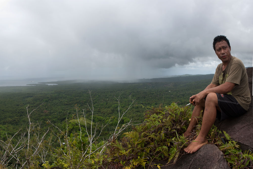
If you have a tough, high-clearance vehicle, you can begin your hike at the Esiel house at the end of an unpaved road that leads north from the Circle Island Road. Otherwise, it’s best to park down by the CIR and walk up, as the upper portion of the road is rough and has a grade of at least 19%. This segment is moderately difficult on foot, but treacherous by car. The hike from the house is short but steep (about 30% slope average), following a narrow footpath that the family uses regularly. The final part of the ascent is very steep and scrubby. No technical climbing is involved to reach the tiny, exposed summit, but there are some sections that might be uncomfortable for people afraid of heights. From the top, unobstructed views extend in all directions. Prominent sights include Dolotomw, Mwudok Harbor, Mwudok Island, and Nipai Rock.
- Plan for 2 hours for this hike. For guides, ask for Wainer, Raynard, or Treveyne and offer $10.00, or call +691.320.5059 ahead of time to make arrangements.
Mand Area Attractions
![]()
![]()
![]()
![]()
![]()
Mand is a little community of Pingelapese people who were given a parcel of land by the Nahnmwarki of Madolenihmw in Pohnpei’s modern past. You can’t call it a town, but it feels more connected than many of the island’s Pohnpeian communities. In addition to the Pingelapese who live in Mand Proper, there’s a small village to the north inhabited by Kapingamarangi islanders, who settled in the area very recently (Kapingamarangi is a distant atoll that is culturally and linguistically Polynesian but politically a part of Pohnpei State). The center of Mand consists of the elementary school and church. Next to the church is a monument which lists the names of the first settlers from Pingelap Atoll — the founding members of the community.
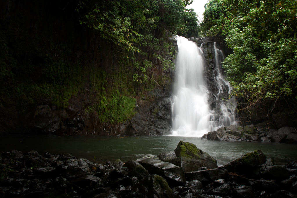
Kokomaru Waterfall
Most local people outside of Mand have never heard of Kokomaru, which is strange, because it is a gorgeous spot and worth visiting. The route to the waterfall, which lies just downstream from the Mand community, begins at the end of an unpaved road next to the Latter-Day Saints (LDS) Church, passes through a plot of private land, and then cuts through the forest to the river. The trail tends to be overgrown, as the falls is rarely visited except by an odd kid or two from the community. Once at the riverbed, you can get a good look at the waterfall, which is similar visually to Liduduhniap. Some of the kids in the area will tell you that the rock behind the falls looks like a heart from certain angles (we didn’t see it). The cliff on the south side of the waterfall pool is the nesting site for a huge colony of Caroline Islands swiftlets which seem to fill the air when they leave their nests.
[warning]Despite Kokomaru’s charms, you can’t swim here — riverside pig pens in Mand have severely contaminated the stream. Testing in April 2013 indicated that the water below Piladad had five times more E. coli than is considered safe for swimming. Don’t be fooled by the clarity of the stream; this is sadly in the top ten most polluted watercourses on Pohnpei Island. Even the Mand kids don’t swim there.[/warning]
- Plan for 45 minutes round-trip for this excursion.
Piladad Pool
There is only one place you can safely swim in the Mand area and that’s at a sweet little pond known as Piladad, which lies up-stream from the last inhabited house and pigpen. The pool, which was once a gauging station for the watershed (the gauge apparatus is still there), is large and pristine with enough depth in the middle for the fun rope swing that dangles from an overhanging tree. There are also two small waterfalls. Piladad is a great place to go on hot days; the spot is close to the feet of the mountains and the water tends to be quite chilly. This also means there’s some potential for flash floods, so it would be wise to avoid the spot when rain clouds lie over the mountains. A narrow, but well-used, 0.4 km footpath to the pool begins on the south bank of the river next to Mand Elementary School. At the one branch in the path, bear toward the river.
Almost any kid you see in the area can guide you to either location. Offer $10 for a group of five or less.
- The hike takes about 10 minutes each way.
Nanpohnmweli (“Kerenis”) Waterfall
This very tall waterfall on the Sapwehrek stream can be reached by following the unpaved road 1.24 km (0.77 mi) north and east from Mand through a tidy Kapingamarangi settlement to the next stream over. The problem with visiting the falls from this access point, however, is that you end up at the top, where you can’t really see much. The rocks are treacherously slippery and there’s a long — certainly fatal — fall for anyone who makes a mistake. A local girl was killed when she fell from this spot a few years back. The nickname of the waterfall is derived from the Kapingamarangi pronunciation of the English word “Greenwich”, which is what sailors called Kapingamarangi Atoll during the whaling period. To visit this waterfall from the bottom, visit the Nanpohnmweli Waterfall page.
- This walk takes 15-20 minutes each way.
Kepirohi Waterfall
Kepirohi, which lies on the lower Mand Stream (Pilen Mand) in Kepirohi Kousapw, is certainly Pohnpei’s most famous and most photographed waterfall and makes a nice picnic stop after a visit to the ruins of Nan Madol just a few minutes away. Here a large volume of water (the most of any waterfall on Pohnpei) cascades over a wide, sloped pyramid of basalt rock and fills a shallow pool before running down toward the coast, giving the spot a singular look. A well-maintained — and in places rock-paved — path begins near Adalina Johnny’s residence and skirts the right side of the river to the falls. It’s an easy, level walk. Unfortunately, the landowners decided a few years back to construct an unsightly concrete viewing platform just to one side of the falls, detracting considerably from the aesthetic and natural appeal of the location.
There’s an old, weather-worn sign out on the Circle Island Road that marks the turn-off and limited parking on either side of the landowner’s driveway.
Visitors can pay the admission fee ($3 per adult and $1.50 per child) at Johnny’s house on the right or at the small store near the trailhead. No guide is needed for this hike.
- Plan for 1 hour for this hike.
[warning]As is true of many of the streams in this part of Madolenihmw, the water at Kepirohi is highly polluted by animal waste; visitors are advised not to swim.[/warning]
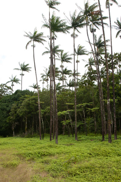
Wou Kutoahr
![]()
![]()
![]()
Today, the name Wou Kutoahr is used to refer to a large area of upland fern meadows, palm forests, giant tree fern stands, and denser hardwood forests, though it actually means “kingfisher valley” and originally referenced a specific feature nearby. There’s a little bit of everything here for hikers and birders. Most of the birding is to be had in the forests below the Nan Peienlam meadow. All of the common species can be seen, as well as rarer birds like the Micronesian pigeon, ground dove, crimson-crowned fruit dove, and long-billed white-eye. There are also some interesting species of plants to be found in the same spots, including native mace (Myristica fragrans), which produces walnut-sized seeds covered by a rubbery bright-red skin. These trees were introduced from Sulawesi by the Japanese in the 1920s. Pohnpei’s endemic palm, called kotop, is common around the fringes of the meadows and on some of the nearby slopes.
You can begin your hike wherever necessary along the unpaved road leading up from the FSM-Chinese Pilot Farm near the Circle Island Road, though most vehicles will need to park further down due to the extremely poor condition of the track. Wherever you start, follow the road up until it narrows to a footpath. This path climbs gradually with an 9-10% slope and to the first savannah. If you walk out among the ferns to the south, you can get some decent views on a clear day. The path continues to climb at the same rate from there, passing into a section of forest dominated by giant tree ferns and beautiful hardwoods. This the key place for birders. In the middle of the forest segment, the trail levels off to about a 4% slope, eventually leaves the forest, and arrives at the second set of fern meadows. A knoll to the south offers excellent views of the lower forests and ocean. Other trails continue 0.74 km from Nan Peienlam to Dolekole (363 m) and 0.67 km to the Mese Stream (Pilen Mese) from the middle of the forested section.
Camping
The kotop (Clinostigma ponapensis) stand on the edge of the upper meadow is a wonderful place to camp with amazing scenery all around and some protection from wind. The nearest fresh water is at Pilen Mese (purify or filter it) about 1.2 km north. Leave the area exactly as you found it and pack out everything you brought in.
No fees are charged for this hike. You can do this hike without a guide.
- Plan for 4 hours round-trip for this hike.
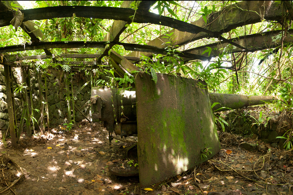
Dolopwuropwur Gun Battery
![]()
![]()
![]()
![]()
![]()
The most extensive Japanese gun battery on Pohnpei lies on Temwen’s rounded central hill, Nindol, perched at its 60 meter peak, Dolopwuropwur.

Gun Stations
The four guns at the summit are identical to the one on Sokehs Mountain — British-made 15 cm Armstrong Whitworth naval canons manufactured in 1905. The guns are arranged in pairs with a concrete ammunition magazine between each set of stations. The semi-circular emplacements are constructed of concrete and local stone. There are also stone retaining walls along the corridors that lead to the stations. Steel girders running over Stations 1 and 4 are evidence that these two guns, at the very least, were covered to make them difficult to identify from the air. All of the stations are in relatively good condition, though the embankment around Station 3 has slipped down and partially buried the walls. Guns 1 and 4 point north and southeast, respectively, while Guns 2 and 3 point northeast. In combination, they would have had firing coverage of around 250 degrees. At the time of operation the hill was probably relatively clear of trees, providing an unobstructed view of the area islands and the two possible points of entry into the lagoon at Kepidauen Deleur and Kepidauen Nahkapw.
Stone Tower
West of Station 4 is a stone tower (possibly a look-out for targeting or even a searchlight emplacement). Presumably, the tower was crowned with a platform of wood or metal, but that is no longer present. Now a flight of twenty-odd steps lead to the edge of a gaping hole as deep as the tower is high. We didn’t find a searchlight, but it may lie hidden somewhere in the surrounding area.
Trench Network
A narrow 0.27 km-long (0.17 mi) trench begins at the tower base and meanders down the hill with short deviations going to a dug-out under the tower itself and a magazine-like structure built into the hillside and currently occupied by a colony of small insectivorous bats. The latter is almost large enough to park a jeep inside, but there’s no evidence of a road leading to it. It was probably additional storage for munitions. It’s possible to climb down into the trench and follow it until it connects with one of the well-trodden footpaths in the Temwen interior.
The 0.3 km (0.19 mi) trail to the battery begins not far from the end of a muddy residential road opposite Temwen Elementary School and can be easily followed without a guide.
The family at the last house on the road charges $3.00 per person to visit Dolopwuropwur.
- Plan for 1-2 hours to fully explore the area and 1 hour (each way) for the drive.