
Wou Kutoahr
![]()
![]()
![]()
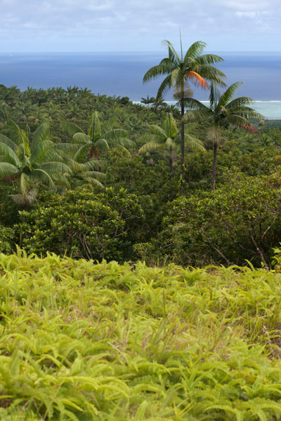
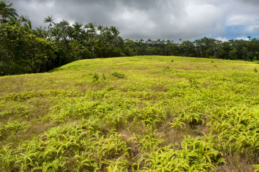
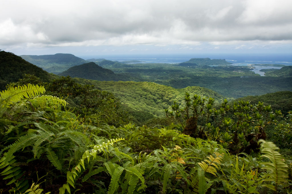
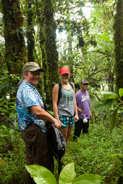
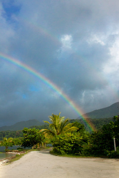
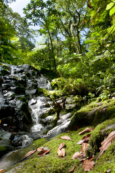
Today, the name Wou Kutoahr is used to refer to a large area of upland fern meadows, palm forests, giant tree fern stands, and denser hardwood forests, though it actually means “kingfisher valley” and originally referenced a specific feature nearby. There’s a little bit of everything here for hikers and birders. Most of the birding is to be had in the forests below the Nan Peienlam meadow. All of the common species can be seen, as well as rarer birds like the Micronesian pigeon, ground dove, crimson-crowned fruit dove, and long-billed white-eye. There are also some interesting species of plants to be found in the same spots, including native mace (Myristica fragrans), which produces walnut-sized seeds covered by a rubbery bright-red skin. These trees were introduced from Sulawesi by the Japanese in the 1920s. Pohnpei’s endemic palm, called kotop, is common around the fringes of the meadows and on some of the nearby slopes.
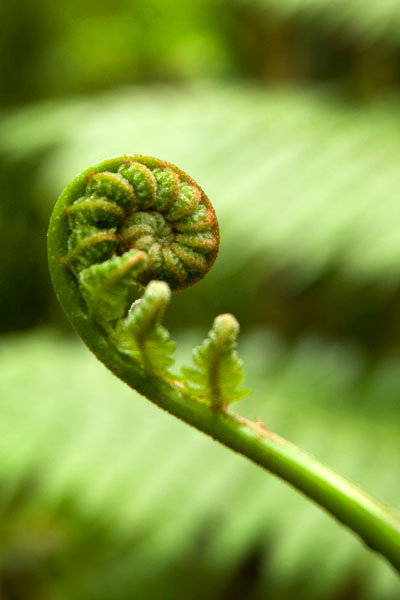
You can begin your hike wherever necessary along the unpaved road leading up from the FSM-Chinese Pilot Farm near the Circle Island Road, though most vehicles will need to park further down due to the extremely poor condition of the track. Wherever you start, follow the road up until it narrows to a footpath. This path climbs gradually with an 9-10% slope and to the first savannah. If you walk out among the ferns to the south, you can get some decent views on a clear day. The path continues to climb at the same rate from there, passing into a section of forest dominated by giant tree ferns and beautiful hardwoods. This the key place for birders. In the middle of the forest segment, the trail levels off to about a 4% slope, eventually leaves the forest, and arrives at the second set of fern meadows. A knoll to the south offers excellent views of the lower forests and ocean. Other trails continue 0.74 km from Nan Peienlam to Dolekole (363 m) and 0.67 km to the Mese Stream (Pilen Mese) from the middle of the forested section.
Camping
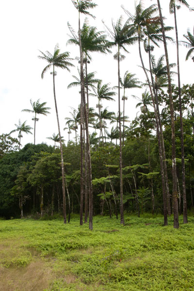
The kotop (Clinostigma ponapensis) stand on the edge of the upper meadow is a wonderful place to camp with amazing scenery all around and some protection from wind. The nearest fresh water is at Pilen Mese (purify or filter it) about 1.2 km north. Leave the area exactly as you found it and pack out everything you brought in.
No fees are charged for this hike. You can do this hike without a guide.
- Plan for 4 hours round-trip for this hike.
Dolen Nahnsapwe
![]()
![]()
![]()
Dolen Nahnsapwe, “hill of thunder,” is a small peak near the Nett–U border. As the crow flies, it’s about 1.3 km (0.8 mi) southwest of the Kupwuriso summit. Though rarely visited and not the highest point in the area, Dolen Nahnsapwe is intriguing because it’s associated with stories about the traditional thunder god, Nahnsapwe, and is said to be the place where thunder storms originate. It’s also the source of the Pwong-Kapwungapwung watercourse, a stream that forms a waterfall below the Lou Rahn ridge in Nett. It’s a challenging climb that follows a trail only part of the way, but the pay-offs come in the form of soaring vistas and gorgeous upland forests. You can approach the peak from either Nett or U or do a full traverse (6.75 km / 4.2 mi) from one side to the other.
Nett Approach
The Nett approach to Dolen Nahnsapwe feels wilder and is steeper and more strenuous. It begins on the side of an unpaved road in Paremkep. The first 0.6 km (0.37 mi) follows the same track that goes to Lou Rahn waterfall and cave with a gentle slope average of about 12%. After that, it branches off and climbs more steeply along the Lou Rahn ridgeline for 2.65 km (1.65 mi) with a slope average ranging between 20% and 25%. This brings hikers to the foot of the peak — a swampy area dominated by thickets of kotop (Clinostigma ponapensis) palms.
U Approach
The way up from U begins behind a cluster of houses at the end of the last road before the Madolenihmw border. On this side, things are much more developed and the trail is clear and well-maintained nearly to the top of the pass north of the peak. One conservation worker told us that sakau farmers from U frequently use this route to access illegal plots in the watershed on the Nett side. The 3.2 km (2 mi) trail meanders through inhabited areas and past a number of a small huts and residences (23% slope avg).
The last bit up to the tiny summit (593 m) is an over-grown, steep (46% slope avg), grubby, and sometimes unnerving scramble from the northwest side. The summit is tiny, and the ground up there has a springy, unstable feel as if you’re actually standing on layers upon layers of ferns and moss rather than solid ground — which may be the case. The effort and unease, however, are rewarded with a truly marvelous 300-degree view. Sokehs Mountain (276 m), Kolonia Town, the open summit of Kupwuriso (630 m), and Dolen Saldenre (629 m) are all visible — weather permitting.
You can do this climb as a day-hike, but a better option is to camp somewhere along the upper Pwong Stream (Pilen Pwong). Remember to pack out everything you packed in. A responsible camp site is one that is invisible once its occupants depart.
- Plan for 8 hours for this hike.
- Please visit the Local Guides & Tour Operators page for a list of experienced guides available for hikes to Dolen Nahnsapwe. Offer $50.00 for a group of five or less.
Pahntakai Cave & Waterfall
![]()
![]()
![]()
![]()
![]()
![]()
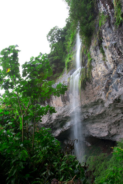
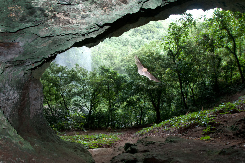
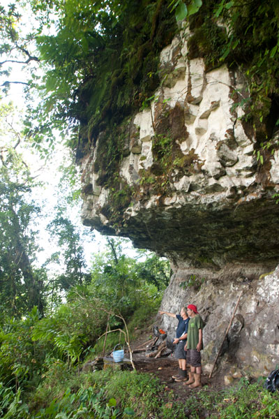
Pahntakai literally means “under the rock” and one visit makes it immediately apparent why this geologically-unique location was given its name. A thin waterfall plummets over a concave cliff-wall more than 30 meters high, which shelters a wide strip of mostly flat ground. You can walk all the way across beneath the cliff to where the ledge widens even more and a small, rocky hill rises up north of the waterfall. Yawning caverns behind the falls host colonies of small insect-eating bats and Caroline Islands Swiftlets that hurry out at dusk to hunt for insects. If you want a closer look, you can climb up through the mounds of guano to the cave openings.
The waterfall itself varies greatly in volume, depending on rain, crashing onto jumbles of rocks below the ledge. It is possible to climb down the slope and stand under the water, but the rocks are slippery and dangerous and there is no pool.
The trail is found at the end of the road and is well-maintained and fairly level most of the way to the cave, skirted by several varieties of sakau (kava) and affording stunning views of the deep gorge below the falls, small huts on the steep hillsides, and the blue sea far out beyond the green of the island. Though you do not need a guide or any special permission to do this hike, the site is private property and the family at the last house on the road charges an entry fee of $3.00 per visitor. Make sure you bear left at the trailhead, rather than taking the path to the right which goes steeply downhill and eventually leads to a house. The hike takes a leisurely 40 minutes round-trip, but Pahntakai is so magical you’ll probably want to hang around and soak up the atmosphere.
Camping
The landowner, Pedro Marvis, permits visitors to camp overnight at Pahntakai, provided they are quiet and respectful of the place and take all their garbage with them afterward. The price per person is the same as when making a day visit — $3.00. The best place to camp is at the northwest end of the trail, where the strip of ground under the cliff is wide and flat. There’s a rock fire-pit there and sometimes some dry firewood left lying around. Because of the overhanging nature of the cliff, things stay dry even during heavy rain. There is one small stream that crosses the main trail about half-way from the trailhead — a good place to filter drinking water if you’re going to stay at Pahntakai a while.
Kupwuriso
![]()
![]()
![]()
![]()
![]()
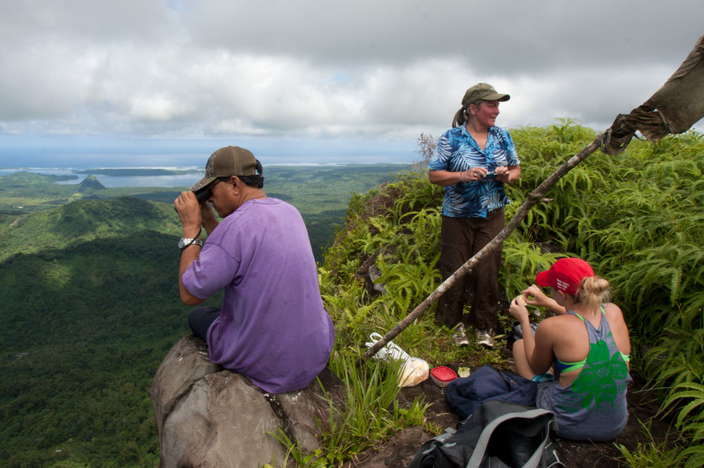
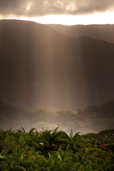
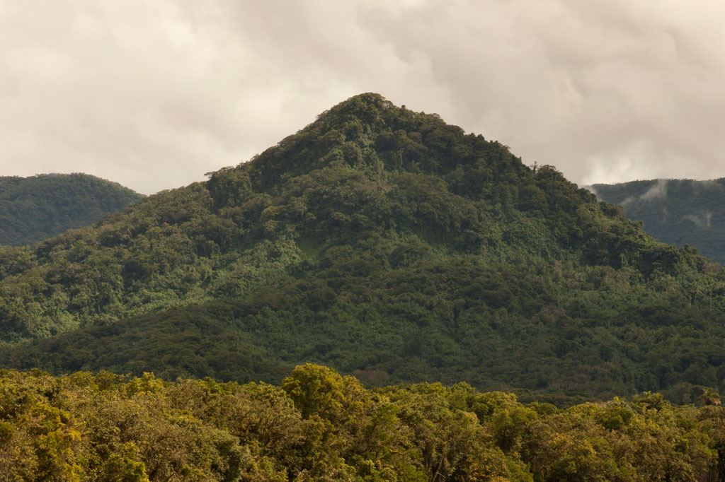
Kupwuriso, Pohnpei’s fifth highest mountain (depending on how you count them), is impossible to miss when driving through eastern U, where it towers over everything, its precipitous slopes clad in groves of endemic palms called kotop (Clinostigma ponapensis). When the Pohnpeian hero Isokelekel sailed around the island in the mid-1600s on a mission to overthrow the Saudeleur dynasty, he initially balked at the sight of the mountain palms which he mistook for an army of giant warriors dressed in grass skirts. It was not until he returned to And Atoll, that a local woman pointed out his mistake. Giants or no, the mountain has an ominous look and feel. It’s unusually close to the coast and rises up very steeply, making it appear much taller than it really is (630 m / 2,067 ft). The name means “stomach.”
Awak Valley Approach
There are two major routes to the small, rocky summit (630 m). The first begins not far from the end of the primary paved road at the rear of the Awak Valley. To protect Mwahnd and Alohkapw (Areu) Passages from invasion, the Japanese decided to place two 15 cm naval canons just below the summit of Kupwuriso at a place called Dol Reirei (“long hill”). To get the massive weapons up the mountain, they constructed a road that climbs up on the south side of the Awak Valley and follows the ridge north. The hike uses this track for most of the way, starting on a rocky private footpath to the right of the road. The steepest section comes at the beginning. Once on the ridge, things mostly flatten out, though there are some gentle ups and downs. The terrain is fairly tame the rest of the way, passing through upland groves of kotop palm, wild banana plants (utin wel), and gnarled stands of campnosperma (dohng) and elaeocarpus (sadak) — trees used to make canoe hulls.
One of the benefits of climbing Kupwuriso is that you’re more likely to get a clear view from the summit than from Nahnalaud. The perspective is better, too; Nahnalaud’s summit sits on a wide plateau, while Kupwuriso’s looks down to the valley from the top of a cliff. Sometimes, however, the mountain is fog-bound — especially from about noon to 2 PM. Plan for 4-6 hours round-trip.
Rohi Approach
The second route starts in Rohi district at the end of a paved road. This way is shorter but considerably more strenuous, shooting 1.3 km (0.82 mi) straight up the side of the mountain. It should be noted that a number of hikers have sustained injuries on this approach, so hire a good guide, go slow, and watch for loose rocks! The route begins in the inhabited lowland agroforest, which Pohnpeians call nansapw, and quickly ascends to the mid-level forests (nanwel), populated by giant hardwoods and tree-ferns. Beyond, the forest opens up and kotop palms abound. Once the slope starts to even out, you’ve entered the cloud forest — a fantasy world of stunted, twisting trees and air plants. It’s always wet here, and every surface is covered with a thick layer of bryophytic growth. Plan for 4-6 hours round-trip.
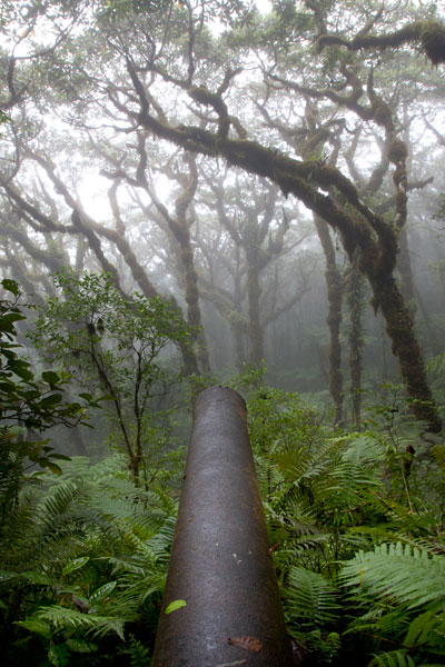
Japanese Gun Battery
The two guns are the British Armstrong Whitworth naval type identical to the one on Sokehs Mountain. Both are housed in steel and concrete bunkers and separated by a pillbox, where machine guns were placed. The battery was installed in 1943 and took fifty-five local men eight months to complete. At 580 meters (1,903 ft), these are the highest guns on Pohnpei Island. The gnarled forest that has grown up in front of the gun sites is mesmerizing, especially in foggy conditions.
Bird-Watching
Birders will find much to look at on the way up the mountain. Besides the typical honey-eaters, starlings, and lorikeets, this is a good place to look for the Crimson-Crowned Fruit Dove, Imperial Pigeon, and Pohnpei Cicadabird. Swiftlets are common at the summit.
- Please visit the Birding page for additional information.
Ridge Camping
There’s a fantastic place to camp at 593 meters not far from the gun sites with a beautiful, unobstructed view of the valley. Bring your own water, dry tender, a tarp or heavy-duty rainfly, and stakes for your tent and tarp (high winds are a distinct possibility at such elevations). Remember to leave your site exactly as you found it. Pack out everything you packed in and properly bury all human waste.
Hiring a Local Guide
A lot of people know the way up Kupwuriso, so finding a guide is not difficult. If you want to tackle the Rohi approach, Miller Benjamin (from Saladak) is a good choice. From Awak, we recommend Relio Lengsi. Conservation Society of Pohnpei (CSP) can also assist you in finding a guide. Offer $40-50 for a group of five hikers or less (plus tips). Agree on a price beforehand.
- Please visit the Local Guides & Tour Operators page for guide contact information.
Marine Parks
Nihco Marine Park
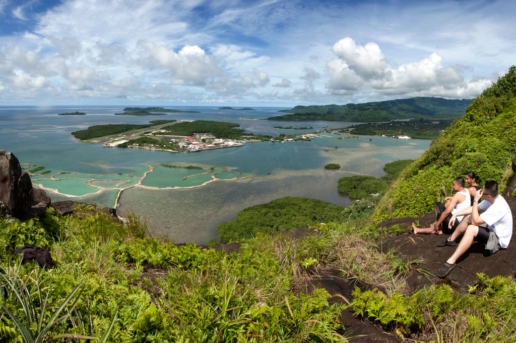
Nihco Marine Park, on the southwest coast of scenic Sokehs Bay is an appealing place for people of all ages to swim, barbecue, and soak up the sun. The park is comprised of a narrow, man-made semi-circle of sand with a placid lagoon in the middle where turtles and reef fish are kept. There’s a white-sand beach on the outer edge and simple thatched huts for either day or overnight visits. Small kayaks can be rented for a few dollars. The place can be packed on weekends and holidays.
- To make reservations for day visits, call +691.320.2135 / 4659.
Awak Pah Marine Park
Awak Pah Marine Park is the most well-known of the parks in the area and has a nice big sign right out on the main road. From the parking area near the owner’s house, a 0.2 km (0.12 mi) coral and concrete walkway leads to the water through a dense section of mangrove forests. At the end, there’s a tiny picnic area by the water, a large nahs, and a few other huts that can be rented at an extra cost. The water is shallow and a bit silty on the south side and deep on the west and northwest side where a huge pair of PVC rings have been anchored (a good place to swim). The rock wall by the water is a fun place to jump from, but it can be difficult to climb back out. Snorkeling can be pretty good to the west along the reef wall with lots of small fish and some interesting coral growth. Unfortunately, local visitors have been careless with their garbage and the beautiful reef scenery is frequently ruined by the presence of discarded aluminum soda cans or flashlight batteries — a sad trend on Pohnpei. Water clarity varies from crystal clear to murky depending on the tides; it’s best to visit on an in-coming tide. You can visit Awak Marine Park without making arrangements beforehand.
Paieke Marine Park

This pleasant, breezy swim-picnic-camp park is located on a network of dredged coral causeways that extend out into the lagoon at the point where the road begins to turn east toward the Awak valley. A number of thatched residential huts varying in size and a nahs (meeting hut) or two are positioned around the water’s edge for guests at an extra cost. The swimming is good all along the west side, though the shallows tend to be silty rather than sandy. Snorkelers should follow the edge of the reef further out into the lagoon for best results. The kids will love tinkering around in the shallows under the shady trees. Paieke operates on a reservation-only basis.
- To make reservations for visits call +691.925.0382.
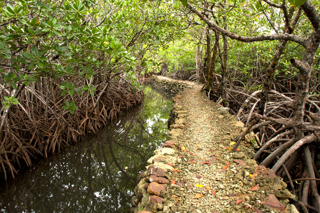
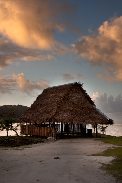
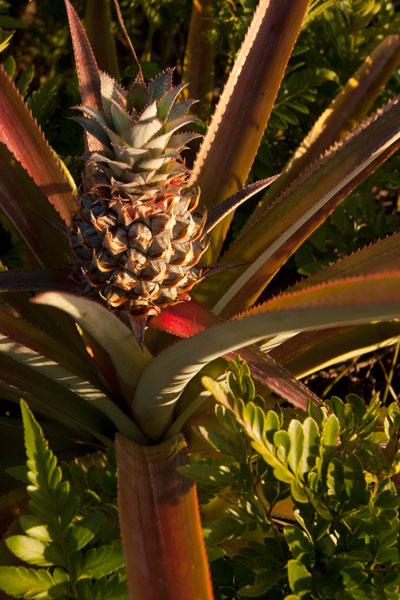
Pein Ahi Marine Park
This charming, but little-known, park (pictured at top) is found just after Awak Marine Park, but as it lacks a sign, most people drive right by without realizing it’s there. From the road, a beautiful 0.16 km (0.1 mi) stone and coral walkway winds through the picturesque mangrove forests and ends at a grassy picnic area with a nahs and a large fish pond. The family keeps some very curious pufferfish and a few other reef fish in the pond, mostly for the amusement of visiting local children. The swimming all around the outside of the pond walls is excellent with consistently good water clarity. There’s a relatively shallow area on the south side that works well for kids or beginning swimmers and deeper water on the west and north. They also have a pair of large bamboo-pontoon rafts that are fun to cruise around the mangrove fringe on. Except on big holidays, you can usually visit without making any prior arrangements.
Dolen Eirike
![]()
![]()
![]()
![]()
Dolen Eirike (“hill of Eirike”) is a prominent pyramid-shaped peak in Eirike district at the rear of Nett — easily visible from Kolonia and standing out from everything else as one drives south from the coast.
The ascent to the summit makes for a nice half to full-day excursion. A paved road runs through Kahmar, crosses the Pilen Kahmar bridge, and then climbs up and along a low ridge in Eirike before dipping back down again. Along the drive, you’ll pass rows of gorgeous Mindinao gums and Terminalia carolinensis trees (a species found only on Pohnpei and Kosrae) and several spots with wonderful views of the river valleys on both sides. The Eirike road, however, has some bad spots near the turn-off, so you’ll need to go slow and have a vehicle that isn’t too low to the ground.
The trailhead is located at the end of the paved road just beyond the last house and at the foot of the mountain. During the Japanese period, Catholic missionaries working in Kolonia were forceably relocated to a camp in this vicinity, though it’s not clear exactly where. Now the area is mostly small farmsteads, sakau plots, and jungle.
")
The well-trodden lower 0.28 km (0.17 mi) of the trail winds upwards through large areas of sakau cultivation with an average slope of about 23%. As you begin to move above the cultivated areas, the forest thickens and provides cover from the sun but not much relief from the stifling heat. The rest of the climb to the summit is a pretty consistent slope of about 38%. Giant tree ferns with blood-red sap, wild banana plants (utin wel), elaeocarpus, and ivory nut palms are abundant on the slopes.
Slightly less than a half kilometer from the top, you’ll pass a series of Japanese World War II trenches that cross the path. Historical records seem to indicate that anti-aircraft guns were also installed nearby, but they aren’t there now.
The summit itself is often overgrown, but you can get some nice views of Kolonia Town and Sokehs Island through the trees. There’s plenty of flat ground for a campsite and enough trees for protection against any wind.
- Plan for 4-8 hours for this hike.
- Please visit the Local Guides & Tour Operators page for a list of experienced guides available for hikes to Dolen Eirike. Offer $25-50.00 for a group of five or less.
The Story of the Tree of Nansokele
Eirike was part of the ancient region of Nansokele before the chiefdom of Nett split off from Sokehs. As is told in one famous legend, shortly after the fall of the Saudeleurs, some men were trying to cut down a large Terminalia carolinensis tree (kehma) near Dolen Eirike with the intention of building a canoe. No matter what they tried, however, the tree would not fall down. The high priest of Wene was called for and used a special adze to chop through the stubborn trunk, but instead of toppling over, the tree rose up and vanished into the clouds. Soon after, word spread that a canoe made from the wood of the same tree had descended from heaven and hovered over the ocean at a spot near Temwen Island (Sounahleng). The people took this to be a divine omen, and a great meeting followed at Poasoile on Temwen Island, where the paramount chief system that exists today was established.
Nan Kiepw & Na Malek
Nan Kiepw
![]()
![]()
![]()
![]()
![]()
Nan Kiepw
Nan Kiepw, which means “in the lilies,” is a hillside overshadowed by Dolmweir peak. A Pohnpeian myth tells of a Yapese magician, named Sou Iap, who voyaged to Pohnpei and was responsible for the creation of Sokehs Rock). One of Sou Iap‘s companions, Souliken And, noticed a girl collecting clams on a reef north of Sokehs Island, and thinking her very attractive, chased her deep into Nett, carrying an ihd leaf with him. On the hillside below Dolmweir peak, Souliken And lost his leaf and named the place after a species of white lily he saw there.
During the Sokehs Rebellion in 1910, Pohnpeian rebels fleeing from German and Melanesian troops briefly took refuge at Nan Kiepw, rebuilding some earthen fortifications from the Spanish Period and repelling a small attack.
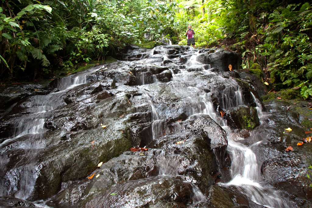
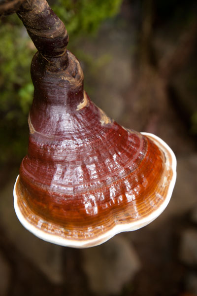
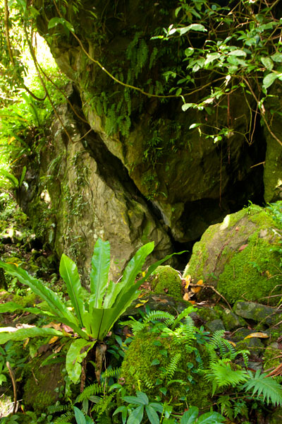
Today, Nan Kiepw maintains a pristine beauty that betrays no sign of past violence. A tributary of the Nanipil River (Pillapen Nanipil) runs through the area, forming a wide gentle cascade, some small pools (though none big enough for swimming), and a “horsetail” waterfall before winding into the valley. Upstream is a basalt outcropping — really a great boulder — that forms an overhang where a few people can comfortably camp out of wind and rain. Huge ivory nut trees, red sandlewood, and a variety of hardwoods dominate the lush native forest, and there are many unusual varieties of fungi to be seen.
The Origin of the Ivory Nut Palm
On the fourth voyage to Pohnpei after its founding, a man came named Mederiap, bringing with him the ivory nut palm and propagating it on the island. Prior to this time people had mostly lived in caves, because they had nothing to use for roofing material, but ever afterward, the fronds of the ivory nut palm were woven together to produce roof thatch for houses.
The moderately challenging trail begins behind a house near the Nett hydroelectic building at the end of the Nanipil River Road (the same trailhead for Nahnalaud). Hikers cross the Nanipil River directly and walk along a well-maintained footpath for 0.99 km / 0.61 mi (5% slope avg) before coming to the first major branch. The left (east) branch leads on toward Nahnalaud, while the right (west) branch heads to Nan Kiepw. From this point it’s 1.4 km / 0.87 mi (14% slope avg) to the last residence along the trail at 265 meters of elevation, and then another 1.8 km (1.12 mi) to the waterfall. This last segment has two little ascents with slope averages of about 20% and 26% and a more moderate bit in between (11% slope avg). Sakau (kava) plantations are found on both sides of the trail much of the way. Hikers should take care to avoid damaging these valuable plants.
[info], Pohnpei, Federated States of Micronesia (FSM)")
Crab’s Eye Vs. Red Sandlewood: What to Know and Why it Matters
Two species of trees found both in inhabited areas and in the upland forests of Pohnpei produce small brilliant red seeds about the size of popcorn kernels. These can be seen scattered across the forest floor and often on the trail leading to Nan Kiepw. Red seeds with a single black dot on them belong to Abrus precatorius (Crab’s Eye Seed or John Crow Bead), while solid red seeds come from Adenanthera pavonina (Red sandlewood). The first type of seed (with the black dot) contains a compound, called abrin, that is 75 times more toxic than ricin and can be fatal if ingested; the fatal dose is about 0.1 mg for an adult of roughly 68 kg (150 lbs). Symptoms of poisoning include nausea, vomiting, convulsions, liver failure, and death after several days. The second type of seed (all red) is harmless when cooked and is sometimes eaten as a snack by Pohnpeian children. Strangely, the same Pohnpeian name — kaikes — is used to identify the two species of trees. Both Abrus precatorius and Adenanthera pavonina originate on the Indian subcontinent. Seeds are sometimes used to make necklaces and other jewelry.[/info]
Na Malek
Na Malek (“his chickens”) is a rock overhang and cave — located in the part of upland Nett once known as Nansokele — said in myth to have been the home of the demon Taimuan. The site, which has excellent views of the valley, Dolen Eirike, and Dol Rakied, is reached via a steep loop of path (0.61 km / 0.38 mi with a 42% slope average) that branches off from the Nan Kiepw trail. The overhang is large enough to provide a protected camping spot, and the elevated cave is bone-dry, flat-floored, and suitable for sleeping. Water running off the rock can be filtered for drinking. This is a relaxing and beautiful place to watch birds, including the Grey White-eye and rare Long-billed White-eye.
- Plan for 8 hours for both Nan Kiepw and Na Malek.
- Please visit the Local Guides & Tour Operators page for a list of experienced guides available for hikes to Nan Kiepw. Offer $50.00 for a group of five or less.
The Tale of Taimuan
A well-known Pohnpeian myth states that Na Malek was the the home of a hideous old demon, named Taimuan, and his sister, Litapinmalekelek. Taimuan had a hankering for human flesh and was, in particular, interested in the beautiful daughter of the Saudeleur — the supreme ruler that reigned from Nan Madol. Deciding that he wished to devour the girl, Taimuan set out for Nan Madol, transforming himself into a handsome young man along the way and leaving his old parts at different points in the mangroves — his white hair, swollen legs, swollen testicles, sagging eyelids, etc. When Taimuan arrived at Nan Madol and presented himself to the Saudeleur, both the girl — who was called Kisin Ntamwahu (“a little bit of good blood”) — and her father were impressed with the young suitor. Kisin Ntamwahu fell for Taimuan and begged her father to let them marry. Soon the two were married and given a home on Pahn Kadira.
After residing at Pahn Kadira for a while, however, Taimuan obtained permission from the Saudeleur to take Kisin Ntamwahu back to Na Malek. On the way, he picked up all his old parts from the mangroves and was restored to his prior appearance. Kisin Ntamwahu realized she had been tricked, but Taimuan carried her away against her will and confined the girl inside the cave at Na Malek. Then he climbed to the top of the mountains to invite all the other demons in the area to join him in feasting on the girl. While he was away, his sister, Litapinmalekelek, discovered Kisin Ntamwahu and felt sorry for her. She began to dig the girl out of her prison and encouraged Kisin Ntamwahu to turn herself into an ant, in order to escape, and flee into the forest. She warned the girl not to pass any plants without greeting them politely. As Kisin Ntamwahu ran, she greeted all the plants, big and small. All except one. Feeling a sudden need to urinate, she relieved herself in the forest and didn’t realize she’d done so on a plant called kampanial.
When Taimuan found that Kisin Ntamwahu was gone, he confronted Litapinmalekelek, but she claimed to know nothing. In a rage, Taimuan showered his sister with obscenities (specifically, he shouted, “Your vagina! My penis!” — a highly offensive reference to an act of incest) and then took off into the forest to catch Kisin Ntamwahu. He questioned each plant he passed, but none would tell him anything until he came upon the kampanial, which told Taimuan which way Kisin Ntamwahu had gone. Shortly thereafter, Taimuan met two worms on the path. He asked them where the girl had gone and they promised they would tell him if he pulled down his eyelids. He did so, and the worms threw dirt in his eyes. When Taimuan tried to wash his eyes out in a nearby streamlet, the worms muddied the water upstream, causing him to go blind and eventually die.
- Please visit the Local Guides & Tour Operators page for a list of experienced guides available for hikes to Nan Kiepw.
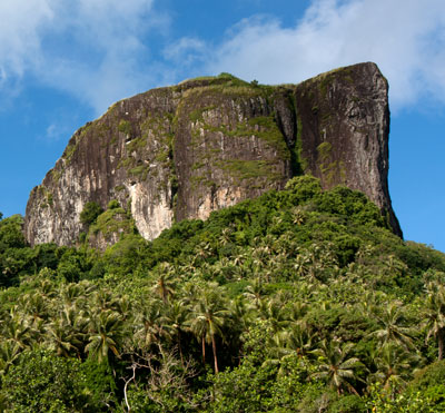
Sokehs Rock
![]()
![]()
![]()
![]()
![]()
![]()
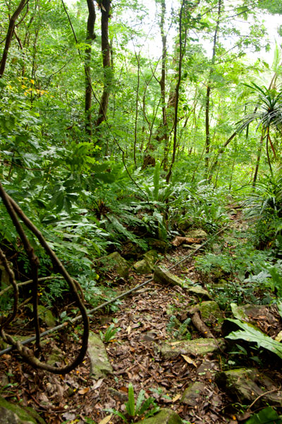
Paipalap, or Sokehs Rock, is without question the most striking feature of Pohnpei’s topography. Over 100 vertical meters (328 ft) of exposed basalt form the upper portion of a gigantic volcanic plug that juts from the north end of Sokehs Mountain and looms over Pohnpei’s harbor and only town, Kolonia. An unmarked trail leading to the Rock, “The Spire”, and “The Adam’s Apple” begins south of a brown house 1.2 km (0.74 mi) beyond Mwalok A-1 Store and just before the Danipei Church (ask permission before hiking). The steep path is well-defined with steep cement steps near the bottom and then a level segment with two
large basalt outcroppings and some cave-like formations. Three quarters of the way along, it begins to follow an electrical conduit running to the beacon on the summit (202 m / 663 ft).
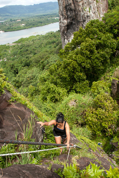
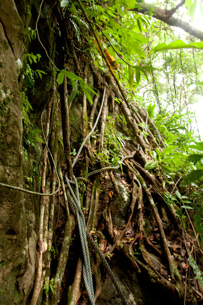
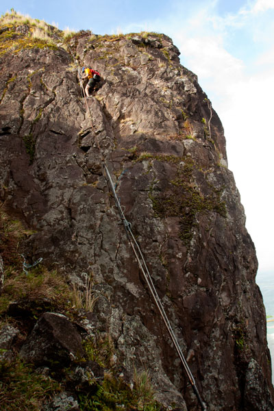
Though not a technical climb, the ascent of the Rock itself is sketchy (triple-pitch, 5.6 R unassisted) and should only be attempted on clear, dry days, as the rocks are treacherous when wet. Pitch 1 begins at the
“Tree Cliff” and skirts a 70° face with the assistance of tree roots, fixed ropes (these you can trust), and the electrical conduit. This section is often underestimated and may, in fact, be the most dangerous part of the endeavor. Several people have been injured in falls at this spot. Pitch 2 starts at the rear foot of the main rock and involves a steep climb with some assistance from the conduit. The crux is a 2-meter section where the conduit has corroded and is no help at all. Climbers must rely on natural holds and a narrow crevice. Ropes also hang along the conduit, but do not trust your weight to any of them as they are in various states of deterioration. Pitch 3 is easier, though no less exposed. Most people straddle the conduit and haul themselves up.
Once on level ground, you can pick out the path that winds through scattered patches of wild pineapples, ferns, and a grove of trees that makes an ideal
campsite before ending at the main cliff on the northern end of the Rock. Spectacular views of the lagoon, reef passes, tuna fleets, and northern islands are found at several spots along the cliff face. On clear days, Pakin Atoll is visible to the west, and you may get a glimpse of Pohnpei’s shy — and perhaps threatened — short-eared owl (Asio flammeus).
The Creation of Sokehs Rock
An ancient Pohnpeian legend states that long ago a man traveling near what is now Sokehs Island was overwhelmed by the force of a geyser-like spring which burst up and swept him all the way to a distant island. There he acquired the help of a powerful magician, who conjured a huge stone and plugged up the spring. Ever after, the rock was known as Paipalap, “the great paip (boulder).” In another version of the story, a Yapese sorcerer named Sou Iap was disturbed by the sound of rushing water and voyaged to Pohnpei to investigate. Upon discovering a great fountain on Sokehs Island, Sou Iap blocked the opening with piles of sea sponges.
Trad Climbing on the Face
The north face of Sokehs Rock has considerable trad climbing potential, though it has yet to be fully explored (several climbers have rappelled down and raved about what they saw there). It is, however, quite extreme and under-cut in places. Note that a top-rope would need to be no less than 200 meters (666 ft) in length. Pioneers are welcome!